San Francisco Map and San Francisco Satellite Images
Navigate San Francisco, California Map, map of San Francisco, San Francisco regions map, San Francisco satellite image, towns map, road map of San Francisco.
San Francisco Map FQA
Can I download a high-resolution map of San Francisco ?
Yes. Download high-resolution political and physical maps of San Francisco for personal or educational use. Redistribution is subject to the terms of our license.Where is California in the US and Cities Map of California
Please subscribe on "World Guide" channnel on Youtube at youtube.com/c/WorldGuide
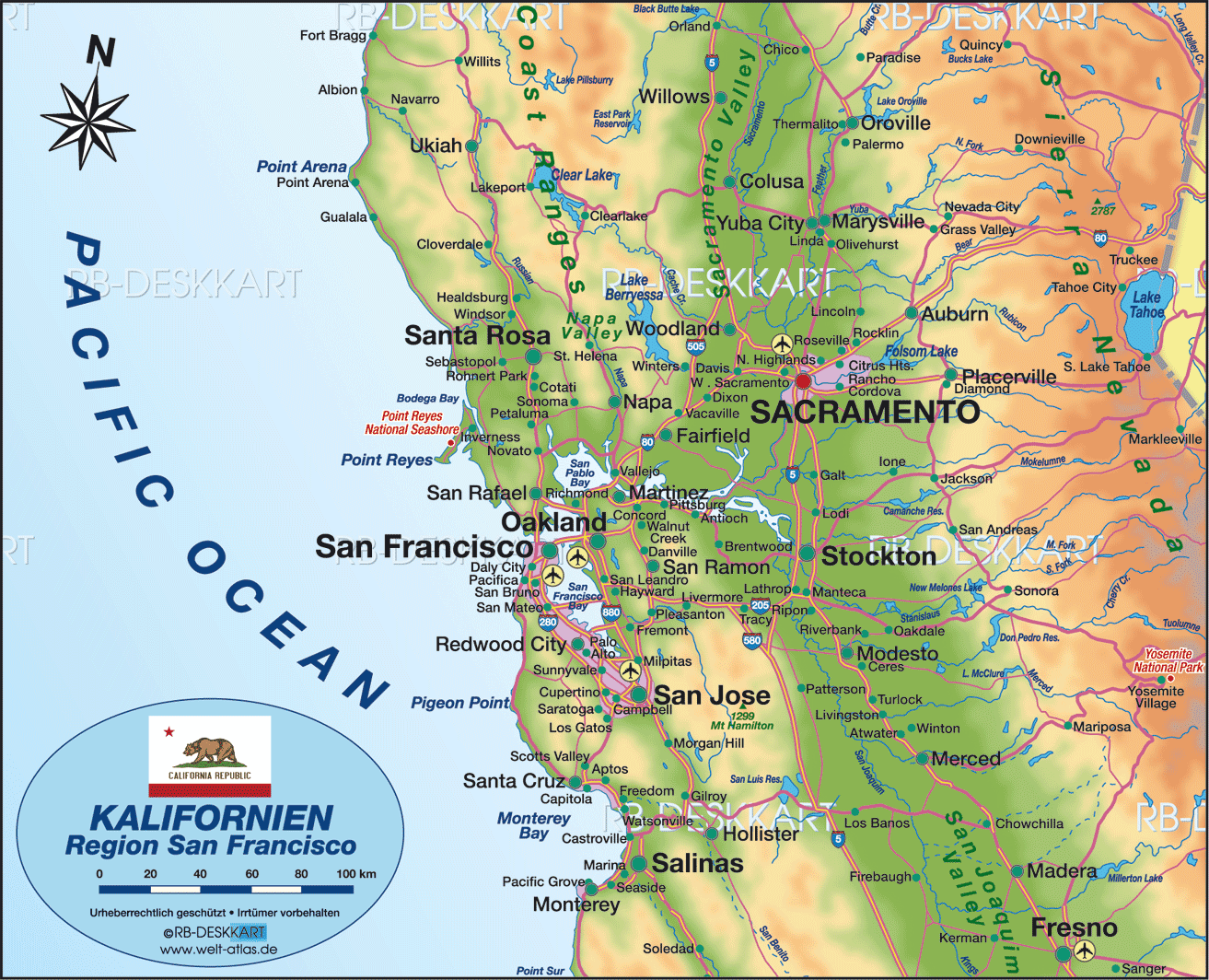
California Map
States Map of USA
Map of San Francisco, California
map of san francisco
Map of San Francisco
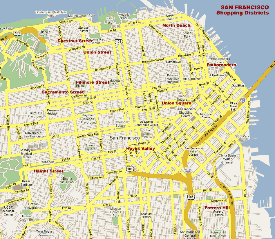
MAP OF SAN FRANCISCO
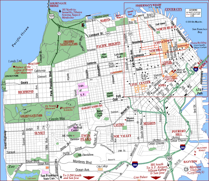
CITY MAP OF SAN FRANCISCO
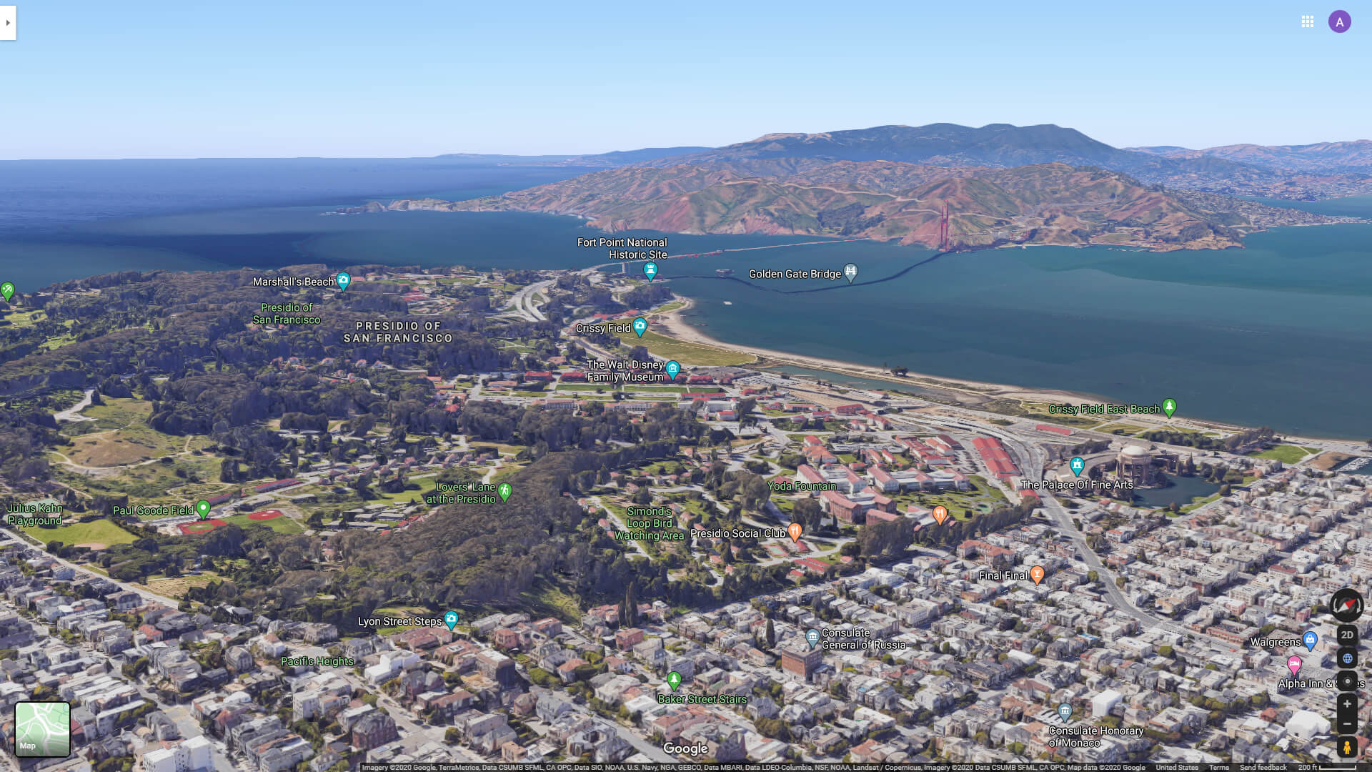
GOLDEN GATE BRIDGE AND THE PALACE OF FINE ART
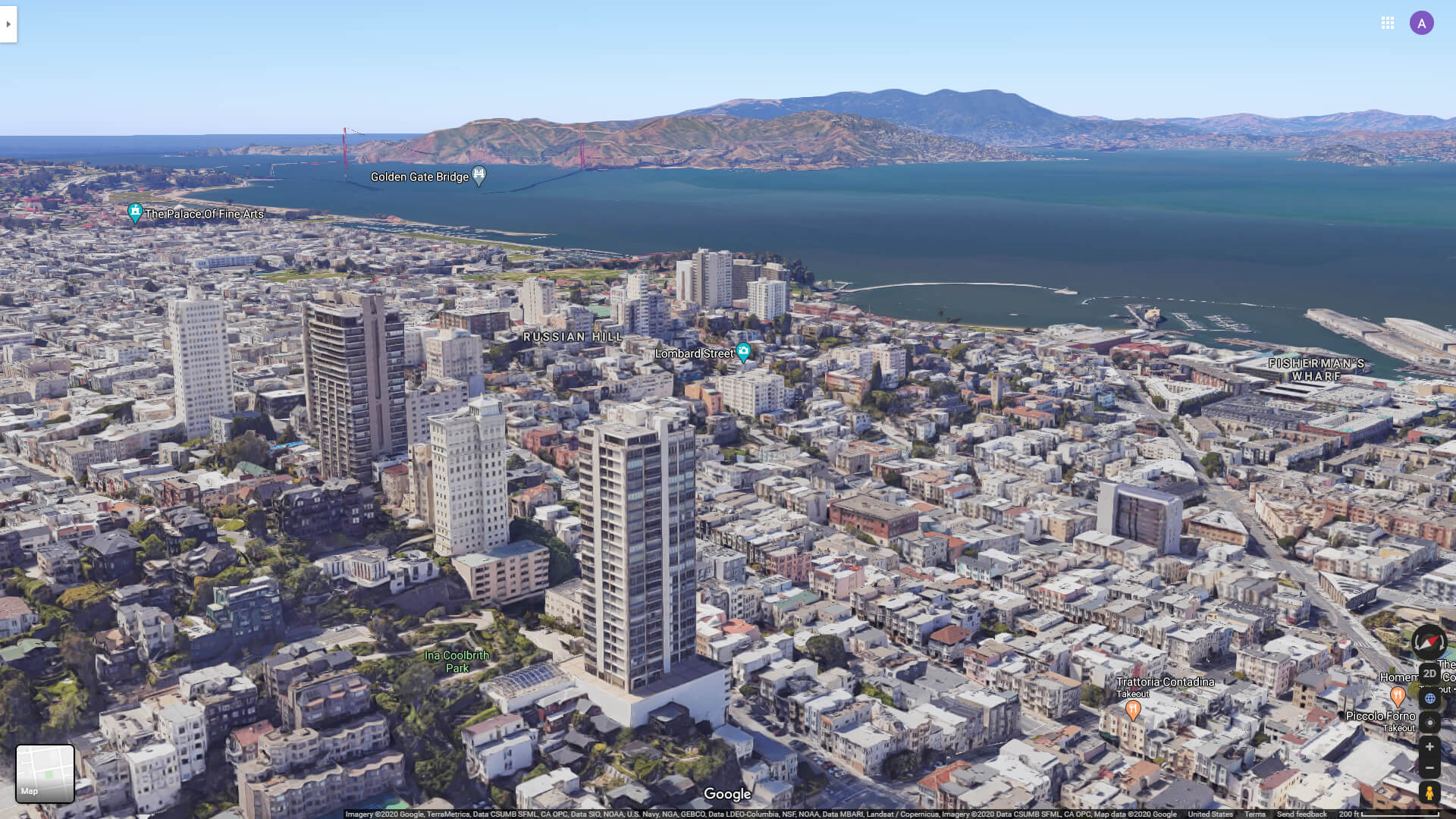
LOMBARD STREET AND RUSSIAN STREET SAN FRANCISCO
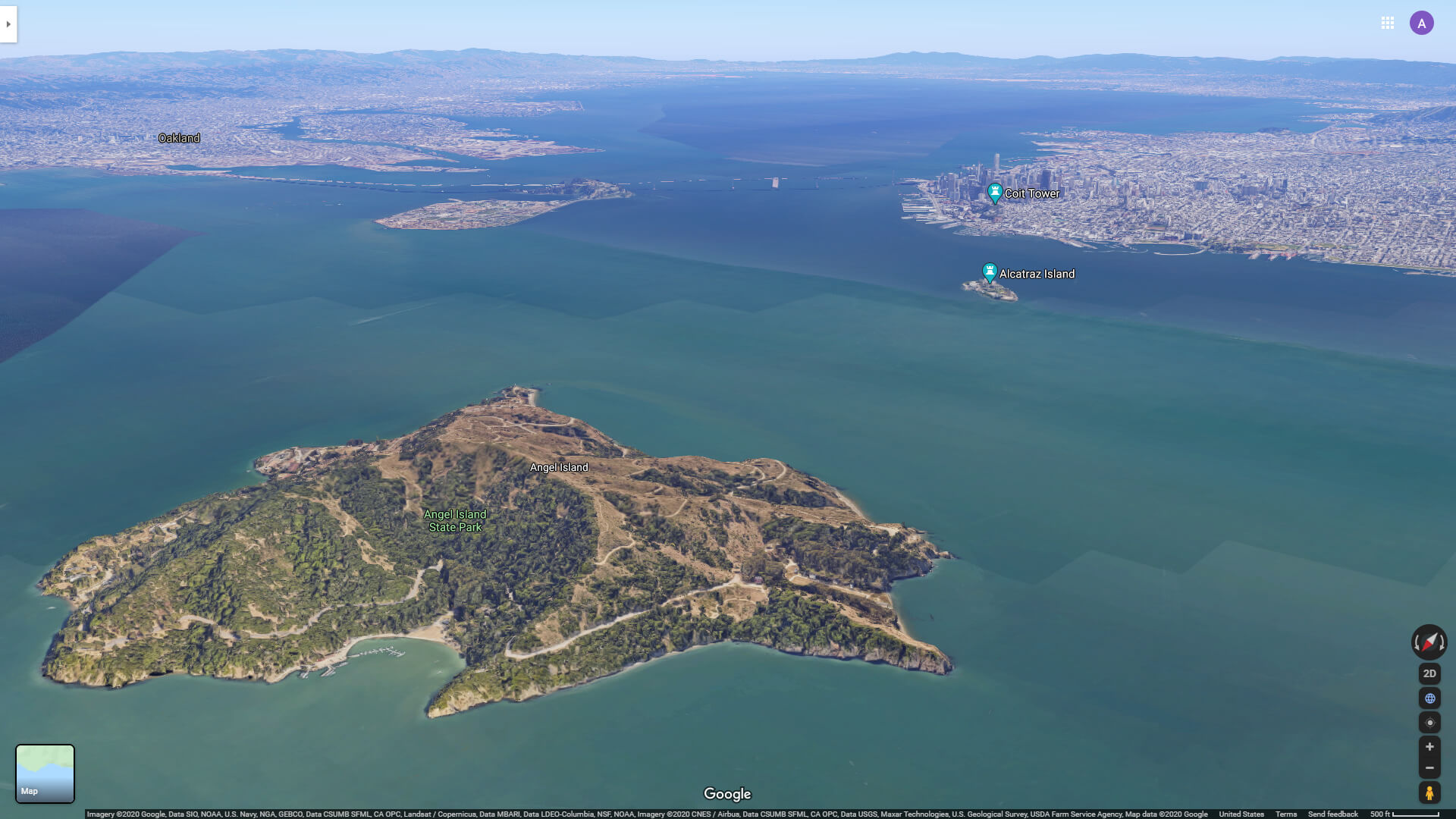
SAN FRANCISCO AND ALCATRAZ ISLAND FROM ANGEL ISLAND
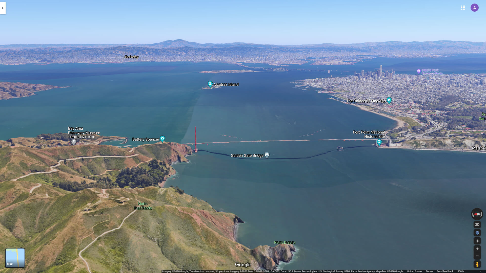
SAN FRANCISCO AND GOLDEN GATE FROM MARIN HEADLANDS
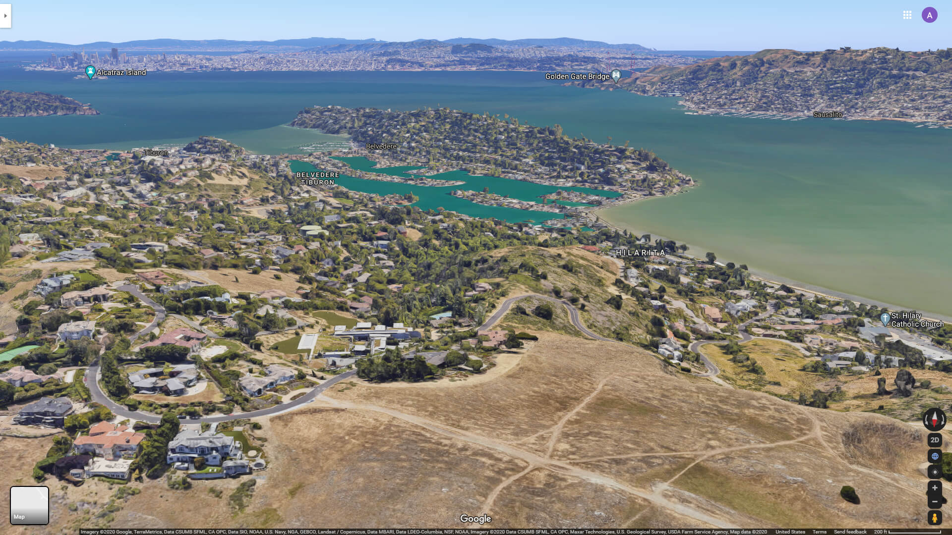
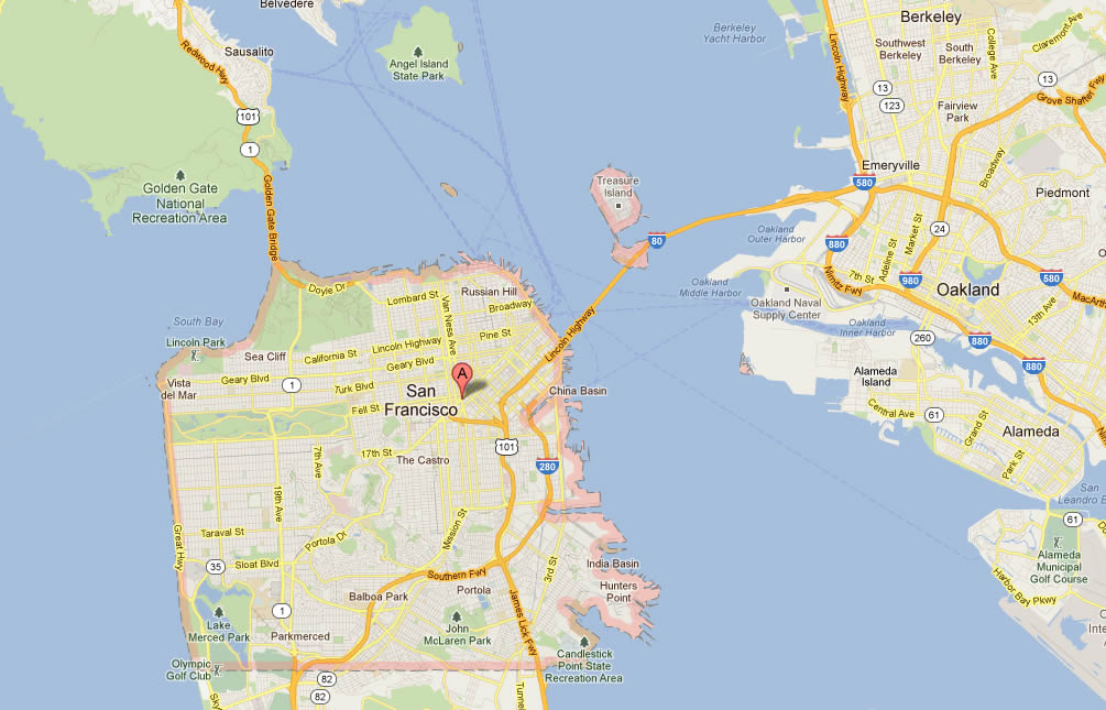
SAN FRANCISCO AND MARIN COUNTY
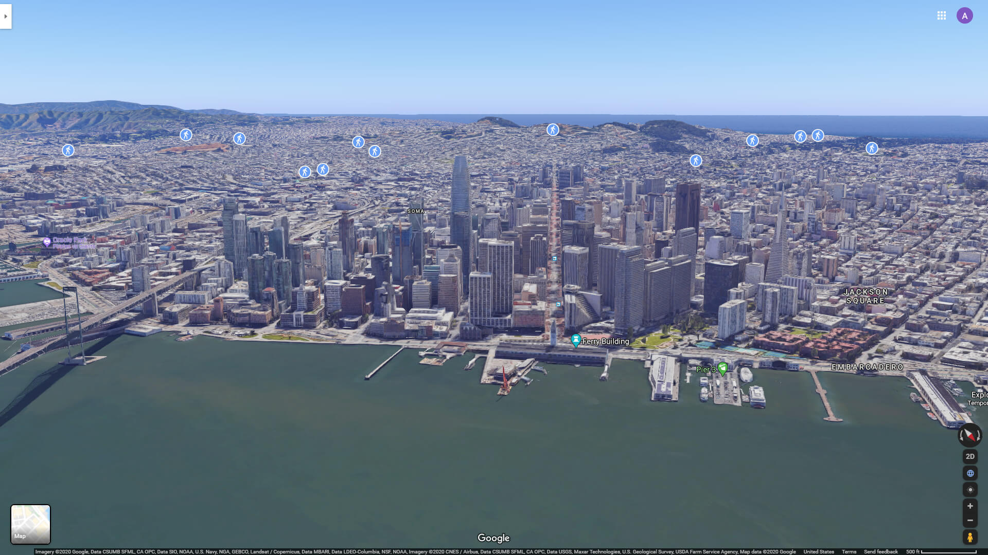
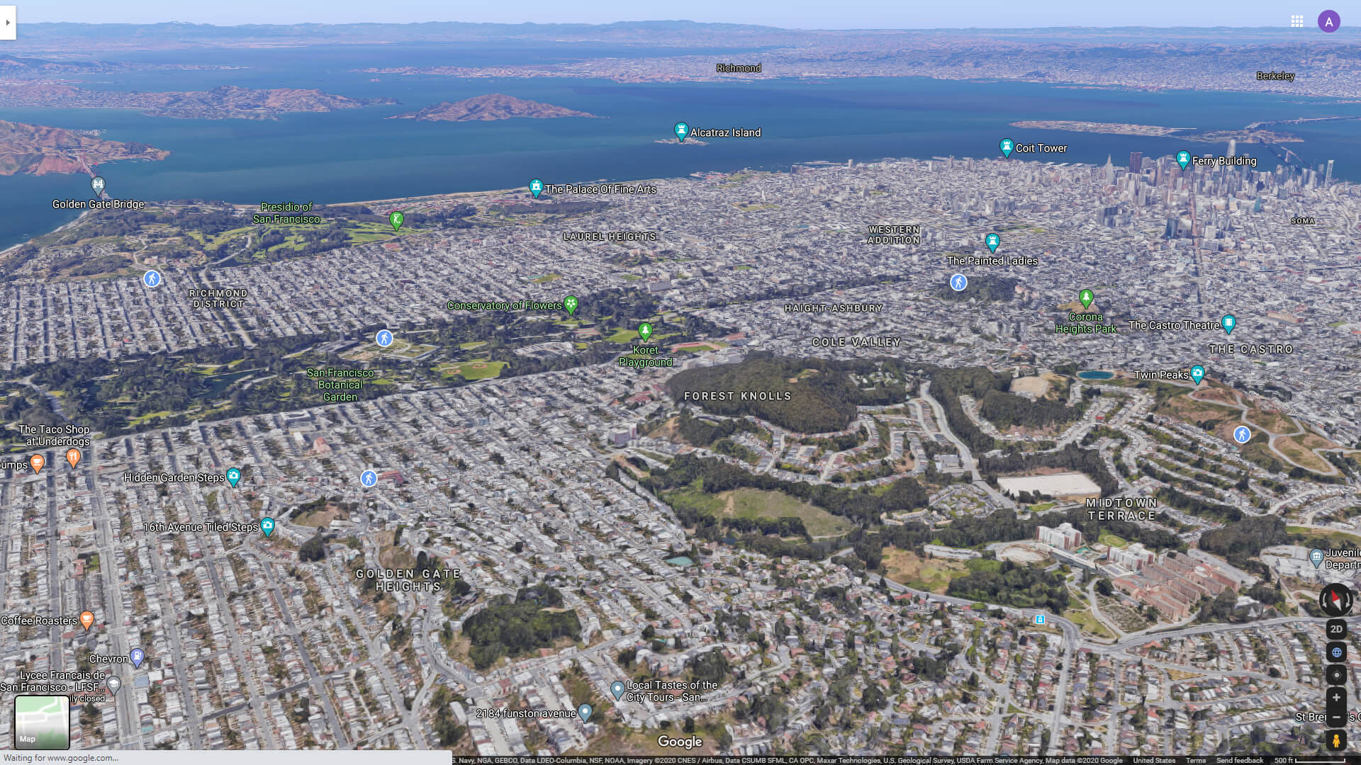
SAN FRANCISCO CITY CENTER AERIAL VIEW
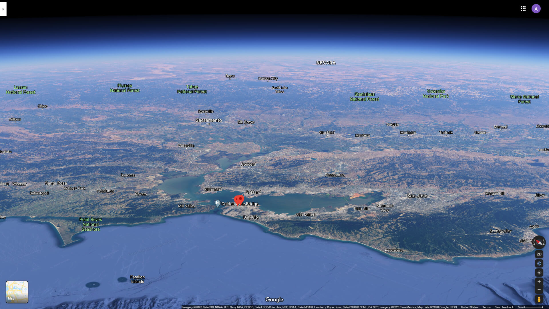
SAN FRANCISCO GOLDEN GATE AERIAL VIEW
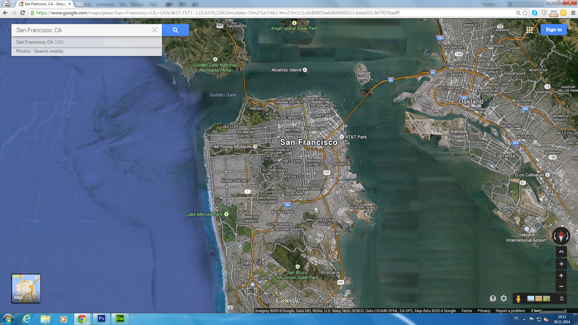
SAN FRANCISCO SATELLITE VIEW AND NATIONAL FORESTS
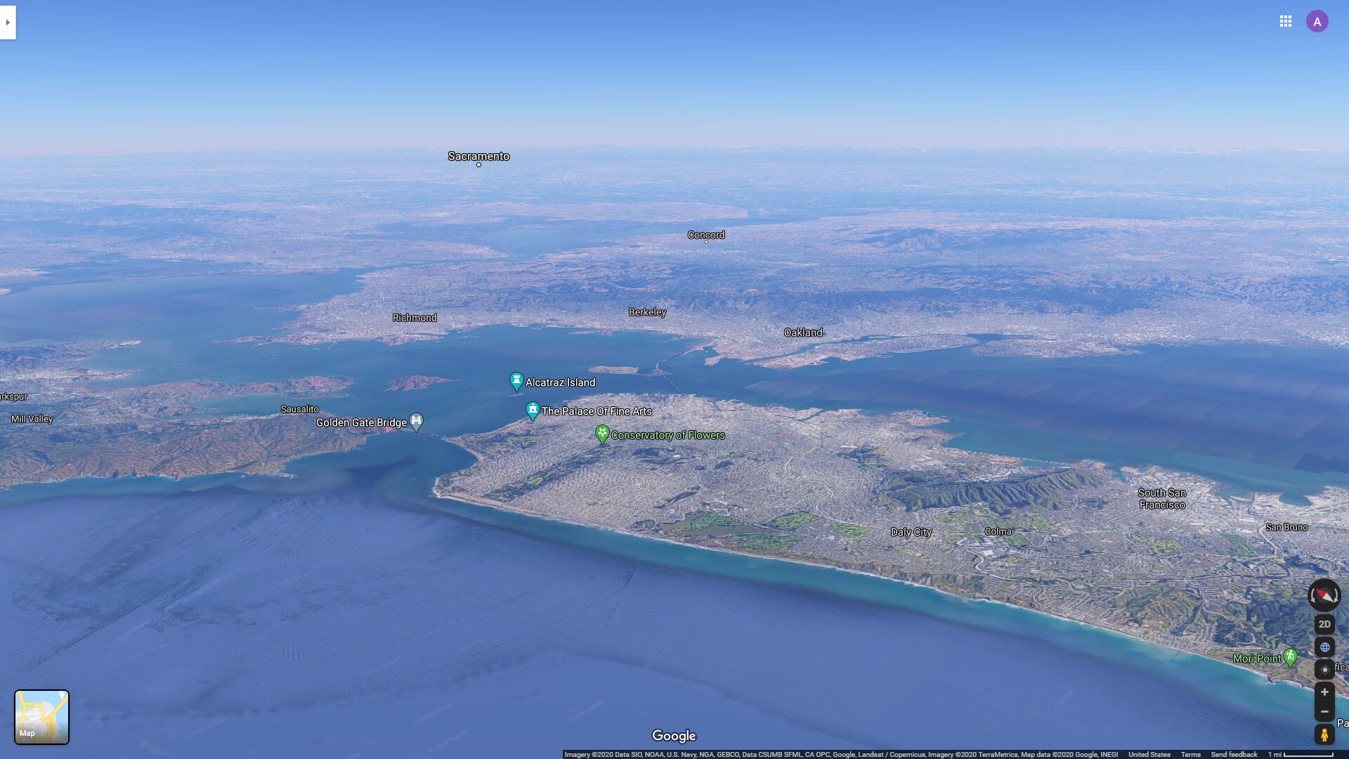
SAN FRANCISCO SATELLITE VIEW FROM PACIFIC OCEAN
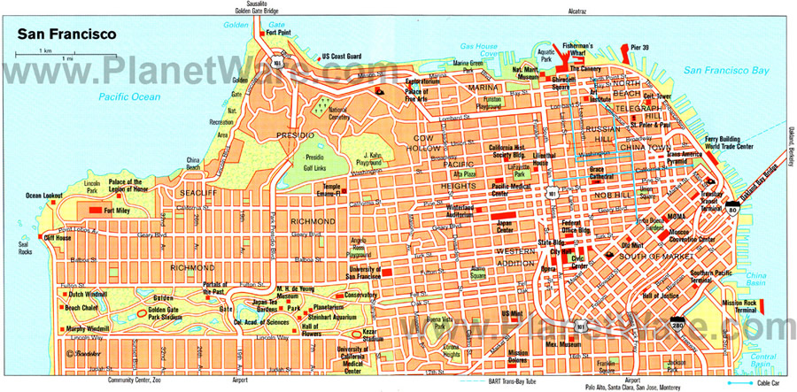
ATLAS MAP OF SAN FRANCISCO
MAP OF SAN FRANCISCO
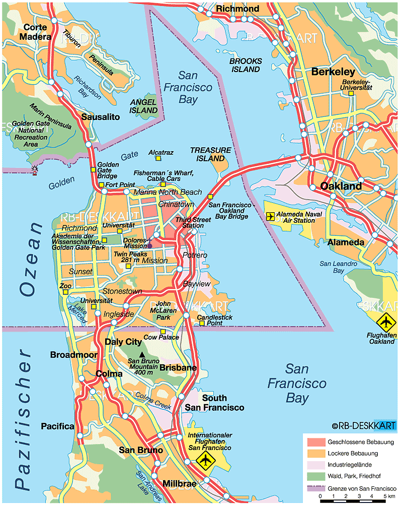
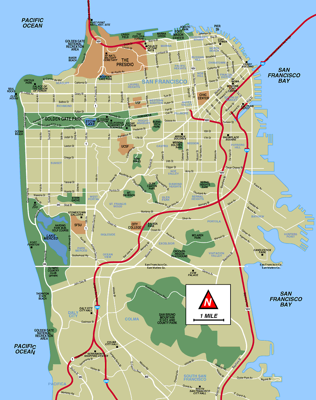
MAP OF SAN FRANCISCO ENVIRONMENT
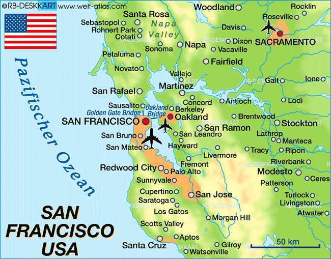
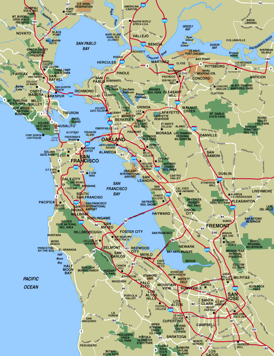
SAN FRANCISCO BAY AREA MAPS
SAN FRANCISCO MAP CITY BOUNDARY
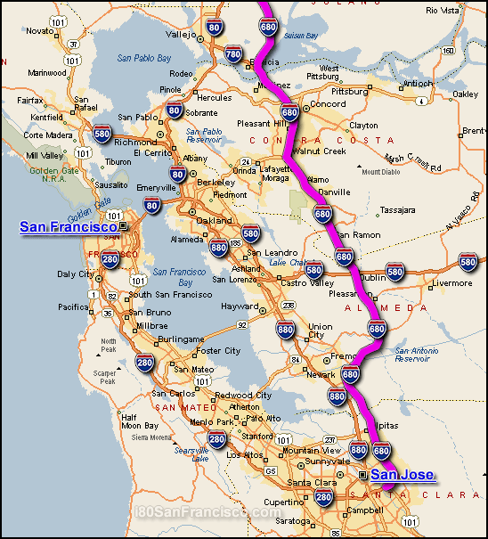
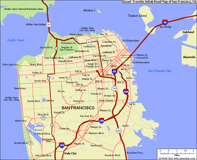
ROAD MAP OF SAN FRANCISCO
SAN FRANCISCO MAP
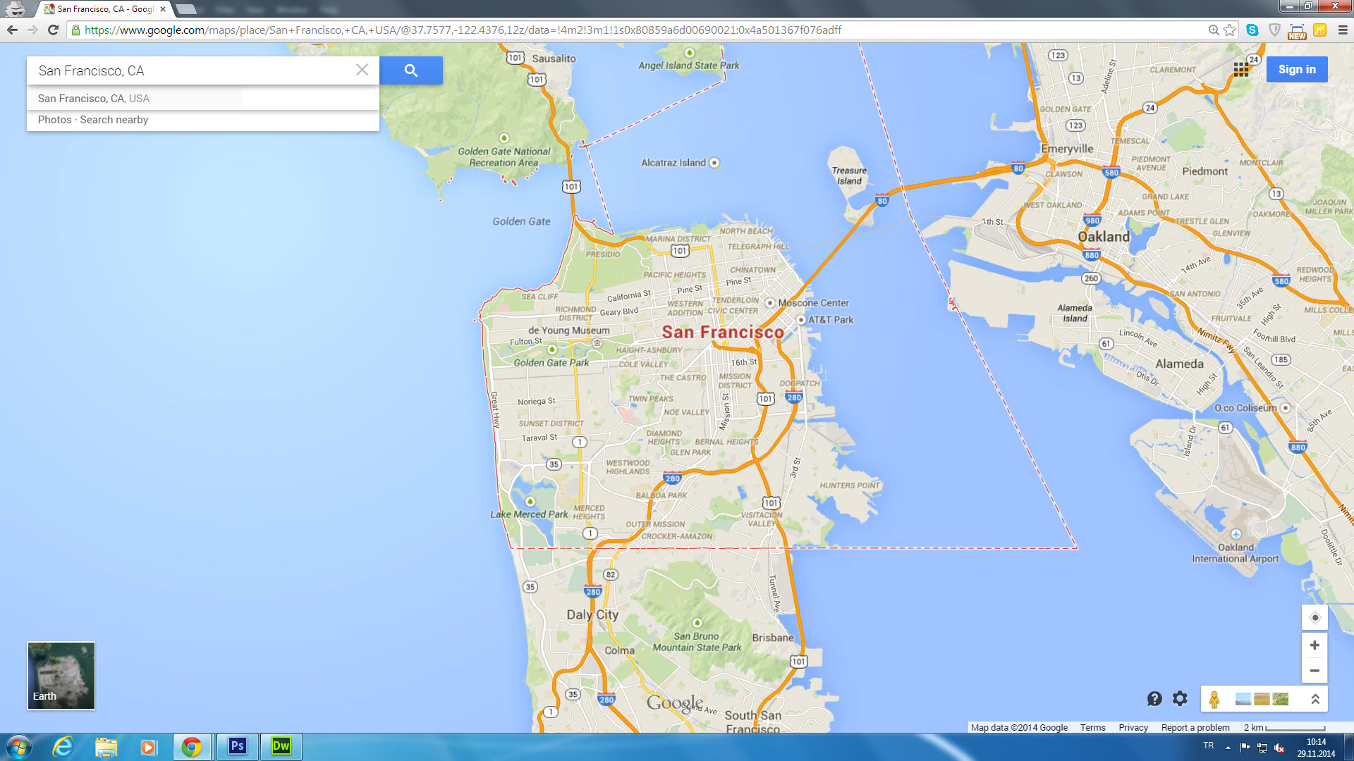
SAN FRANCISCO BAY AREA MAP
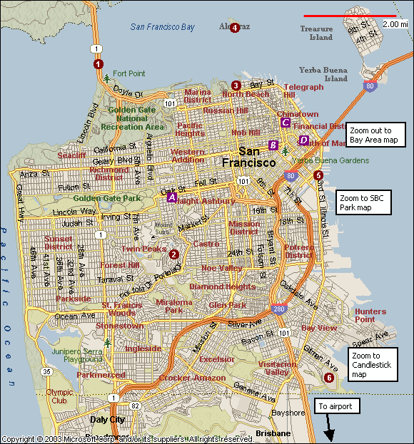
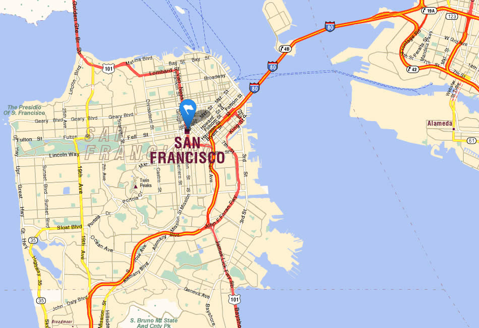
SAN FRANCISCO CITY MAP
SAN FRANCISCO MAP
SAN FRANCISCO MAP
SAN FRANCISCO MAP CALIFORNIA US
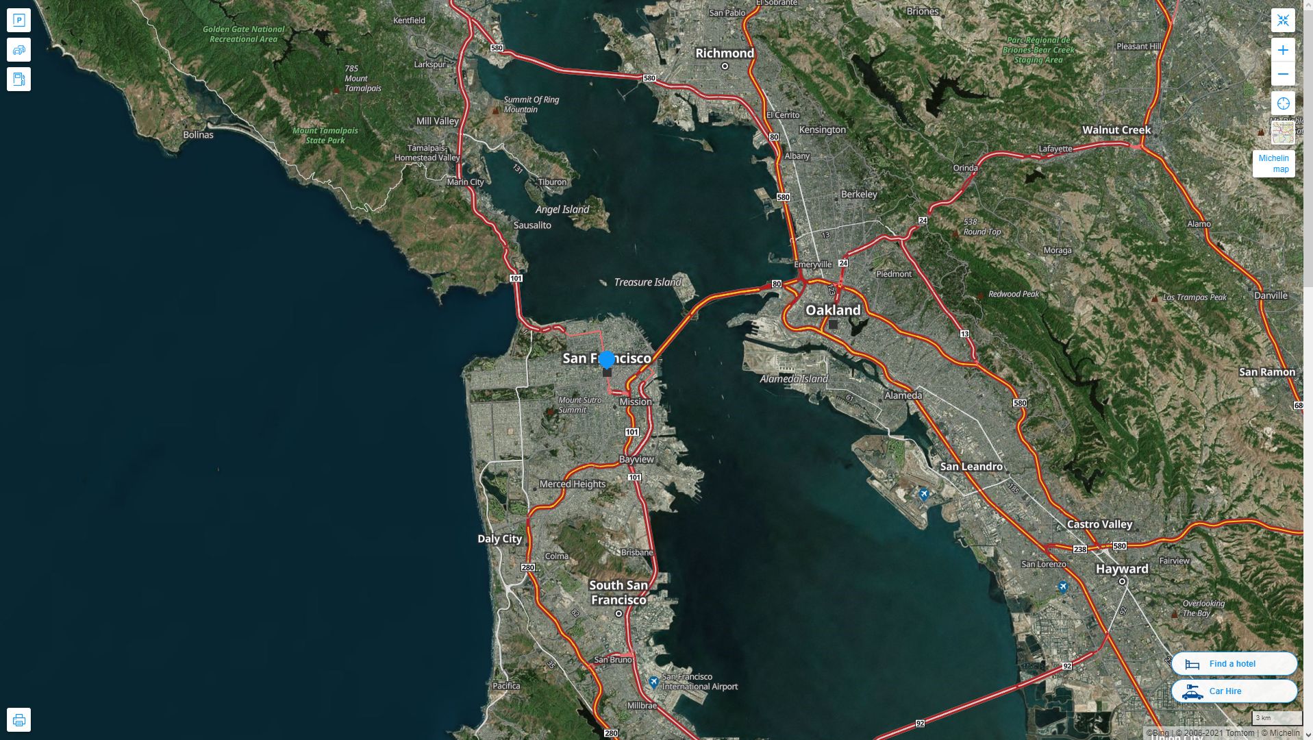
SAN FRANCISCO MAP CALIFORNIA US SATELLITE
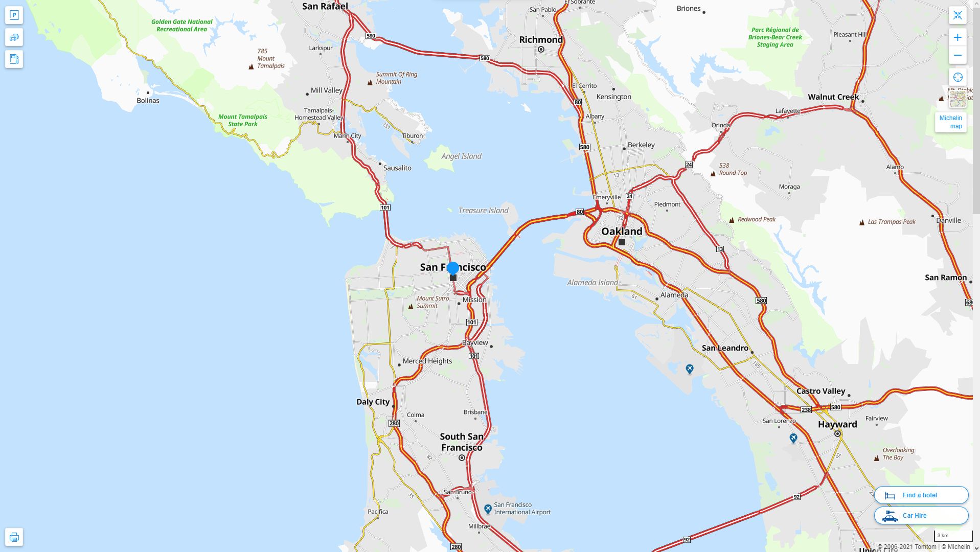
SAN FRANCISCO CALIFORNIA HIGHWAY AND ROAD MAP WITH SATELLITE VIEW
SAN FRANCISCO CALIFORNIA HIGHWAY AND ROAD MAP
Where is California in the US and Cities Map of California
Please subscribe on "World Guide" channnel on Youtube at youtube.com/c/WorldGuide
Largest California Cities by Population
Los Angeles Map San Diego Map San Jose Map San Francisco Map Fresno Map Sacramento Map Long Beach Map Oakland Map Bakersfield Map Anaheim Map Santa Ana Map Riverside Map Stockton Map Chualar Map Fremont Map Irvine Map San Bernardino Map Modesto Map Oxnard Map Fontana Map Moreno Valley Map Glendale Map Huntington Beach Map Santa Clarita Map Garden Grove Map Santa Rosa Map Oceanside Map Rancho Cucamonga Map Ontario Map Lancaster Map Elk Grove Map Palmdale Map Corning Map Salinas Map Pomona Map Torrance Map Hayward Map Escondido Map Sunnyvale Map Pasadena Map Orange Map Fullerton Map Thousand Oaks Map East La Mirada Map Visalia Map Simi Valley Map Compton Map Roseville Map Santa Clara Map Vallejo Map Victorville Map El Granada Map Benton Map Douglas City Map Corte Madera Map Inglewood Map San Buenaventura (Ventura) Map West Covina Map Norwalk Map Caribou Map Fairfield Map Richmond Map Murrieta Map Buena Vista Map Antelope Map Cypress Map Temecula Map Santa Maria Map Edwards AFB Map Rialto Map San Mateo Map Comptche Map Cloverdale Map South Gate Map Vista Map Mission Viejo Map Vacaville Map Arcata Map Carrick Map Hesperia Map Redding Map Santa Monica Map Westminster Map Santa Barbara Map Chester Map Whittier Map Newport Beach Map San Leandro Map Hawthorne Map San Marcos Map Citrus Map Alhambra Map Tracy Map Livermore Map Buellton Map Lakewood Map Merced Map Hemet Map Chinese Camp Map Menifee Map Lake Forest Map Napa Map Redwood City Map Bella Vista Map Indio Map Tustin Map Baker Map Chino Map Mountain View Map Alameda Map Upland Map Folsom Map San Ramon Map Pleasanton Map Lynwood Map Union City Map Anza Map Redlands Map Turlock Map Perris Map Manteca Map Milpitas Map Redondo Beach Map Davenport Map Camanche Village Map Yuba City Map Rancho Cordova Map Palo Alto Map Yorba Linda Map Walnut Creek Map South San Francisco Map San Clemente Map Florence Graham Map Pittsburg Map Laguna Niguel Map Pico Rivera Map Montebello Map Lodi Map Carmet Map Madera Map Castle Hill Map Monterey Park Map La Habra Map Santa Cruz Map Encinitas Map Tulare Map Gardena Map National City Map Culver City Map Huntington Park Map Petaluma Map San Rafael Map South Whittier Map Perris Camp Map La Mesa Map Rocklin Map Arbuckle Map Diablo Grande Map Woodland Map Fountain Valley Map Porterville Map Paramount Map Hacienda Heights Map Hanford Map Rosemead Map Easton Map Santee Map Highland Map Del Rio Map Coloma Map Novato Map Lake Elsinore Map Brea Map Yucaipa Map Castroville Map Watsonville Map Placentia Map Glendora Map Daly City Map Corona Map Chula Vista Map Berkeley Map Costa Mesa Map Burbank Map Carlsbad Map Antioch Map Downey Map- Head of Performance Marketing
- Head of SEO
- Linkedin Profile: linkedin.com/in/arifcagrici
For all California Cities Map
San Francisco Google Map, Street Views, Maps Directions, Satellite Images
istanbul-city-guide.com offers a collection of San Francisco map, google map, San Francisco atlas, political, physical, satellite view, country infos, cities map and more map of San Francisco.
US States by Population
California Map Texas Map New York Map Florida Map Illinois Map Pennsylvania Map Ohio Map Michigan Map Georgia Map New Jersey Map North Carolina Map Virginia Map Massachusetts Map District of Columbia Map Indiana Map Tennessee Map Arizona Map Missouri Map Maryland Map Washington Map Minnesota Map Colorado Map Alabama Map Louisiana Map South Carolina Map Kentucky Map Oregon Map Oklahoma Map Connecticut Map Iowa Map Mississippi Map Arkansas Map Kansas Map Utah Map Nevada Map New Mexico Map West Virginia Map Nebraska Map Idaho Map Maine Map New Hampshire Map Hawaii Map Rhode Island Map Montana Map Delaware Map South Dakota Map Alaska Map North Dakota Map Vermont Map Wisconsin Map Wyoming Map
Addresse: Hakarinne 2 Espoo, Uusimaa - Finland 02210
Web: istanbul-city-guide.com
Email: [email protected]
Web: istanbul-city-guide.com
Email: [email protected]
Copyright istanbul-city-guide.com - 2004 - 2026. All rights reserved. Privacy Policy | Disclaimer