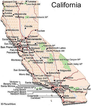
California Map and California Satellite Images
A quick look at where California is on the map. California is one of the largest and most diverse states in the US. California has a rich heritage and history that goes back to the Spanish, Native Americans, and Franciscan Missions.
California Map FQA
How many cities are in California ?
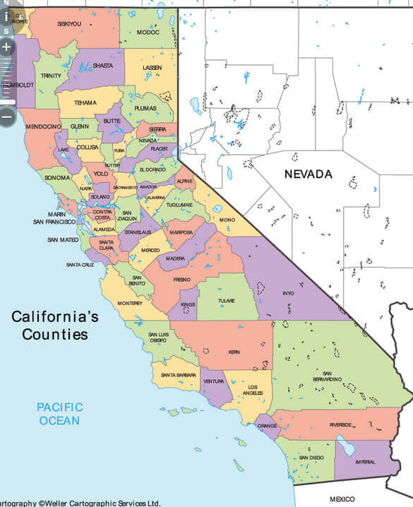
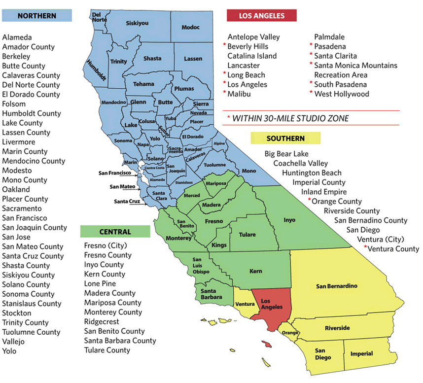
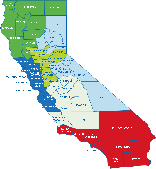
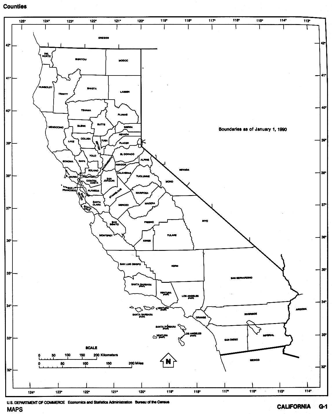
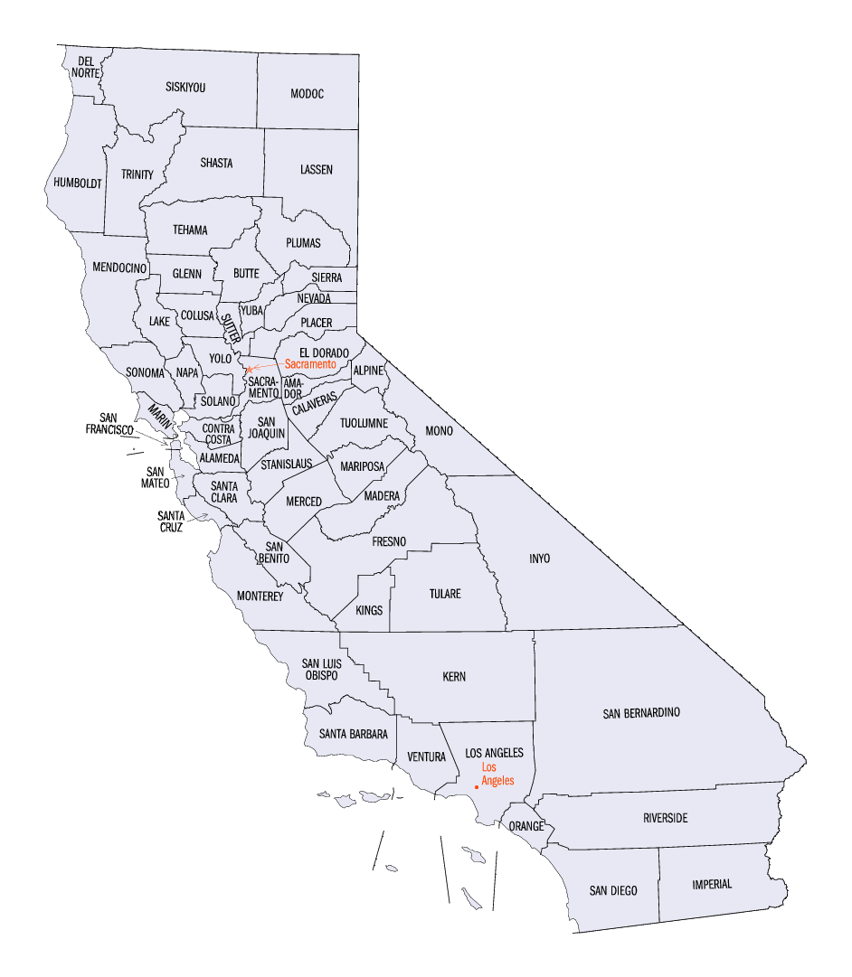
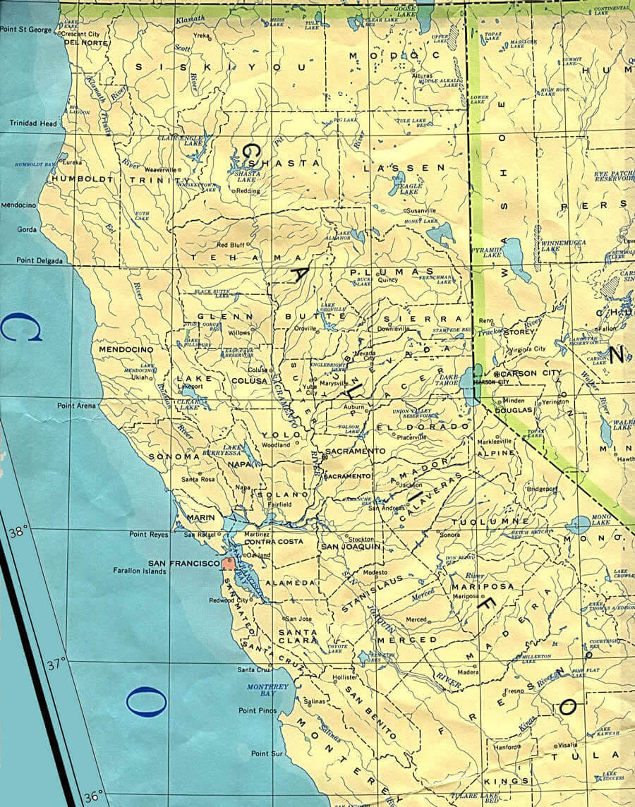
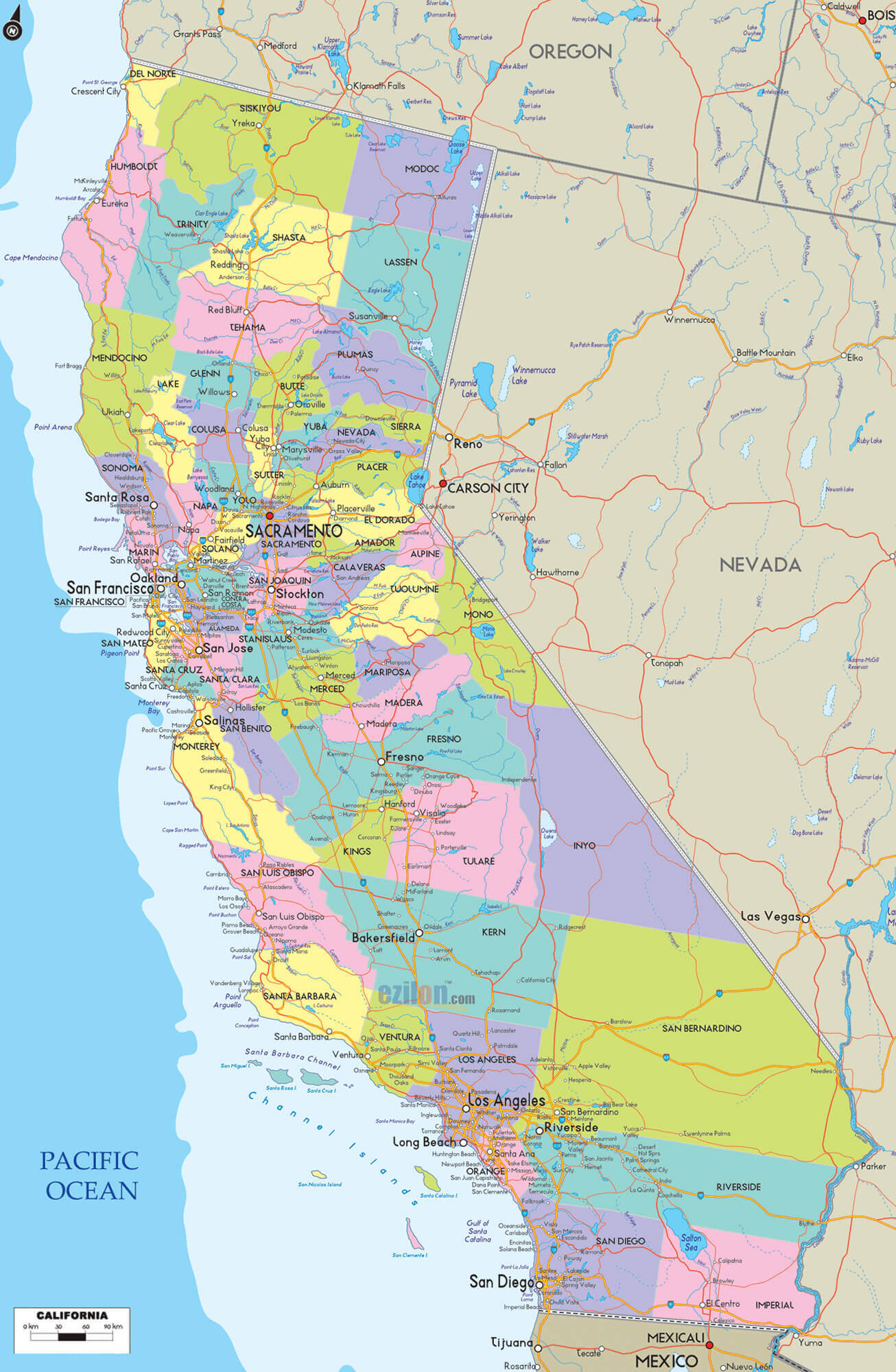
California has 58 counties. The largest by population are: Los Angeles County; San Diego County; Orange County; Riverside County; San Bernardino County; Santa Clara County; Alameda County; Sacramento County; Contra Costa County; Fresno County.What are the major geographical features of California ?
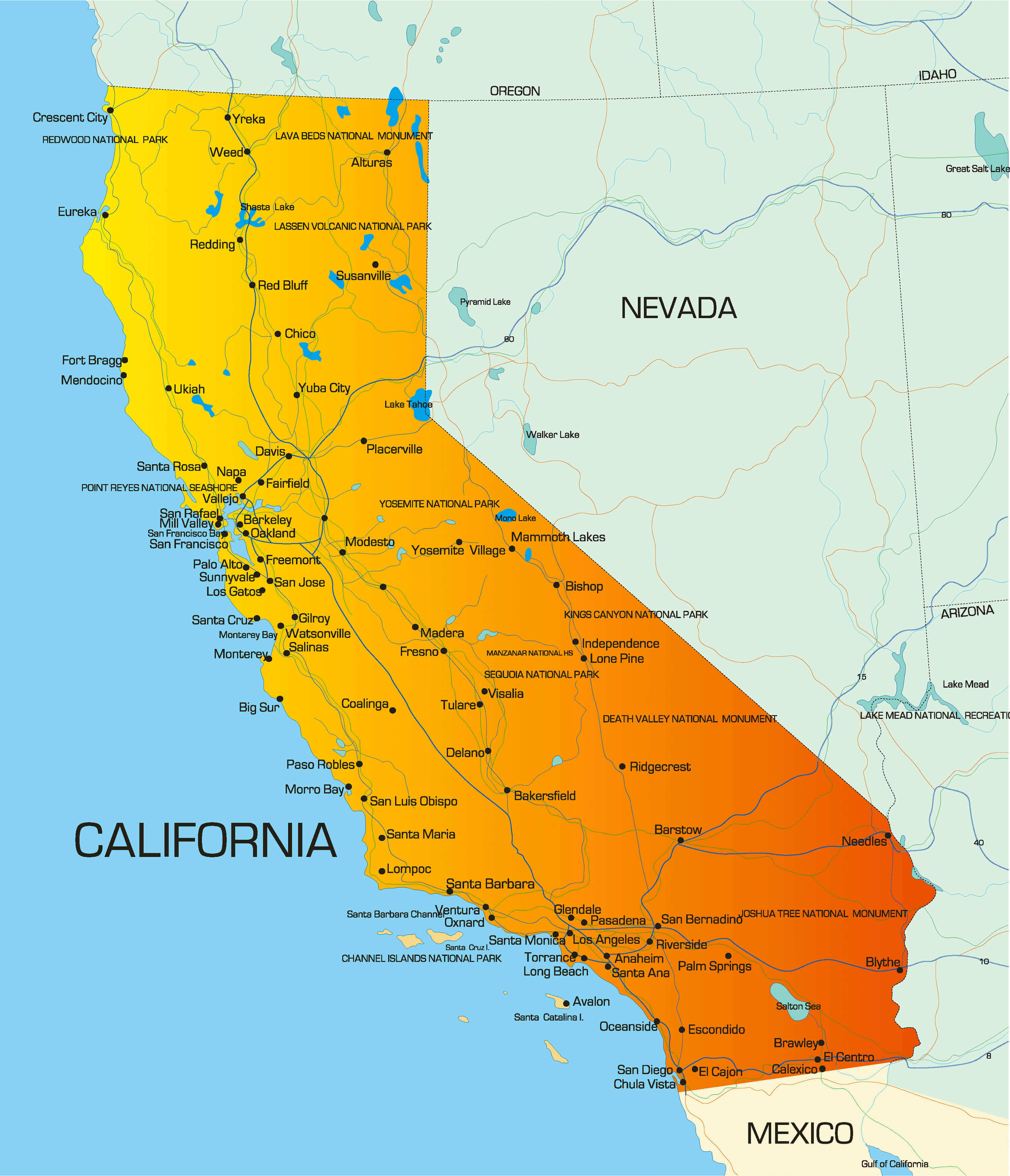
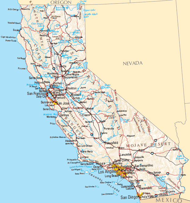
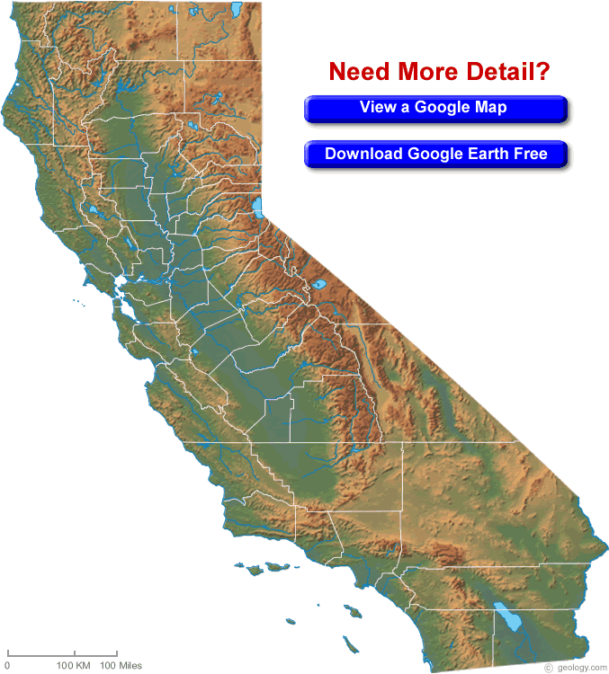
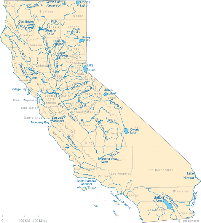
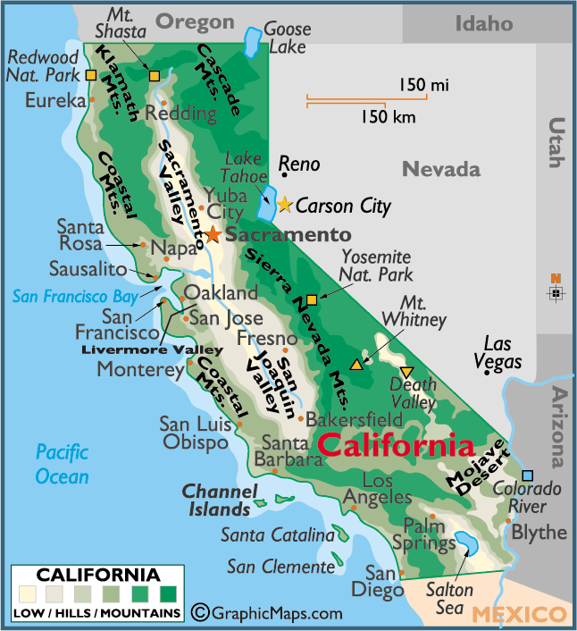
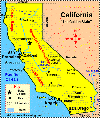
California has diverse geography including the Sierra Nevada mountains, fertile Central Valley, Mojave Desert, and a long Pacific coastline. It also features rivers such as the Sacramento and San Joaquin.Can I download a high-resolution map of California ?
Yes. Download high-resolution political and physical maps of California for personal or educational use. Redistribution is subject to the terms of our license.Discover the Golden State: Explore California's Top Attractions with our Interactive Map
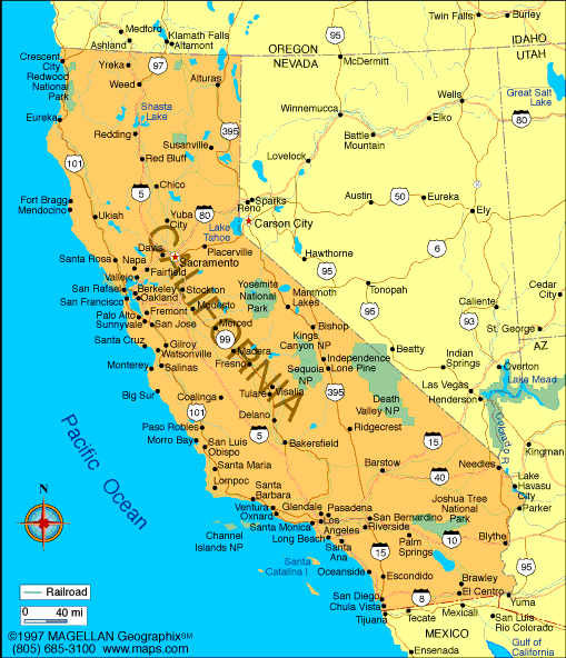
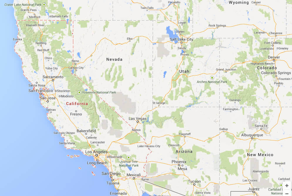
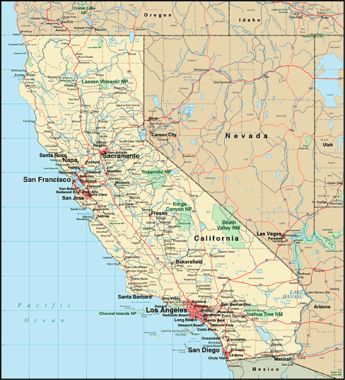
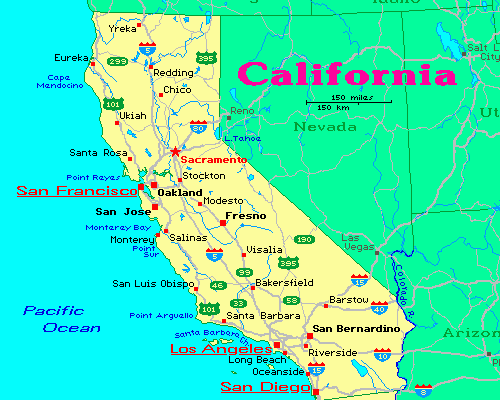
California is located on the West Coast of the United States. California is the most populous U.S. state and the third largest by area. California borders Oregon to the north, Nevada to the east, and Arizona to the southeast.What are some facts about California
- Area: 163,696 sq mi (423,970 km2)
- Population: 39,185,605 (2022)
- Population Density: 251.3/sq mi (97/km2)
- GDP (nominal): $3.3 trillion (2021 est.)
- GDP per capita: $85,500 (2021 est.)
- Religions:
Protestantism: 32%
Catholicism: 28%
Unaffiliated: 27%
Judaism: 2%
Buddhism: 2%
Hinduism: 2%
Islam: 1%
Mormonism: 1%
Other: 5% - Largest Cities:
Los Angeles Map
San Diego Map
San Jose Map
San Francisco Map
Fresno Map
Sacramento Map
Long Beach Map
Oakland Map
Bakersfield Map
Anaheim Map
For all California Cities Map
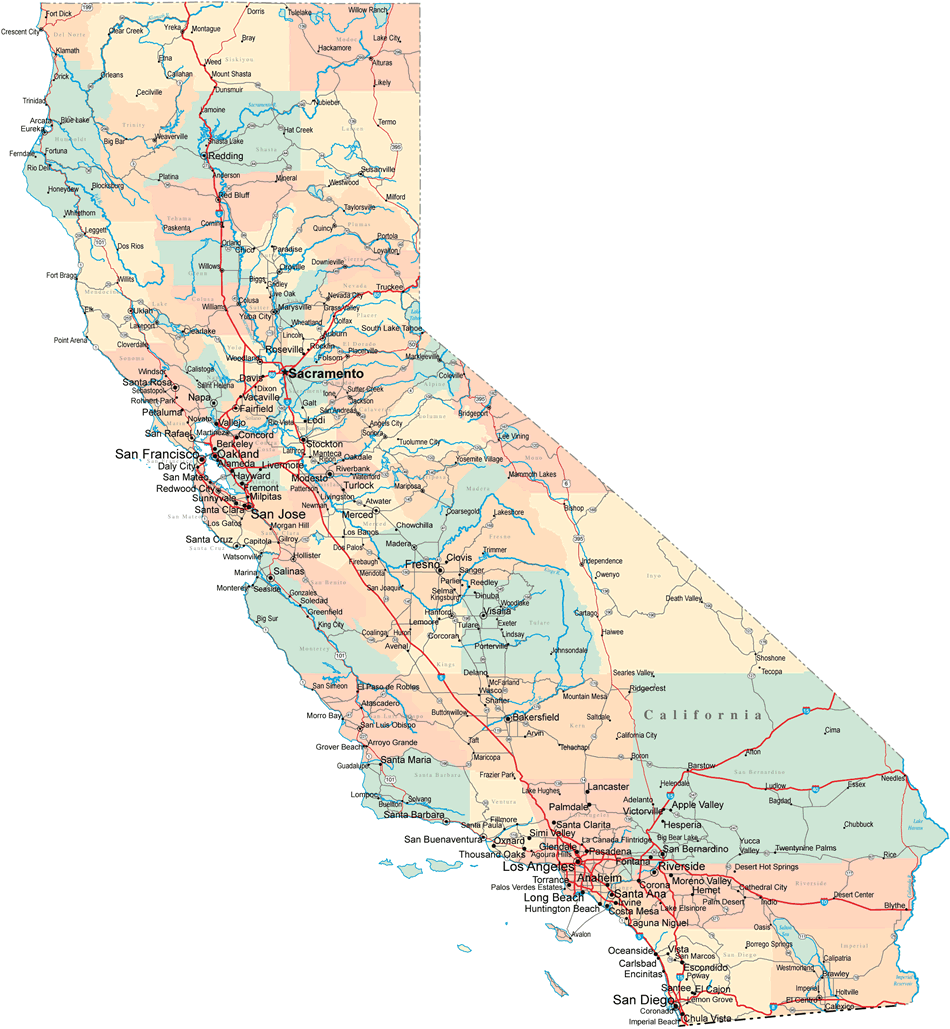
Map of California
Where is California in the US and and Cities Map of California

▶ Play
Watch this video directly on YouTube
Watch on YouTubeFor the best viewing experience, watch the full video on the World Guide YouTube channel at youtube.com/@WorldGuide.
About California
 California is the most populous state in the United States, with a population of over 38 million. Four out of five people who live in California live along its coast!
California History
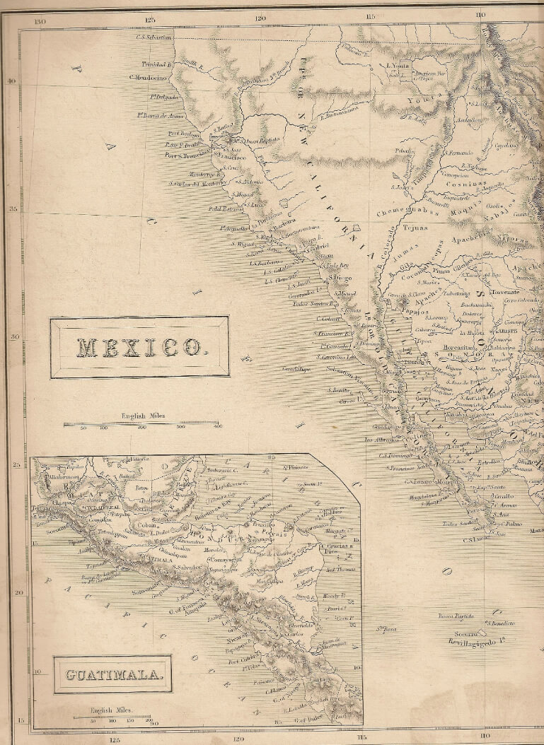 The Spanish had claimed the area since 1542, but they didn't have much success colonizing it. The first permanent European settlement was established by the Spanish missionaries at Mission San Diego de Alcalá in 1769. The U.S. purchased California from Mexico after the Mexican-American War ended in 1848; California became an official territory on September 9th of 1850 with its capital at Monterey.
California Location
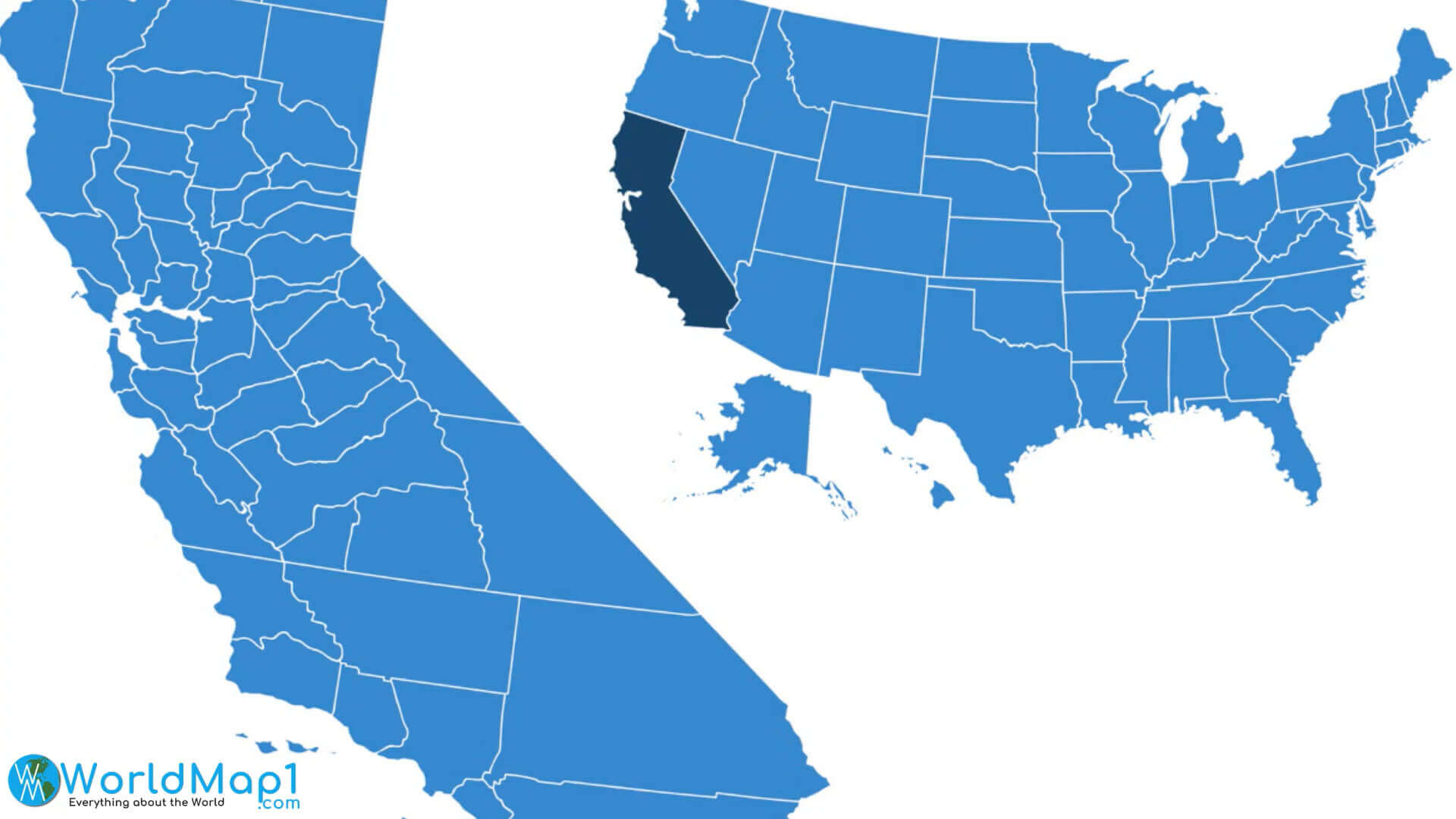 The state of California is bordered by Oregon and Nevada to the north, Arizona to the east, and Mexico to the south (and Baja California).
California Geography
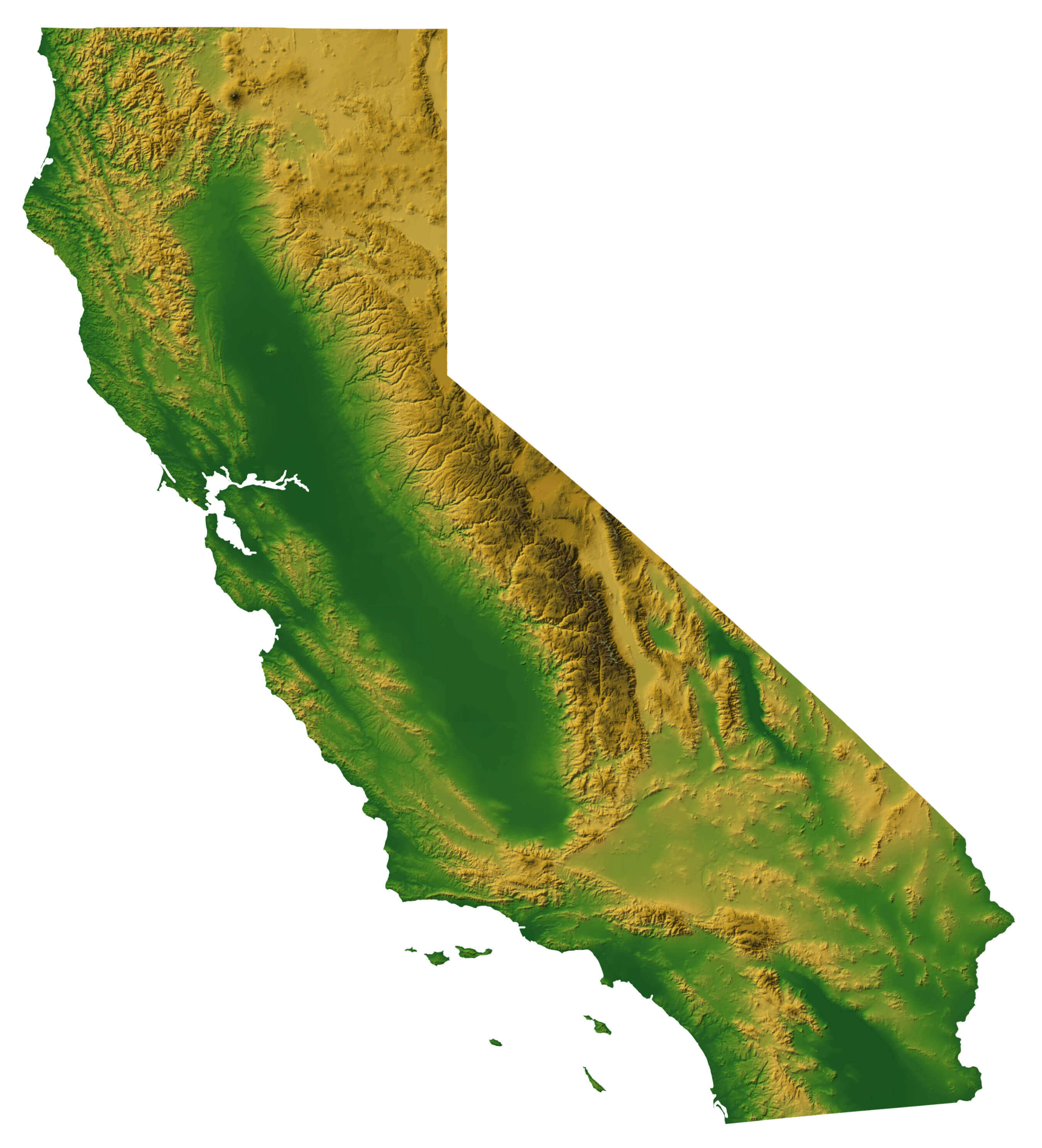
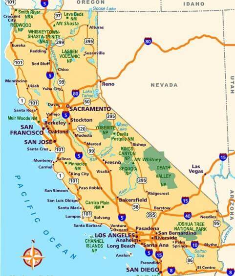
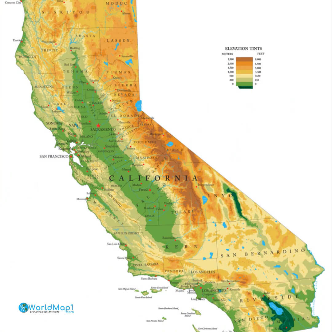 California covers an area of 163,696 sq mi (423,970 km2), making it larger than France and Italy combined!
List of Largest Airports in California
- Los Angeles International Airport (IATA code: LAX)
- San Francisco International Airport (IATA code: SFO)
- San Diego International Airport (Lindbergh Field) (IATA code: SAN)
- Norman Y. Mineta San José International Airport (IATA code: SJC)
- Oakland International Airport (IATA code: OAK)
- Sacramento International Airport (IATA code: SMF)
California National Park and Trails
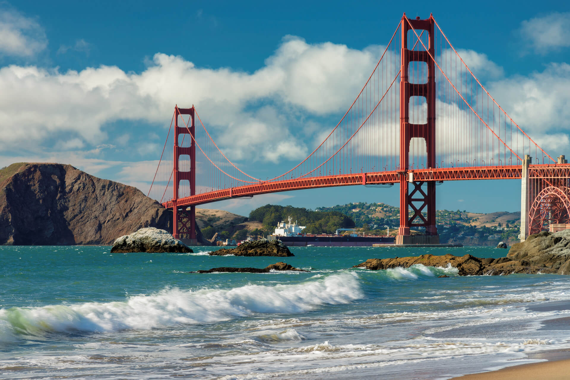
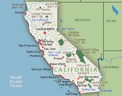
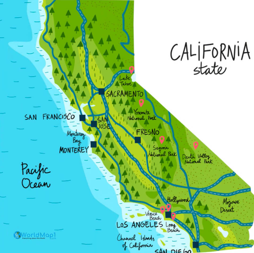 California is also home to some of America's most visited National Parks, including The Redwood National, Yosemite National Park and Death Valley National Park.
California Climate
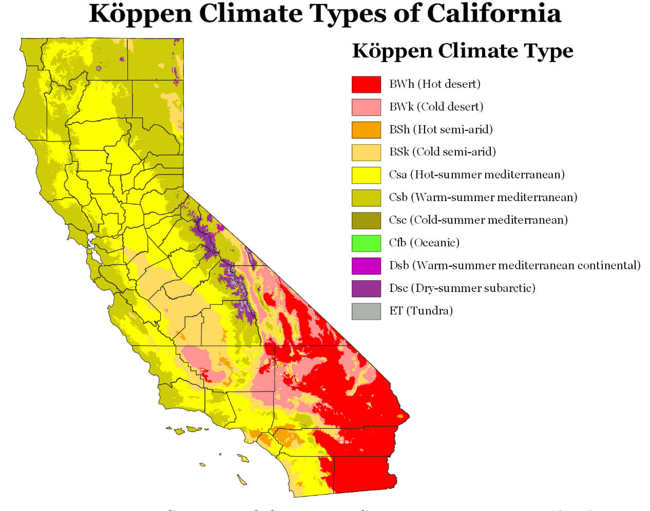 California's summer weather typically runs from April through October, during which time temperatures can reach as high as 110 degrees Fahrenheit (43 Celsius). The rest of the year is generally more moderate, with temperatures rarely falling below freezing during winter months (November through March).
The northern portion of the state gets about 3-4 times more rainfall than the southern portion. Rainfall tends to be highest between October and May, with some areas getting up to 50 inches in that period! Fall is also known for being a rainy season, but not as much as winter or spring. Winter is when most of California's precipitation falls—and especially in San Francisco (which gets about 47 inches each year). Summer is drier overall with average temperatures ranging from 70 degrees F (21 C) in July to 55 F (13 C) in August.
California Time Zones
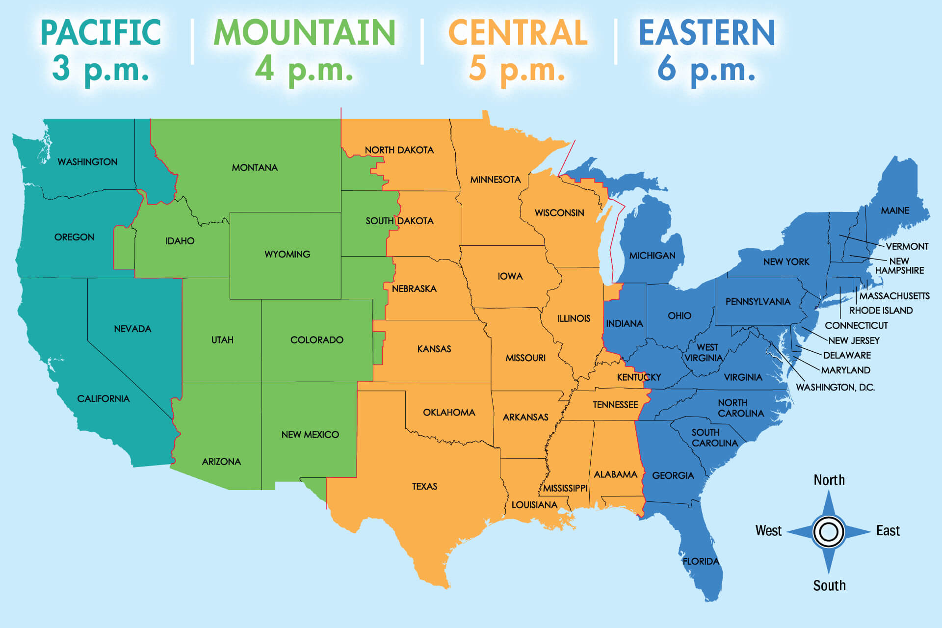 UTC−08:00 (PST)
Latitude 32°32′ N to 42° N
Longitude 114°8′ W to 124°26′ W
California Satellite Map
California Colorful Map
California Terrain Map
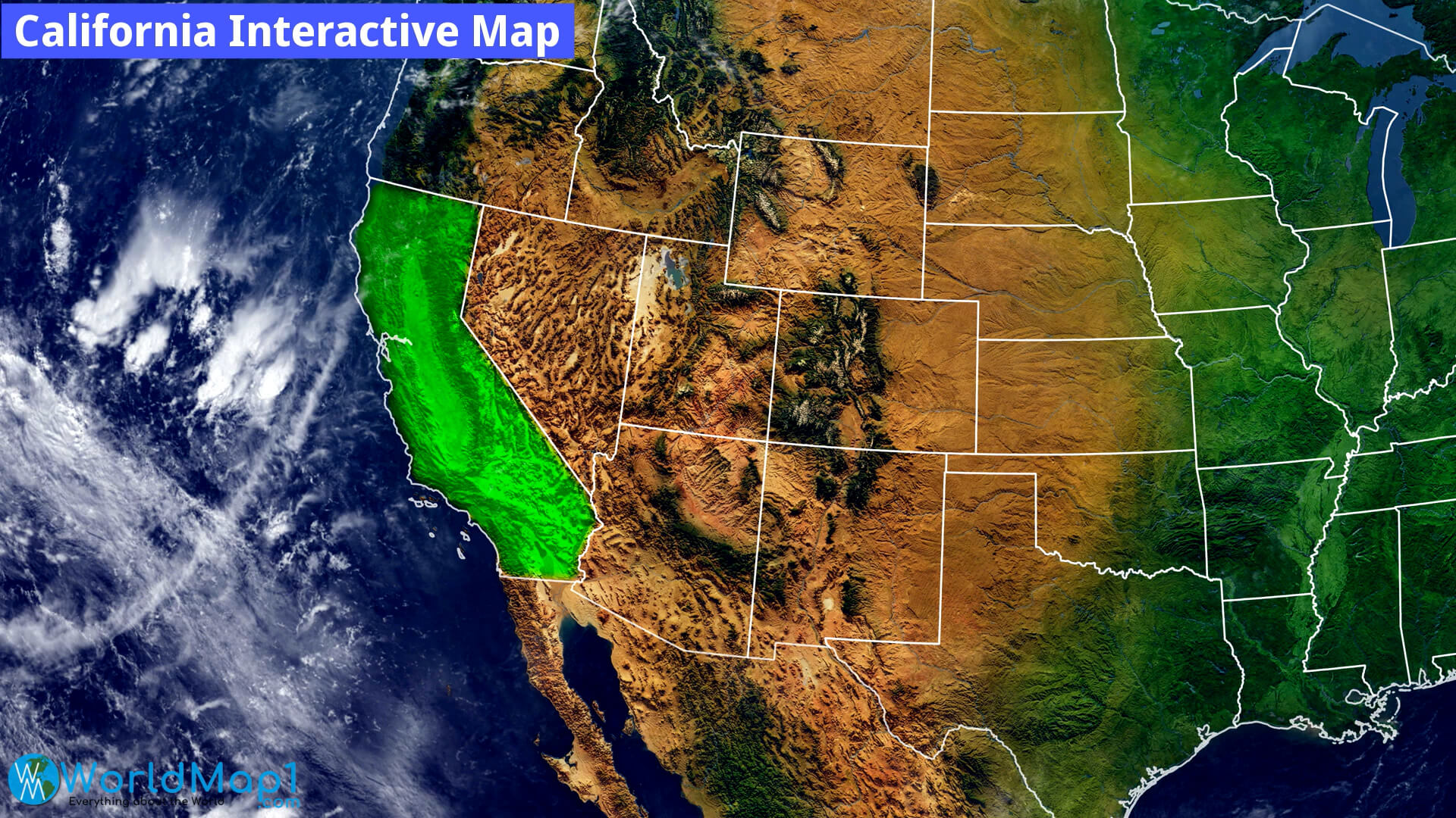
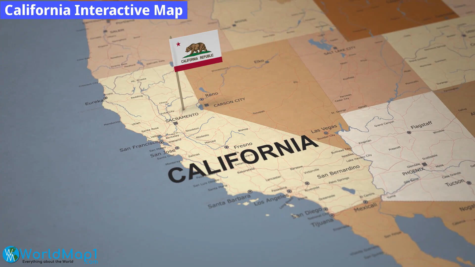
California Interactive Map
Where is Located California in the US
Please view more California Cities Aerial Views, Map and Photos
High Detailed California Map California Free Printable Map Where is Located California in the US and Cities Map of CaliforniaMAP OF CALIFORNIA
CALIFORNIA MAPS
A Collection of California Maps and California Satellite Images
MAP OF CALIFORNIA
CALIFORNIA COUNTY MAP
CALIFORNIA MAP
CALIFORNIA MAPS
CALIFORNIA
CALIFORNIA MAPS
CALIFORNIA CITIES MAP

CALIFORNIA COUNTIES MAP
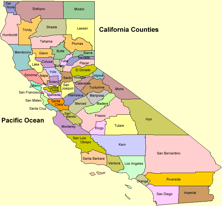
CALIFORNIA COUNTY MAP
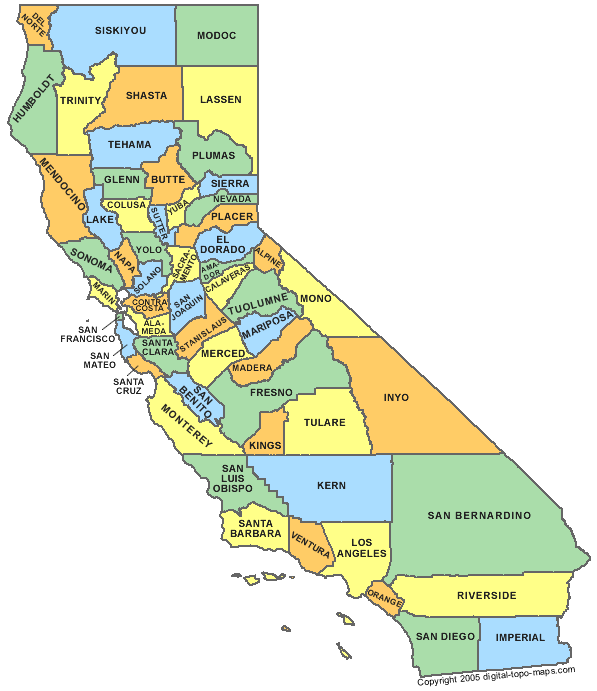
CALIFORNIA COUNTY MAP
CALIFORNIA MAP
CALIFORNIA MAP
CALIFORNIA MAP 1990
CALIFORNIA MAP 1990
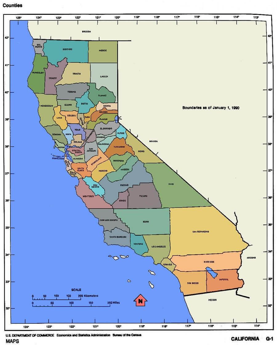
CALIFORNIA MAP COUNTIES
CALIFORNIA PHYSICAL MAP
CALIFORNIA RIVERS MAP
CALIFORNIA ROAD MAP

COUNTY MAP OF CALIFORNIA
GEOGRAPHIC MAP OF CALIFORNIA
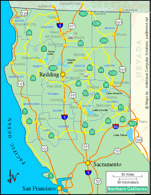
MAP OF NORTHERN CALIFORNIA
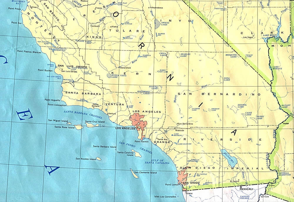
MAPF SOUTH CALIFORNIA
MAPS OF CALIFORNIA
NORTH CALIFORNIA MAP
PHYSICAL MAP CALIFORNIA
ROAD MAP CALIFORNIA
STATE MAP OF CALIFORNIA
A collection of California Maps

- Head of Performance Marketing
- Head of SEO
- Linkedin Profile: linkedin.com/in/arifcagrici
Largest Cities Map of California and Population
Los Angeles Map - 3,792,621 San Diego Map - 1,307,402 San Jose Map - 945,942 San Francisco Map - 805,235 Fresno Map - 494,665 Sacramento Map - 466,488 Long Beach Map - 462,257 Oakland Map - 390,724 Bakersfield Map - 347,483 Anaheim Map - 336,265 Santa Ana Map - 324,528 Riverside Map - 303,871 Stockton Map - 291,707 Chualar Map - 243,916 Fremont Map - 214,089 Irvine Map - 212,375 San Bernardino Map - 209,924 Modesto Map - 201,165 Oxnard Map - 197,899 Fontana Map - 196,069 Moreno Valley Map - 193,365 Glendale Map - 191,719 Huntington Beach Map - 189,992 Santa Clarita Map - 176,320 Garden Grove Map - 170,883 Santa Rosa Map - 167,815 Oceanside Map - 167,086 Rancho Cucamonga Map - 165,269 Ontario Map - 163,924 Lancaster Map - 156,633 Elk Grove Map - 153,015 Palmdale Map - 152,750 Corning Map - 152,374 Salinas Map - 150,441 Pomona Map - 149,058 Torrance Map - 145,438 Hayward Map - 144,186 Escondido Map - 143,911 Sunnyvale Map - 140,081 Pasadena Map - 137,122 Orange Map - 136,416 Fullerton Map - 135,161 Thousand Oaks Map - 126,683 East La Mirada Map - 126,496 Visalia Map - 124,442 Simi Valley Map - 124,237 Compton Map - 122,067 Roseville Map - 118,788 Santa Clara Map - 116,468 Vallejo Map - 115,942 Victorville Map - 115,903 El Granada Map - 113,475 Benton Map - 112,580 Douglas City Map - 111,772 Corte Madera Map - 109,960 Inglewood Map - 109,673 San Buenaventura (Ventura) Map - 106,433 West Covina Map - 106,098 Norwalk Map - 105,549 Caribou Map - 105,328 Fairfield Map - 105,321 Richmond Map - 103,701 Murrieta Map - 103,466 Buena Vista Map - 103,340 Antelope Map - 102,372 Cypress Map - 101,123 Temecula Map - 100,097 Santa Maria Map - 99,553 Edwards AFB Map - 99,478 Rialto Map - 99,171 San Mateo Map - 97,207 Comptche Map - 96,455 Cloverdale Map - 95,631 South Gate Map - 94,396 Vista Map - 93,834 Mission Viejo Map - 93,305 Vacaville Map - 92,428 Arcata Map - 92,186 Carrick Map - 91,714 Hesperia Map - 90,173 Redding Map - 89,861 Santa Monica Map - 89,736 Westminster Map - 89,701 Santa Barbara Map - 88,410 Chester Map - 86,187 Whittier Map - 85,331 Newport Beach Map - 85,186 San Leandro Map - 84,950 Hawthorne Map - 84,293 San Marcos Map - 83,781 Citrus Map - 83,301 Alhambra Map - 83,089 Tracy Map - 82,922 Livermore Map - 80,968 Buellton Map - 80,530 Lakewood Map - 80,048 Merced Map - 78,958 Hemet Map - 78,657 Chinese Camp Map - 77,983 Menifee Map - 77,519 Lake Forest Map - 77,264 Napa Map - 76,915 Redwood City Map - 76,815 Bella Vista Map - 76,616 Indio Map - 76,036 Tustin Map - 75,540 Baker Map - 75,390 Chino Map - 74,799 Mountain View Map - 74,066 Alameda Map - 73,812 Upland Map - 73,732 Folsom Map - 72,203 San Ramon Map - 72,148 Pleasanton Map - 70,285 Lynwood Map - 69,772 Union City Map - 69,516 Anza Map - 69,135 Redlands Map - 68,747 Turlock Map - 68,549 Perris Map - 68,386 Manteca Map - 67,096 Milpitas Map - 66,790 Redondo Beach Map - 66,748 Davenport Map - 65,622 Camanche Village Map - 65,201 Yuba City Map - 64,925 Rancho Cordova Map - 64,776 Palo Alto Map - 64,403 Yorba Linda Map - 64,234 Walnut Creek Map - 64,173 South San Francisco Map - 63,632 San Clemente Map - 63,522 Florence Graham Map - 63,387 Pittsburg Map - 63,264 Laguna Niguel Map - 62,979 Pico Rivera Map - 62,942 Montebello Map - 62,500 Lodi Map - 62,134 Carmet Map - 61,762 Madera Map - 61,416 Castle Hill Map - 61,388 Monterey Park Map - 60,269 La Habra Map - 60,239 Santa Cruz Map - 59,946 Encinitas Map - 59,518 Tulare Map - 59,278 Gardena Map - 58,829 National City Map - 58,582 Culver City Map - 58,302 Huntington Park Map - 58,114 Petaluma Map - 57,941 San Rafael Map - 57,713 South Whittier Map - 57,156 La Mesa Map - 57,065 Perris Camp Map - 57,065 Rocklin Map - 56,974 Arbuckle Map - 56,364 Diablo Grande Map - 55,544 Woodland Map - 55,468 Fountain Valley Map - 55,313 Porterville Map - 54,165 Paramount Map - 54,098 Hacienda Heights Map - 54,038 Hanford Map - 53,967 Rosemead Map - 53,764 Easton Map - 53,668 Santee Map - 53,413 Highland Map - 53,104 Del Rio Map - 53,041 Coloma Map - 52,154 Novato Map - 51,904 Lake Elsinore Map - 51,821 Brea Map - 51,481 Yucaipa Map - 51,367 Castroville Map - 51,200 Watsonville Map - 51,199 Placentia Map - 50,533 Glendora Map - 50,073 Daly City Map - 33,351 Corona Map - 18,912 Chula Vista Map - 10,866 Berkeley Map - 7,282 Costa Mesa Map - 7,265 Burbank Map - 4,926 Carlsbad Map - 4,407 Antioch Map - 3,014 Downey Map - 282
Addresse: Hakarinne 2 Espoo, Uusimaa - Finland 02210
Web: istanbul-city-guide.com
Email: [email protected]
Web: istanbul-city-guide.com
Email: [email protected]
Copyright istanbul-city-guide.com - 2004 - 2026. All rights reserved. Privacy Policy | Disclaimer