Bangladesh Map and Bangladesh Satellite Images
Explore map of Bangladesh, Bangladesh map, cities map of Bangladesh, satellite images of Bangladesh, Bangladesh largest cities maps, political map of Bangladesh, driving directions, country atlas and traffic map.
Bangladesh Map FQA
How many cities are in Bangladesh ?
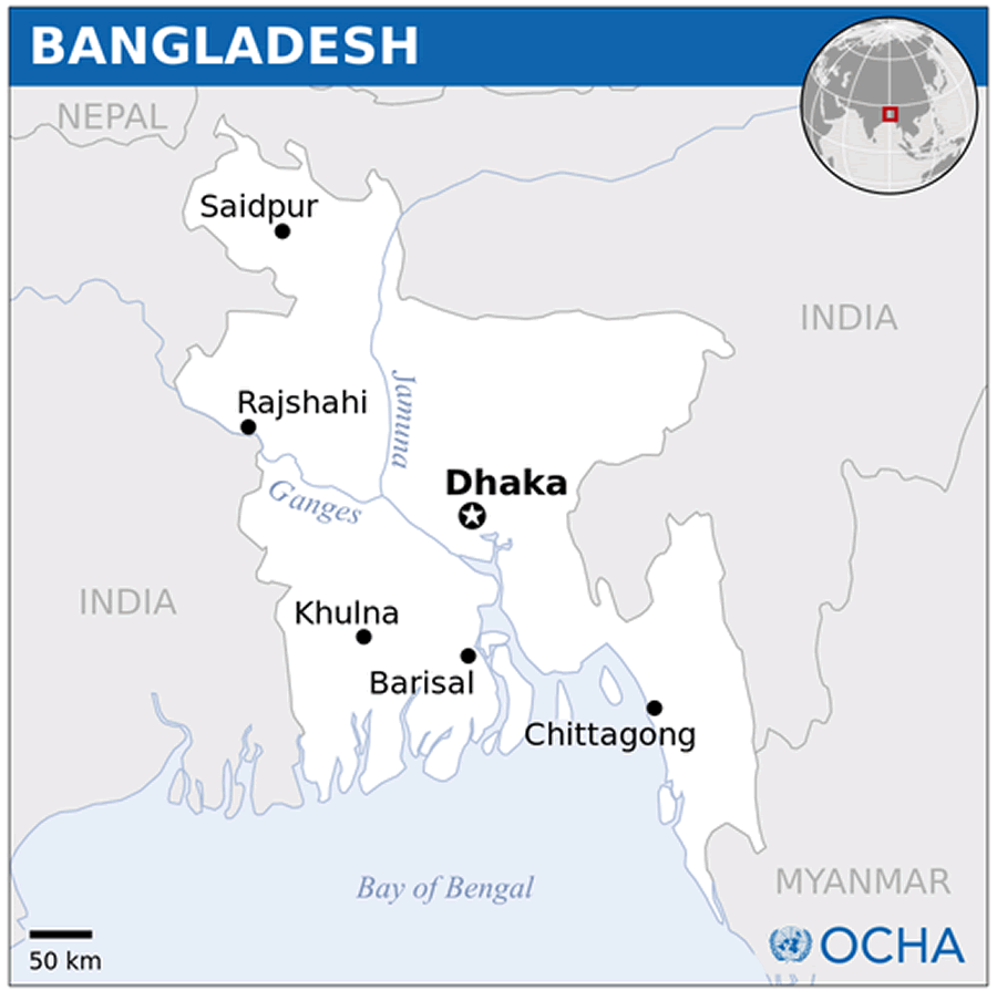
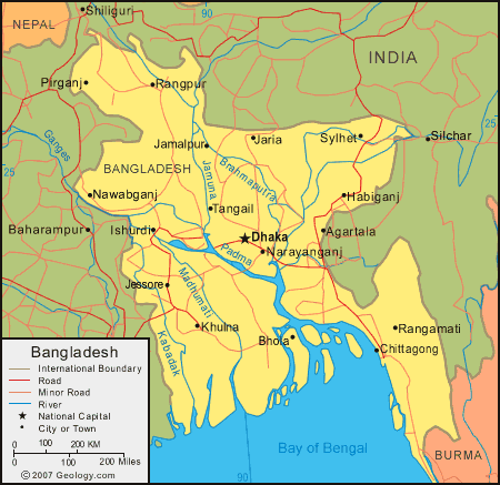
Bangladesh has more than 50 cities. The 10 largest by population are: Dhaka, Chittagong, Khulna, Rajshahi, Sylhet, Barisal, Rangpur, Comilla, Gazipur, and Narayanganj.What are the major geographical features of Bangladesh ?
Bangladesh is a low-lying country in South Asia dominated by the Ganges-Brahmaputra Delta. It features extensive river systems, fertile floodplains, and coastal mangrove forests such as the Sundarbans. The Chittagong Hill Tracts in the southeast provide hilly terrain.BANGLADESH LOCATION MAP ASIA
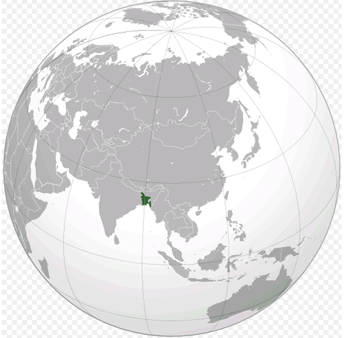
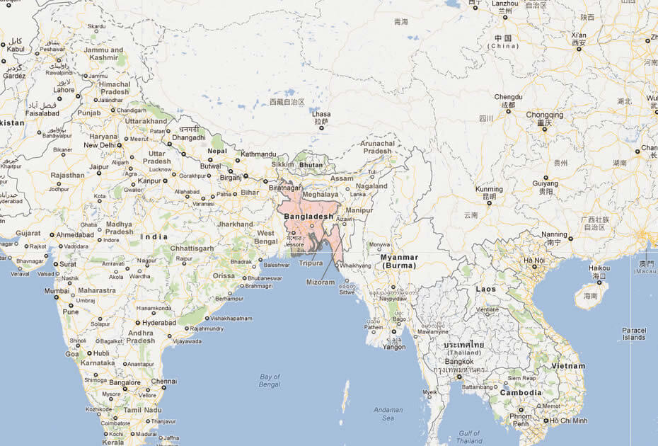
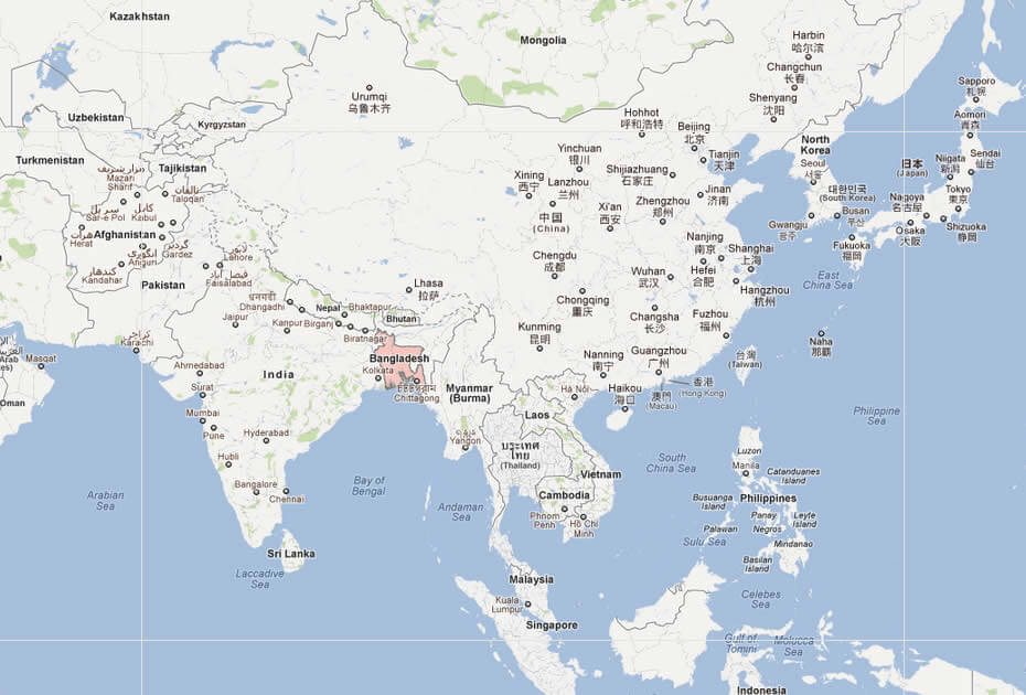
WHERE IS BANGLADESH IN THE WORLD
BANGLADESH LOCATION MAP ASIA
Can I download a high-resolution map of Bangladesh ?
Yes. Download high-resolution political and physical maps of Bangladesh for personal or educational use. Redistribution is subject to the terms of our license.
- Capital : Dhaka
- Population : 161,083,804
- GDP : 113.855 billion (59)
- Per Capita : $700
- Calling Code : +880
- Jobless Rate : 4.50%
- Time Zone : +6
For more about Bangladesh >>
A Collection of Bangladesh Maps and Bangladesh Satellite Images
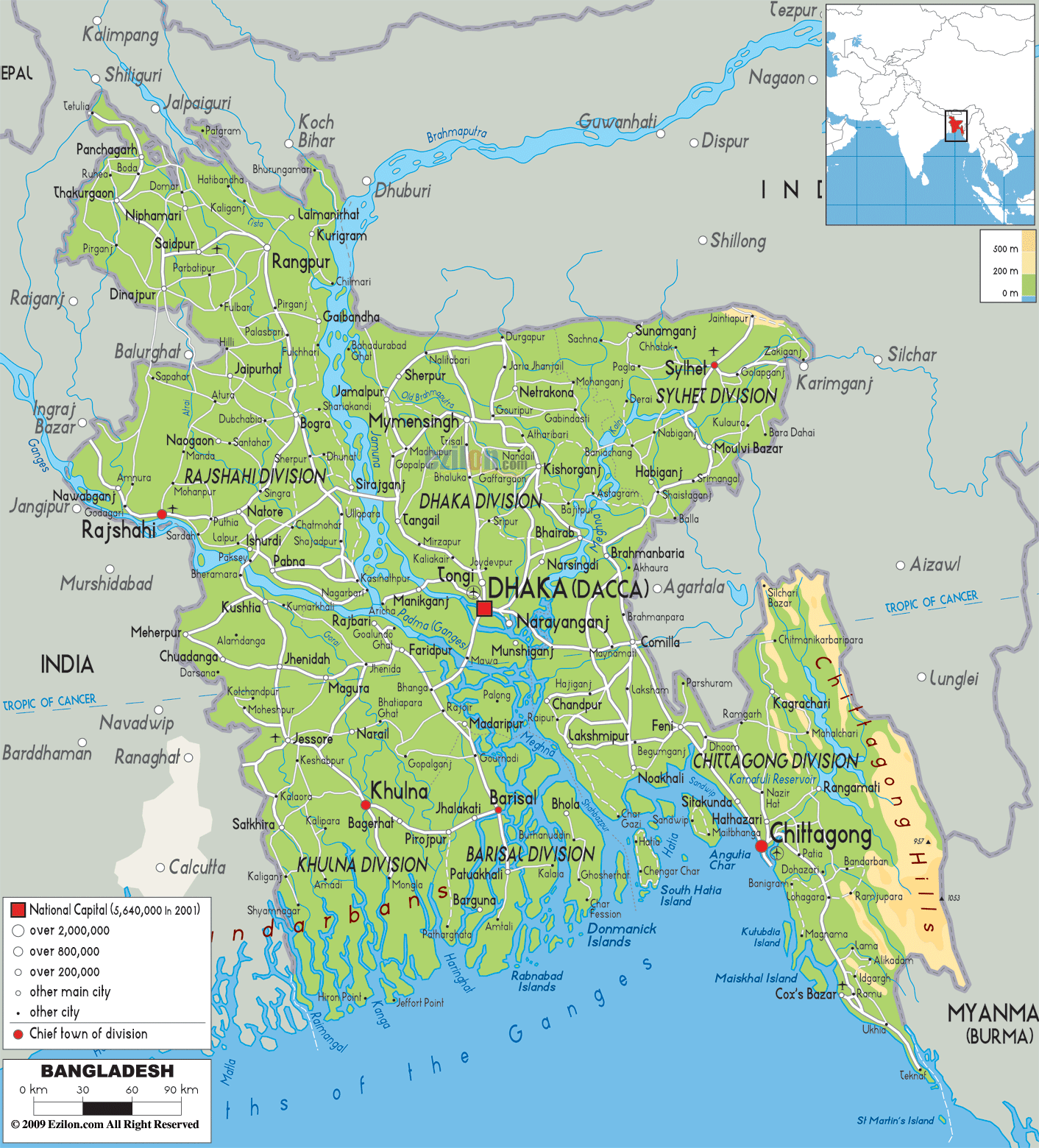
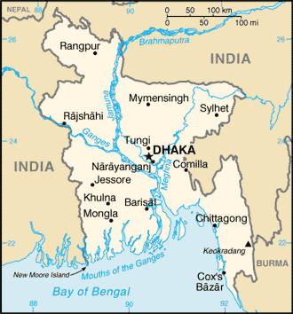
MAP OF BANGLADESH
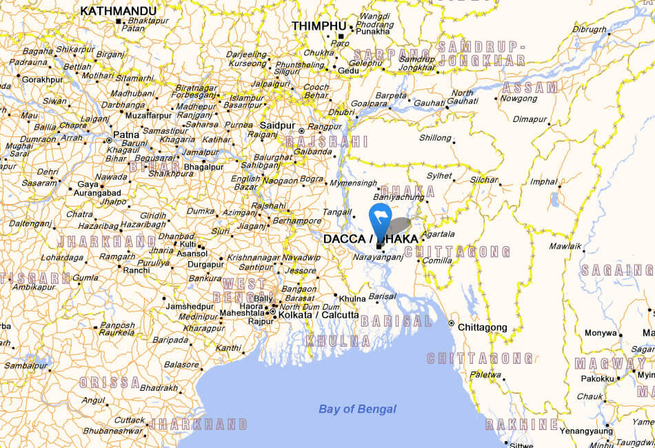
WHERE IS BANGLADESH IN THE WORLD
BANGLADESH LOCATION MAP ASIA
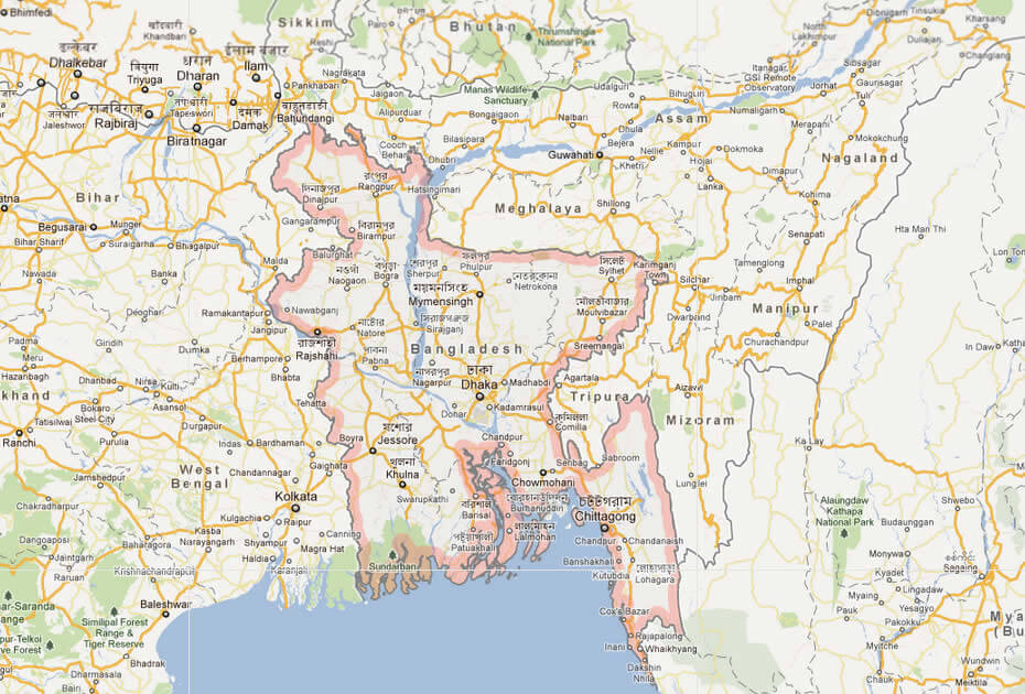
BANGLADESH CITIES MAP
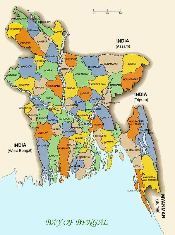
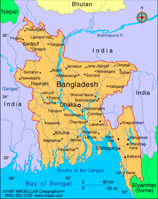
BANGLADESH MAP

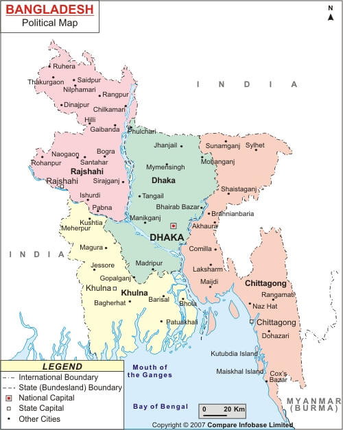
BANGLADESH POLITICAL MAP
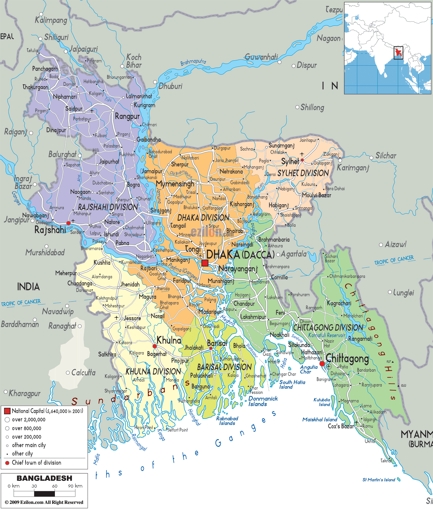
BANGLADESH REGIONAL MAP
BANGLADESH MAP
BANGLADESH PHYSICAL MAP
MAP BANGLADESH
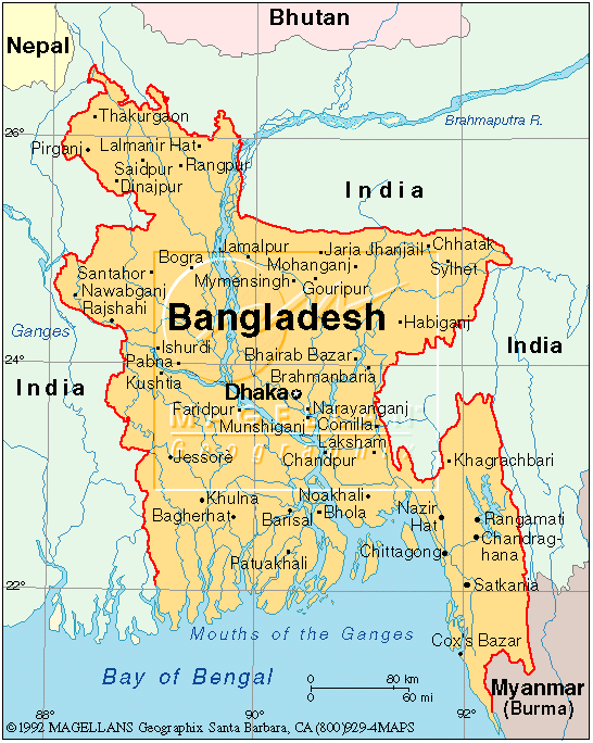
MAP OF BANGLADESH INDIA
MAP OF BANGLADESH WORLD
MAP OF BANGLADESH
MAP BANGLADESH
POLITICAL MAP OF BANGLADESH
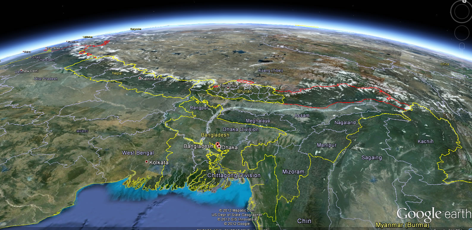
BANGLADESH EARTH MAP
Exploring Bangladesh Through Maps: A Visual Journey of the Land of Rivers
Please subscribe on "World Guide" channnel on Youtube at youtube.com/c/WorldGuide
Dhaka Unveiled: A Cinematic Journey Through the City's Icons
Largest Cities' Map of Bangladesh
Chittagong Map Narayanganj Map Khulna Map Gazipur Map Comilla Map Mymensingh Map Rangpur Map Barisal Map Rajshahi Map Sylhet Map Dhaka Map Jessore Map Bogra Map
Addresse: Hakarinne 2 Espoo, Uusimaa - Finland 02210
Web: istanbul-city-guide.com
Email: [email protected]
Web: istanbul-city-guide.com
Email: [email protected]
Copyright istanbul-city-guide.com - 2004 - 2026. All rights reserved. Privacy Policy | Disclaimer