Greece Map and Greece Satellite Images
Explore map of Greece, Greece map, cities map of Greece, satellite images of Greece, Greece largest cities maps, political map of Greece, driving directions, country atlas and traffic map.
Greece Map FQA
How many cities are in Greece ?
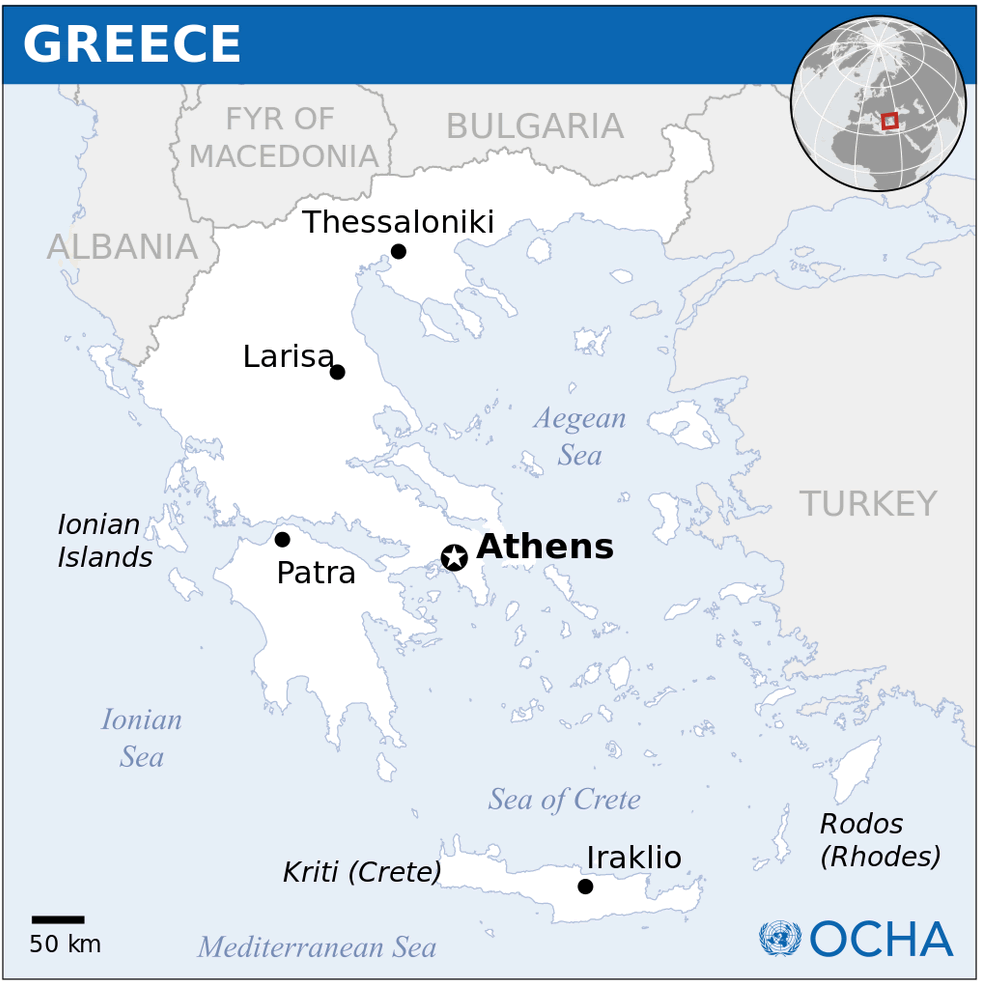
Greece has more than 200 cities and towns. The 10 largest are: Athens, Thessaloniki, Patras, Heraklion, Larissa, Volos, Acharnes, Chania, Agrinio, and Ioannina.What are the major geographical features of Greece ?
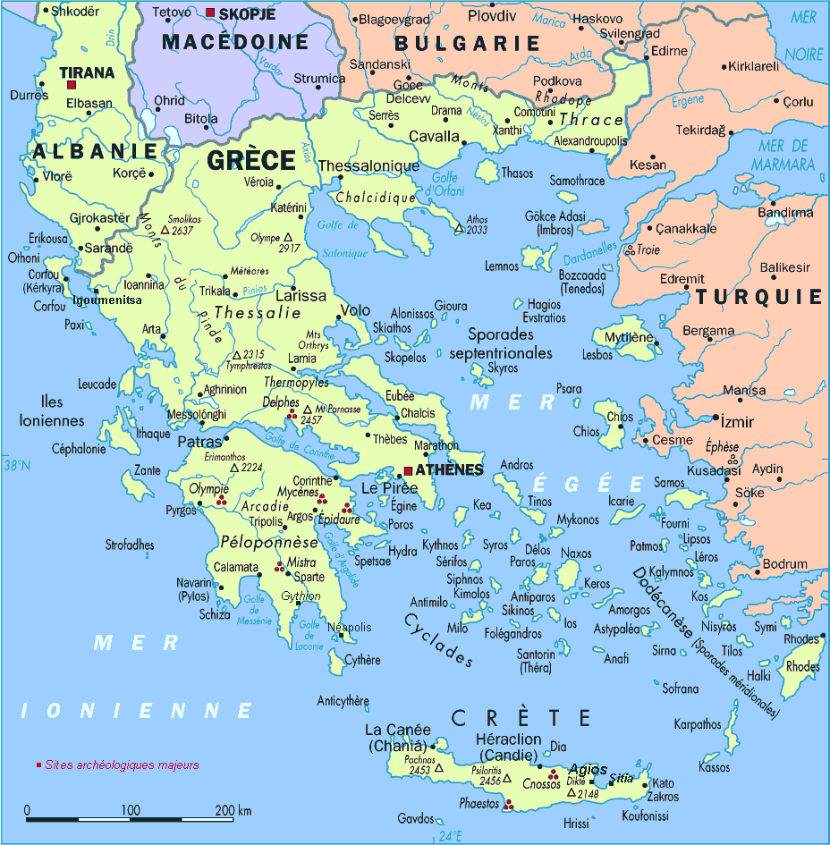
Greece is a mountainous country in southeastern Europe with ranges such as the Pindus and Olympus. It has thousands of islands, extensive coastlines, fertile plains, and rivers like the Axios and Evros.WHERE IS GREECE IN THE WORLD
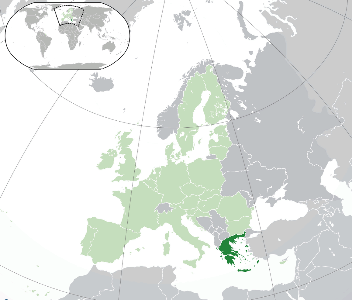
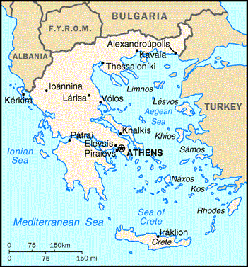
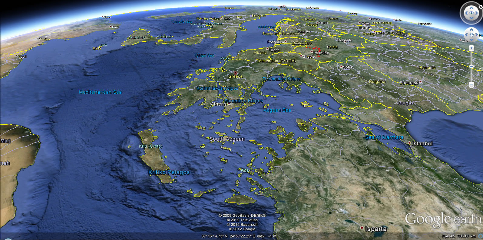
GREECE LOCATION MAP
WHERE IS GREECE IN THE WORLD
Can I download a high-resolution map of Greece ?
Yes. Download high-resolution political and physical maps of Greece for personal or educational use. Redistribution is subject to the terms of our license.
- Capital : Athens
- Population : 10,815,197
- GDP : $254.978 billion (35th)
- Per Capita : $22,757 (30th)
- Calling Code : +30
- Jobless Rate : 26.80%
- Time Zone : +2
For more about Greece >>
A Collection of Greece Maps and Greece Satellite Images
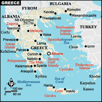
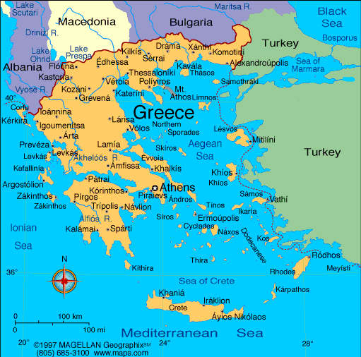
MAP OF GREECE

GREECE LOCATION MAP
WHERE IS GREECE IN THE WORLD
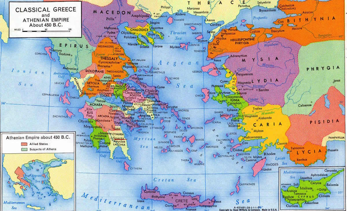
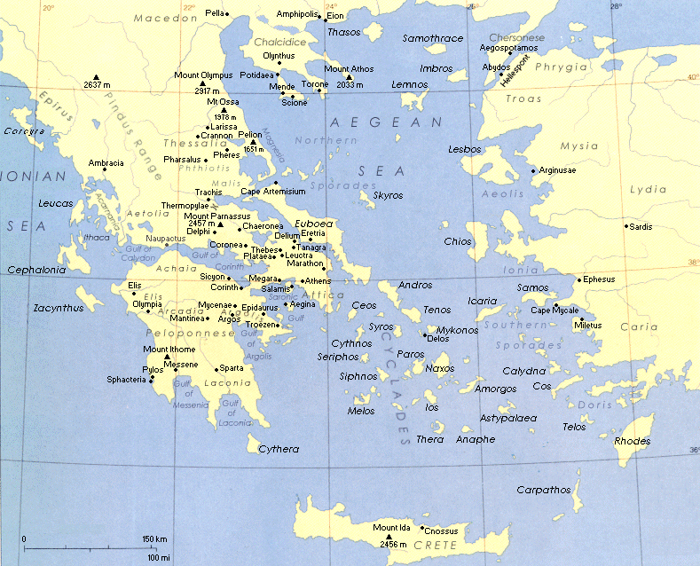
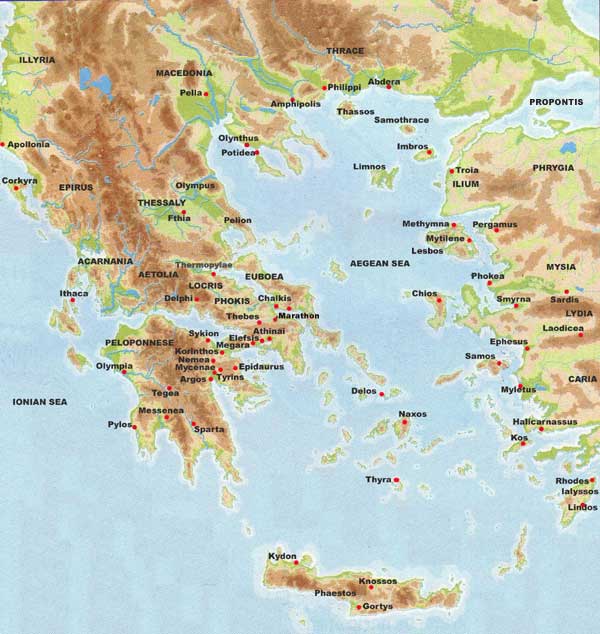
ANCIENT TIME MAP GREECE
GREECE MAP
GREECE MAPS
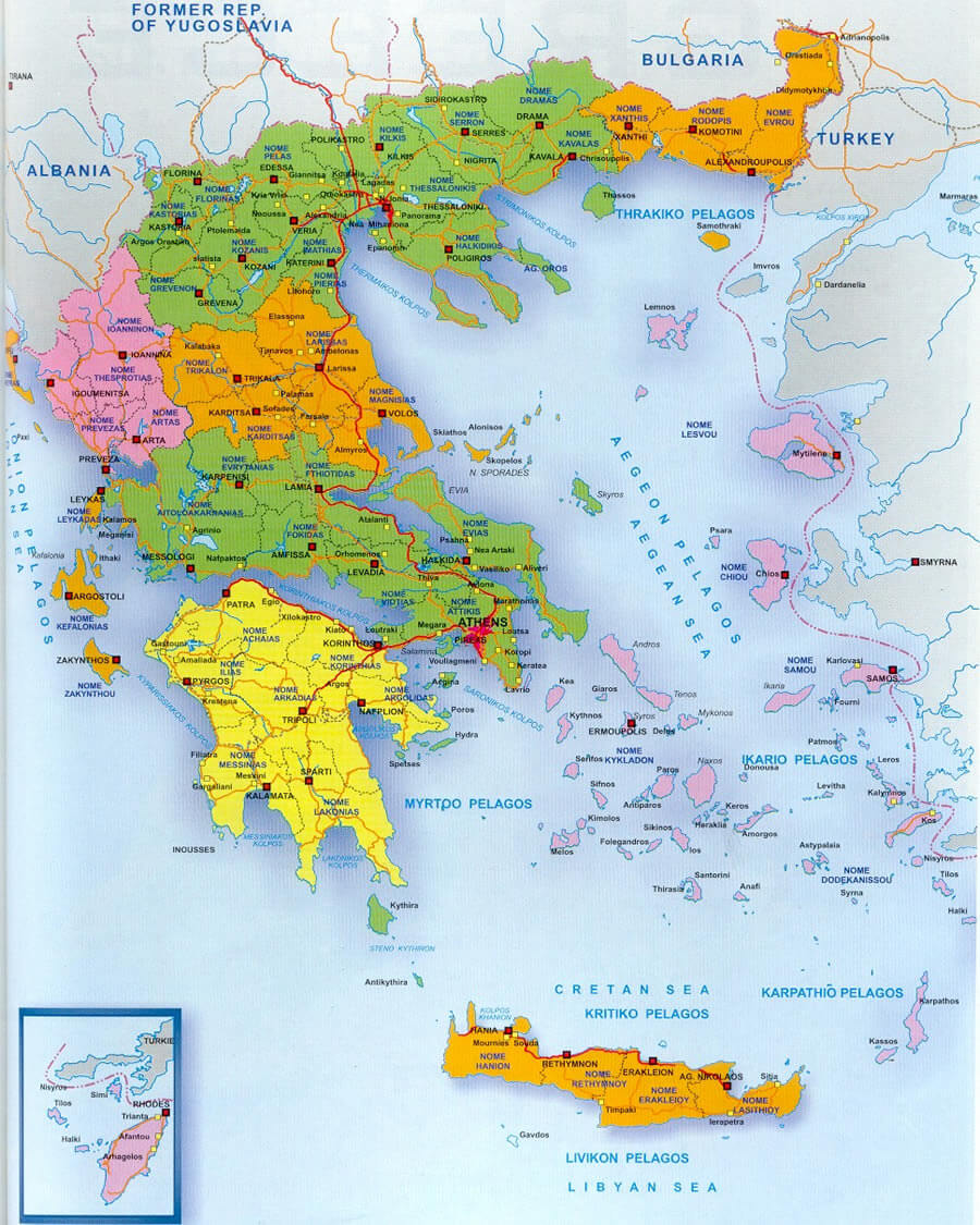
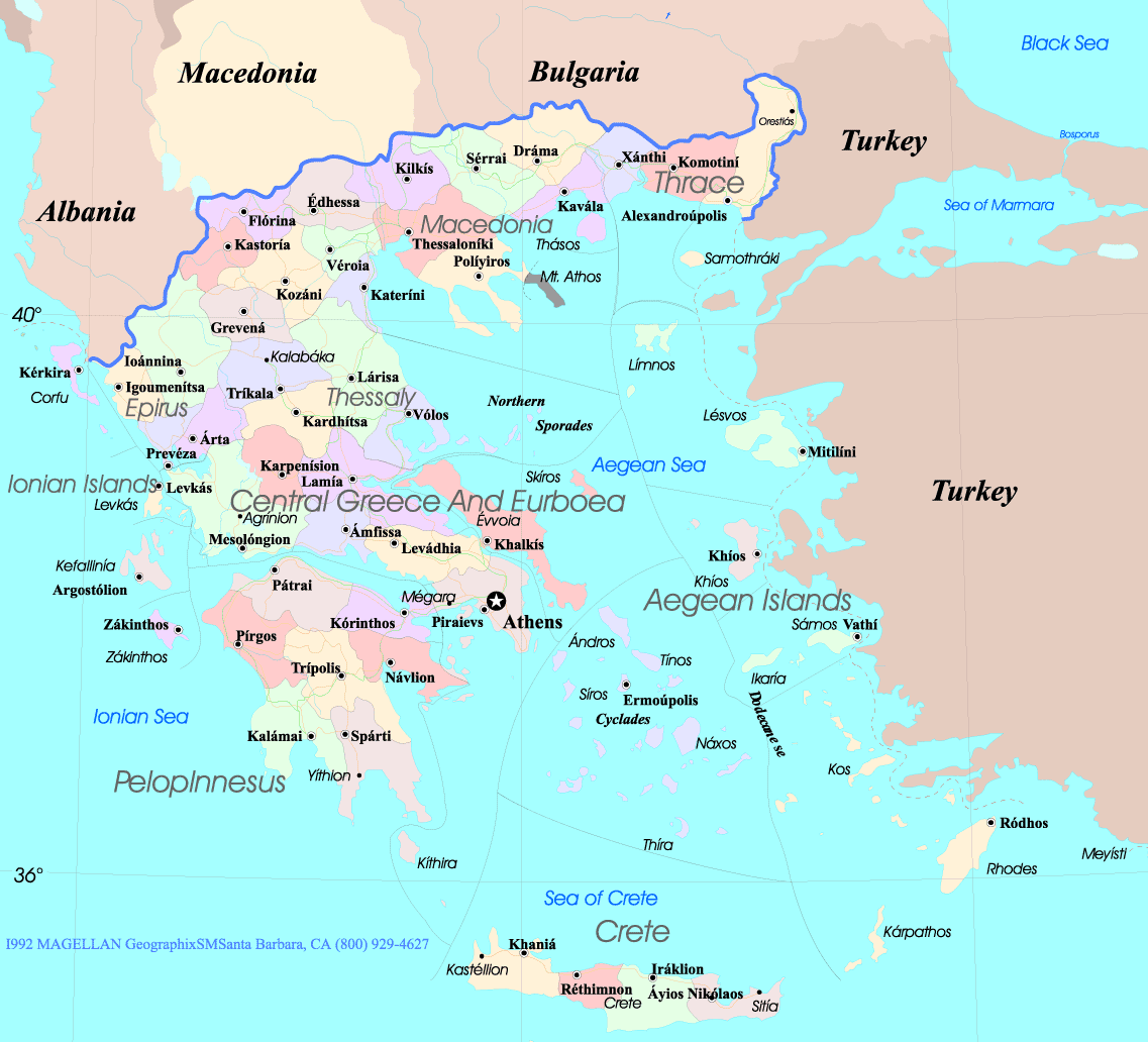
GREECE DIVISION MAP

GREECE MAP
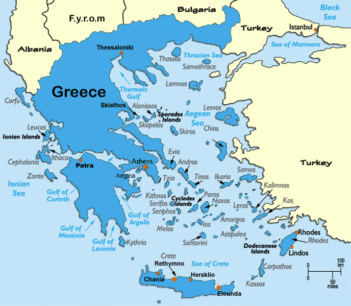
GREECE MAP AEGEAN SEA
GREECE MAP BOUNDARY
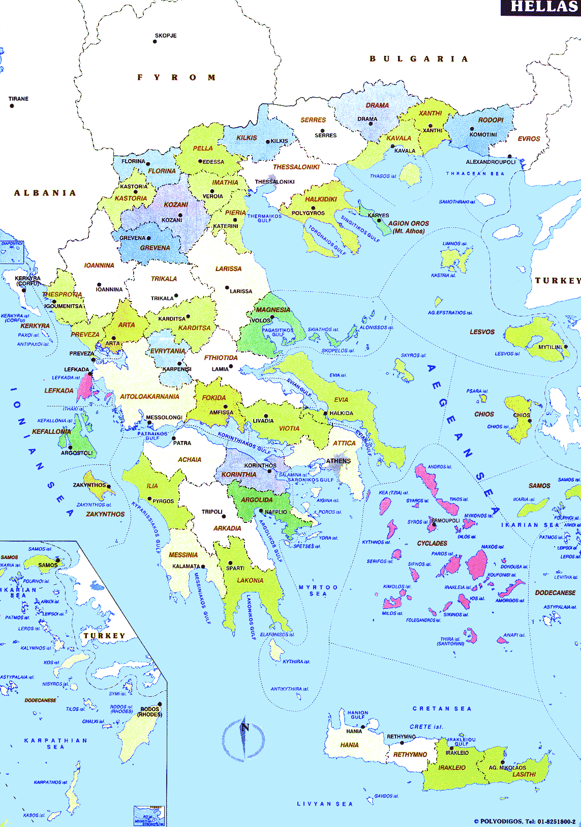
GREECE MAP HELLAS
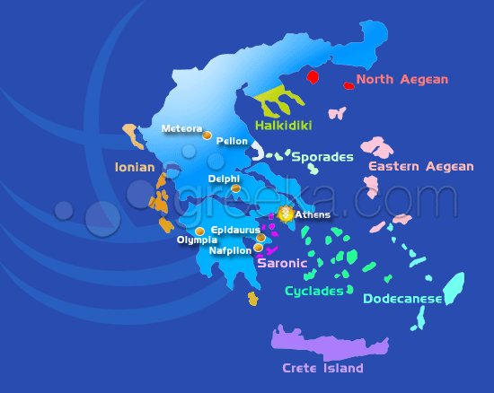
GREECE MAP ISLANDS
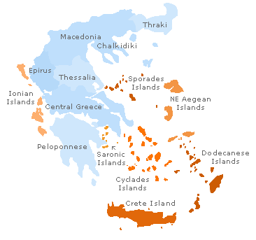
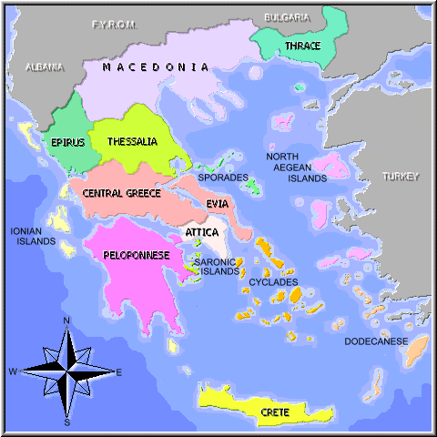
GREECE REGIONS MAP
GREECEMAP
MAP GREECE
MAP OF ANCIENT GREECE
MAP OF GREECE
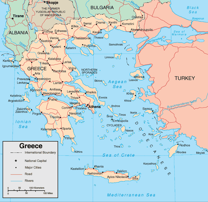
MAP OF GREECE

MAPS OF GREECE
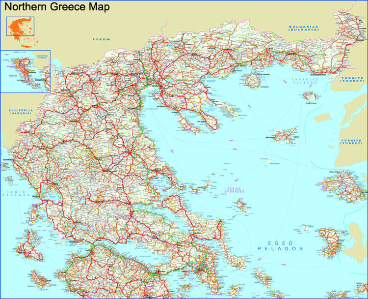
NORTHERN GREECE MAP
POLITICAL MAP OF GREECE
GREECE EARTH MAP
Mesopotamia-s Heartbeat: A Visual Odyssey Through Baghdad
Please subscribe on "World Guide" channnel on Youtube at youtube.com/c/WorldGuide
ASIA from Space and Asian Countries Satellite View - Day Time and in the Night
Largest Cities' Map of Greece
Athens Map Thessaloniki Map Volos Map Patras Map Larissa Map Heraklion Map Chania Map Akharnai Map Ioannina Map Kavala Map
Addresse: Hakarinne 2 Espoo, Uusimaa - Finland 02210
Web: istanbul-city-guide.com
Email: [email protected]
Web: istanbul-city-guide.com
Email: [email protected]
Copyright istanbul-city-guide.com - 2004 - 2026. All rights reserved. Privacy Policy | Disclaimer