Netherlands Map and Netherlands Satellite Images
Explore map of Netherlands, Netherlands map, cities map of Netherlands, satellite images of Netherlands, Netherlands largest cities maps, political map of Netherlands, driving directions, country atlas and traffic map.
Netherlands Map FQA
How many cities are in Netherlands ?
Netherlands has more than 10 cities. The largest by population are: Amsterdam; Rotterdam; The Hague; Utrecht; Eindhoven; Tilburg; Groningen; Almere; Breda; Nijmegen.What are the major geographical features of Netherlands ?
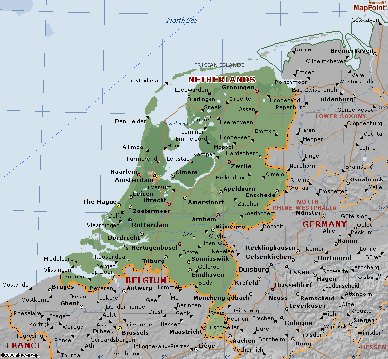
The Netherlands is a low-lying country in Western Europe. Much of its land is below sea level, protected by dikes and polders. It features rivers such as the Rhine, Maas, and Scheldt, and flat agricultural plains.NETHERLANDS LOCATION MAP
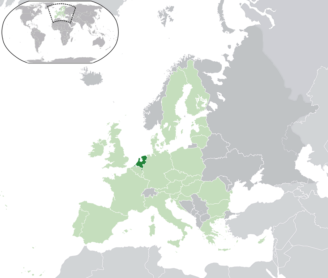
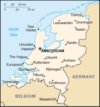
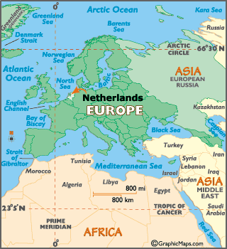
WHERE IS NETHERLANDS IN THE WORLD
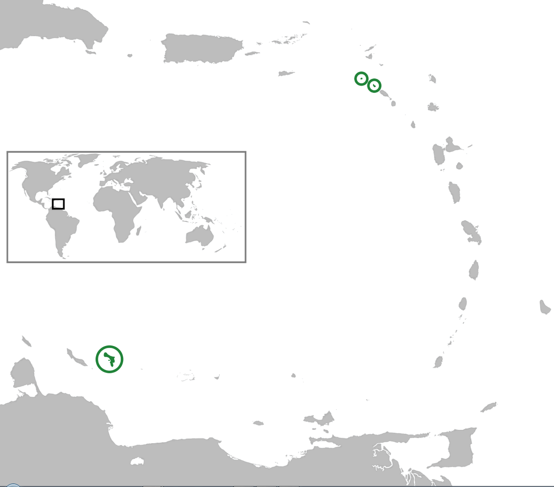
NETHERLANDS LOCATION MAP
Can I download a high-resolution map of Netherlands ?
Yes. Download high-resolution political and physical maps of Netherlands for personal or educational use. Redistribution is subject to the terms of our license.
- Capital : Amsterdam
- Population : 16,751,323
- GDP : $840.433 billion
- Per Capita : $50,355
- Calling Code : +31
- Jobless Rate : 7.20%
- Time Zone : +1
For more about Netherlands >>
A Collection of Netherlands Maps and Netherlands Satellite Images
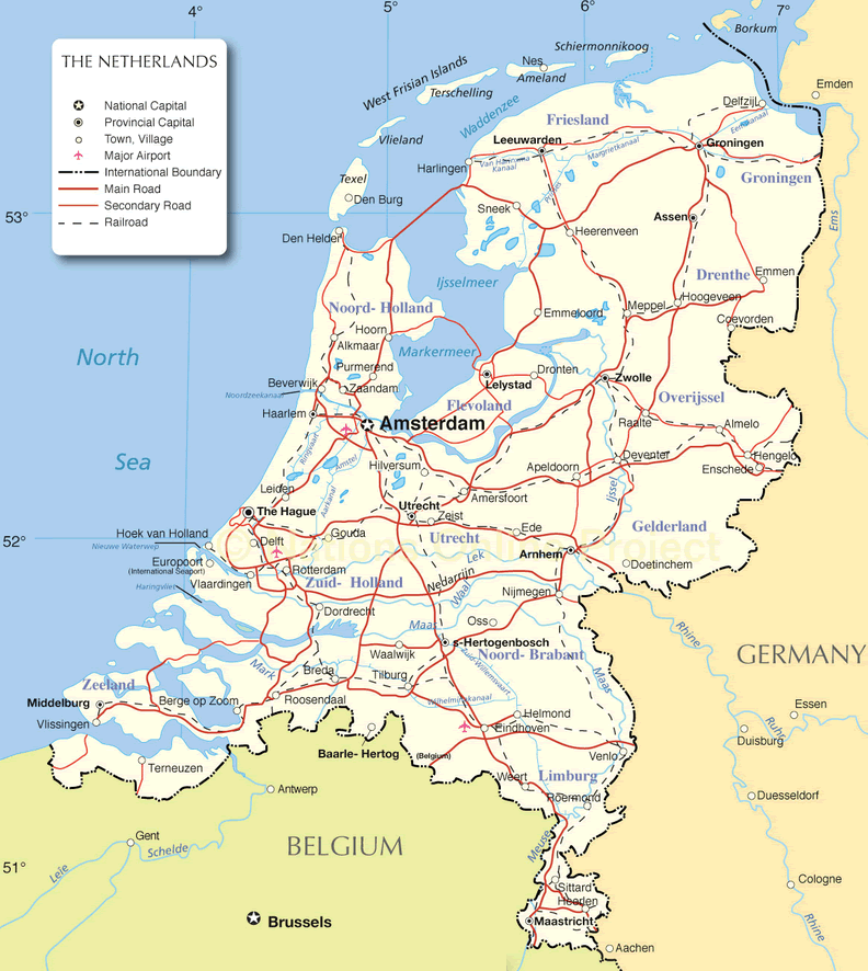
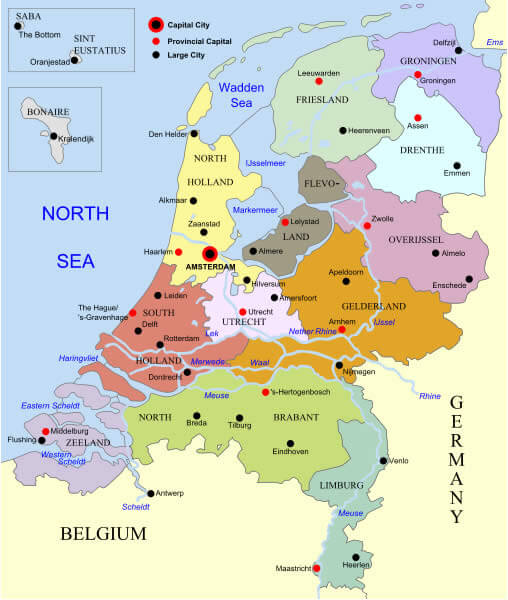
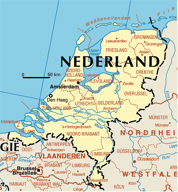
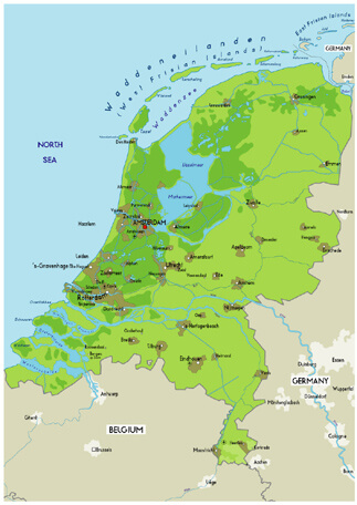
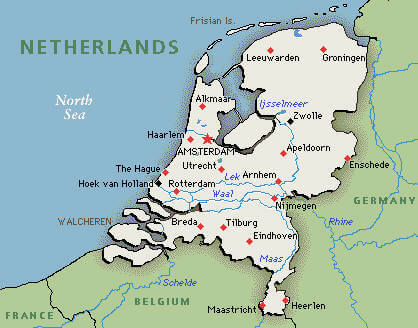
MAP OF NETHERLANDS

WHERE IS NETHERLANDS IN THE WORLD
NETHERLANDS LOCATION MAP
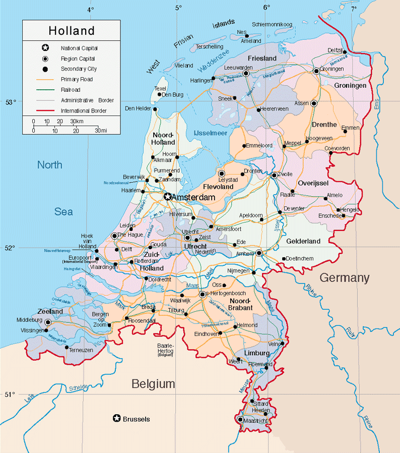
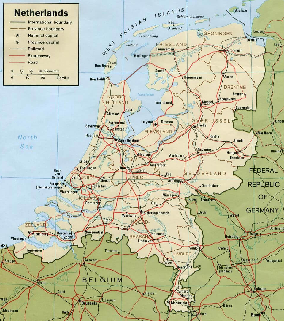
HOLLAND PHYSICAL MAP
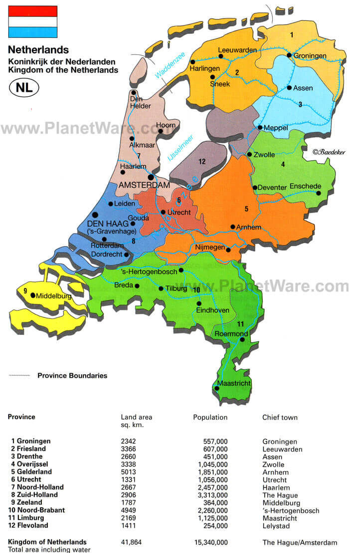
KINGDOM OF THE NETHERLANDS MAP
MAP NETHERLANDS
MAP OF NETHERLANDS
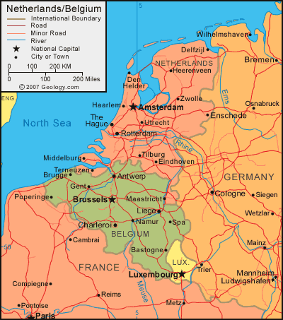
NETHERLANDS MAP BELGIUM
NETHERLANDS MAP
NETHERLANDS POPULATION MAP
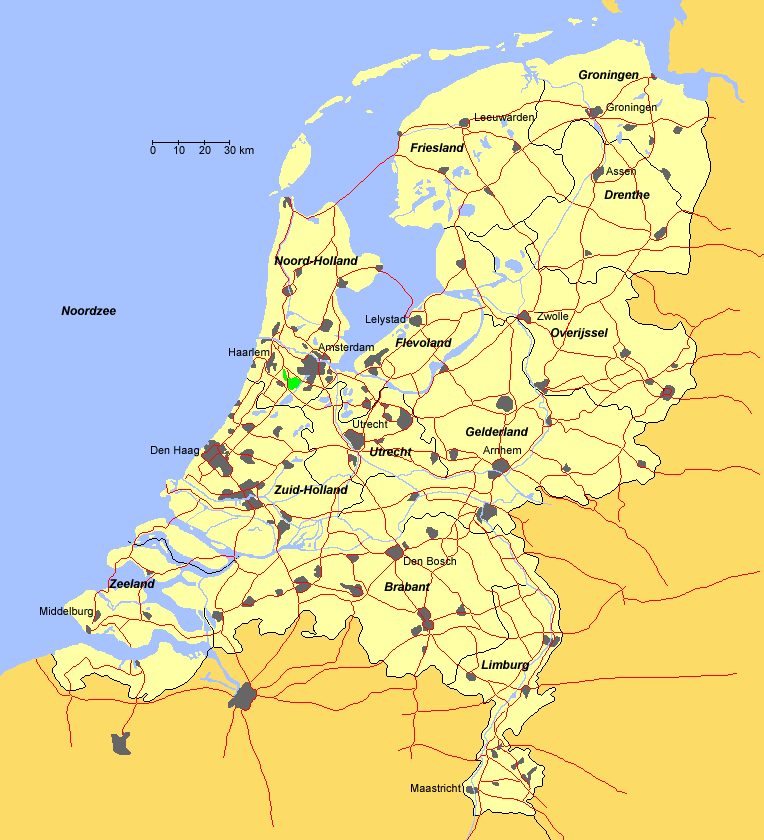
NETHERLANDS CITIES MAP
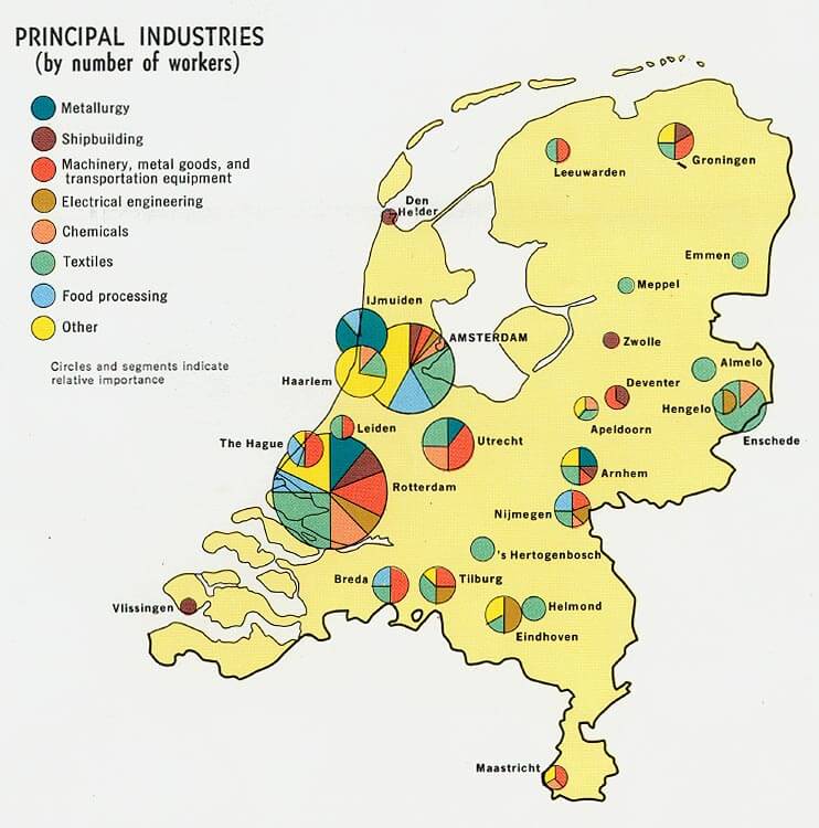
NETHERLANDS INDUSTRY MAP
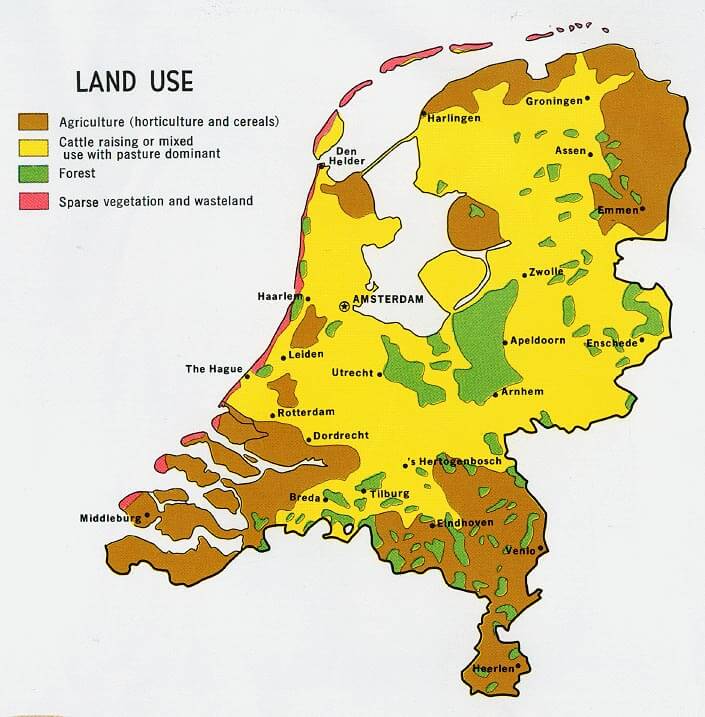
NETHERLANDS LAND MAP
NETHERLANDS MAP EUROPE
NETHERLANDS PHYSICAL MAP
NETHERLANDS POLITICAL MAP
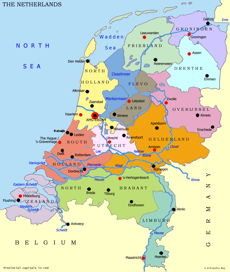
NETHERLANDS PROVINCES MAP
PHYSICAL MAP NETHERLANDS
POLITICAL NETHERLANDS MAP
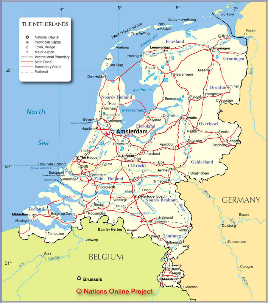
THE NETHERLANDS MAP
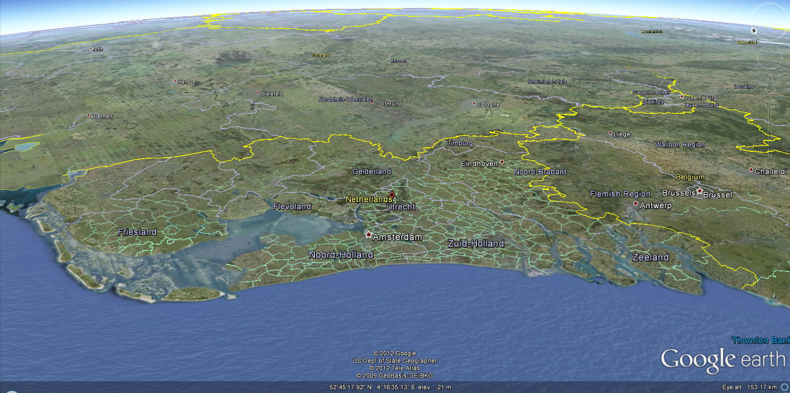
NETHERLANDS EARTH MAP
Amsterdam's Magic: Canals, Culture, and Hidden Corners
Please subscribe on "World Guide" channnel on Youtube at youtube.com/c/WorldGuide
Getting the Best of Amsterdam: 10 Must-Do Activities in the Dutch Capital
Largest Cities' Map of Netherlands
Almere Map Amersfoort Map Amsterdam Map Apeldoorn Map Arnhem Map Breda Map Delft Map Deventer Map Dordrecht Map Ede Map Eindhoven Map Emmen Map Enschede Map Groningen Map Haarlem Map Haarlemmermeer Map Heerlen Map Helmond Map Hengelo Map Leeuwarden Map Leiden Map Maastricht Map Nijmegen Map Rotterdam Map The Hague Map Hertogenbosch Map Sittard Geleen Map Tilburg Map Utrecht Map Venlo Map Zaanstad Map Zoetermeer Map Zwolle Map
Addresse: Hakarinne 2 Espoo, Uusimaa - Finland 02210
Web: istanbul-city-guide.com
Email: [email protected]
Web: istanbul-city-guide.com
Email: [email protected]
Copyright istanbul-city-guide.com - 2004 - 2026. All rights reserved. Privacy Policy | Disclaimer