Ireland Map and Ireland Satellite Images
Explore map of Ireland, Ireland map, cities map of Ireland, satellite images of Ireland, Ireland largest cities maps, political map of Ireland, driving directions, country atlas and traffic map.
Ireland Map FQA
How many cities are in Ireland ?
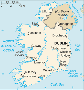
Ireland has about 40 cities and large towns. The 10 largest are: Dublin, Cork, Limerick, Galway, Waterford, Drogheda, Swords, Dundalk, Bray, and Navan.What are the major geographical features of Ireland ?
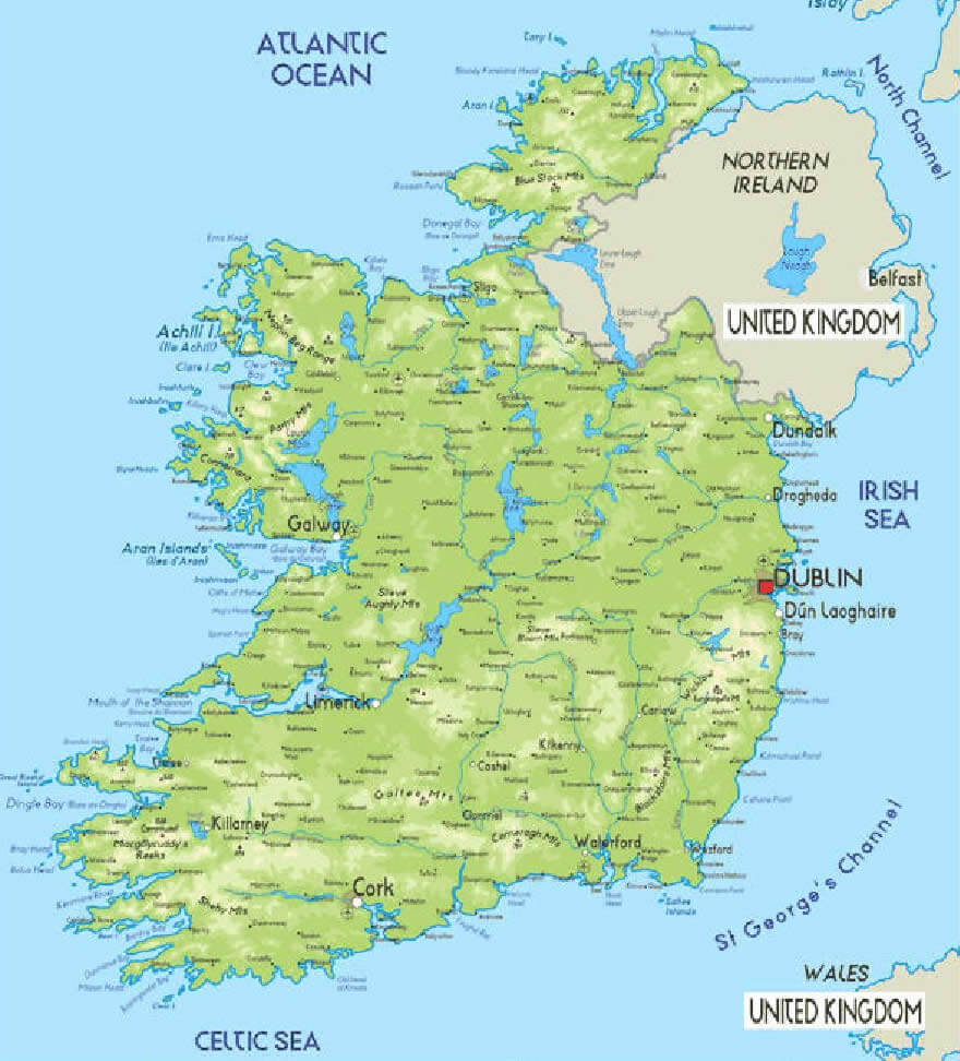
Ireland is an island in the North Atlantic with rolling plains, hills, and low mountains. It has many rivers, such as the Shannon, and coastal cliffs like the Cliffs of Moher. Lakes such as Lough Neagh are also notable features.WHERE IS IRELAND IN THE WORLD
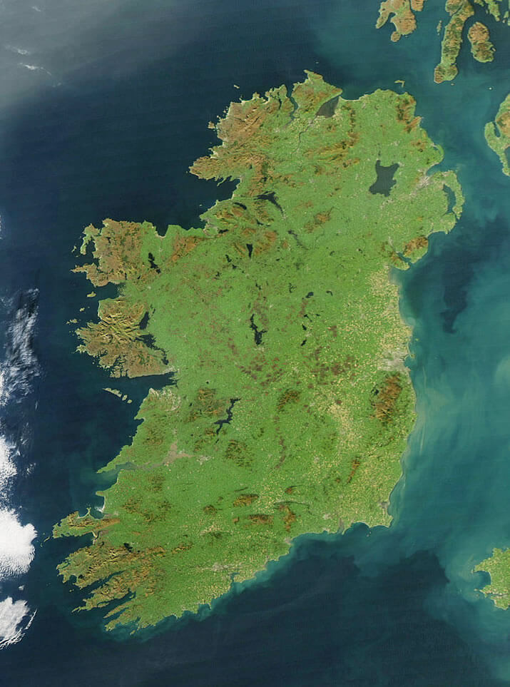
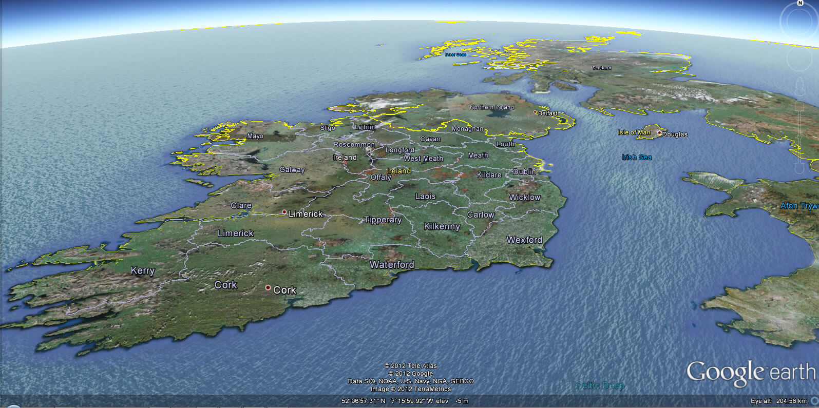
IRELAND SATELLITE IMAGE
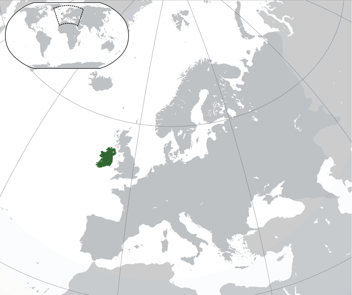
WHERE IS IRELAND IN THE WORLD
Can I download a high-resolution map of Ireland ?
Yes. Download high-resolution political and physical maps of Ireland for personal or educational use. Redistribution is subject to the terms of our license.
- Capital : Dublin
- Population : 4,588,252
- GDP : $217.669 billion
- Per Capita : $47,513
- Calling Code : +353
- Jobless Rate : 14.60%
- Time Zone : +0
For more about Ireland >>
A Collection of Ireland Maps and Ireland Satellite Images
MAP OF IRELAND

IRELAND SATELLITE IMAGE
WHERE IS IRELAND IN THE WORLD
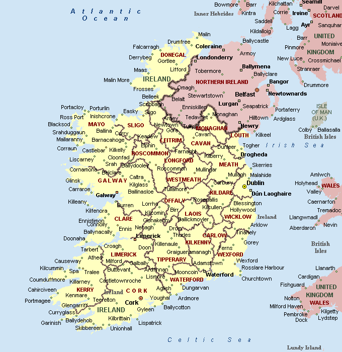
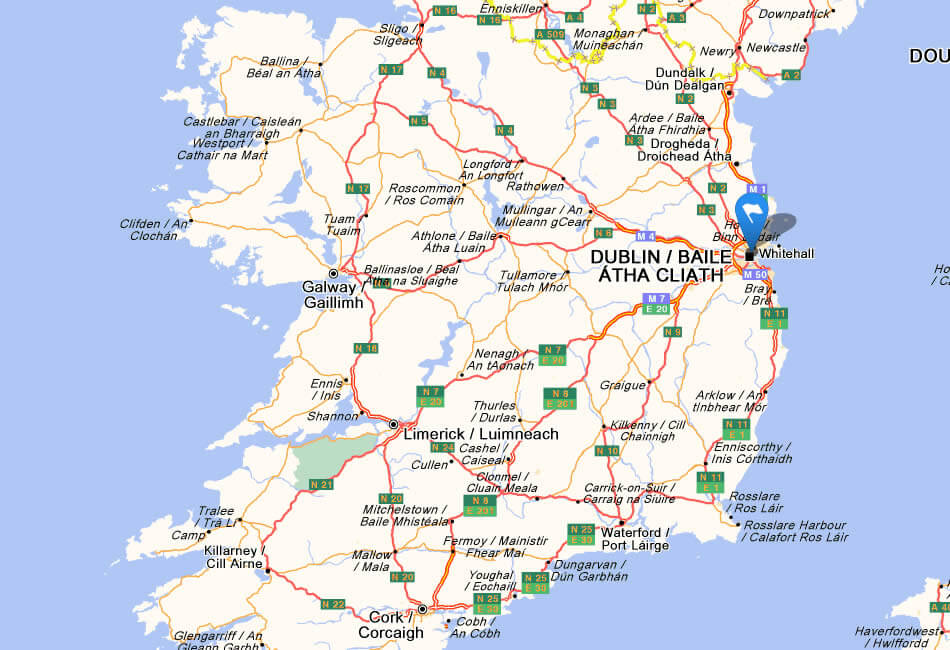
CITIES MAP OF IRELAND
IRELAND CITIES MAP
IRELAND MAP
IRELAND SATELLITE MAP

IRELAND CITIES MAP
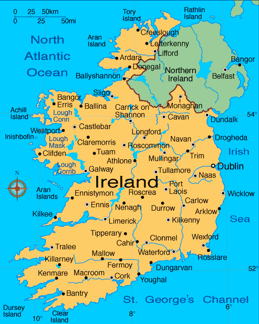
IRELAND MAP

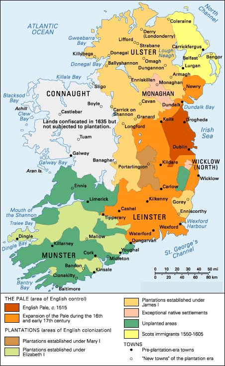
IRELAND MAP 1014

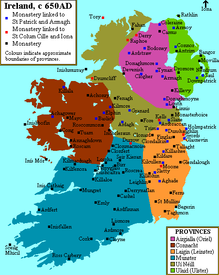
IRELAND MAP 650 AD
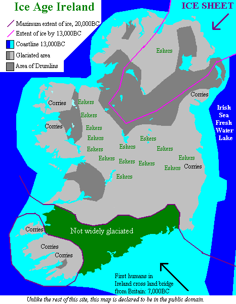
IRELAND MAP ICE AGE
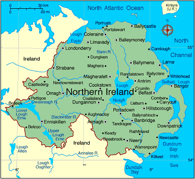
IRELAND MAP NORTHERN IRELAND

IRELAND MAP PROVINCES

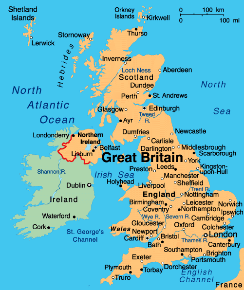
IRELAND MAP UK
IRELAND PHYSICAL MAP

IRELAND POLITICAL MAP

IRELAND REGIONS MAP

MAP OF IRELAND
MAP OF IRELAND
NORTHERN IRELAND MAP
PHYSICAL IRELAND MAP

IRELAND EARTH MAP
IRELAND PROVINCE BORDERS MAP

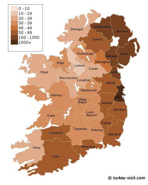
POPULATION DENSITY OF IRELAND MAP
Belfast: Where Every Cobblestone Holds a Story
Please subscribe on "World Guide" channnel on Youtube at youtube.com/c/WorldGuide
Mapping the Majesty: A Deep Dive into the UK's Geographic Tapestry
Largest Cities' Map of Ireland
Dublin Map Belfast Map Cork Map Limerick Map Derry Map Galway Map Craigavon Map Waterford Map Drogheda Map Dundalk Map Lucan Map Wexford Map
Addresse: Hakarinne 2 Espoo, Uusimaa - Finland 02210
Web: istanbul-city-guide.com
Email: [email protected]
Web: istanbul-city-guide.com
Email: [email protected]
Copyright istanbul-city-guide.com - 2004 - 2026. All rights reserved. Privacy Policy | Disclaimer