Finland Map and Finland Satellite Images
Explore map of Finland, Finland map, cities map of Finland, satellite images of Finland, Finland largest cities maps, political map of Finland, driving directions, country atlas and traffic map.
Finland Map FQA
How many cities are in Finland ?
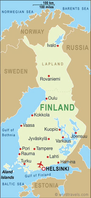
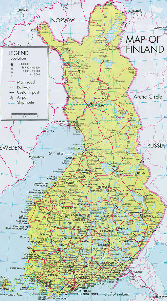
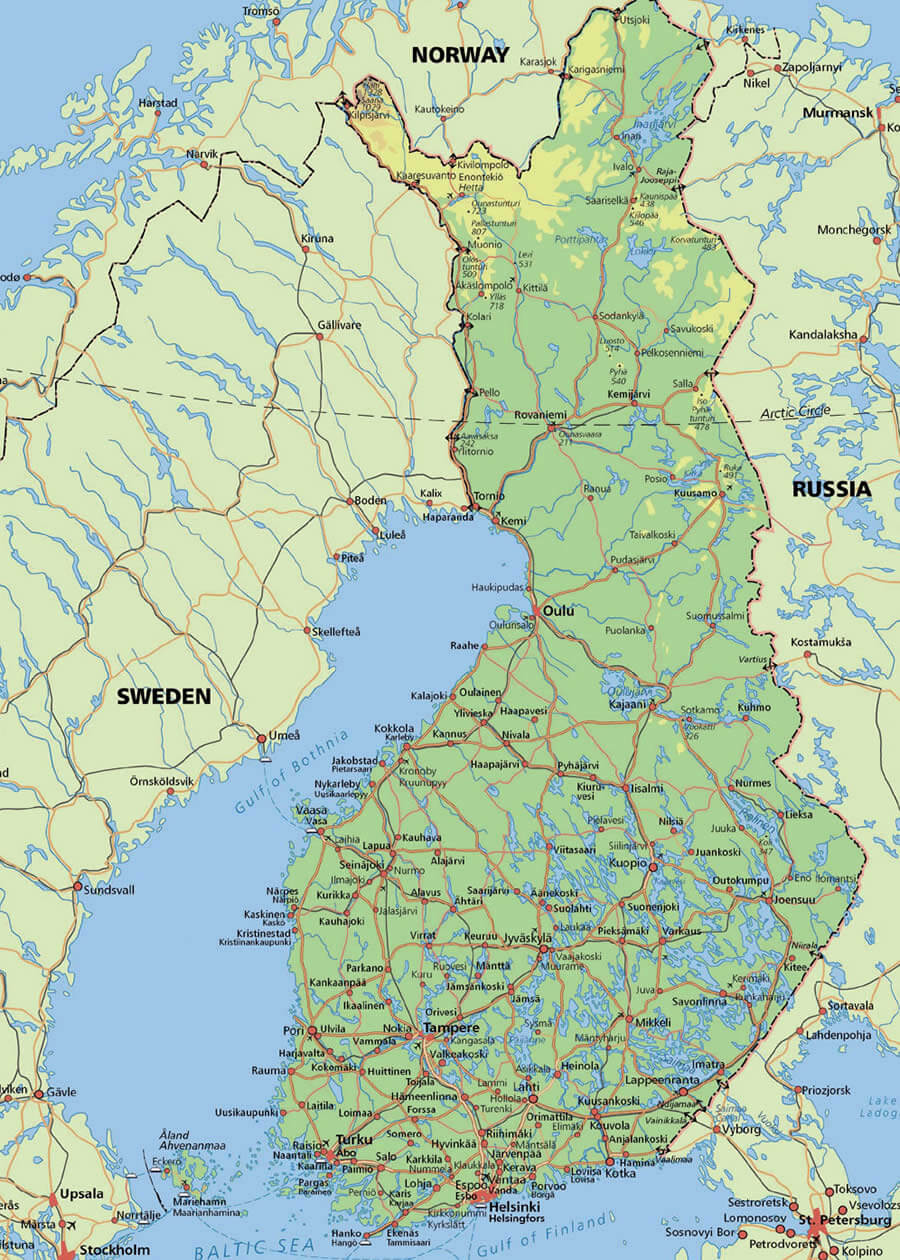
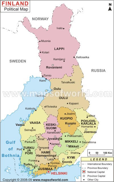
Finland has more than 100 cities and towns. The 10 largest by population are: Helsinki, Espoo, Tampere, Vantaa, Oulu, Turku, Jyväskylä, Lahti, Kuopio, and Pori.What are the major geographical features of Finland ?
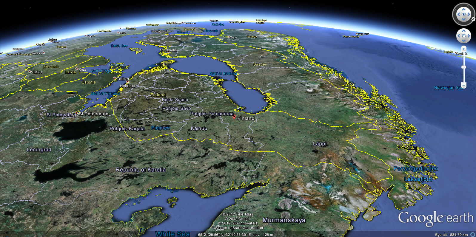
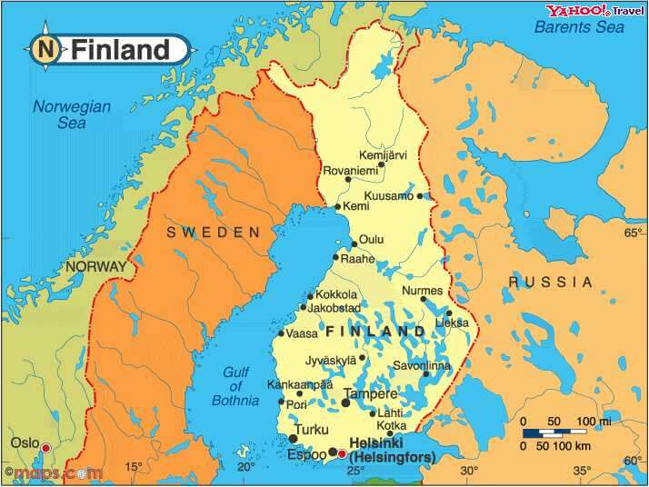
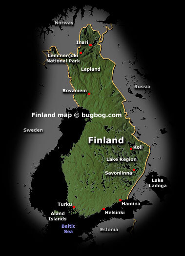
Finland is characterized by thousands of lakes and forests, with a flat to gently rolling landscape shaped by glaciers. The Scandinavian Mountains rise in the northwest, while much of the country is low-lying with extensive boreal forests.WHERE IS FINLAND IN THE WORLD
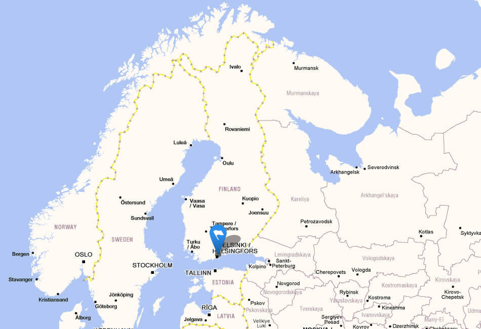
FINLAND LOCATION MAP
WHERE IS FINLAND IN THE WORLD
Can I download a high-resolution map of Finland ?
Yes. Download high-resolution political and physical maps of Finland for personal or educational use. Redistribution is subject to the terms of our license.
- Capital : Helsinki
- Population : 5,421,827
- GDP : $266.553 billion
- Per Capita : $49,349
- Calling Code : +358
- Jobless Rate : 6.90%
- Time Zone : +2
For more about Finland >>
A Collection of Finland Maps and Finland Satellite Images
MAP OF FINLAND
FINLAND LOCATION MAP
WHERE IS FINLAND IN THE WORLD
CITIES MAP OF FINLAND
FINDLANDMAP
FINLAND EARTH MAP
FINLAND CITIES MAP
FINLAND MAP
FINLAND MAPS

FINLAND CITIES MAP
FINLAND LAKES MAP

FINLAND MAP
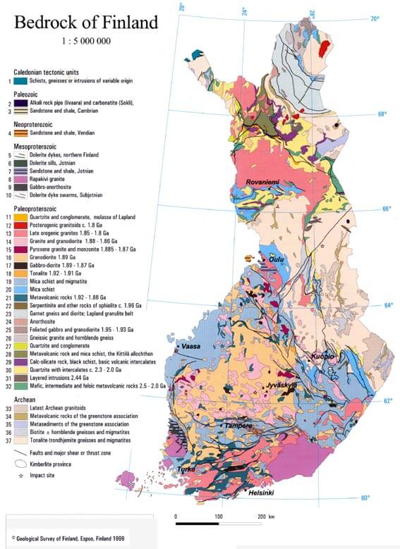
FINLAND MAP BEDROCK
FINLAND MAP BIG
FINLAND MAP SCANDINAVIA
FINLAND MAP SWEDEN RUSSIA
FINLAND MAPS
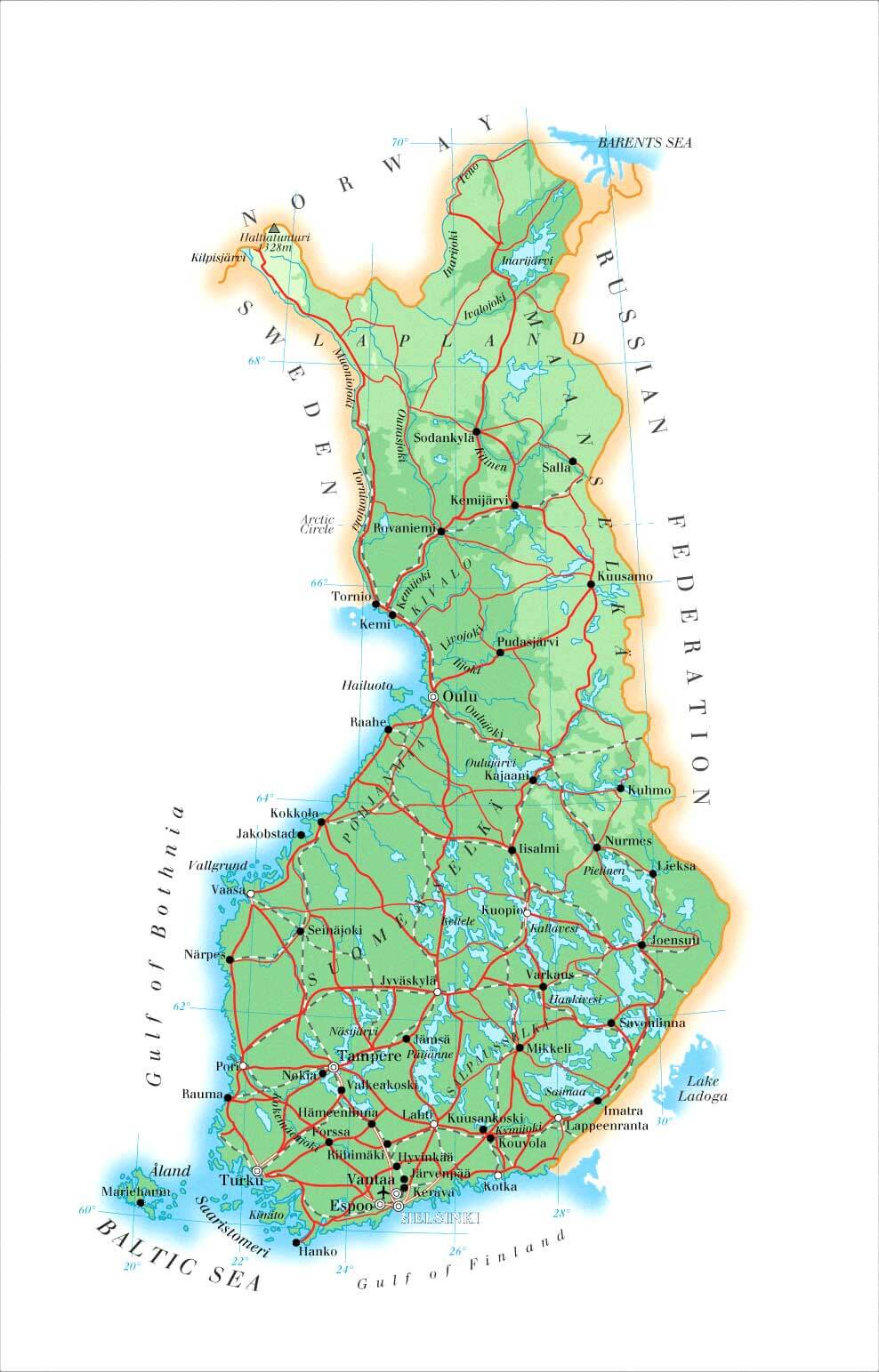
FINLAND PHYSICAL MAP
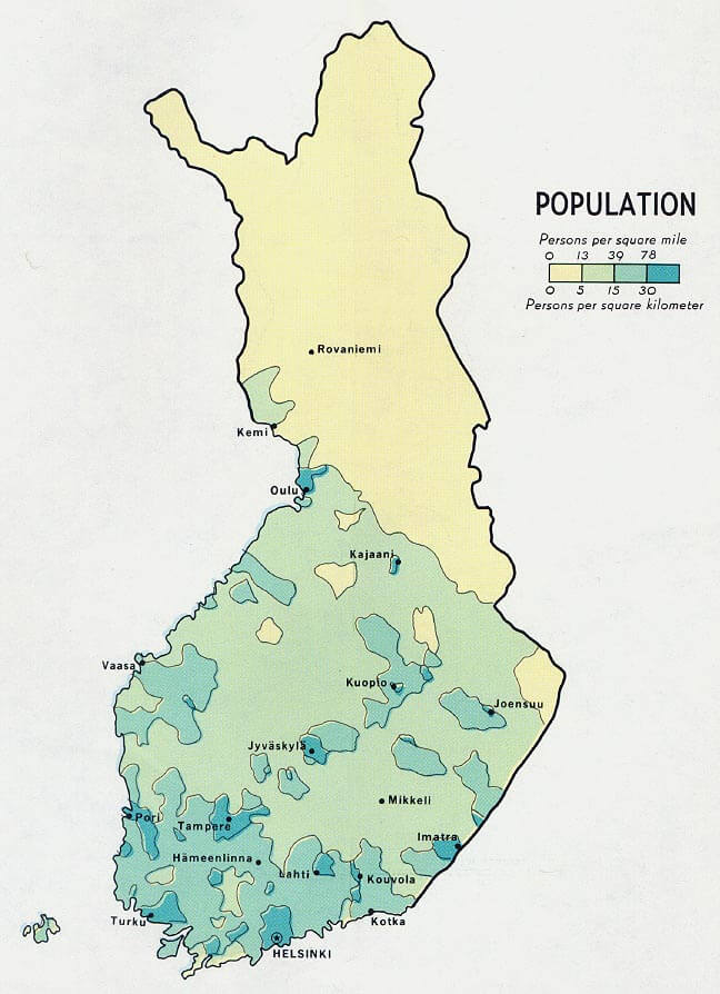
FINLAND POPULATION MAP
FINLAND RELIEF MAP

MAP FINLAND
MAP OF FINLAND
REGIONS MAP OF FINLAND
SATELLITE FINLAND MAP
Finland Free Printable High Detailed Map with Russia Border
Please subscribe on "World Guide" channnel on Youtube at youtube.com/c/WorldGuide
Largest Cities' Map of Finland
Helsinki Map Espoo Map Tampere Map Vantaa Map Turku Map Oulu Map Jyvaskyla Map Lahti Map Kuopio Map Pori Map Kotka Map Lappeenranta Map Rovaniemi Map Seinajoki Map Vaasa Map Joensuu Map Salo Map Mikkeli Map Hameenlinna Map Porvoo Map Hyvinkaa Map Kajaani Map Jarvenpaa Map Lohja Map Rauma Map Kokkola Map Kerava Map Kouvola Map Nokia Map Imatra Map Riihimaki Map Savonlinna Map Ylojarvi Map Raisio Map Varkaus Map Kemi Map Raahe Map Iisalmi Map Tornio Map Kaarina Map Hamina Map Pieksamaki Map Heinola Map aanekoski Map Valkeakoski Map Kuusankoski Map Jakobstad Map Forssa Map Kuusamo Map Anjalankoski Map Vammala Map Jamsa Map Uusikaupunki Map
Addresse: Hakarinne 2 Espoo, Uusimaa - Finland 02210
Web: istanbul-city-guide.com
Email: [email protected]
Web: istanbul-city-guide.com
Email: [email protected]
Copyright istanbul-city-guide.com - 2004 - 2026. All rights reserved. Privacy Policy | Disclaimer