South America Map and South America Satellite Images
South America Explore South America Map, world countries map, satellite images of the South America, South America largest cities maps, political map of South America, driving directions and traffic map.
South America regional highways maps, leaflets, road situations, transportation, lodging, guide, geographical, physical information can be found with South America interactive map. With South America Map all states, regions, cities, towns, districts, avenues, streets and popular centers' satellite, sketch and terrain views are available.
For more about Map of South America >>
South America Maps

A Collection of South America Maps and South America Satellite Images
MAP OF SOUTH AMERICA
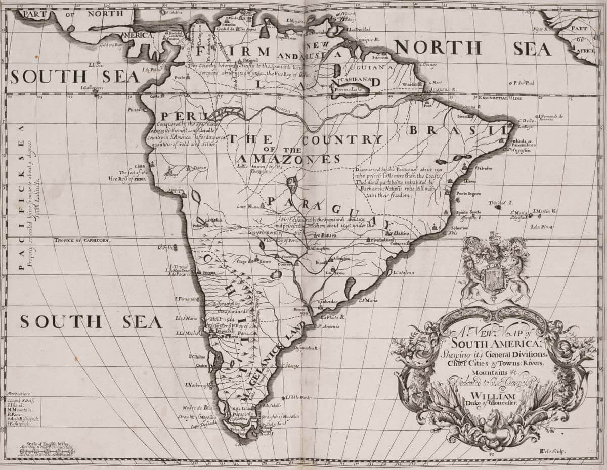
HISTORICAL MAP OF SOUTH AMERICA 1704
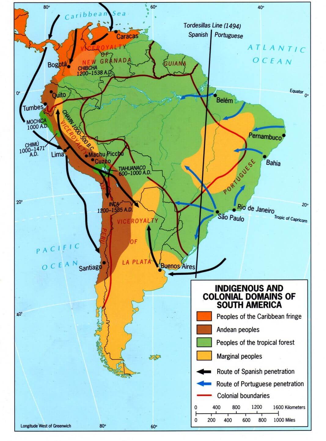
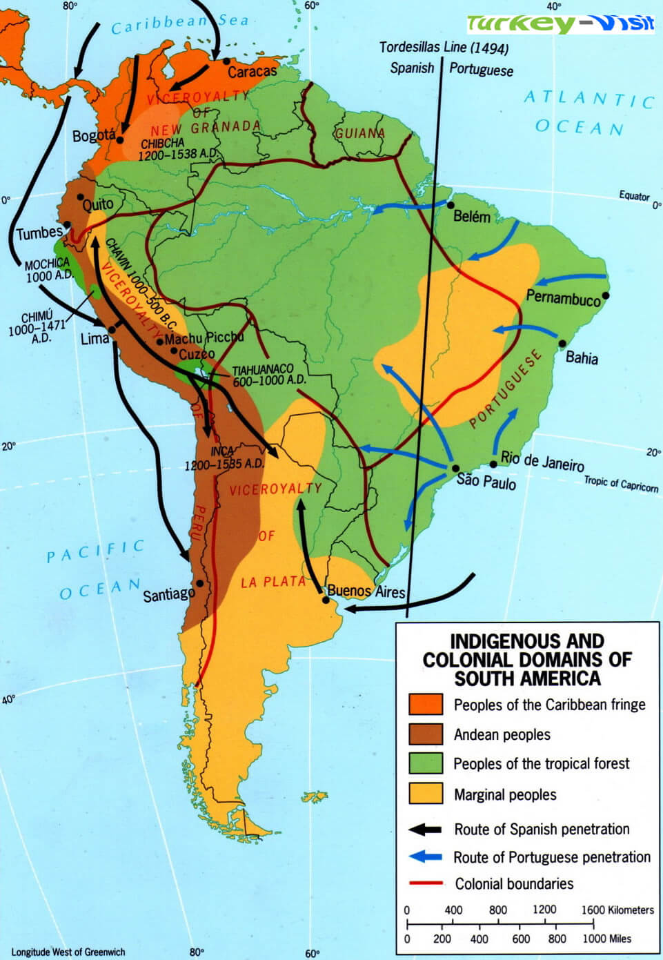
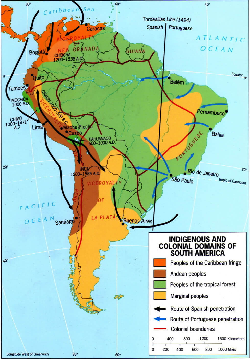
INDIGENOUS COLONIAL DOMAINS MAP SOUTH AMERICA

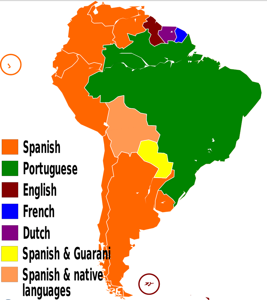
LANGUAGES MAP OF SOUTH AMERICA
MAP OF SOUTH AMERICA
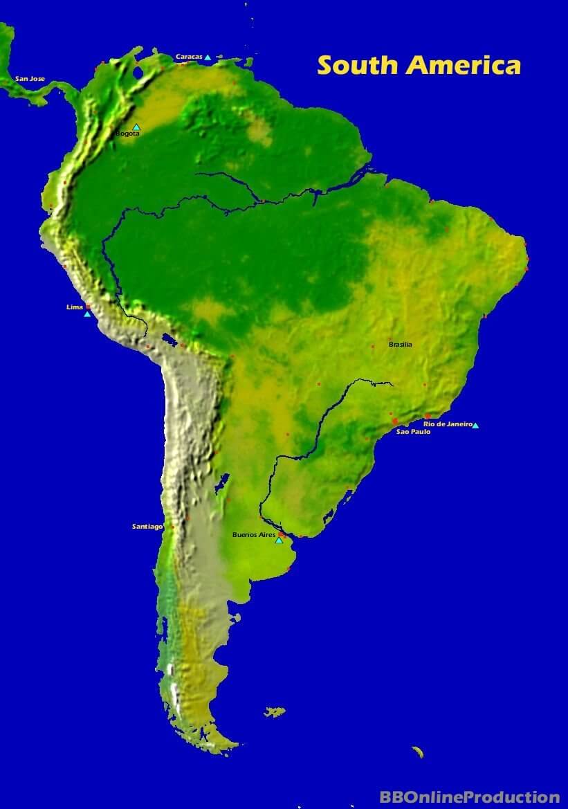
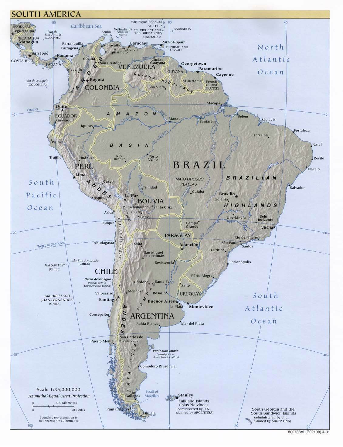
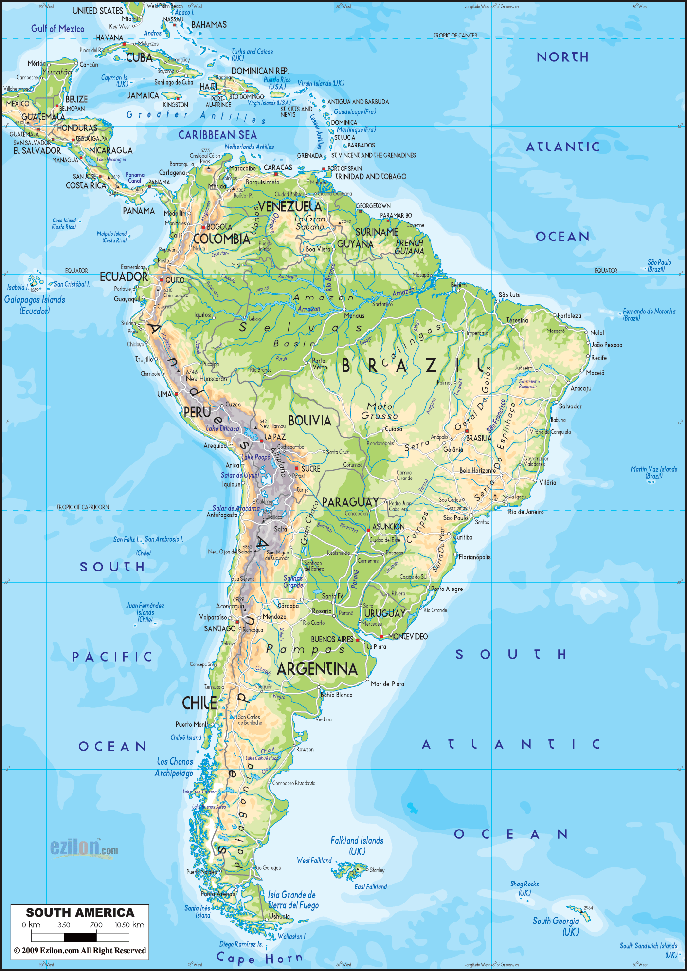
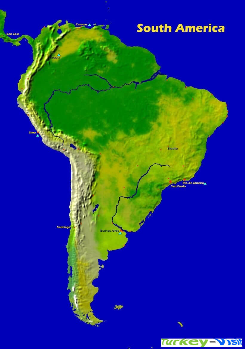
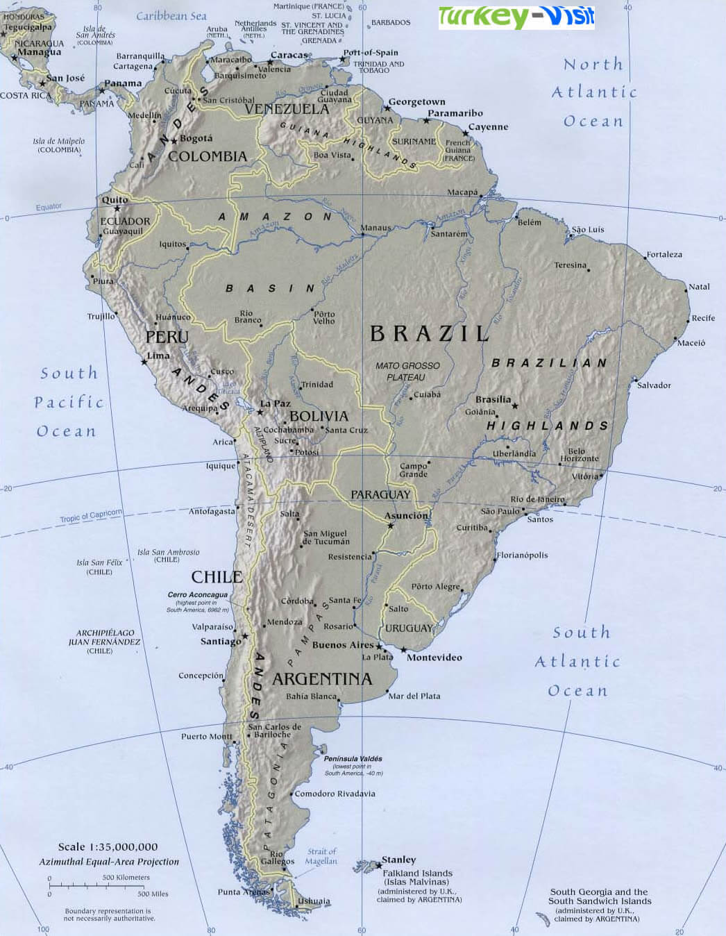
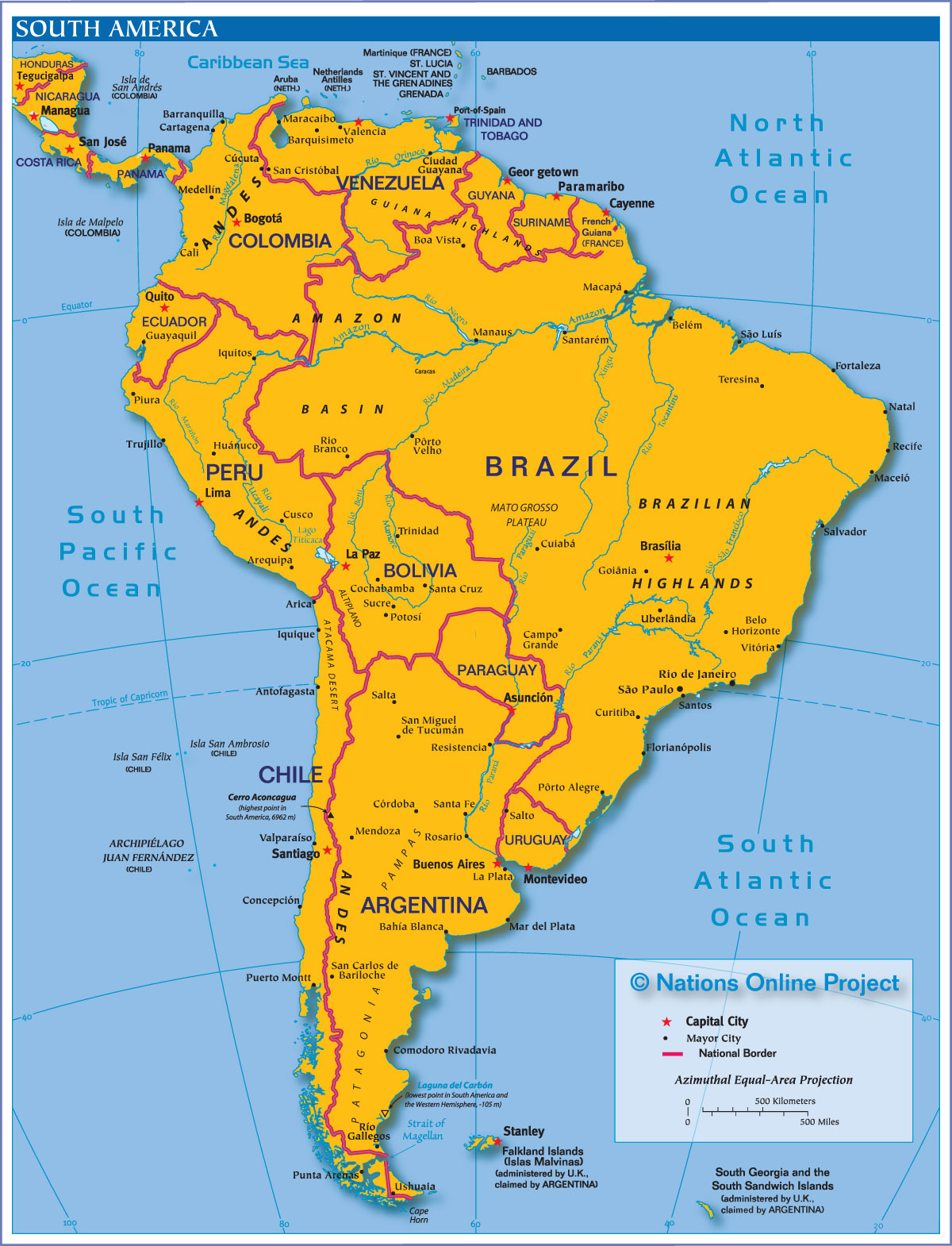
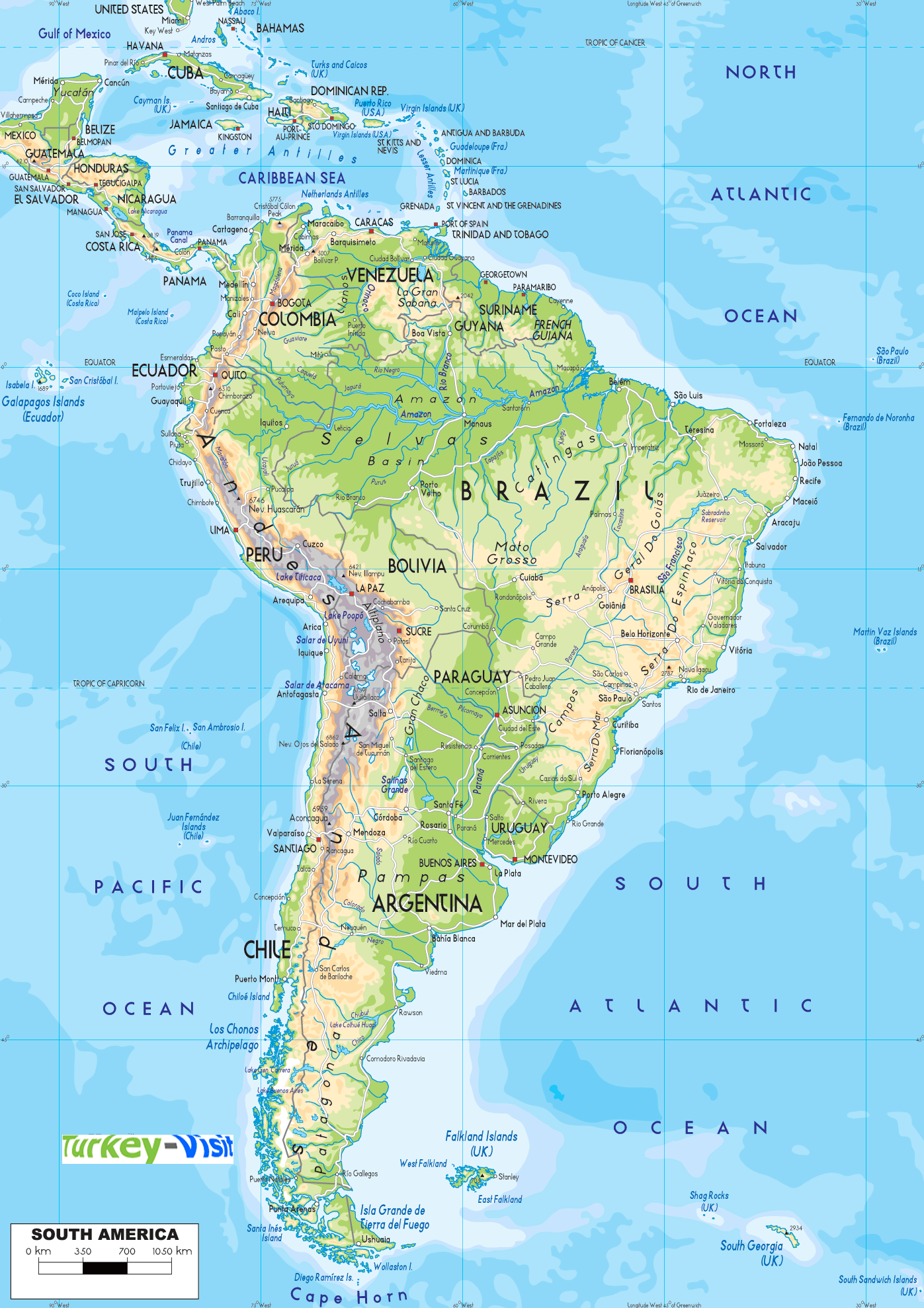
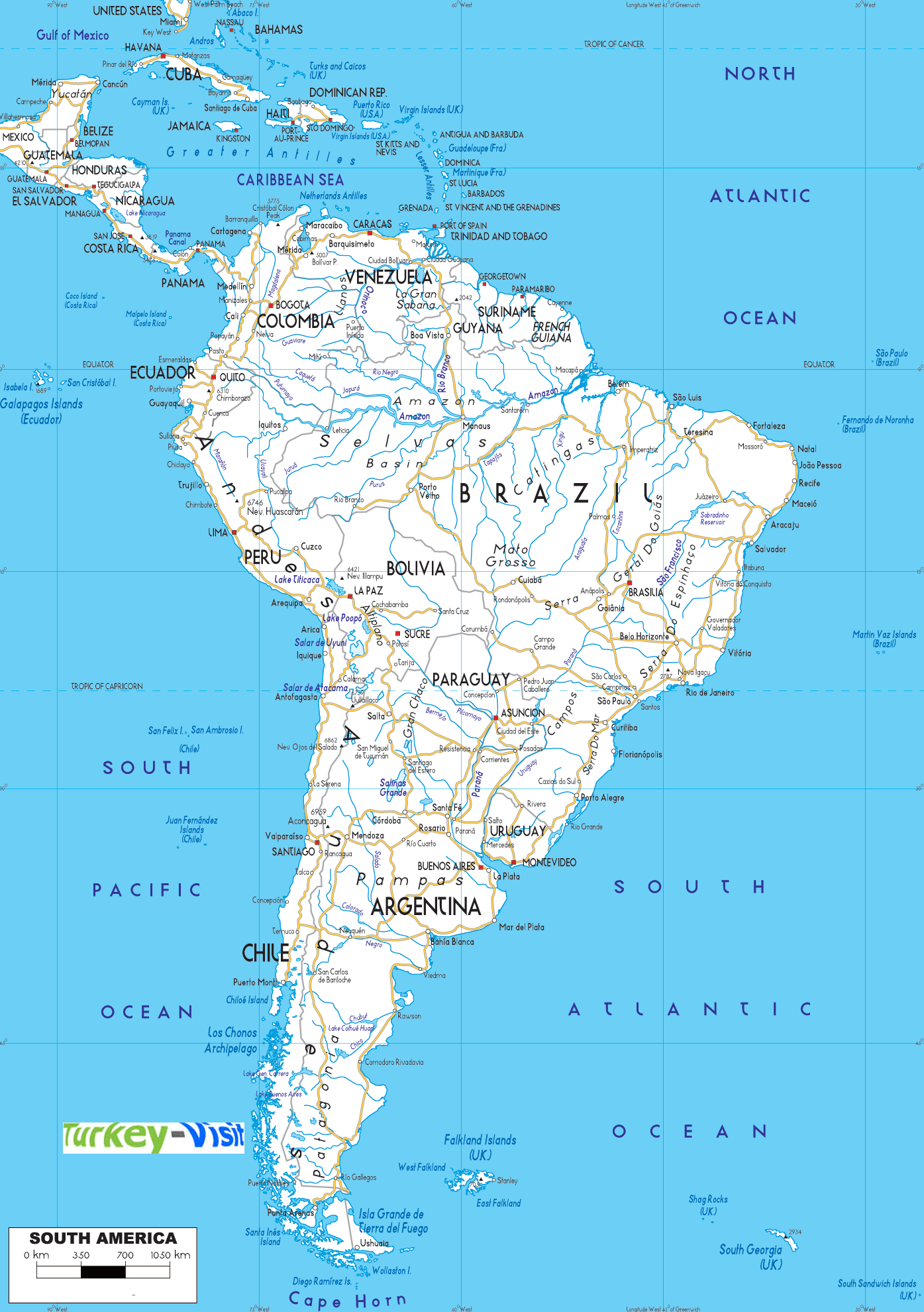
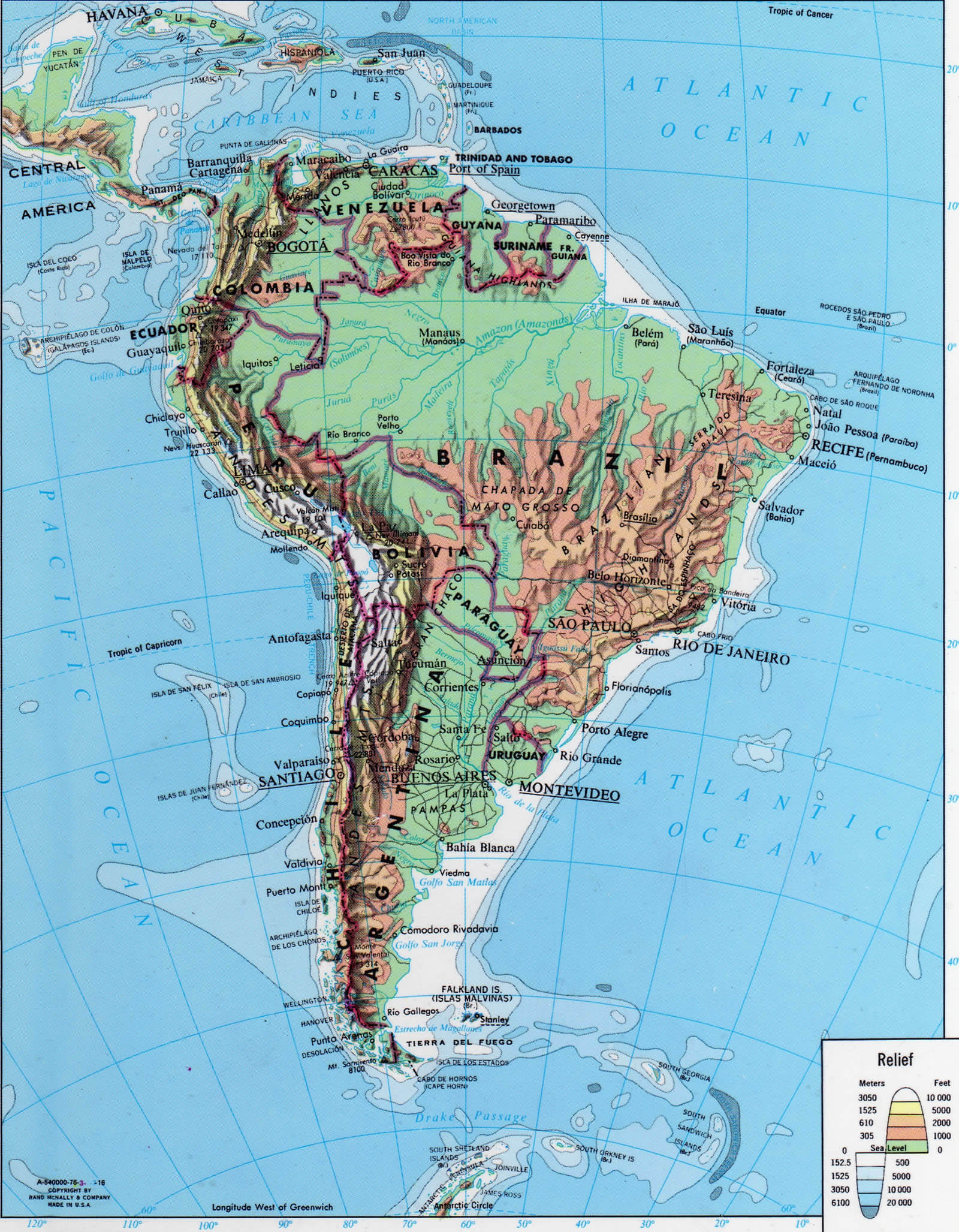
PHYSICAL MAP OF SOUTH AMERICA
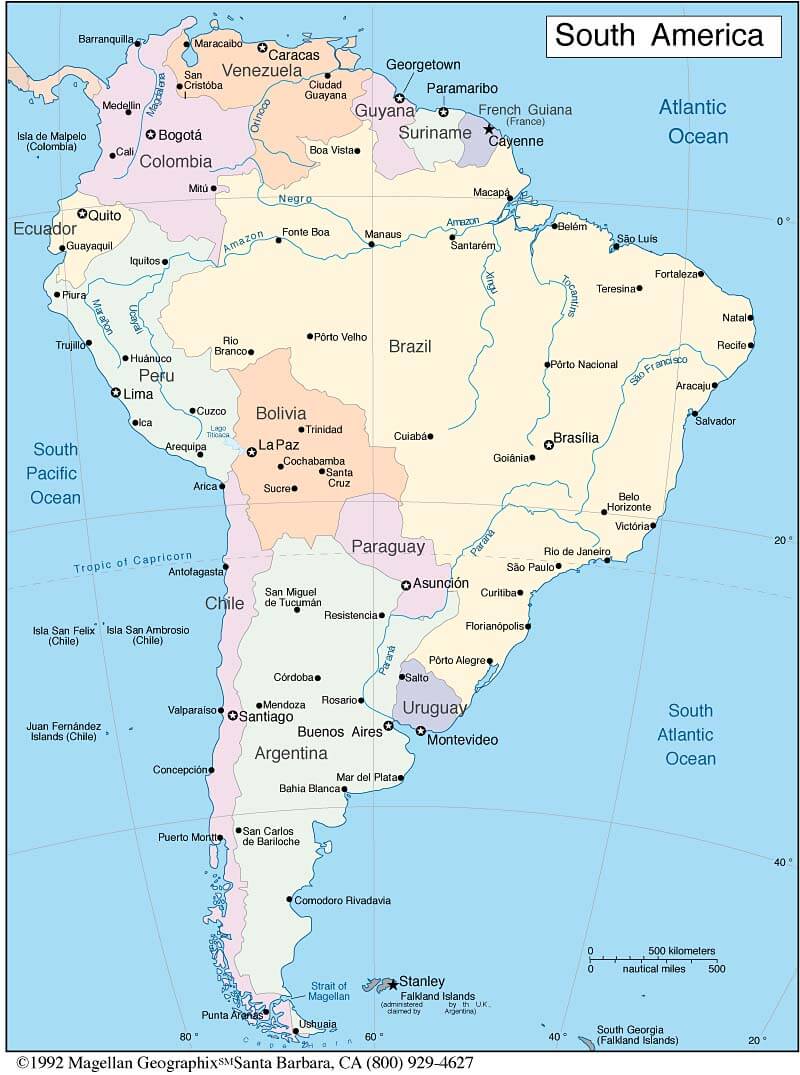
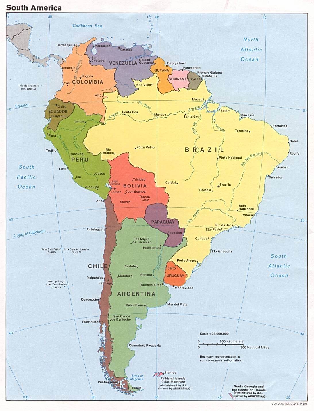
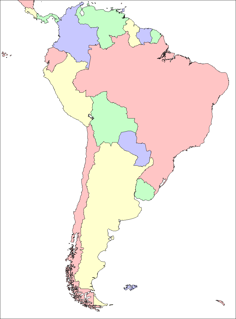
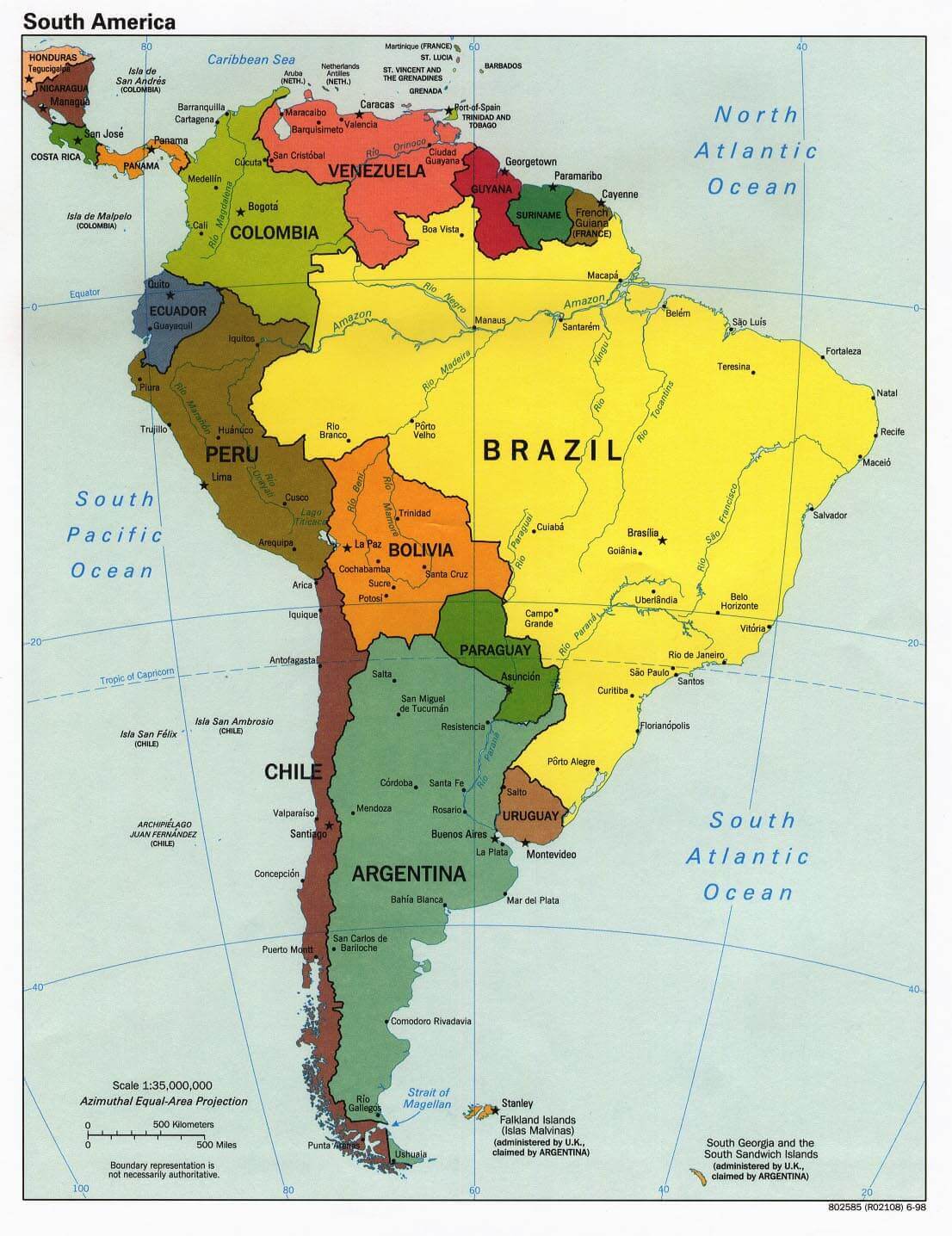
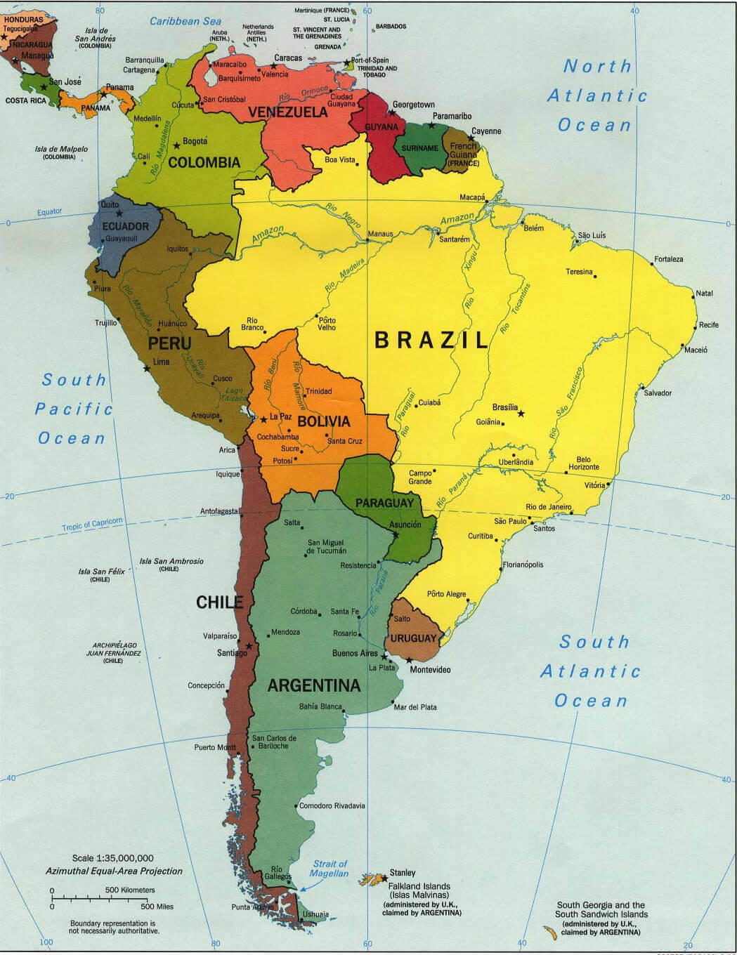
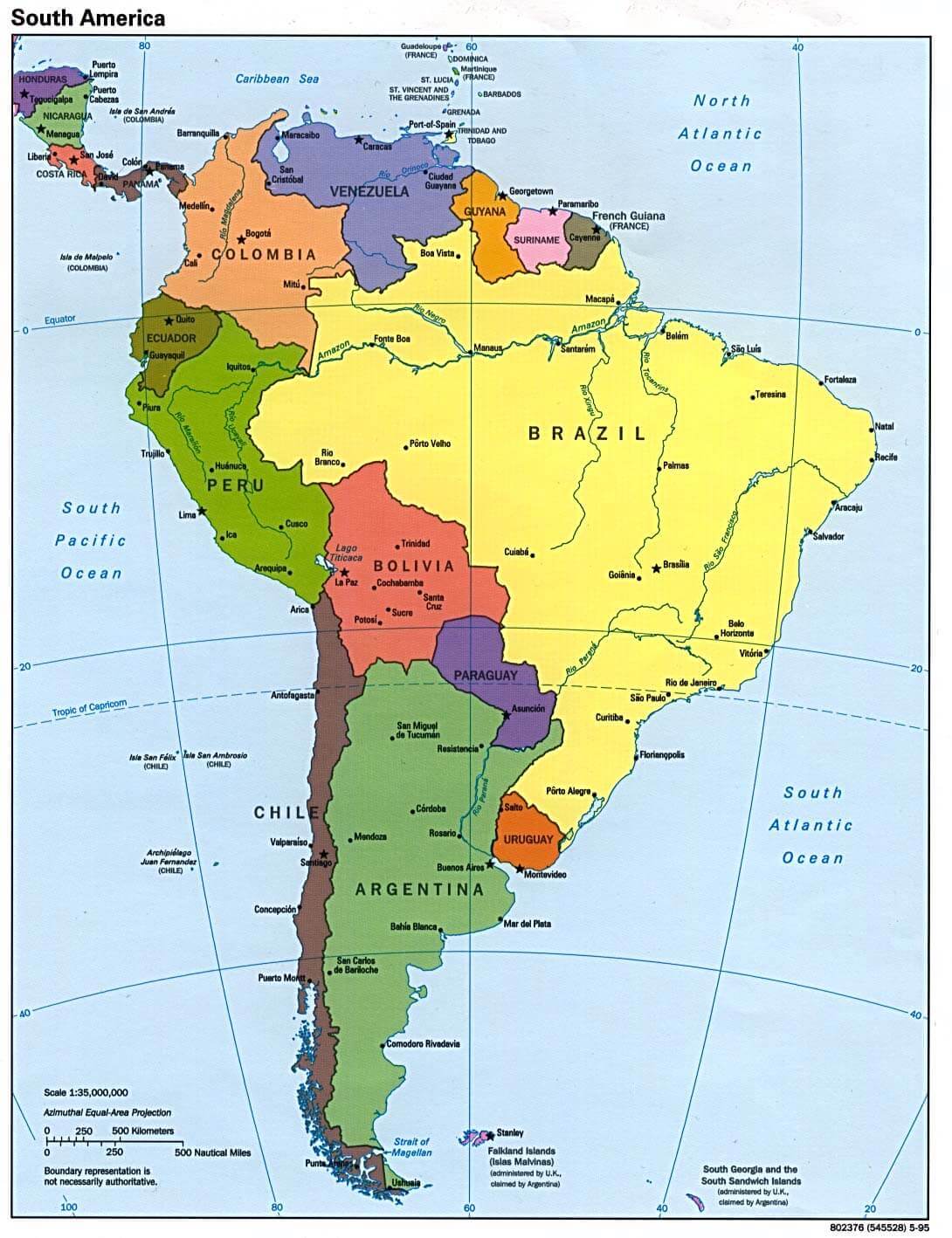
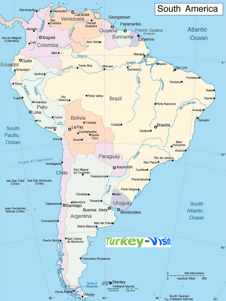
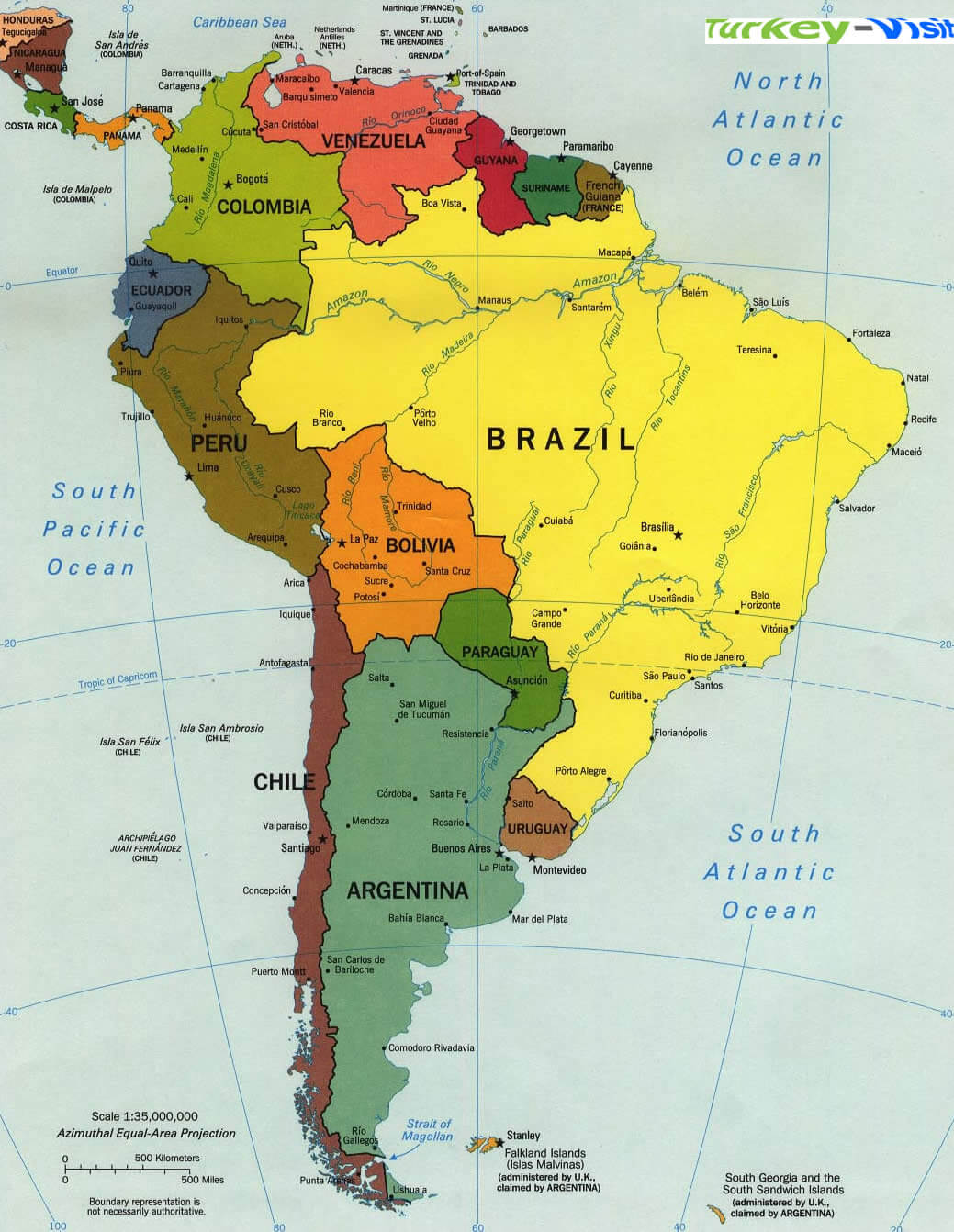
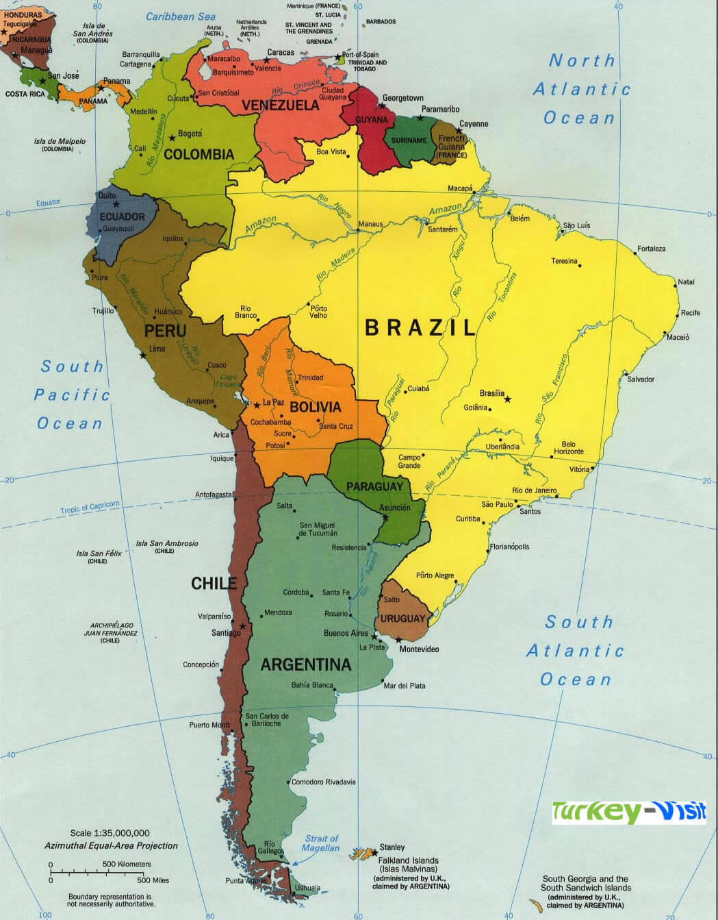
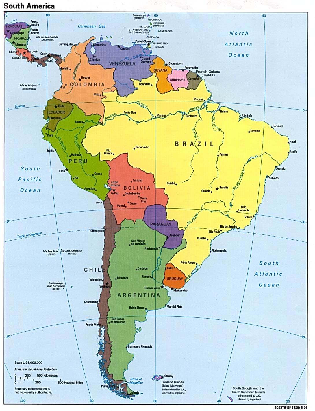
POLITICAL MAP OF SOUTH AMERICA
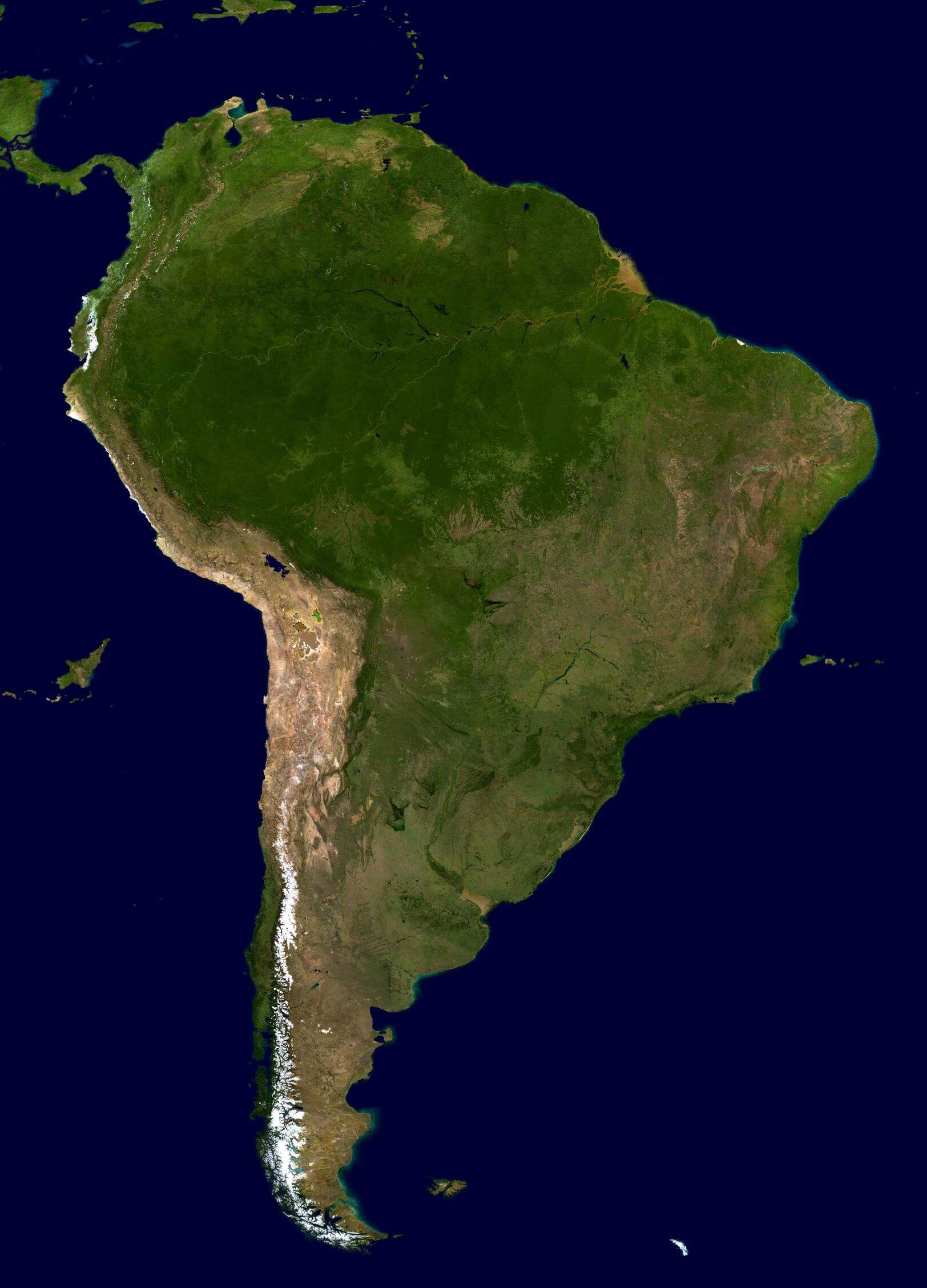
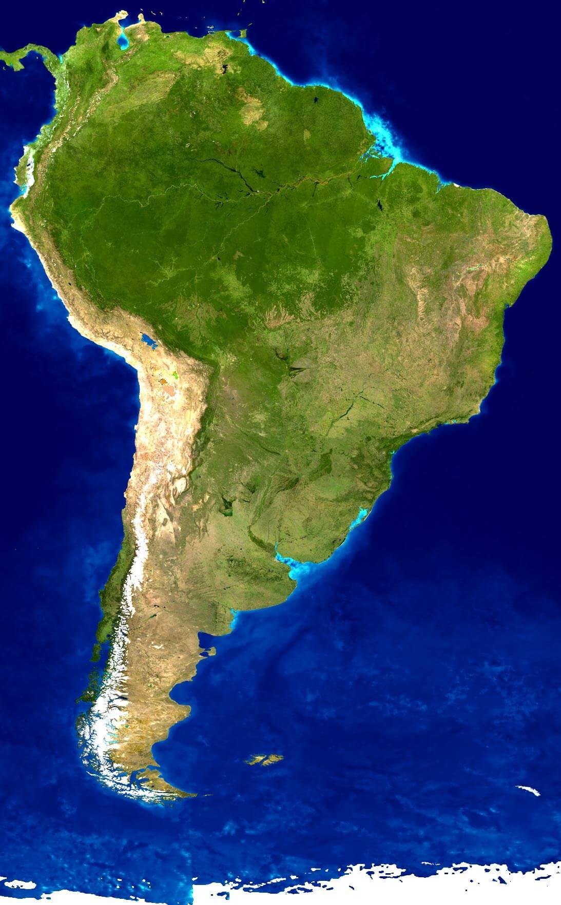
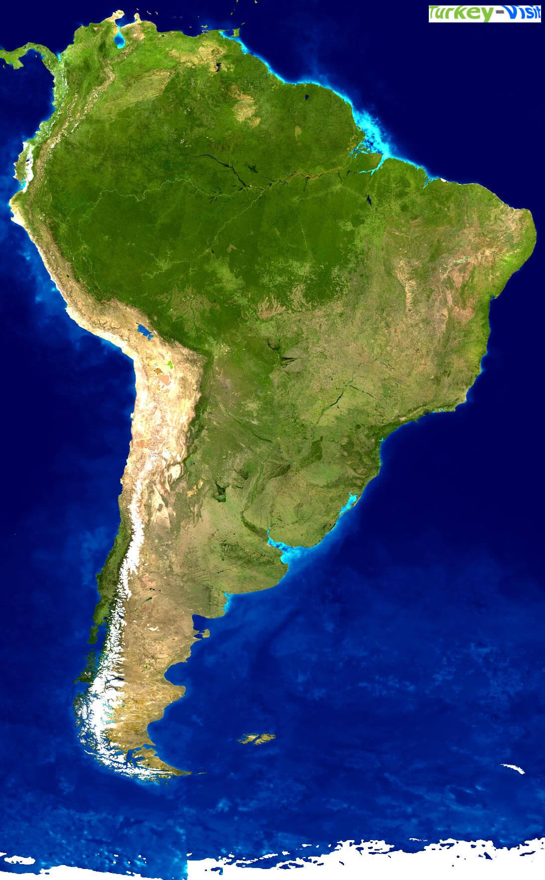
SATELLITE MAP OF SOUTH AMERICA
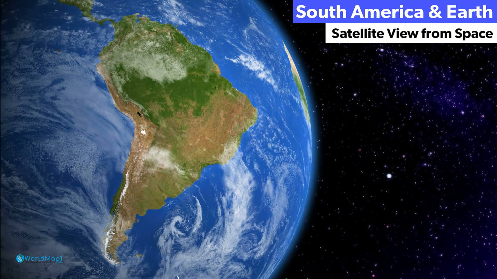
SOUTH AMERICA EARTH MAP
SOUTH AMERICA MAP
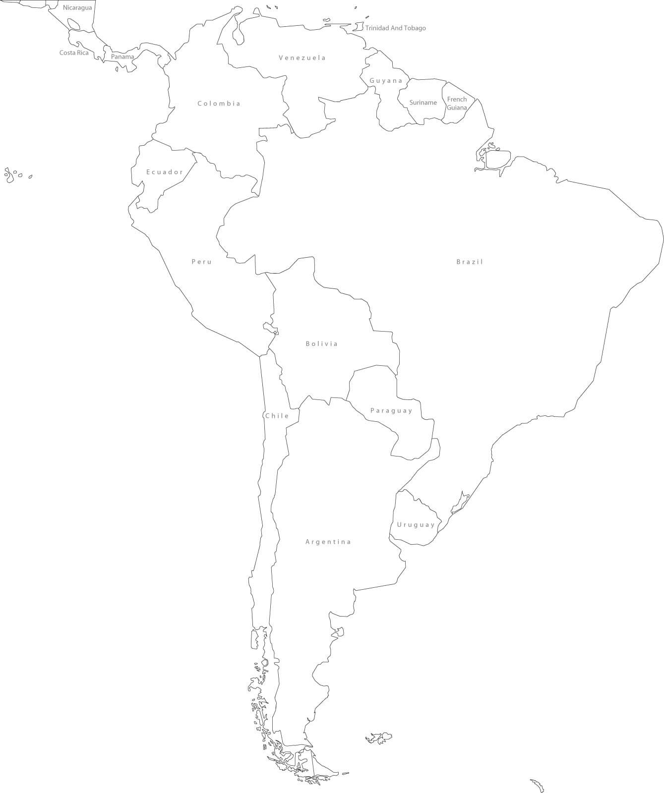
SOUTH AMERICA BLANK MAP
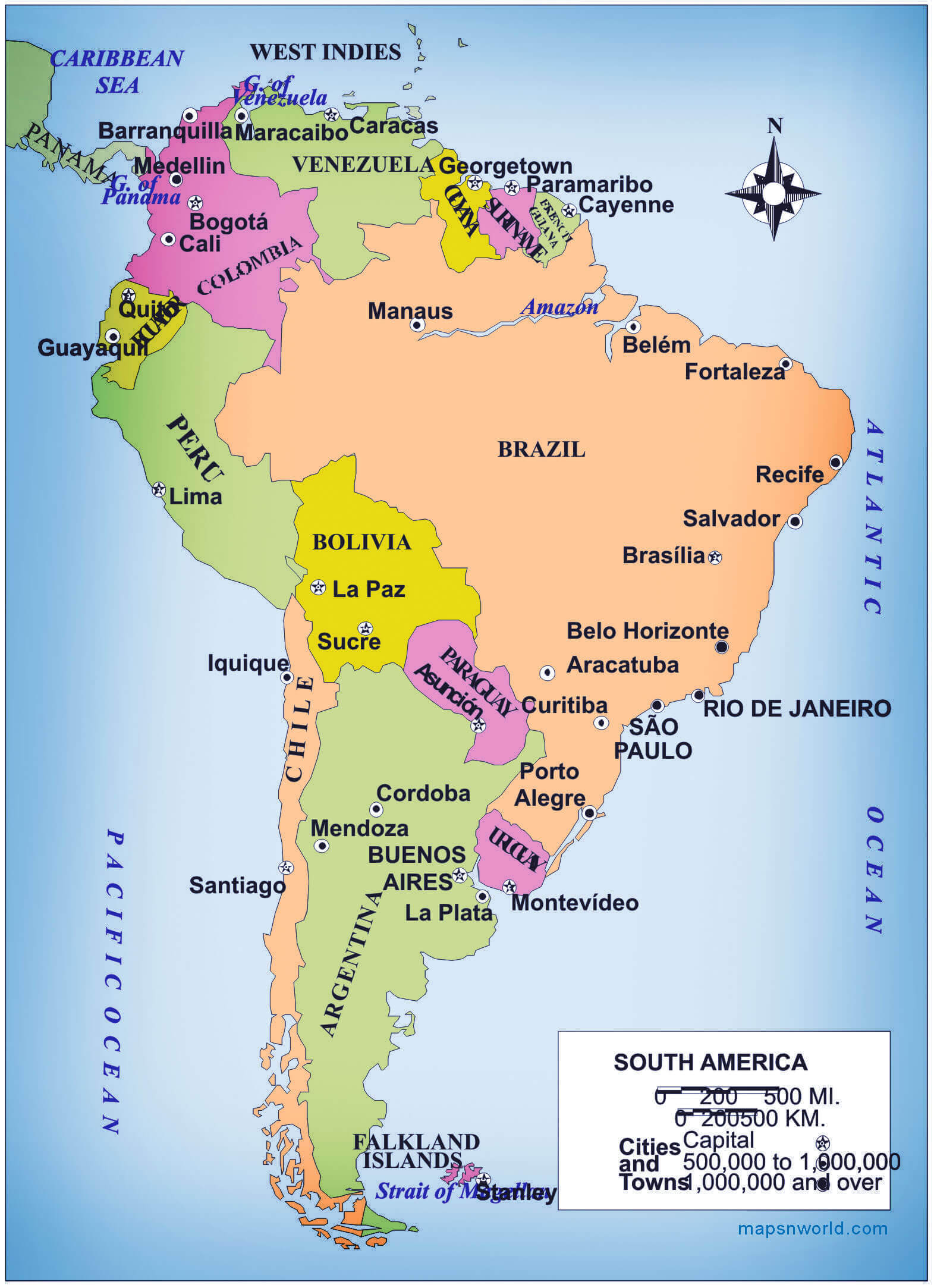
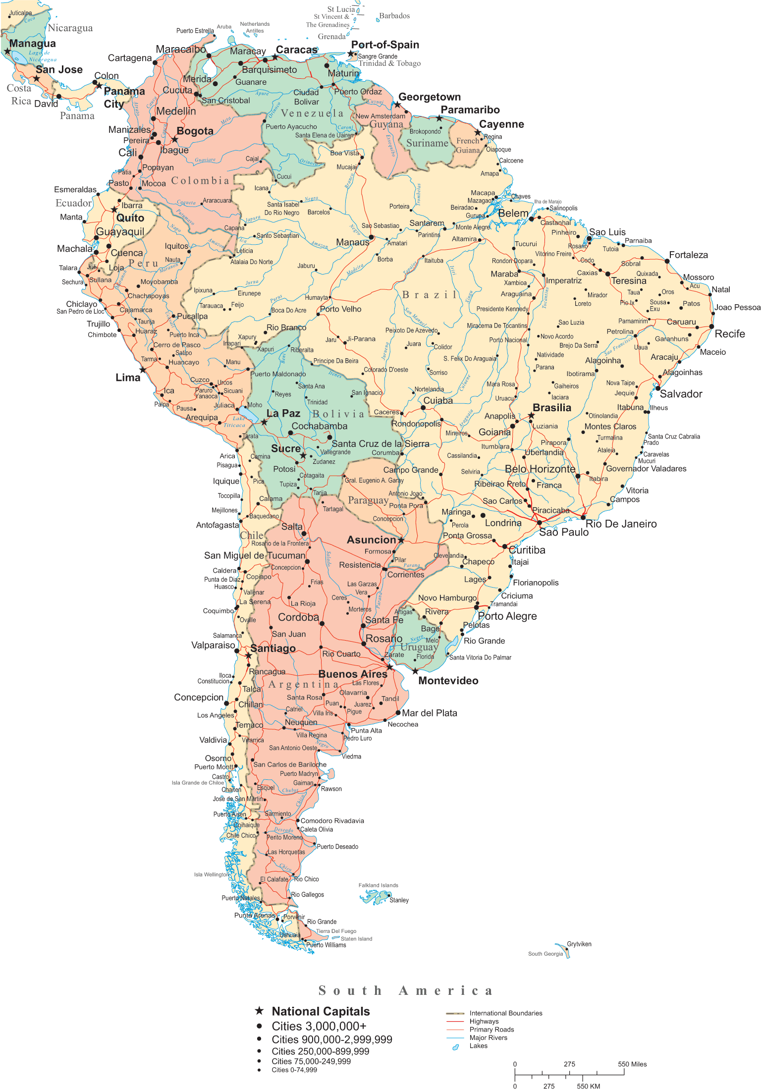
SOUTH AMERICA CITIES MAP
SOUTH AMERICA COLONIES MAP
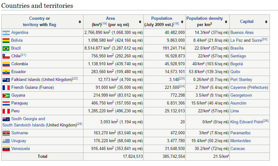
SOUTH AMERICA COUNTRIES AREA POPULATION
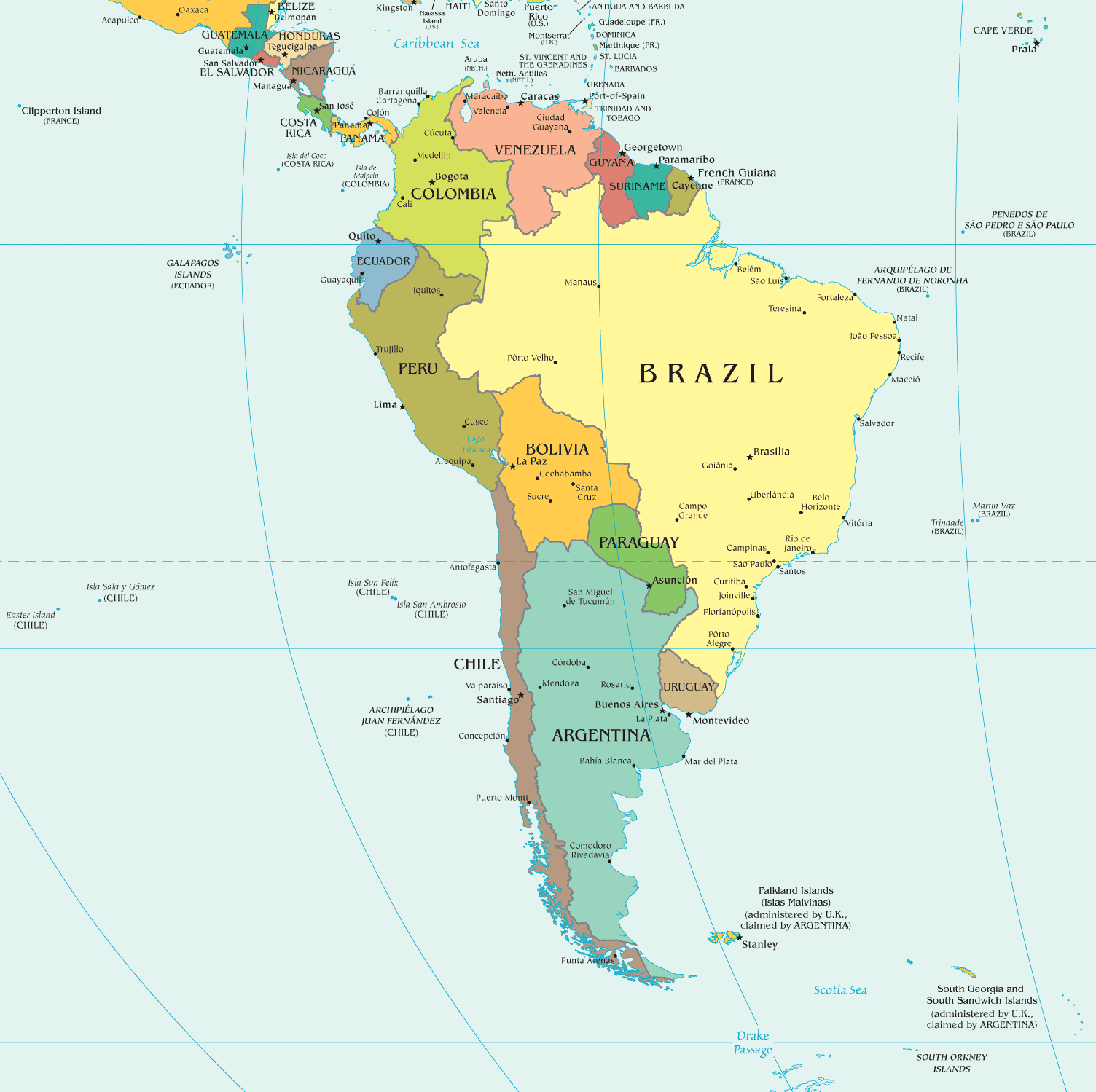
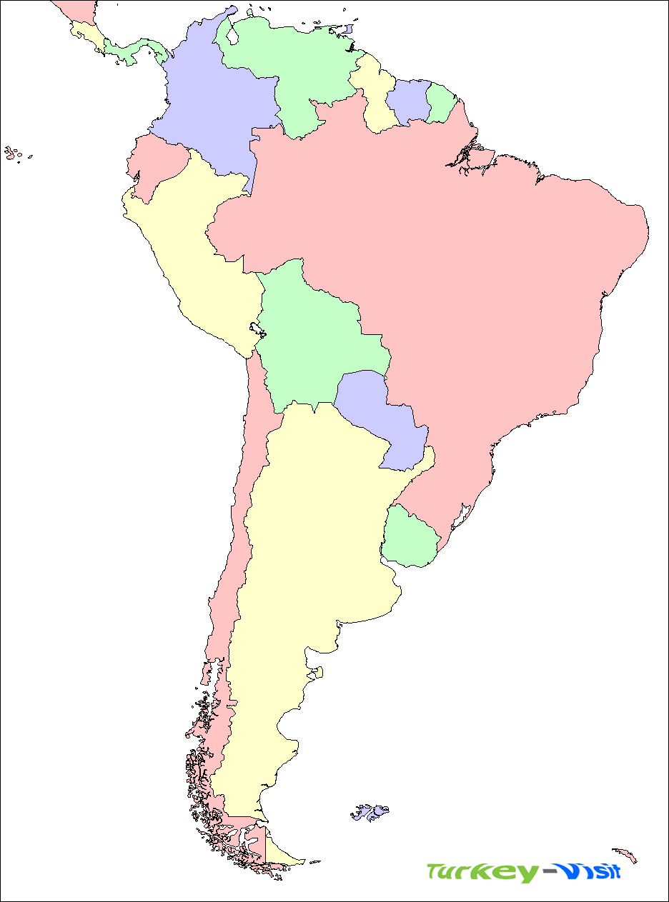
SOUTH AMERICA COUNTRIES MAP

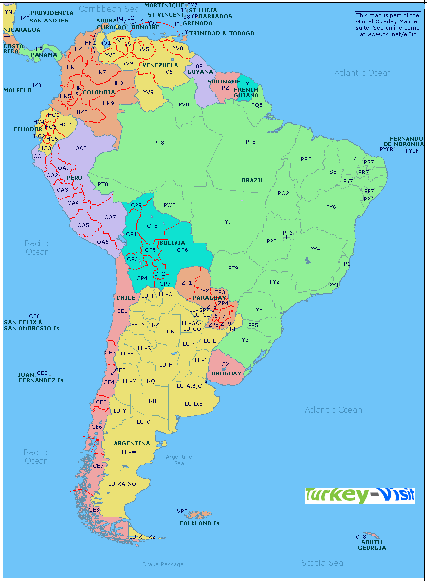
SOUTH AMERICA COUNTRIES SATELLITE MAP

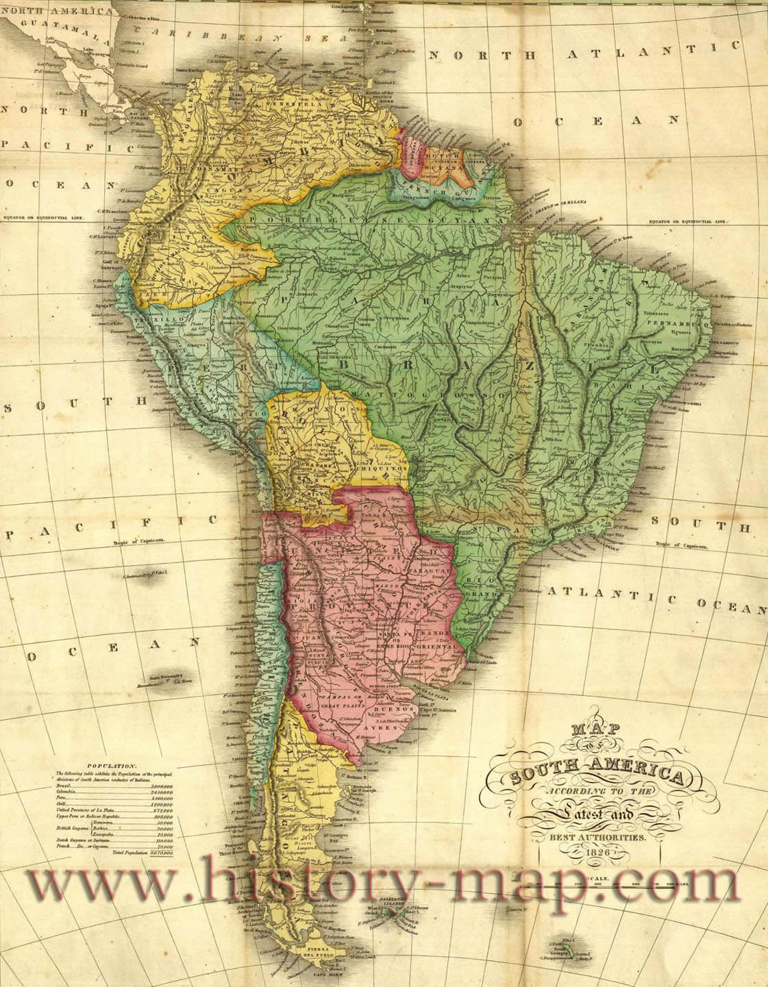
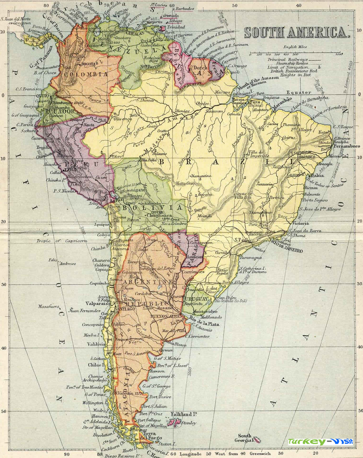
SOUTH AMERICA HISTORICAL MAP
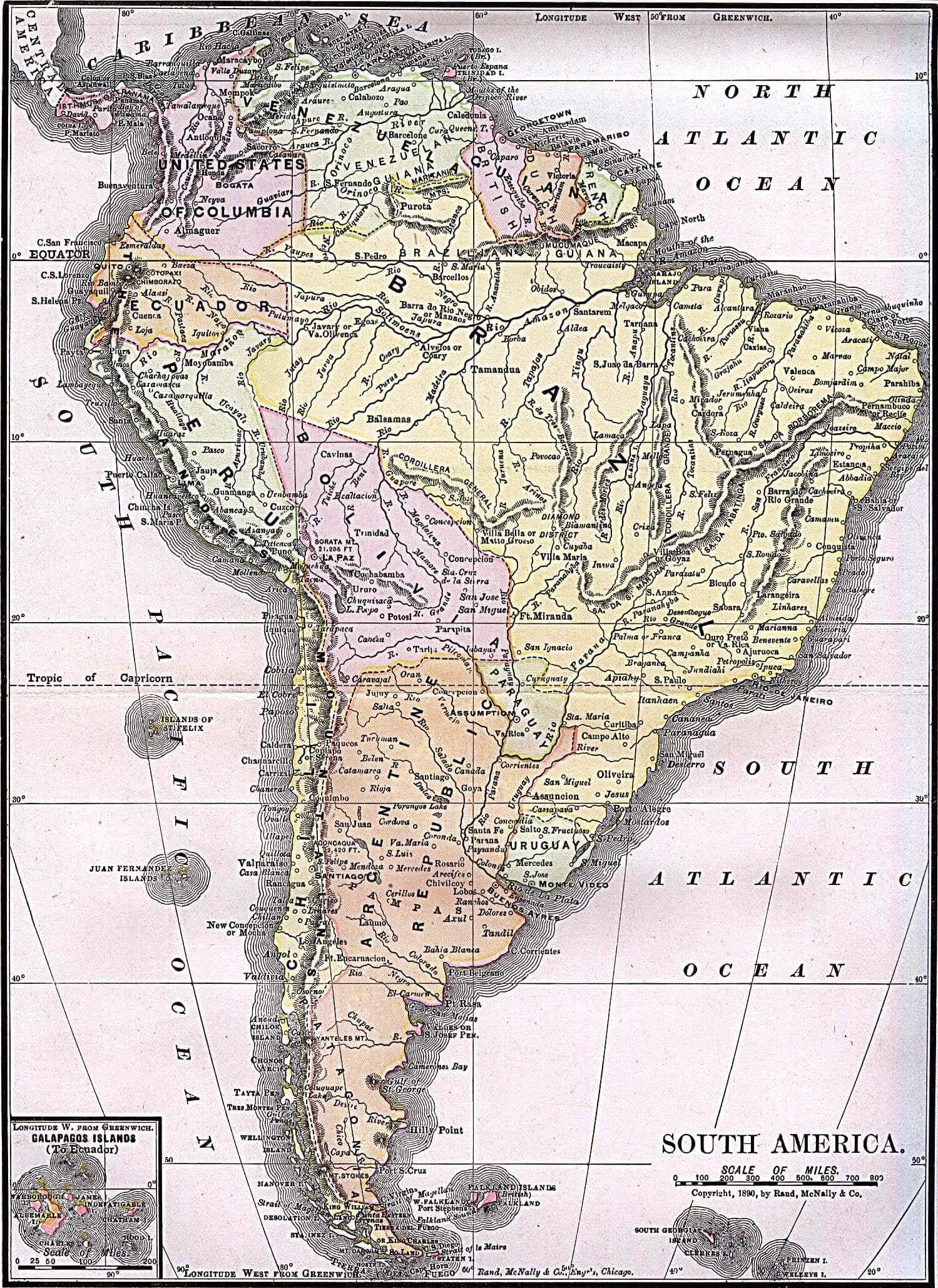
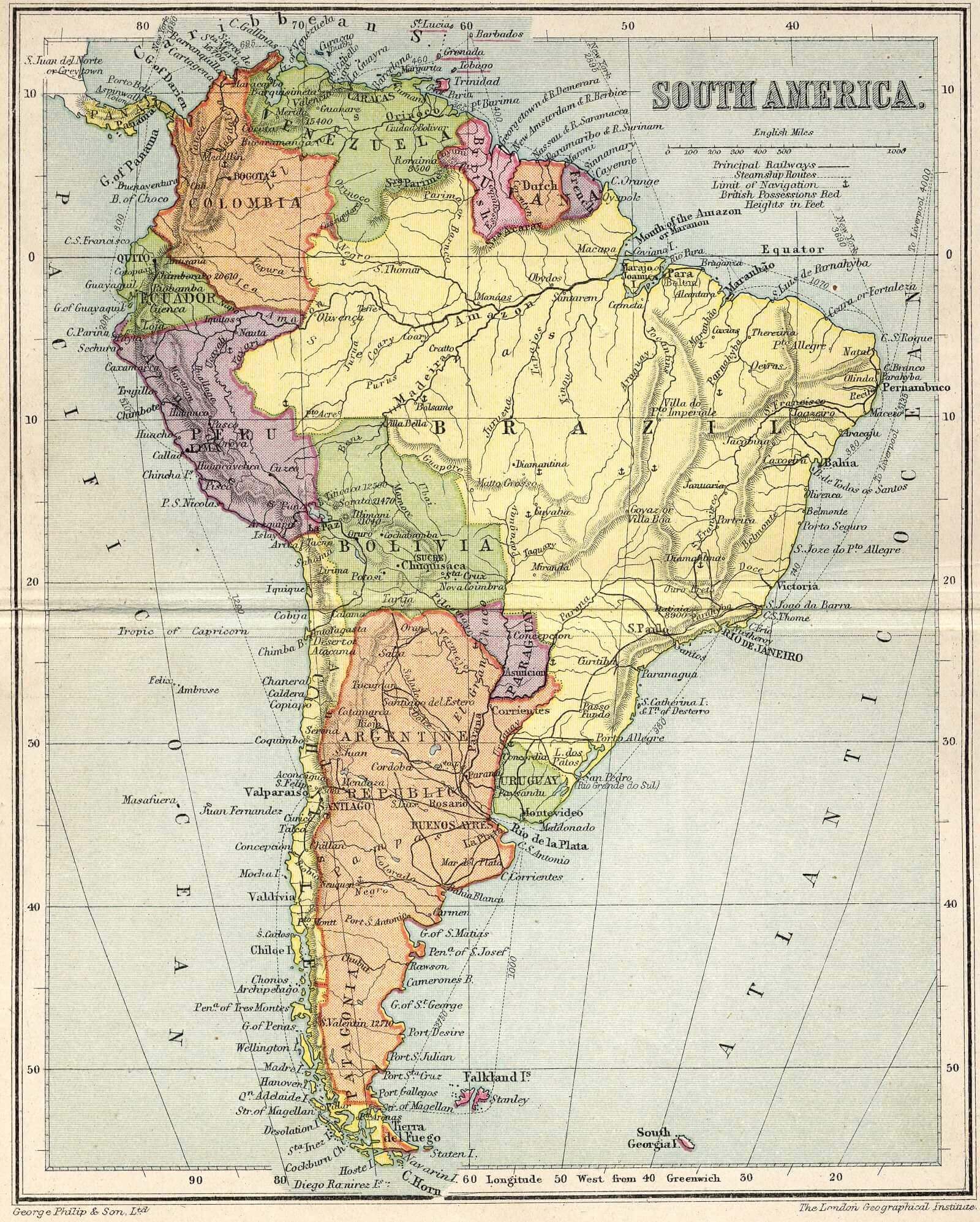
SOUTH AMERICA HISTORICAL MAP 1892
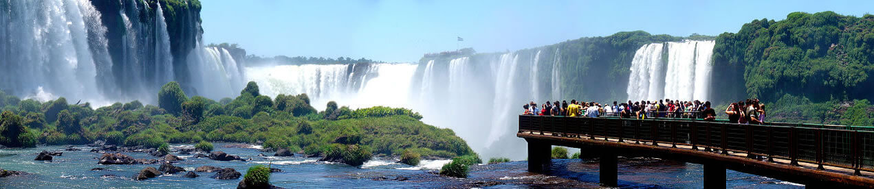
SOUTH AMERICA IGUAZU FALLS ARGENTINA BRAZIL
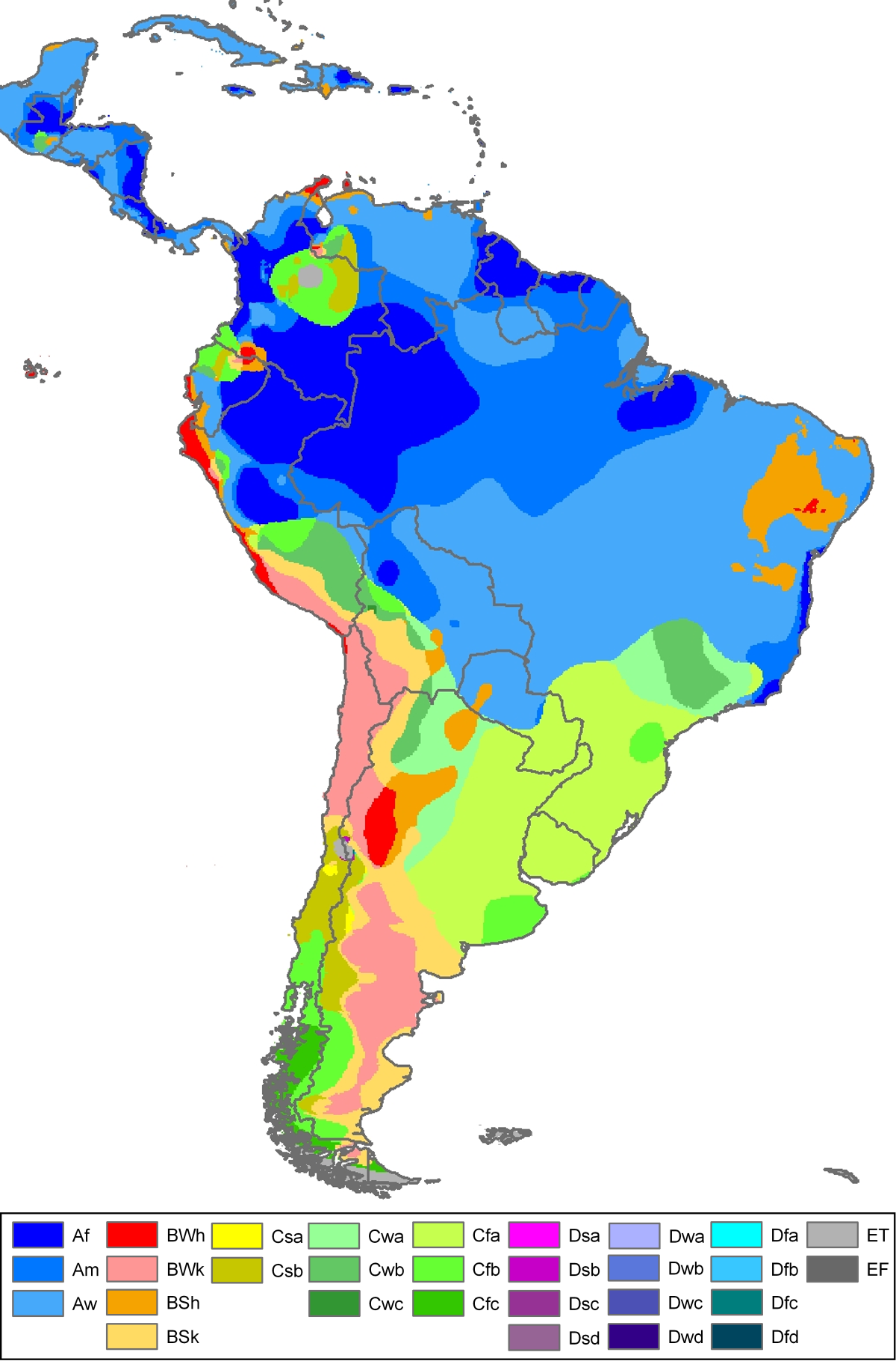
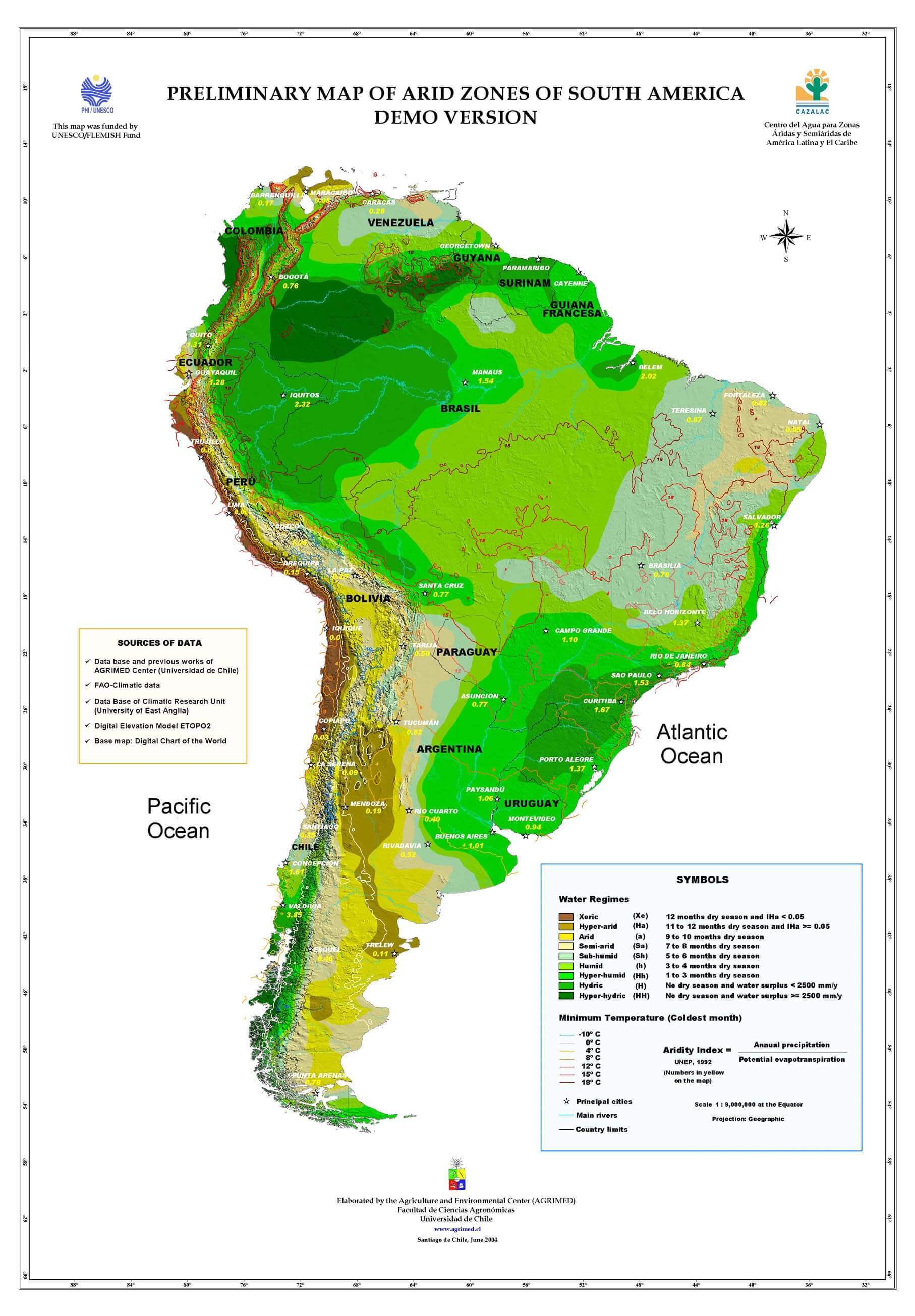
SOUTH AMERICA KOPPEN MAP
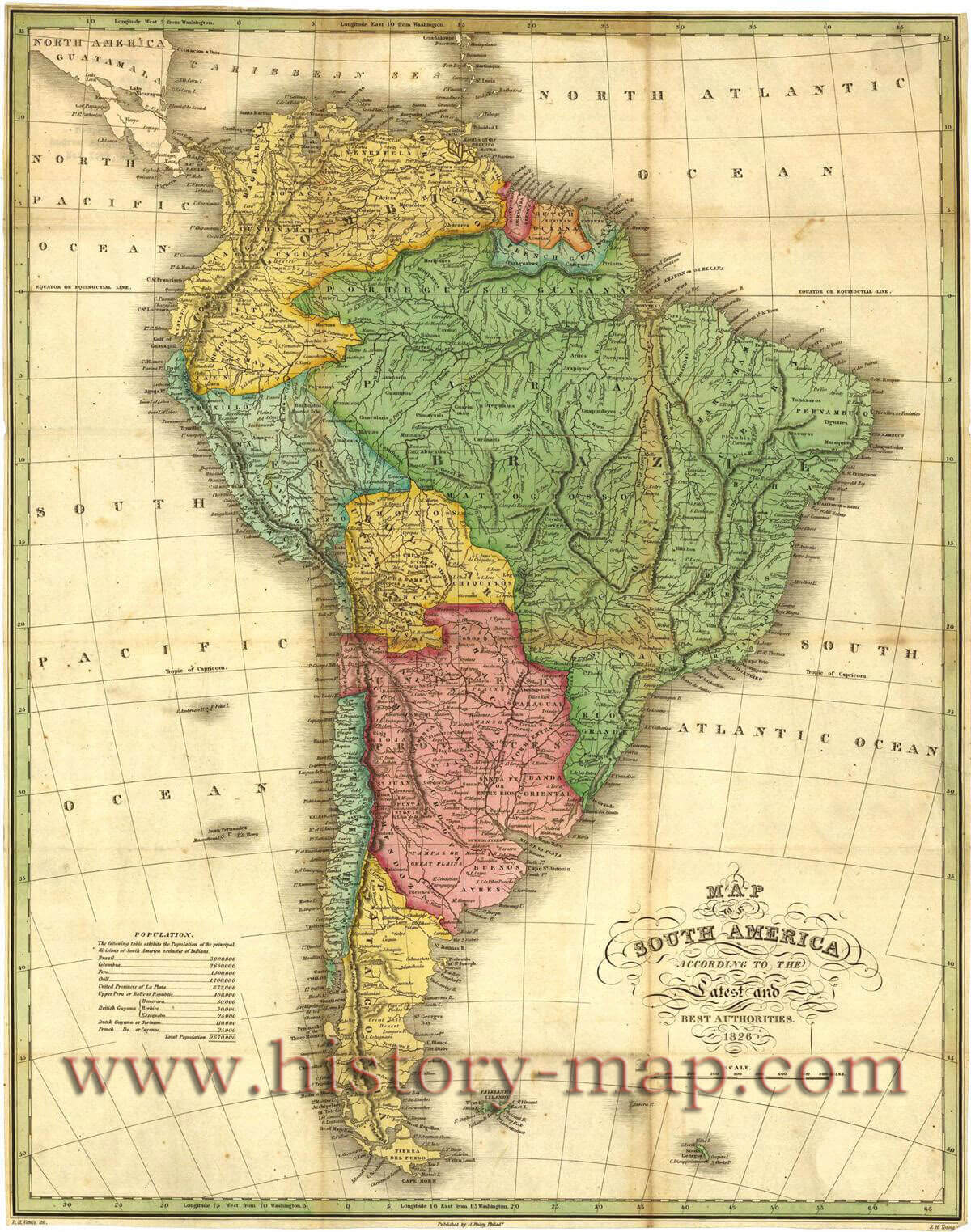
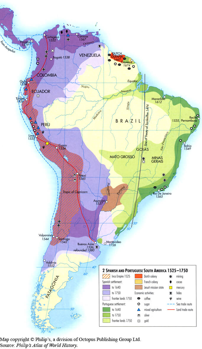
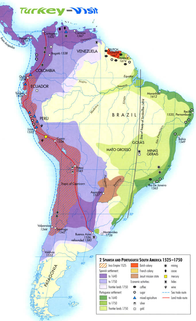
SOUTH AMERICA MAP 1525 1750
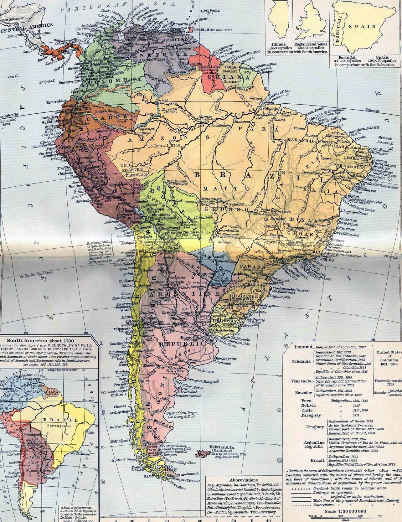
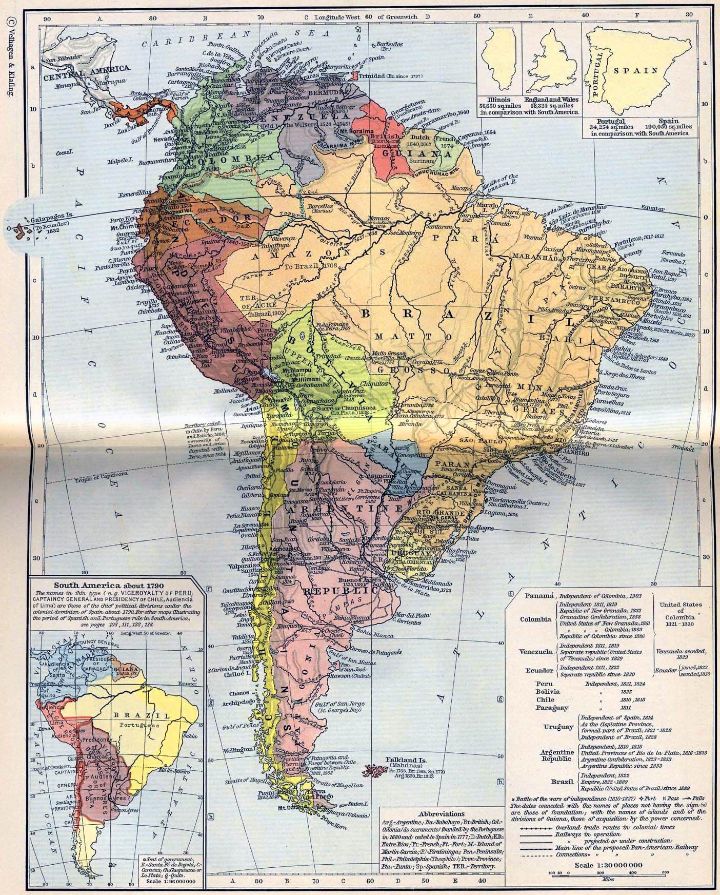
SOUTH AMERICA MAP 1790
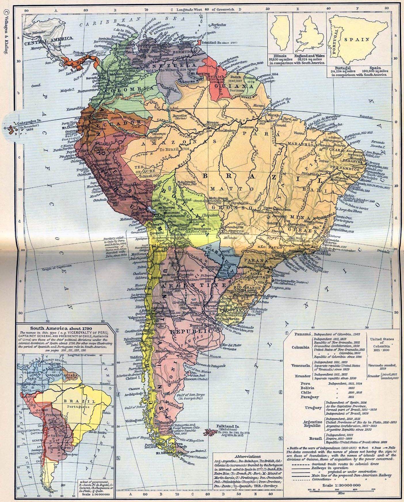
SOUTH AMERICA MAP 1790 1911

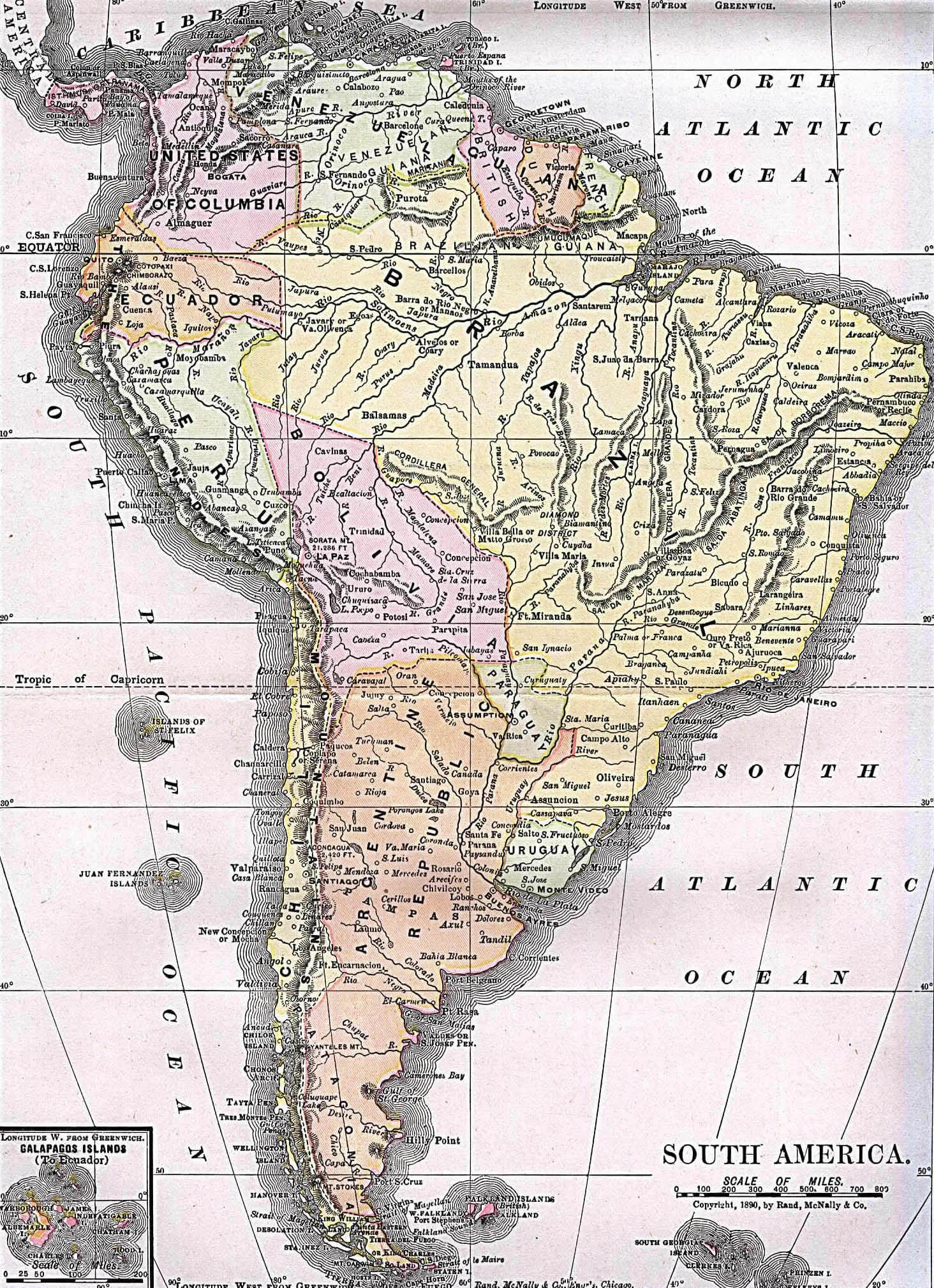
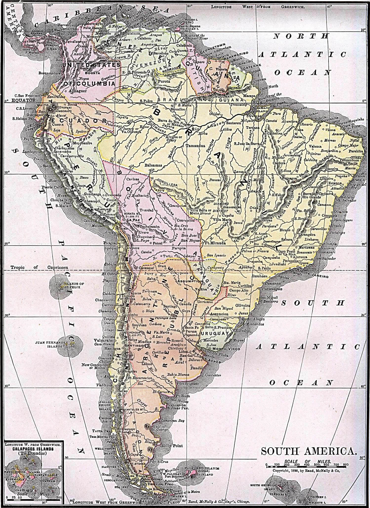
SOUTH AMERICA MAP 1892

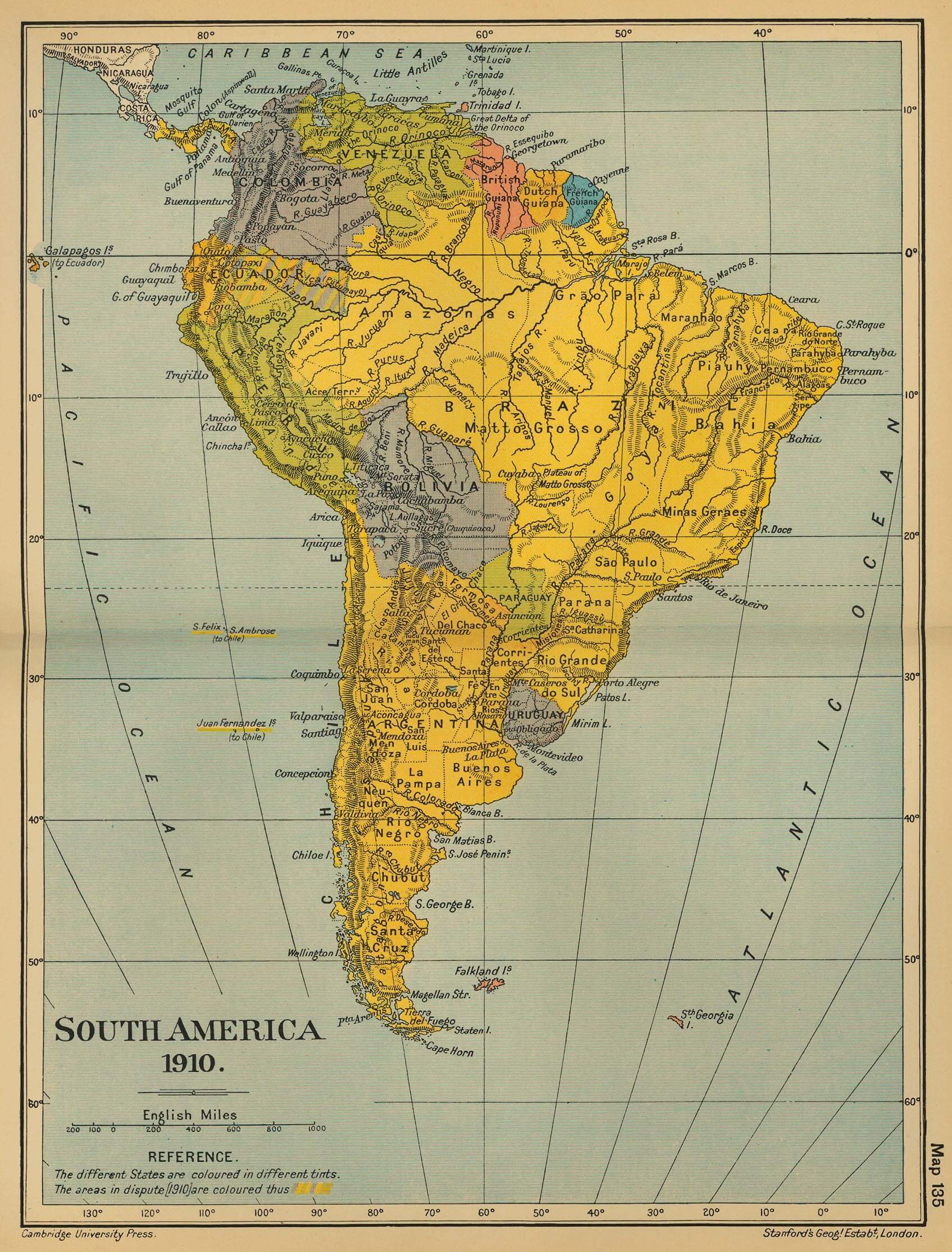
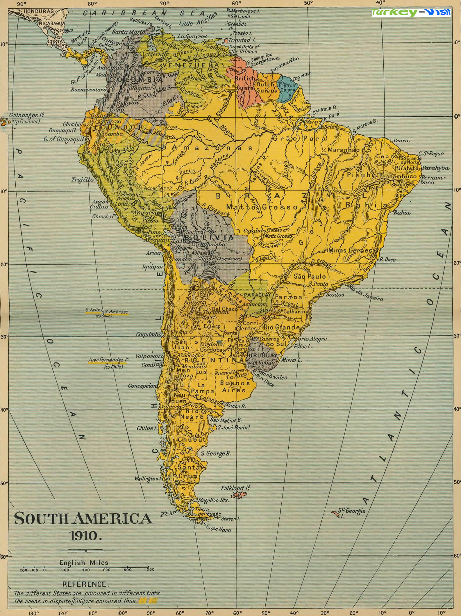
SOUTH AMERICA MAP 1910
SOUTH AMERICA MAP 1911
SOUTH AMERICA MAP BRAZIL
SOUTH AMERICA MAP IN 1910

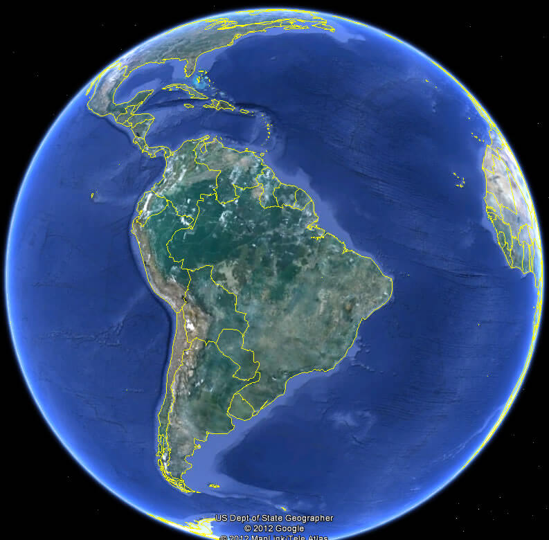
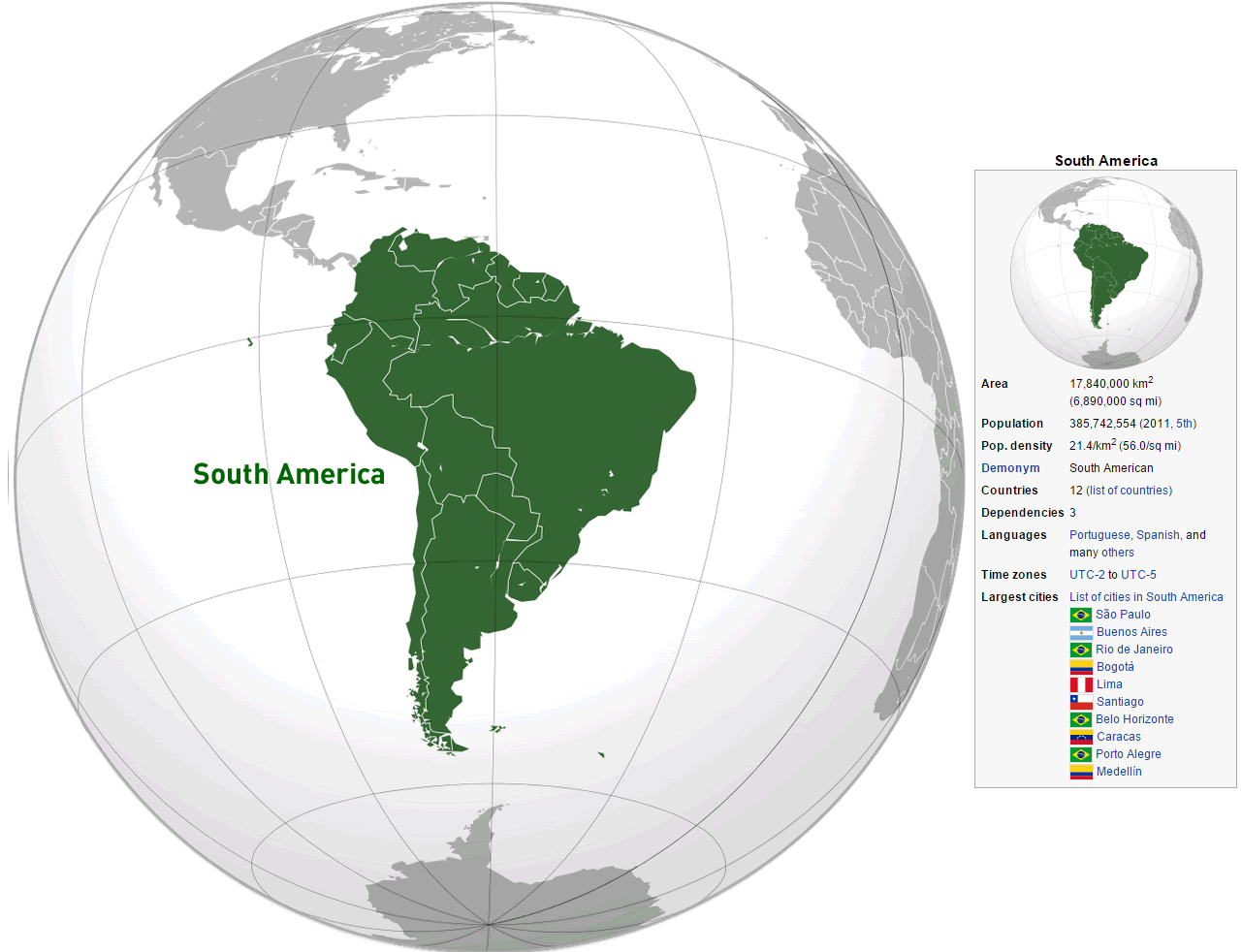
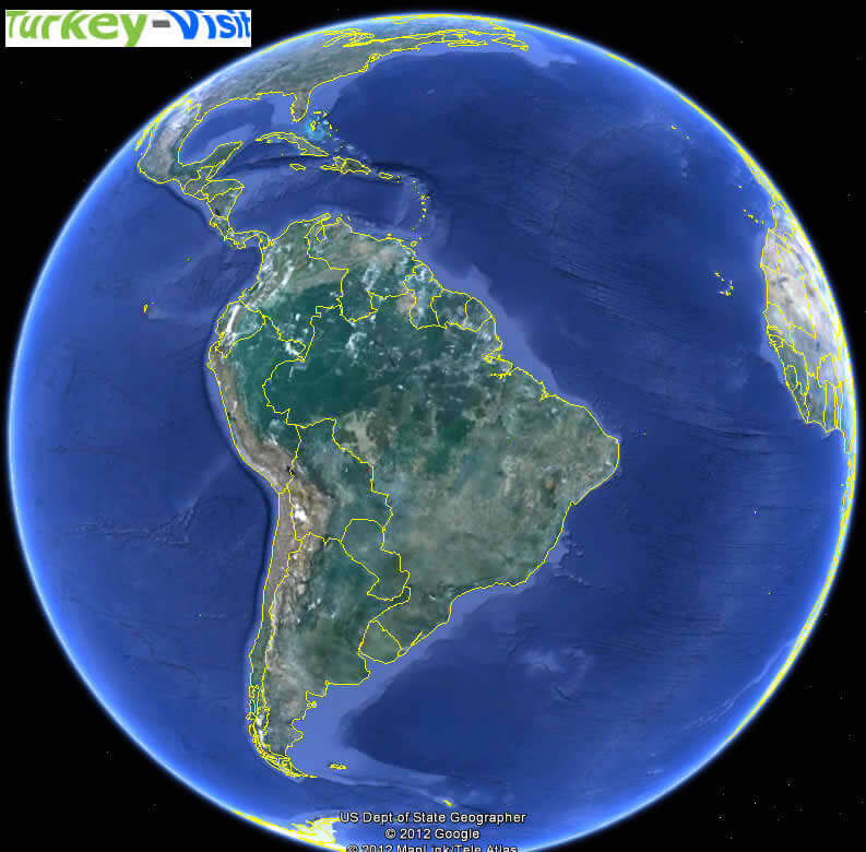
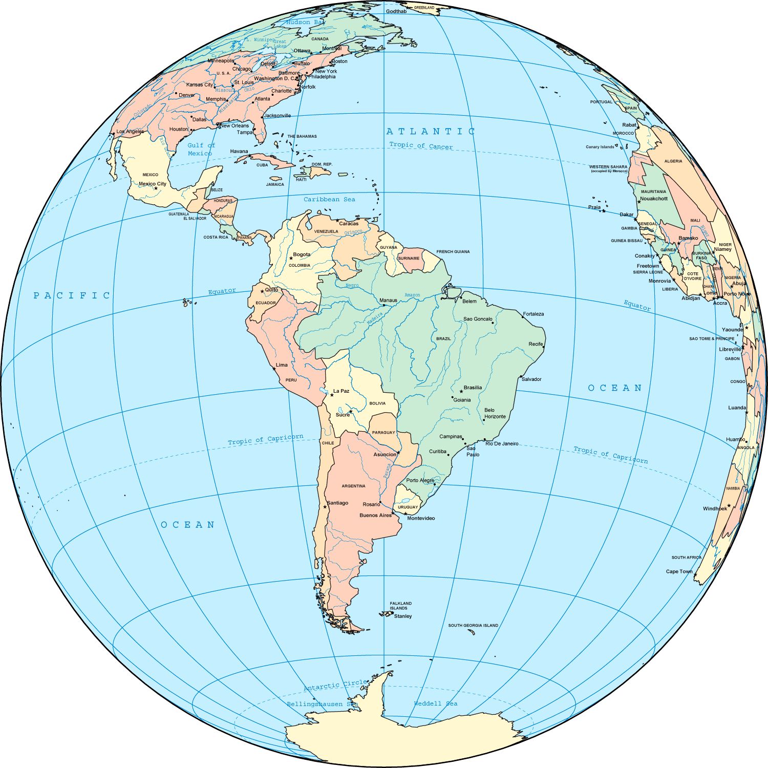
SOUTH AMERICA MAP ON GLOBE

SOUTH AMERICA MAP WORLD

SOUTH AMERICA PHYSICAL MAP
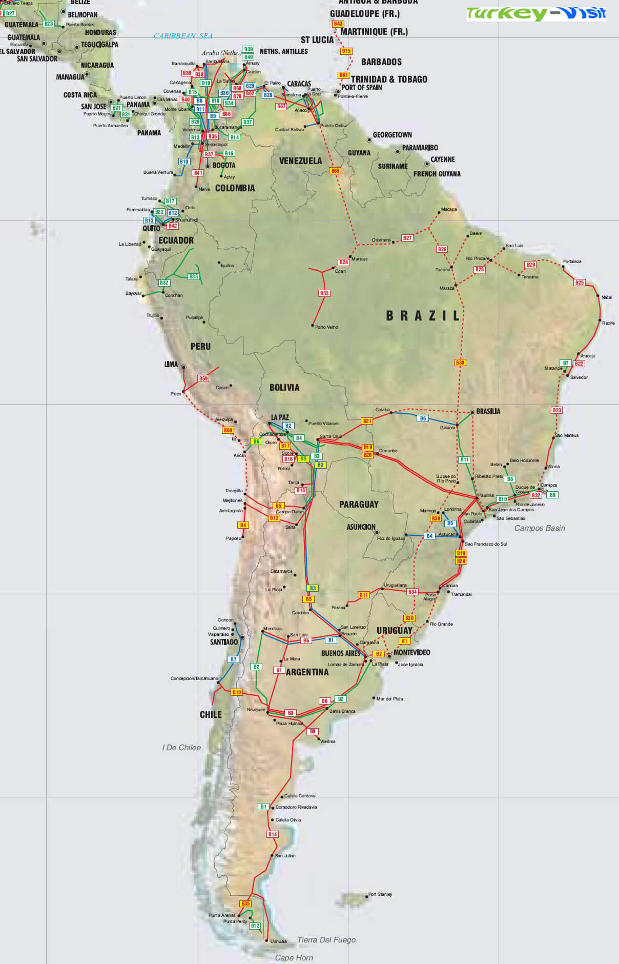
SOUTH AMERICA PIPELINES MAP

SOUTH AMERICA POLITICAL MAP
SOUTH AMERICA POLITICAL MAP
SOUTH AMERICA POLITICAL MAP 1989

SOUTH AMERICA POLITICAL MAP 1995
SOUTH AMERICA POLITICAL MAP COUNTRIES

SOUTH AMERICA POLITICAL OUTLINE MAP

SOUTH AMERICA PRELIMINARY MAP
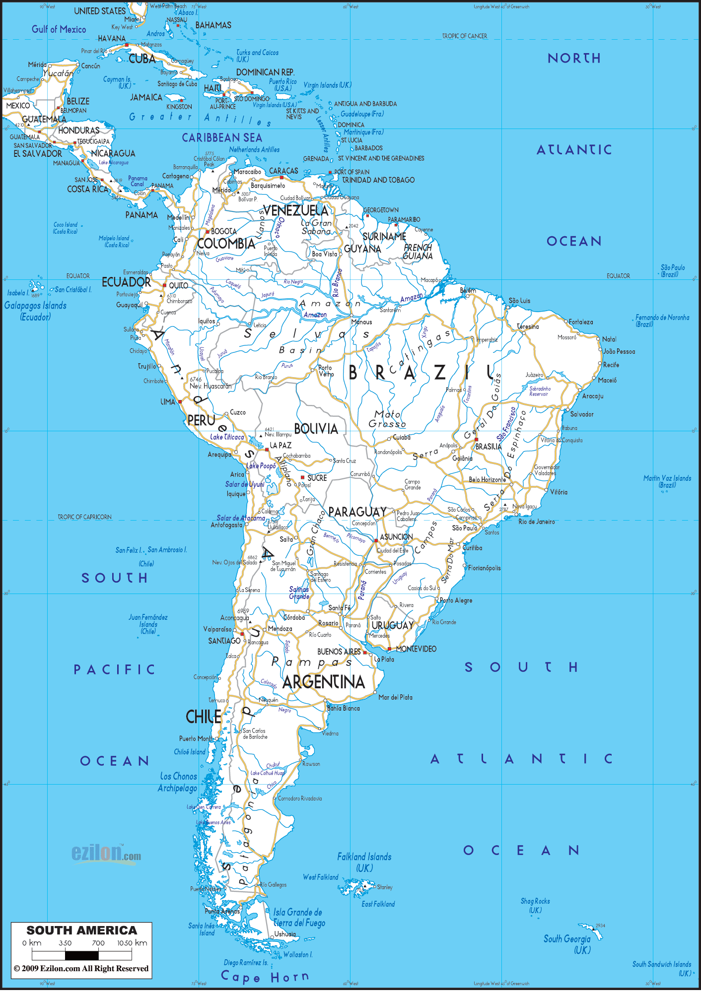
SOUTH AMERICA ROAD MAP
SOUTH AMERICA SATELLITE IMAGE
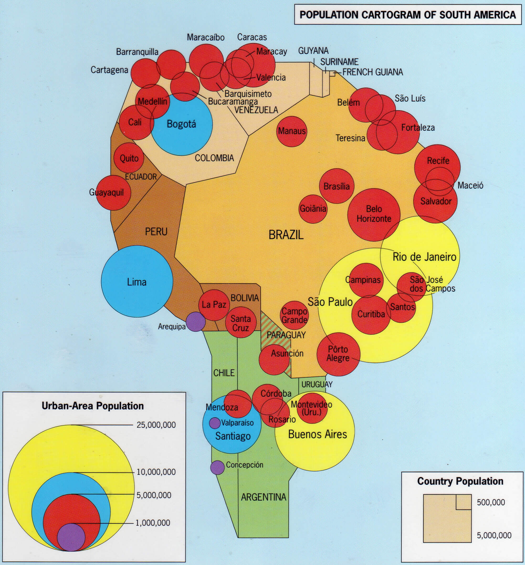
SOUTH AMERICAN POPULATION MAP
TOPOGRAPHY MAP OF SOUTH AMERICA

WHERE IS SOUTH AMERICA IN THE WORLD
South America Countries Map
Argentina Map Bolivia Map Brazil Map Chile Map Colombia Map Ecuador Map Falkland Islands Map Guyana Map Paraguay Map Peru Map Suriname Map Uruguay Map Venezuela Map French Guiana MapSOUTH AMERICA from Space and Latin American Countries Satellite View
Please subscribe on "World Guide" channnel on Youtube at youtube.com/c/WorldGuide
Where is South America in the World?

South America Satellite Image
SOUTH AMERICA MAP : Countries Maps and Satellite Images from Space
Please subscribe on "World Guide" channnel on Youtube at youtube.com/c/WorldGuide
A Variety of South America Maps and South America Satellite Images


Submit URL to South America :
Addresse: Hakarinne 2 Espoo, Uusimaa - Finland 02210
Web: istanbul-city-guide.com
Email: [email protected]
Web: istanbul-city-guide.com
Email: [email protected]
Copyright istanbul-city-guide.com - 2004 - 2026. All rights reserved. Privacy Policy | Disclaimer