Europe Map and Europe Satellite Images
Europe Explore Europe Map, world countries map, satellite images of the Europe, Europe largest cities maps, political map of Europe, driving directions and traffic map.
Europe regional highways maps, leaflets, road situations, transportation, lodging, guide, geographical, physical information can be found with Europe interactive map. With Europe Map all states, regions, cities, towns, districts, avenues, streets and popular centers' satellite, sketch and terrain views are available.
For more about Map of Europe >>
Europe Maps

A Collection of Europe Maps and Europe Satellite Images
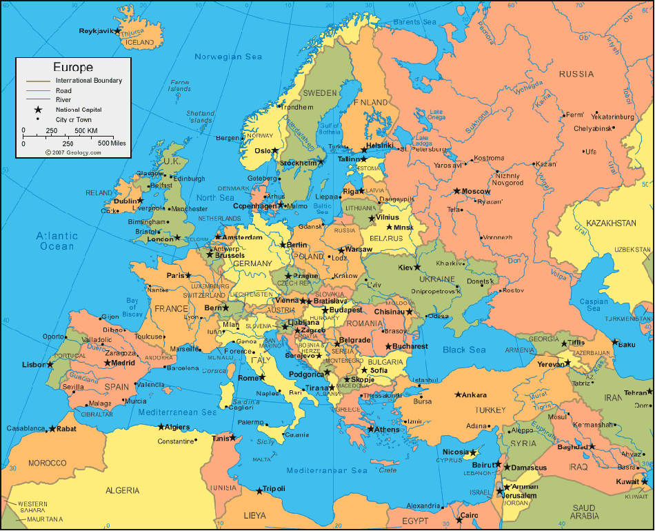
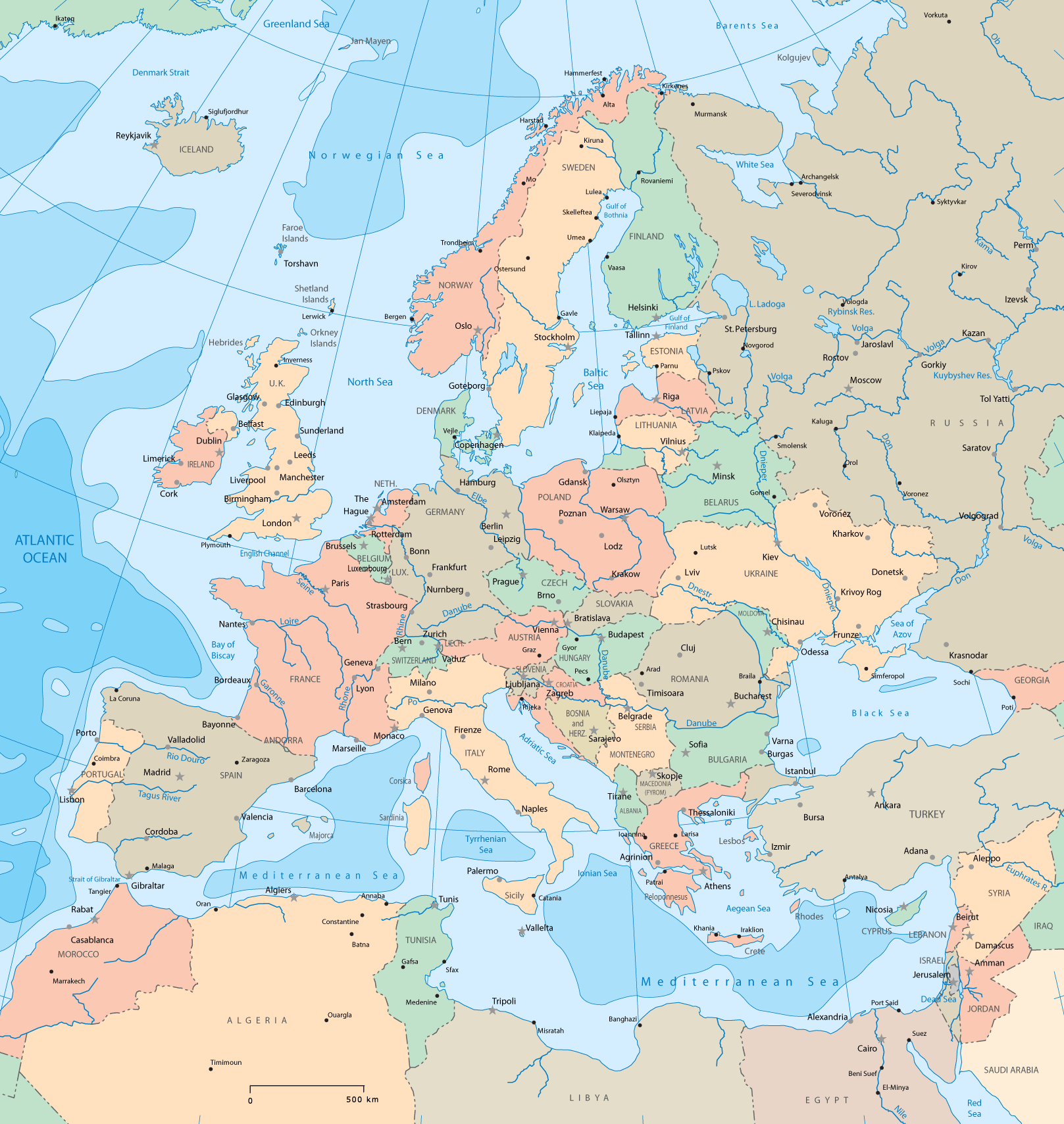
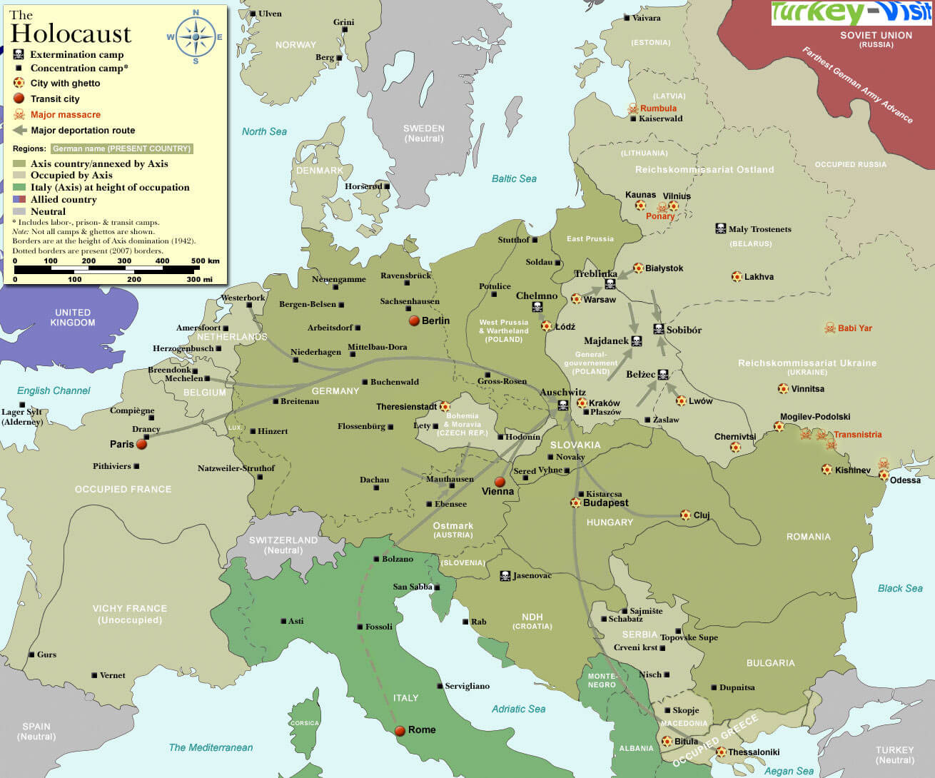
MAP OF EUROPE
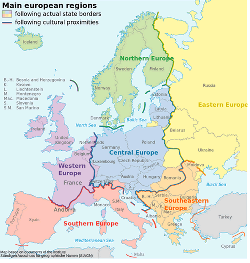
MAIN EUROPEAN REGIONS MAP
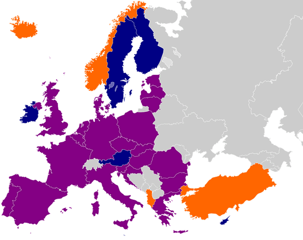
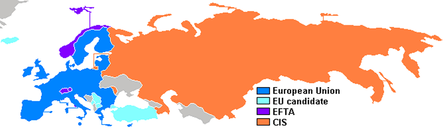
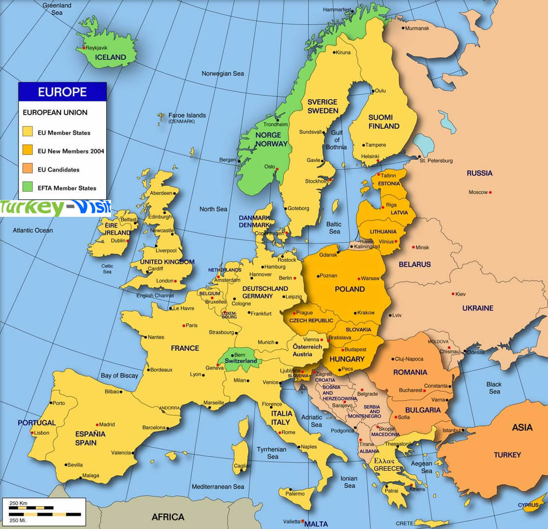
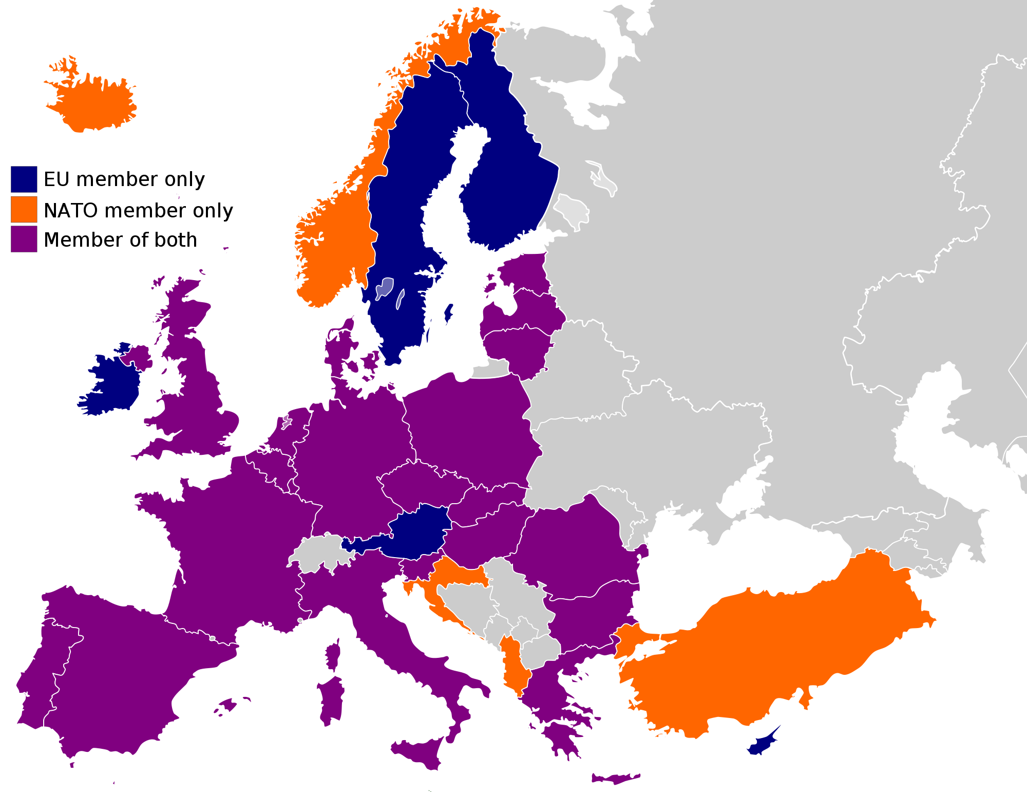
EU NATO MAP
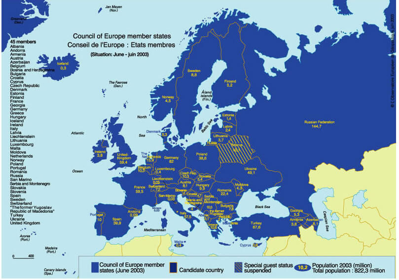
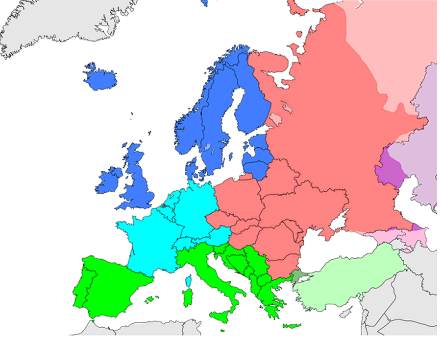
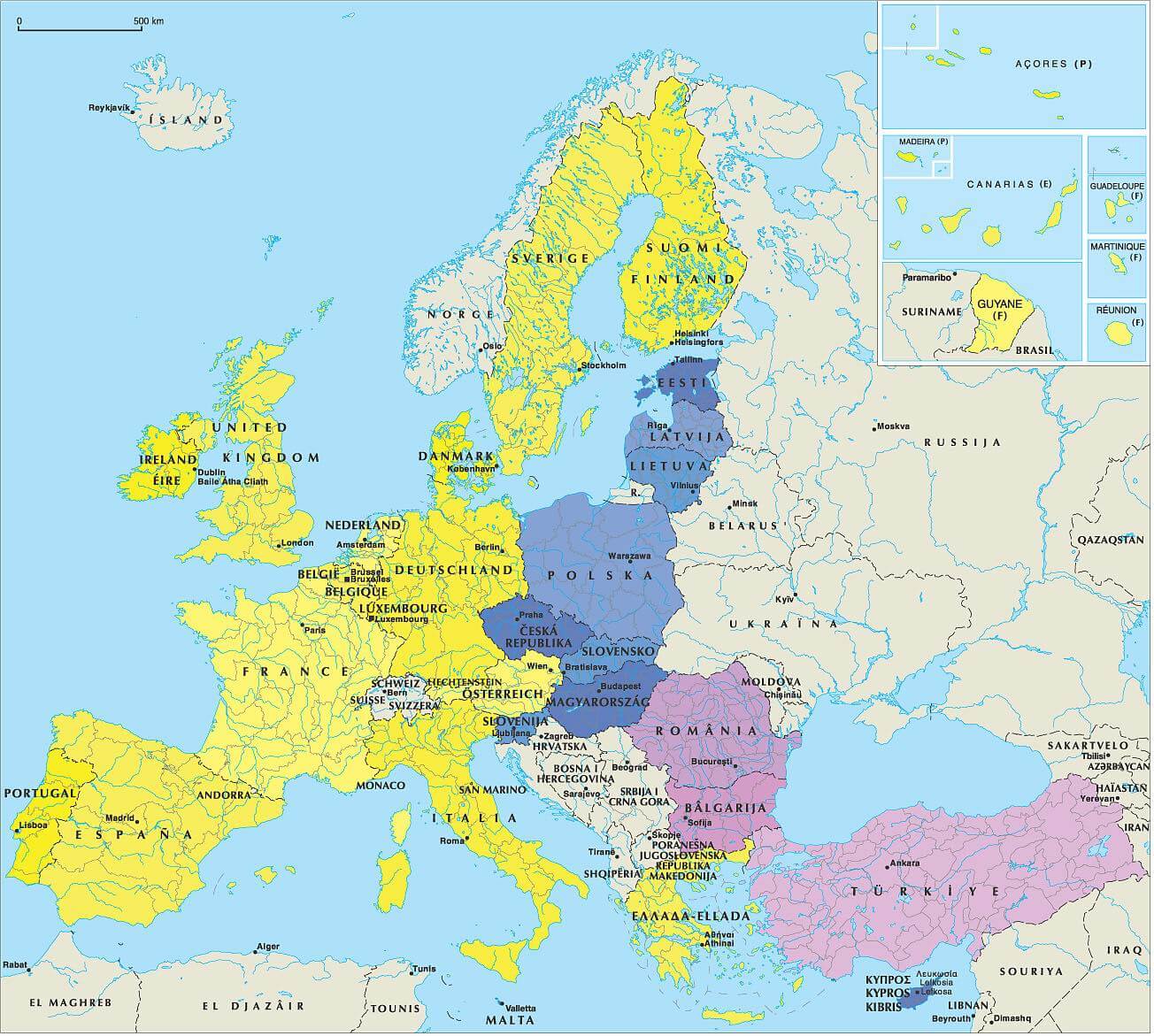
EUROPEAN COUNCIL MAP
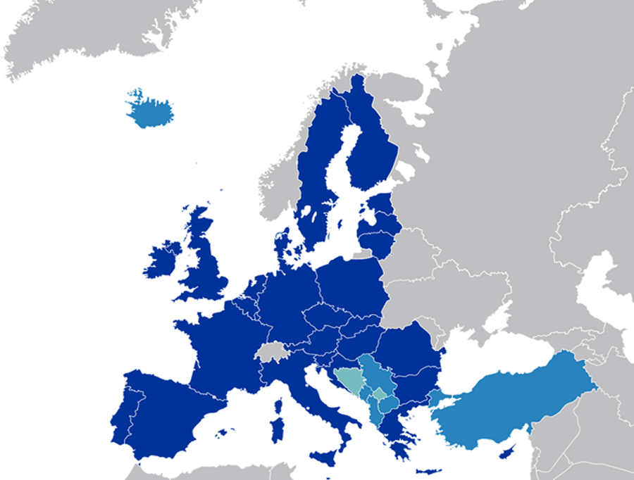
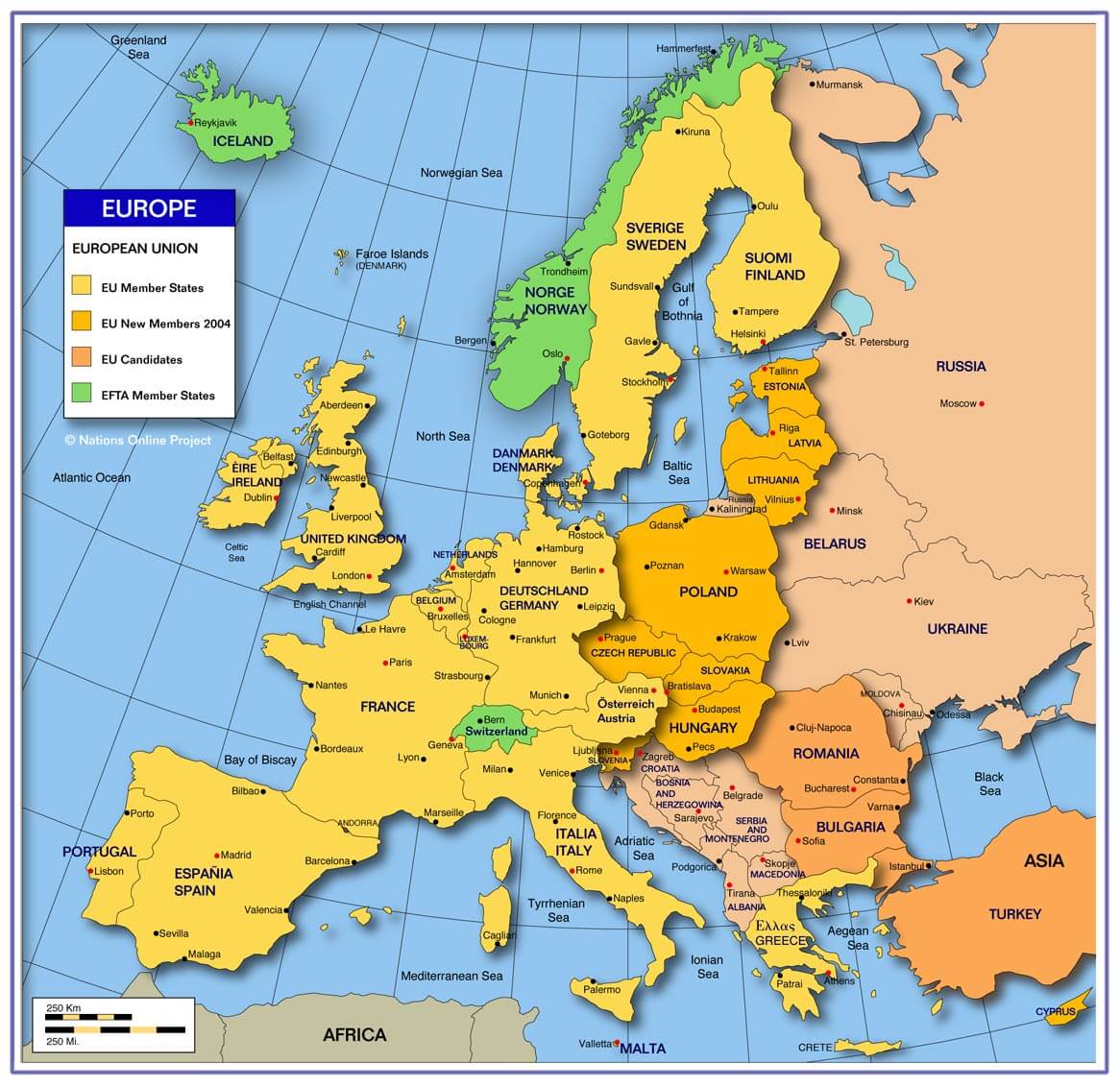
EUROPEAN UNION COUNTIRES CANDITATES
EUROPE SUBREGION MAP UN GEOSCHME
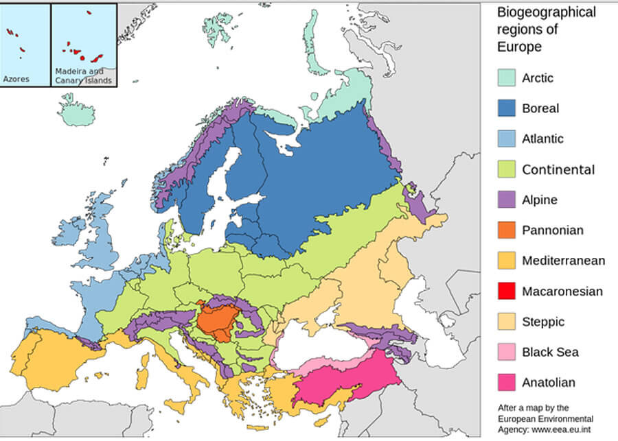
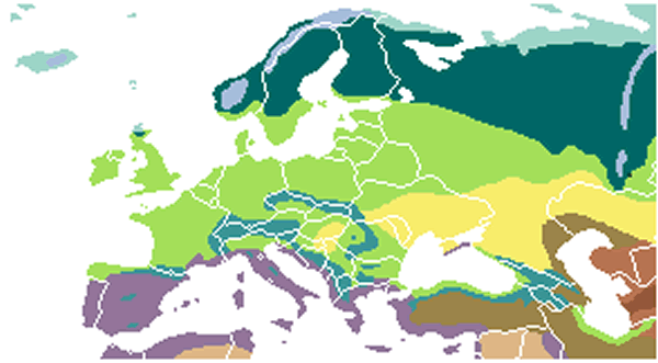
EUROPE BIOGEOGRAPHY COUNTRIES MAP
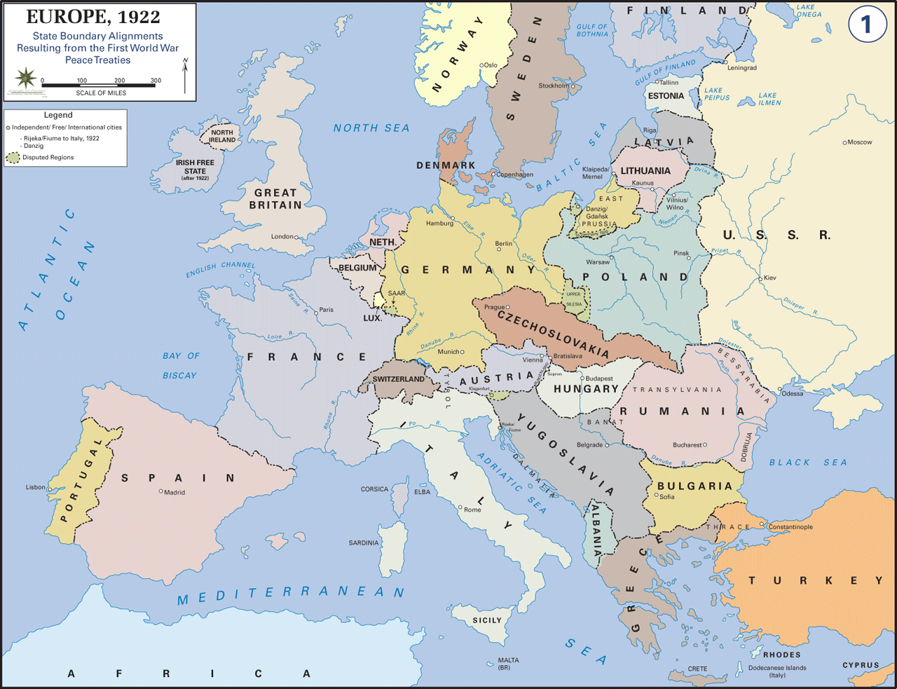
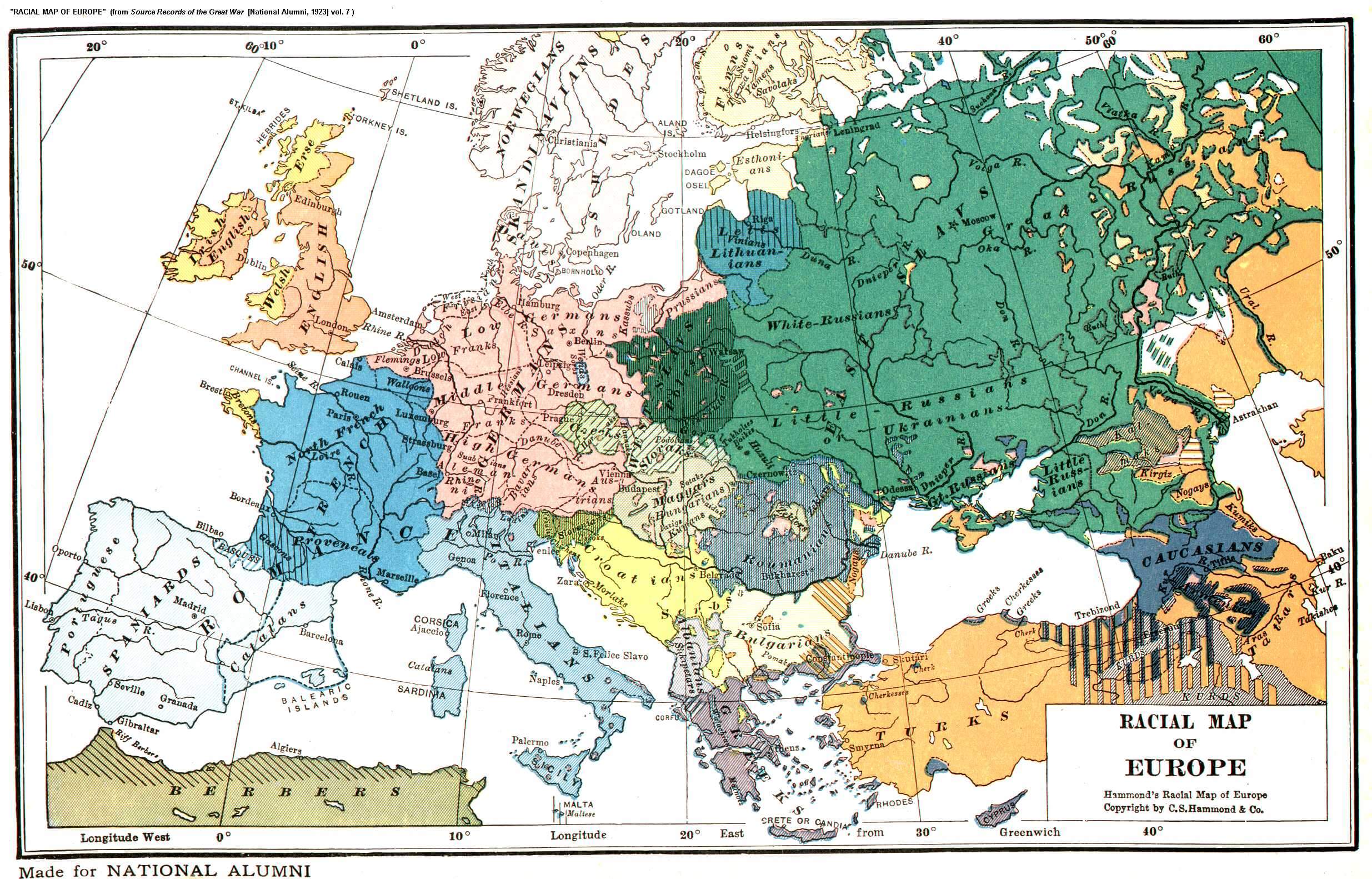
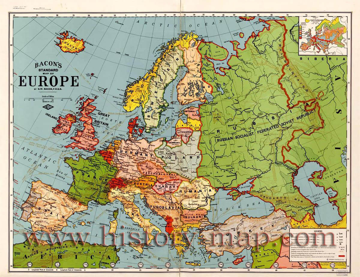
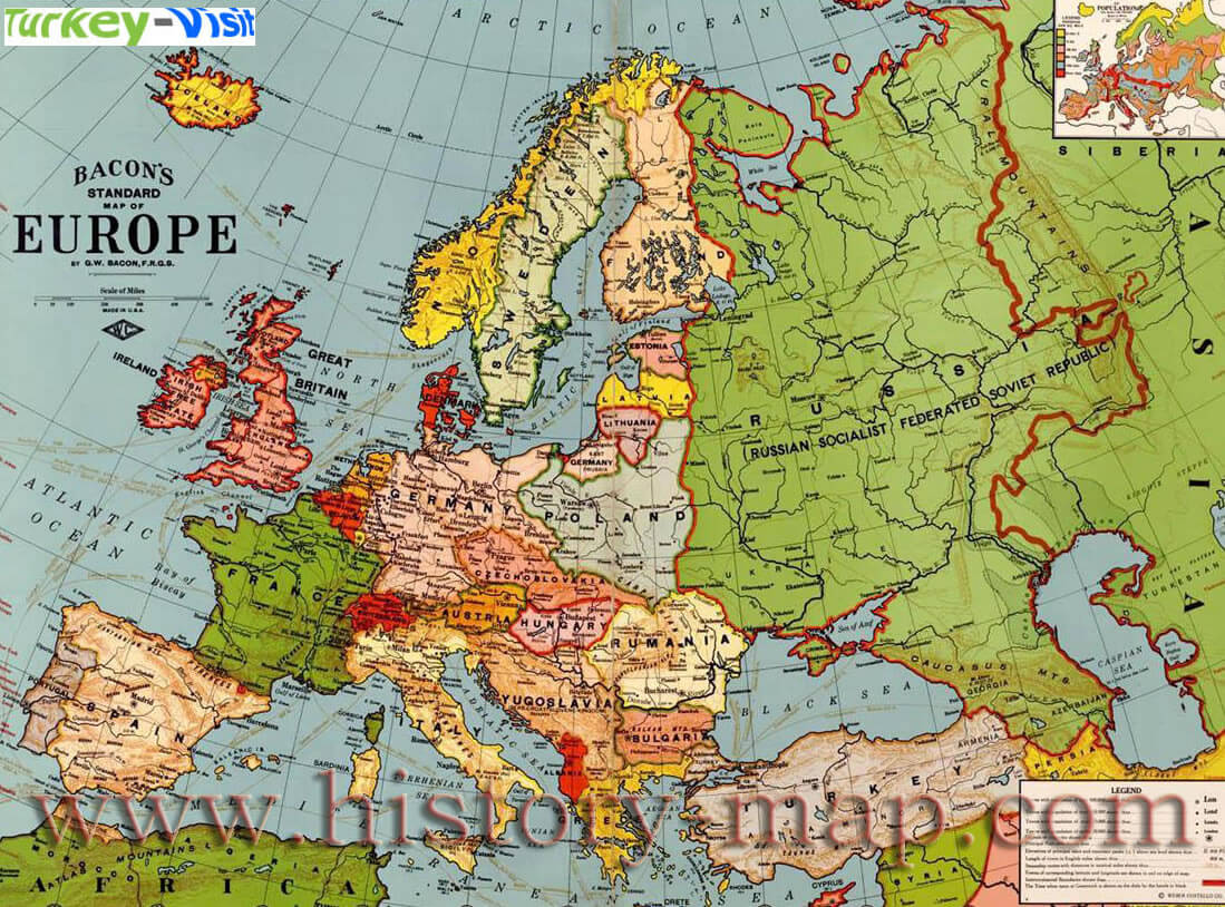
EUROPE MAP 1923
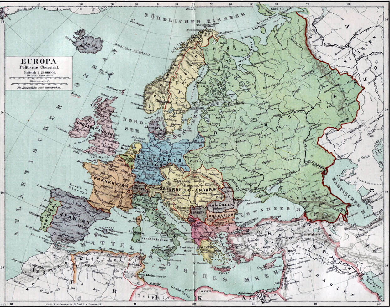
EUROPE MAP 1890
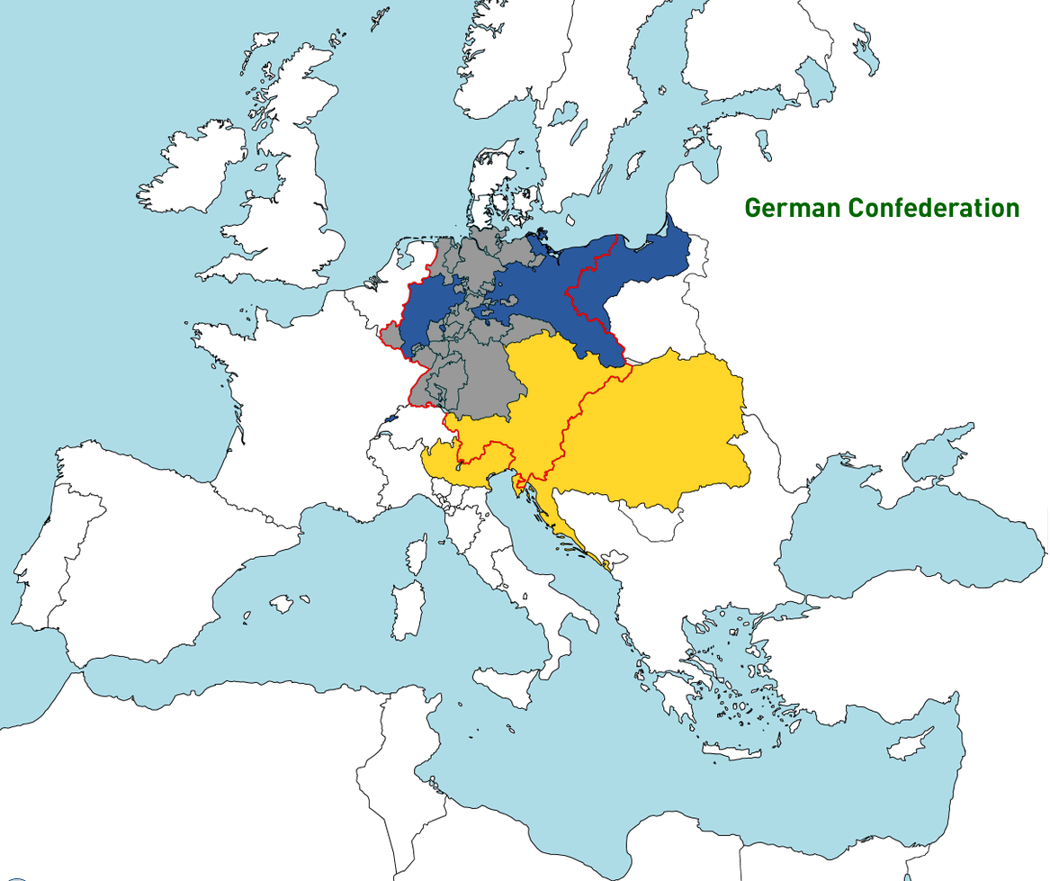
EUROPE MAP GERMAN CONFEDERATION
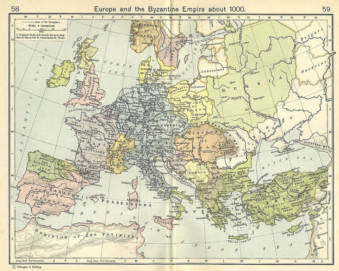
EUROPE BYZANTINE EMPIRE 1000 TURKS
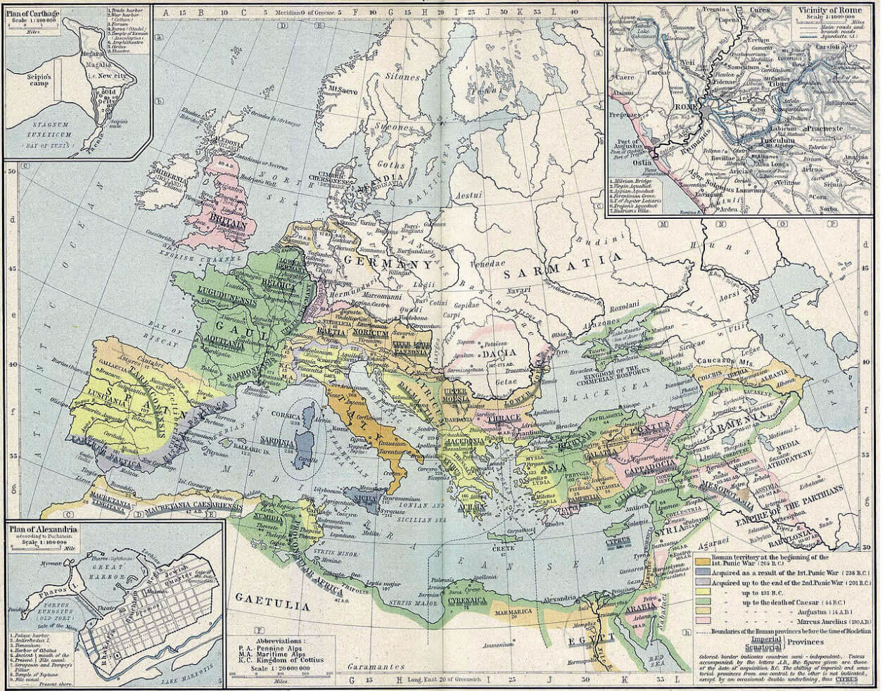
EUROPE ROMAN EXPANSION 264 BC
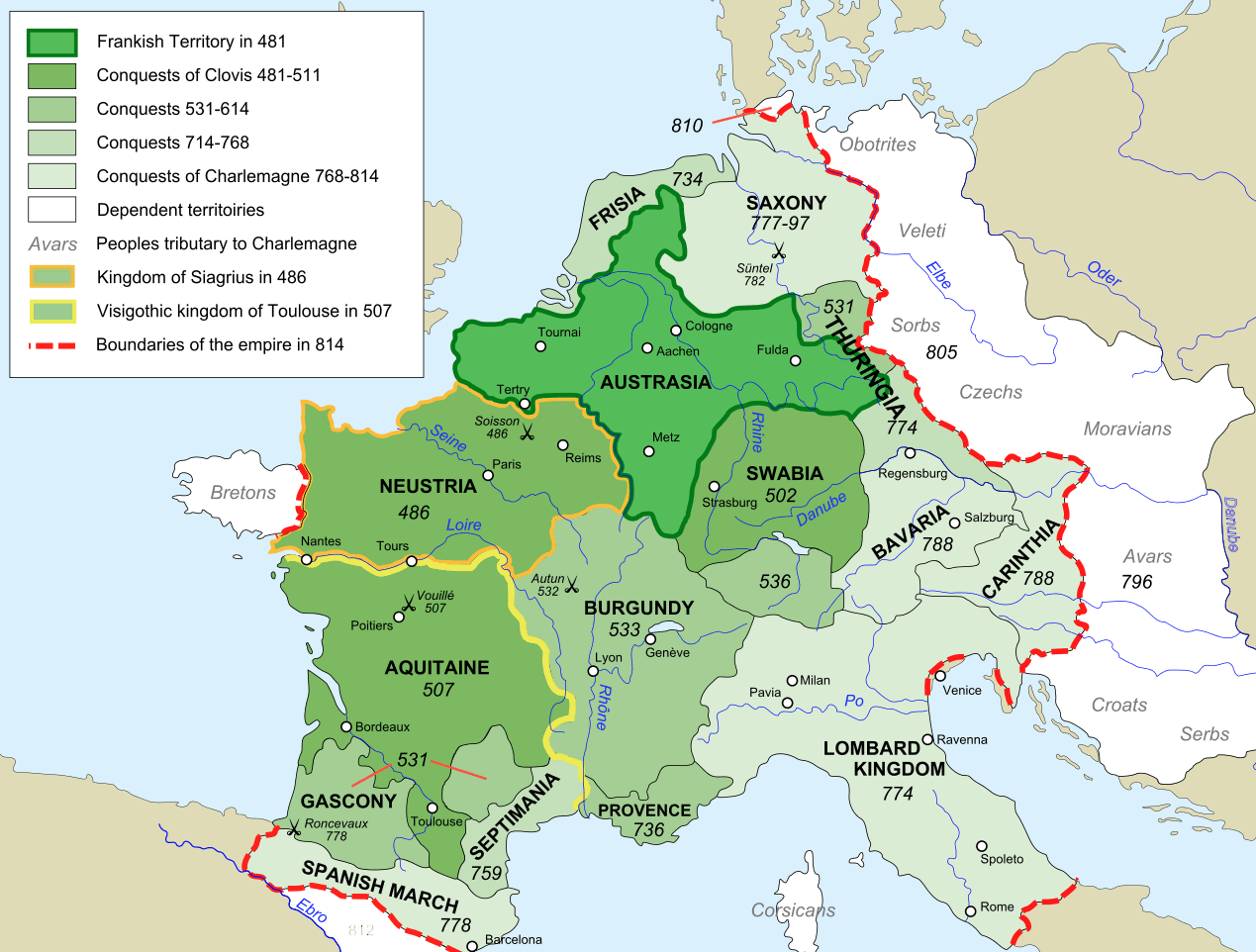
EUROPE MAP FRANKISH EMPIRE 481 814
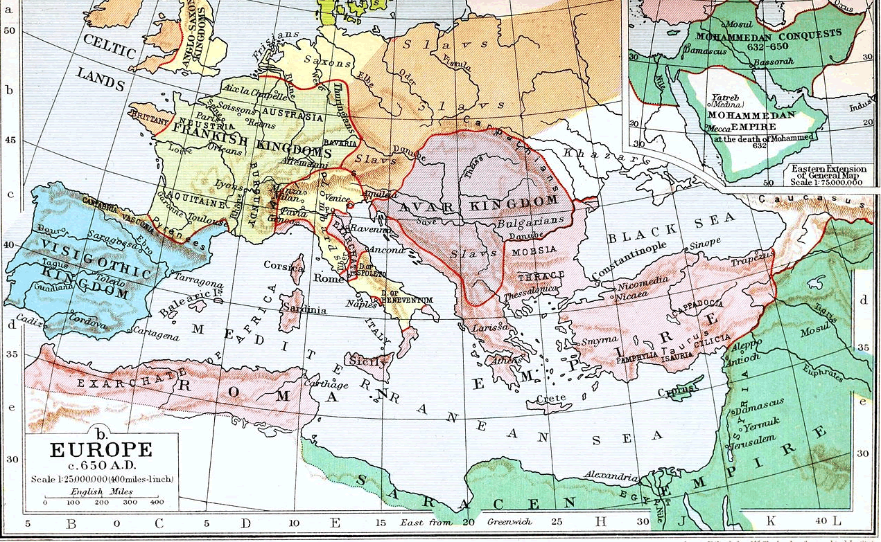
EUROPE MAP 650
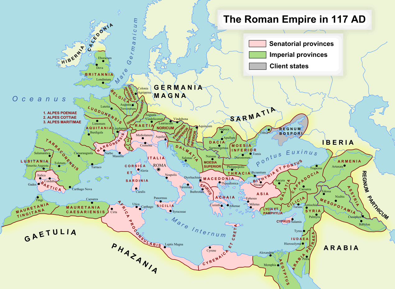
EUROPE THE ROMAN EMPIRE MAP 117
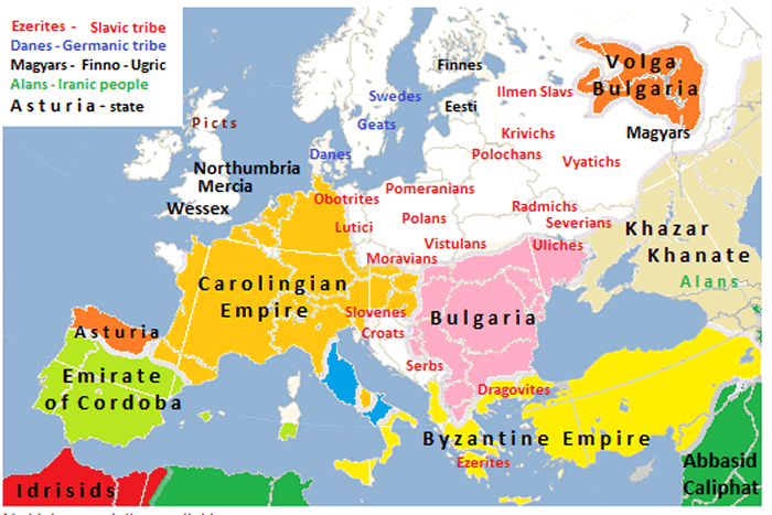
EUROPE MAP 814
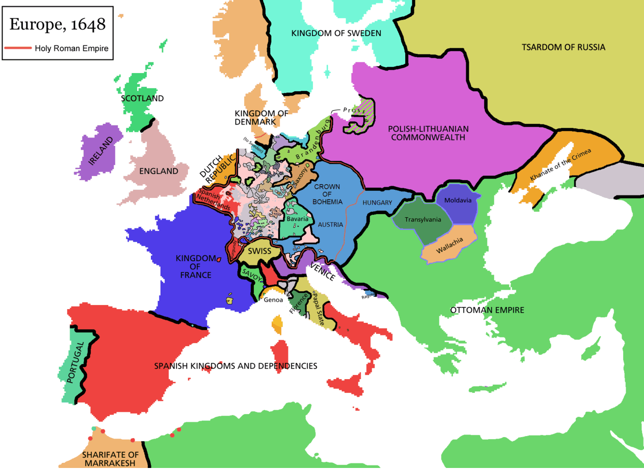
EUROPE HOLY ROMAN EMPIRE MAP 1648
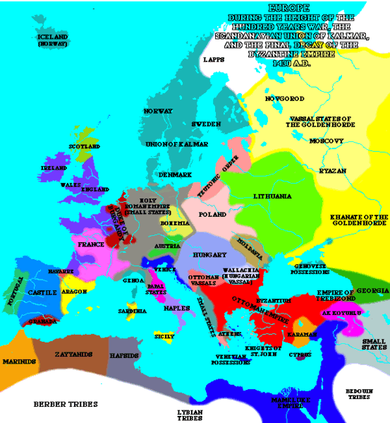
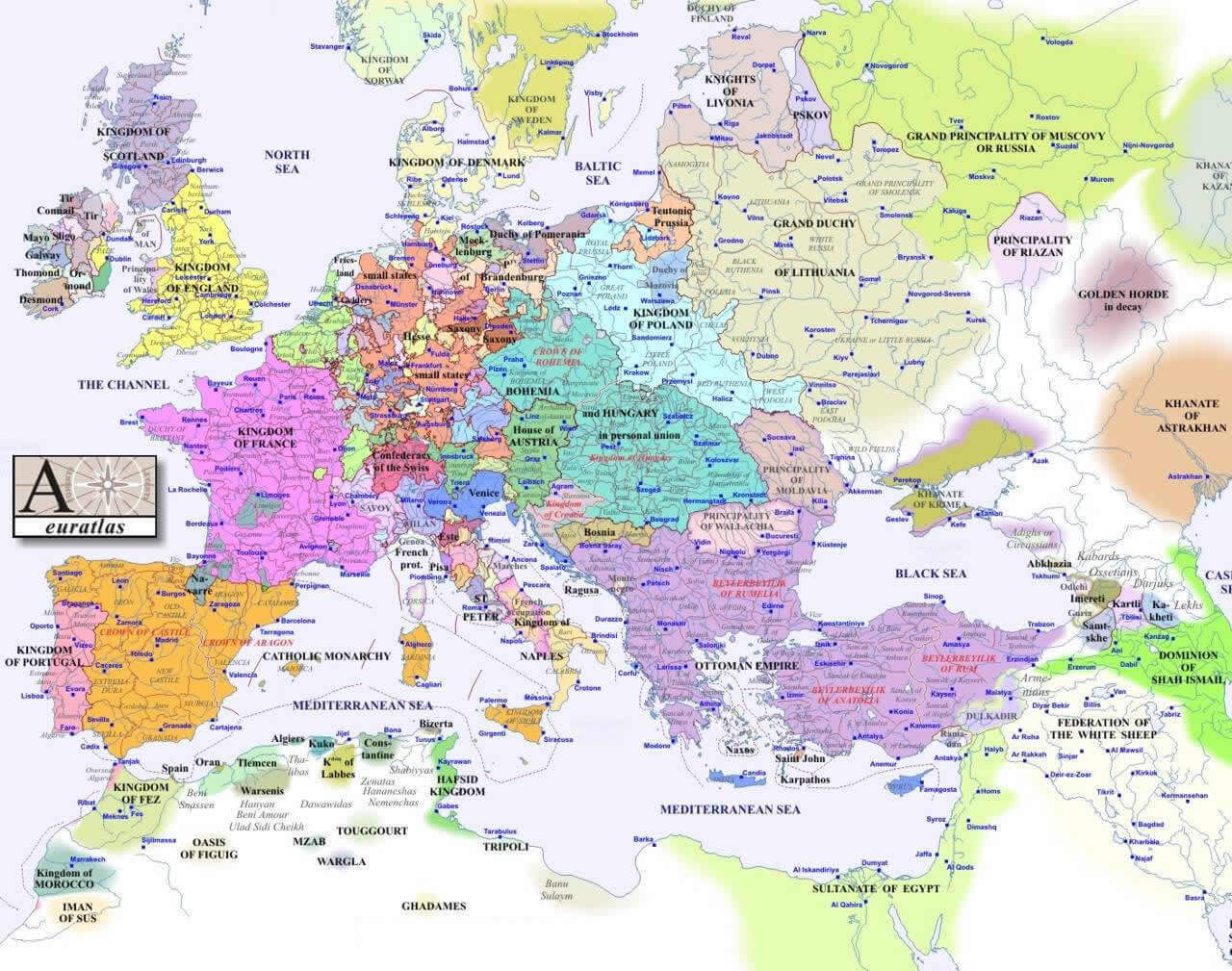
EUROPE MAP 1430
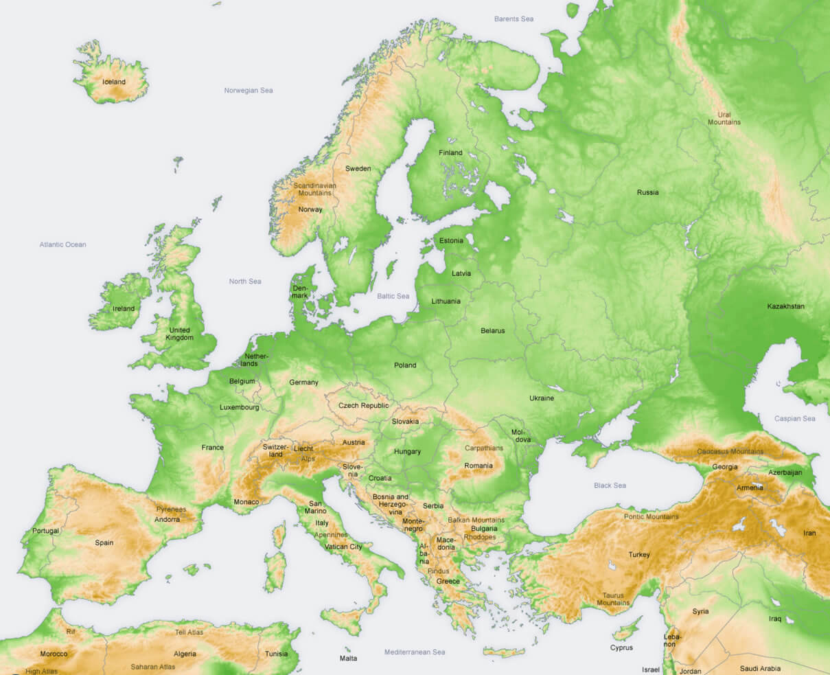
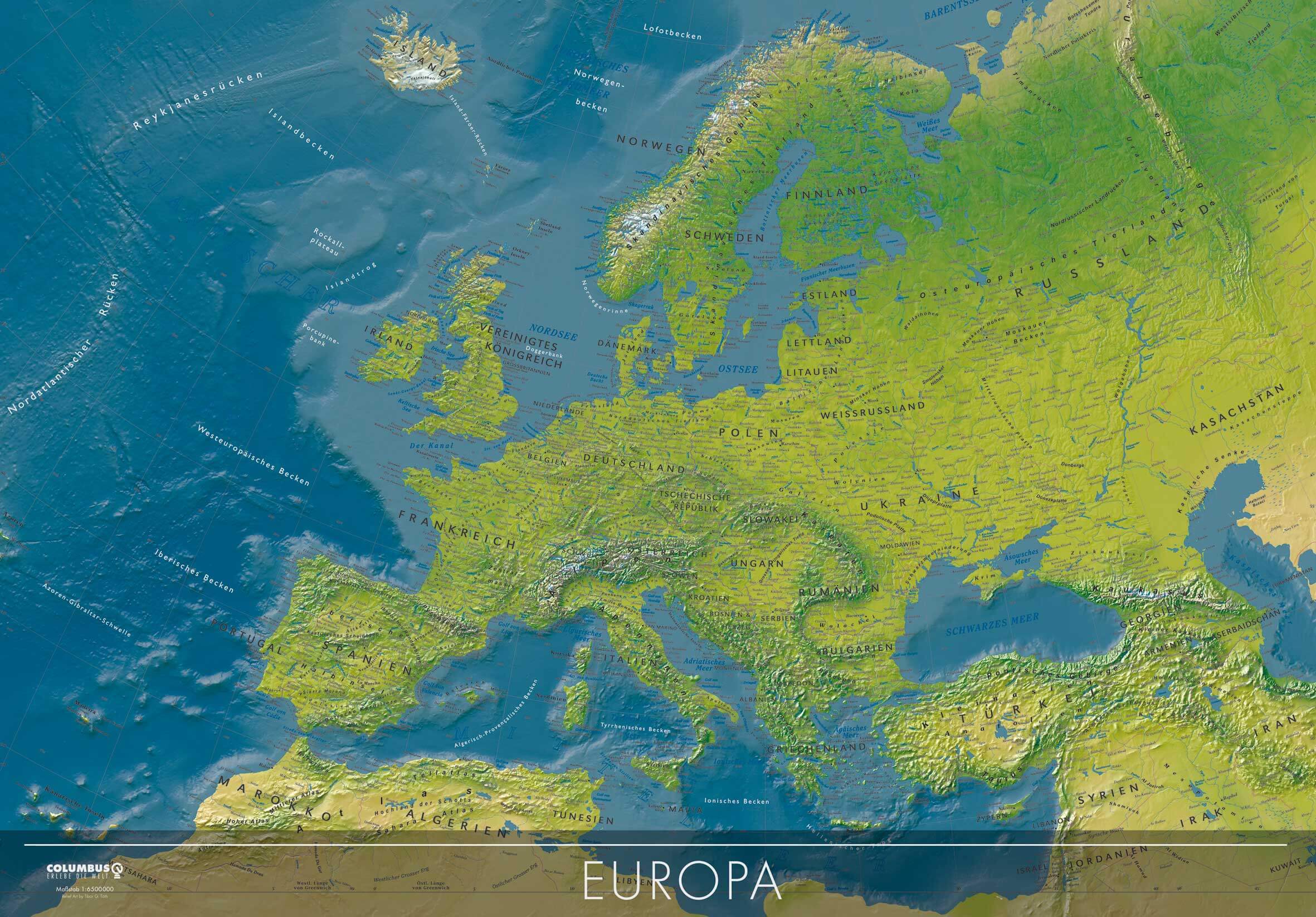
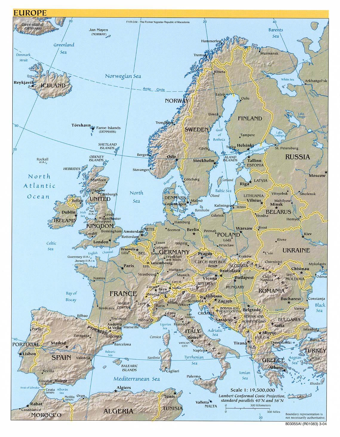
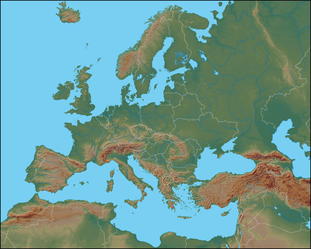
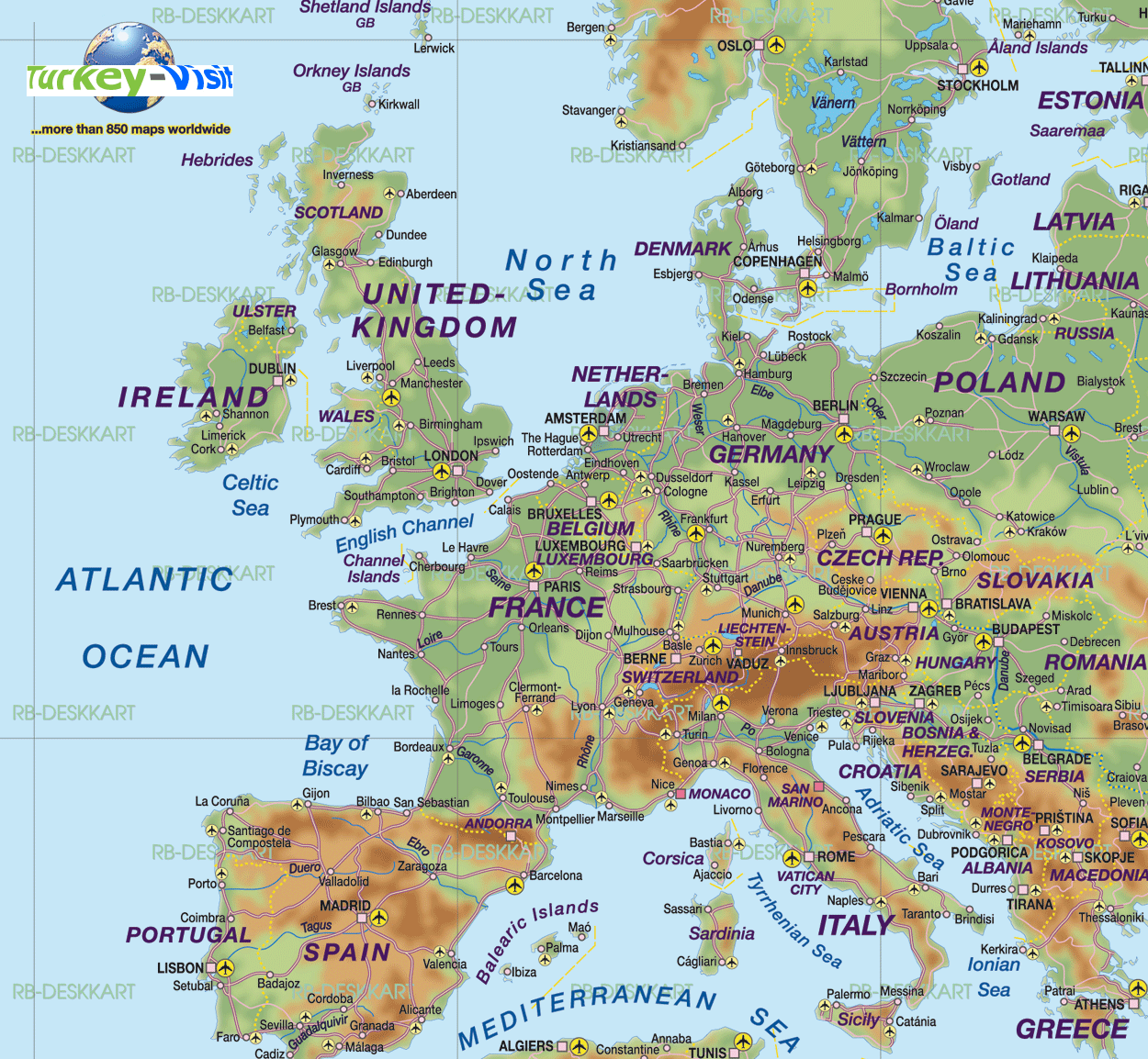
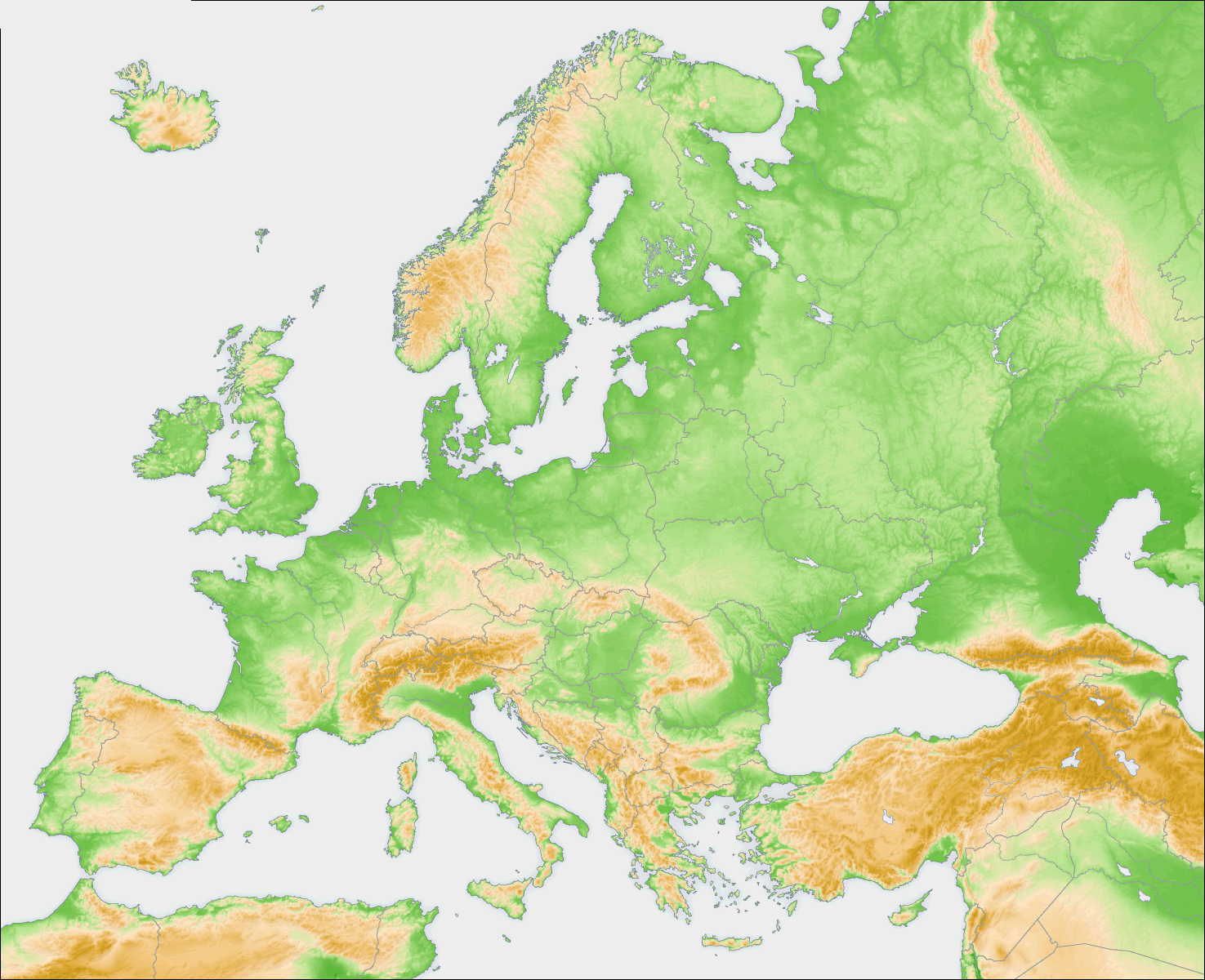
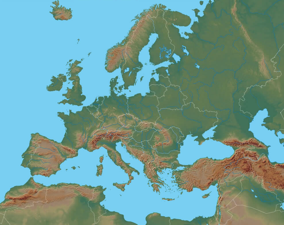
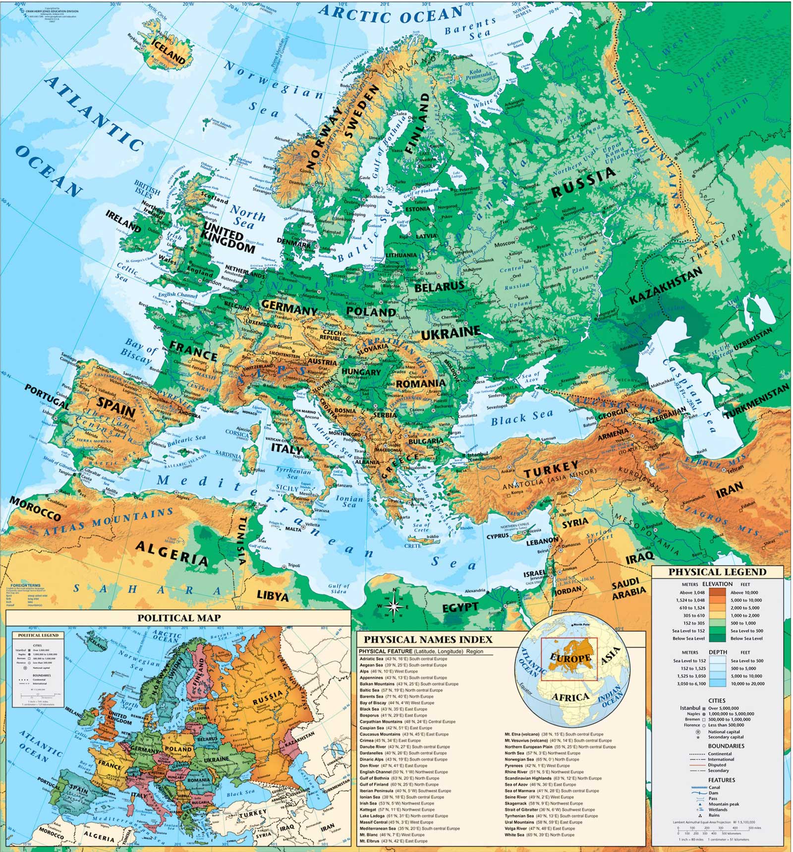
EUROPE TOPOGRAPHY MAP ENGLISH
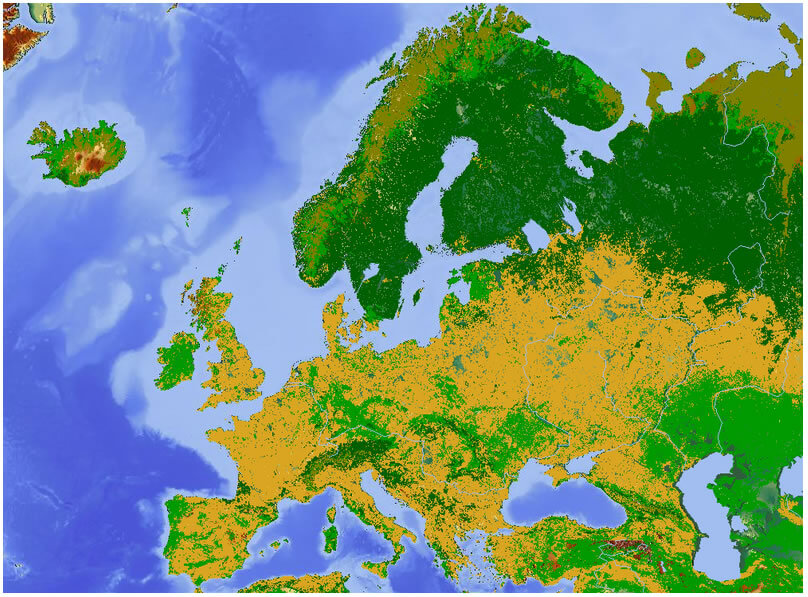
EUROPE LAND USAGE MAP
EUROPE VEGETATION MAP
EUROPE ECONOMICAL REGIONS MAP
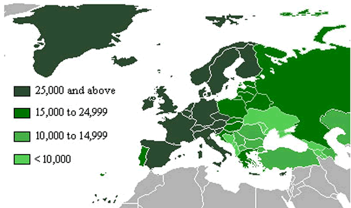
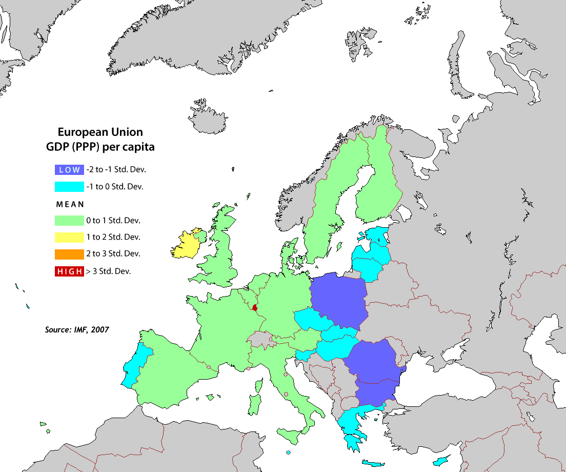
EUROPE GDP MAP
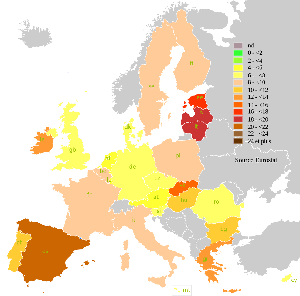
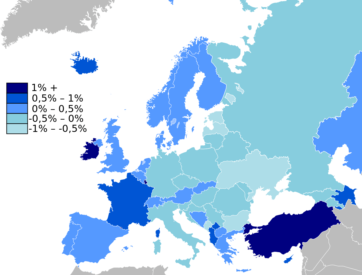
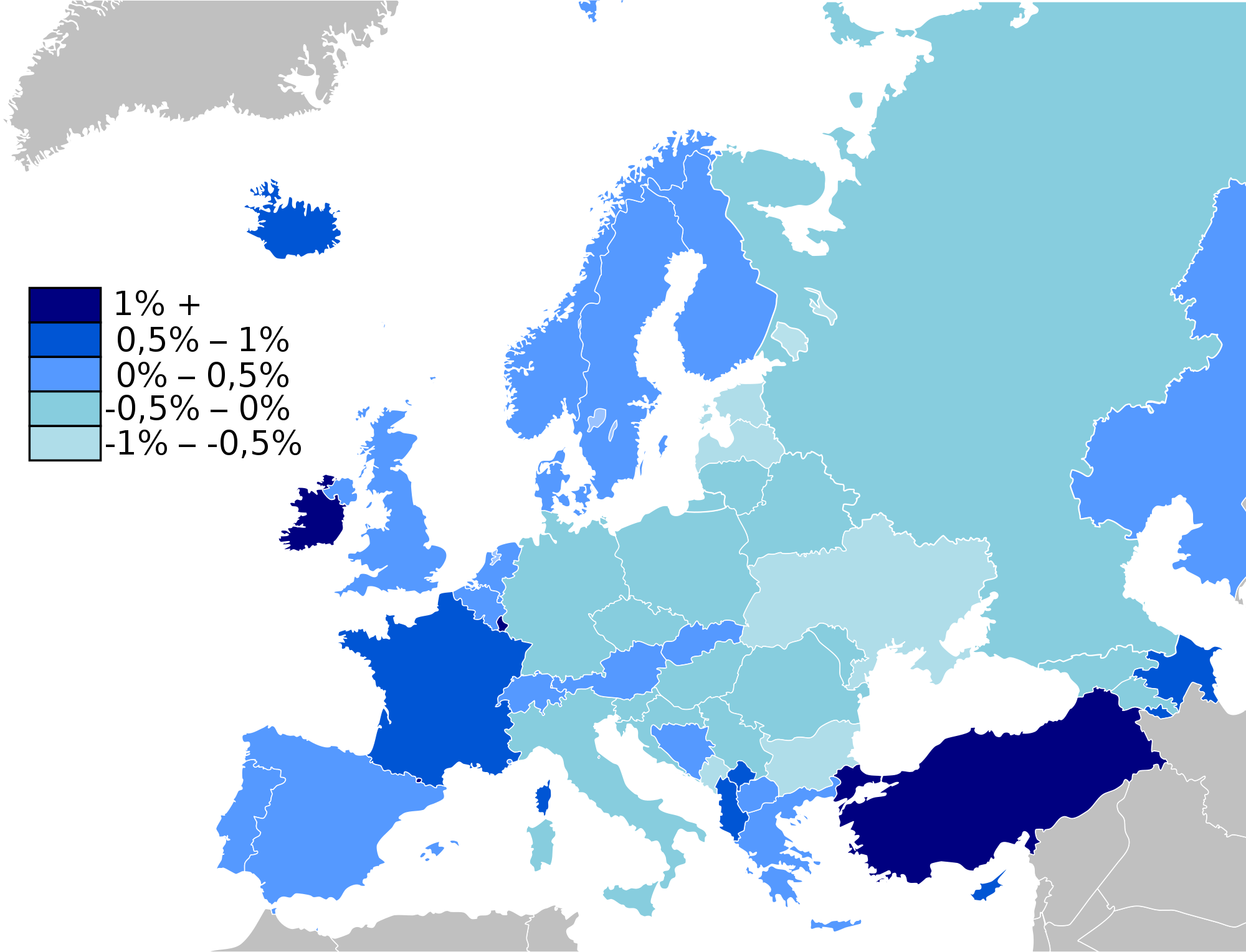
EUROPE EU UNEMPLOYMENT MAP 2010
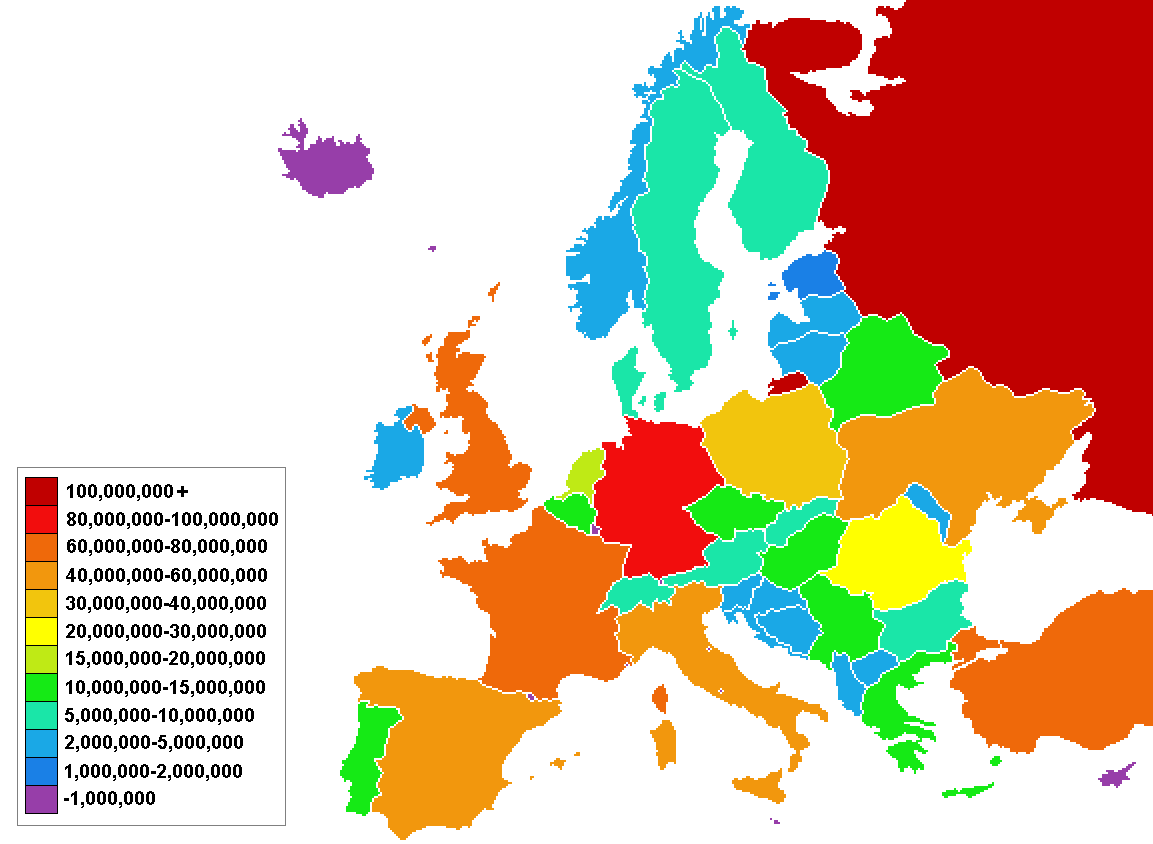
DEMOGRAPHICS MAP OF EUROPE
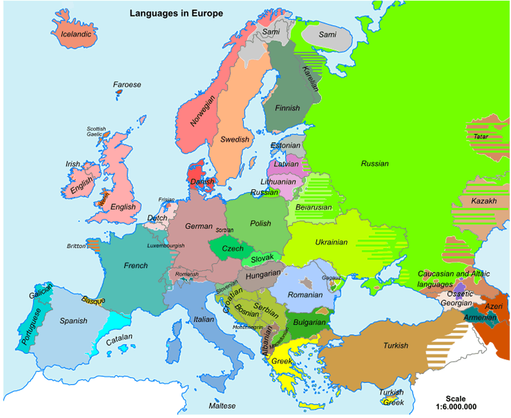
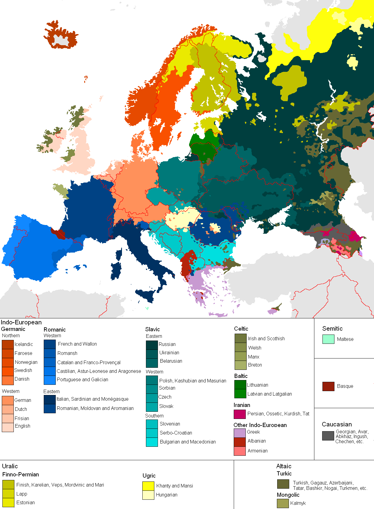
RECTIFIED LANGUAGES MAP OF EUROPE
EUROPE COUNTRIES BOUNDARIES MAP
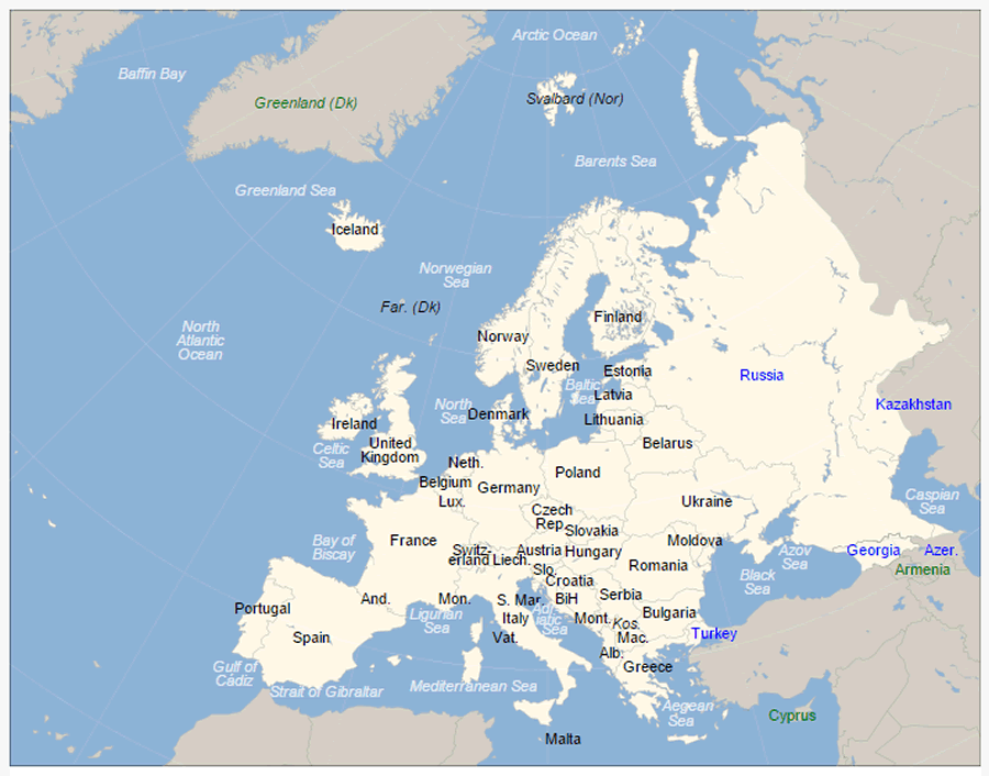
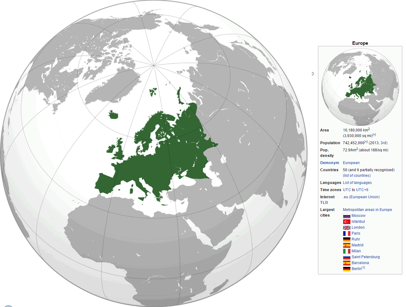
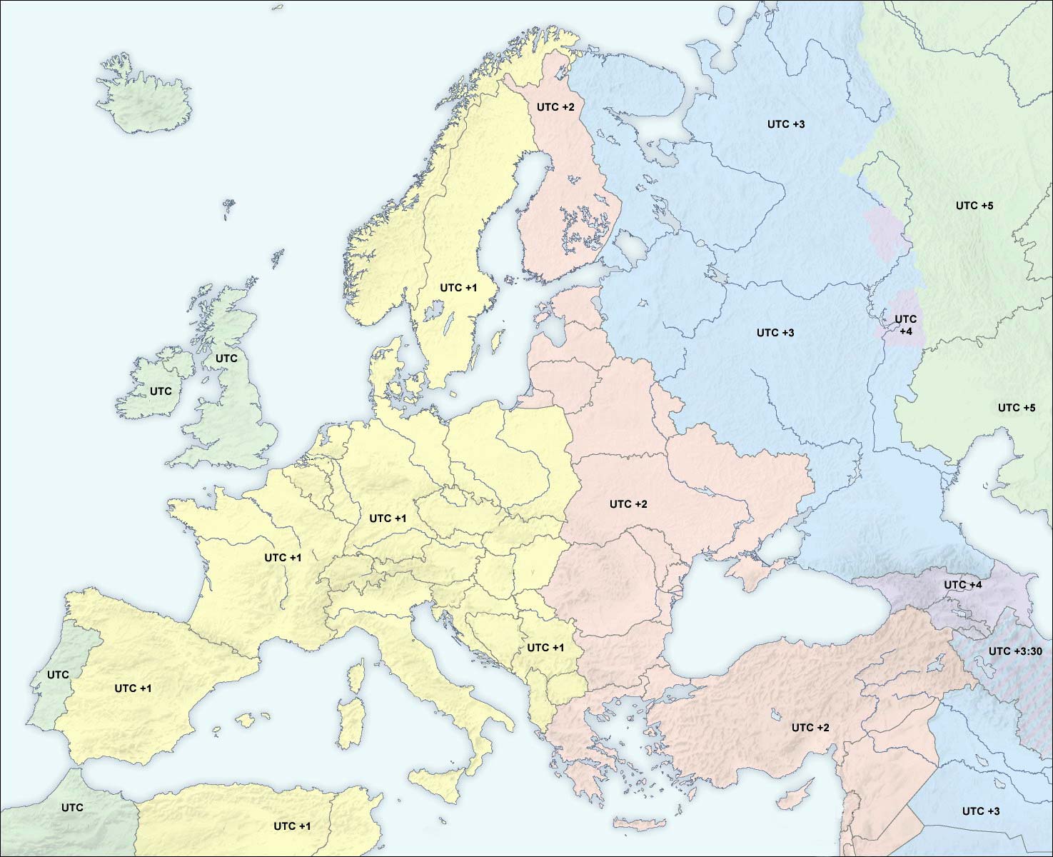
WHERE IS EUROPE IN THE WORLD

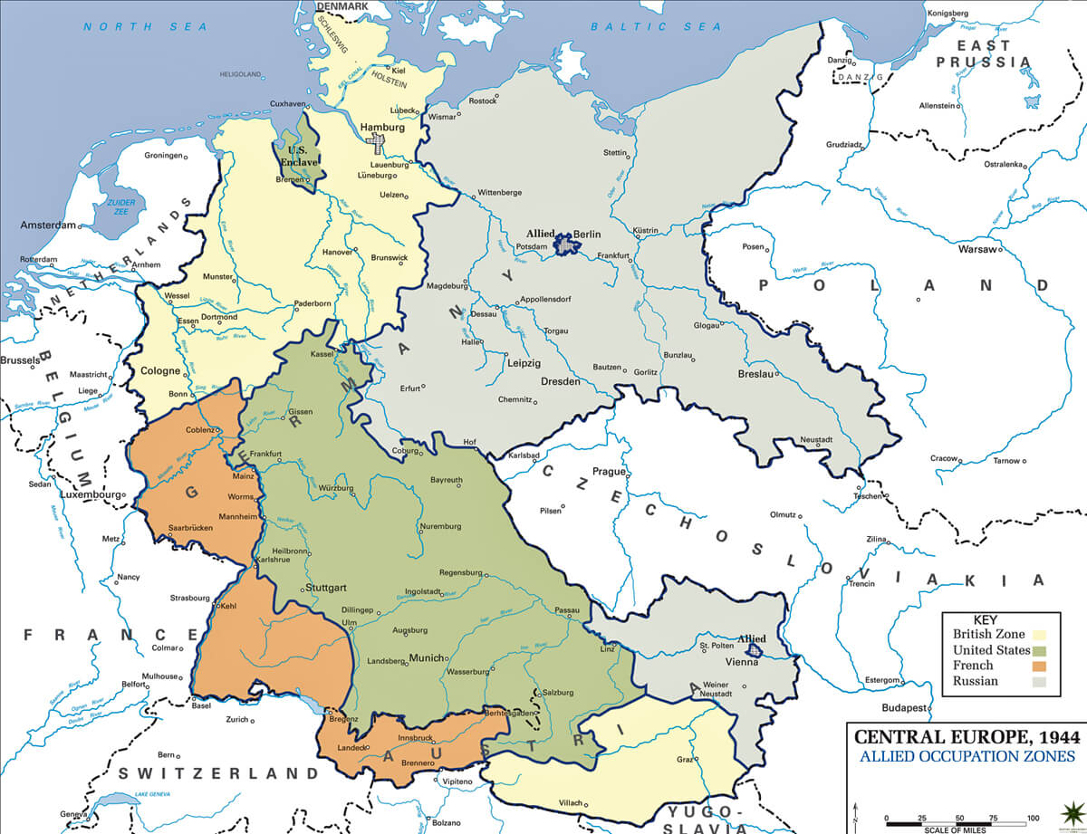
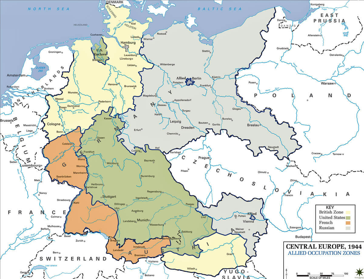
CENTRAL EUROPE MAP 1945
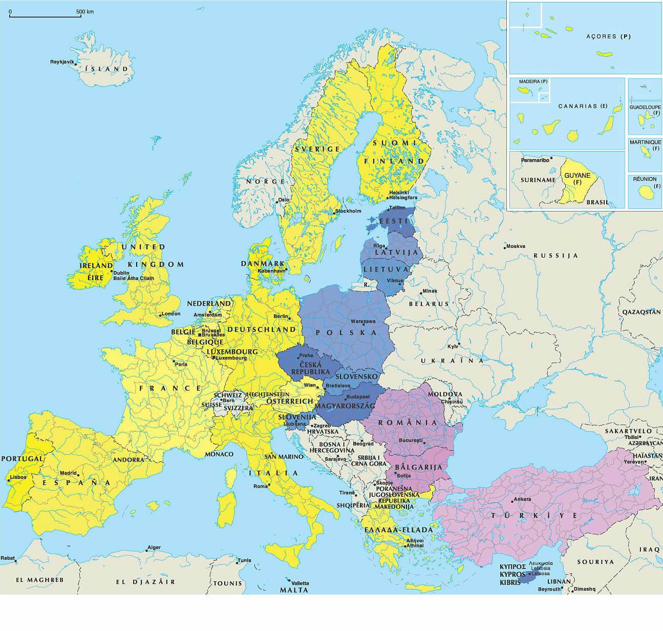
EU MAP
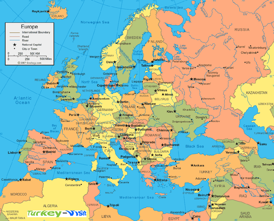
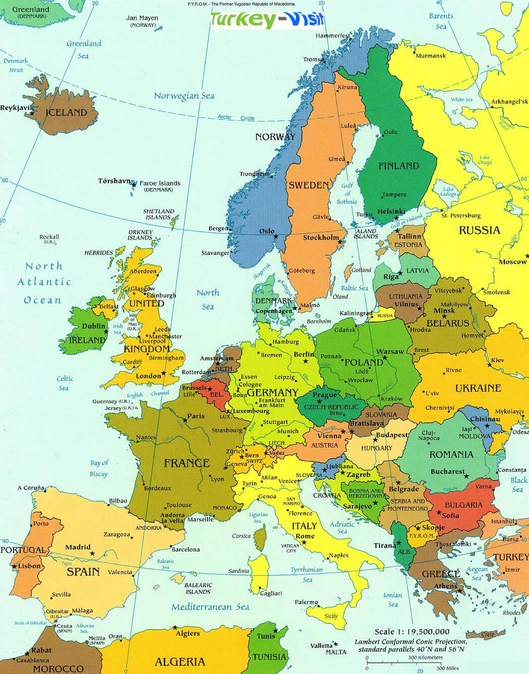
EUROPE MAP
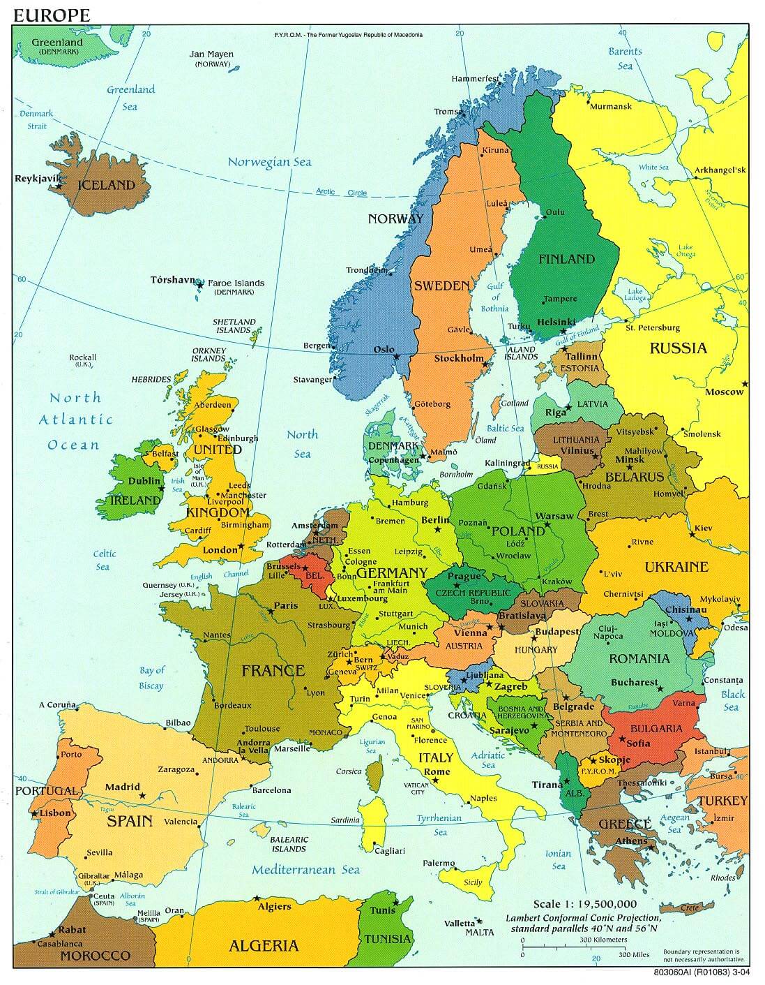
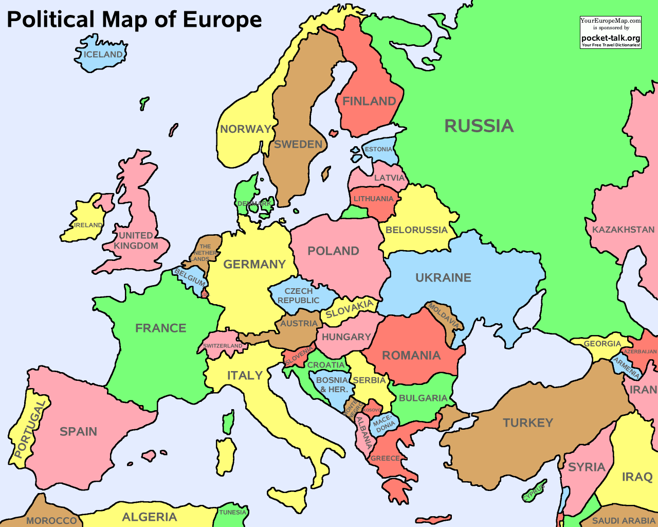
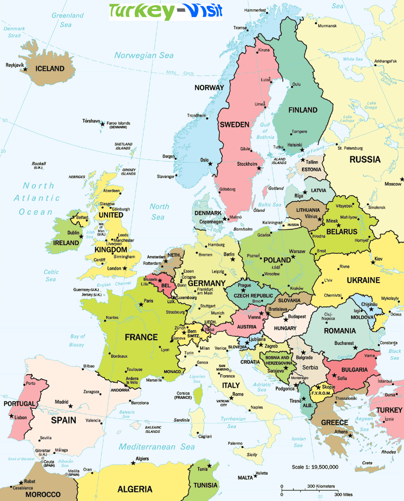
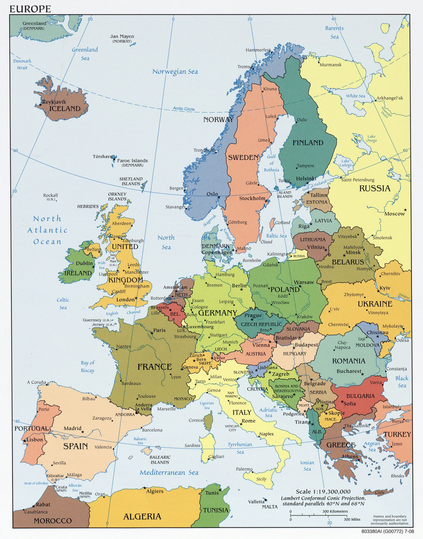
EUROPE POLITICAL MAP

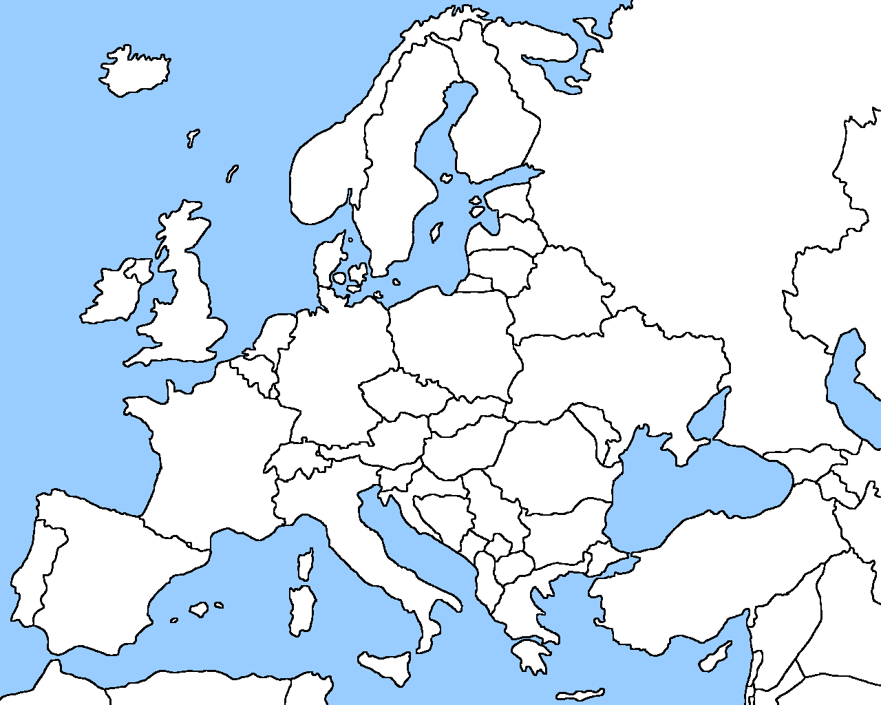
EUROPE BLANK MAP
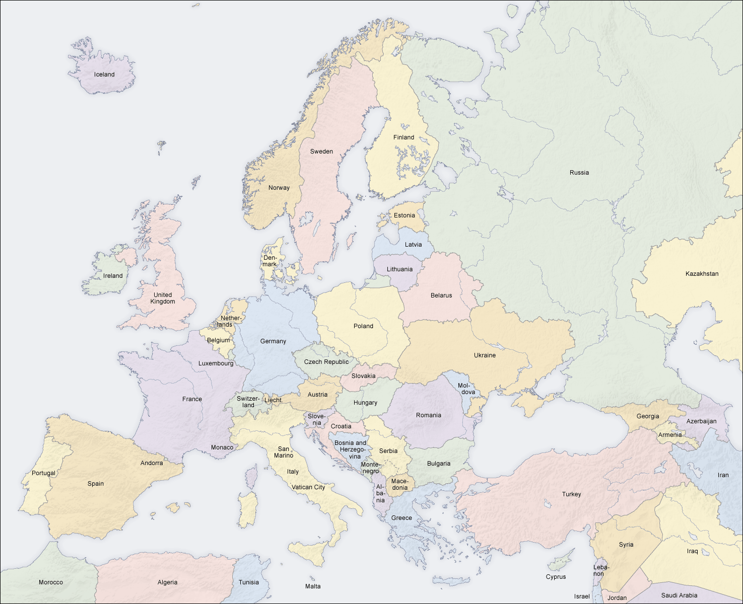
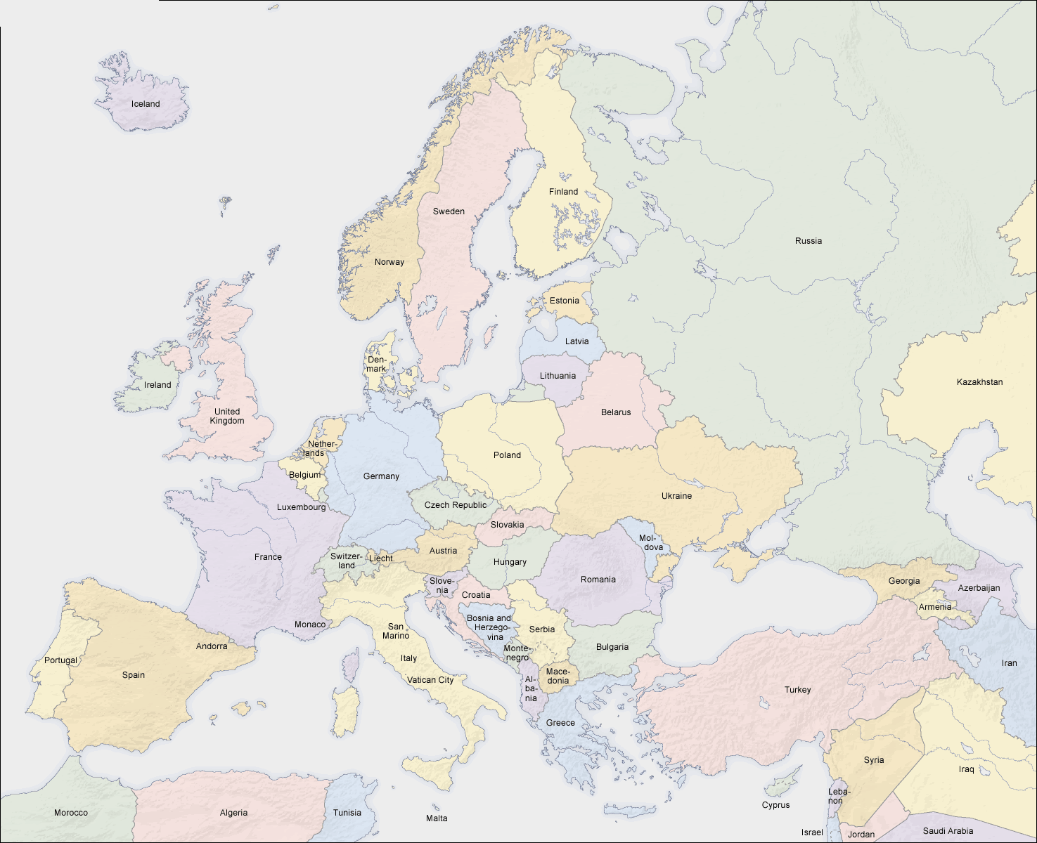
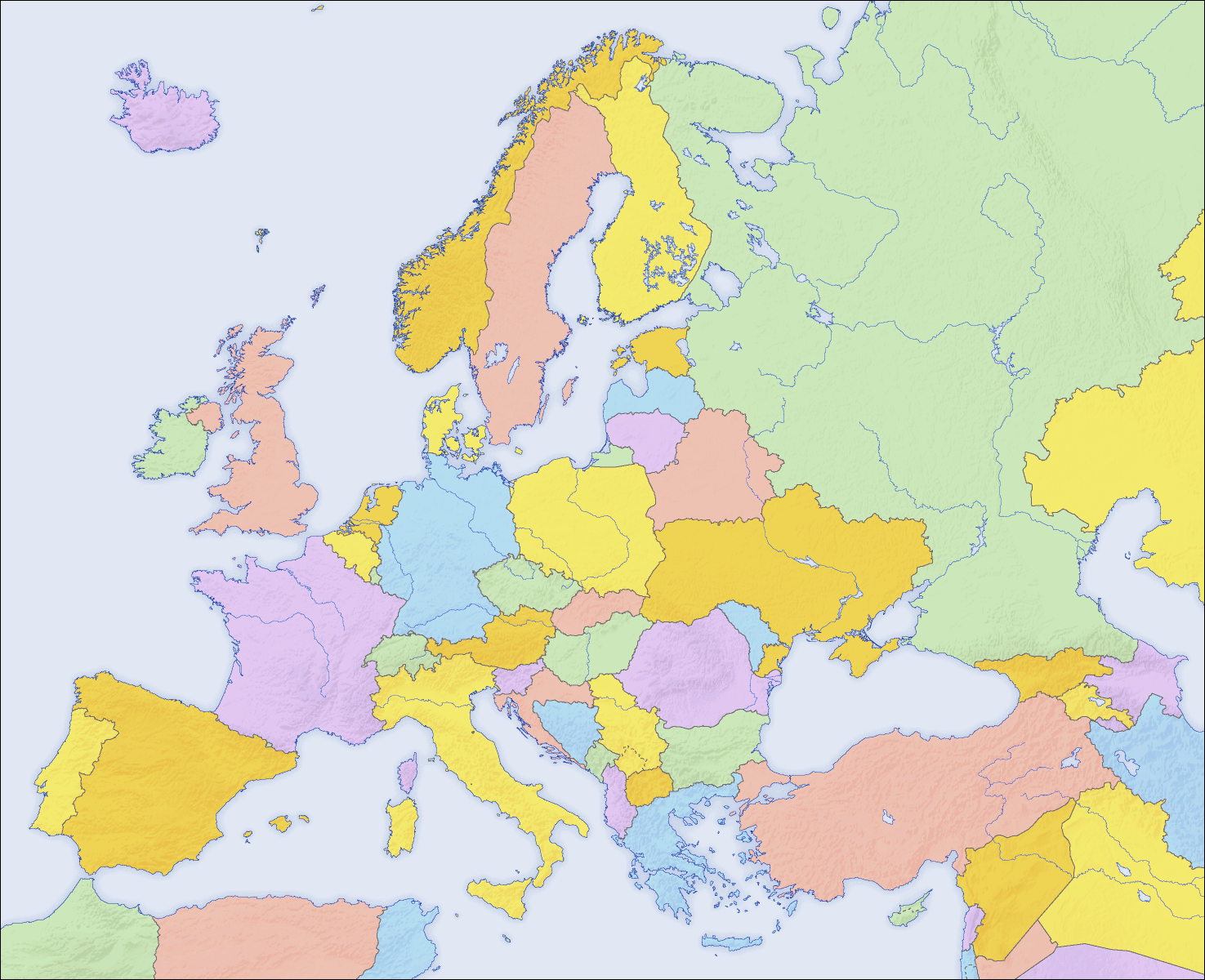
EUROPE COUNTRIES MAP
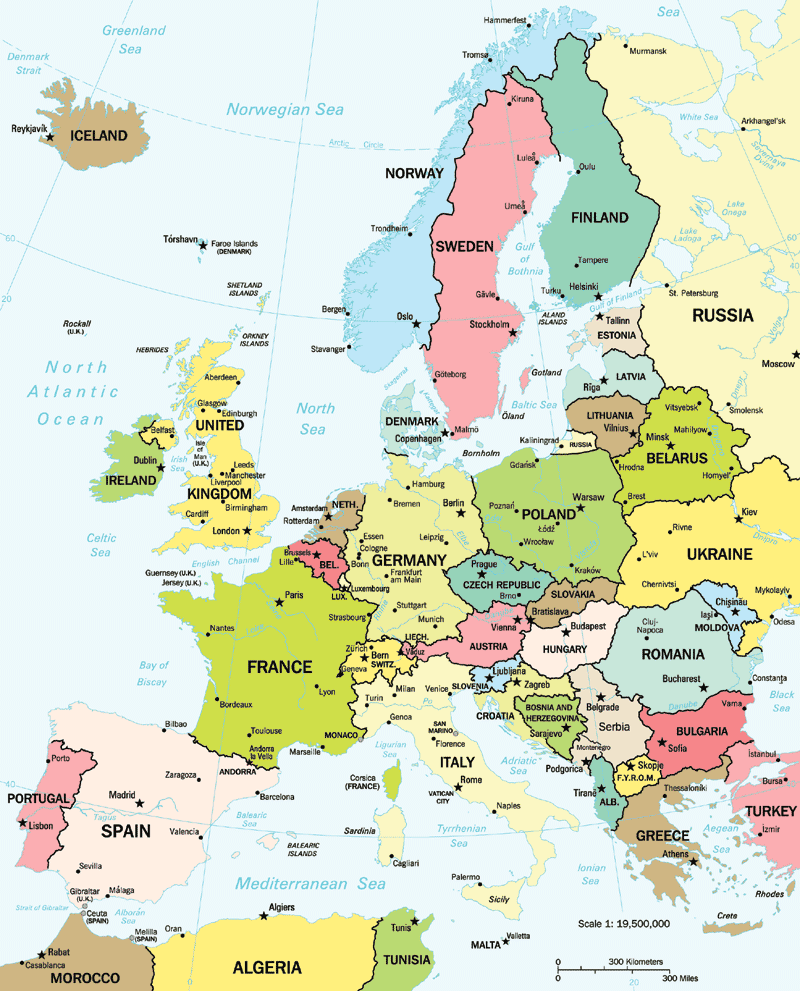
EUROPE COUNTRIES MAP
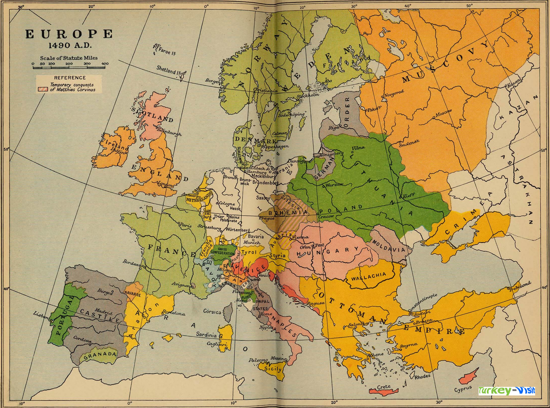
EUROPE MAP 1490
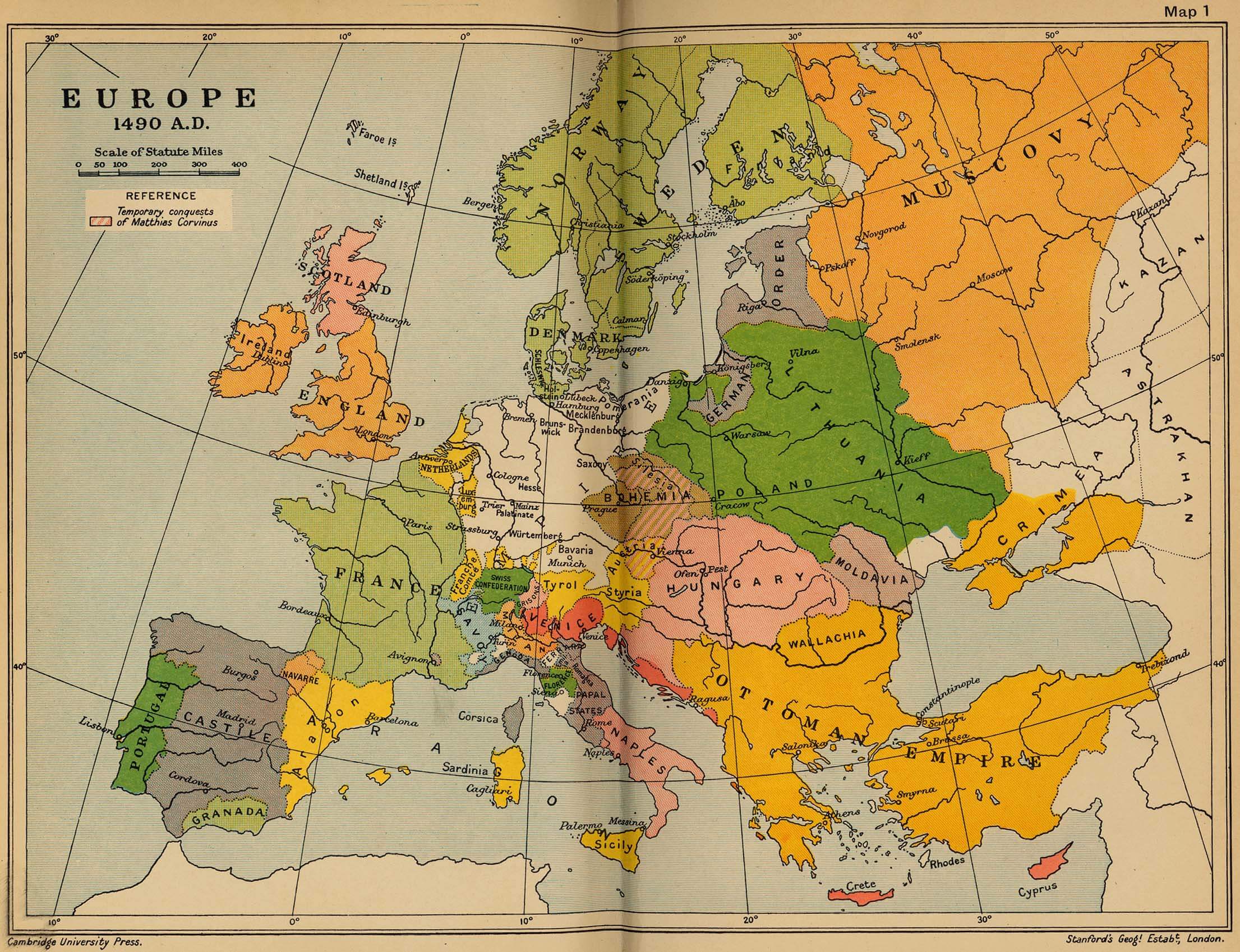
EUROPE MAP 1500
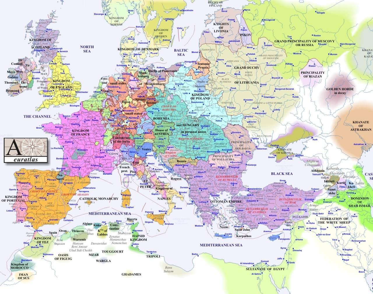
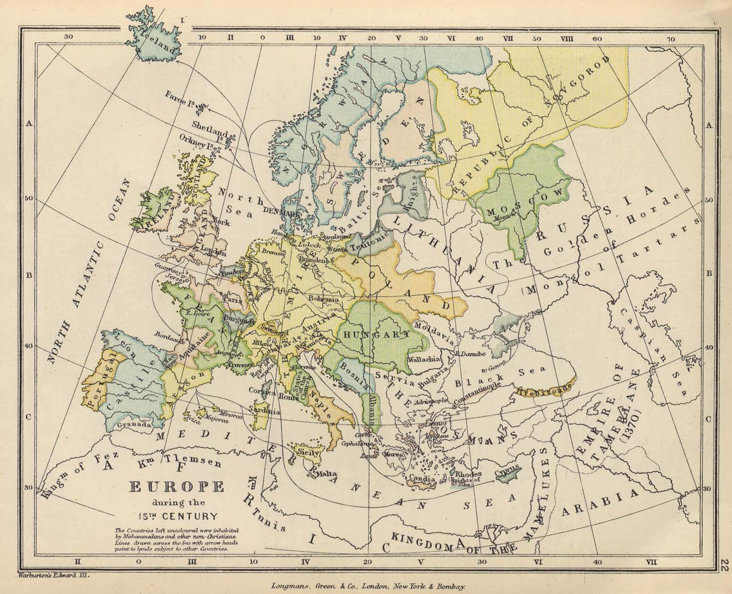
EUROPE MAP 15TH CENTURY
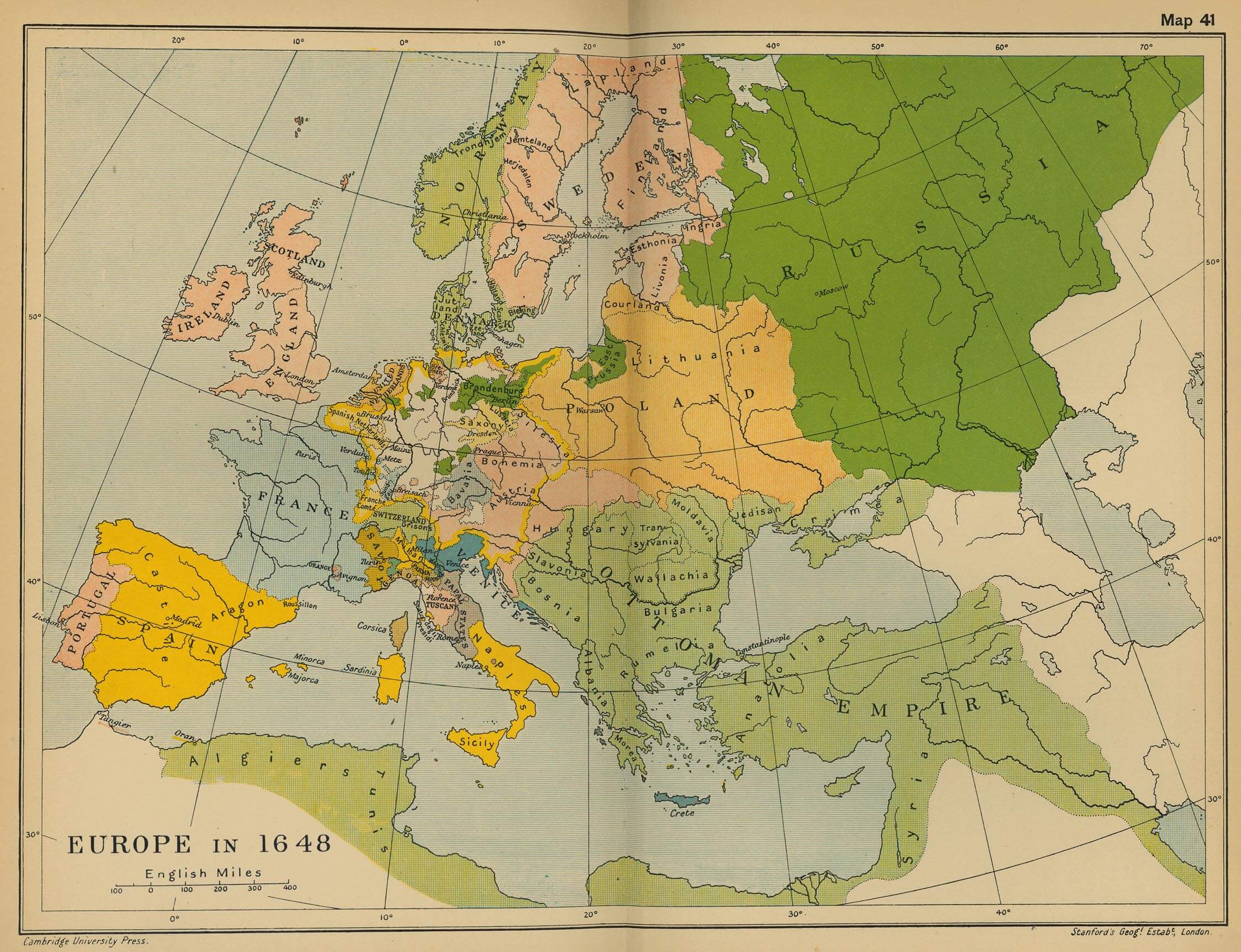
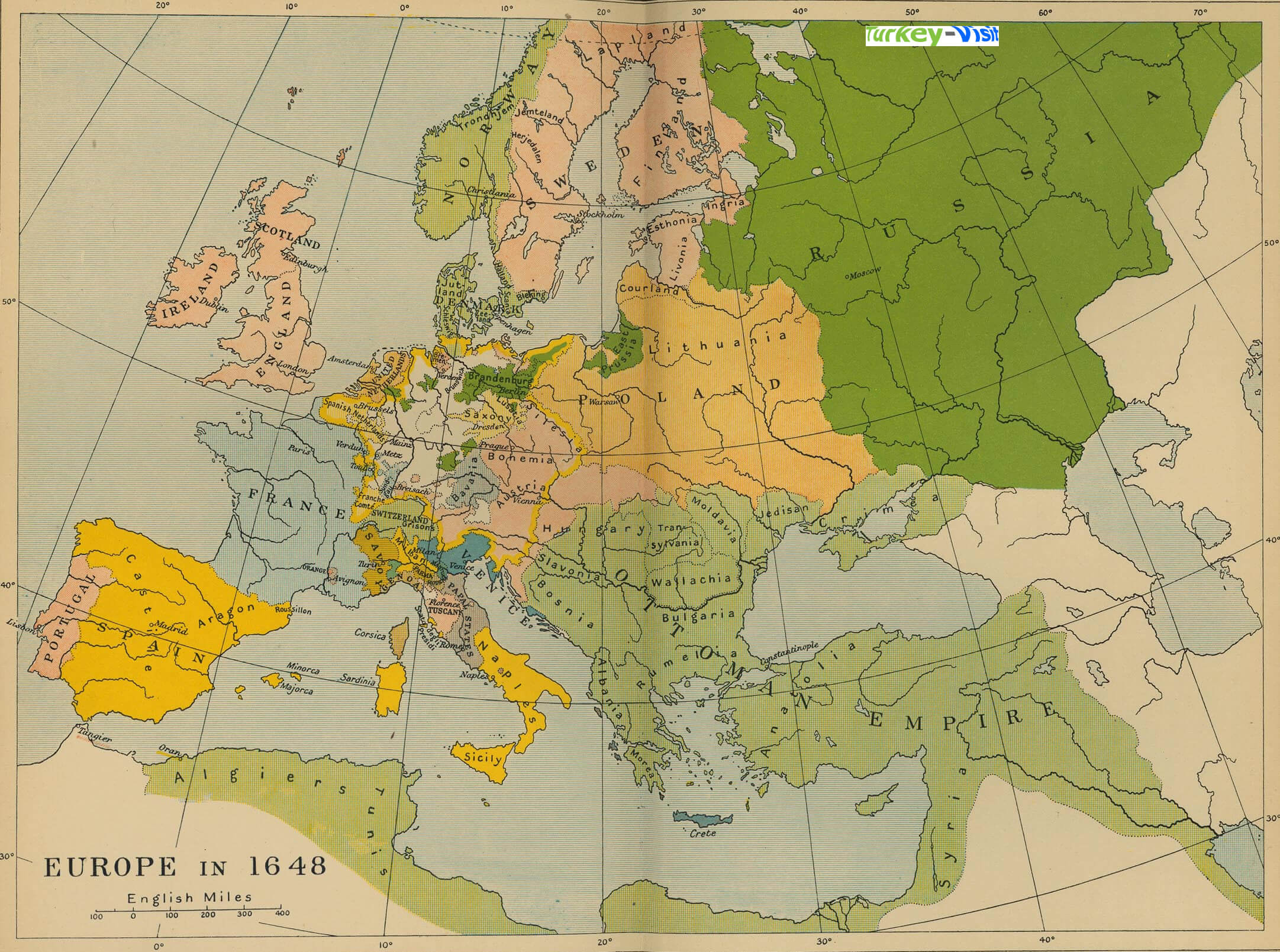
EUROPE MAP 1648
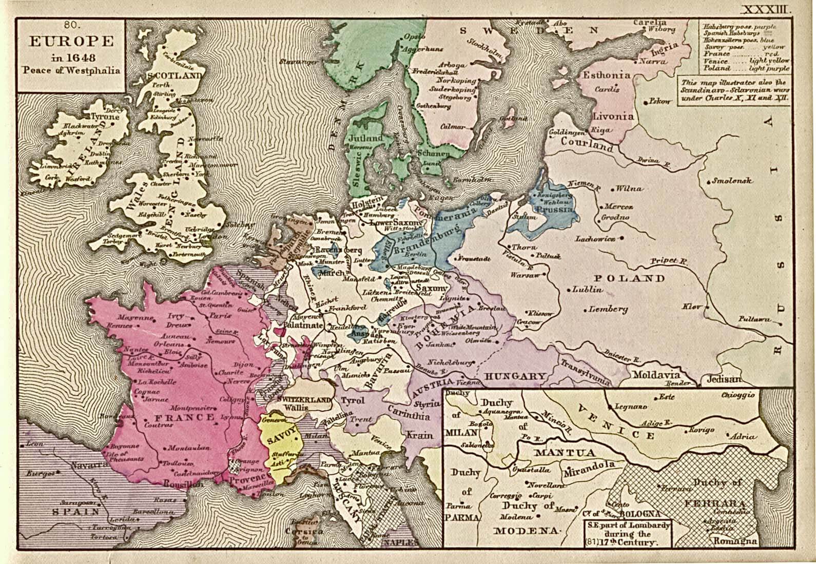
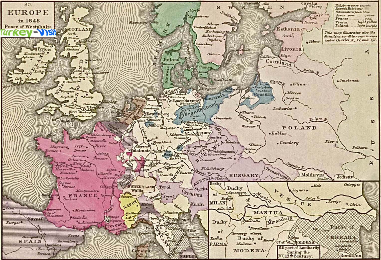
EUROPE MAP 1648 WESTPHALIA
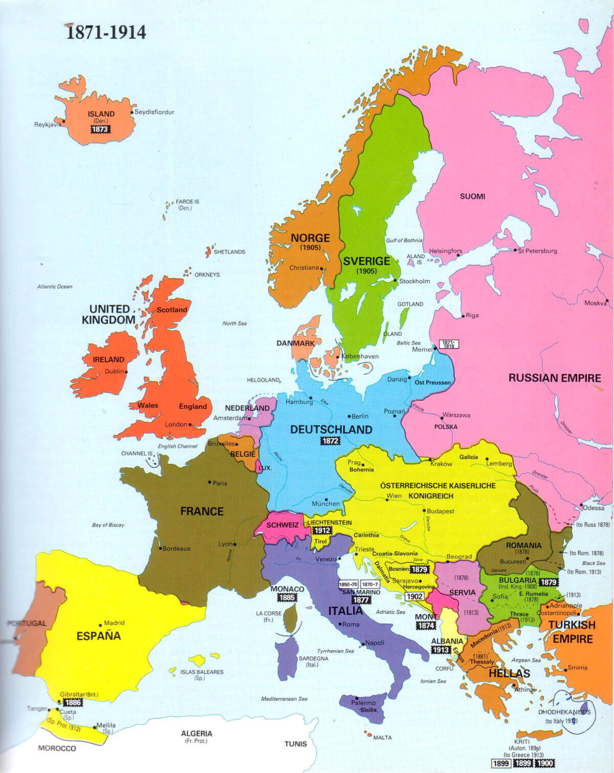
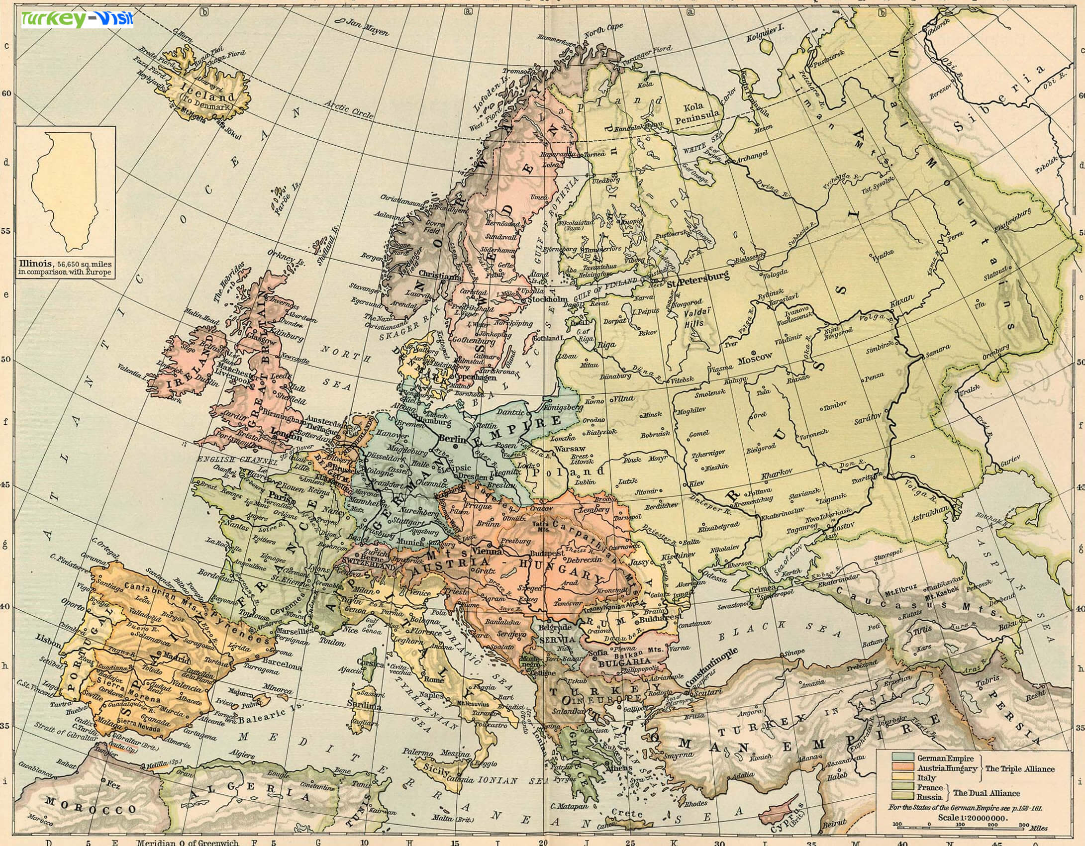
EUROPE MAP 1871 1914
EUROPE MAP 1911
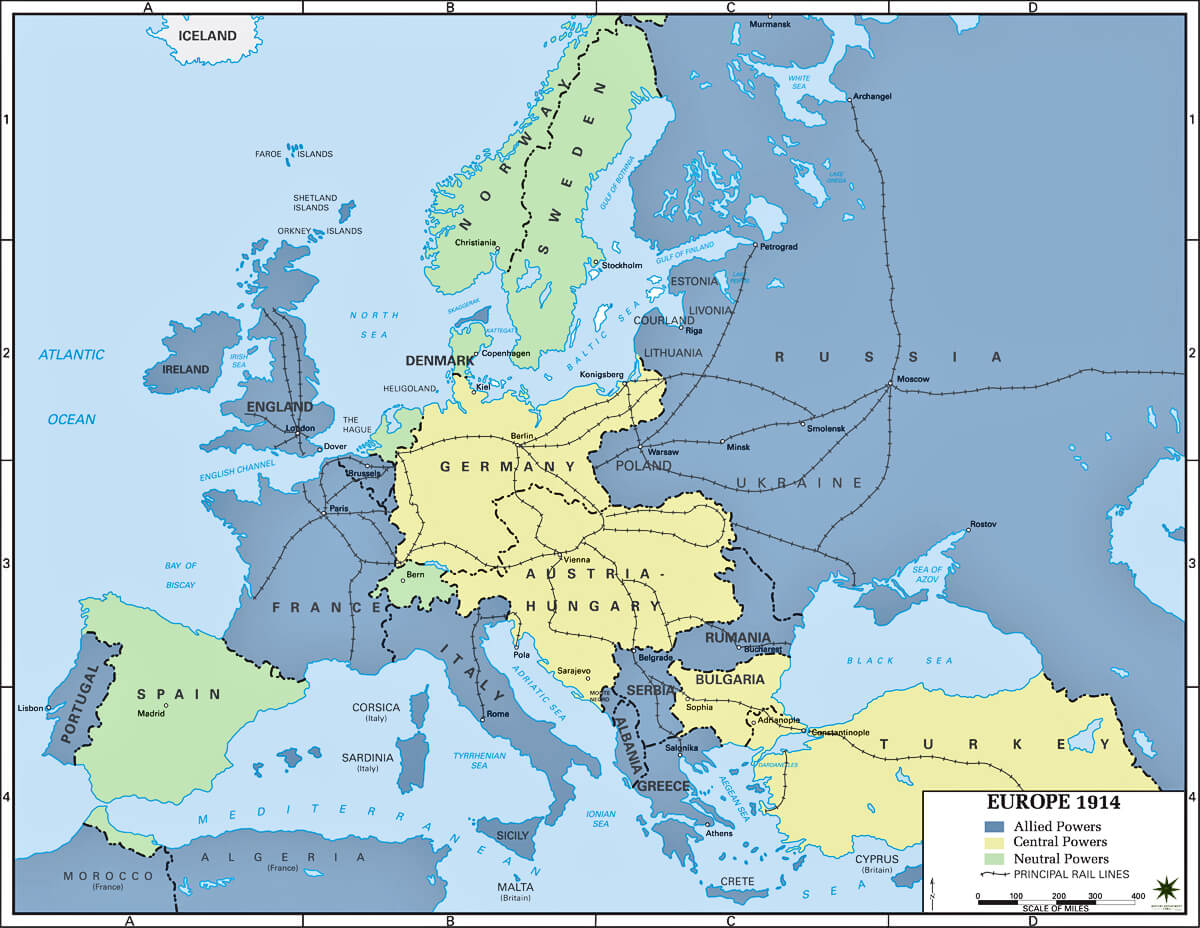
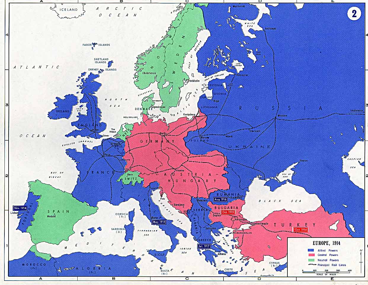
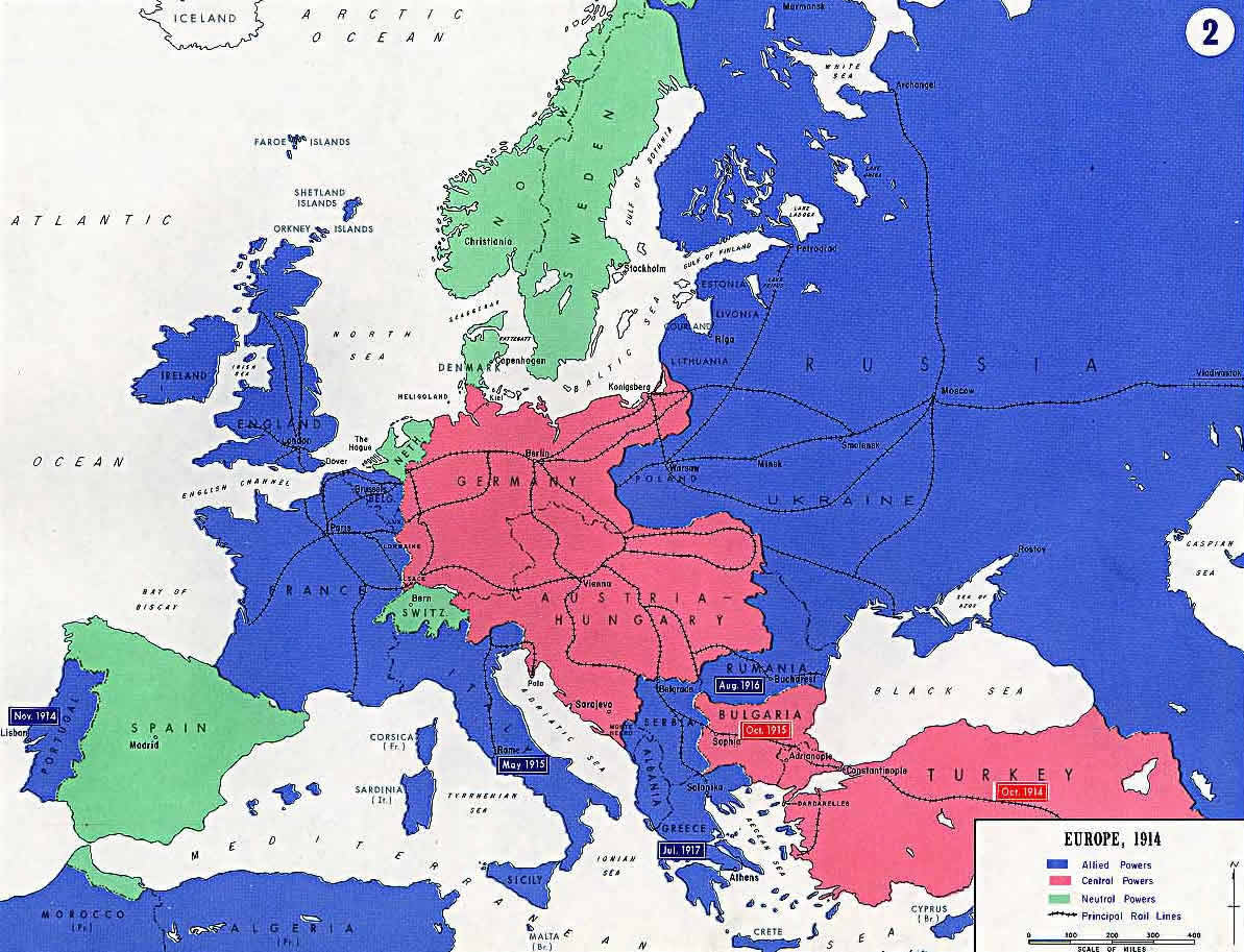
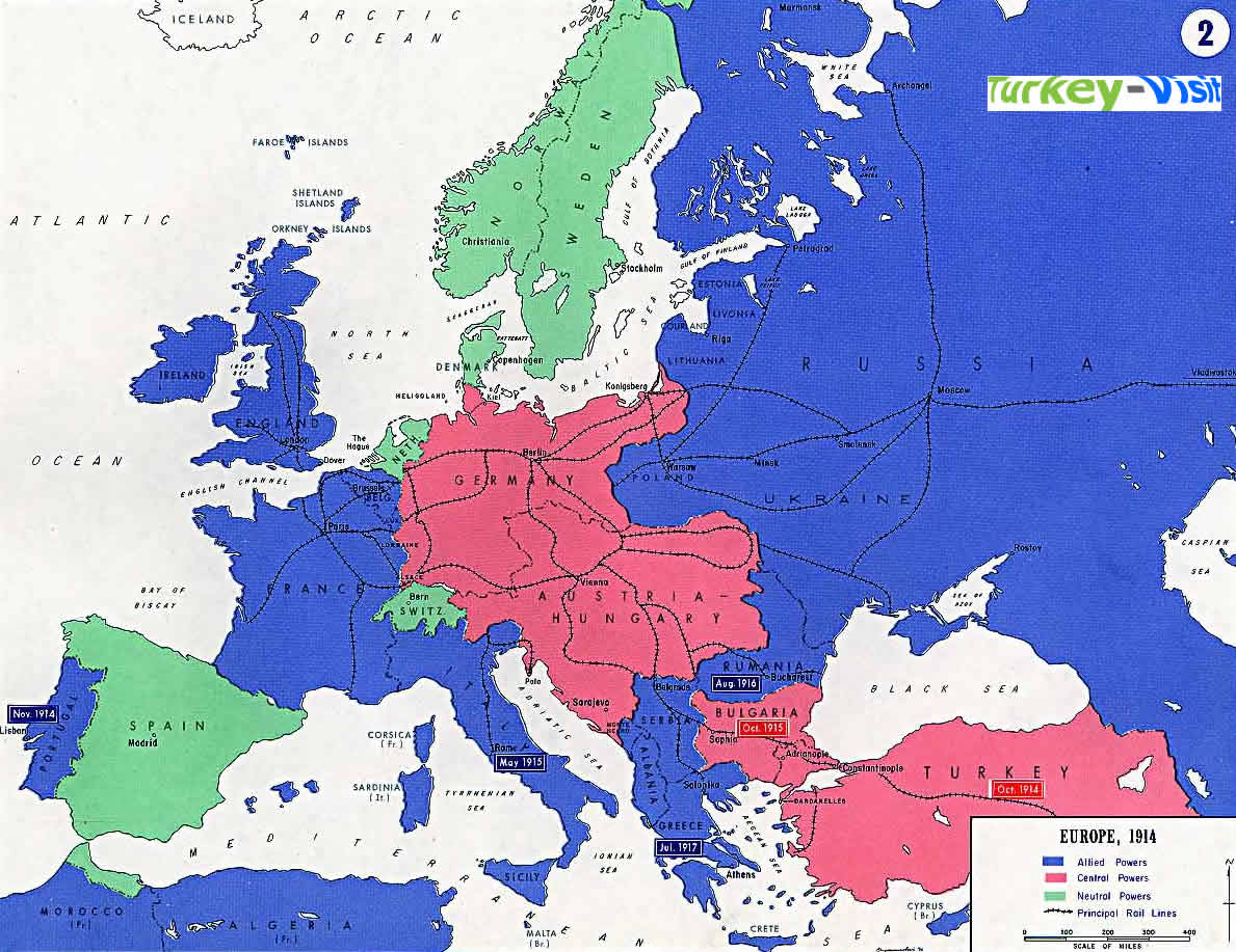
EUROPE MAP 1914
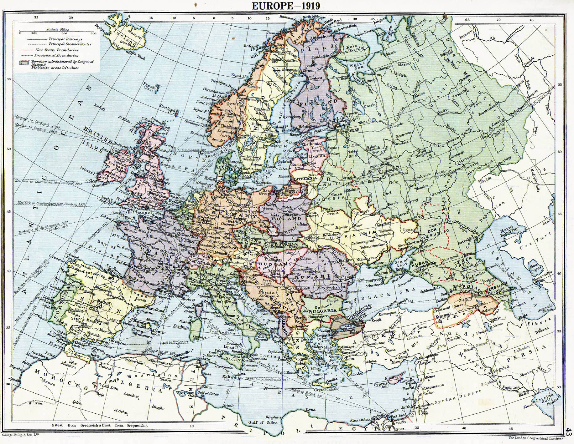
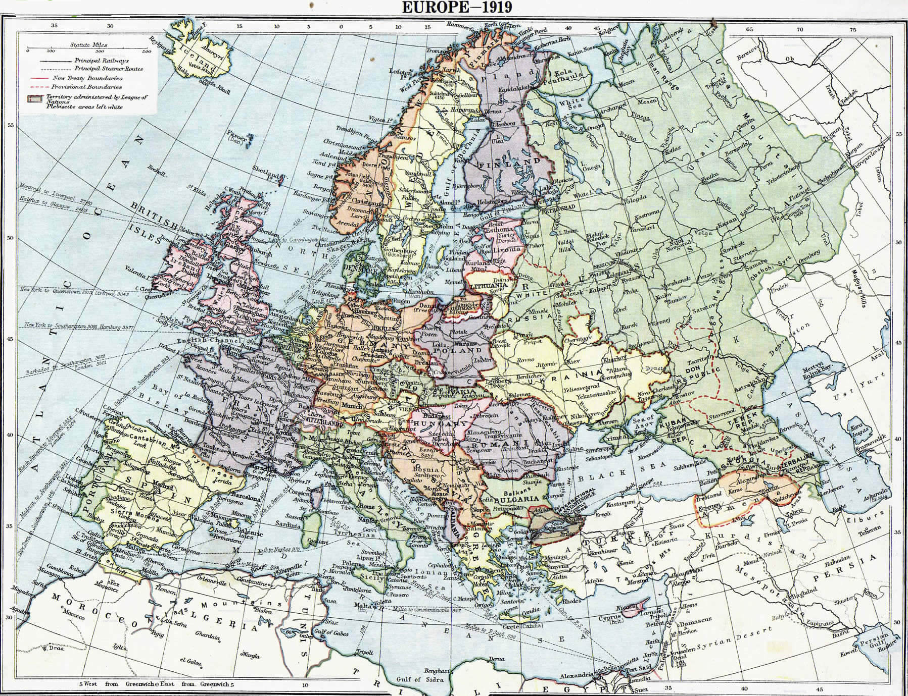
EUROPE MAP 1919
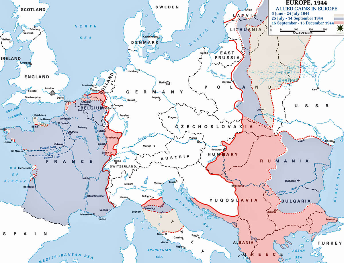
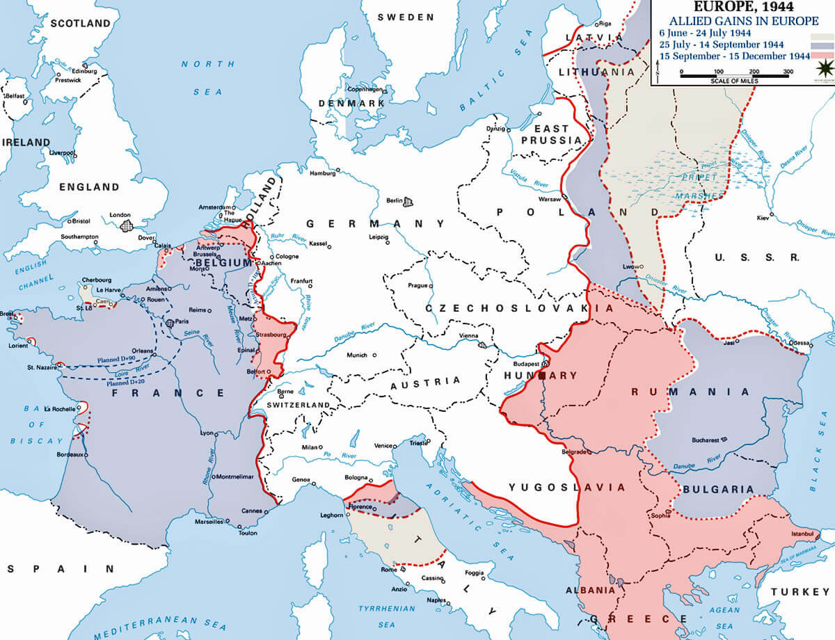
EUROPE MAP 1944
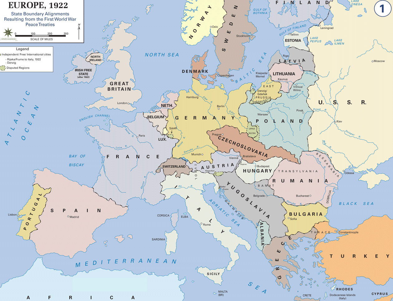
EUROPE MAP AFTER WORLD WAR1
EUROPE MAP COLUMBUS
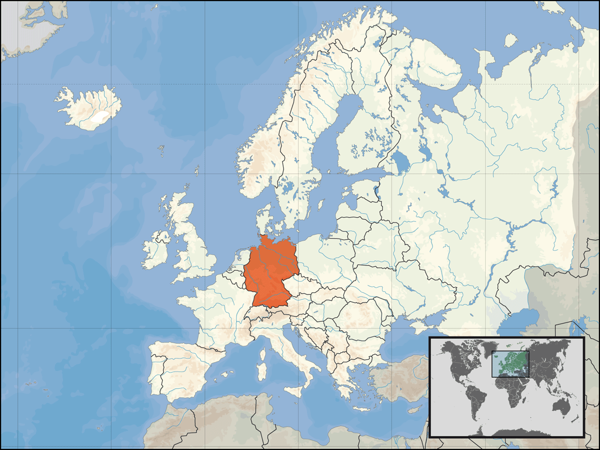
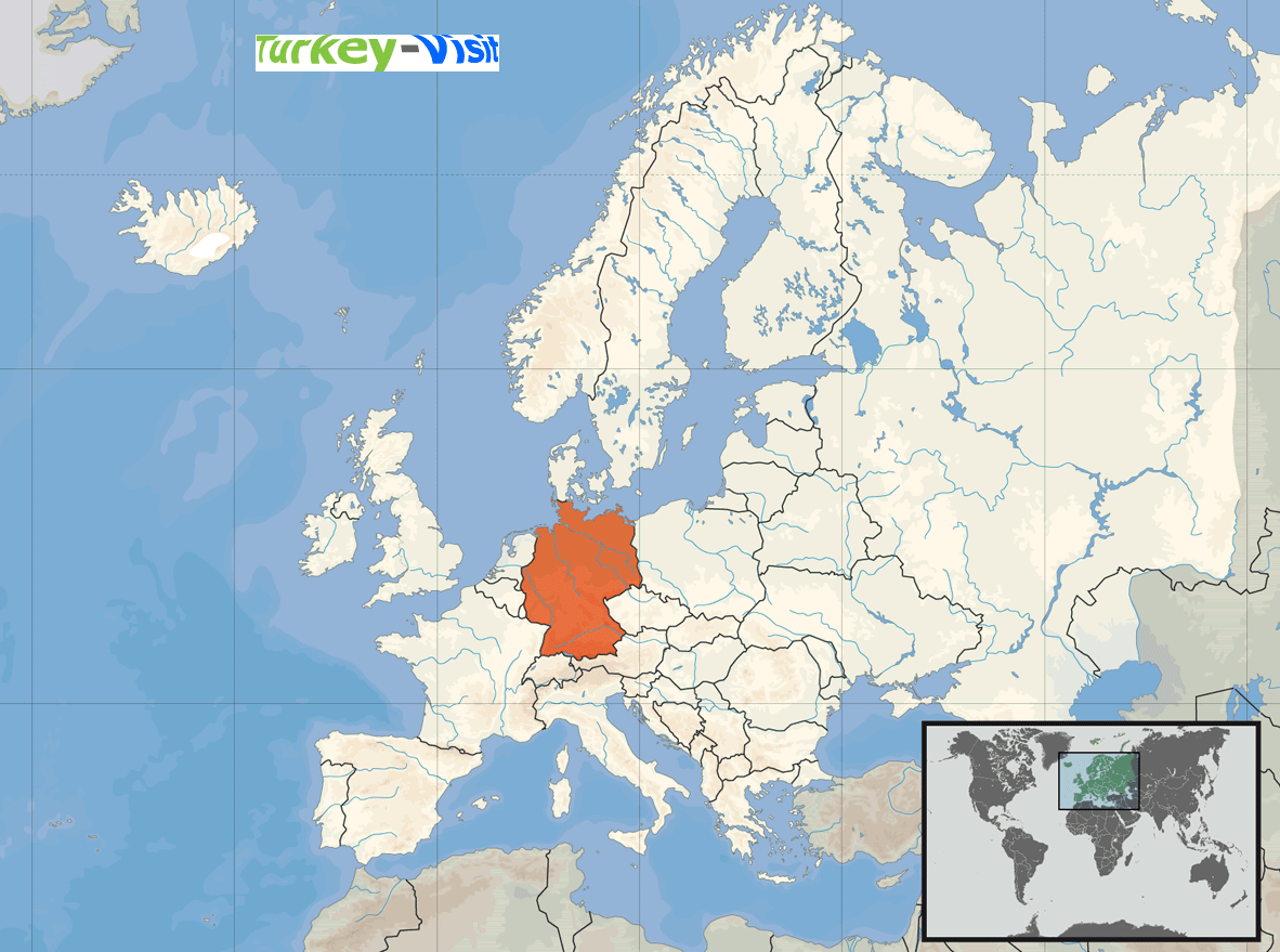
EUROPE MAP GERMANY
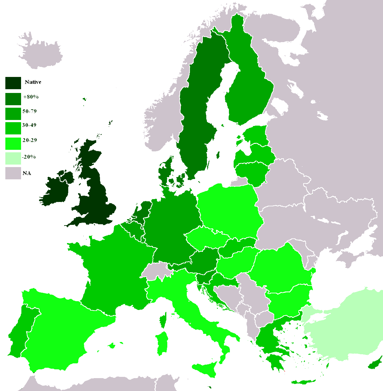
EUROPE MAP KNOWLEDGE ENGLISH

EUROPE MAP KNOWLEDGE OF GERMAN

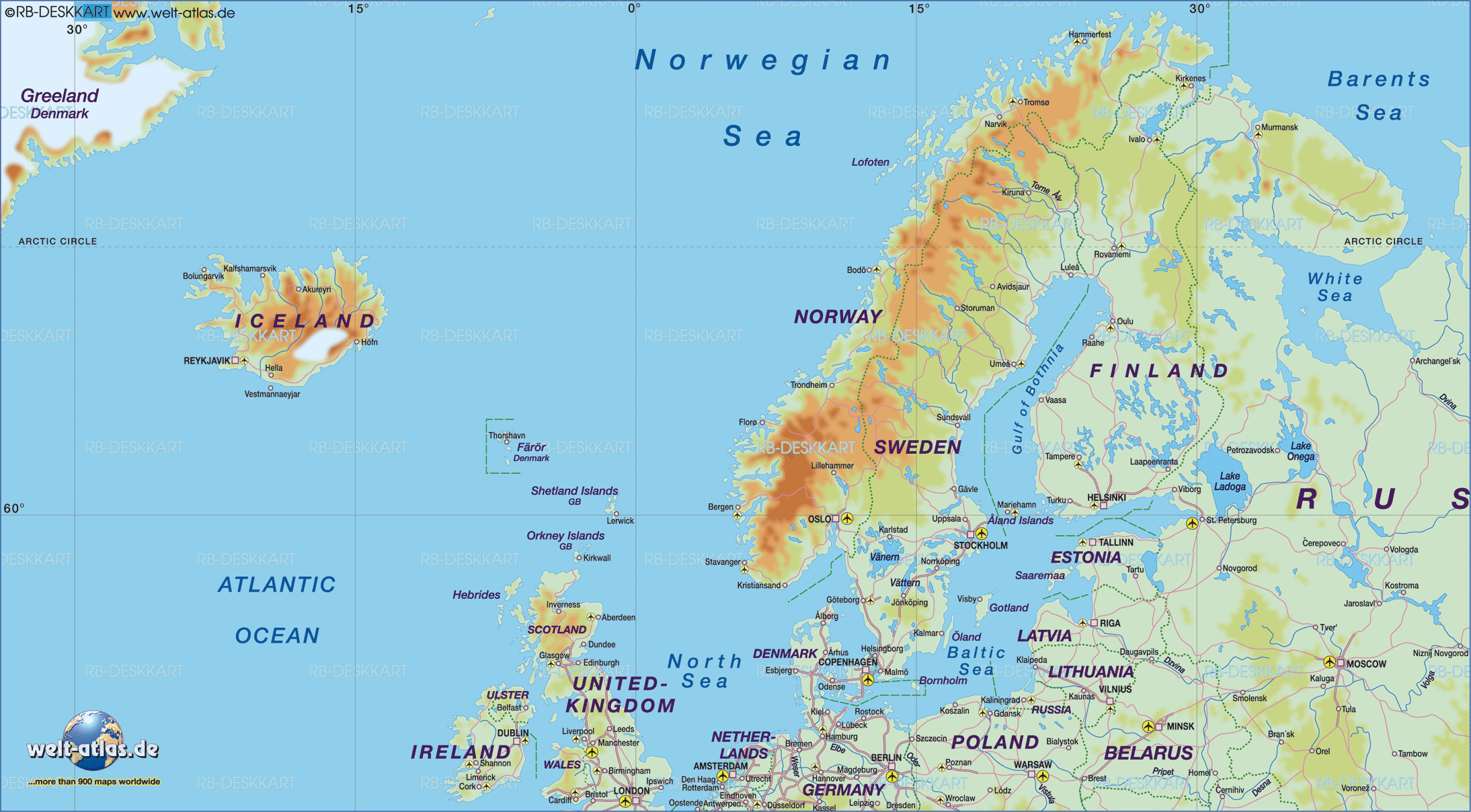
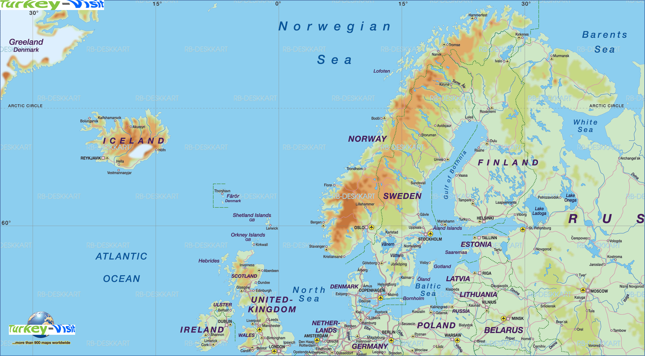
EUROPE MAP SCANDINAVIA
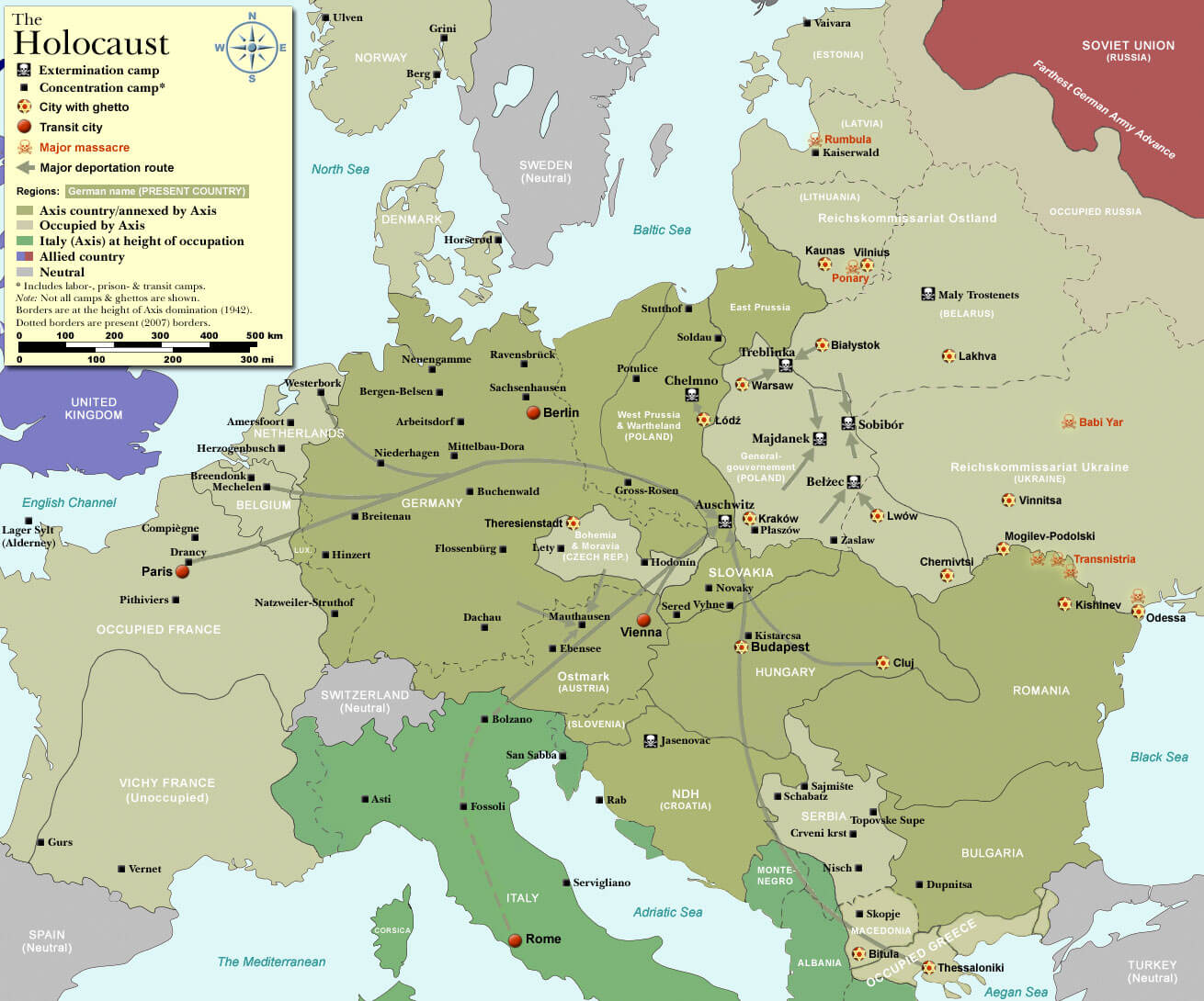
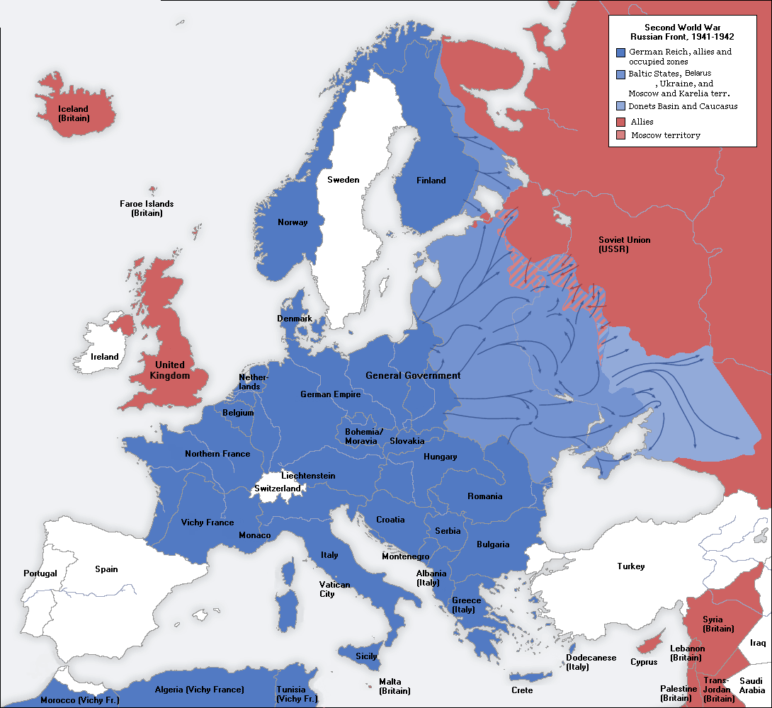
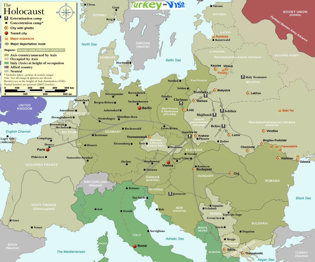
EUROPE MAP SECOND WORLD WAR 1941 1942

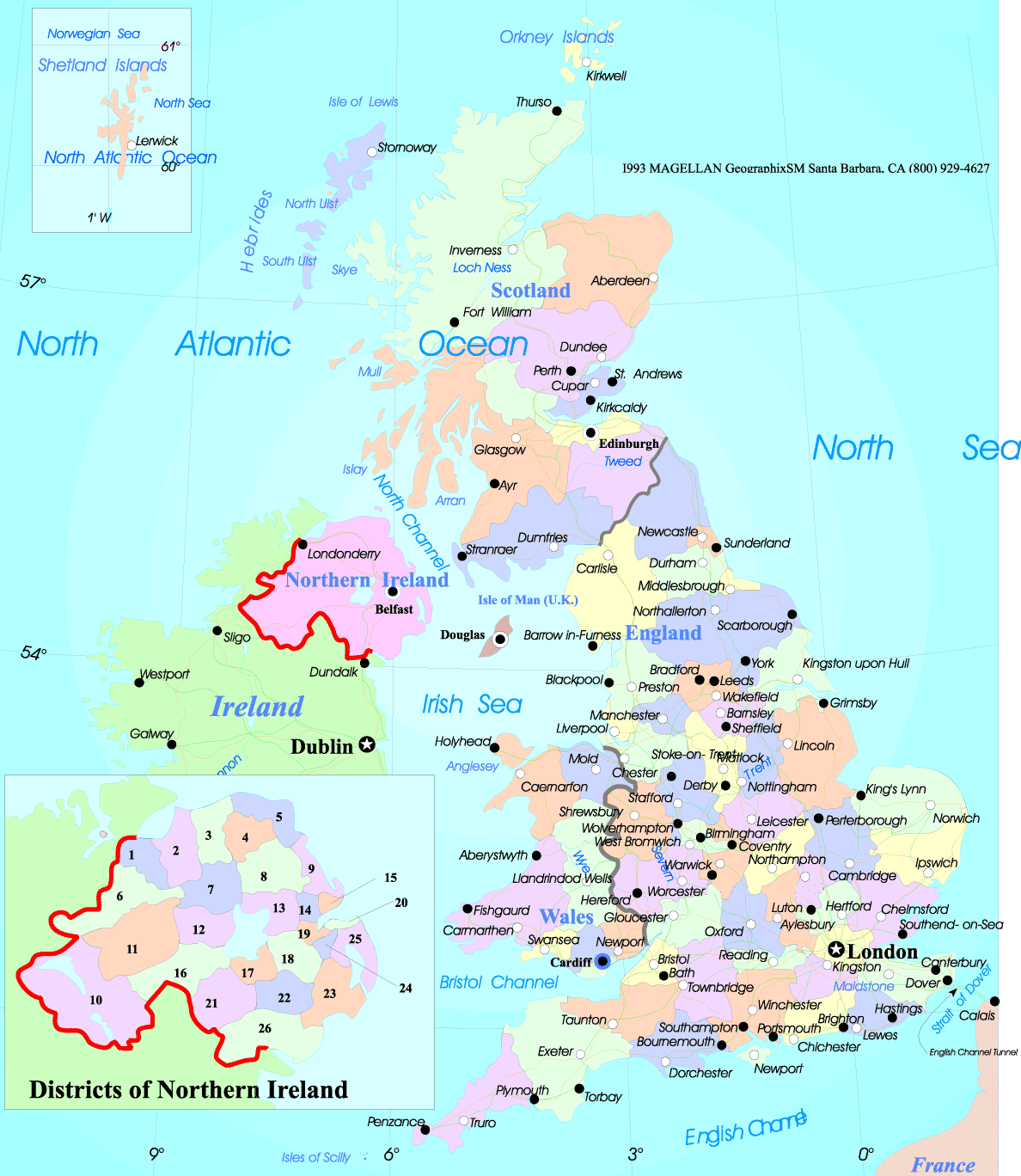
EUROPE MAP UK
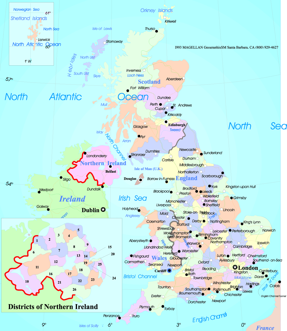
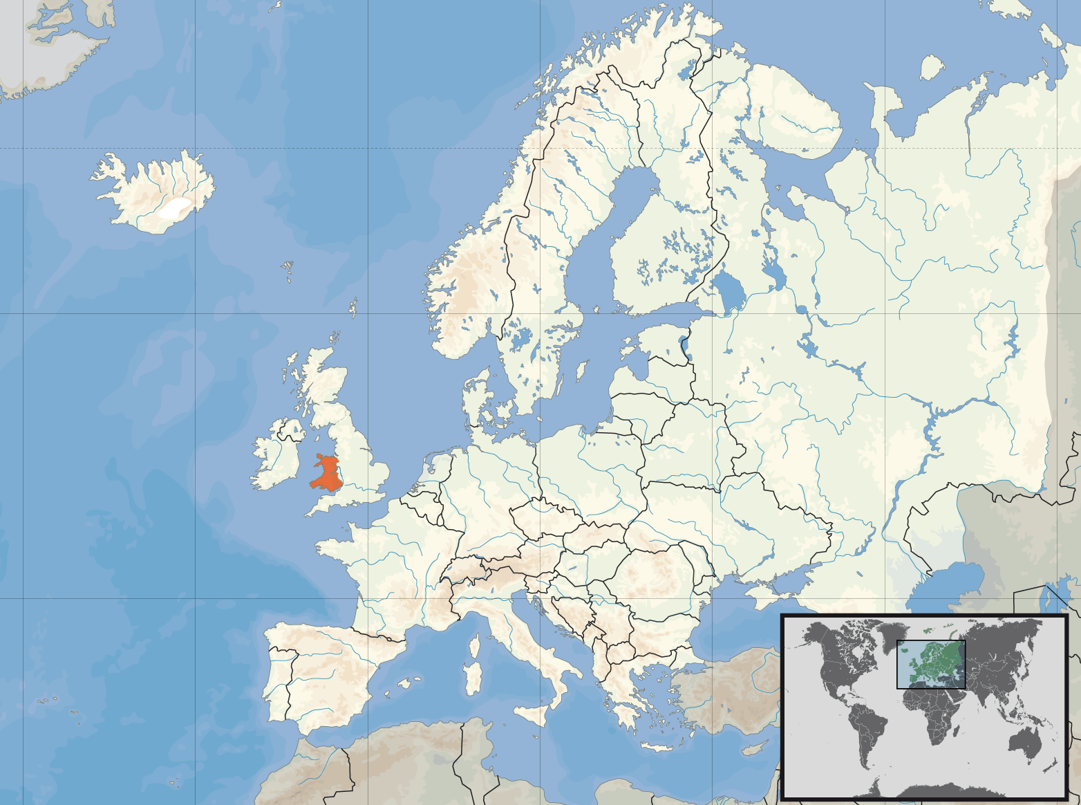
EUROPE MAP WALES

EUROPE MAP WORLD WAR2

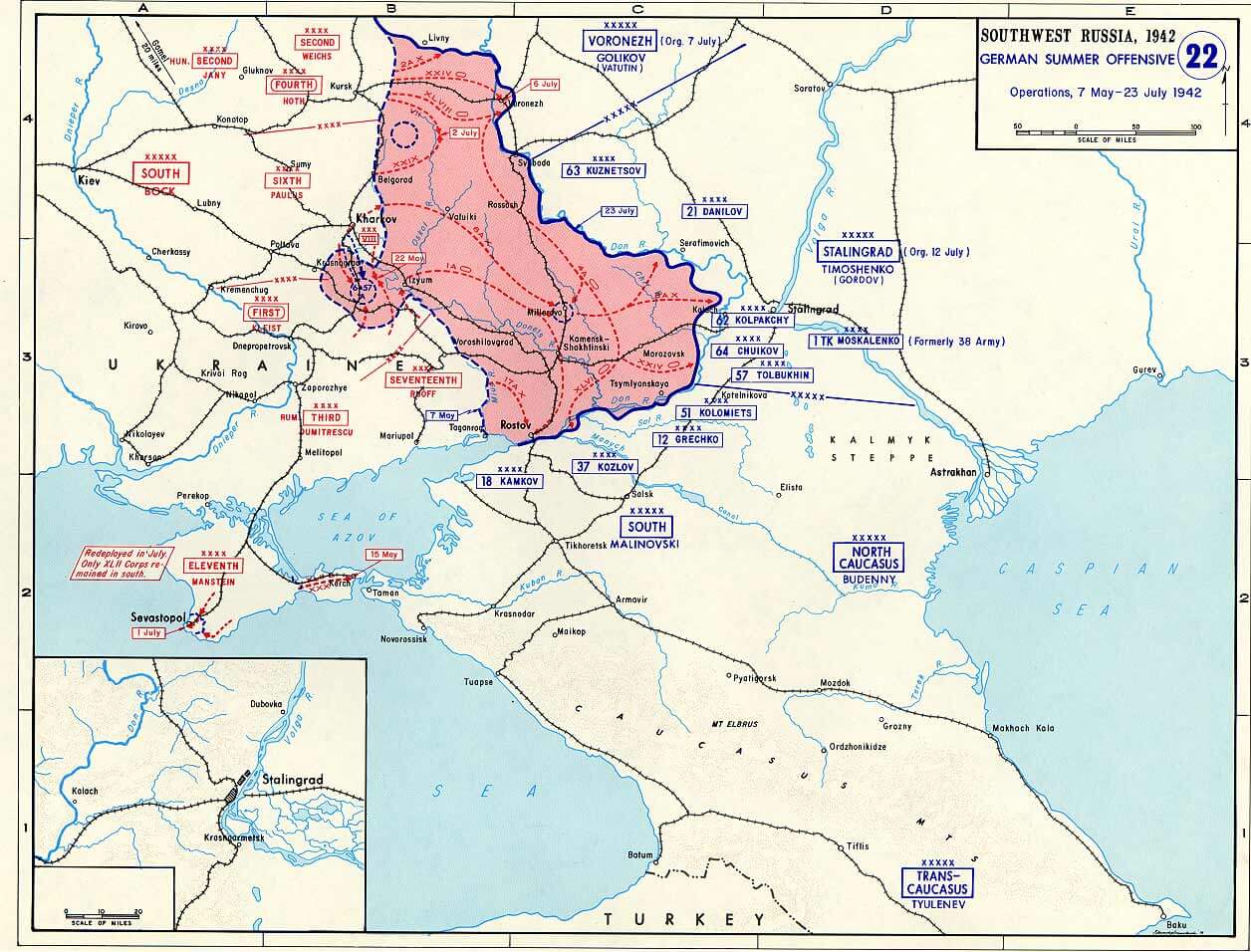
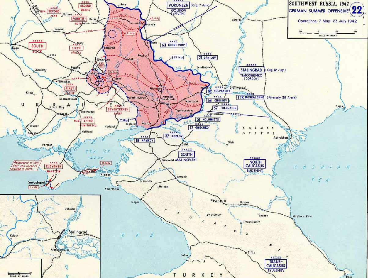
EUROPE MAP WORLD WAR2 STALINGRAD 1942
EUROPE MAP WORLD WAR 1914

EUROPE MAP WORLD WAR II
EUROPE OIL GAS PIPELINES MAP

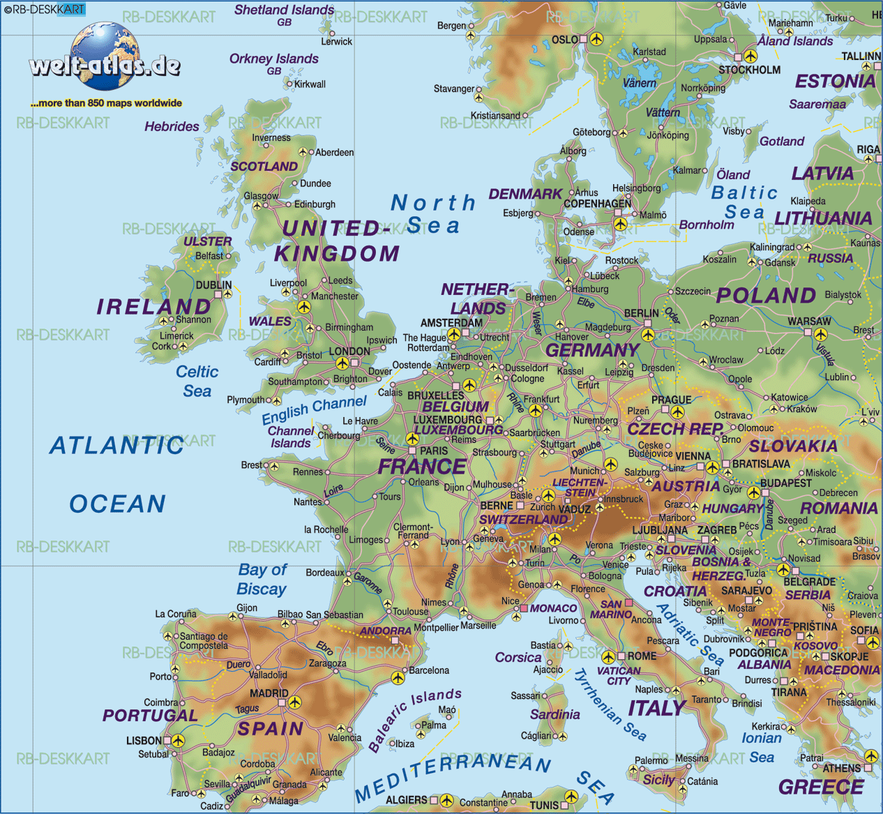
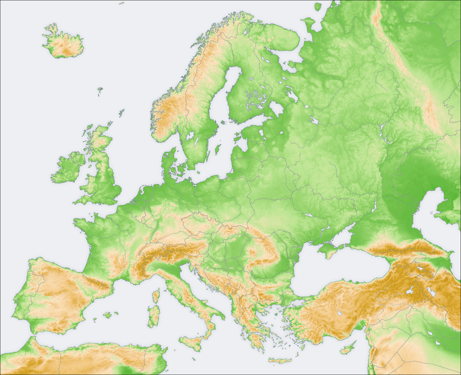
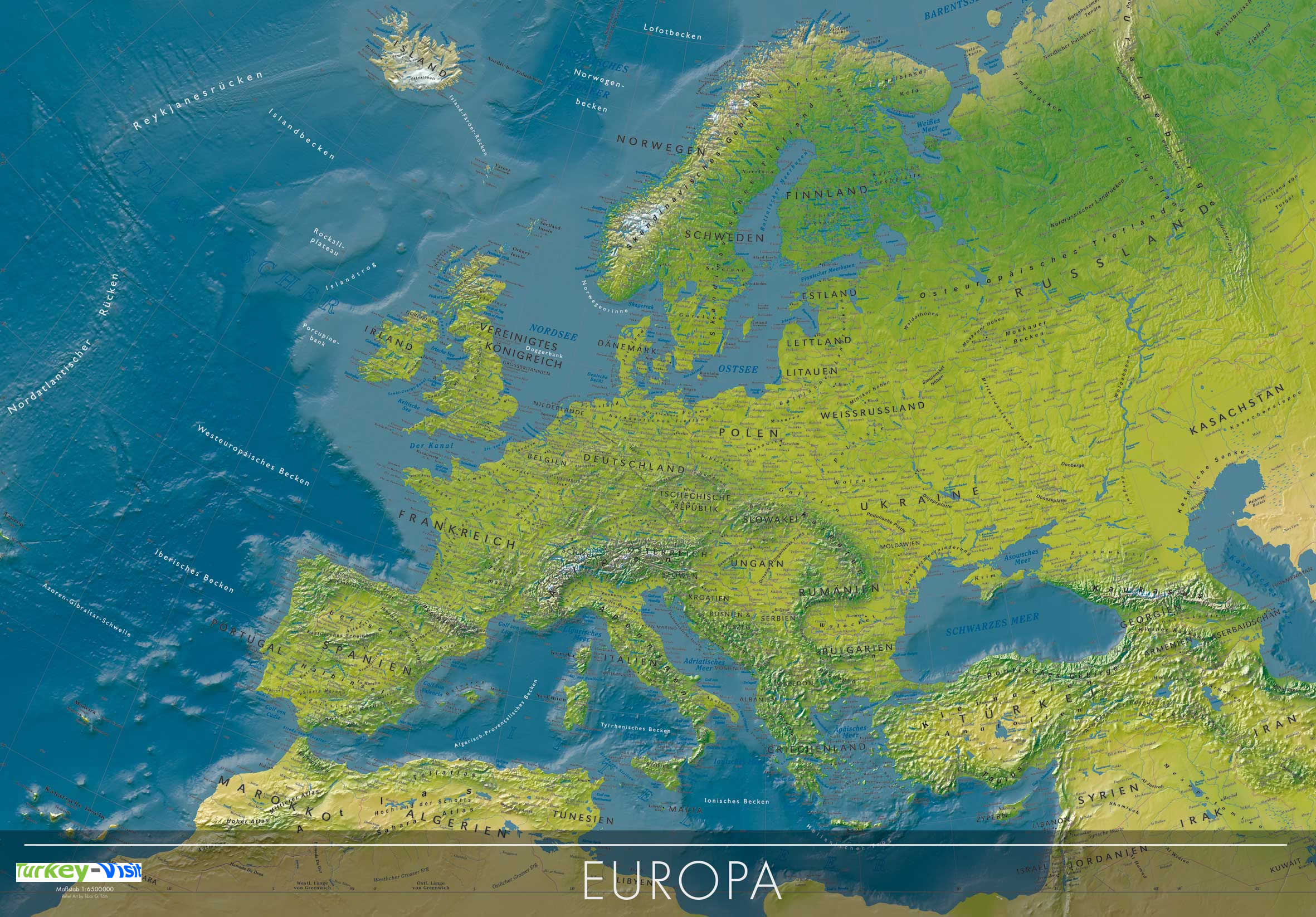
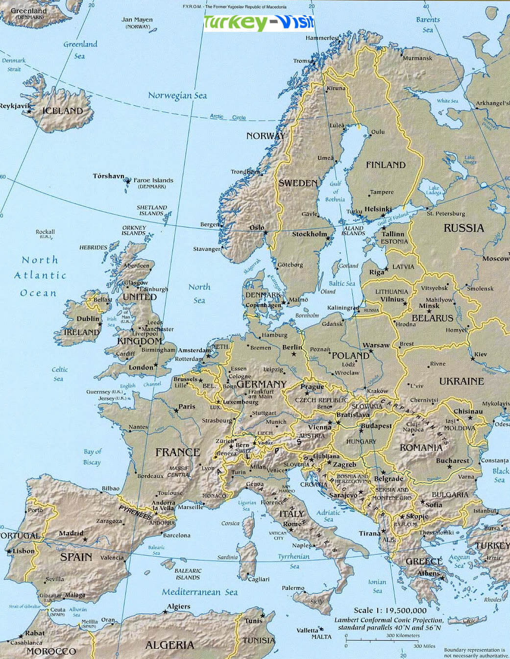
EUROPE PHYSICAL MAP
EUROPE POLITICAL MAP
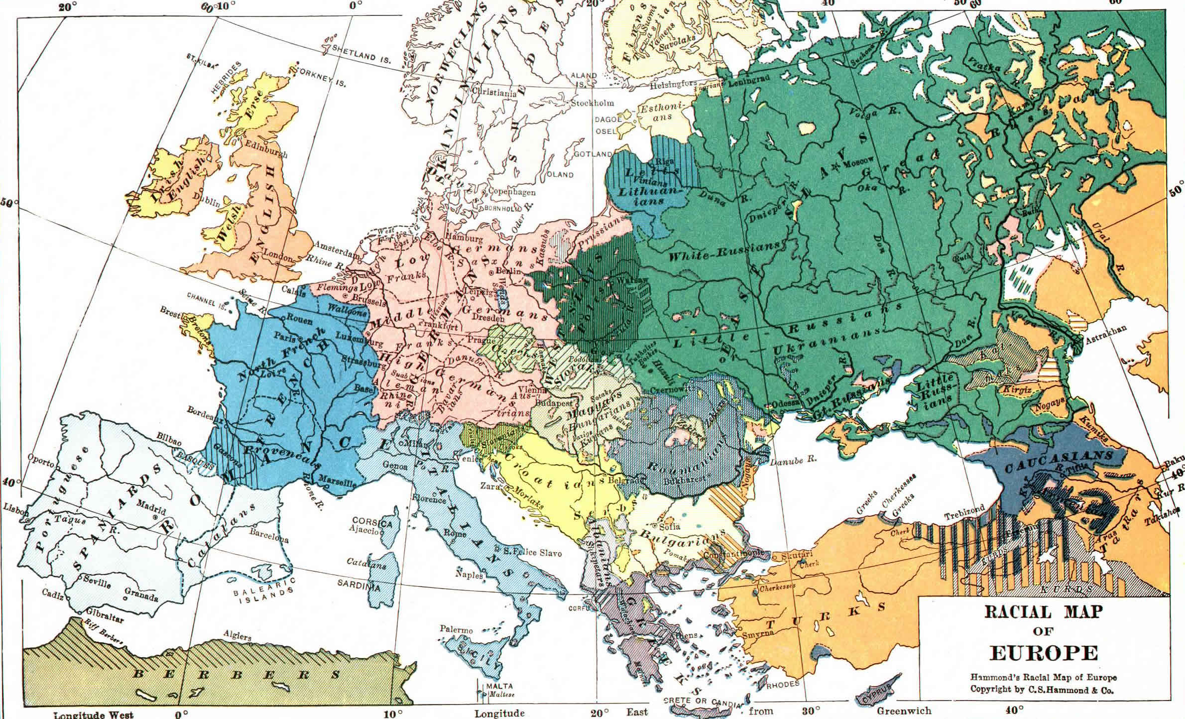
EUROPE RACIAL MAP
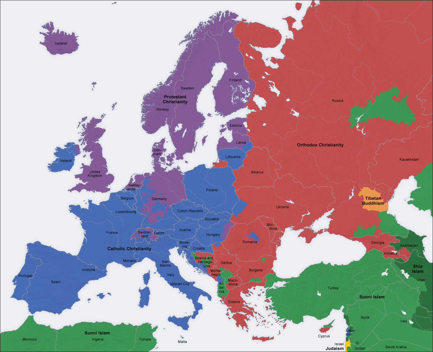
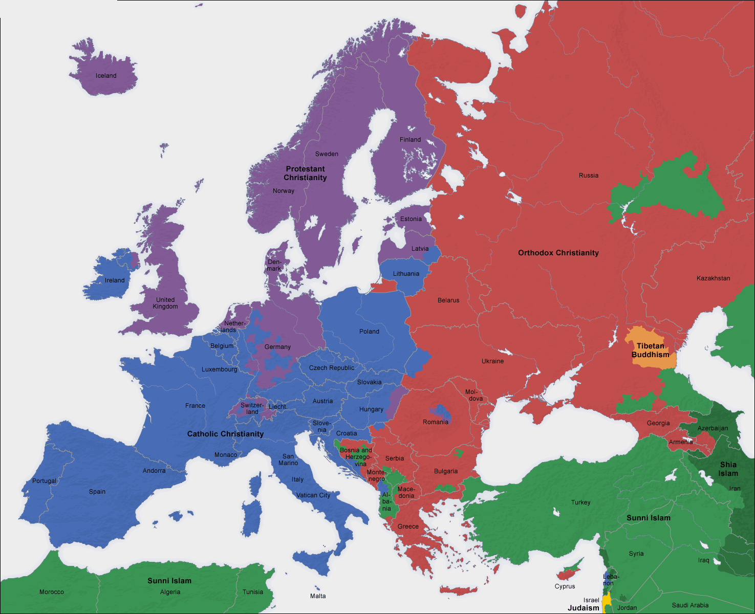
EUROPE RELIGION MAP
EUROPE TERRAIN MAP
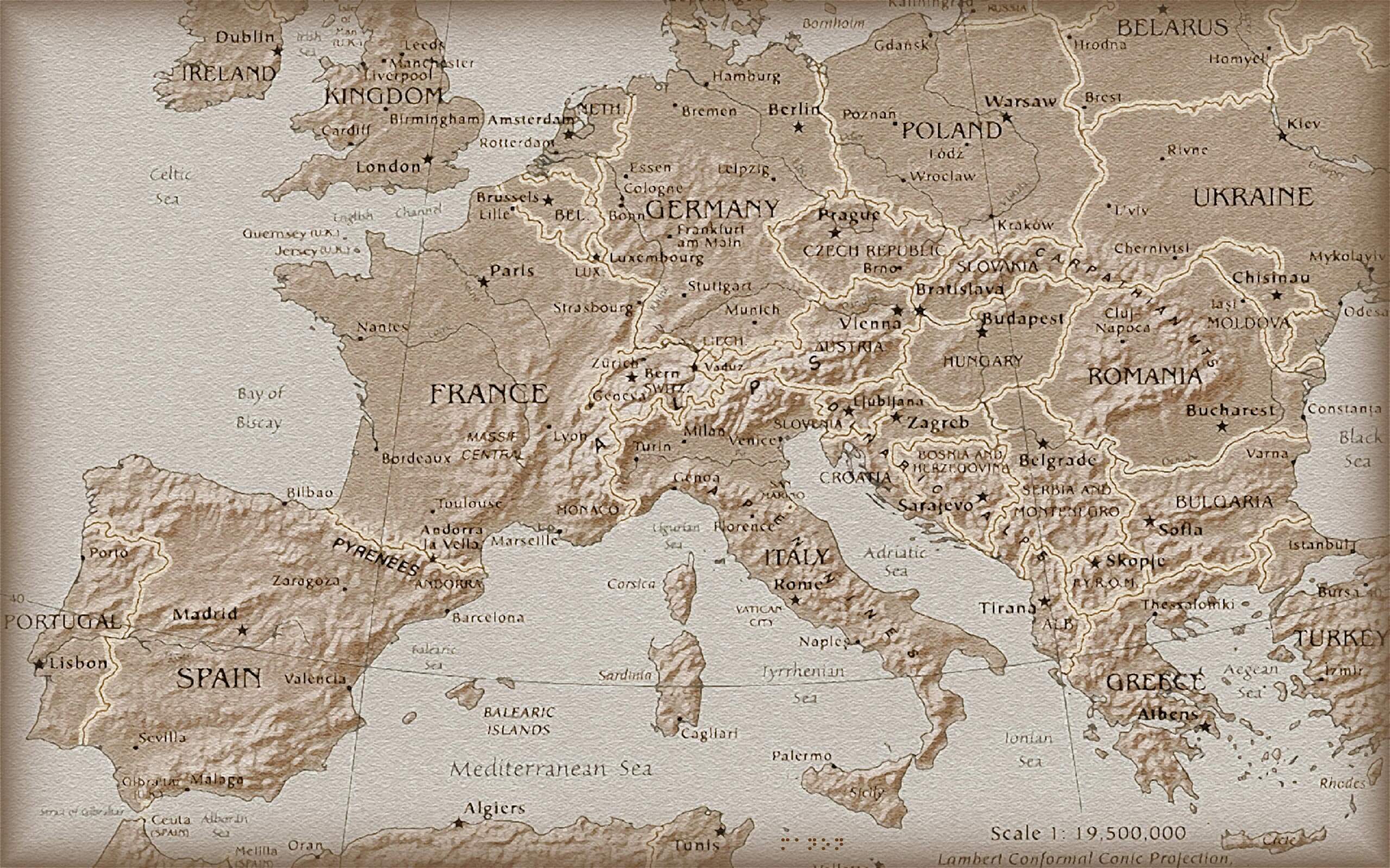
EUROPE TOPOGRAPHY MAP
EUROPE UNION MAP
EUROPE WORLD WAR1 MAP 1914
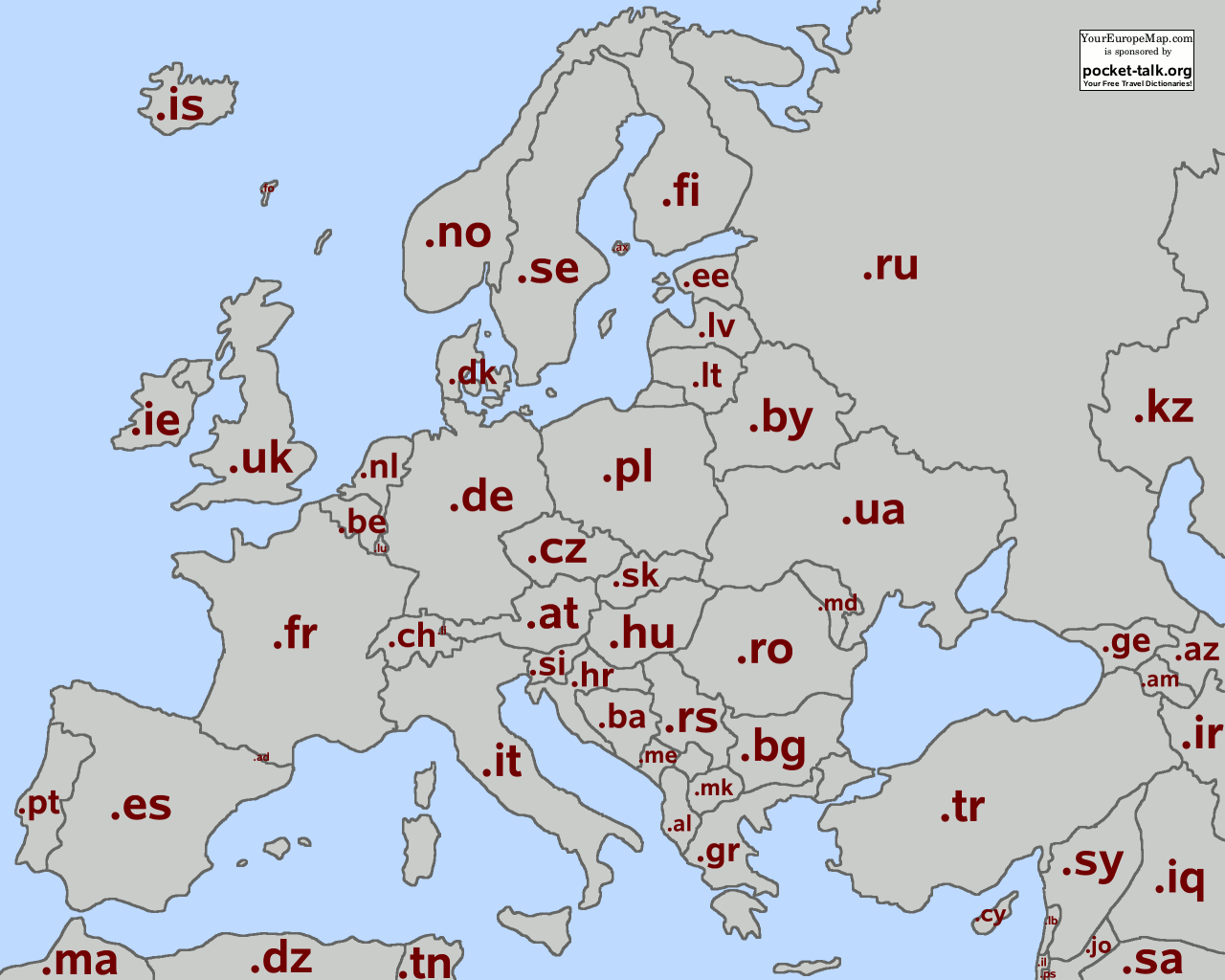
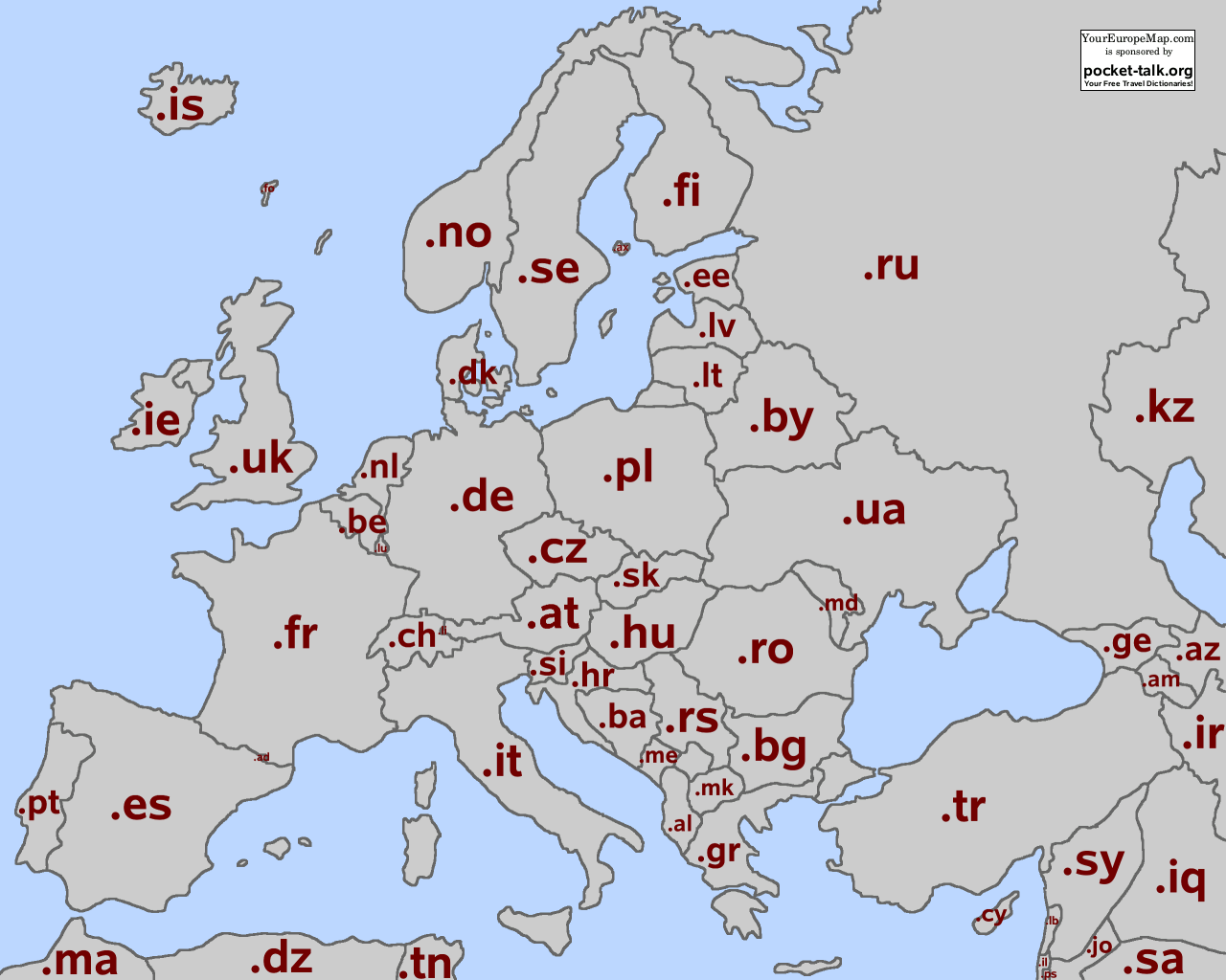
MAP OF TLD EUROPE
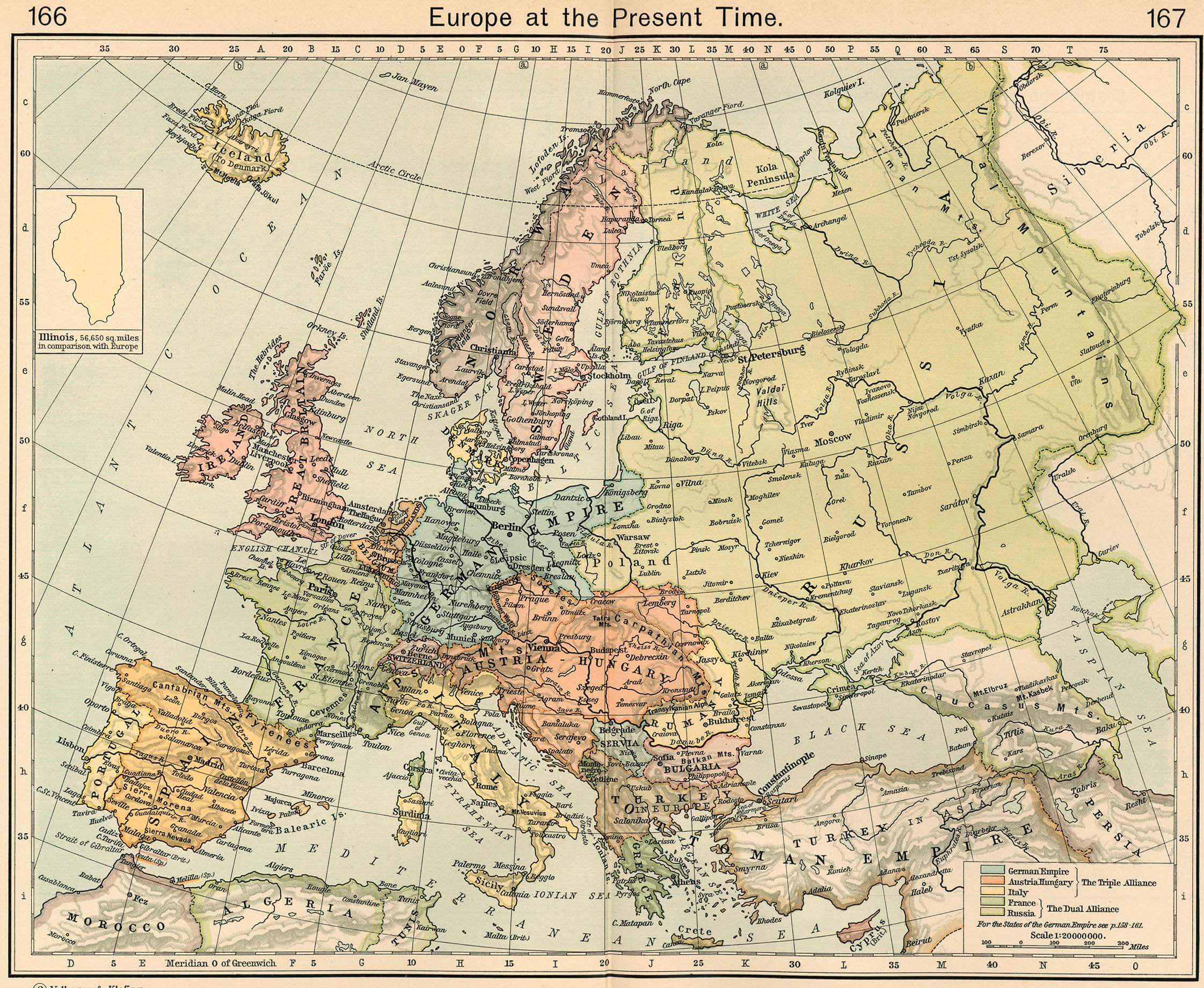
POLITICAL MAP OF EUROPE
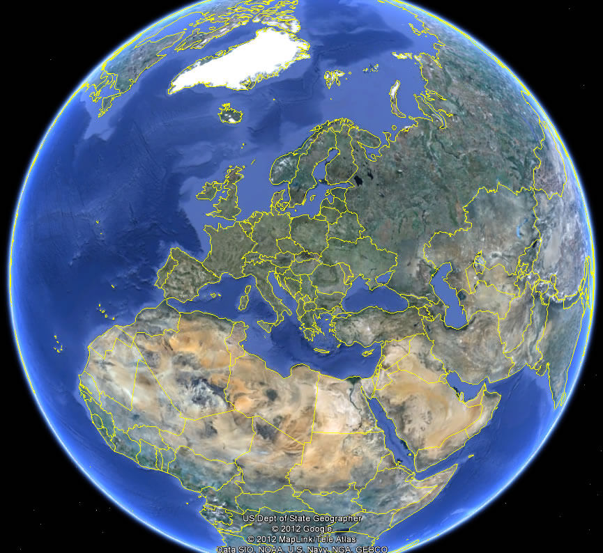
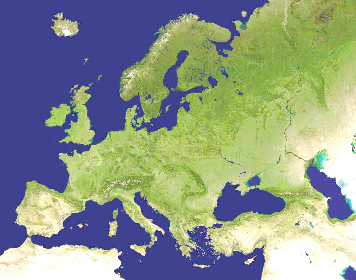
SATELLITE IMAGE OF EUROPE
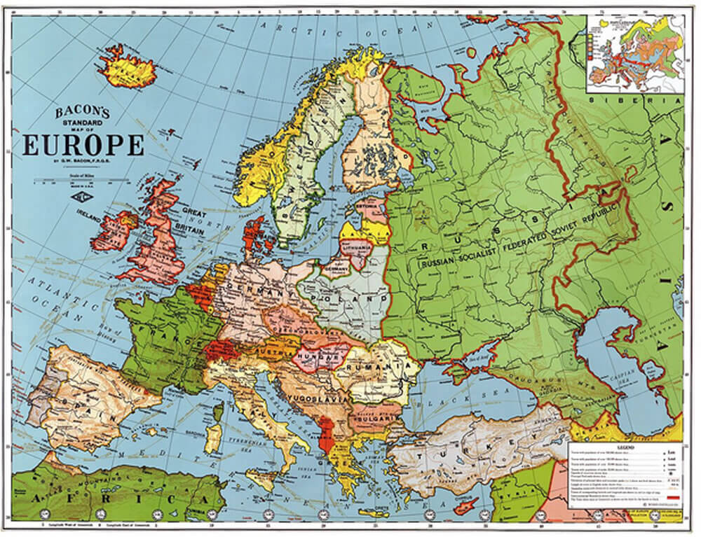
STANDARD EUROPE MAP
EUROPE EARTH MAP

Europe Countries Map
Abkhazia Map Akrotiri and Dhekelia Map Aland Islands Map Albania Map Andorra Map Armenia Map Austria Map Azerbaijan Map Belarus Map Belgium Map Bosnia and Herzegovina Map Bulgaria Map Croatia Map Cyprus Map Czech Republic Map Denmark Map Estonia Map Faroe Islands Map Finland Map France Map Georgia Map Germany Map Gibraltar Map Greece Map Guernsey Map Hungary Map Iceland Map Ireland Map Isle of Man Map Italy Map Jersey Map Kosovo Map Latvia Map Liechtenstein Map Lithuania Map Luxembourg Map Macedonia Map Malta Map Moldova Map Monaco Map Montenegro Map Nagorno Karabakh Map Netherlands Map Northern Cyprus Map Norway Map Poland Map Portugal Map Romania Map San Marino Map Serbia Map Slovakia Map Slovenia Map South Ossetia Map Spain Map Sweden Map Switzerland Map Transnistria Map Turkey Map Ukraine Map United Kingdom Map Vatican MapThe Earth, Europe and Countries View from Space - Day Time and in the Night
Please subscribe on "World Guide" channnel on Youtube at youtube.com/c/WorldGuide
Where is Europe in the World?
Europe Satellite Image
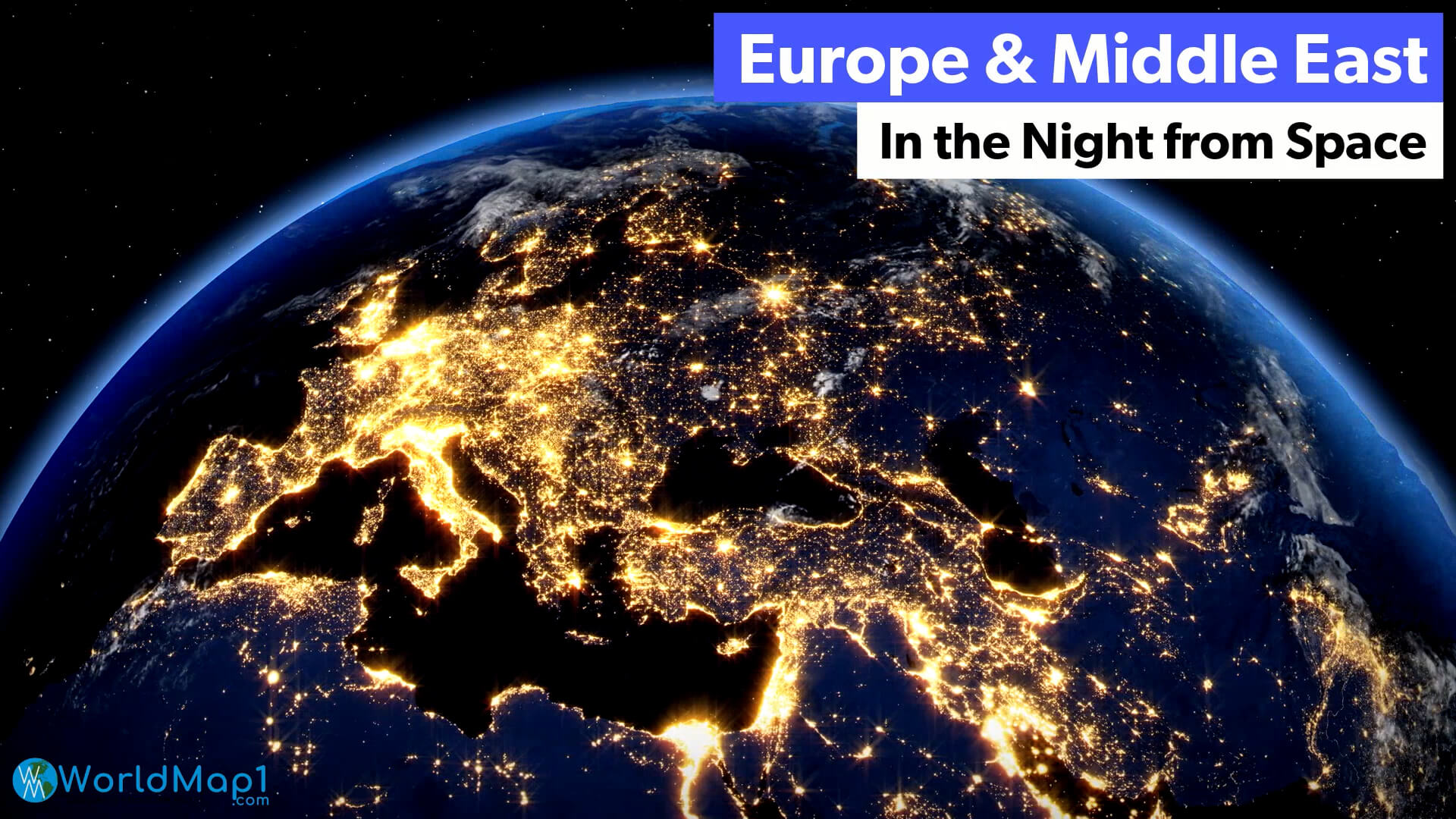
Europe Maps, Countries Map and Earth Views from Space
Please subscribe on "World Guide" channnel on Youtube at youtube.com/c/WorldGuide
A Variety of Europe Maps and Europe Satellite Images


Addresse: Hakarinne 2 Espoo, Uusimaa - Finland 02210
Web: istanbul-city-guide.com
Email: [email protected]
Web: istanbul-city-guide.com
Email: [email protected]
Copyright istanbul-city-guide.com - 2004 - 2026. All rights reserved. Privacy Policy | Disclaimer