Norway Map and Norway Satellite Images
Explore map of Norway, Norway map, cities map of Norway, satellite images of Norway, Norway largest cities maps, political map of Norway, driving directions, country atlas and traffic map.
Norway Map FQA
How many cities are in Norway ?
Norway has 108 officially recognized cities. The largest by population are: Oslo; Bergen; Stavanger/Sandnes; Trondheim; Drammen; Fredrikstad; Kristiansand; Tromsø; Sandefjord; Ålesund.What are the major geographical features of Norway ?
Norway is known for its rugged terrain, with the Scandinavian Mountains, deep fjords, glaciers, and extensive coastlines along the North Atlantic. It also features high plateaus and numerous lakes.WHERE IS NORWAY IN THE WORLD
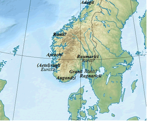
NORWAY TRIBES MAP
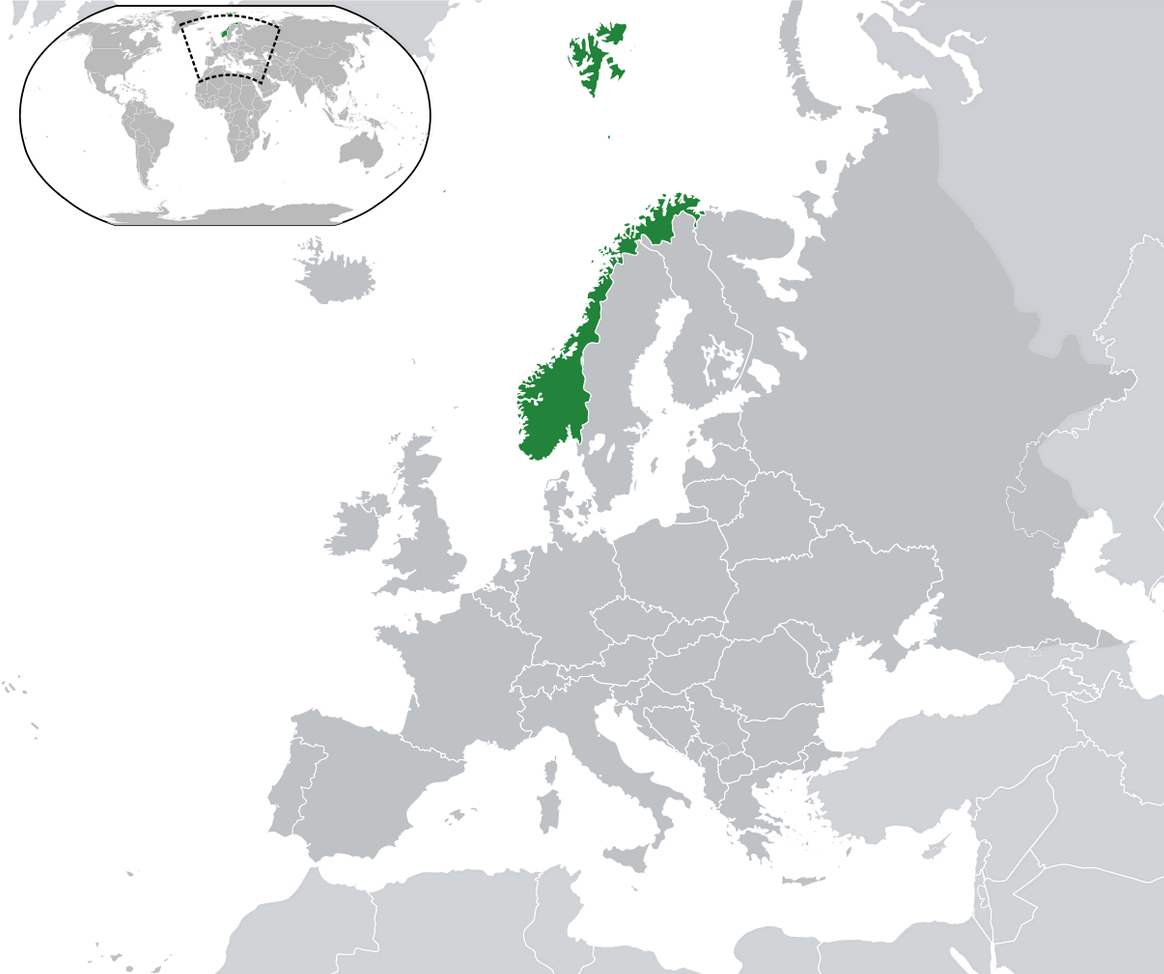
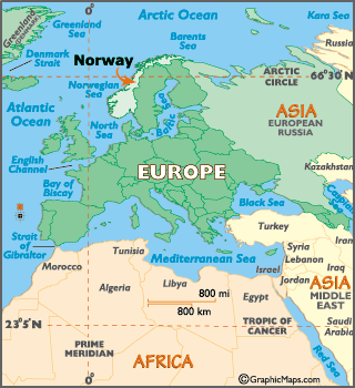
WHERE IS NORWAY IN THE WORLD
Can I download a high-resolution map of Norway ?
Yes. Download high-resolution political and physical maps of Norway for personal or educational use. Redistribution is subject to the terms of our license.
- Capital : Oslo
- Population : 5,033,675
- GDP : $483.650 billion
- Per Capita : $97,254
- Calling Code : +47
- Jobless Rate : 3.50%
- Time Zone : +1
For more about Norway >>
A Collection of Norway Maps and Norway Satellite Images
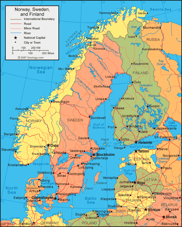
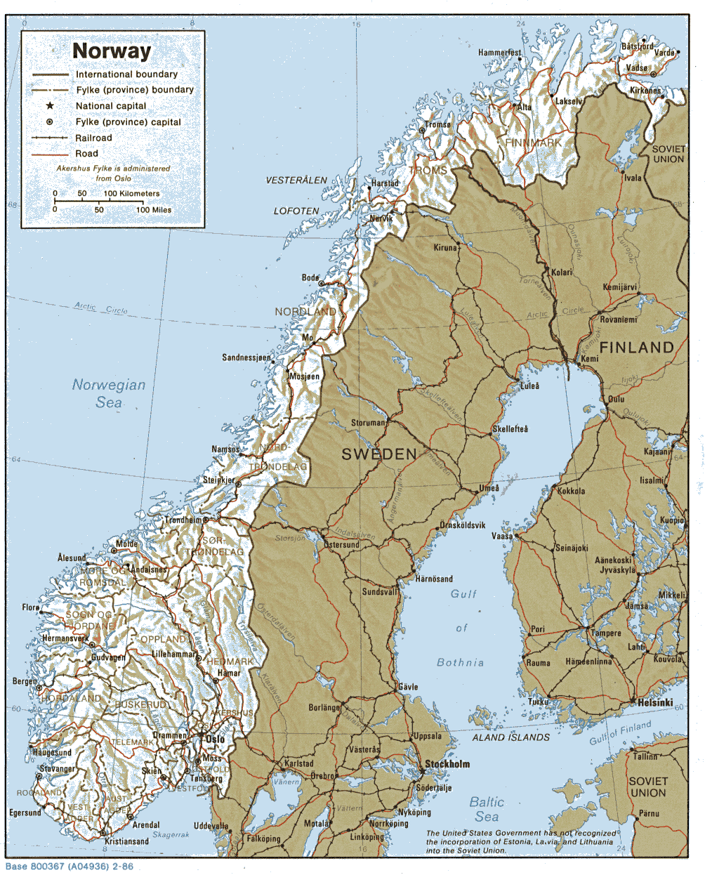
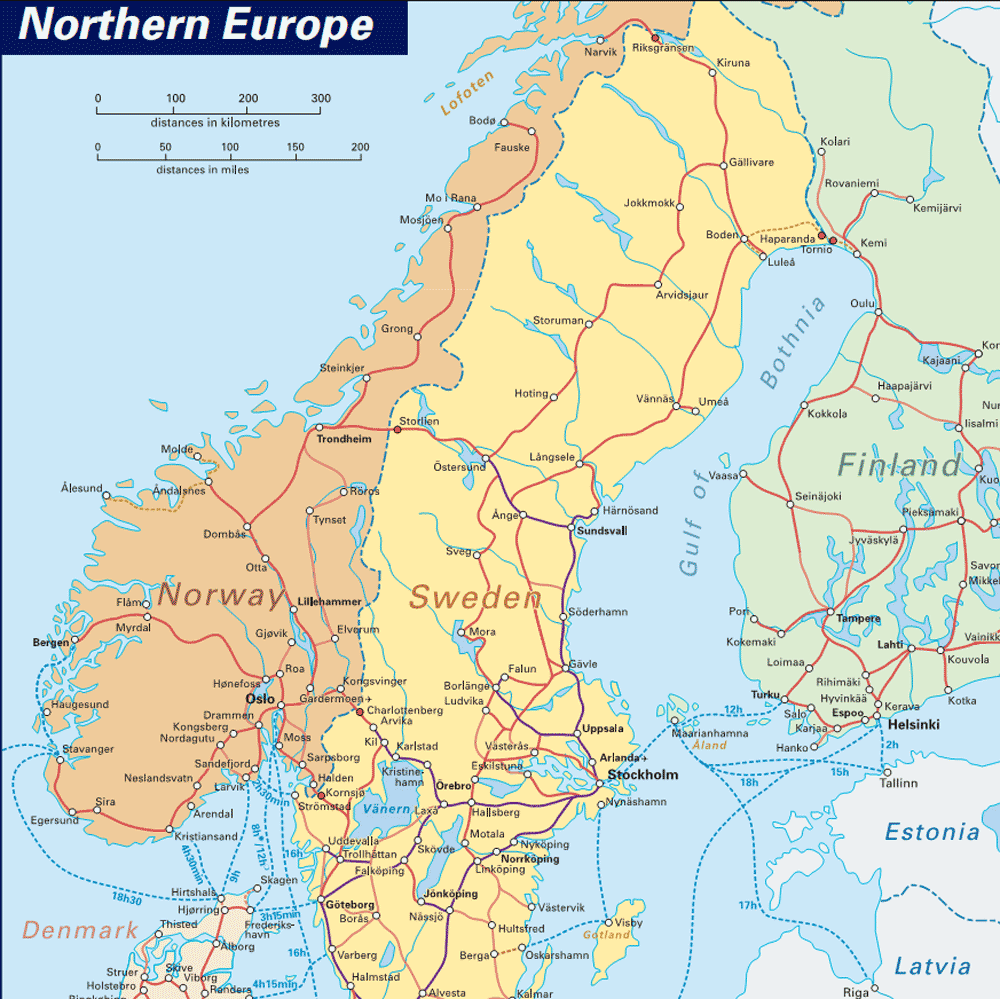
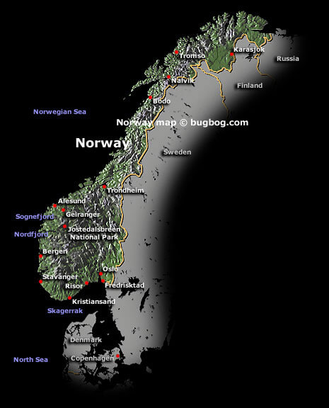
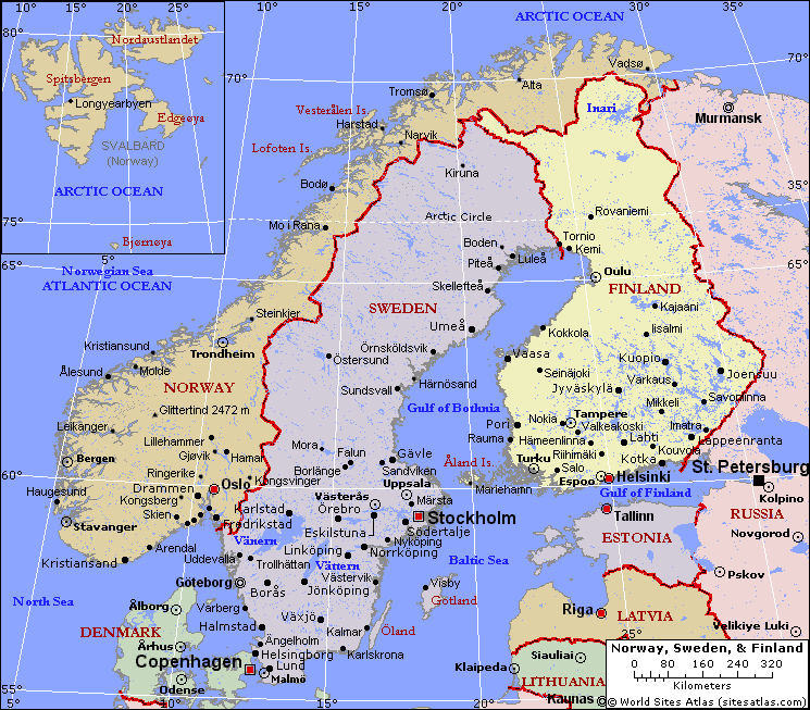
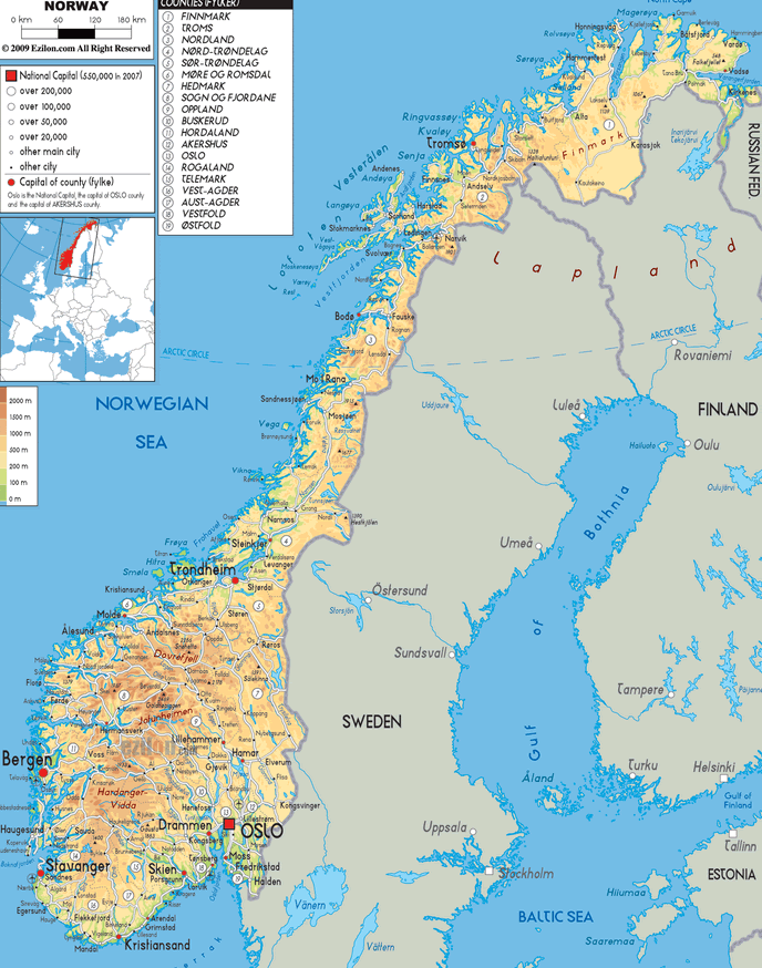
MAP OF NORWAY
NORWAY TRIBES MAP
WHERE IS NORWAY IN THE WORLD
MAP NORWAY

MAP OF NORWAY
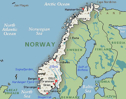
NORWAY CITIES MAP
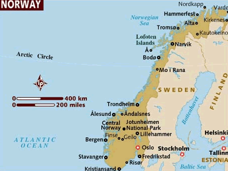
NORWAY MAP
NORWAY MAPS
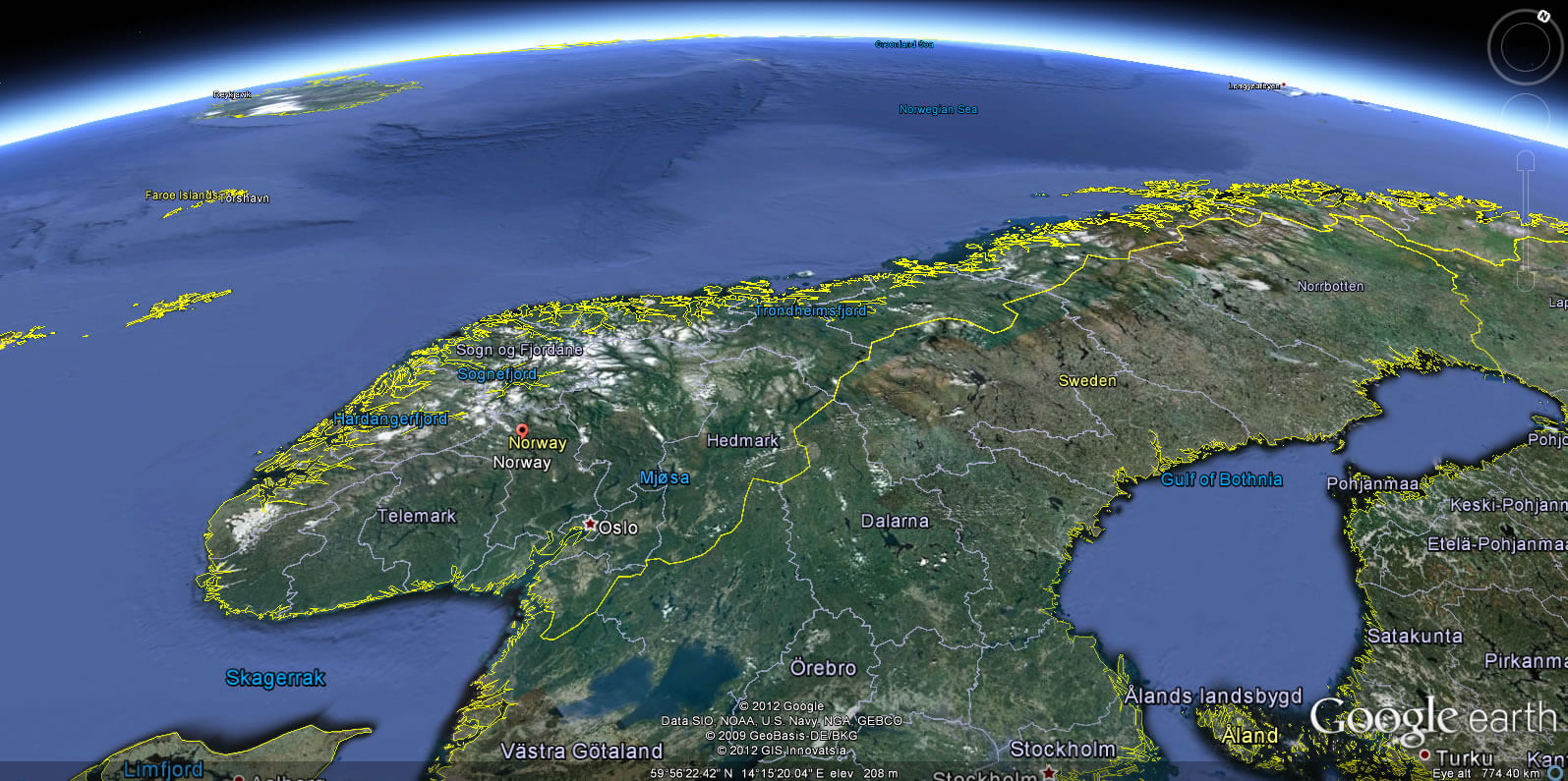
NORWAY SATELLITE MAP
NORWAY CITIES MAP
NORWAY CITY MAP

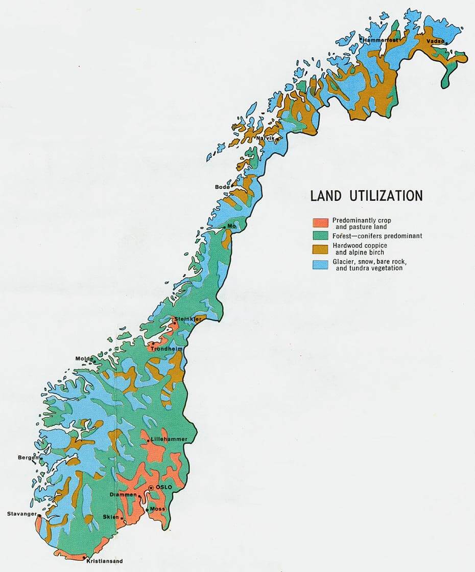
NORWAY LAND MAP
NORWAY MAP
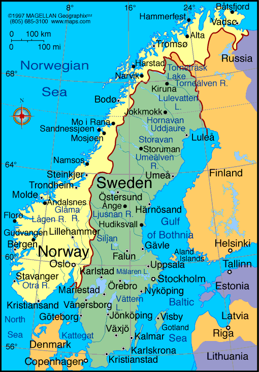
NORWAY MAP EUROPE
NORWAY MAP SCANDINAVIA
NORWAY MAPS
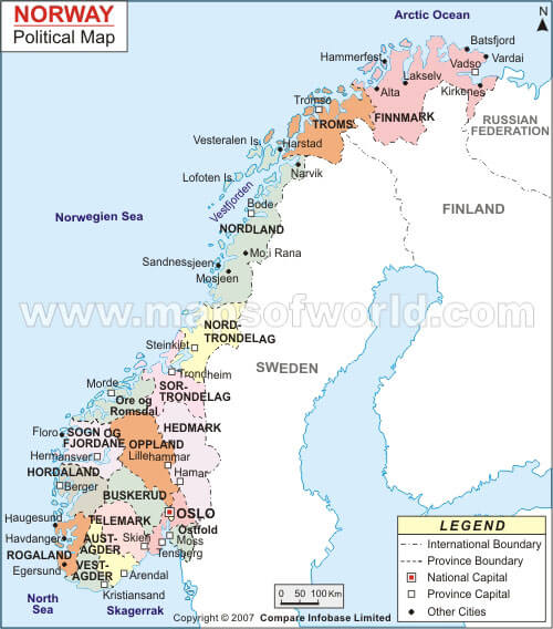
NORWAY POLITICAL MAP
NORWAY POPULATION MAP
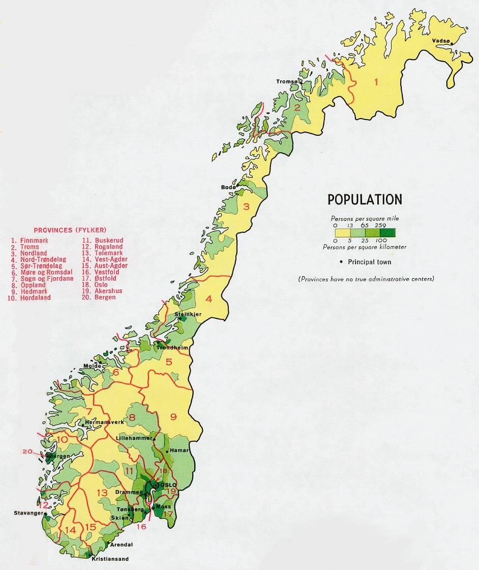
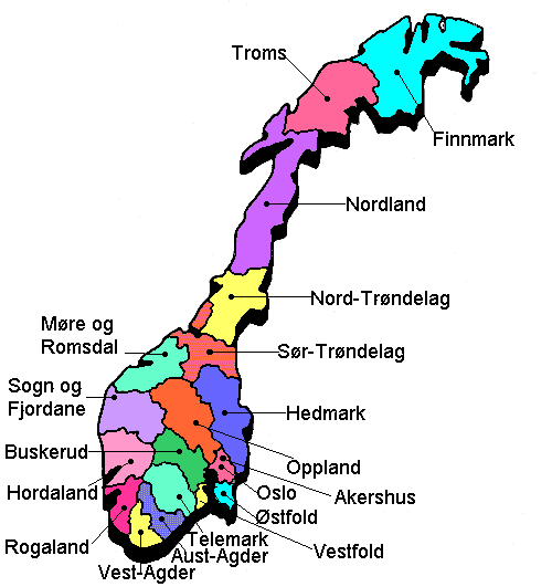
NORWAY PROVINCES MAP

NORWAY MAP
NORWAY EARTH MAP
Where is Located Norway in Europe, Is Norway Member of NATO and EU?
Please subscribe on "World Guide" channnel on Youtube at youtube.com/c/WorldGuide
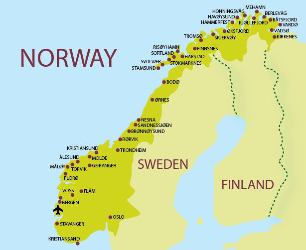
Largest Cities' Map of Norway
Oslo Map Bergen Map Trondheim Map Stavanger Map Baerum Map Kristiansand Map Fredrikstad Map Tromso Map Sandnes Map Skien Map Drammen Map Sarpsborg Map Bodo Map Sandefjord Map Alesund Map Larvik Map Arendal Map Tonsberg Map Porsgrunn Map Haugesund Map Hamar Map Moss Map Halden Map Gjovik Map Lillehammer Map Horten Map Molde Map Kongsberg Map Harstad Map Kristiansund Map Steinkjer Map Grimstad Map Narvik Map Kongsvinger Map Honefoss Map Mandal Map Egersund Map Namsos Map Notodden Map Holmestrand Map Farsund Map Hammerfest Map Flekkefjord Map Floro Map Risor Map Vadso Map Vardo Map
Addresse: Hakarinne 2 Espoo, Uusimaa - Finland 02210
Web: istanbul-city-guide.com
Email: [email protected]
Web: istanbul-city-guide.com
Email: [email protected]
Copyright istanbul-city-guide.com - 2004 - 2026. All rights reserved. Privacy Policy | Disclaimer