Navigate Oceania Map, countries map, satellite images of the Oceania, largest cities maps, political map, capitals and physical maps.
World Continents Map
North America Map Europe Map South America Map Africa Map Asia Map Antarctica MapCountries Map of Oceania
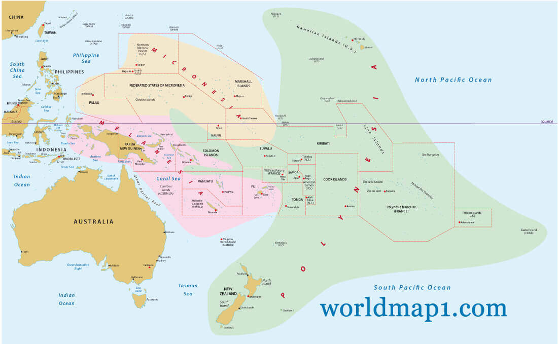
Oceania Countries Political Map
OCEANIA MAP : Countries Maps and Satellite Images from Space
Please subscribe on "World Guide" channnel on Youtube at youtube.com/c/WorldGuide
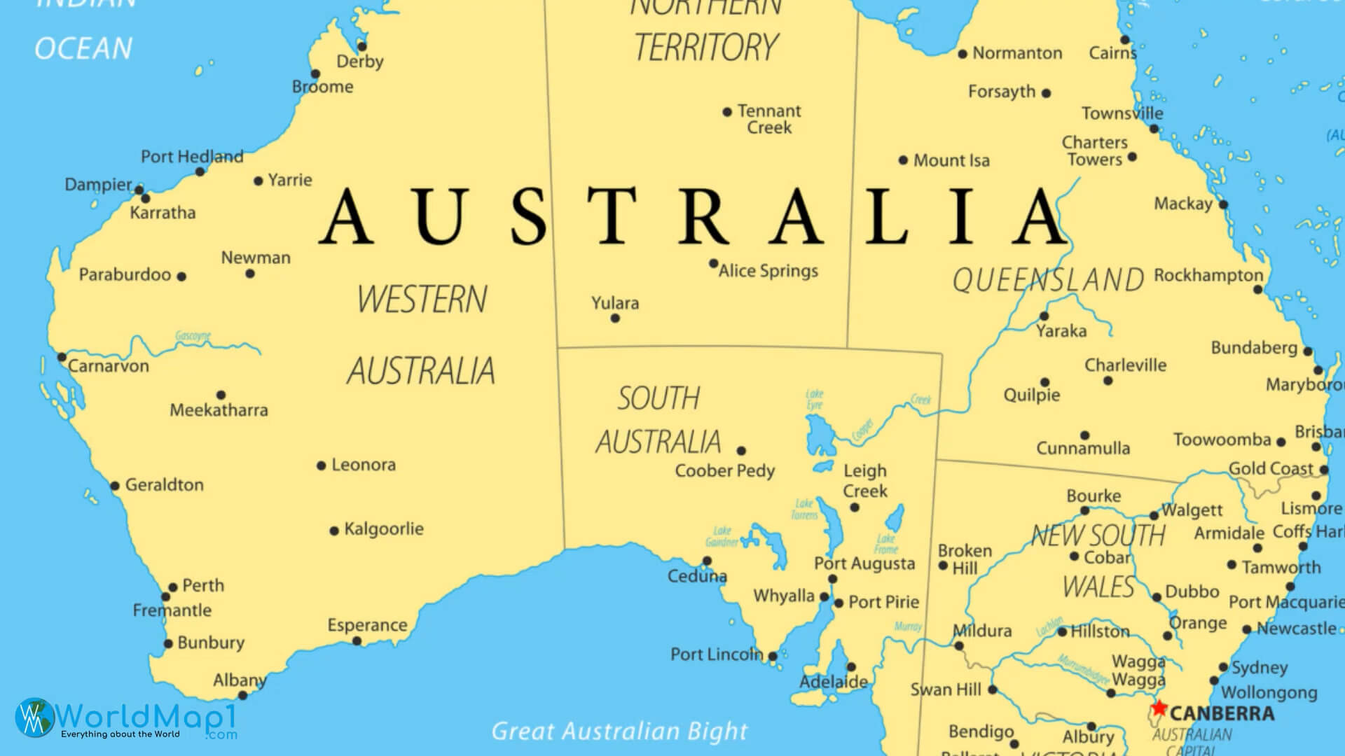
Australia Interactive Map
Please view more Oceania Countries Maps
- Oceania Countries Maps, Satellite Images from Space 1
- Oceania Countries Maps, Satellite Images from Space 2
- Oceania Countries Maps, Satellite Images from Space 3
- Oceania Countries Maps, Satellite Images from Space 4
- Oceania Countries Maps, Satellite Images from Space 5
Oceania Map & Oceania Satellite Images
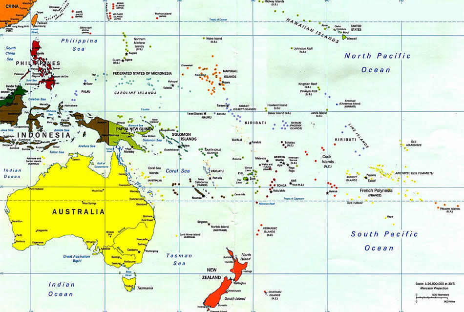
A Collection of Oceania Maps and Oceania Satellite Images
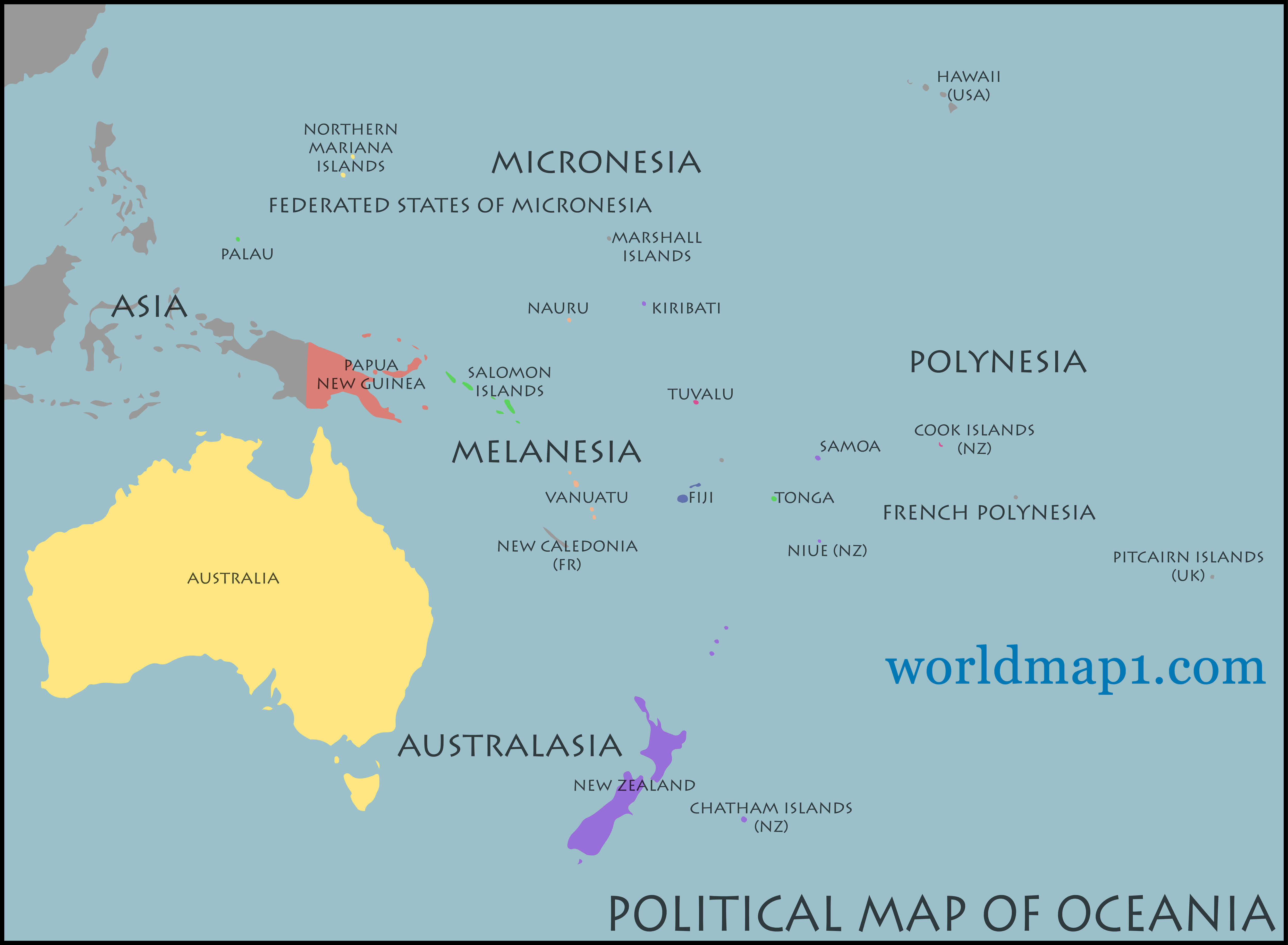
Oceania Countries Political Map
Oceania Countries Political Map with national borders.
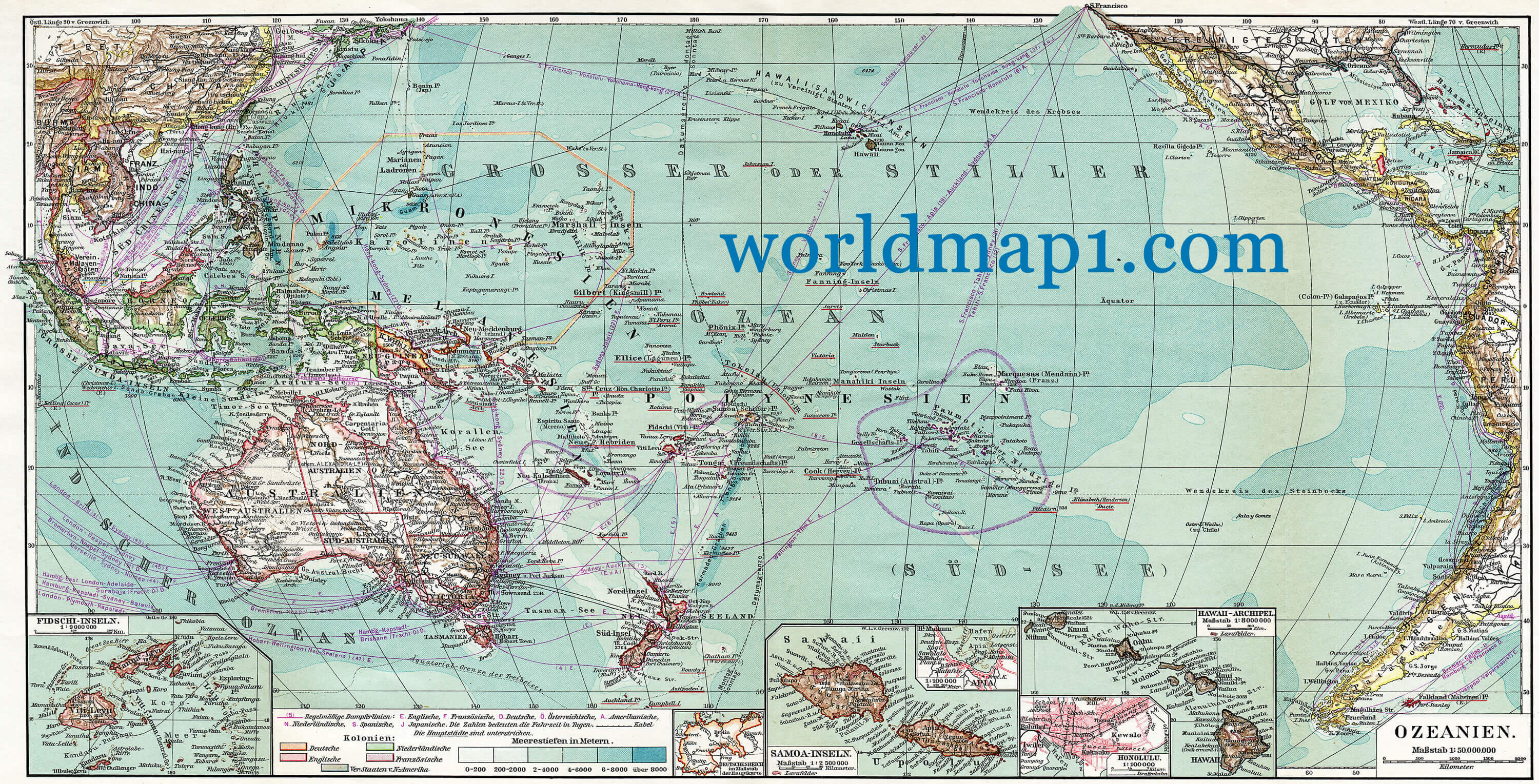
Oceania Retro Map
 Oceania Retro Map.
Map of Australia and Oceania
 Map of Australia and Oceania. Publication of the book "Meyers Konversations-Lexikon", Leipzig, Germany, 1910
World Oceania Map Centered in the American Continent
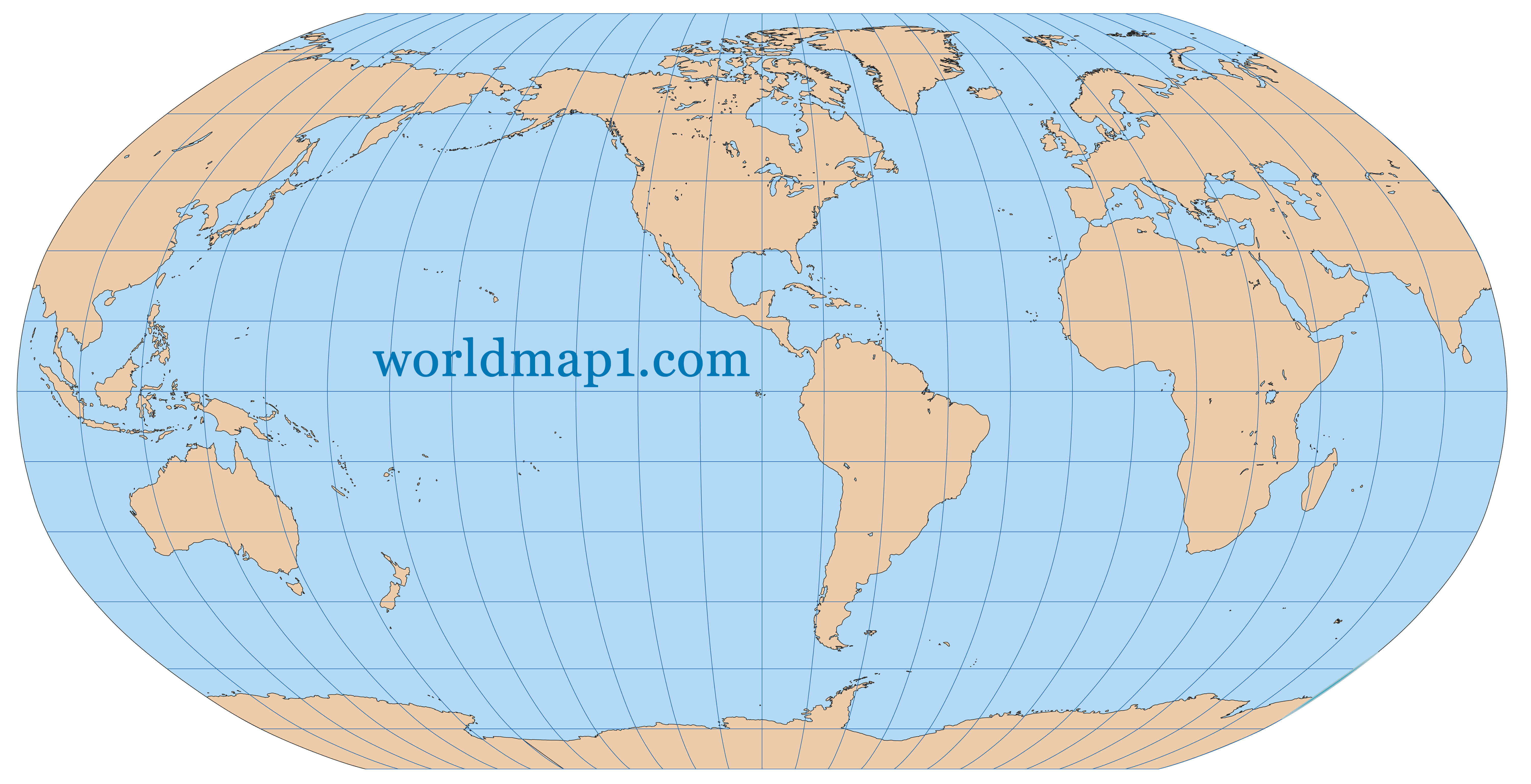 Very high detailed map of the world in Robinson projection with graticule. Centered in the American Continent.
Oceania Map Southeast Asia
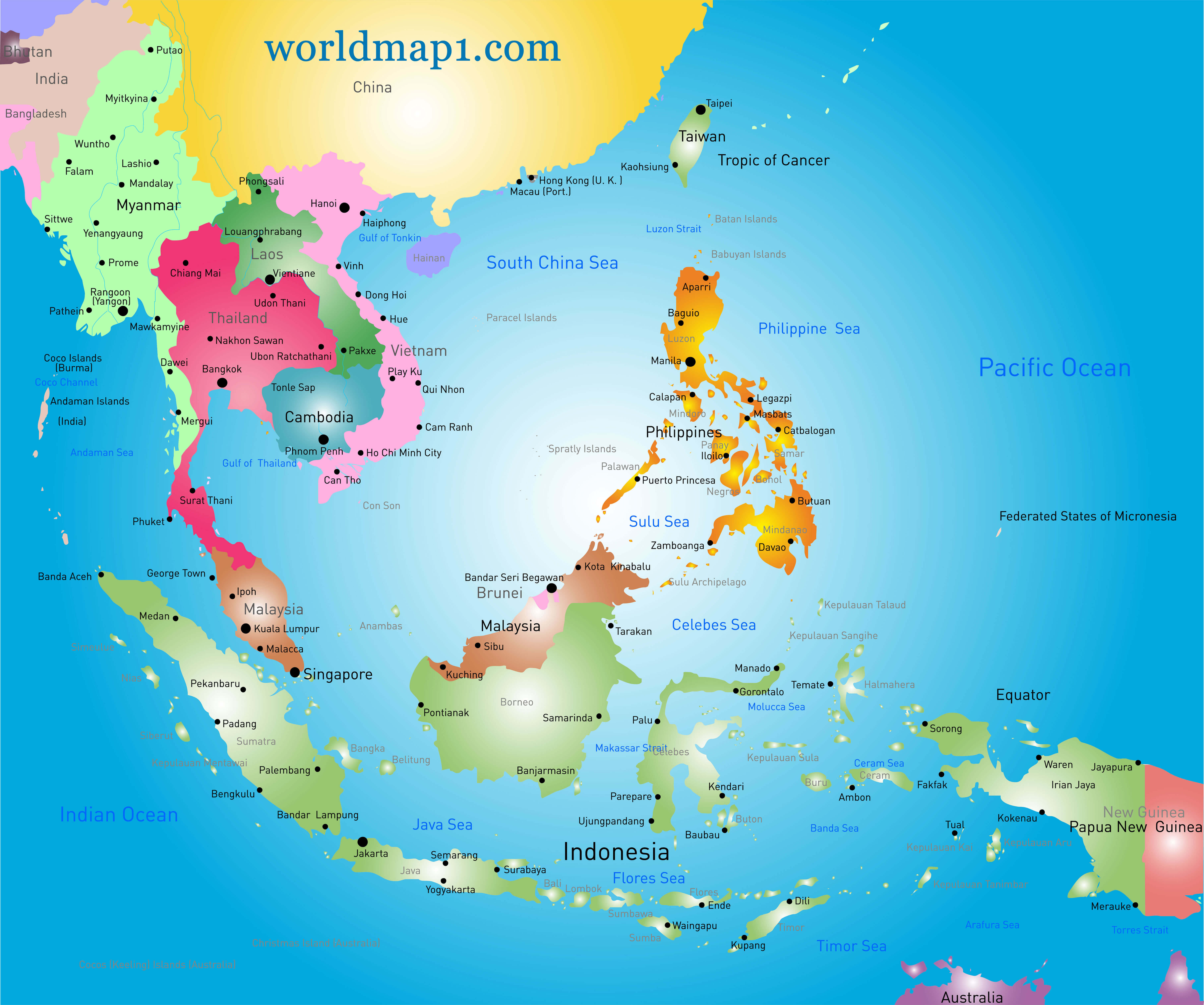 Vector color Southeast Asia map and Oceania.
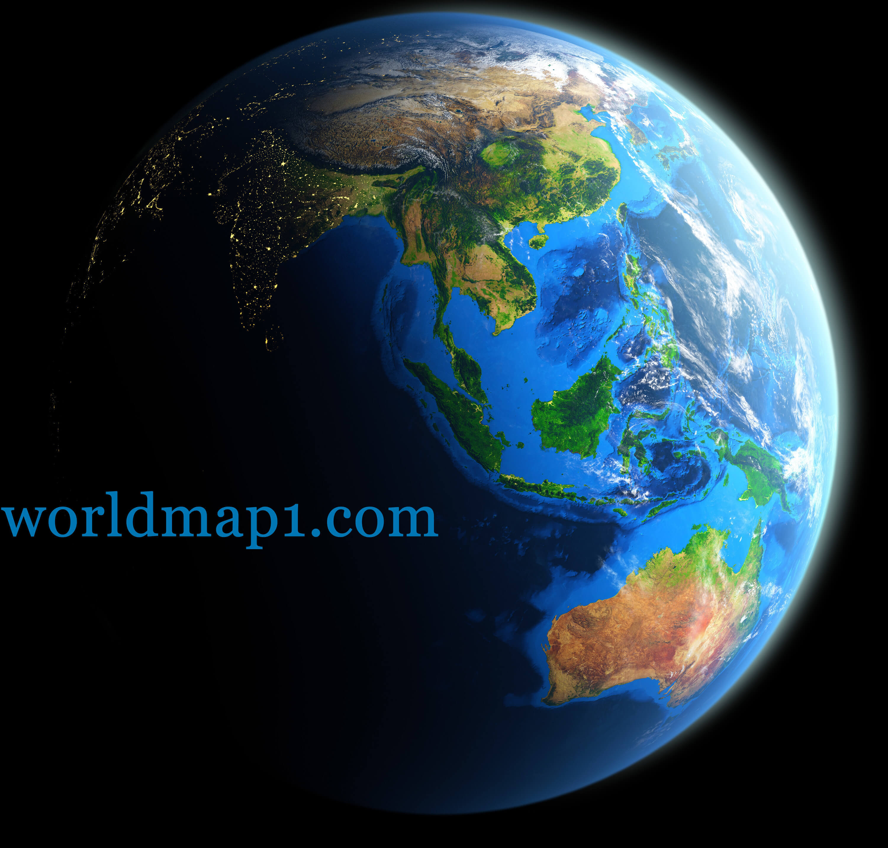
Oceania Map Earth at Night
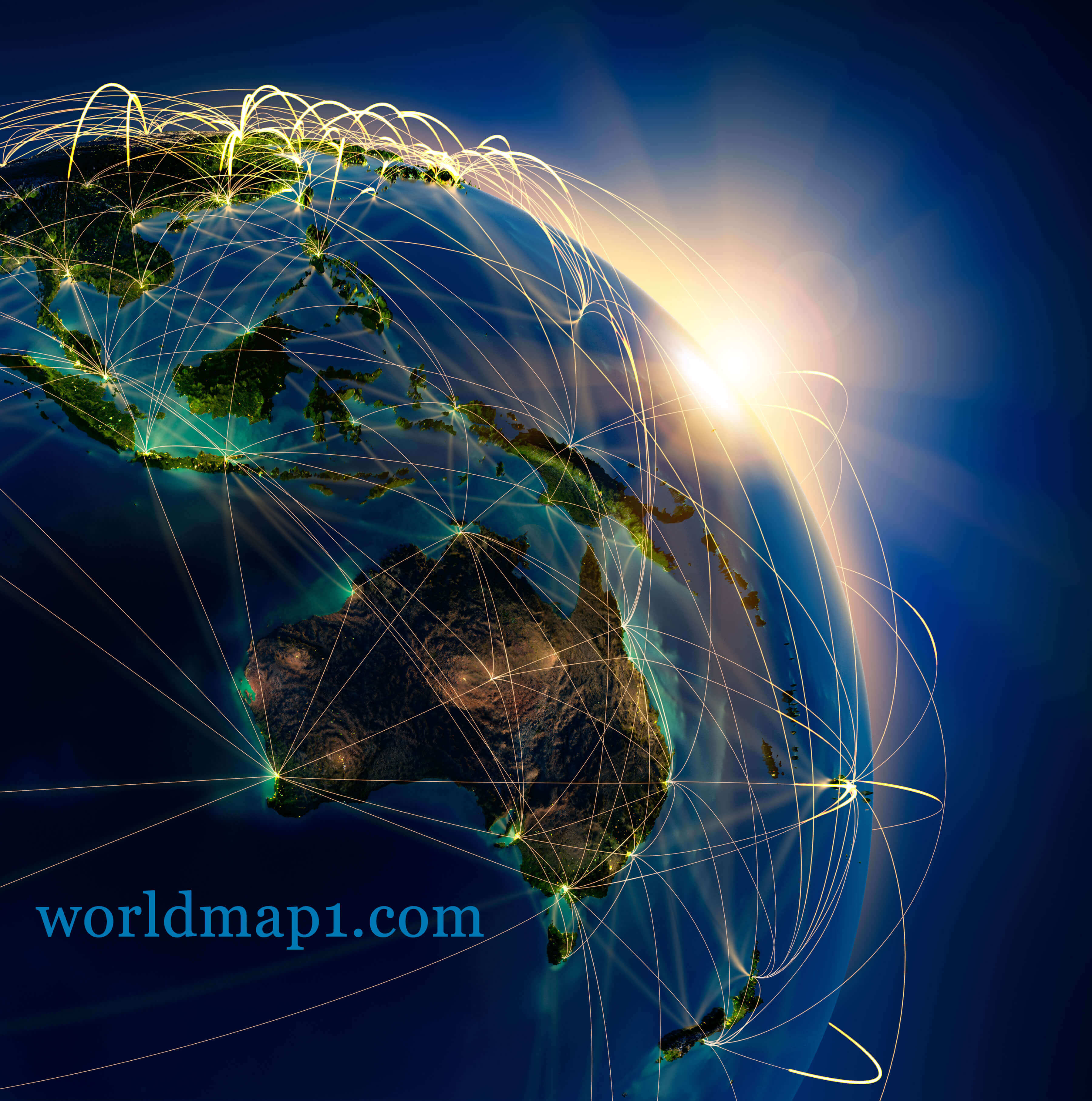 Highly detailed planet Earth at night and Oceania, lit by the rising sun, illuminated by light of cities.
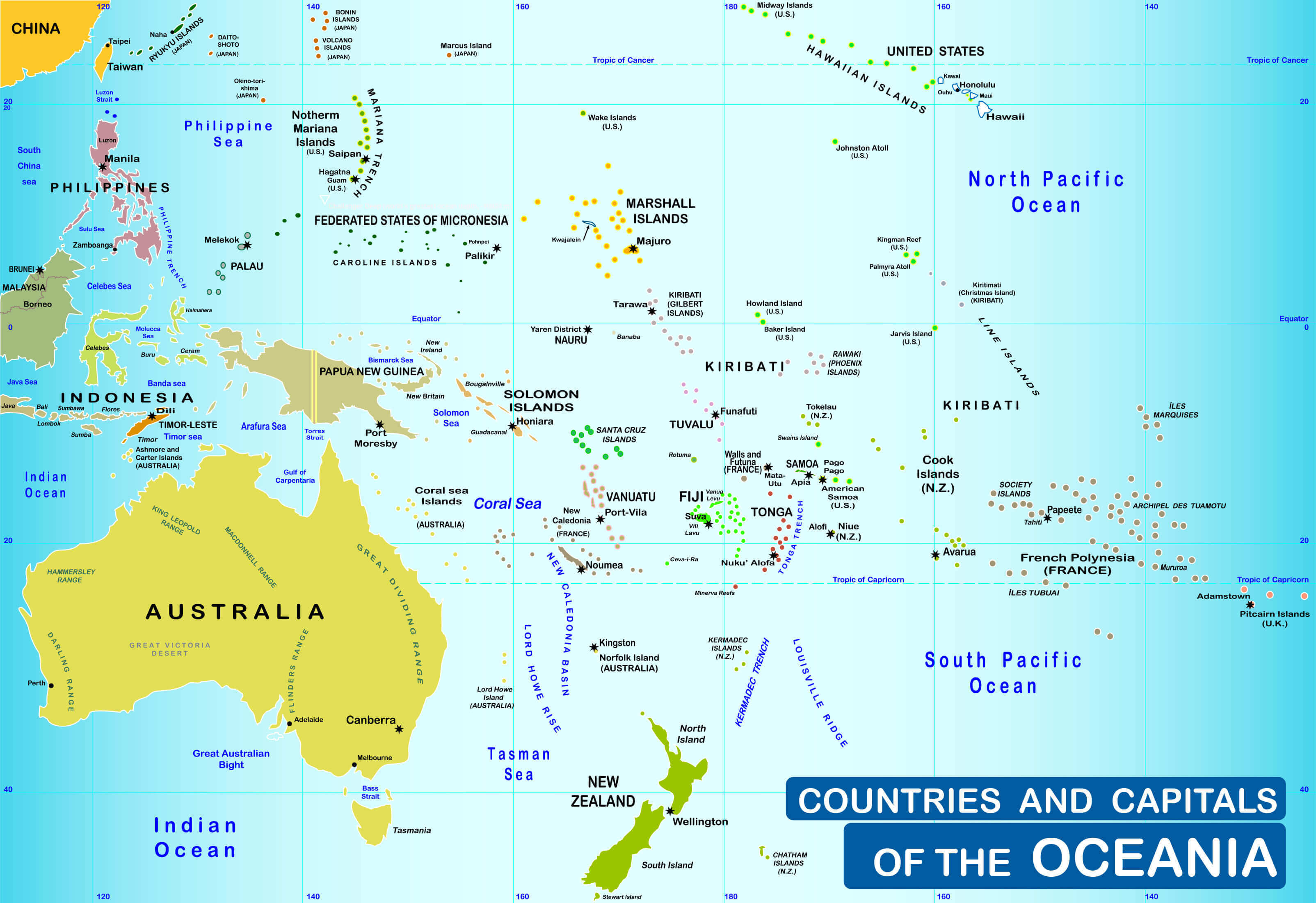
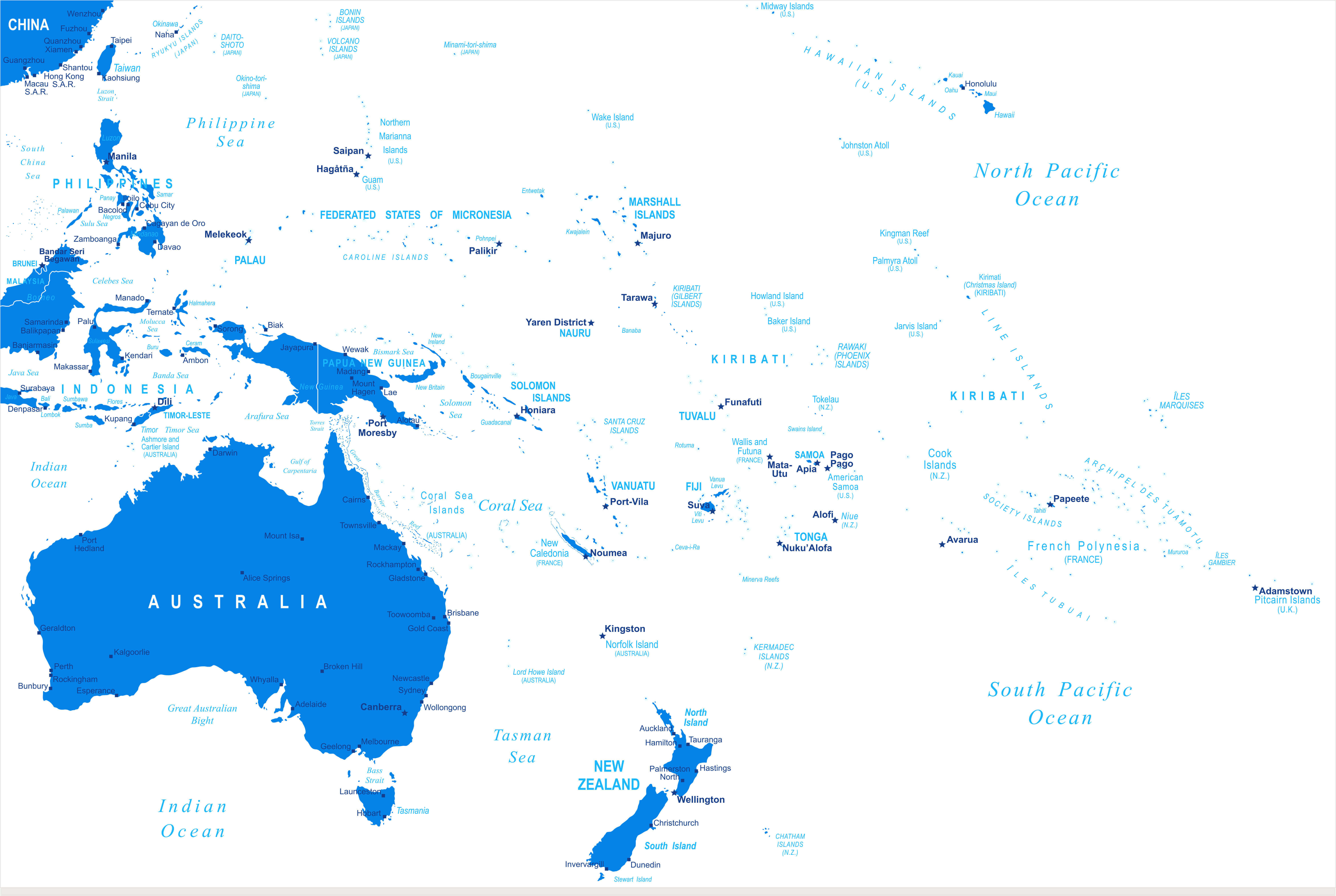
Countries and capitals of the Oceania Map
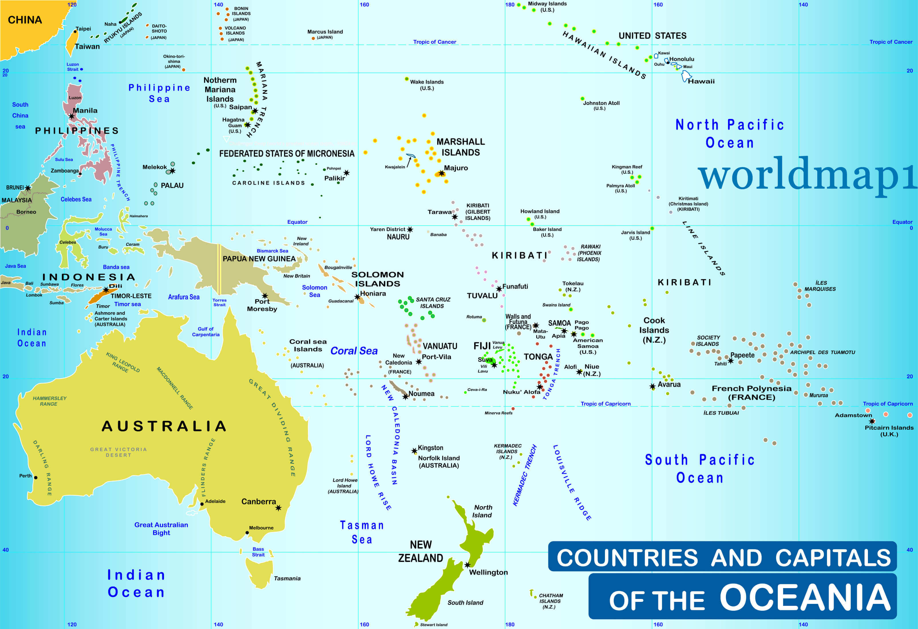 Countries and capitals of the Oceania and Australia Map.
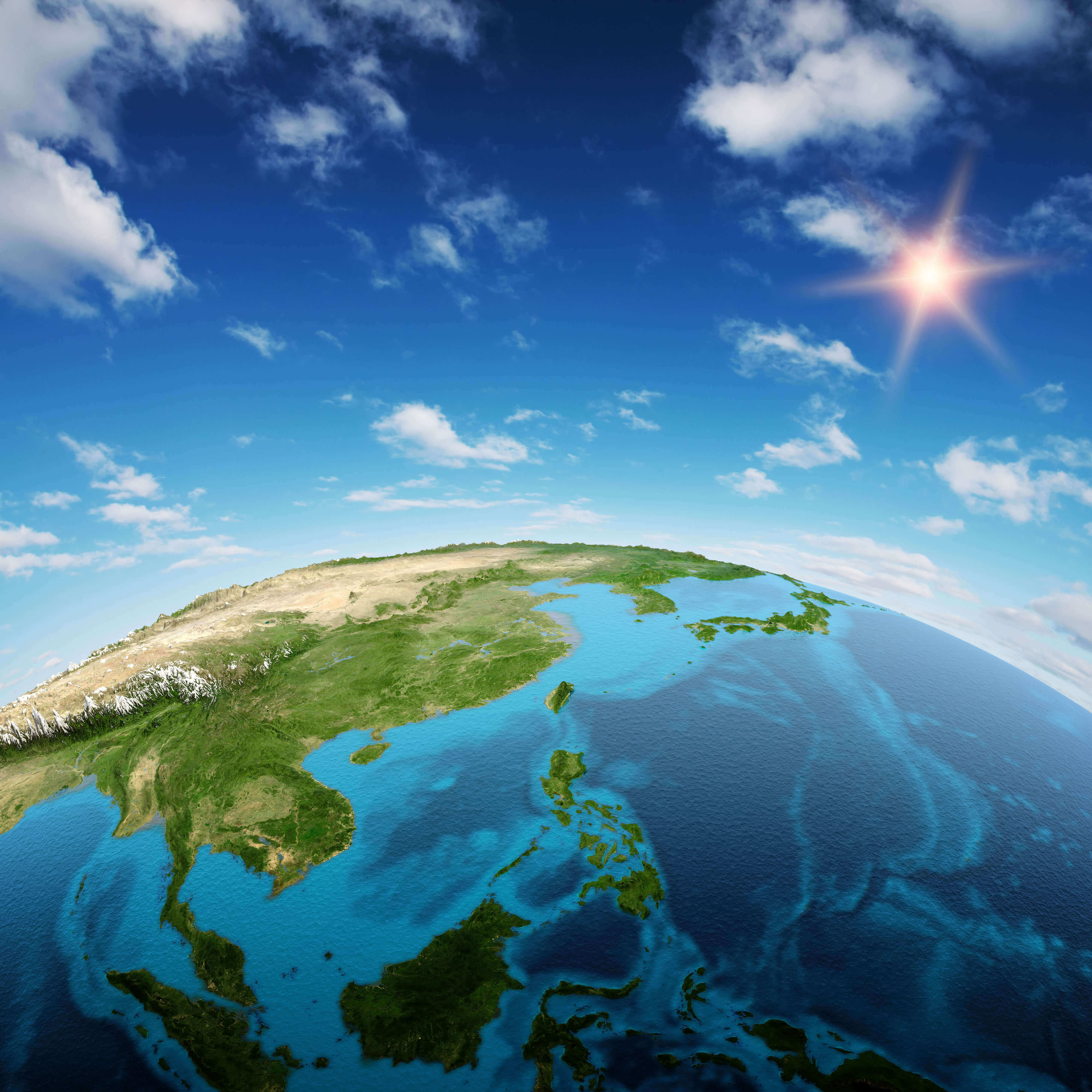
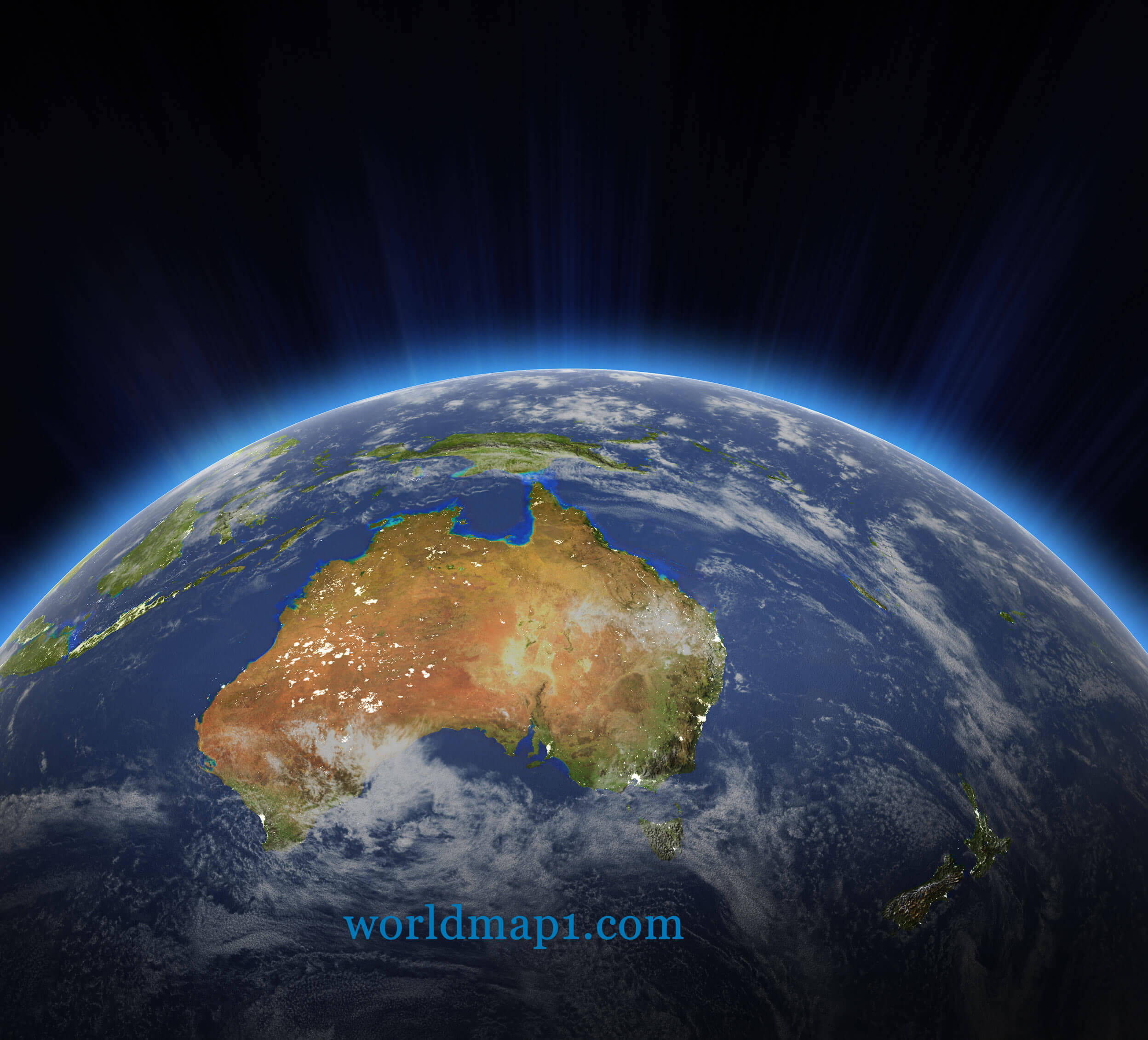
Detailed Oceania Map Earth and Australia
 Planet Earth isolated on black. Detailed picture of the Earth, view of Asian and Australian continent.
Oceania and Blue Political World Map
 Vector soft blue gradient political world map.
South-East Asia and Oceania Satellite Image
 South-East Asia and Oceania Countries Satellite Image Map.
Australia & Oceania Blue Gradient Map
 Australia and Oceania blue gradient map and navigation icons.
Map of Oceania and Pacific Ocean
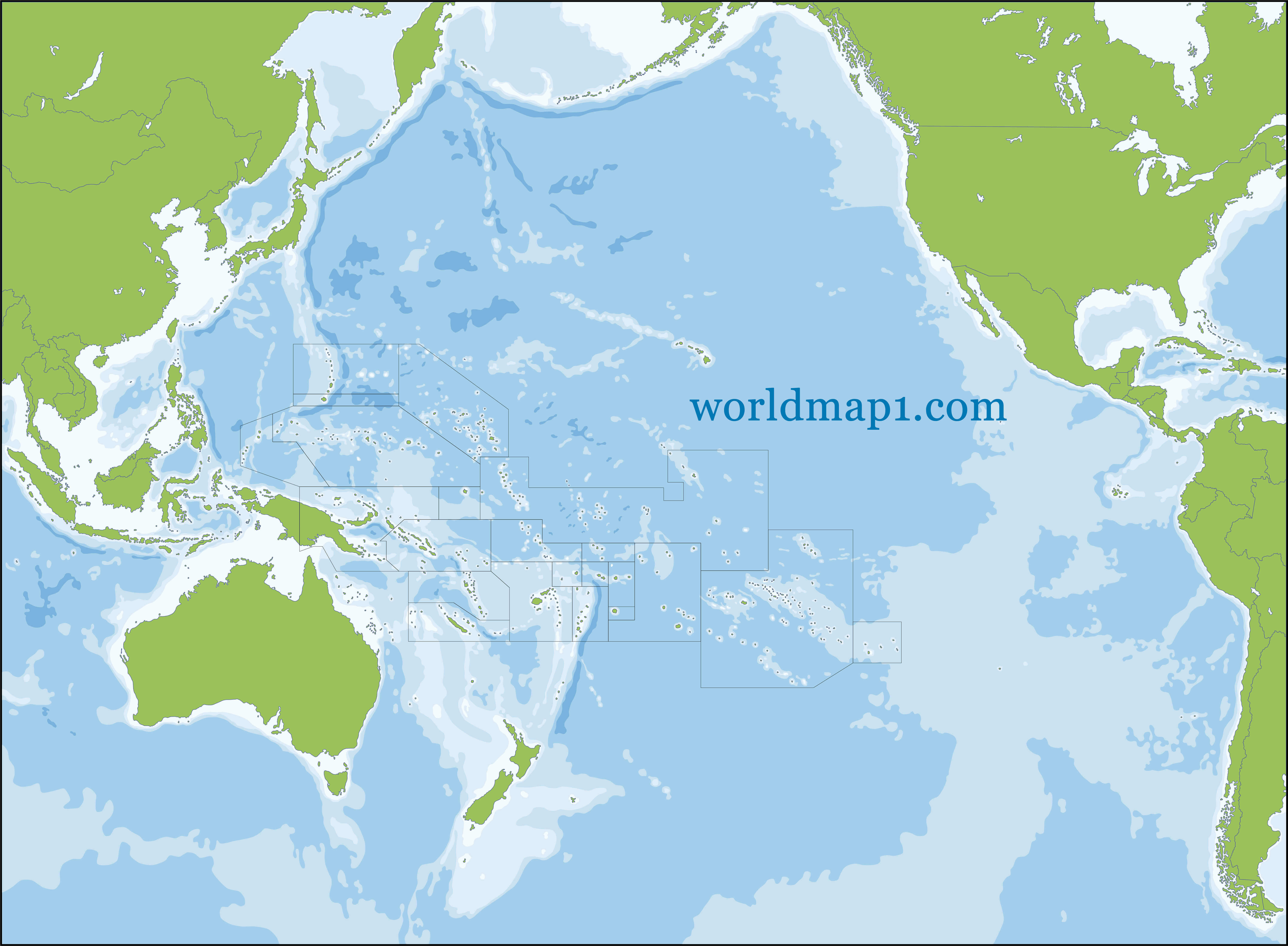 Blank Map of Oceania and Pacific Ocean
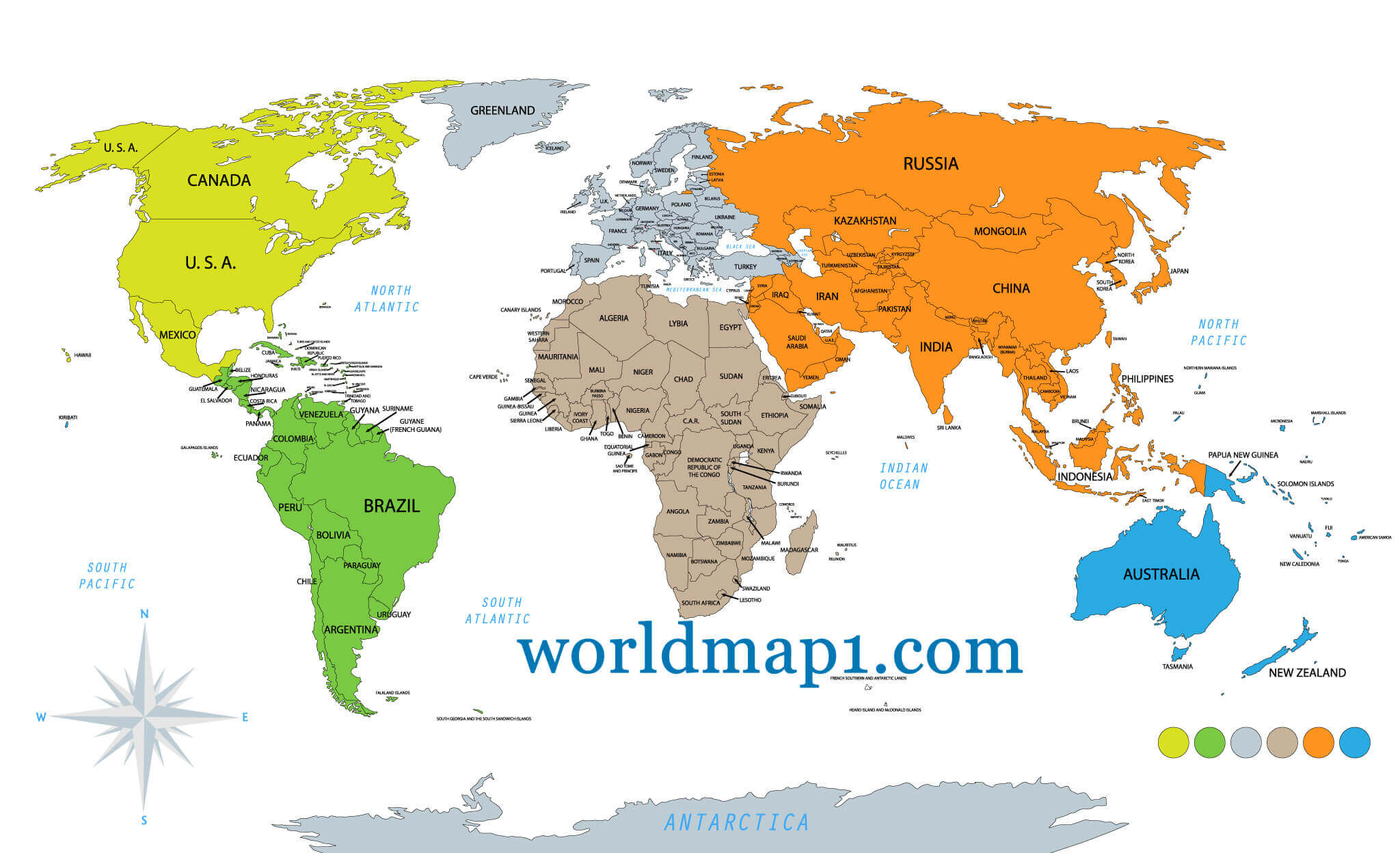
World Map and Oceania Countries
 World Map and Oceania Countries Map
Australia and Oceania Map
Oceania and Physical Map of Australia
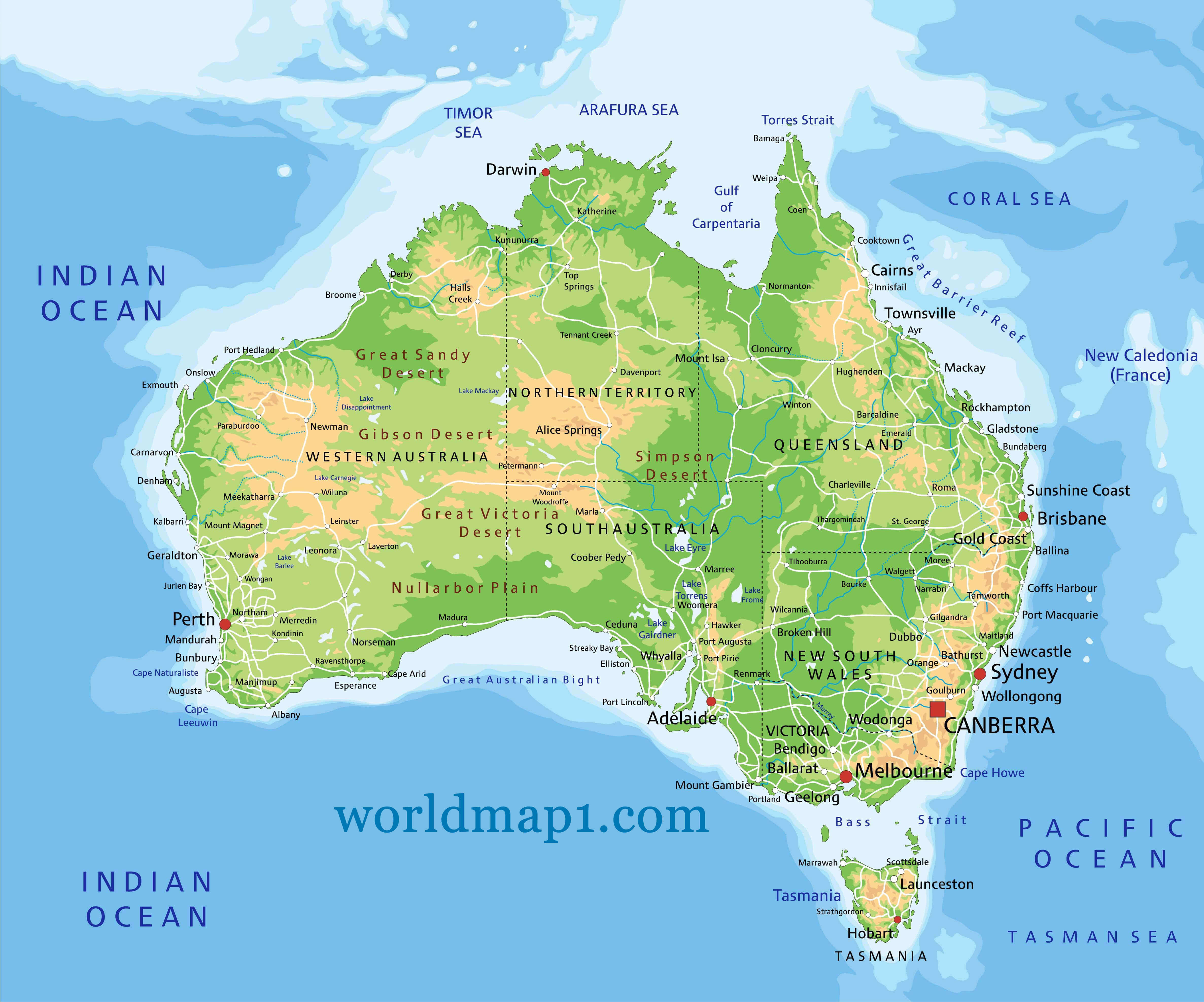 Oceania and Physical Map of Australia, States, Cities, Indian Ocean.
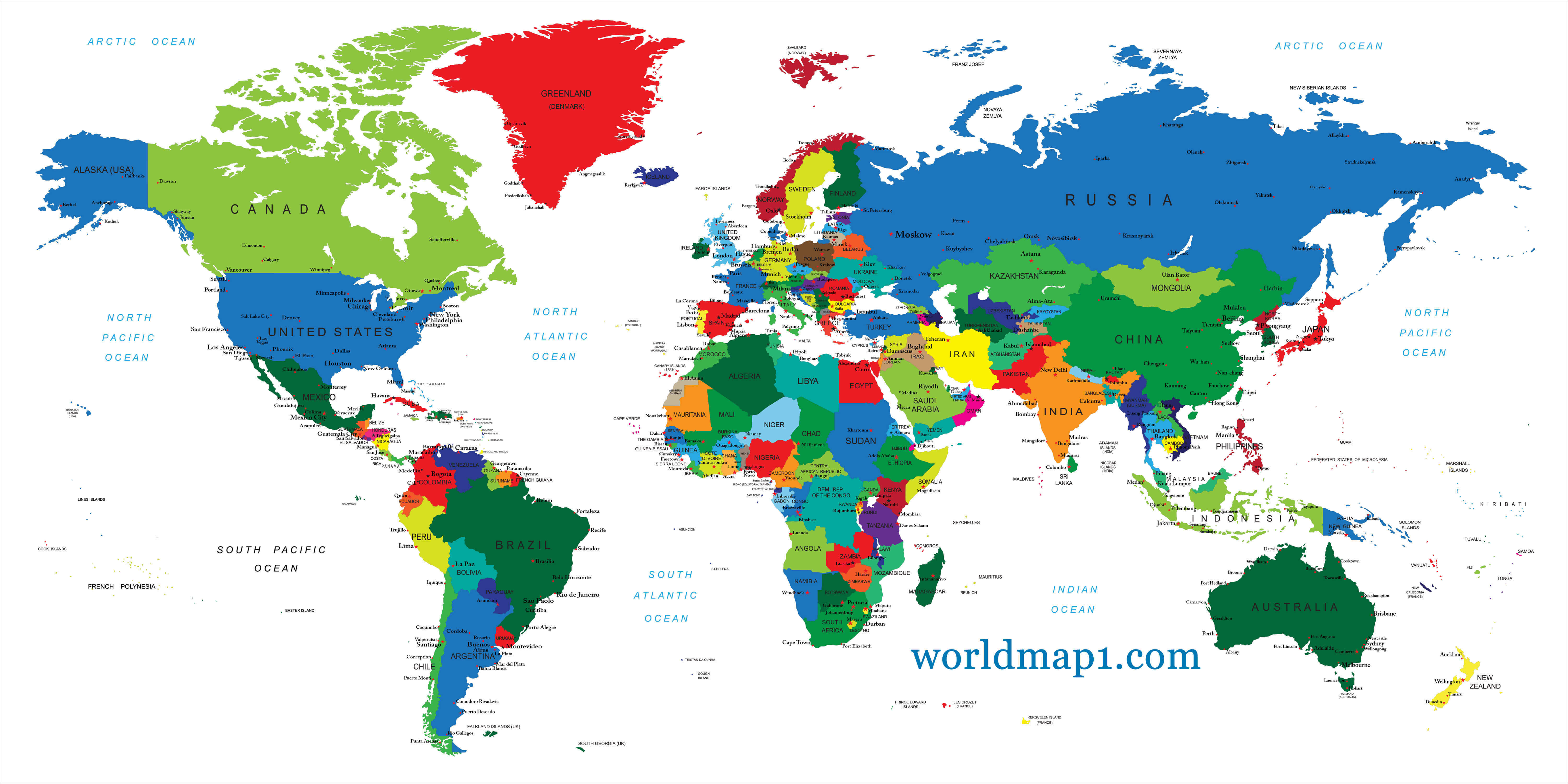
World Countries Map and Oceania
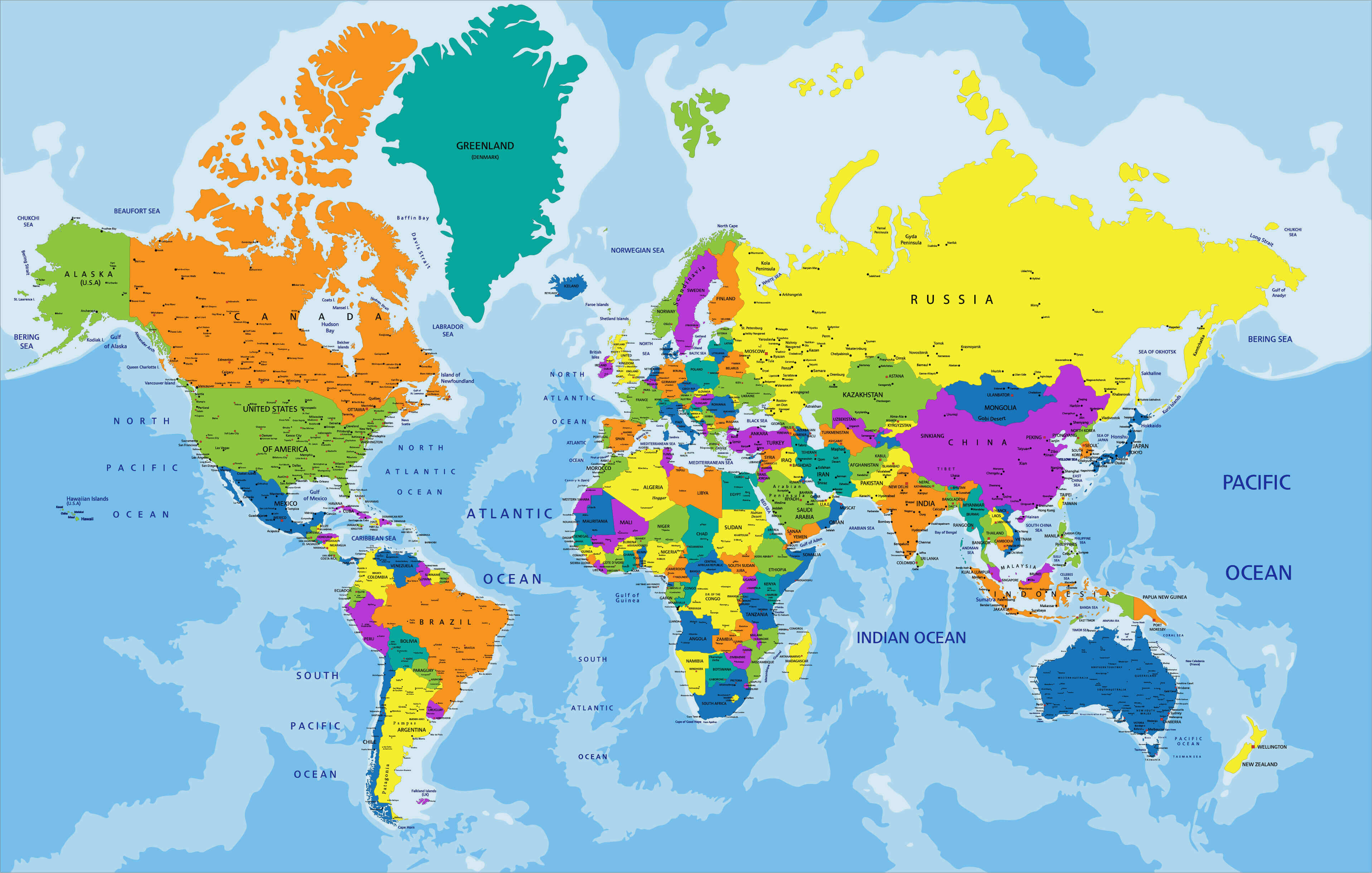 World Countries Political Map and Oceania.
Political Map of Oceania
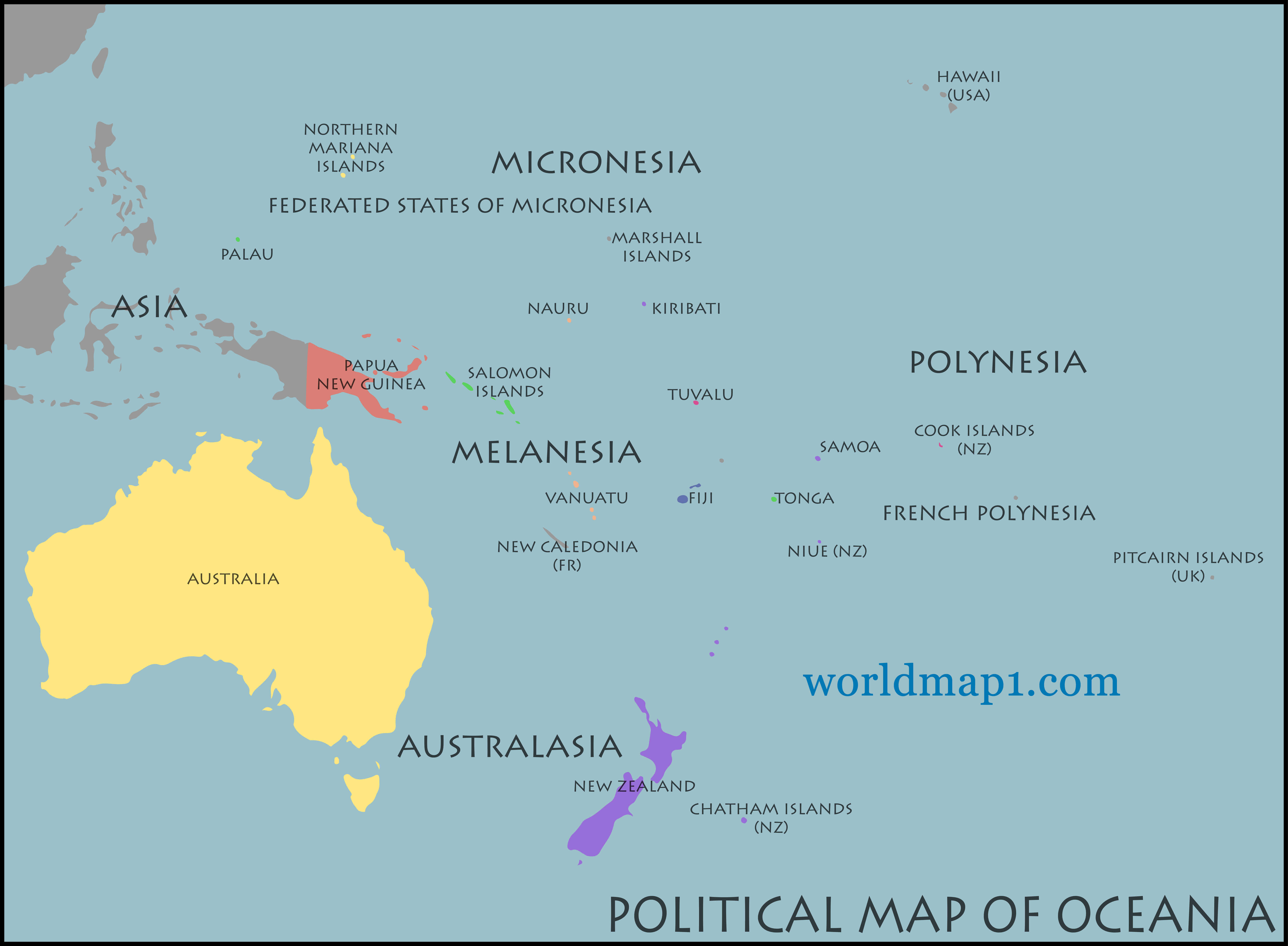 Political Map of Oceania, Australia and New Zealand
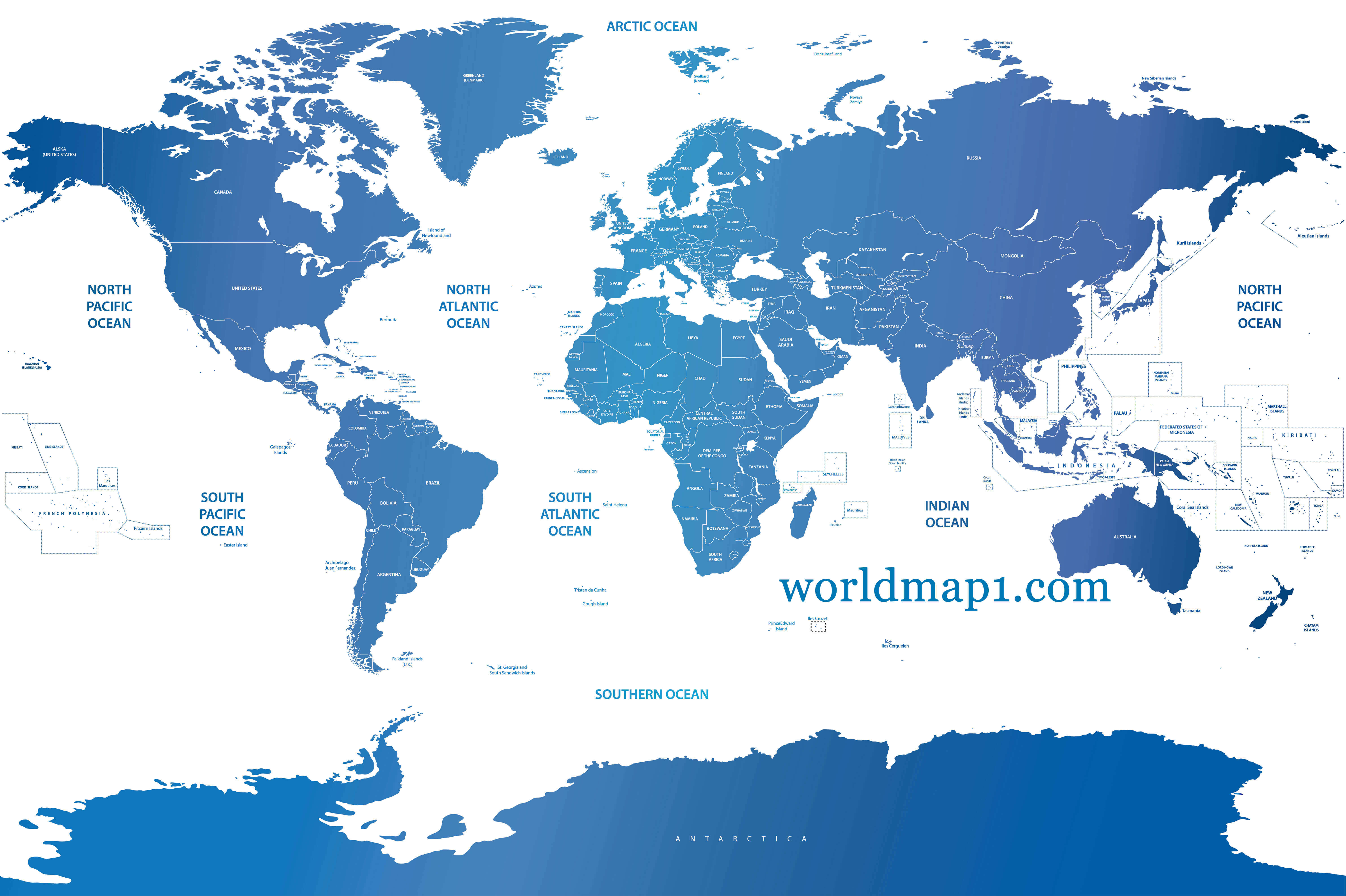
Political World Map and Oceania
 Political world map on white background and colored by continents.
Australia and New Zeland at Night
 Oceania - Australia and New Zeland city lights at night by NASA.
Oceania Country Maps and Australia
 Oceania Country Maps and Australia
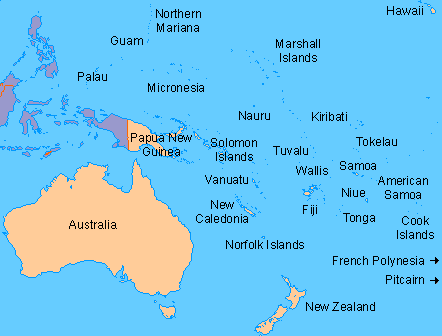
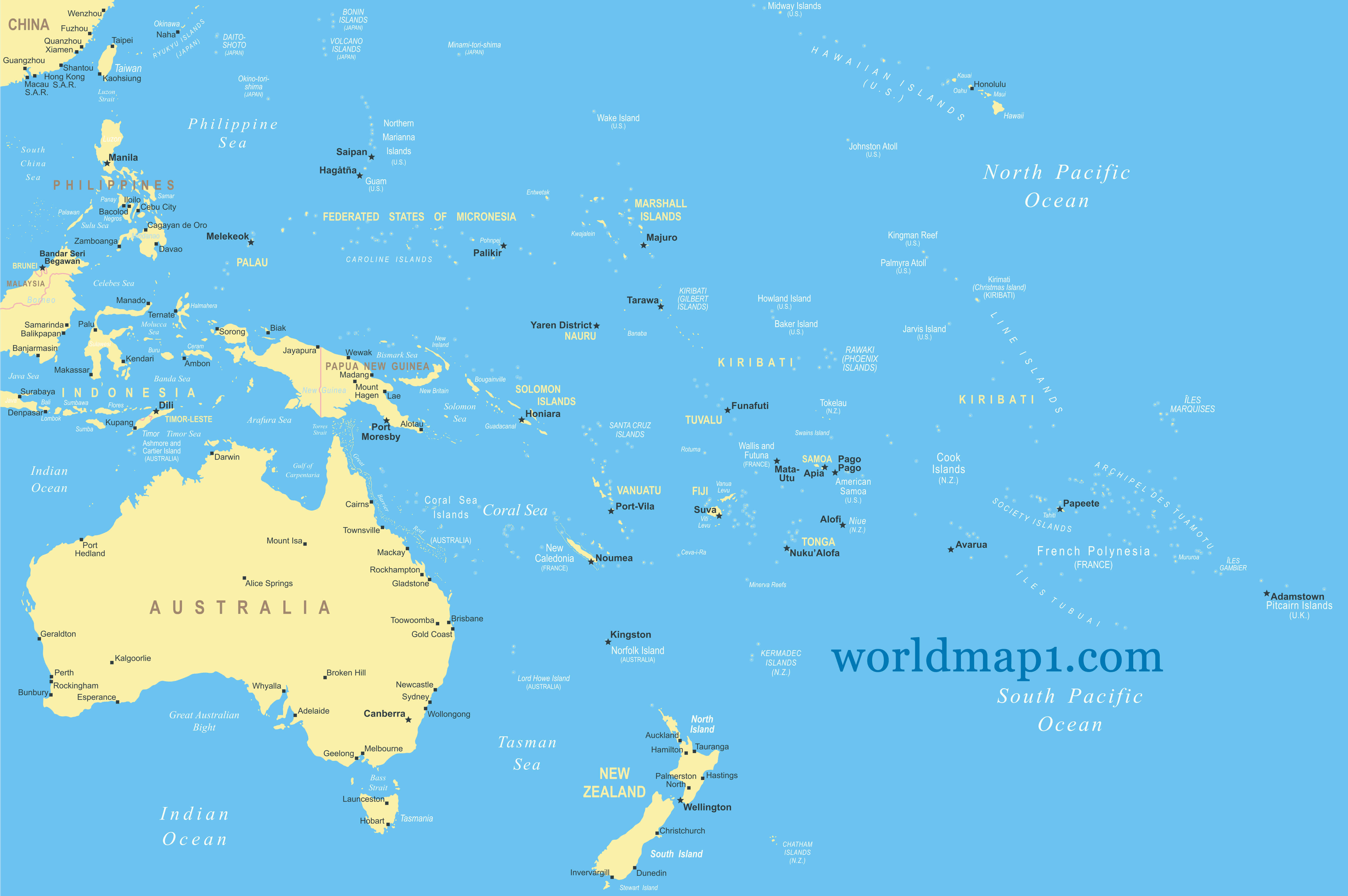
Oceania Map with Countries and Capital Cities.
 Oceania map with countries and capital cities.
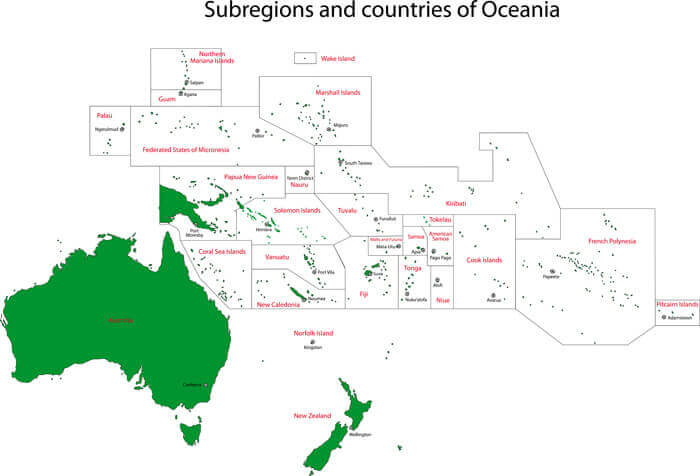
Oceania Countries Map
Fiji Map
French Polynesia Map
Guam Map
Oceania Map
Tokelau Map
Tonga Map
Tuvalu Map
Vanuatu Map
Wallis and Futuna Map
Niue Map
Norfolk Island Map
Northern Mariana Islands Map
Palau Map
Papua New Guinea Map
Pitcairn Islands Map
Samoa Map
Solomon Islands Map
Kiribati Map
Marshall Islands Map
Micronesia Map
Nauru Map
New Caledonia Map
New Zealand Map
American Samoa Map
Antarctica Map
Australia Map
Christmas Island Map
Cook Islands Map
World Top 20 Largest Countries by Population Map
- 1. China Map - 1,439,323,776
- 2. India Map - 1,399,828,108
- 3. United States Map - 333,839,503
- 4. Indonesia Map - 277,749,346
- 5. Pakistan Map - 227,153,261
- 6. Brazil Map - 214,767,569
- 7. Nigeria Map - 213,593,168
- 8. Bangladesh Map - 167,086,674
- 9. Russia Map - 146,025,949
- 10. Mexico Map - 130,911,878
- 11. Japan Map - 125,910,309
- 12. Ethiopia Map - 119,117,925
- 13. Philippines Map - 111,711,419
- 14. Egypt Map - 105,152,003
- 15. Vietnam Map - 98,618,321
- 16. Democratic Republic Congo (DRC) Map - 93,531,207
- 17. Turkey Map - 85,664,955
- 18. Iran Map - 85,563,317
- 19. Germany Map - 84,175,561
- 20. Thailand Map - 68,407,231