Marshall Islands Map and Marshall Islands Satellite Images
Explore map of Marshall Islands, Marshall Islands map, cities map of Marshall Islands, satellite images of Marshall Islands, Marshall Islands largest cities maps, political map of Marshall Islands, driving directions, country atlas and traffic map.
Marshall Islands Map FQA
How many cities are in Marshall Islands ?
Marshall Islands has about 2 main urban centers. The largest are: Majuro; Ebeye.What are the major geographical features of Marshall Islands ?
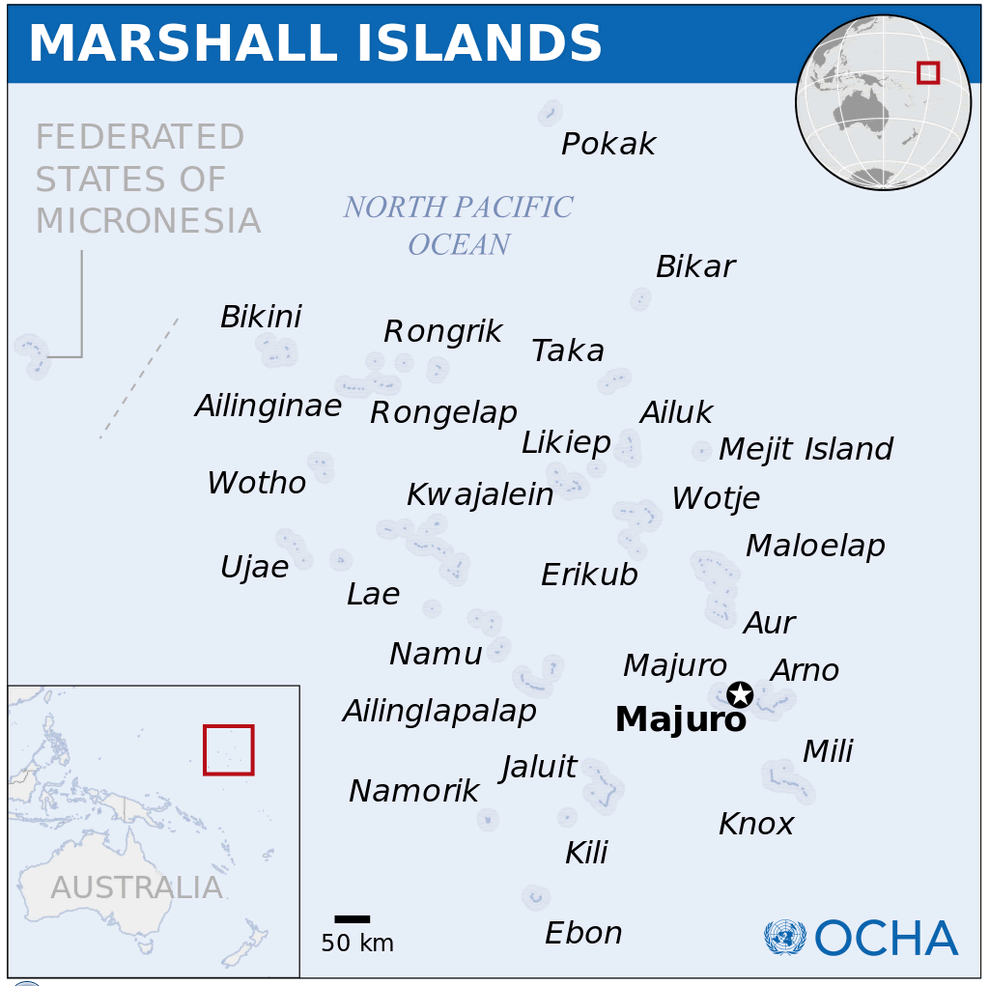
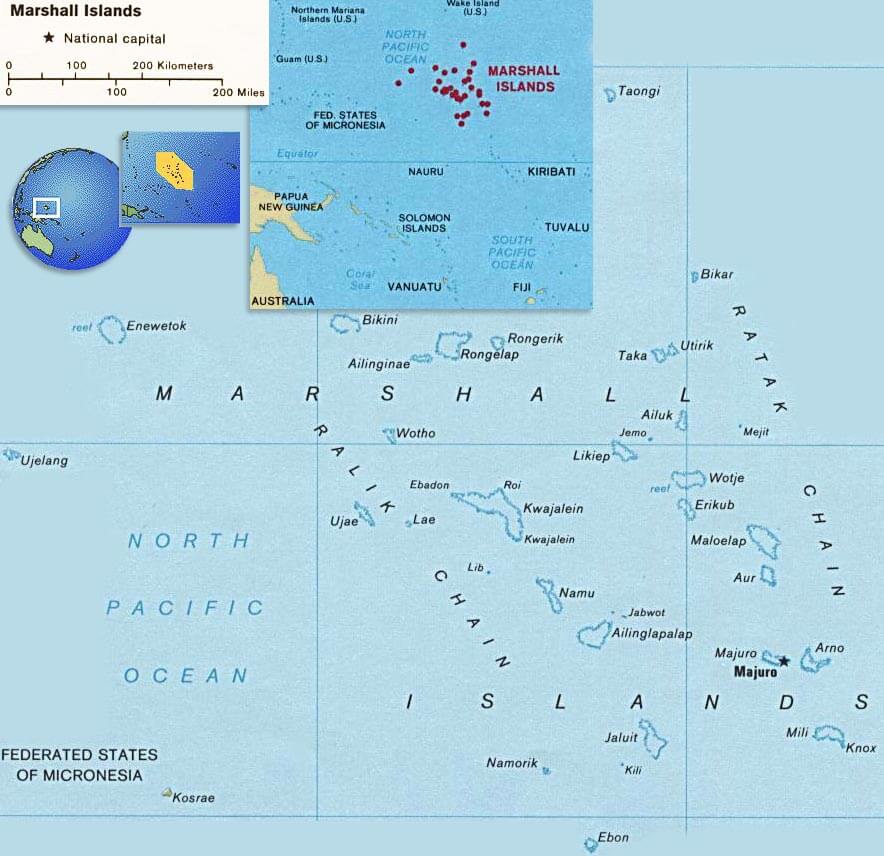
The Marshall Islands in the Pacific Ocean consist of coral atolls and low-lying islands. They have lagoons, reefs, and are highly vulnerable to sea-level rise.WHERE IS MARSHALL ISLANDS IN THE WORLD
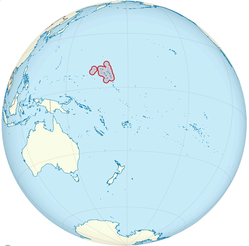
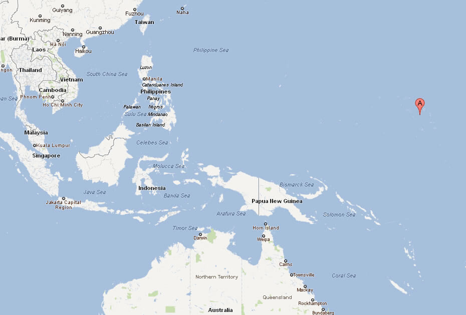
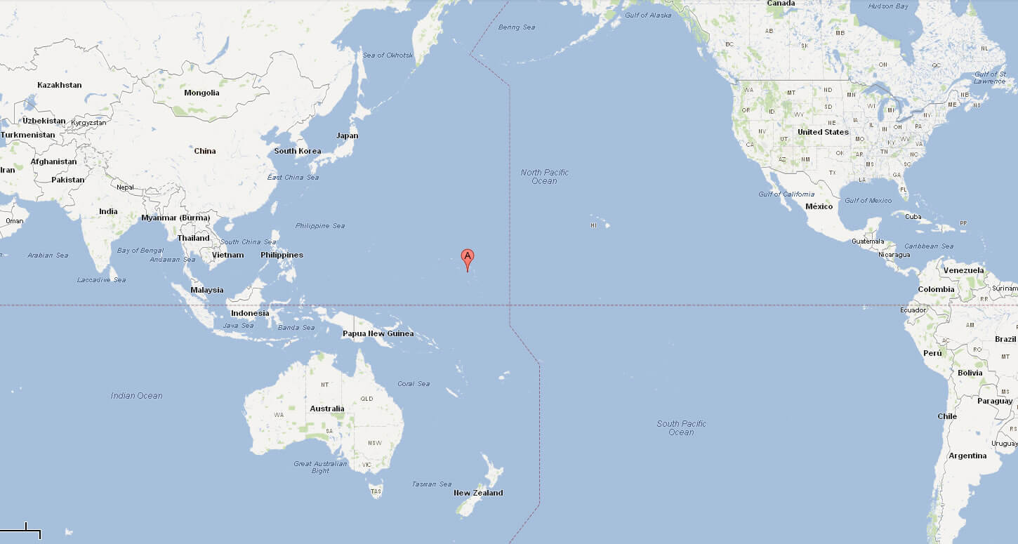
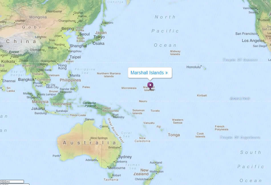
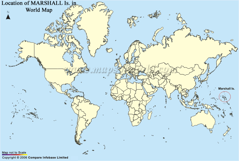
MARSHALL ISLANDS LOCATION MAP
WHERE IS MARSHALL ISLANDS IN THE WORLD
Can I download a high-resolution map of Marshall Islands ?
Yes. Download high-resolution political and physical maps of Marshall Islands for personal or educational use. Redistribution is subject to the terms of our license.
- Capital : Majuro
- Population : 68,000
- GDP : $115 million (220th)
- Per Capita : $2,900 (195th)
- Calling Code : +692
- Jobless Rate : N/A
- Time Zone : +12
For more about Marshall Islands >>
A Collection of Marshall Islands Maps and Marshall Islands Satellite Images
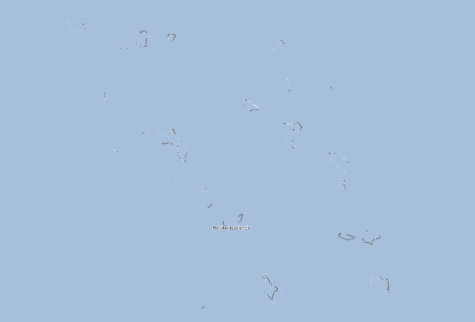
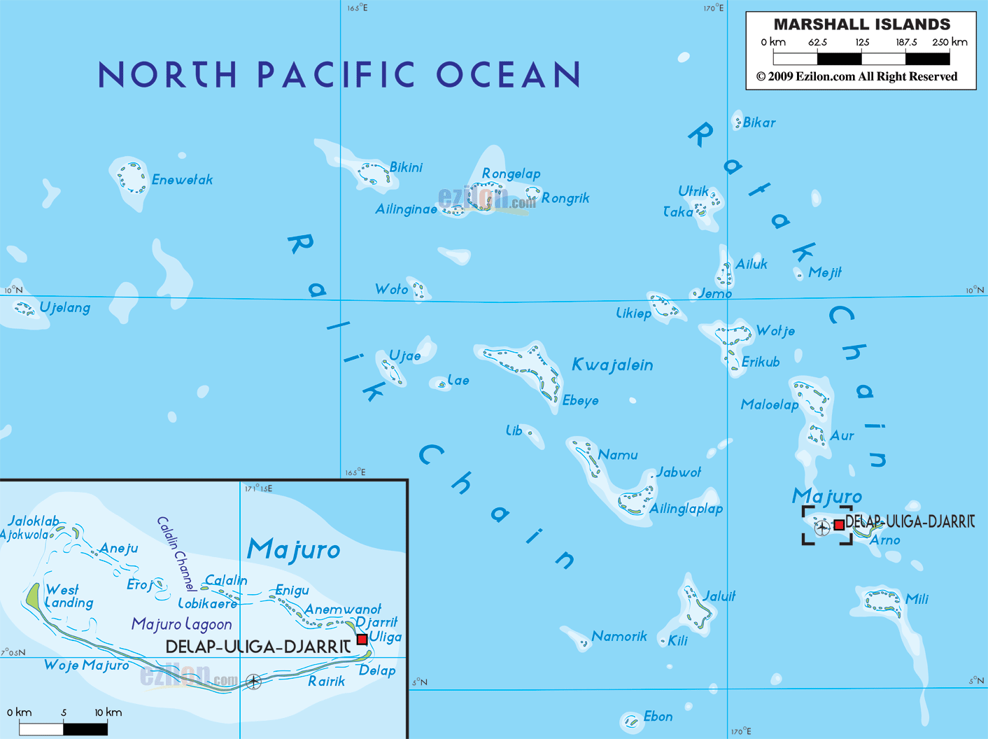
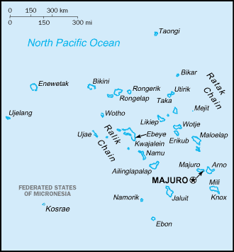
MAP OF MARSHALL ISLANDS

MARSHALL ISLANDS LOCATION MAP
WHERE IS MARSHALL ISLANDS IN THE WORLD
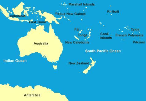
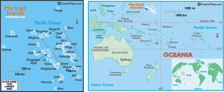
MAP OF MARSHALL ISLANDS OCEANIA AUSTRALIA
MAP OF MARSHALL ISLANDS WORLD
MAP OF MARSHALL ISLANDS
MARSHALL ISLANDS MAP AUSTRALIA
MARSHALL ISLANDS MAP PACIFIC OCEAN

MARSHALL ISLANDS MAP
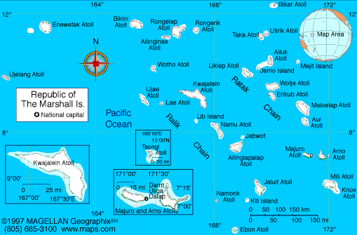
MARSHALL ISLANDS MAP
MARSHALL ISLANDS POLITICAL MAP
MARSHALL ISLANDS MAP WORLD
MARSHALL ISLANDS MAP
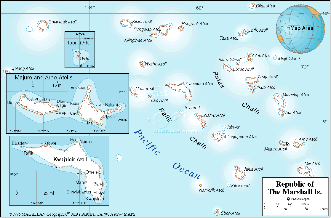
MARSHALL ISLANDS MAP
MARSHALL ISLANDS MAP MAJURO
MARSHALL ISLANDS MAP OCEANIA
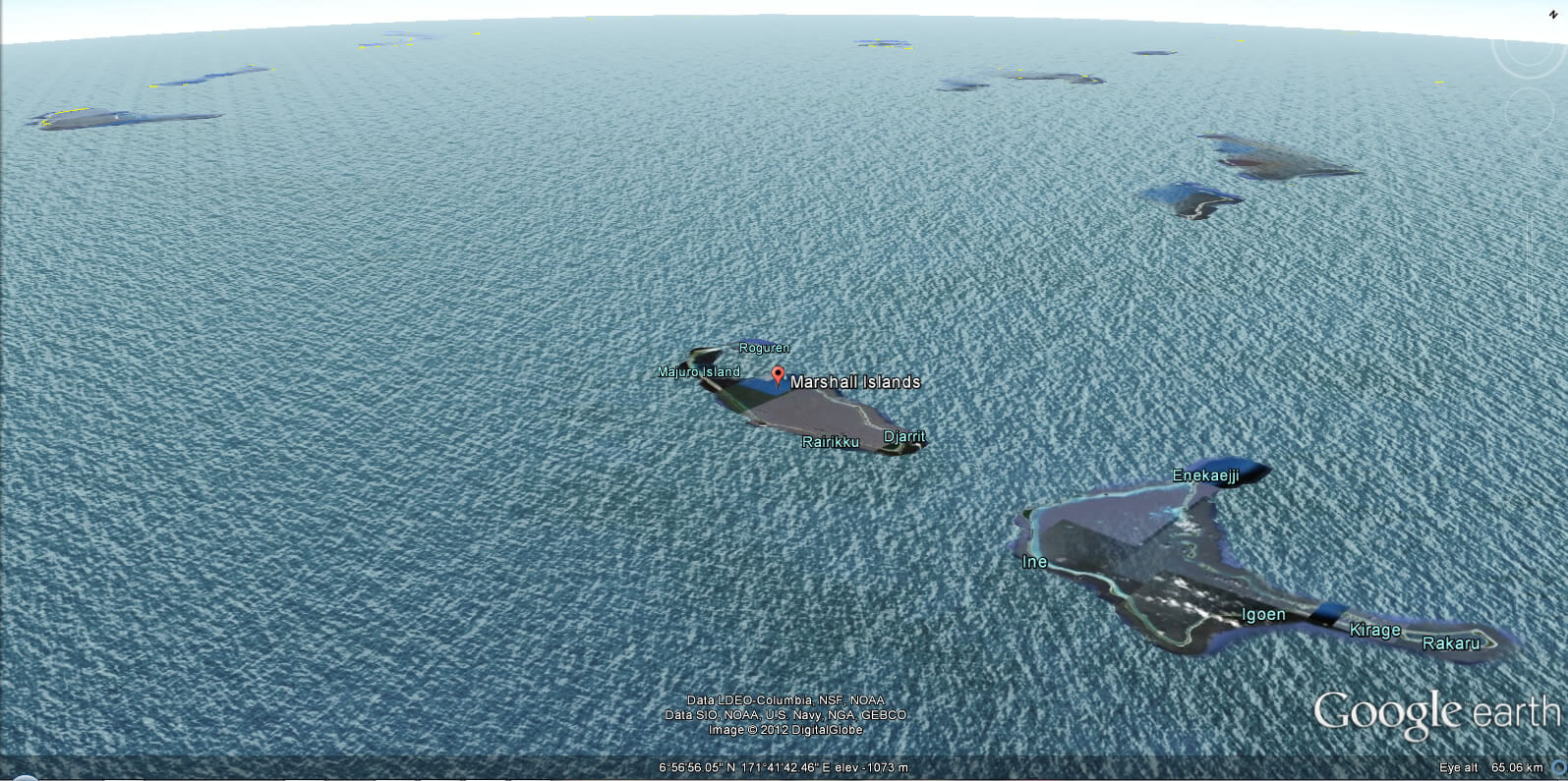
MARSHALL ISLANDS EARTH MAP
Largest Cities' Map of Marshall Islands
Addresse: Hakarinne 2 Espoo, Uusimaa - Finland 02210
Web: istanbul-city-guide.com
Email: [email protected]
Web: istanbul-city-guide.com
Email: [email protected]
Copyright istanbul-city-guide.com - 2004 - 2026. All rights reserved. Privacy Policy | Disclaimer