Navigate France map, satellite images of the France, states, largest cities, political map, capitals and physical maps.

- Capital : Paris
- Population : 65,350,000
- GDP : $2.580 trillion (5th)
- Per Capita : $40,690 (20th)
- Calling Code : +33
- Jobless Rate : 10.30%
- Time Zone : +1
For more about France >>
A Collection of France Maps
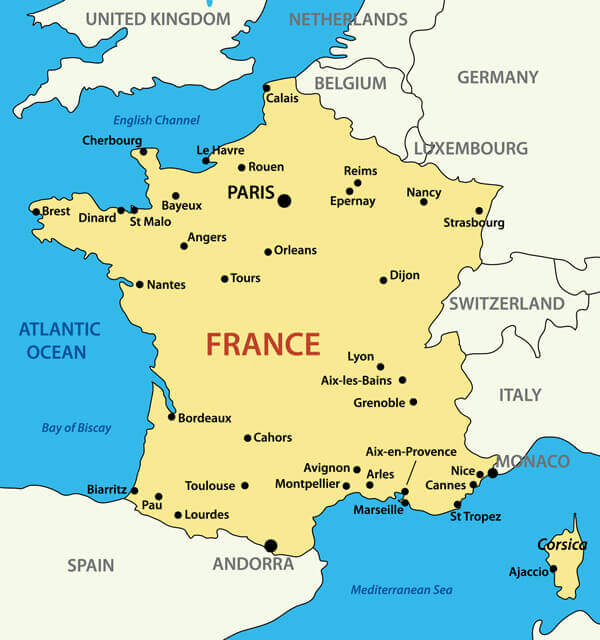
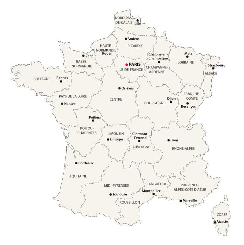
France Political Map with Cities and Regions
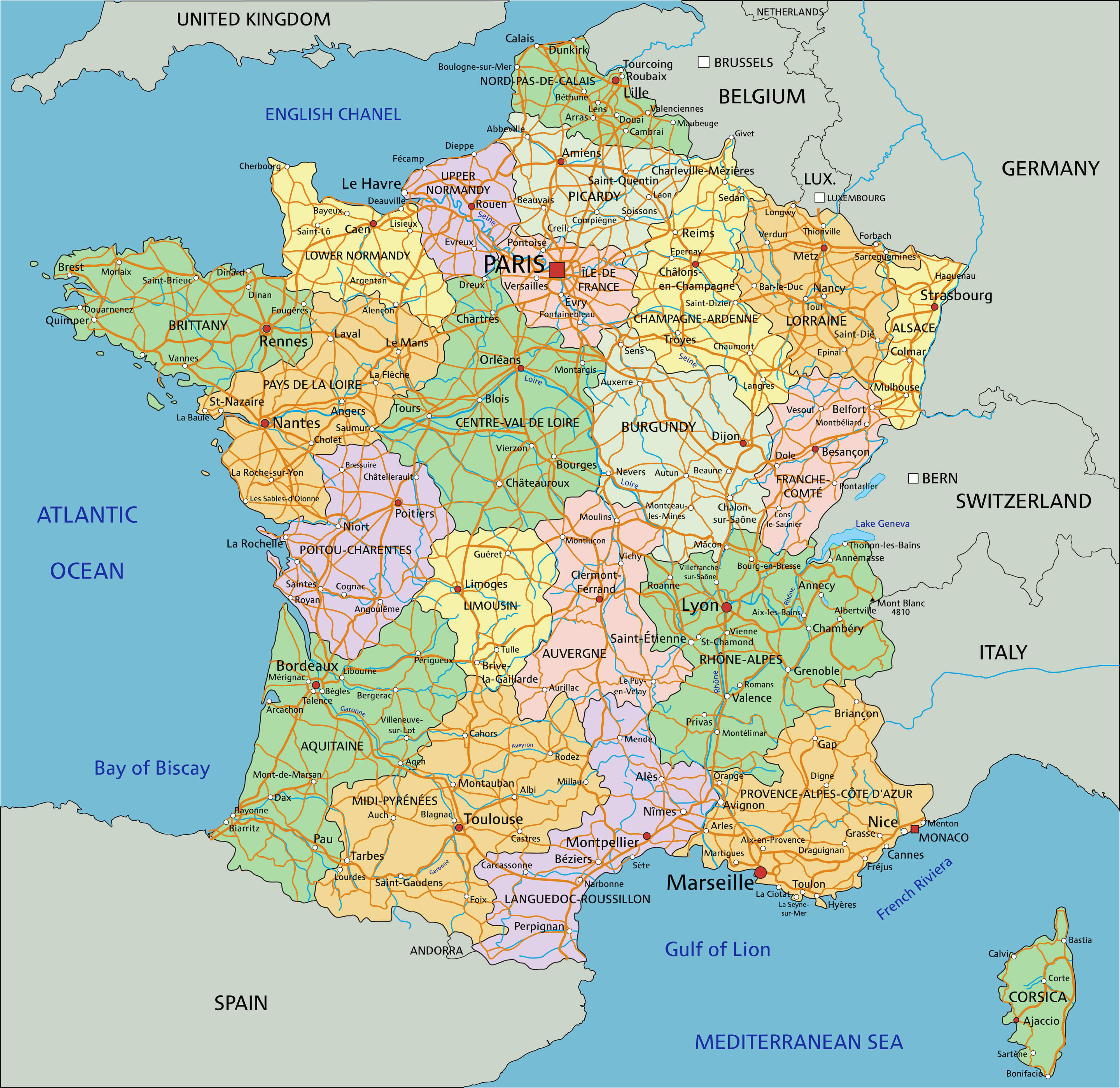 Highly detailed France political map with cities and regions.
France Map with Earth
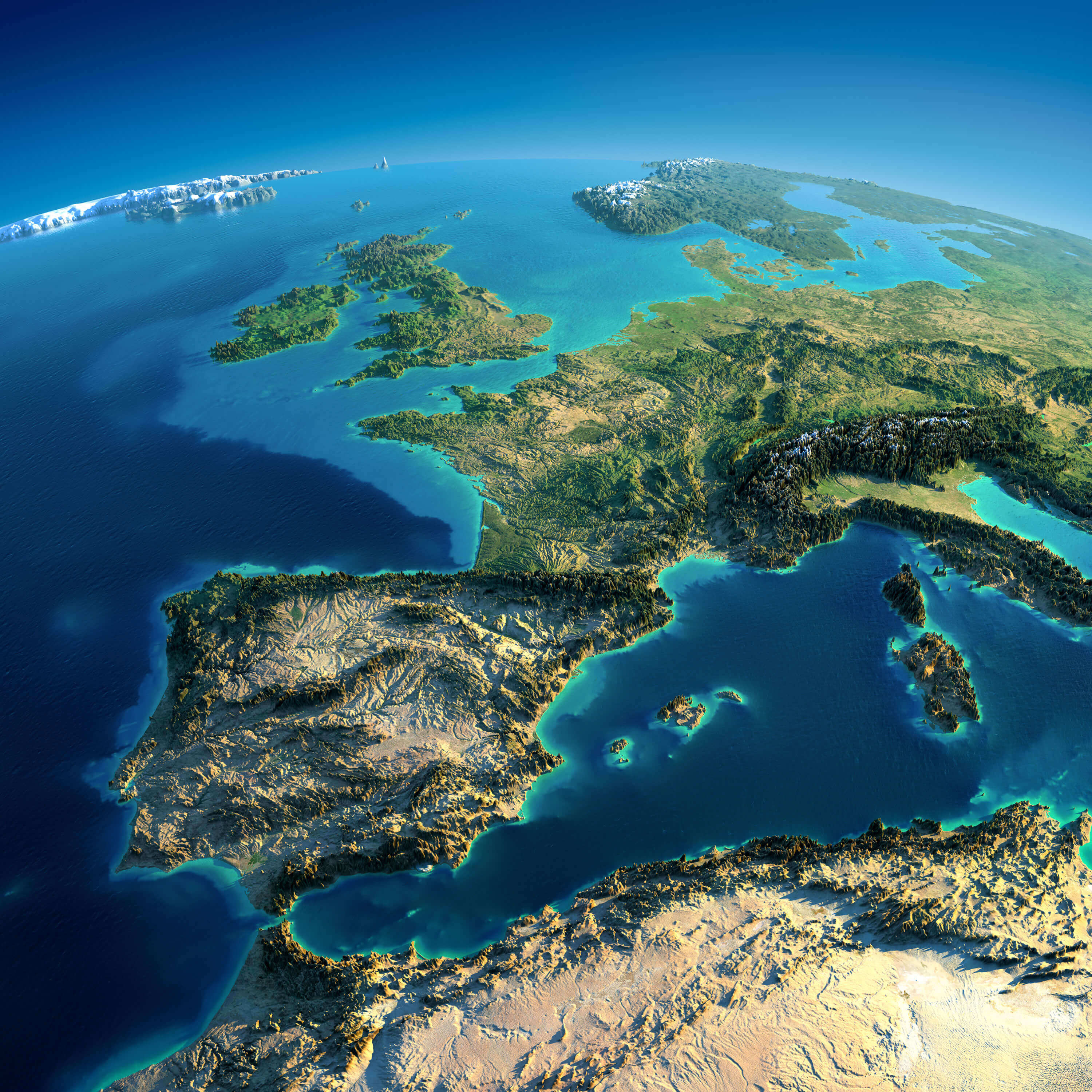 Highly detailed France map with planet Earth. Exaggerated precise relief is illuminated by the rising sun from the east. Part of Europe, Spain, the Mediterranean Sea.
France Relief Map
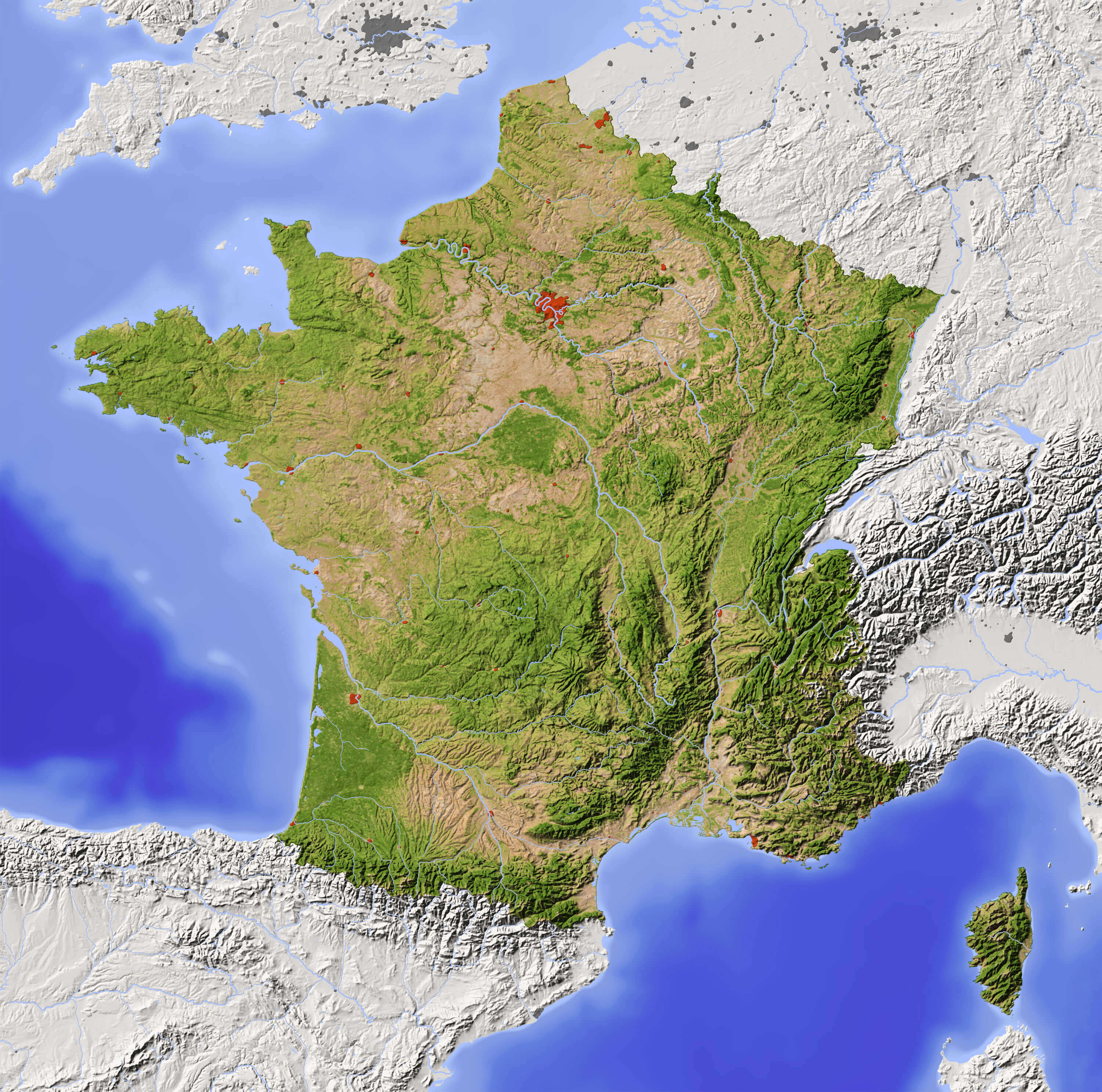 Shaded France Relief Map with major urban areas. Surrounding territory greyed out. Colored according to vegetation. Includes clip path for the state area.
France Road River Map
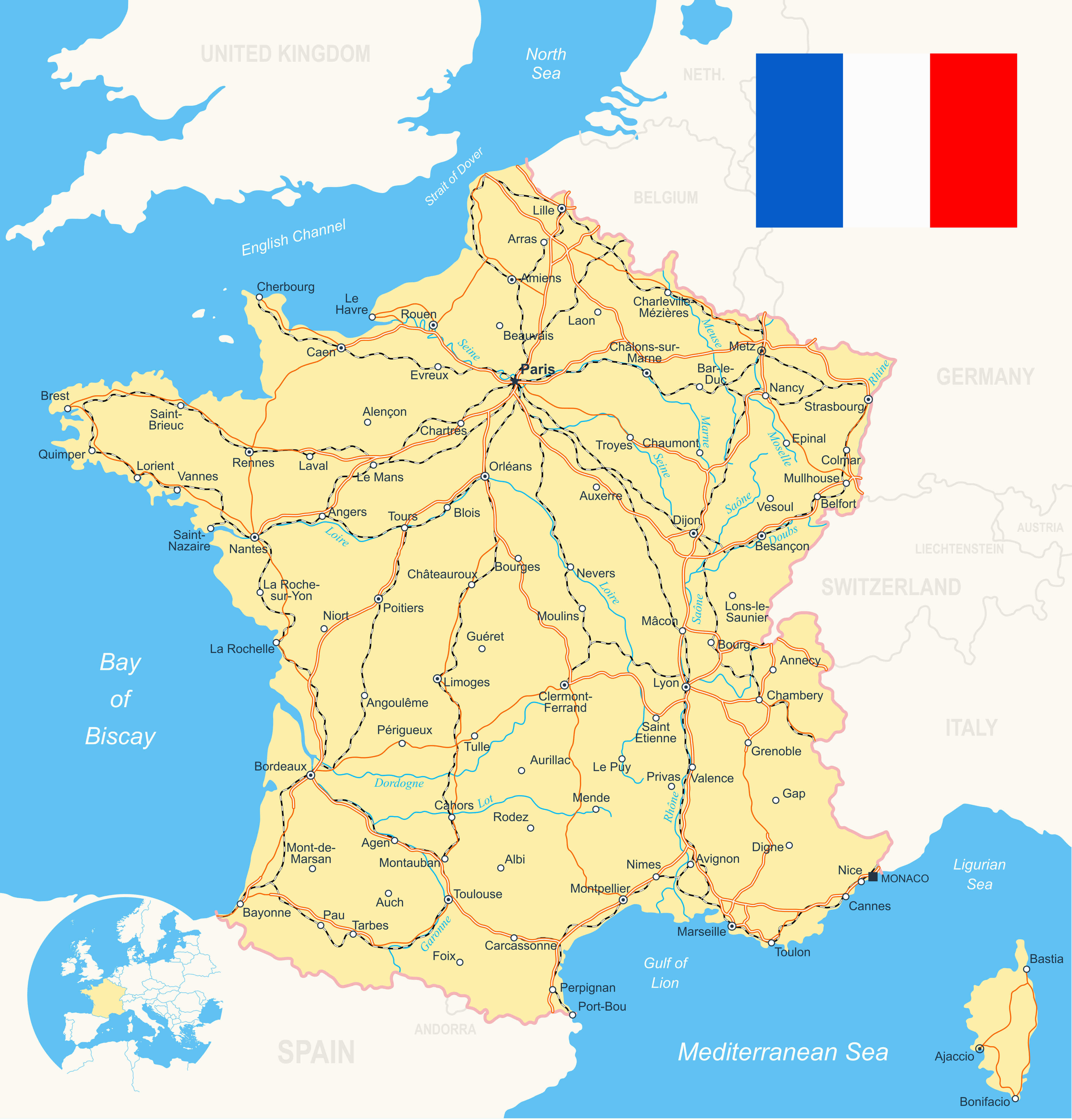 France Road River Map with flag, navigation icons, roads, rivers, land contours - country and land names - city names - water object names, roads - railways - rivers.
Map of France with Major Cities and Rivers
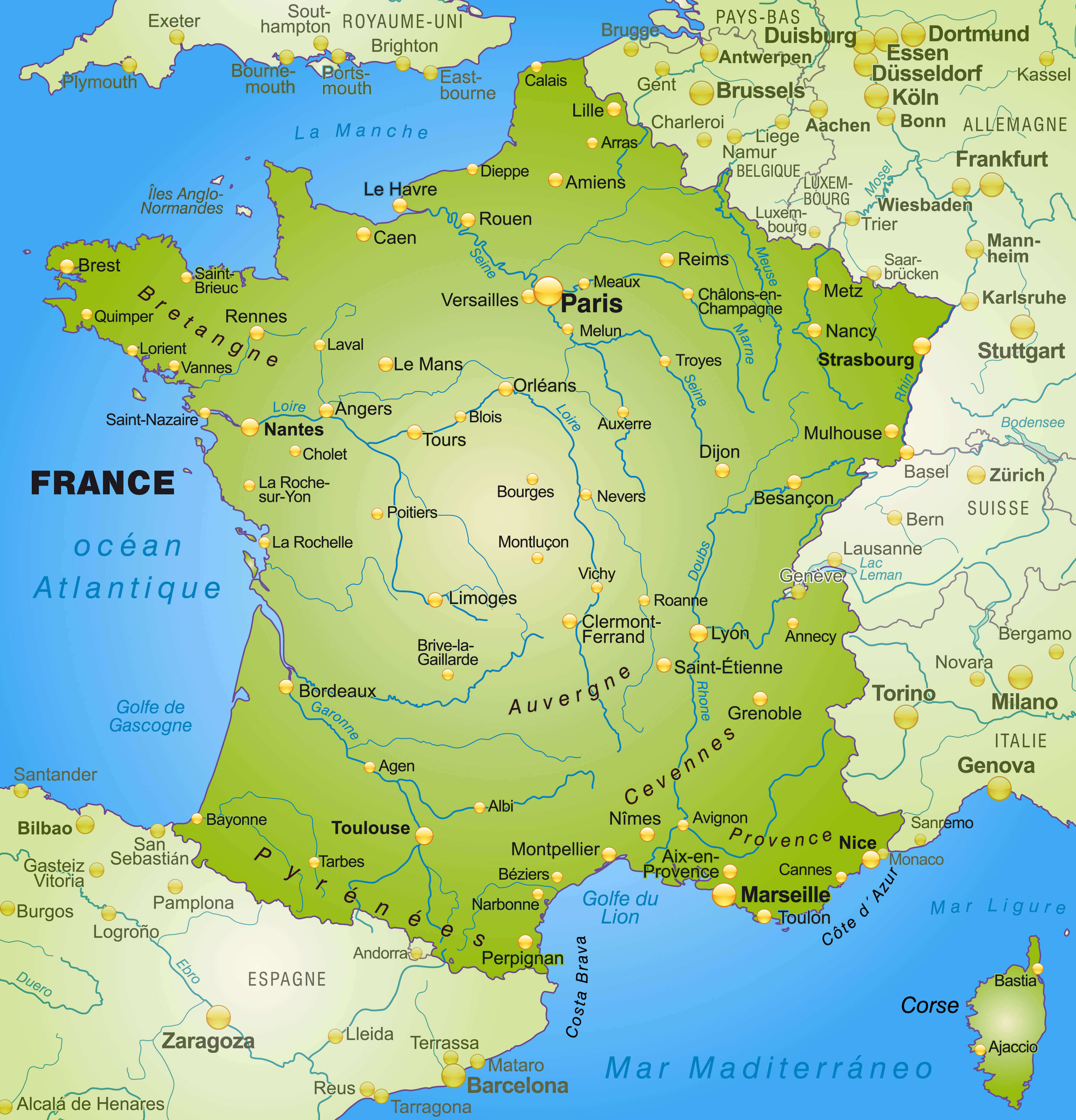 Map of France as an overview map in green, major cities and rivers.
France Travel Map
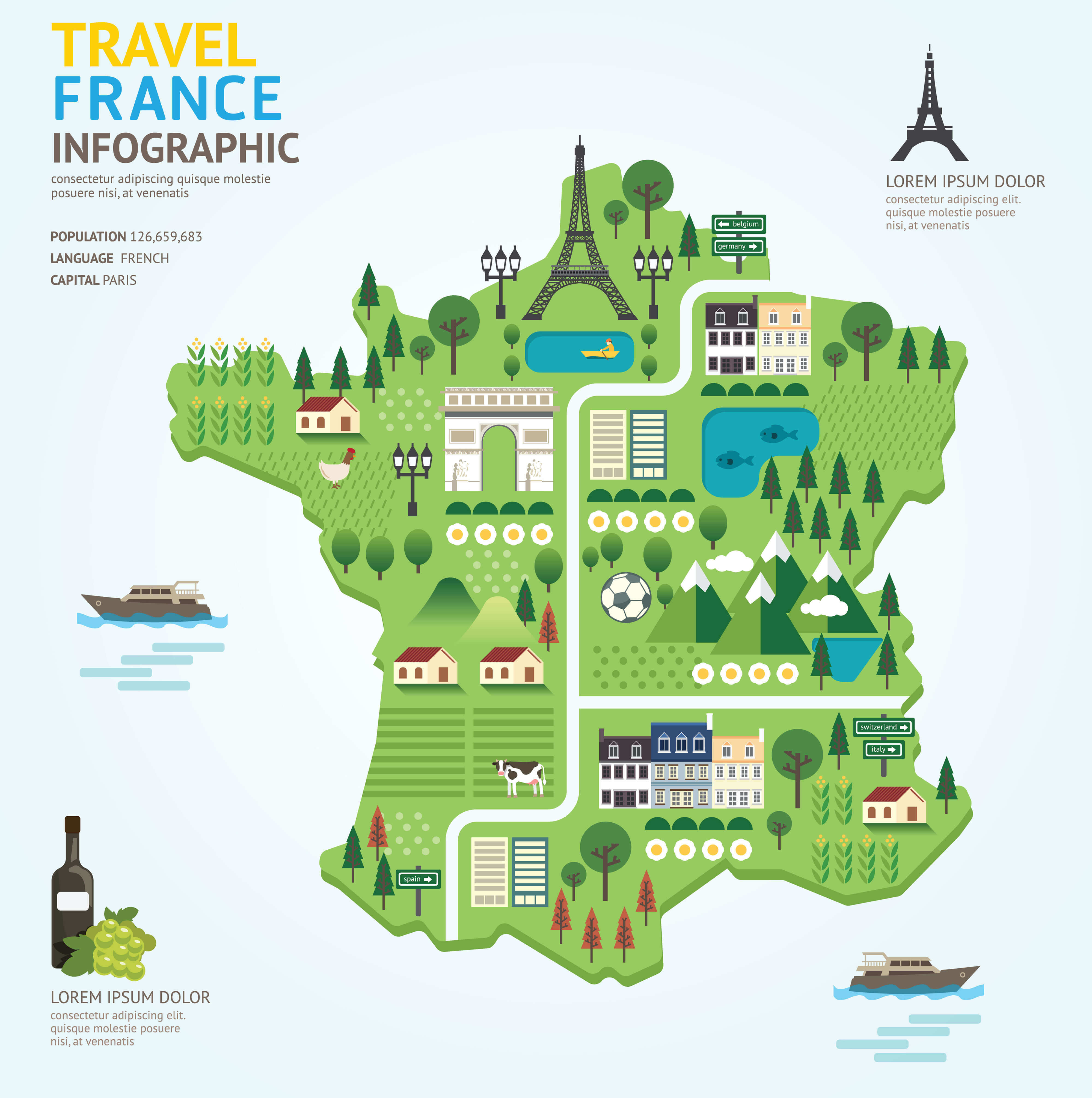 Infographic travel and landmark france map shape template design. France country navigator concept vector illustration / graphic.
France Cities Map
 France Cities Map - vector illustration.
Colorful France Map with Regions
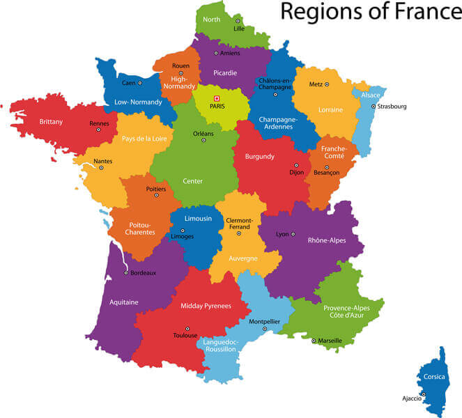 Colorful France map with regions and main cities.
France Administrative Map
 France Administrative Map
Largest Cities Map of France
Paris Map - Marseille Map - Lyon Map - Toulouse Map - Nice Map - Nantes Map - Strasbourg Map - Montpellier Map - Bordeaux Map - Rennes Map - Le Havre Map - Reims Map - Lille Map - Saint Etienne Map - Toulon Map - Grenoble Map - Angers Map - Brest Map - Le Mans Map - Dijon Map - Caen Map - Rouen Map - Cholet Map - La Rochelle Map - Castres Map - Beziers Map - Perpignan Map - Amiens Map - Saint Quentin Map - Metz Map - Nancy Map - Colmar Map - Mulhouse Map - Besancon Map - Clermont Ferrand Map - Valence Map - Vienne Map - Calais Map - Antibes Map - Pau Map - Albi Map - Montauban Map - Chambery Map - Annecy Map - Annemasse Map - Cannes Map - Arles Map - Ales Map - Nimes Map - Troyes Map - Thionville Map - Versailles Map - Cergy Map - Orleans Map - Laval Map - Saint Malo Map - Tours Map - Colombes Map - Quimper Map - Asnieres sur Seine Map - Saint Nazaire Map - Blois Map - Poitiers Map - Limoges Map - Niort Map - Bressuire Map - Bourges Map - Charleville Mezieres Map - Frejus Map - Avignon Map - Aix en Provence Map -France Google Map, Street Views, Maps Directions, Satellite Images
istanbul-city-guide.com offers a collection of France map, google map, France atlas, political, physical, satellite view, country infos, cities map and more map of France.