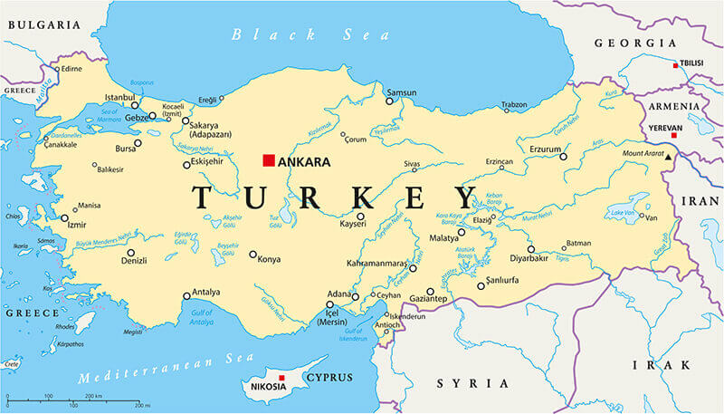
Map Turkey
Navigate Turkey map, satellite images of the Turkey, states, largest cities, political map, capitals and physical maps.
- Capital : Ankara
- Population : 75,627,384
- GDP : $774.336 billion
- Per Capita : $10,362
- Calling Code : +90
- Jobless Rate : 9.30%
- Time Zone : +2
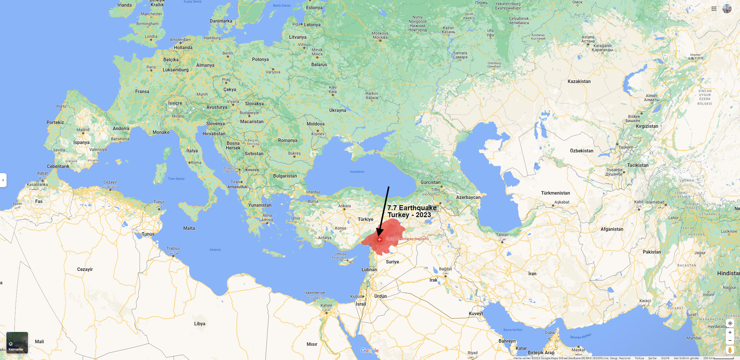
7.8 Magnitude Earthquake Strikes Turkey and Syria
A deadly earthquake with a magnitude of 7.8, according to a U.S. agency, struck Turkey on Monday morning at 4:00 a.m., Feb. 6, 2023.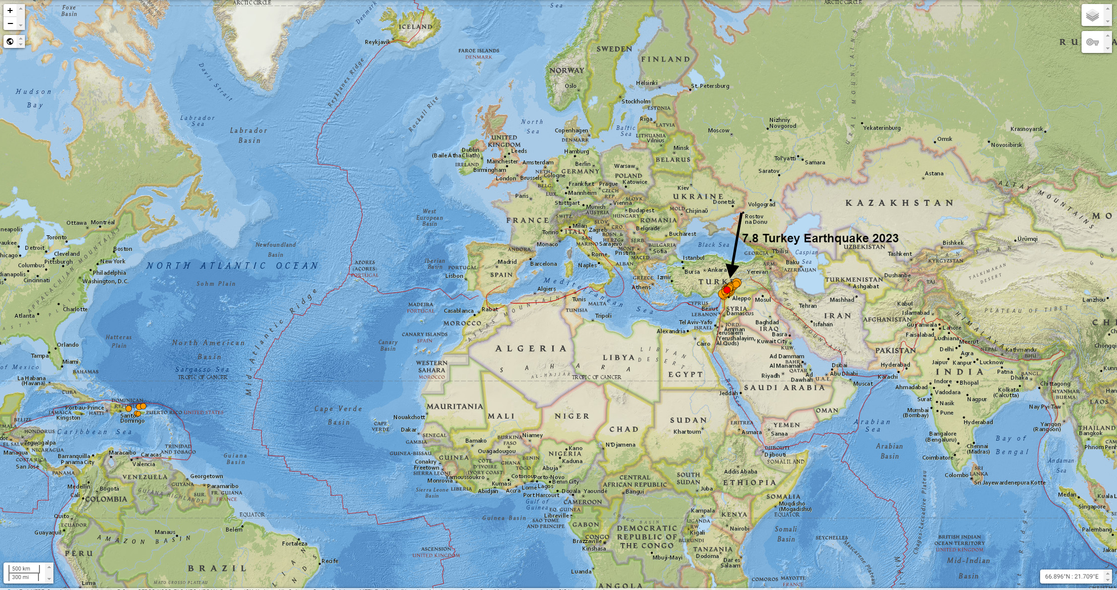
Which Cities Affected by the 2023 Turkey Earthquake
A Collection of Turkey Maps
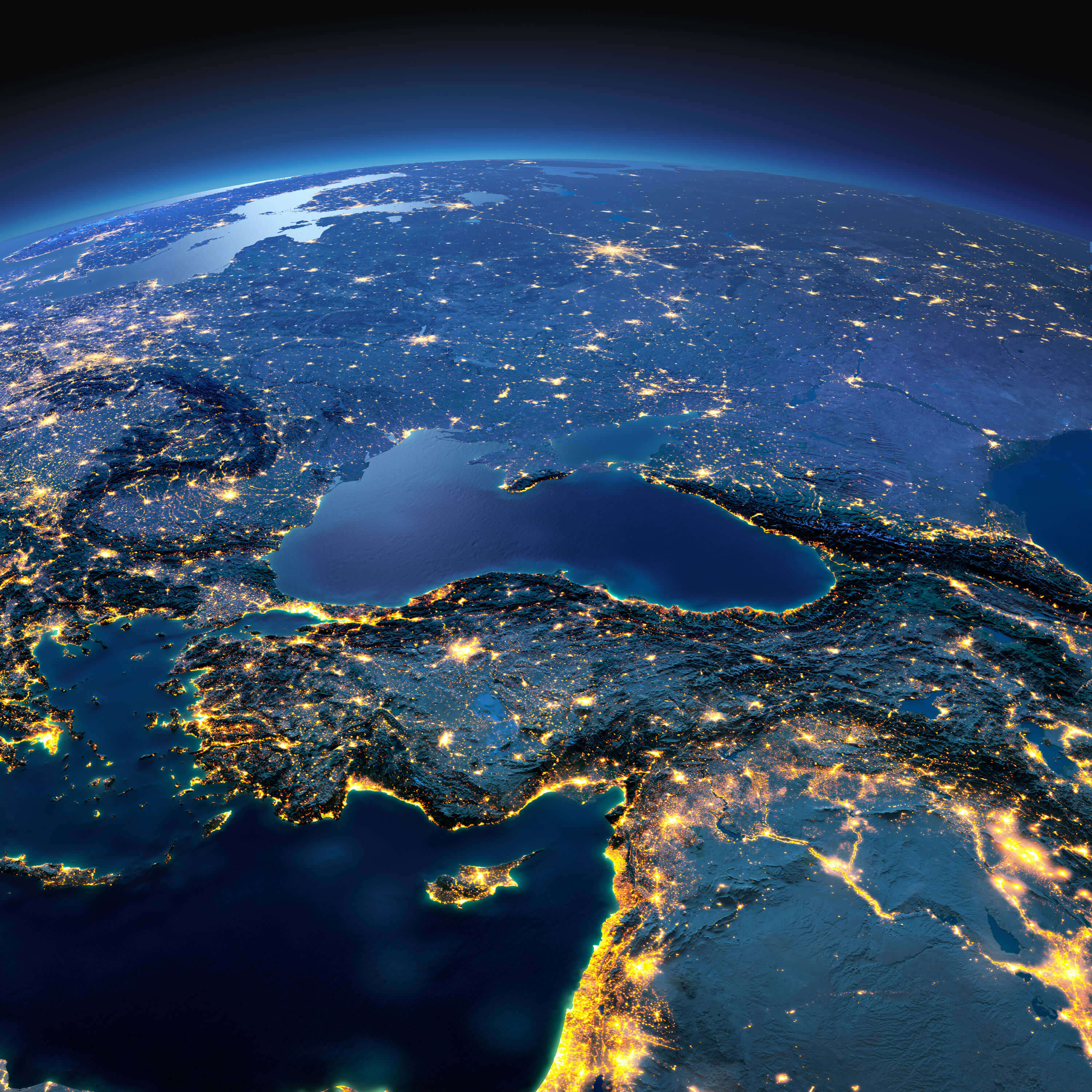
Turkey Satellite Map
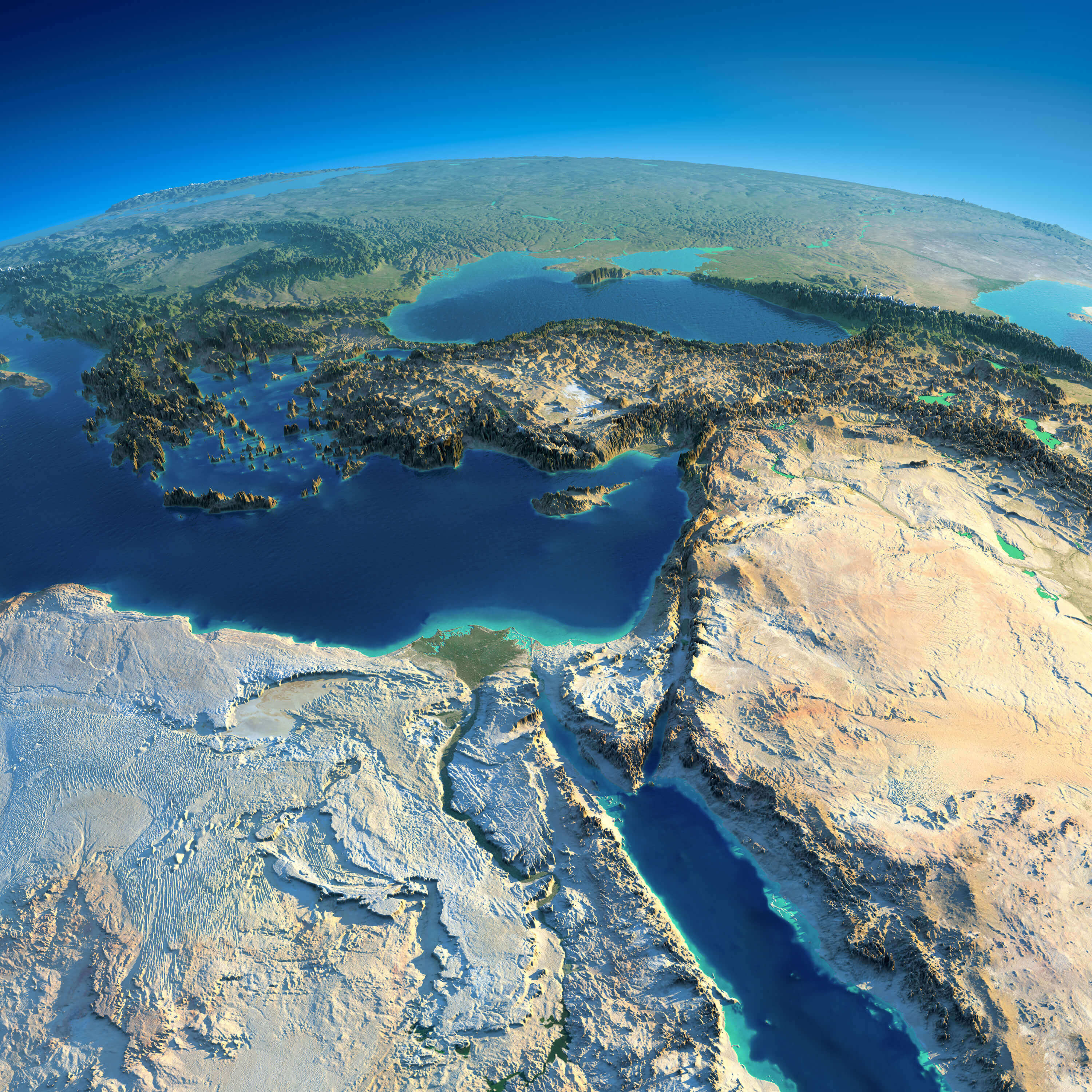 Highly detailed planet Earth and Turkey, Africa and Middle East in the morning. Exaggerated precise relief lit morning sun.
Turkey Administrative Map
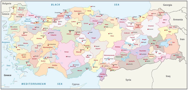 Turkey administrative map with ciites' borders.
Turkey and Middle East Countries Satellite Image
Turkey 7.7 Earthquake 2023 Map
 Here are the 10 largest earthquakes that occurred in Turkey along with their date and estimated loss information:
- August 17, 1999 - Izmit, 7.6 magnitude, approximately 17,000 people killed, 50,000 injured, and hundreds of thousands left homeless.
- November 12, 2020 - Eastern Turkey, 6.8 magnitude, at least 51 people killed, over 1,000 injured.
- March 23, 2010 - Western Turkey, 6.0 magnitude, at least 51 people killed, over 1,000 injured.
- March 3, 1992 - Erzincan, 6.8 magnitude, at least 500 people killed and thousands injured.
- December 27, 1939 - Erzurum, 7.8 magnitude, approximately 30,000 people killed.
- November 1, 1983 - Eastern Turkey, 6.9 magnitude, approximately 1,000 people killed, over 3,000 injured.
- October 20, 2011 - Eastern Turkey, 7.2 magnitude, over 600 people killed, thousands injured.
- August 7, 1999 - Gölcük, 7.4 magnitude, approximately 17,000 people killed and 50,000 injured.
- June 13, 2011 - Van, 7.2 magnitude, over 600 people killed, thousands injured.
- February 5, 1997 - Bolu, 6.3 magnitude, approximately 75 people killed, hundreds injured.
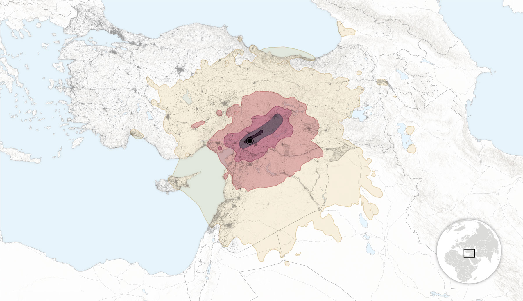
Turkey Earthquake 2023 Map
 Turkey and Middle East countries and night planet Earth with precise detailed relief and city lights illuminated by moonlight.
Photograph of map Syria Jordan and Turkey
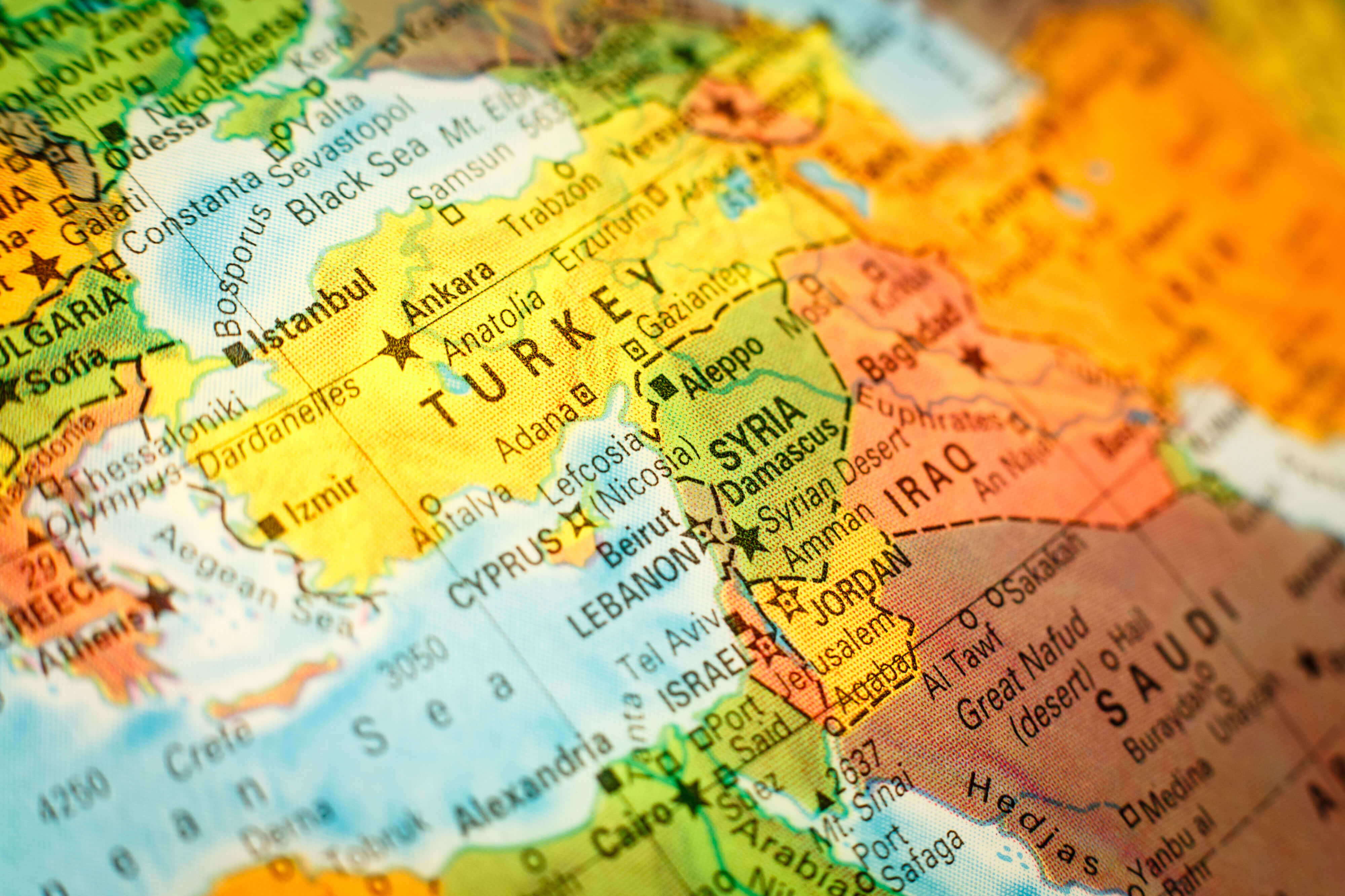 Close-up macro photograph of map Syria Jordan and Turkey. Selective focus on Syria.
Turkey Map with Flag Buttons
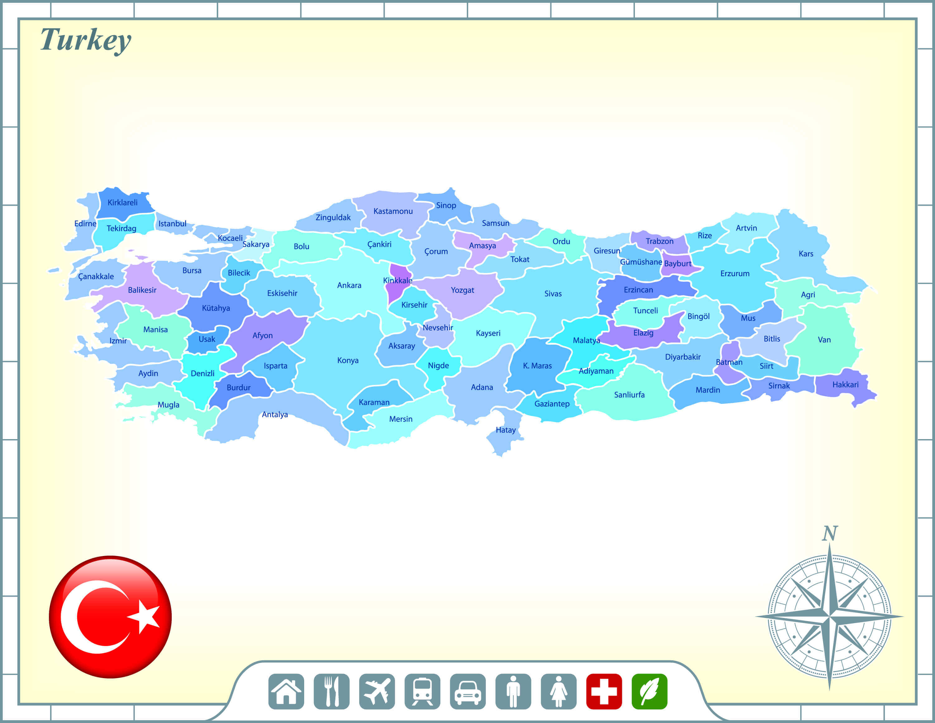 Turkey Map with Flag Buttons and Assistance & Activates Icons Original Illustration.
Turkey Color Map
 Vector map of Turkey country
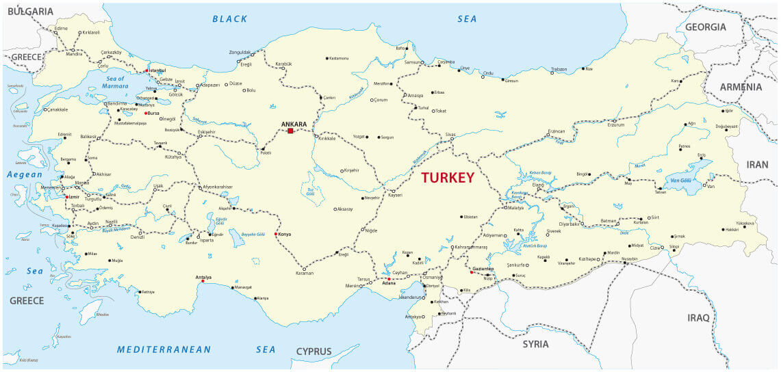
Turkey Road Map
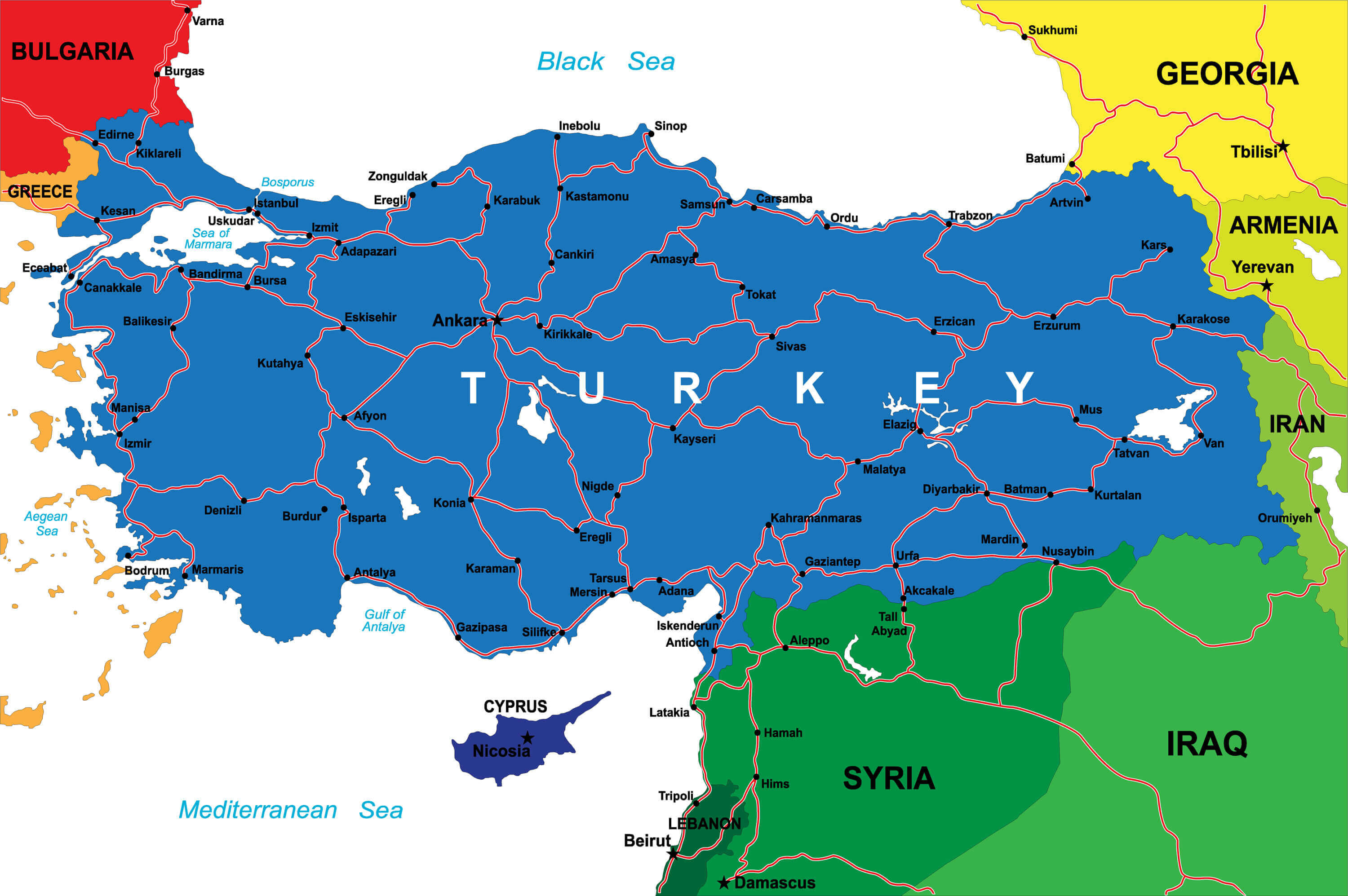 Turkey Road Map with National Borders.
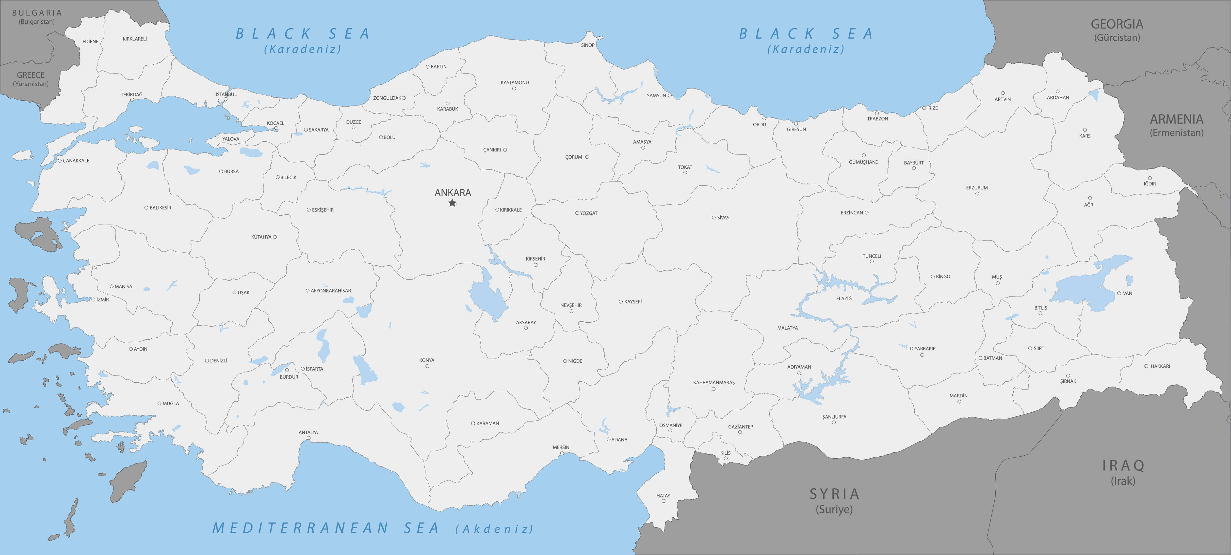
Turkey Main Cities Map
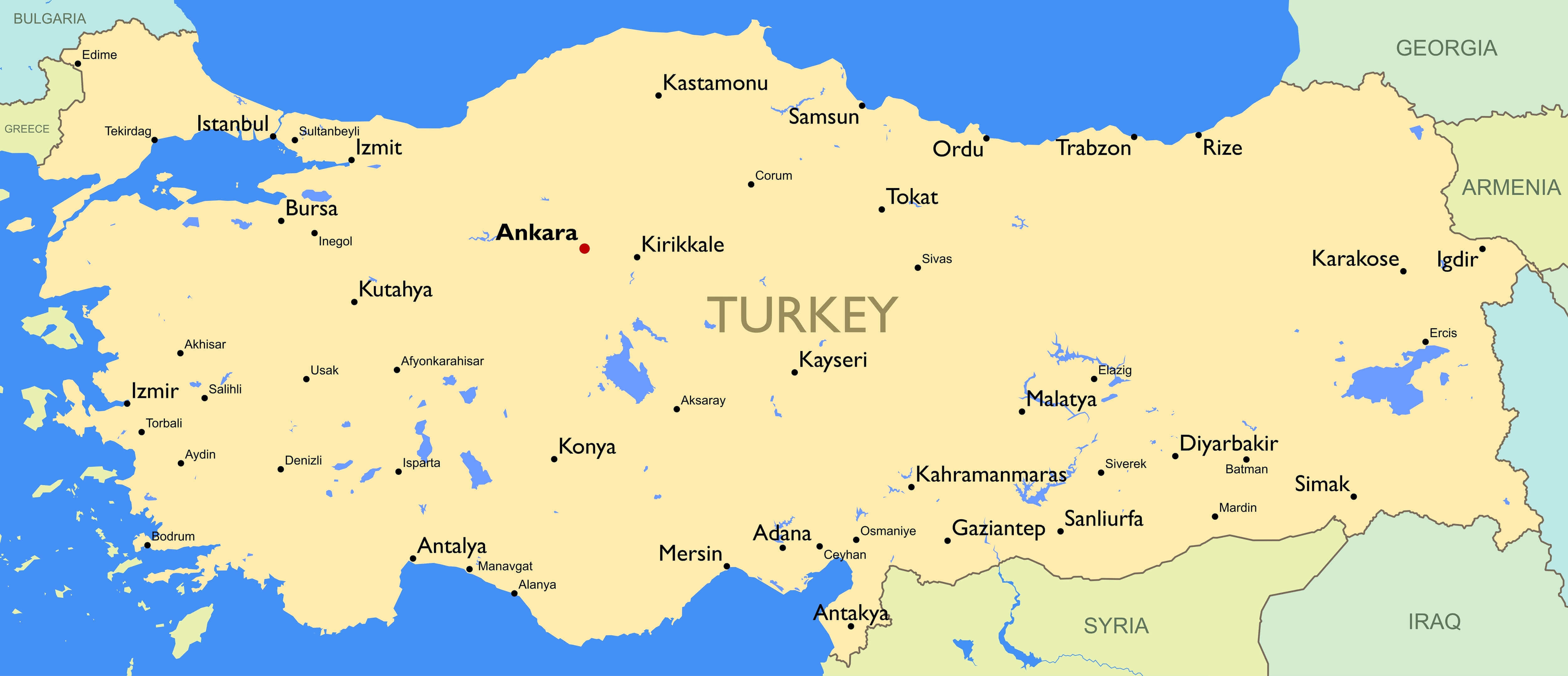 Detailed map of Turkey, Detailed color Turkey map with main cities.
Turkey Regions & Provinces Map
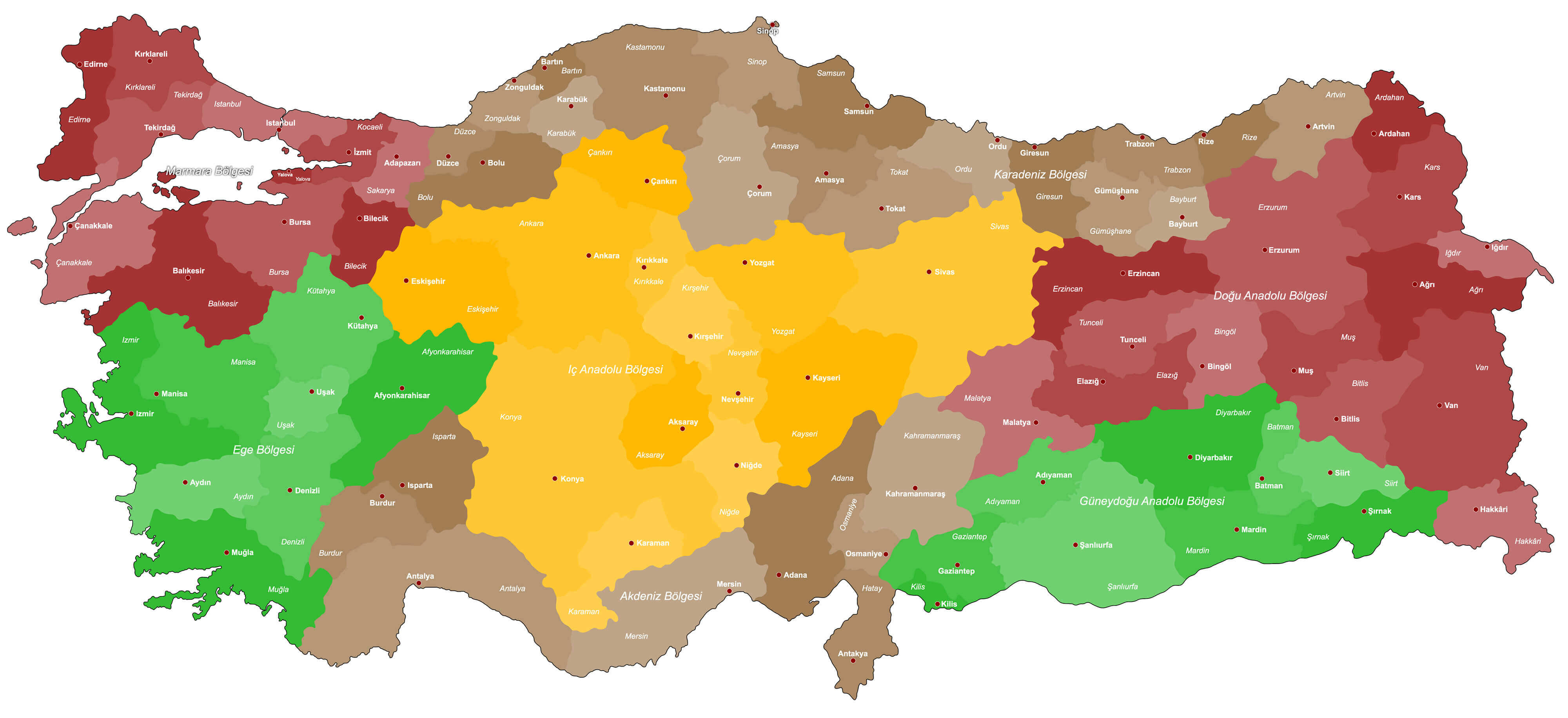 A large, colorful and detailed map of Turkey with all regions, provinces and big cities.
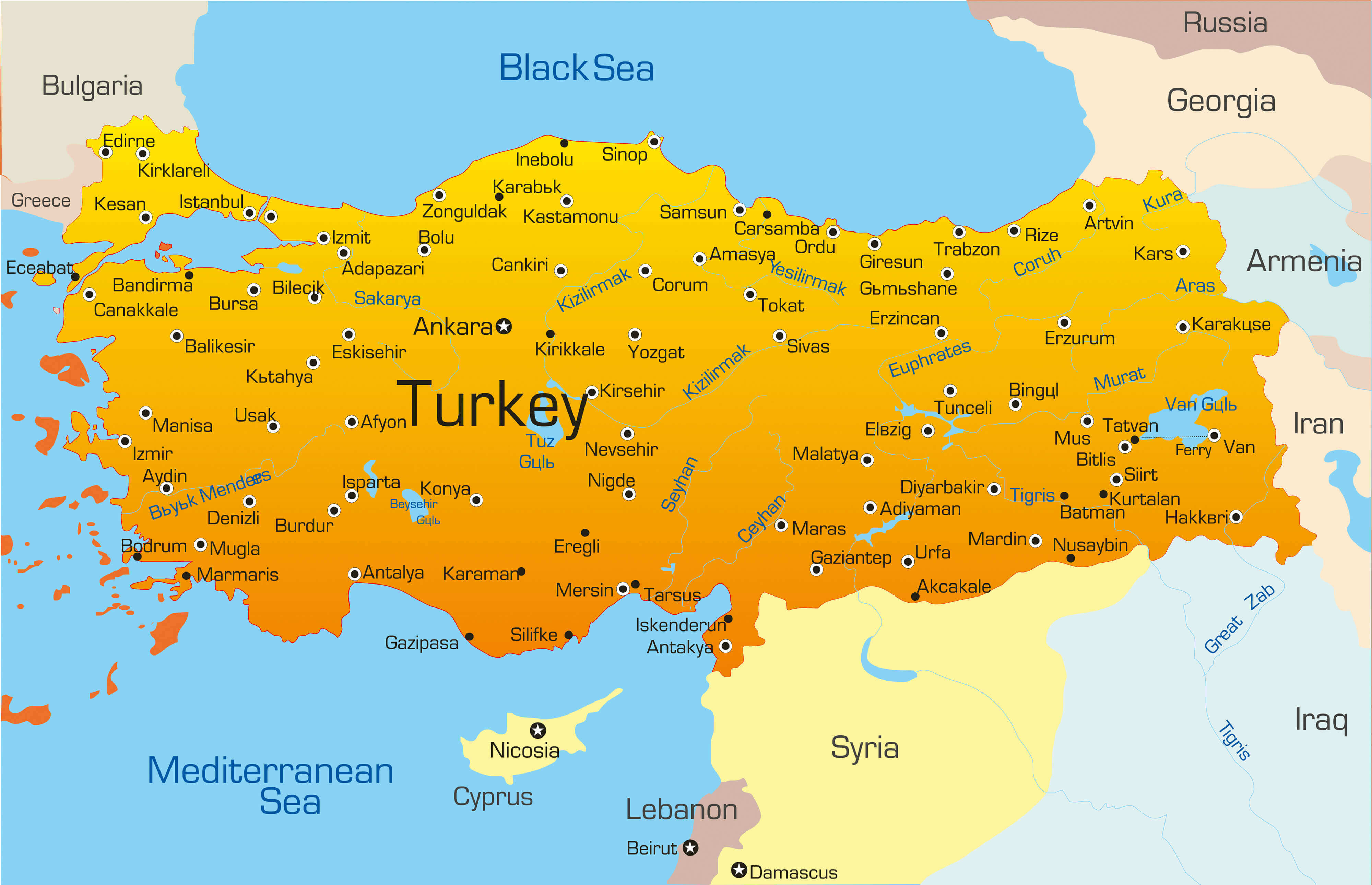
Detailed Map of Turkey with Major Cities
 Highly detailed map of Turkey, vector with Major Cities.
Turkey Satellite Map
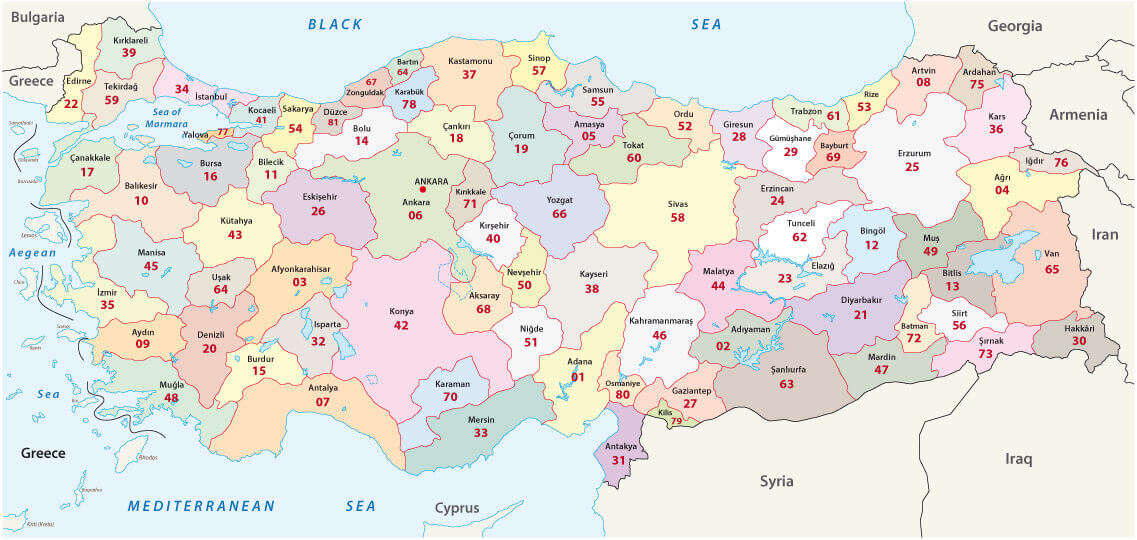 Turkey 2-digit postcodes map and provinces borders.
Turkey Railroad Map
 Turkey Railroad Map with cities.
Turkey Political Map
 Turkey Political Map with capital Ankara, national borders, most important cities, rivers and lakes. English labeling and scaling. Illustration.
Largest Cities' Map of Turkey
Agri Map Aydin Map Bitlis Map Elazig Map Hakkari Map Kahramanmaras Map Konya Map Nevsehir Map Siirt Map Yalova Map Ankara Map Antalya Map Bursa Map Canakkale Map Denizli Map Isparta Map Icel Map Manisa Map Mardin Map Sirnak Map Trabzon Map Antakya Map Adana Map Afyon Map Artvin Map Balikesir Map Gumushane Map Hatay Map Izmir Map Karabuk Map Samsun Map Sinop Map Sanliurfa Map Tunceli Map Van Map Izmit Map Batman Map Bilecik Map Erzurum Map Gaziantep Map Kars Map Kayseri Map Kirklareli Map Ordu Map Rize Map Yozgat Map North Cyprus Map Adiyaman Map Ardahan Map Burdur Map Duzce Map Giresun Map Karaman Map Kilis Map Mugla Map Sivas Map Usak Map Mersin Map Aksaray Map Amasya Map Cankiri Map Corum Map Igdir Map Istanbul Map Kutahya Map Malatya Map Tekirdag Map Tokat Map Adapazari Map Bingol Map Bolu Map Diyarbakir Map Edirne Map Kirsehir Map Kocaeli Map Mus Map Nigde Map Bartin Map Bayburt Map Erzincan Map Eskisehir Map Kastamonu Map Kirikkale Map Osmaniye Map Sakarya Map Zonguldak Map
Addresse: Hakarinne 2 Espoo, Uusimaa - Finland 02210
Web: istanbul-city-guide.com
Email: [email protected]
Web: istanbul-city-guide.com
Email: [email protected]
Copyright istanbul-city-guide.com - 2004 - 2026. All rights reserved. Privacy Policy | Disclaimer