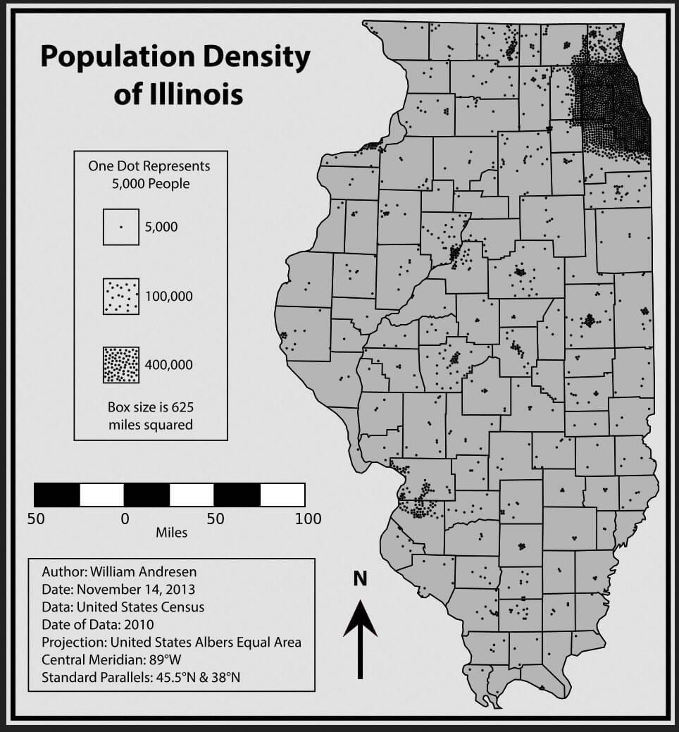
Population Density Map of Illinois
The United States Census Bureau estimates that the population of Illinois was 12,880,580 on July 1, 2014, a 0.39% increase since the 2010 United States Census. Illinois is the most populous state in the Midwest region. Chicago, the third most populous city in the United States, is the center of the Chicago metropolitan area. Chicagoland, as this area is known locally, comprises only 8% of the land area of the state, but contains 65% of the state's residents.
Where is Illinois in the US and Cities Map of Illinois
Please subscribe on "World Guide" channnel on Youtube at youtube.com/c/WorldGuide
Largest Cities Map of Illinois and Population
- Chicago Map - 2.695.598 - (41.878114, -87.629798)
- Aurora Map - 197.899 - (41.761,-88.32)
- Rockford Map - 152.871 - (42.271,-89.094)
- Joliet Map - 147.433 - (41.525,-88.082)
- Naperville Map - 141.853 - (41.786,-88.147)
- Springfield Map - 116.250 - (39.802,-89.644)
- Peoria Map - 115.007 - (40.694,-89.589)
- Elgin Map - 108.188 - (42.037,-88.281)
- Waukegan Map - 89.078 - (42.364,-87.845)
- Cicero Map - 83.891 - (41.84558770000,-87.75394480000)
- Champaign Map - 81.055 - (40.116420, -88.243383)
- Bloomington Map - 76.610 - (40.484203, -88.993687)
- Decatur Map - 76.122 - (39.840315, -88.954800)
- Arlington Heights Map - 75.101 - (42.088360, -87.980626)
- Evanston Map - 74.486 - (42.041141, -87.690059)
- Schaumburg Map - 74.227 - (42.033361, -88.083406)
- Bolingbrook Map - 73.366 - (41.698642, -88.068395)
- Palatine Map - 68.557 - (42.110304, -88.034240)
- Skokie Map - 64.784 - (42.033364, -87.733393)
- Des Plaines Map - 58.364 - (42.033362, -87.883399)
- Head of Performance Marketing
- Head of SEO
- Linkedin Profile: linkedin.com/in/arifcagrici
- Head of Performance Marketing
- Head of SEO
- Linkedin Profile: linkedin.com/in/arifcagrici
Google Map, Street Views, Maps Directions, Satellite Images
Istanbul-City-Guide.com offers a collection of map, google map, atlas, political, physical, satellite view, country infos, cities map and more map of .
Addresse: Hakarinne 2 Espoo, Uusimaa - Finland 02210
Web: istanbul-city-guide.com
Email: [email protected]
Web: istanbul-city-guide.com
Email: [email protected]
Copyright istanbul-city-guide.com - 2004 - 2026. All rights reserved. Privacy Policy | Disclaimer