Louisiana Map and Louisiana Satellite Images
Discover Louisiana's geography, topography, and key points of interest with WorldMap1's interactive Louisiana map. Explore the state's 64 parishes, major cities like New Orleans, Baton Rouge, and Shreveport, and popular tourist destinations including the French Quarter, Plantation Country, and the Gulf Coast.
Louisiana Map FQA
How many cities are in Louisiana ?
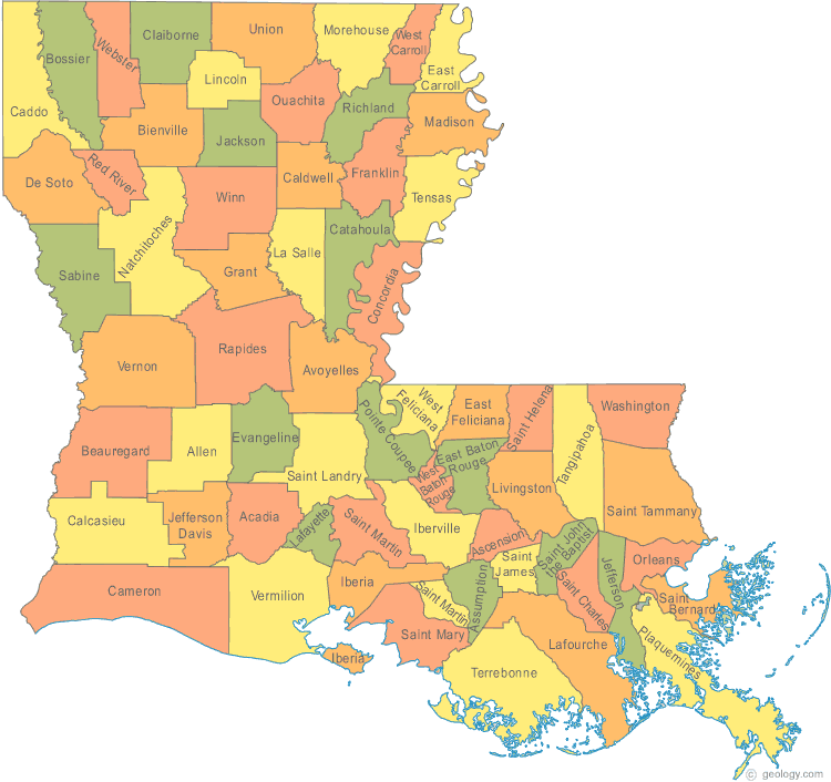
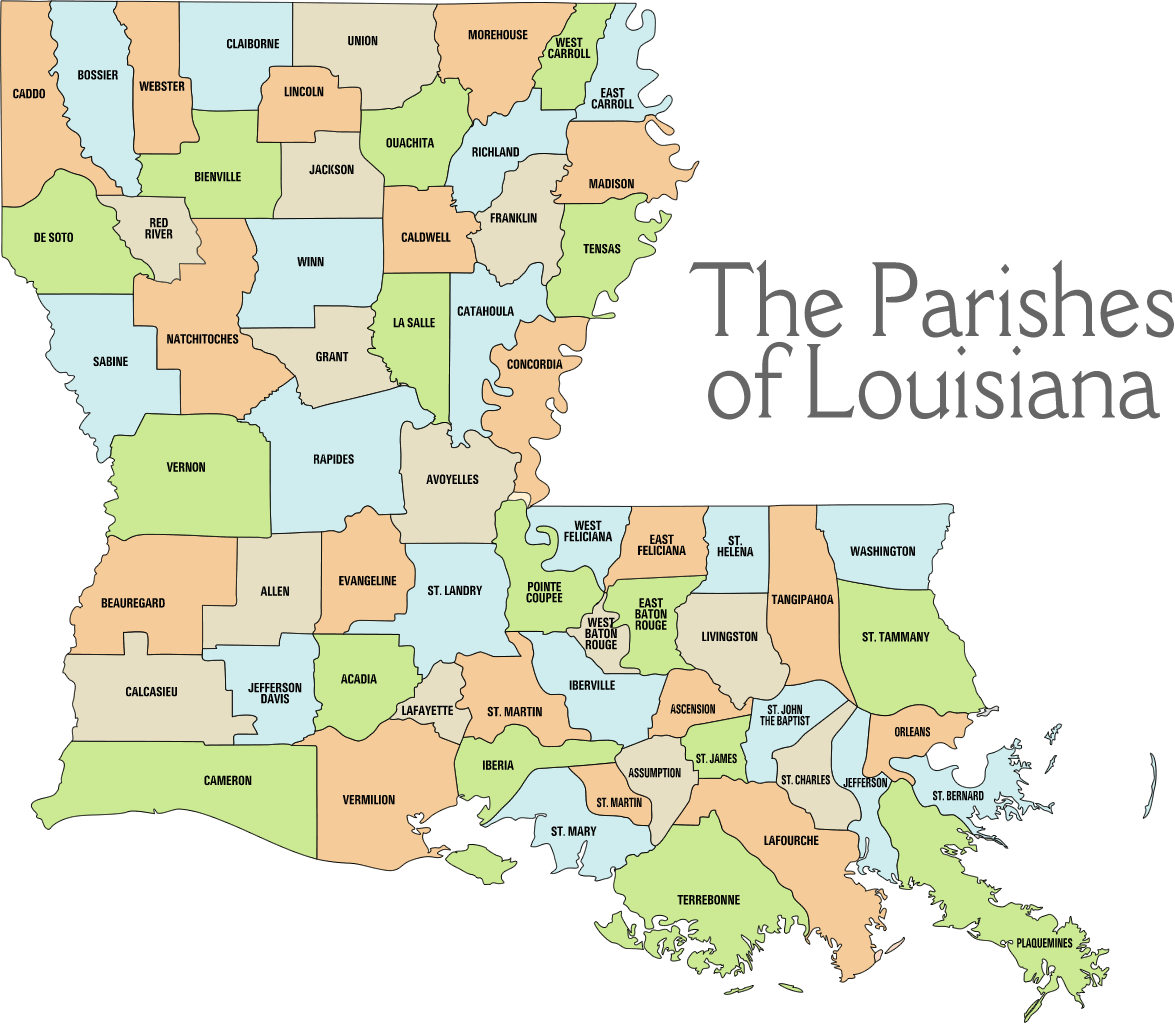
Louisiana has 64 parishes (equivalent to counties). The largest by population are: East Baton Rouge Parish; Jefferson Parish; Orleans Parish; St. Tammany Parish; Lafayette Parish; Caddo Parish; Calcasieu Parish; Ouachita Parish; Livingston Parish; Tangipahoa Parish.What are the major geographical features of Louisiana ?
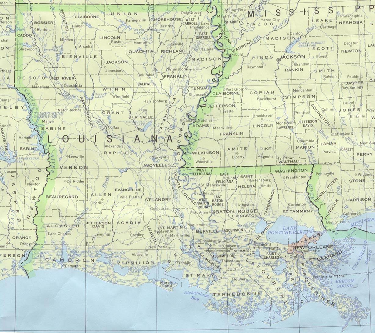
Louisiana features the Mississippi River Delta, vast wetlands, and the Gulf Coastal Plain. It has bayous, swamps, and fertile alluvial plains, with a humid subtropical climate.Can I download a high-resolution map of Louisiana ?
Yes. Download high-resolution political and physical maps of Louisiana for personal or educational use. Redistribution is subject to the terms of our license.For all Louisiana Cities Map
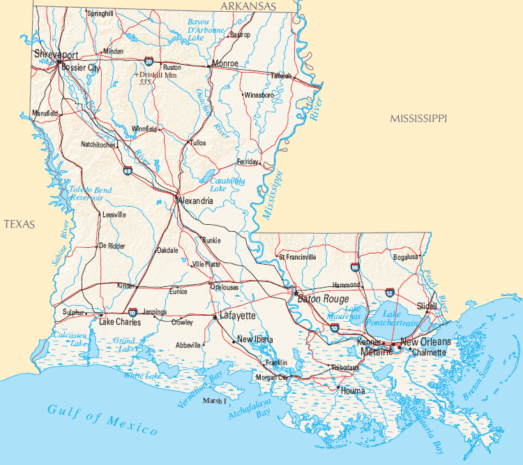
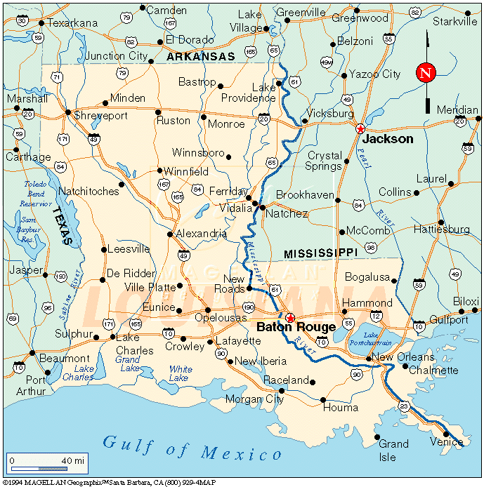
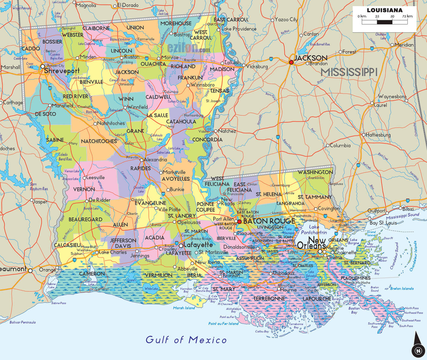
MAP OF LOUISIANA
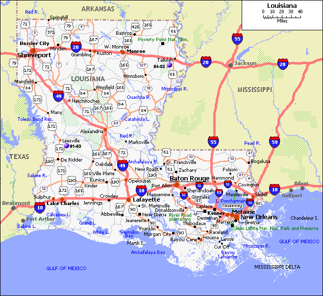
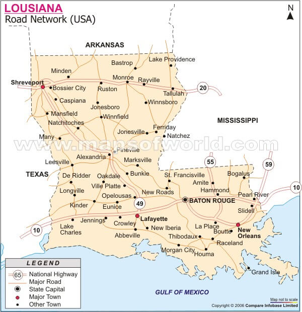
LOUISIANA ROAD MAPS
Brief information about Louisiana, US
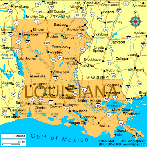
Louisiana is a state located in the southern region of the United States. It is bordered by Texas to the west, Arkansas to the north, Mississippi to the east, and the Gulf of Mexico to the south. The state has a diverse cultural heritage, influenced by French, Spanish, African, and Native American cultures.A Collection of Louisiana Maps and Louisiana Satellite Images
MAP OF LOUISIANA
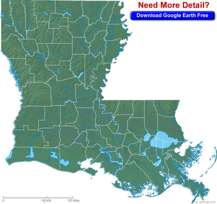
BLANK LOUISIANA PHYSICAL MAP
COUNTY MAP OF LOUISIANA

LOUISIANA ROAD MAPS
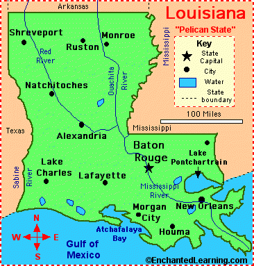
LOUISIANA STATE MAP
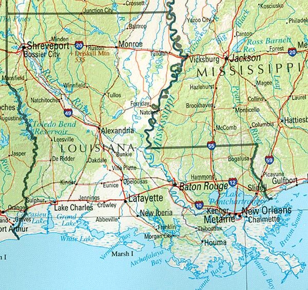
LOUISIANA REFERENCE MAP
LOUISIANA ROAD MAP

LOUISIANA CITIES MAP
LOUISIANA COUNTY MAP
LOUISIANA HISTORICAL MAP
LOUISIANA MAIN CITIES MAP

LOUISIANA MAP

LOUISIANA MAP USA
LOUISIANA ROAD MAP
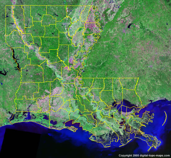
LOUISIANA SATELLITE IMAGE
PHYSICAL MAP OF LOUISIANA
STATE MAP OF LOUISIANA

A collection of Louisiana Maps
- Head of Performance Marketing
- Head of SEO
- Linkedin Profile: linkedin.com/in/arifcagrici
Largest Cities Map of Louisiana and Population
New Orleans Map - 343,829 Baton Rouge Map - 229,493 Shreveport Map - 199,311 Metairie Map - 138,481 Lafayette Map - 120,623 Lake Charles Map - 71,993 Kenner Map - 66,702 Bossier City Map - 61,315 Monroe Map - 48,815 Alexandria Map - 47,723 Houma Map - 33,727 Marrero Map - 33,141 New Iberia Map - 30,617 Laplace Map - 29,872 Slidell Map - 27,068
Addresse: Hakarinne 2 Espoo, Uusimaa - Finland 02210
Web: istanbul-city-guide.com
Email: [email protected]
Web: istanbul-city-guide.com
Email: [email protected]
Copyright istanbul-city-guide.com - 2004 - 2026. All rights reserved. Privacy Policy | Disclaimer