Mugla Map
Navigate Mugla Map, Mugla city map, satellite images of Mugla, Mugla towns map, political map of Mugla, driving directions and traffic maps.
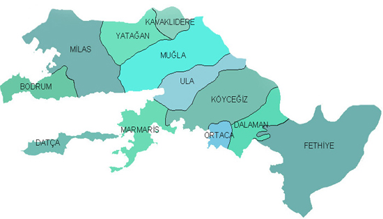
For all Mugla Towns Map
For more >> Turkey Maps
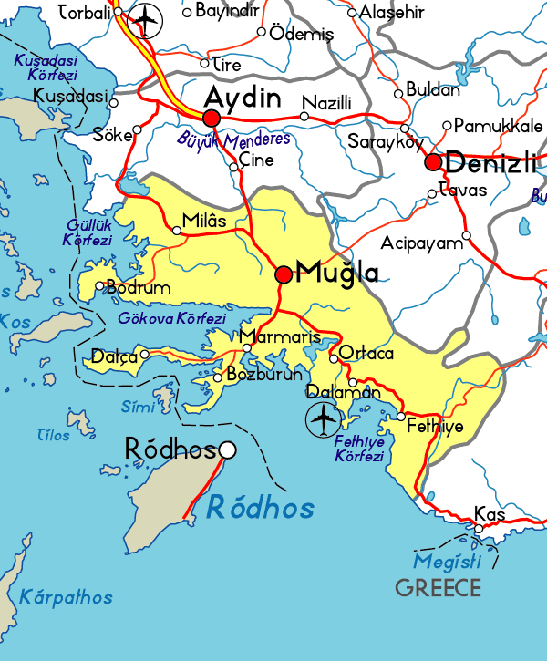
For more info >> Turkey
For more >> Turkey Towns Map
map of mugla
15 Best Places to Visit in Istanbul
Please subscribe on "World Guide" channnel on Youtube at youtube.com/c/WorldGuide
Discovering the Gems of Mugla Top 10 Must-Visit Spots
Map of Mugla and Satellite Images
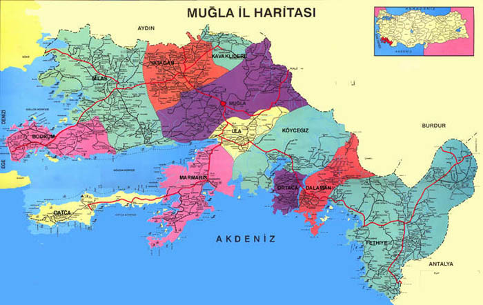
MAP OF MUGLA
MAP OF MUGLA
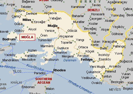
MUGLA MAP
MUGLA MAP
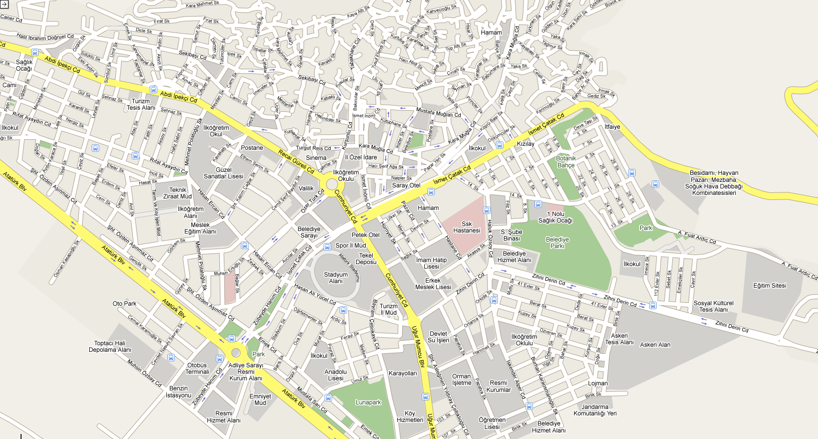
MUGLA CENTER MAP
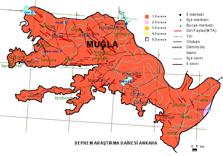
MUGLA EARTHQUAKE MAP
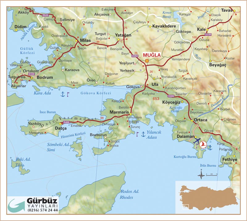
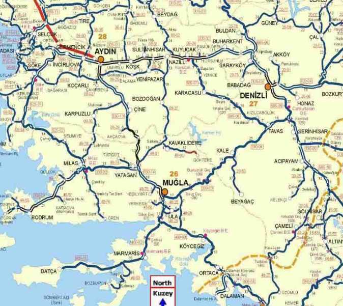
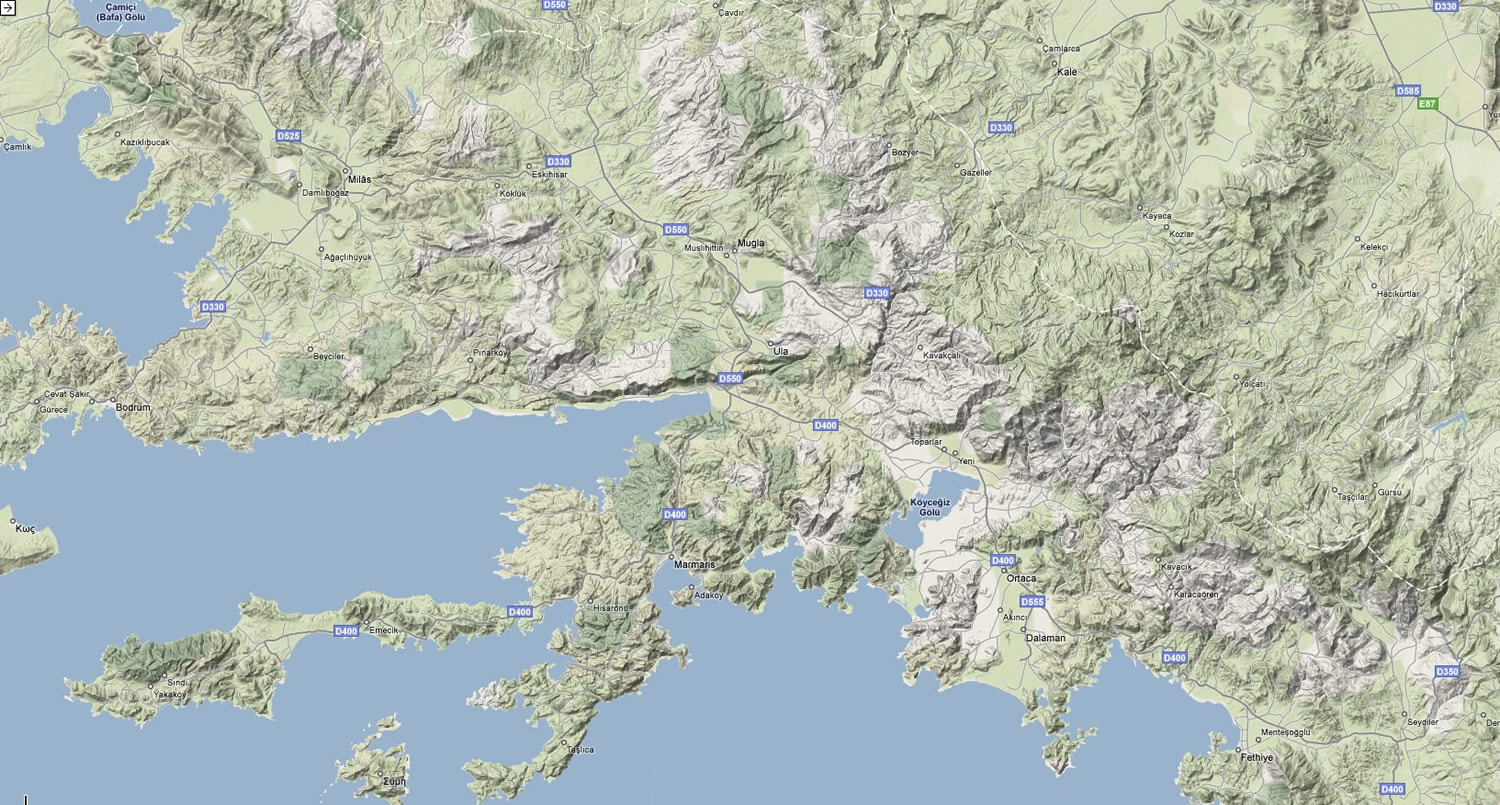
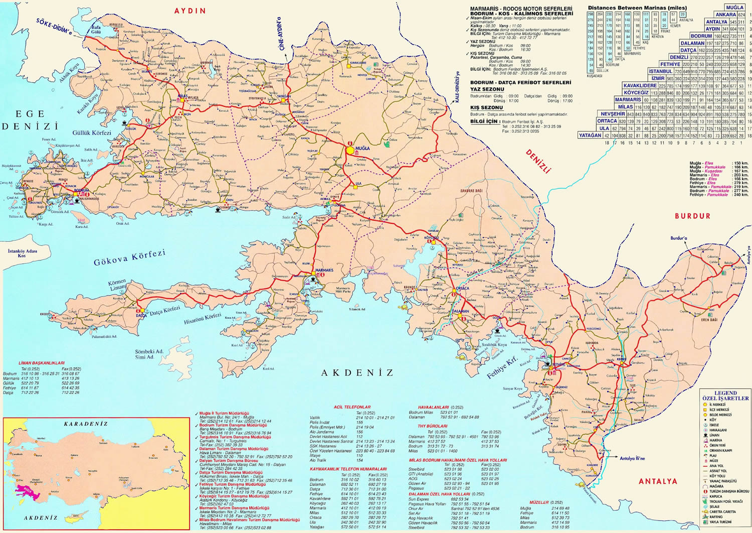
MUGLA HIGHWAYS MAP
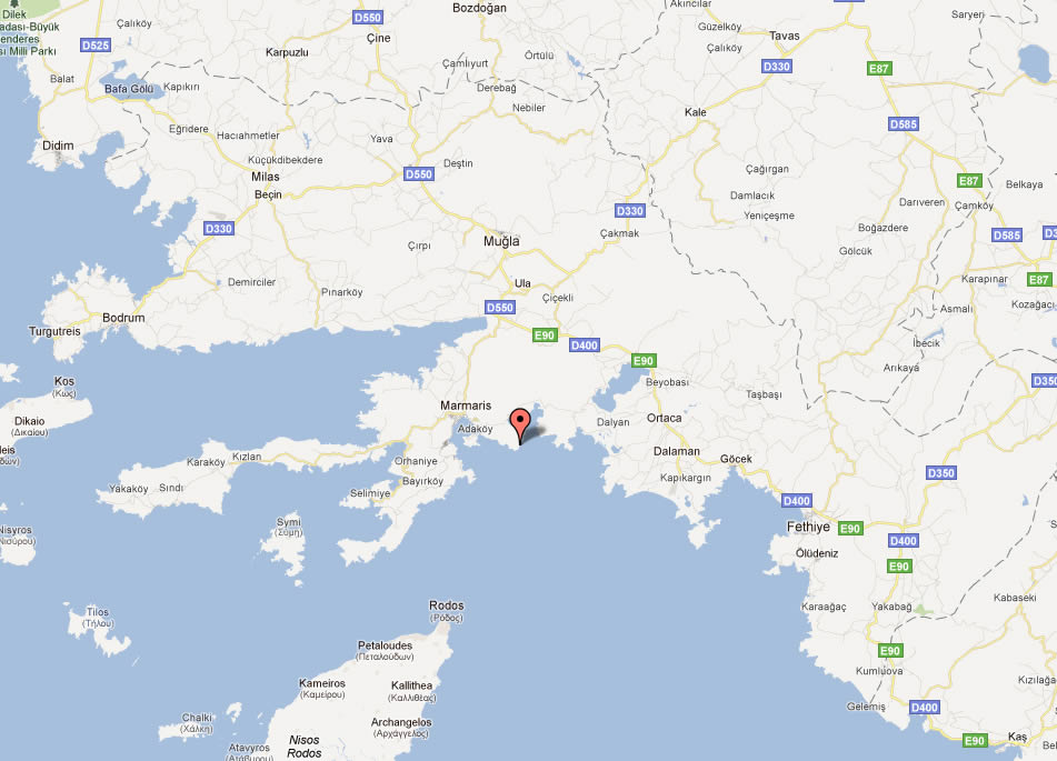
MUGLA MAP
MUGLA MAP
MUGLA MAP
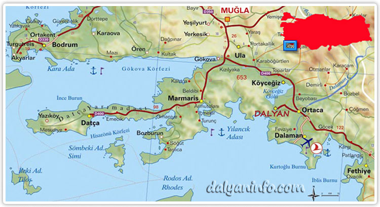
MUGLA MAP MARMARIS DALAMAN
MUGLA MAPS
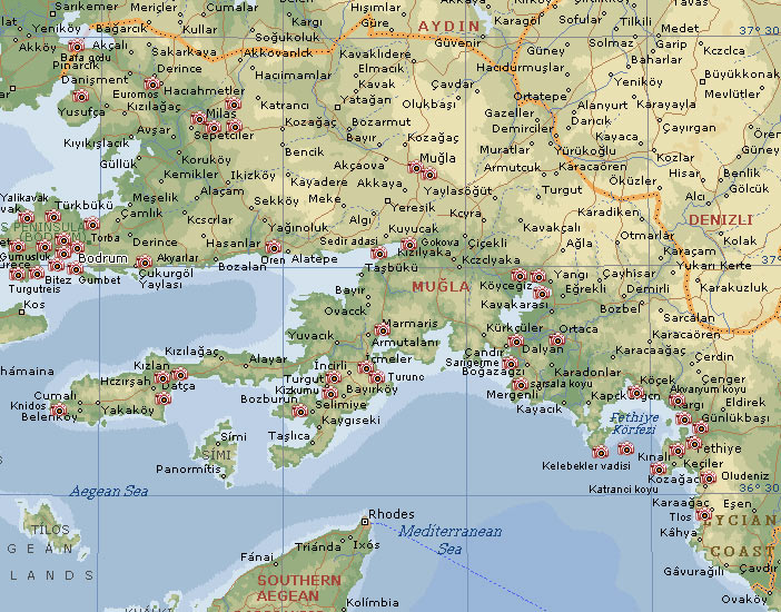
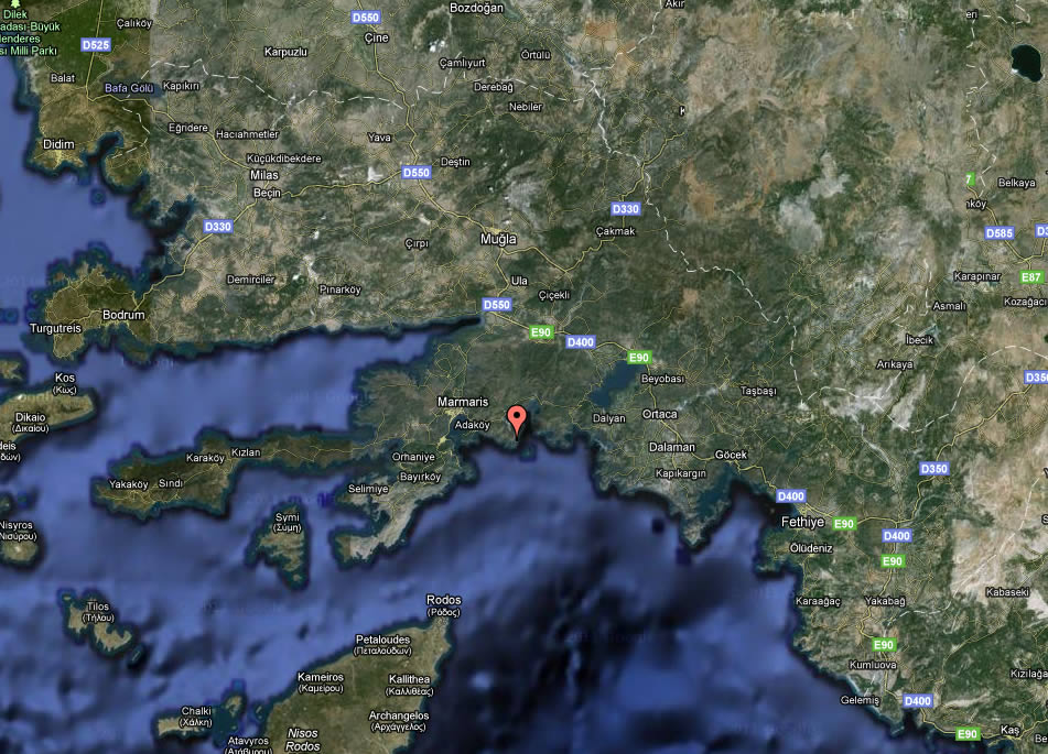
MUGLA SATELLITE IMAGE
MUGLA SKECTH
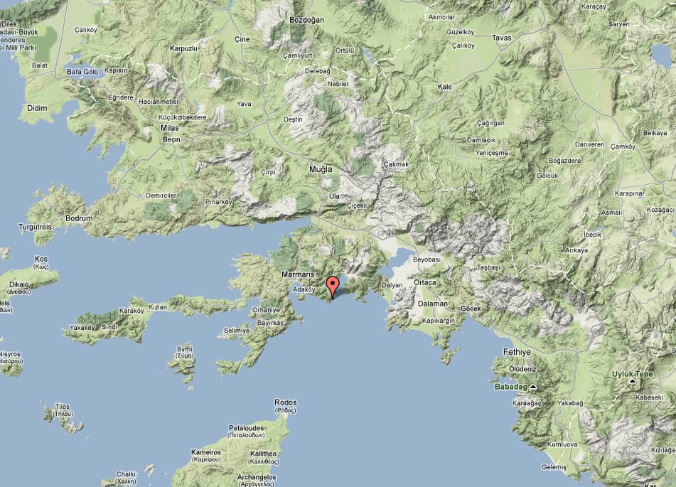
MUGLA TERRAIN MAP
MUGLA TOURISTIC MAP
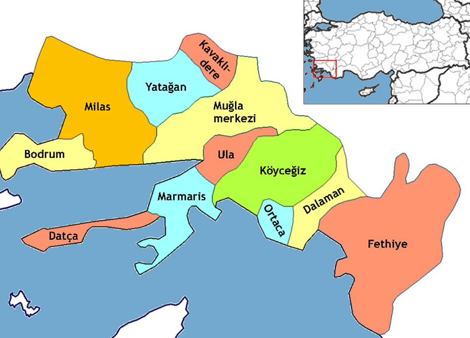
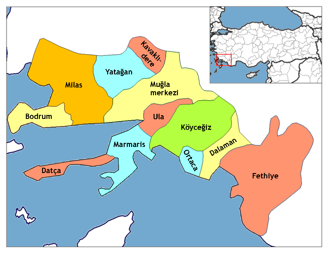
MUGLA TOWNS MAP
Alphabetically Towns Map of Mugla & Population of Mugla Towns
Bencik MUgla Map Bozarmut MUgla Map Bozuyuk MUgla Map Cazkirlar MUgla Map Cakirlar MUgla Map Cukuroz MUgla Map Destin MUgla Map Dogan MUgla Map Elmacik MUgla Map ESenkoy MUgla Map Eskihisar MUgla Map Gokgedik MUgla Map Gokpinar MUgla Map Hacibayramlar MUgla Map Haciveliler MUgla Map Hisarardi MUgla Map Kadikoy MUgla Map Kafacakaplancik MUgla Map Kapibag MUgla Map Katranci MUgla Map Kavakkoy MUgla Map Kirik MUgla Map Kozagac MUgla Map Kokluk MUgla Map Madanlar MUgla Map Akkaya MUgla Map Aricilar MUgla Map Armutcuk MUgla Map Atakoy MUgla Map Citlik MUgla Map Cicekli MUgla Map Corus MUgla Map Elmali MUgla Map Esentepe MUgla Map Gokce MUgla Map Gokova MUgla Map Golcuk MUgla Map Karabogurtlen MUgla Map Kavakcali MUgla Map Kiyra MUgla Map Kizilagac MUgla Map Kizilyaka MUgla Map Portakallik MUgla Map Saravyani MUgla Map sirinkoy MUgla Map Turgut MUgla Map Yaylasogut MUgla Map Yesilcam MUgla Map Yesilova MUgla Map Dalyan MUgla Map Derekoy MUgla Map Eksiliyurt MUgla Map Eskikoy MUgla Map Fevziye MUgla Map Gokbel MUgla Map Golbasi MUgla Map Guzelyurt MUgla Map Kizilkaya MUgla Map Narli MUgla Map Sabunlu MUgla Map serefler MUgla Map Tasbasi MUgla Map Bahceyakasi MUgla Map Bitez MUgla Map Camlik MUgla Map Comlekci MUgla Map Dagbelen MUgla Map Derekoy MUgla Map Gokpinar MUgla Map GolturkBuku MUgla Map Gumusluk MUgla Map Gundogan MUgla Map Gurece MUgla Map Guvercinlik MUgla Map islamhaneleKayseri MUgla Map Kemer MUgla Map Konacik MUgla Map Kumkoy MUgla Map Mazikoy MUgla Map Mumcular MUgla Map Ortakent Yahsi MUgla Map Peksimet MUgla Map Pinarlibelen MUgla Map Sazkoy MUgla Map Turgutreis MUgla Map Yakakoy MUgla Map Yali MUgla Map Yalikavak MUgla Map Yenikoy MUgla Map Akyarlar MUgla Map Bozbel MUgla Map Cumali MUgla Map Alacat MUgla Map Camlibel MUgla Map Beyobasi MUgla Map Adakoy MUgla Map Agaclihuyuk MUgla Map Akinci MUgla Map Akcapinar MUgla Map Akgedik MUgla Map Alasar MUgla Map Bagyaka MUgla Map Bahceyaka MUgla Map Cinarli MUgla Map Armutalan MUgla Map Bayirkoy MUgla Map Beldibi MUgla Map Bozburun MUgla Map Camli MUgla Map Cetibeli MUgla Map Hisaronu MUgla Map icmeler MUgla Map Karaca MUgla Map Orhaniye MUgla Map Selimiye MUgla Map Sogutkoy MUgla Map Taslica MUgla Map Turgutkoy MUgla Map Turunc MUgla Map Yesilbelde MUgla Map Candir MUgla Map Cayhisar MUgla Map Demirli MUgla Map Dogusbelen MUgla Map Ekincik MUgla Map Hamitkoy MUgla Map Karacam MUgla Map Kavakarasi MUgla Map Koyc Egiz MUgla Map Otmanlar MUgla Map Pinar MUgla Map Sazak MUgla Map sultaniye MUgla Map Caltiozu MUgla Map Camkoy MUgla Map Camurkoy MUgla Map Catak MUgla Map Cayan MUgla Map Caykenari MUgla Map Cenger MUgla Map Ciftlik MUgla Map Cobanisa MUgla Map Cobanlar MUgla Map Cokek MUgla Map Cukurincir MUgla Map Demirler MUgla Map Derekoy MUgla Map Dodurga MUgla Map Doganlar MUgla Map duger MUgla Map Eldirek MUgla Map Emecik MUgla Map Hizirsah MUgla Map Karakoy MUgla Map Kizlan MUgla Map Mesudiye MUgla Map Sindi MUgla Map Yakakoy MUgla Map Yazikoy MUgla Map Cogmen MUgla Map Dariyeri MUgla Map Elcik MUgla Map Gurkoy MUgla Map Gurlek MUgla Map Kapukargin MUgla Map Karacaagac MUgla Map Karginkuru MUgla Map Kavacik MUgla Map Kayadibi MUgla Map Bodrum Map Dalaman Map Dalyan Map Datca Map Fethiye Map Kavaklidere Map Koyc Egiz Map Marmaris Map Merkez Map Milas Map Ortaca Map Sarigerme Map Torba Map Ula Map Yatagan Map Toparlar MUgla Map Yangi MUgla Map Yayla MUgla Map Yesilkoy MUgla Map Zaferler MUgla Map Zeytinalani MUgla Map Camliyurt MUgla Map Cavdir MUgla Map Cayboyu MUgla Map Derebag MUgla Map Kurucaova MUgla Map Mentese MUgla Map Nebiler MUgla Map Ortakoy MUgla Map Salkim MUgla Map Yesilkoy MUgla MapMugla Google Map, Street Views, Maps Directions, Satellite Images
istanbul-city-guide.com offers a collection of Mugla map, google map, Mugla atlas, political, physical, satellite view, country infos, cities map and more map of Mugla.
Largest Cities' Map of Turkey
Adana Map Adiyaman Map Afyon Map Agri Map Aksaray Map Amasya Map Ankara Map Antalya Map Mersin Map Izmit Map Antakya Map Adapazari Map Karabuk Map Karaman Map Kars Map Kastamonu Map Kayseri Map Kirikkale Map Kirklareli Map Kirsehir Map Kilis Map Kocaeli Map Konya Map Kutahya Map Malatya Map Manisa Map Mardin Map Mugla Map Mus Map Nevsehir Map Nigde Map Ordu Map Osmaniye Map Rize Map Sakarya Map Samsun Map Siirt Map Sinop Map Sivas Map Sanliurfa Map Sirnak Map Tekirdag Map Tokat Map Trabzon Map Tunceli Map Usak Map Ardahan Map Artvin Map Aydin Map Balikesir Map Bartin Map Batman Map Bayburt Map Bilecik Map Bingol Map Bitlis Map Bolu Map Burdur Map Bursa Map Canakkale Map Cankiri Map Corum Map Denizli Map Diyarbakir Map Duzce Map Edirne Map Elazig Map Erzincan Map Erzurum Map Eskisehir Map Gaziantep Map Giresun Map Gumushane Map Hakkari Map Hatay Map Igdir Map Isparta Map Icel Map Istanbul Map Izmir Map Kahramanmaras Map Van Map Yalova Map Yozgat Map Zonguldak Map North Cyprus Map
Addresse: Hakarinne 2 Espoo, Uusimaa - Finland 02210
Web: istanbul-city-guide.com
Email: [email protected]
Web: istanbul-city-guide.com
Email: [email protected]
Copyright istanbul-city-guide.com - 2004 - 2026. All rights reserved. Privacy Policy | Disclaimer