Map of Antakya, Turkey
Navigate Antakya map, Antakya country map, satellite images of Antakya, Antakya largest cities, towns maps, political map of Antakya, driving directions, physical, atlas and traffic maps in Turkey.
15 Best Places to Visit in Istanbul
Please subscribe on "World Guide" channnel on Youtube at youtube.com/c/WorldGuide
Discovering the Gems of Mugla Top 10 Must-Visit Spots
Antakya City Town Maps
MAP OF ANTAKYA
A Collection of Antakya Maps and Antakya Satellite Images
MAP OF ANTAKYA
ANTAKYA MAP
ANTAKYA CENTER MAP
ANTAKYA CITY MAP
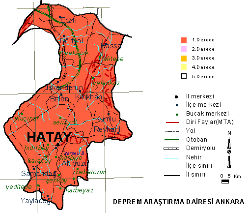
ANTAKYA EARTHQUAKE MAP
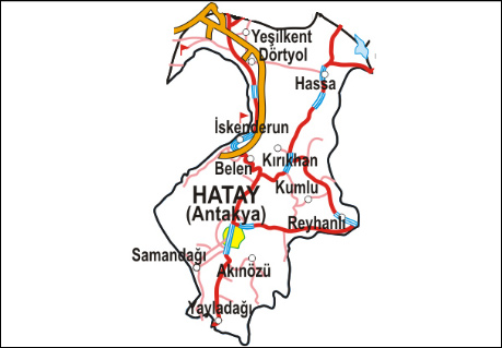
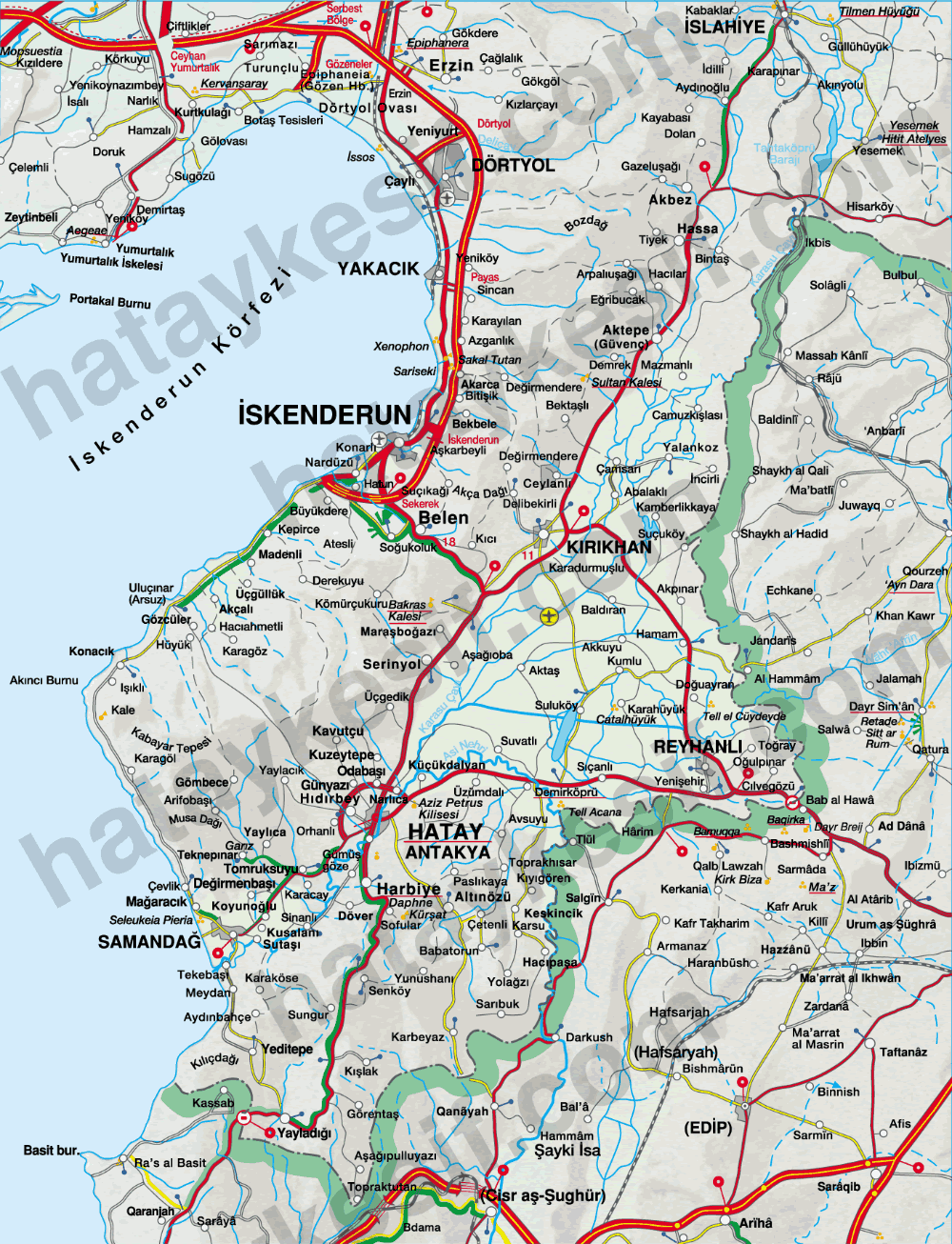
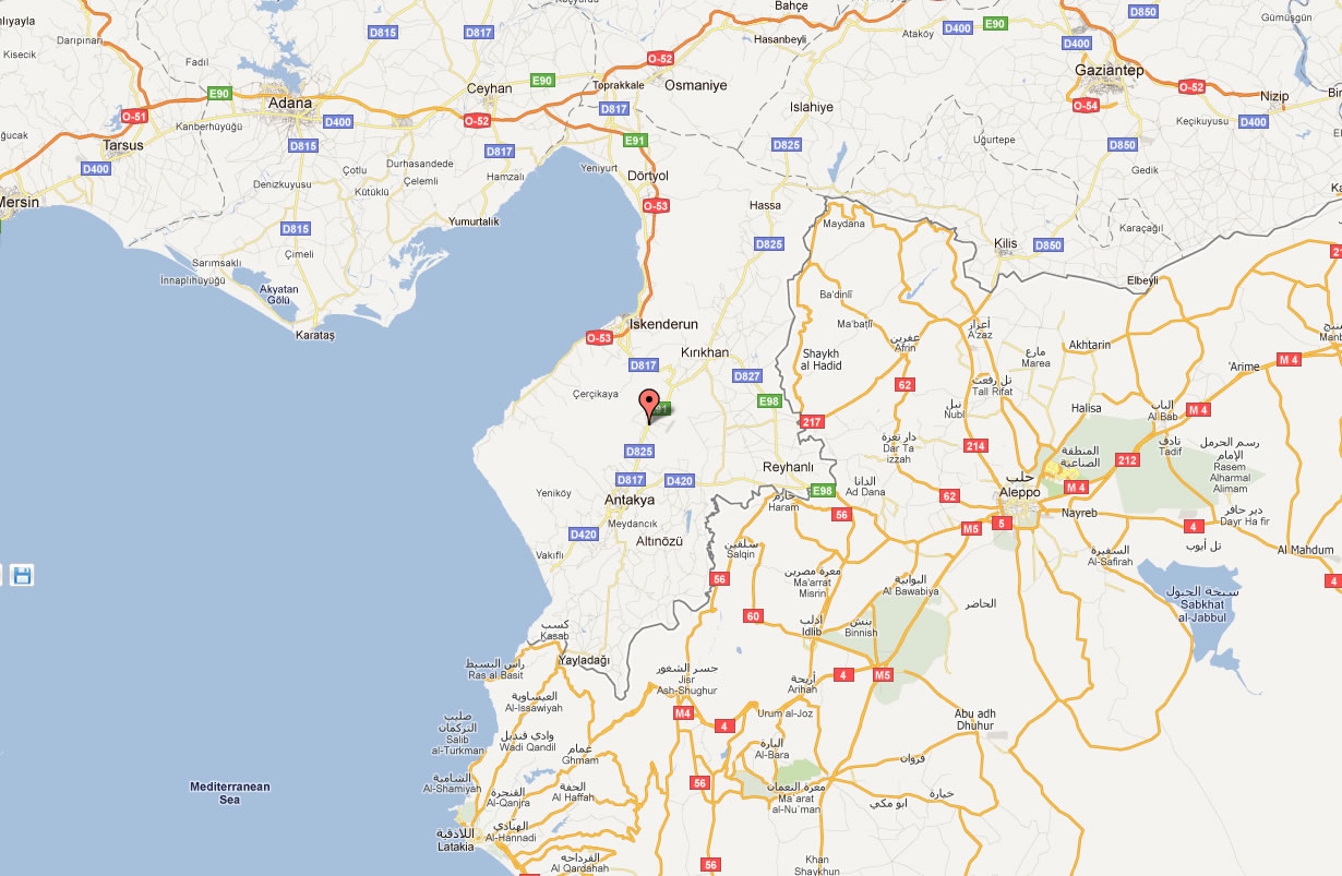
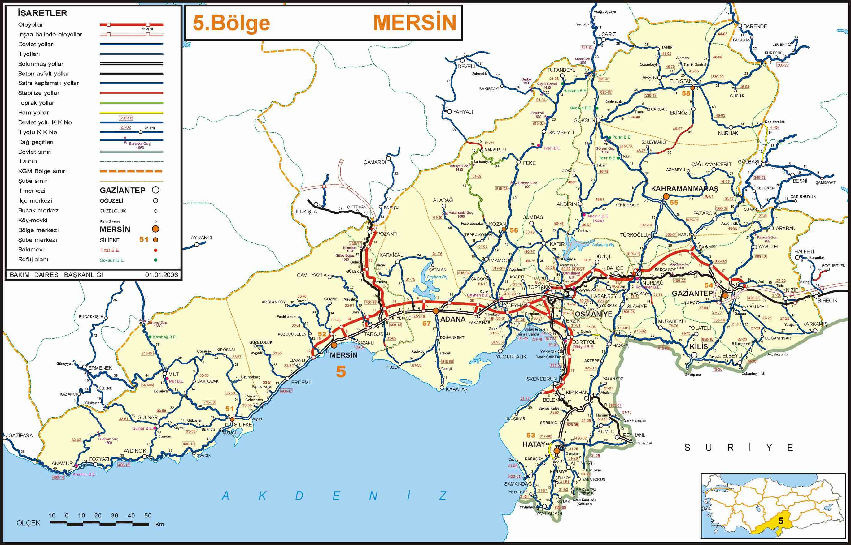
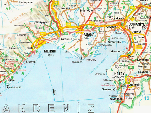
ANTAKYA HIGHWAYS MAP
ANTAKYA KROKISI
ANTAKYA MAP

ANTAKYA MAP ASI RIVER
ANTAKYA ROAD MAP
ANTAKYA ROUTE DIRECTION MAP

ANTAKYA ROUTE MAP
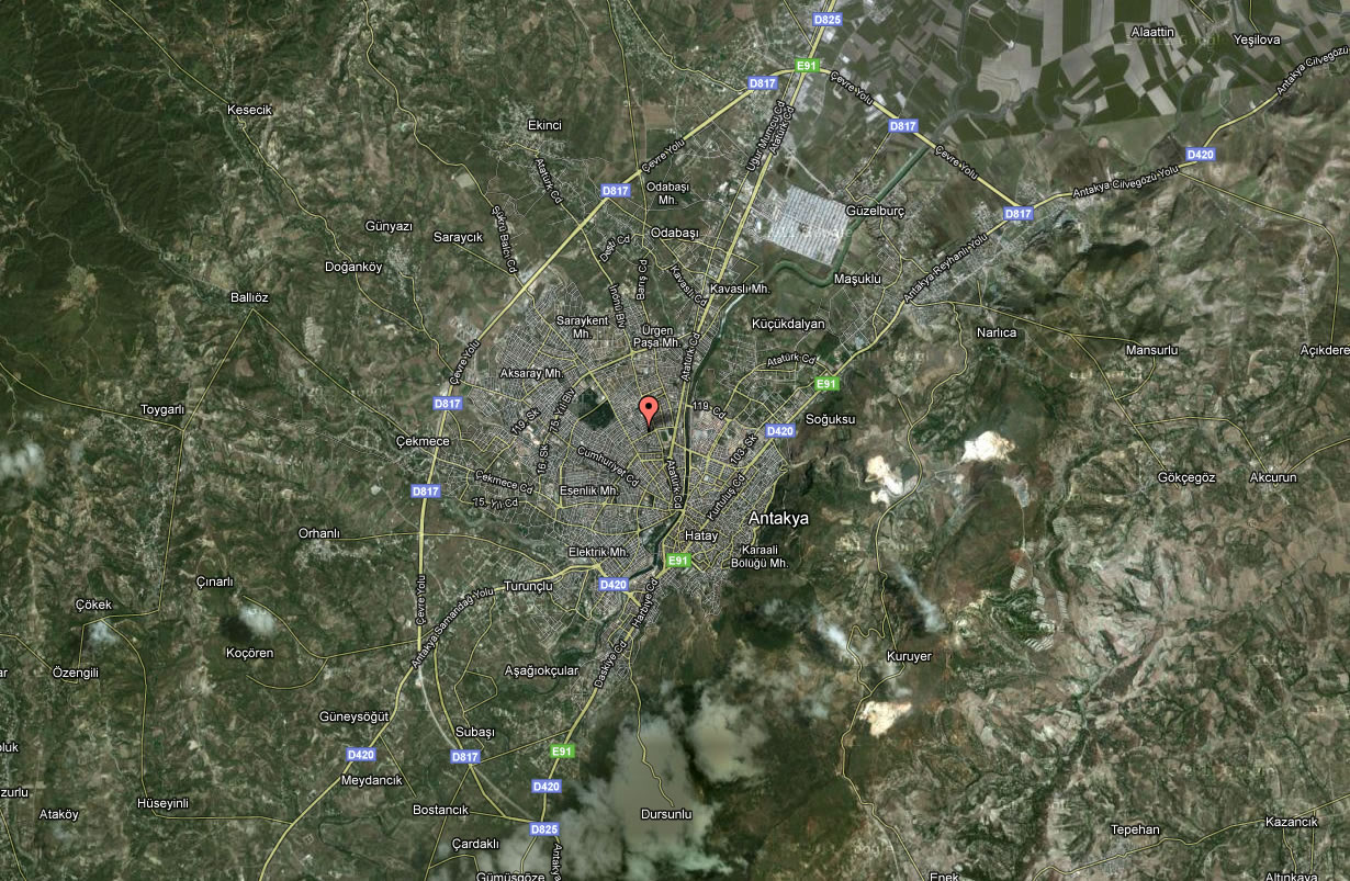
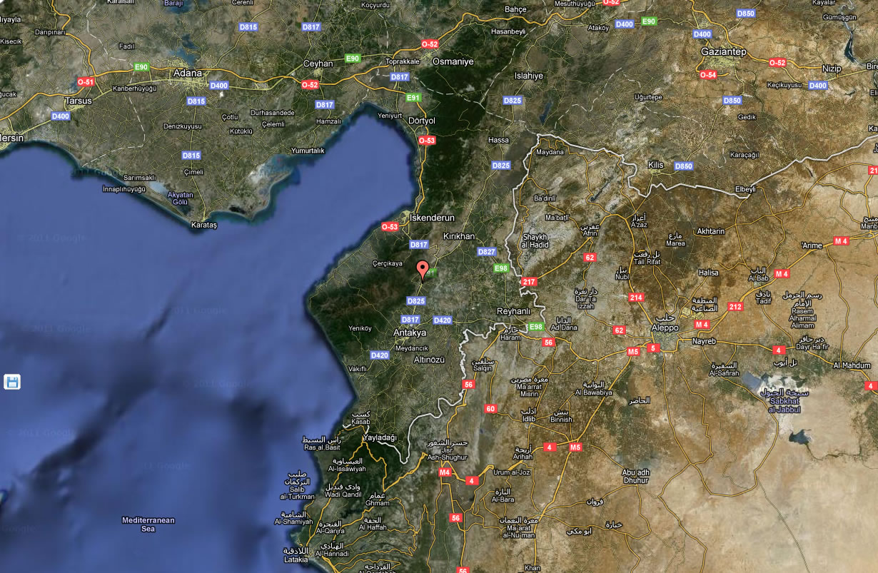
ANTAKYA SATELLITE MAP
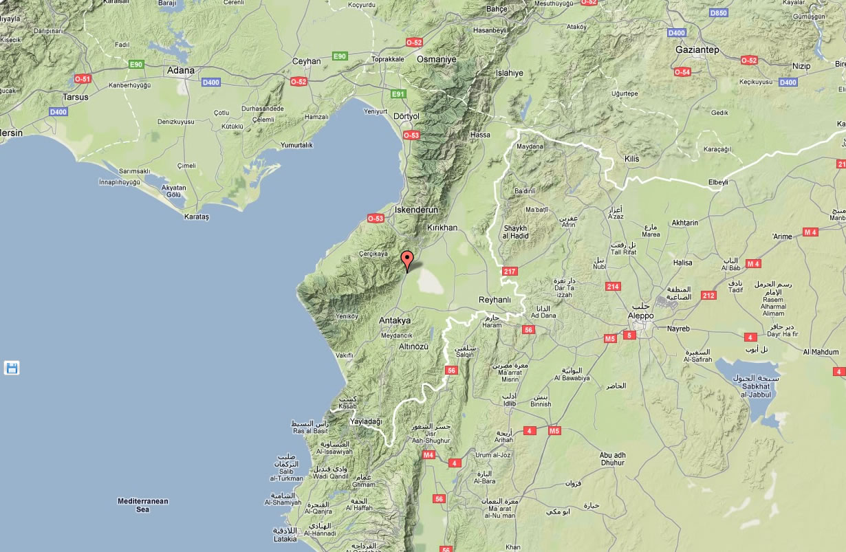
ANTAKYA TERRAIN MAP
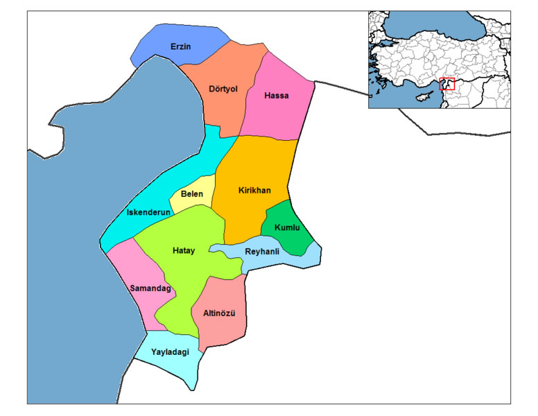
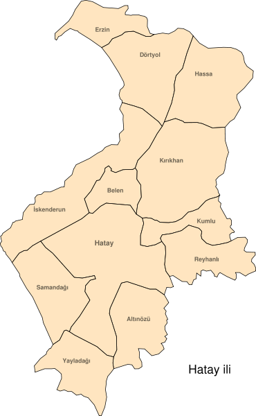
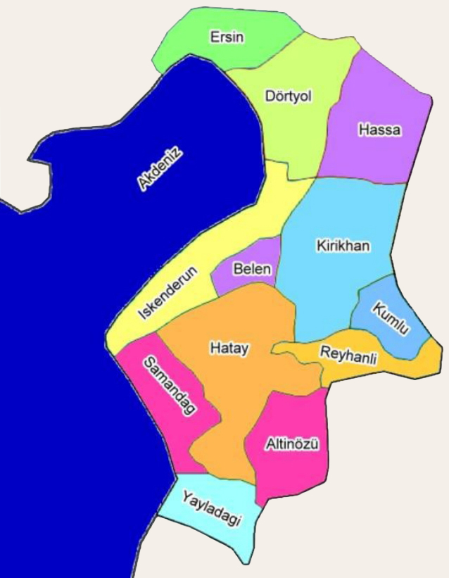
ANTAKYA TOWNS MAP
Alphabetically Cities Map of Antakya & Population of Antakya Cities
Agri Map Aydin Map Bitlis Map Elazig Map Hakkari Map Kahramanmaras Map Konya Map Nevsehir Map Siirt Map Yalova Map Ankara Map Antalya Map Bursa Map Canakkale Map Denizli Map Isparta Map Icel Map Manisa Map Mardin Map Sirnak Map Trabzon Map Antakya Map Adana Map Afyon Map Artvin Map Balikesir Map Gumushane Map Hatay Map Izmir Map Karabuk Map Samsun Map Sinop Map Sanliurfa Map Tunceli Map Van Map Izmit Map Batman Map Bilecik Map Erzurum Map Gaziantep Map Kars Map Kayseri Map Kirklareli Map Ordu Map Rize Map Yozgat Map North Cyprus Map Adiyaman Map Ardahan Map Burdur Map Duzce Map Giresun Map Karaman Map Kilis Map Mugla Map Sivas Map Usak Map Mersin Map Aksaray Map Amasya Map Cankiri Map Corum Map Igdir Map Istanbul Map Kutahya Map Malatya Map Tekirdag Map Tokat Map Adapazari Map Bingol Map Bolu Map Diyarbakir Map Edirne Map Kirsehir Map Kocaeli Map Mus Map Nigde Map Bartin Map Bayburt Map Erzincan Map Eskisehir Map Kastamonu Map Kirikkale Map Osmaniye Map Sakarya Map Zonguldak Map- Head of Performance Marketing
- Head of SEO
- Linkedin Profile: linkedin.com/in/arifcagrici
See Also
Antakya Google Map, Street Views, Maps Directions, Satellite Images
istanbul-city-guide.com offers a collection of Antakya map, google map, Antakya atlas, political, physical, satellite view, country infos, cities map and more map of Antakya.
Turkey Largest Cities Map by Population
Mersin Map Izmit Map Antakya Map Adapazari Map Karabuk Map Karaman Map Kars Map Kastamonu Map Kayseri Map Kirikkale Map Kirklareli Map Kirsehir Map Kilis Map Kocaeli Map Konya Map Kutahya Map Malatya Map Manisa Map Mardin Map Mugla Map
Addresse: Hakarinne 2 Espoo, Uusimaa - Finland 02210
Web: istanbul-city-guide.com
Email: [email protected]
Web: istanbul-city-guide.com
Email: [email protected]
Copyright istanbul-city-guide.com - 2004 - 2025. All rights reserved. Privacy Policy | Disclaimer