Finland Map
Navigate Finland map, satellite images of the Finland, states, largest cities, political map, capitals and physical maps.
- Capital : Helsinki
- Population : 5,421,827
- GDP : $266.553 billion
- Per Capita : $49,349
- Calling Code : +358
- Jobless Rate : 6.90%
- Time Zone : +2
Color Map of Finland
 Abstract vector color map of Finland country.
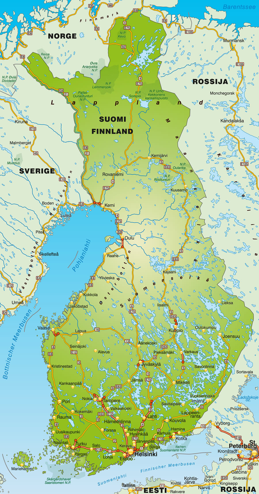
Finland Europe Shaded Relief Map
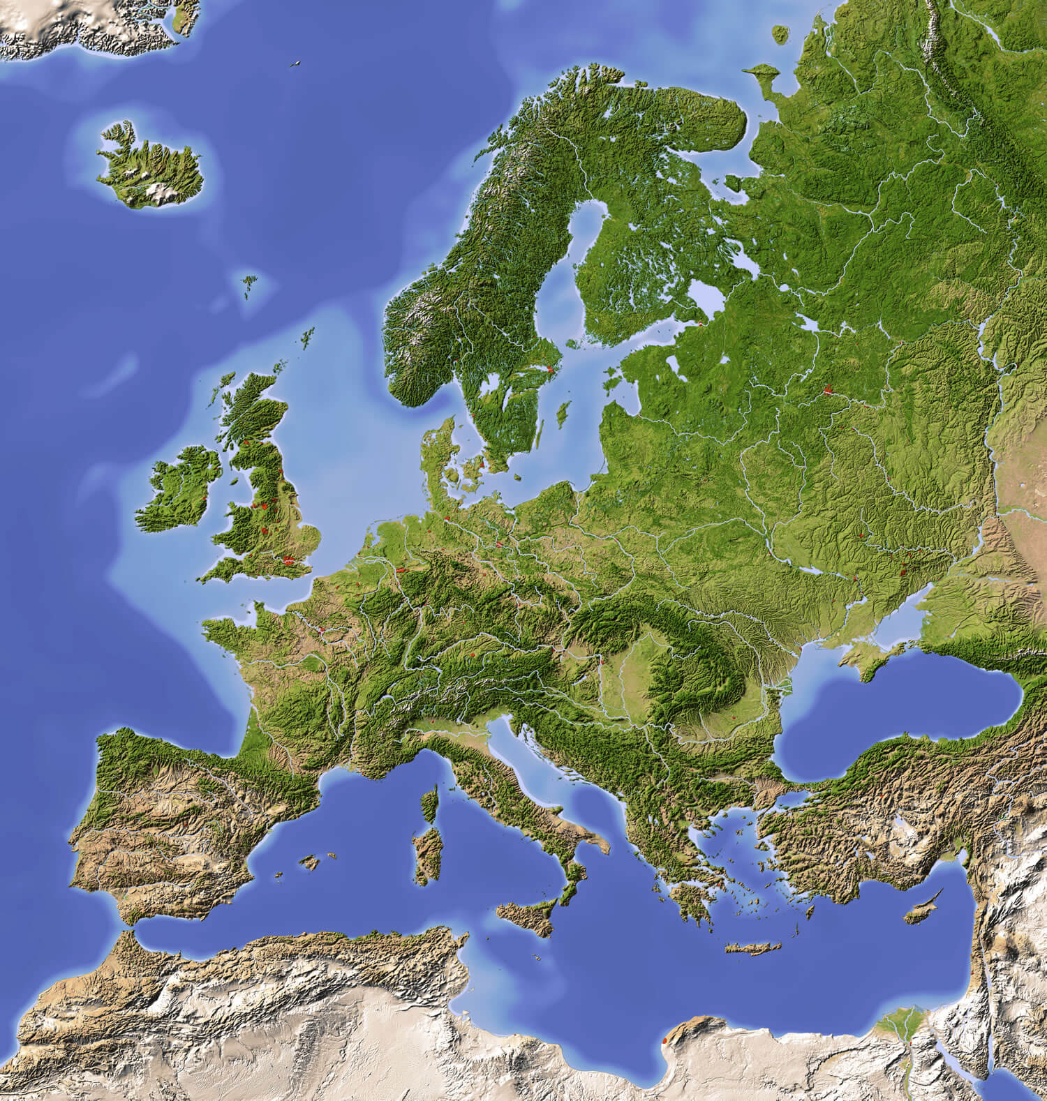 Finland Europe Shaded Relief Map with major urban areas. Colored according to vegetation.
Finland Shaded Relief Map
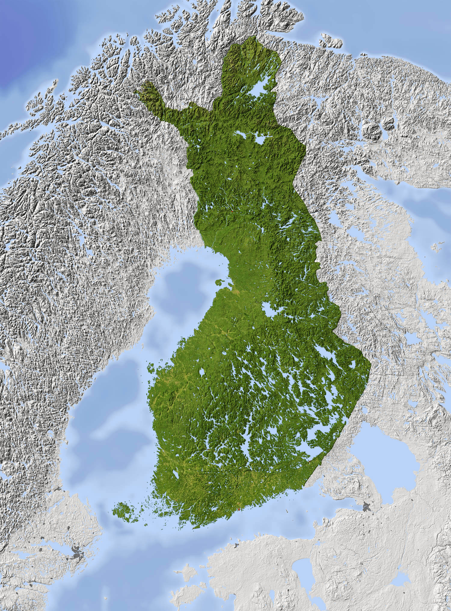 Finland Shaded relief map. Surrounding territory greyed out. Colored according to vegetation. Includes clip path for the state area.
Administrative Map of Finland
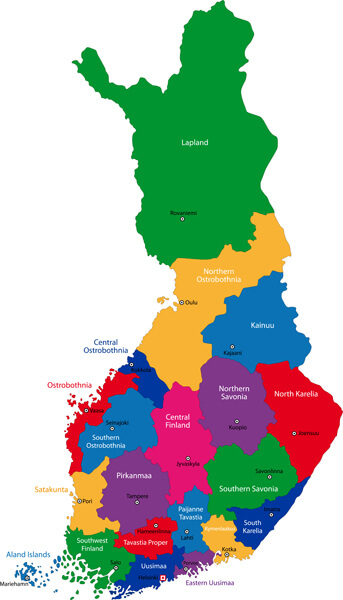 Color map of administrative divisions of Finland.
Finland Vector Map
 Republic of Finland vector map.
Map of Finland with Highways
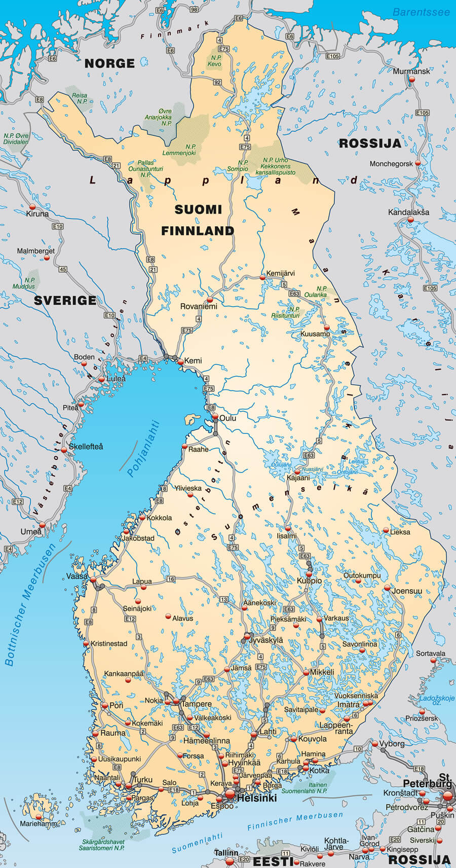 Map of Finland with highways in pastel orange.
Map of Finland with Autoroutes
 Map of Finland with autoroutes.
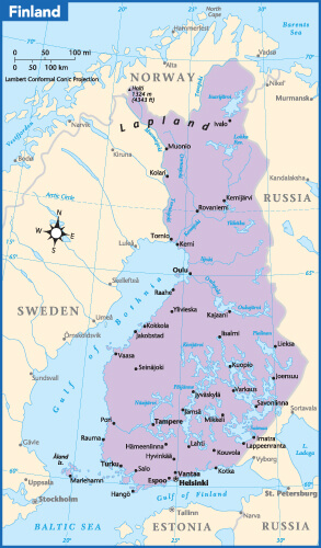
Finland Cities Map in Finnish and Swedish
 Finland map, cities in Finnish and Swedish language.
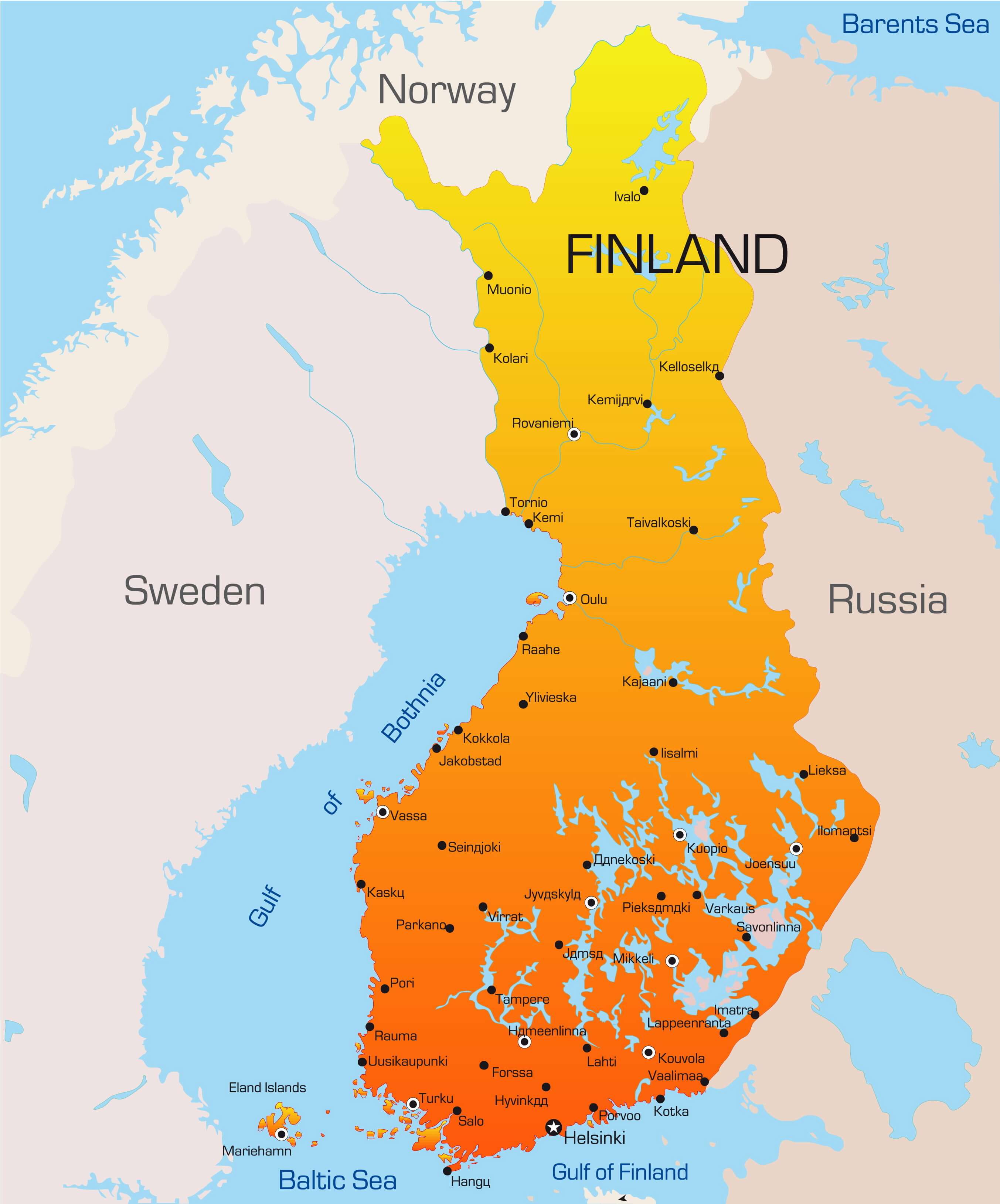
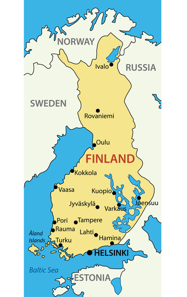
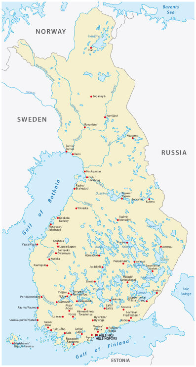
Finland Country Map
 Finland Country Map with main Cities Map.
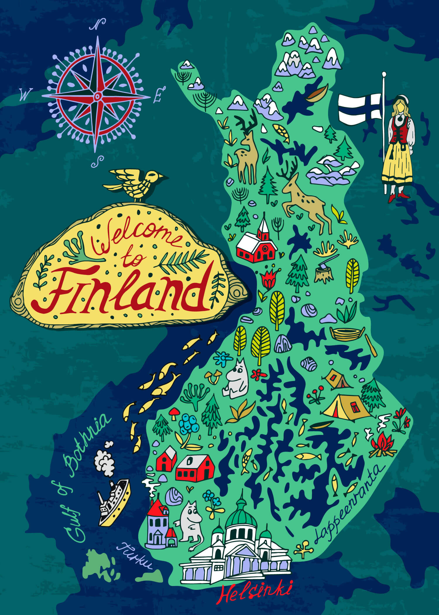
Travel Map of Finland
Finland Brexit European Union Map
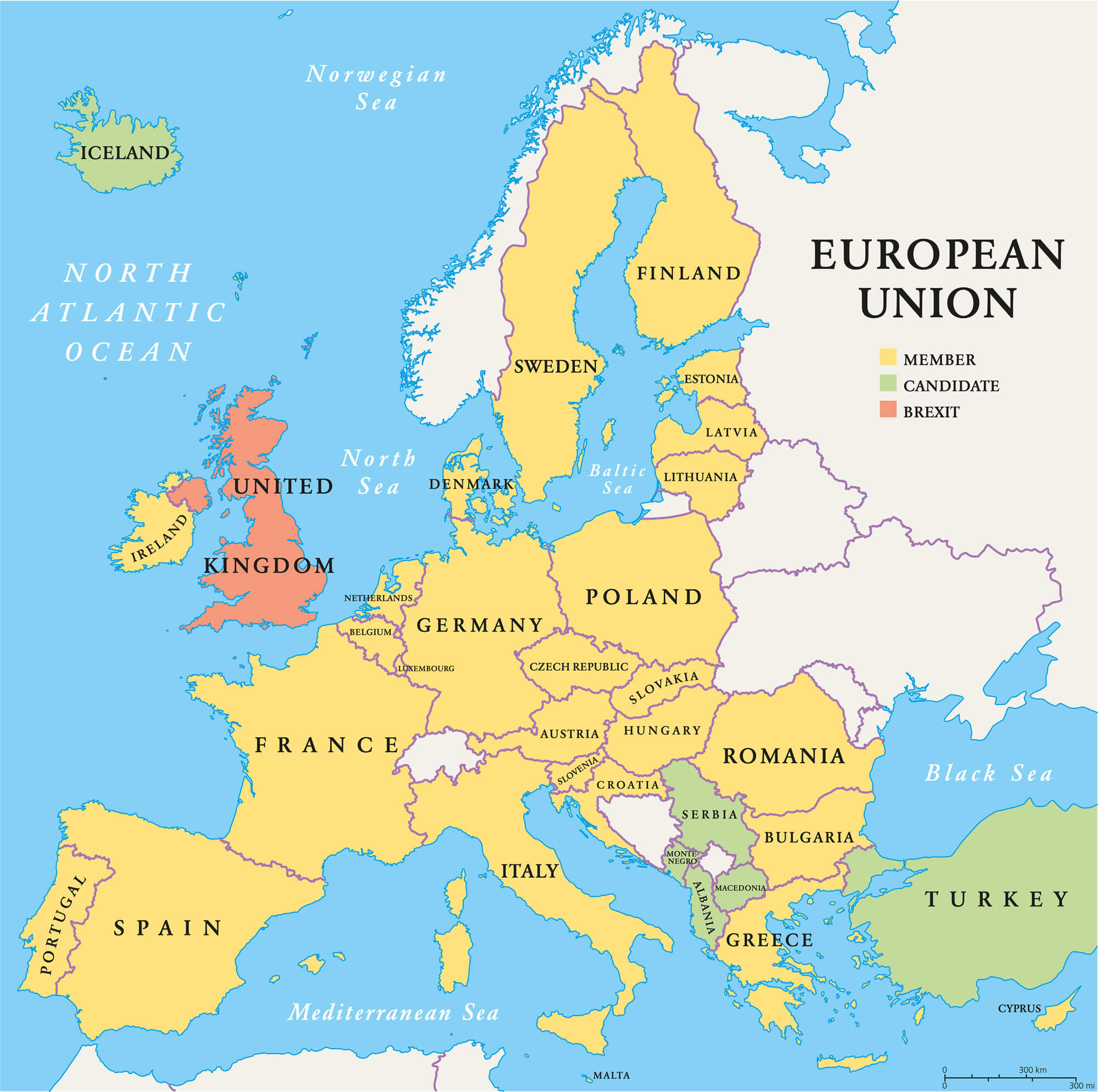 Finland Brexit European Union map. Outline political map with European Union member states and British withdrawal from the European Union, shortened to Brexit.
Finland Europe Map
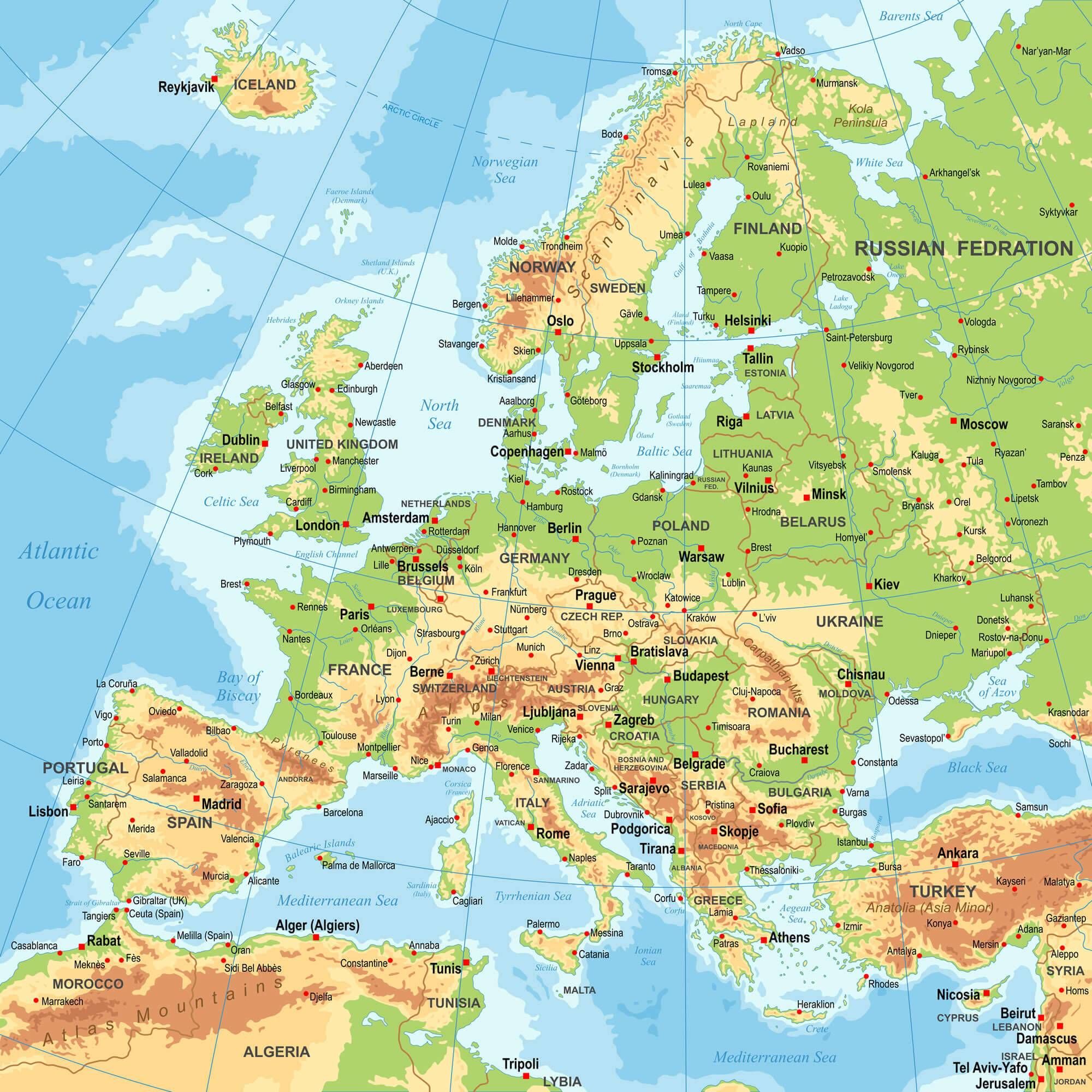 Highly detailed colored vector illustration of Europe map - borders, countries and cities - illustration.
Largest Cities' Map of Finland
Helsinki Map Espoo Map Tampere Map Vantaa Map Turku Map Oulu Map Jyvaskyla Map Lahti Map Kuopio Map Pori Map Kotka Map Lappeenranta Map Rovaniemi Map Seinajoki Map Vaasa Map Joensuu Map Salo Map Mikkeli Map Hameenlinna Map Porvoo Map Hyvinkaa Map Kajaani Map Jarvenpaa Map Lohja Map Rauma Map Kokkola Map Kerava Map Kouvola Map Nokia Map Imatra Map Riihimaki Map Savonlinna Map Ylojarvi Map Raisio Map Varkaus Map Kemi Map Raahe Map Iisalmi Map Tornio Map Kaarina Map Hamina Map Pieksamaki Map Heinola Map aanekoski Map Valkeakoski Map Kuusankoski Map Jakobstad Map Forssa Map Kuusamo Map Anjalankoski Map Vammala Map Jamsa Map Uusikaupunki Map
Addresse: Hakarinne 2 Espoo, Uusimaa - Finland 02210
Web: istanbul-city-guide.com
Email: [email protected]
Web: istanbul-city-guide.com
Email: [email protected]
Copyright istanbul-city-guide.com - 2004 - 2026. All rights reserved. Privacy Policy | Disclaimer