Trinidad and Tobago Map and Trinidad and Tobago Satellite Images
Explore map of Trinidad and Tobago, Trinidad and Tobago map, cities map of Trinidad and Tobago, satellite images of Trinidad and Tobago, Trinidad and Tobago largest cities maps, political map of Trinidad and Tobago, driving directions, country atlas and traffic map.
Trinidad and Tobago Map FQA
How many cities are in Trinidad and Tobago ?
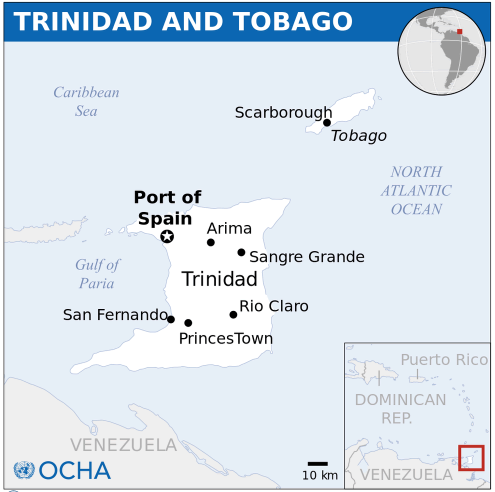
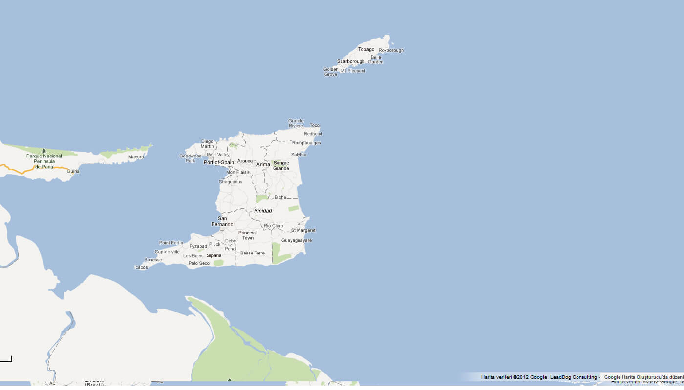
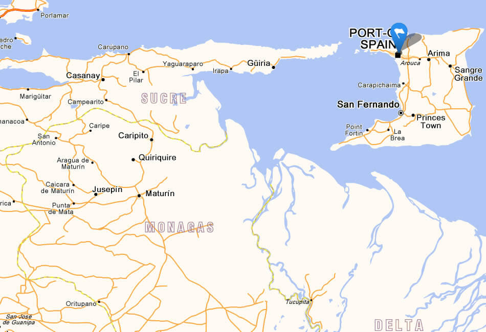
Trinidad and Tobago has 5 main cities. The largest by population are: Chaguanas; San Fernando; Port of Spain; Arima; Point Fortin.What are the major geographical features of Trinidad and Tobago ?
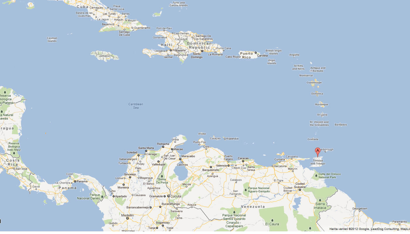
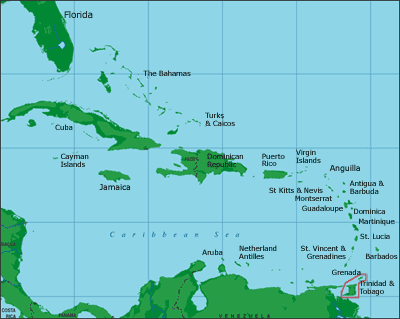
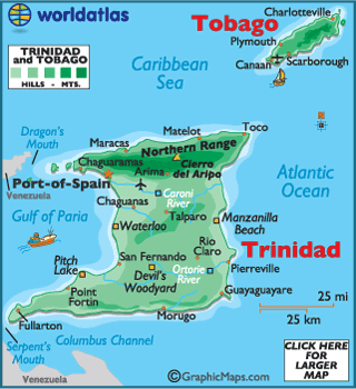
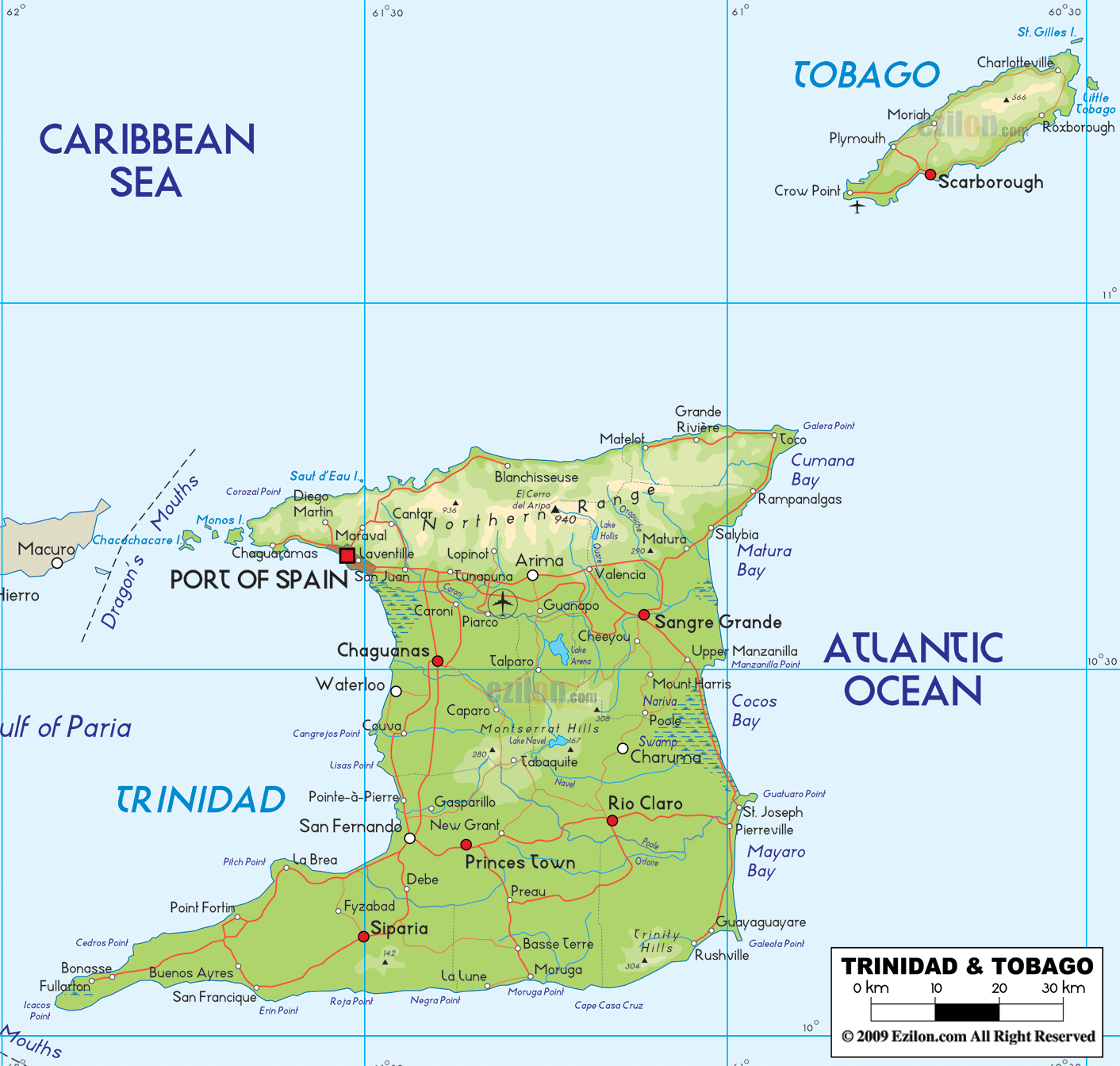
Trinidad and Tobago, located in the Caribbean near Venezuela, consists of two main islands. Trinidad has the Northern Range mountains, the Caroni Swamp, and fertile plains, while Tobago is more hilly with coral reefs and beaches.WHERE IS TRINIDAD AND TOBAGO IN THE WORLD
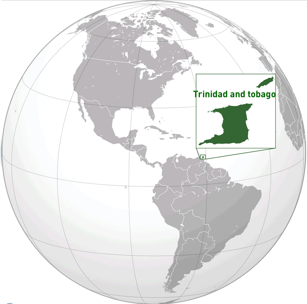
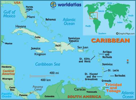
TRINIDAD AND TOBAGO LOCATION MAP
WHERE IS TRINIDAD AND TOBAGO IN THE WORLD
Can I download a high-resolution map of Trinidad and Tobago ?
Yes. Download high-resolution political and physical maps of Trinidad and Tobago for personal or educational use. Redistribution is subject to the terms of our license.
- Capital : Port of Spain
- Population : 1,346,350
- GDP : $22.707 billion
- Per Capita : $17,158
- Calling Code : +1-868
- Jobless Rate : 5.40%
- Time Zone : -4
For more about Trinidad and Tobago >>
A Collection of Trinidad and Tobago Maps and Trinidad and Tobago Satellite Images
MAP OF TRINIDAD AND TOBAGO

TRINIDAD AND TOBAGO LOCATION MAP
WHERE IS TRINIDAD AND TOBAGO IN THE WORLD
MAP OF TRINIDAD AND TOBAGO CARIBBEAN SEA
MAP OF TRINIDAD AND TOBAGO WORLD

MAP OF TRINIDAD AND TOBAGO
MAP OF TRINIDAD TOBAGO
PHYSICAL MAP TRINIDAD TOBAGO

TRINIDAD AND TOBAGO CARIBBEAN MAP
TRINIDAD AND TOBAGO MAP
TRINIDAD PHYSICAL MAP
TRINIDAD TOBAGO MAP

TRINIDAD AND TOBAGO MAP

TRINIDAD MAP

TRINIDAD TOBAGO MAP
Largest Cities' Map of Trinidad and Tobago
Port of Spain Map Princess Town Map San Fernando Map Point Fortin Map
Addresse: Hakarinne 2 Espoo, Uusimaa - Finland 02210
Web: istanbul-city-guide.com
Email: [email protected]
Web: istanbul-city-guide.com
Email: [email protected]
Copyright istanbul-city-guide.com - 2004 - 2026. All rights reserved. Privacy Policy | Disclaimer