Poland Map and Poland Satellite Images
Explore map of Poland, Poland map, cities map of Poland, satellite images of Poland, Poland largest cities maps, political map of Poland, driving directions, country atlas and traffic map.
Poland Map FQA
How many cities are in Poland ?
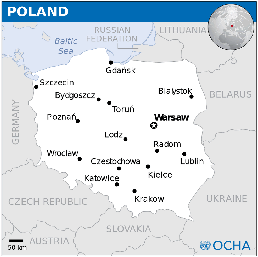
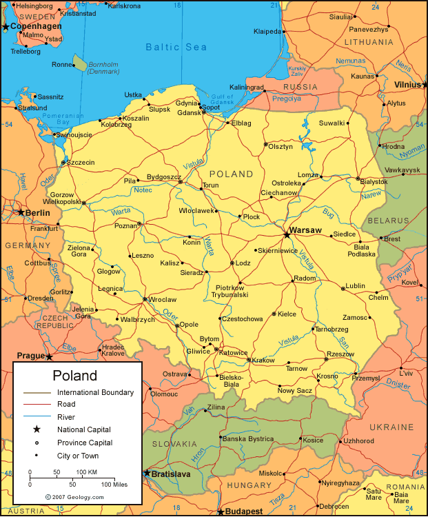
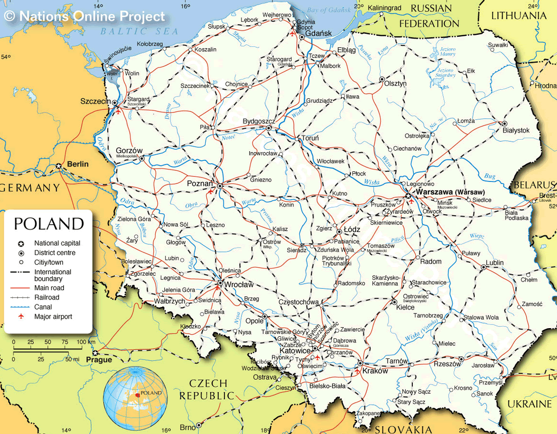
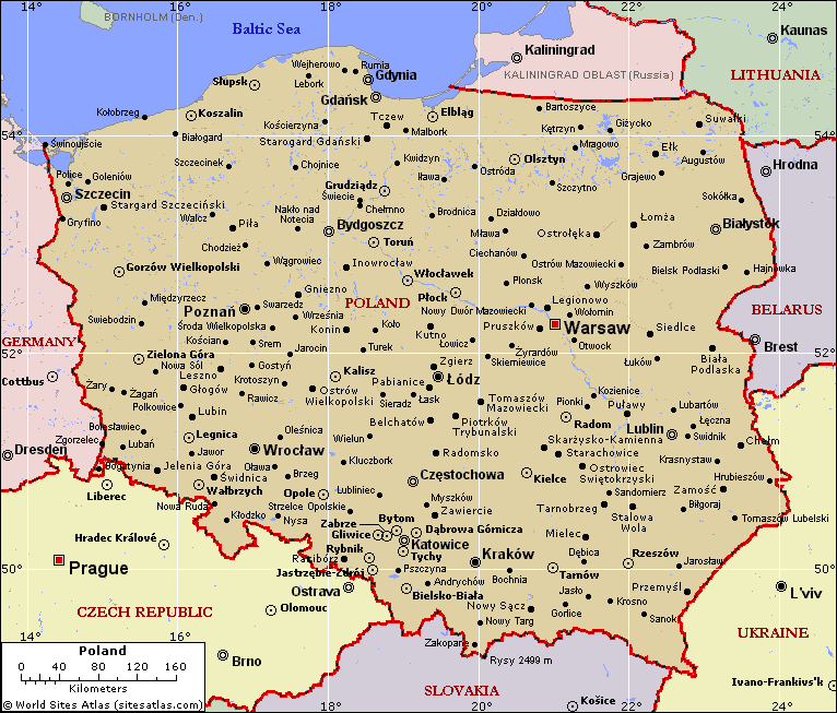
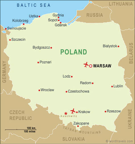
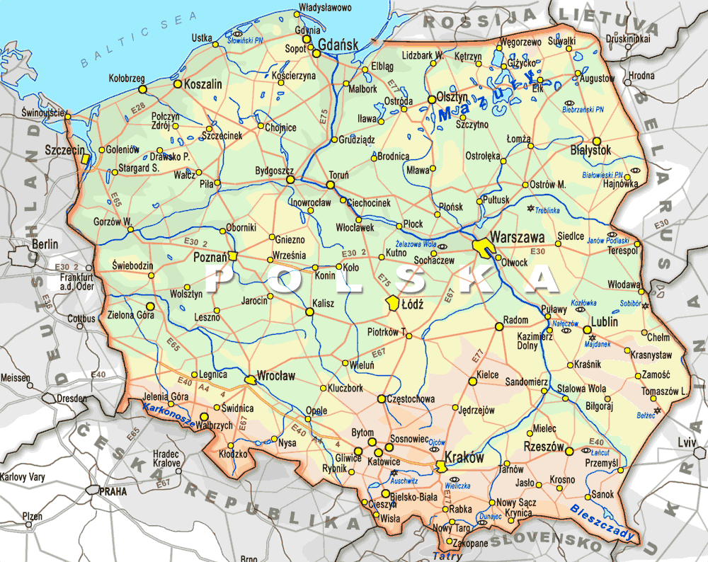
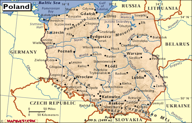
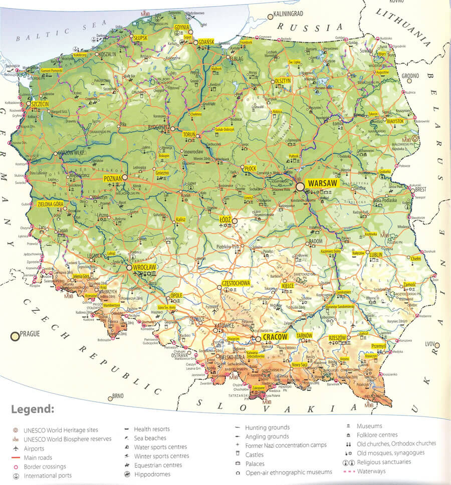
Poland has more than 10 major cities. The largest by population are: Warsaw; Kraków; Lódz; Wroclaw; Poznan; Gdansk; Szczecin; Bydgoszcz; Lublin; Katowice.What are the major geographical features of Poland ?
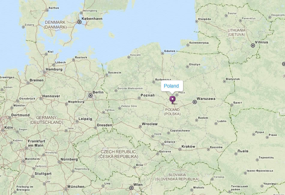
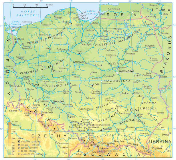
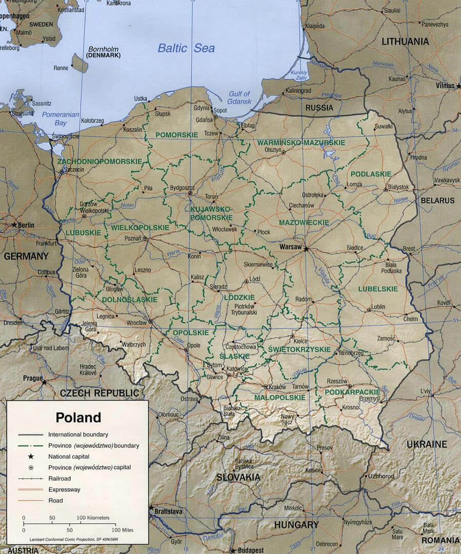
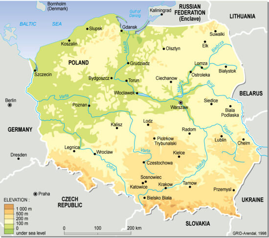
Poland in Central Europe has diverse geography, including the Carpathian and Sudeten mountains in the south, the Masurian Lake District in the northeast, and the Baltic Sea coast in the north. The Vistula and Oder rivers are major waterways.WHERE IS POLAND IN THE WORLD
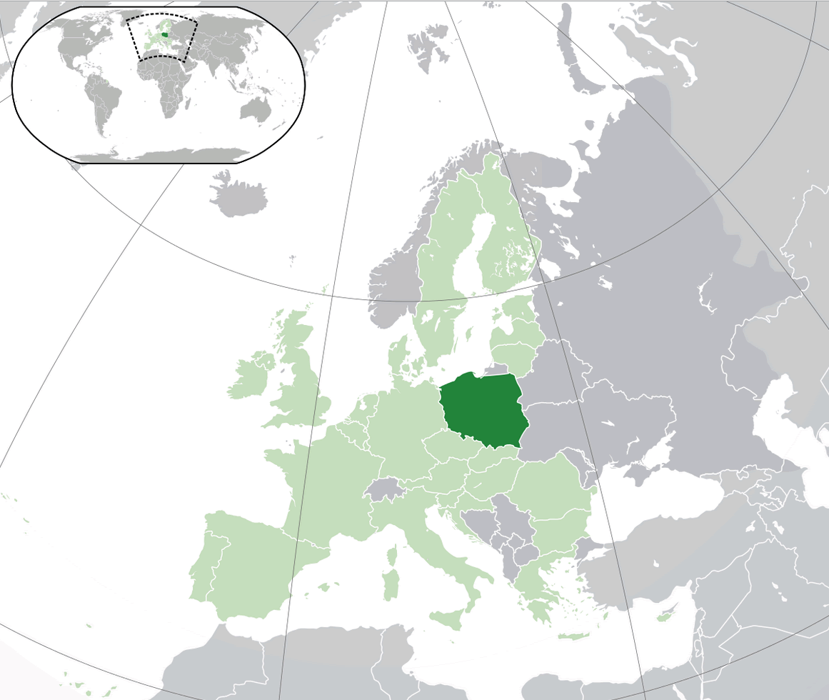
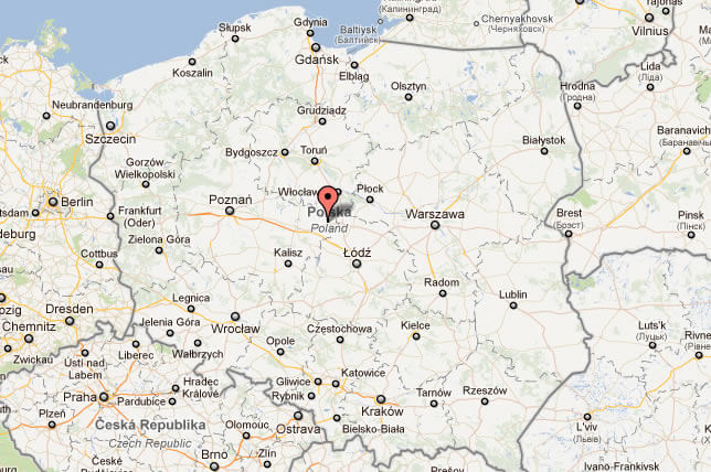
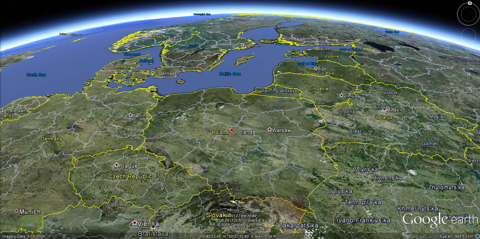
POLAND LOCATION MAP
WHERE IS POLAND IN THE WORLD
Can I download a high-resolution map of Poland ?
Yes. Download high-resolution political and physical maps of Poland for personal or educational use. Redistribution is subject to the terms of our license.
- Capital : Warsaw
- Population : 38,186,860
- GDP : $513.821 billion
- Per Capita : $13,540
- Calling Code : +48
- Jobless Rate : 13.40%
- Time Zone : +1
For more about Poland >>
A Collection of Poland Maps and Poland Satellite Images
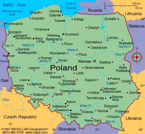
MAP OF POLAND
POLAND LOCATION MAP
WHERE IS POLAND IN THE WORLD
MAP OF POLAND
MAP POLAND

MAPS OF POLAND
POLAND MAP
POLAND MAPS
POLAND CITIES MAP
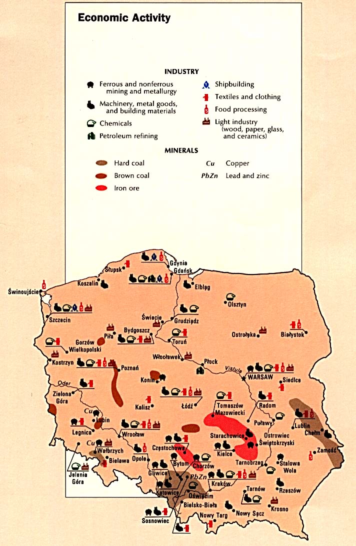
POLAND ECONOMY MAP
POLAND GOOGLE MAP
POLAND LAND MAP
POLAND MAP
POLAND MAP
POLAND MAP WARSAW
POLAND MAPS
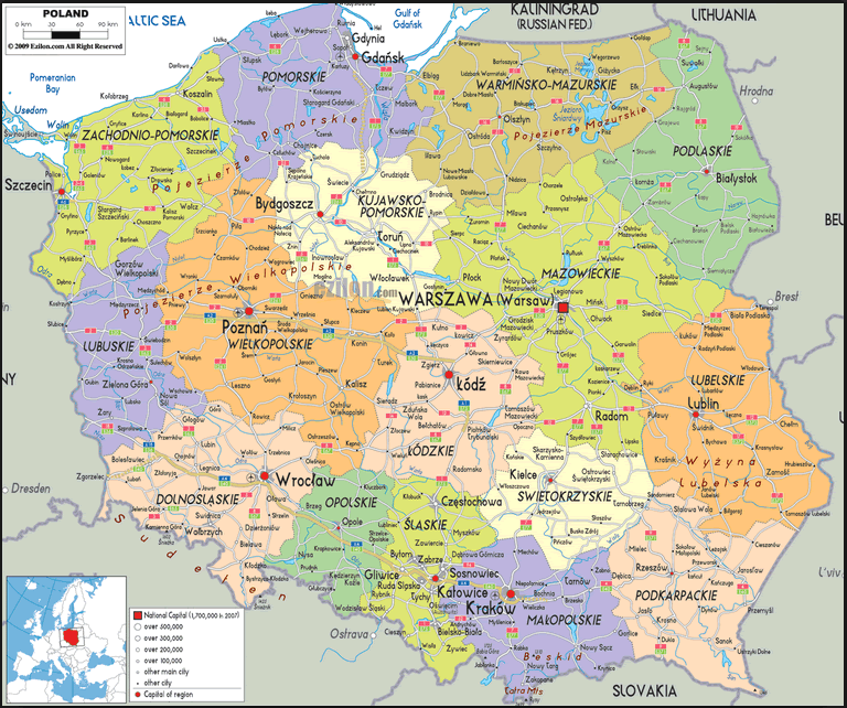
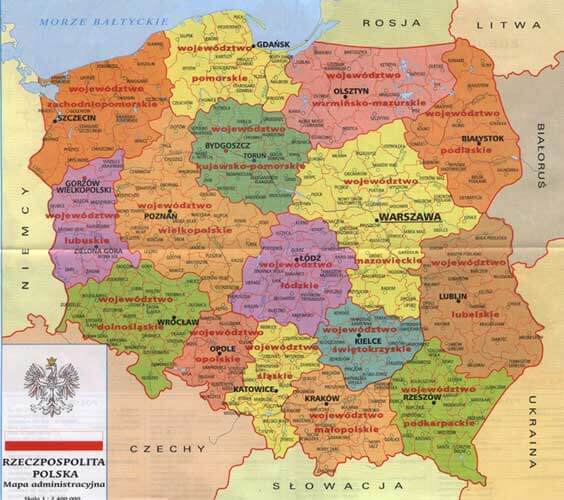
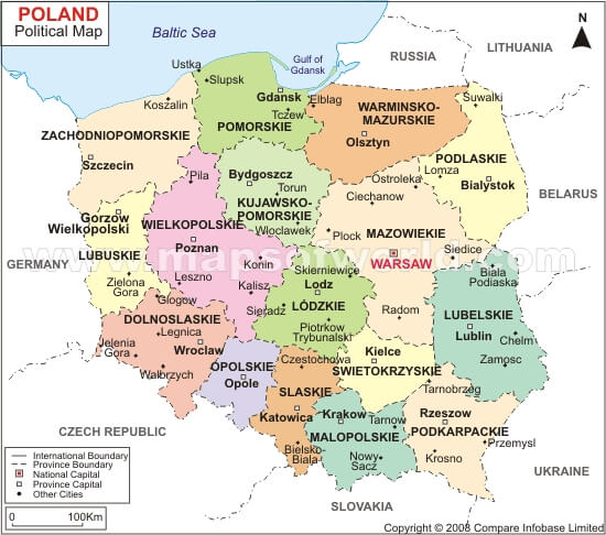
POLAND POLITICAL MAP
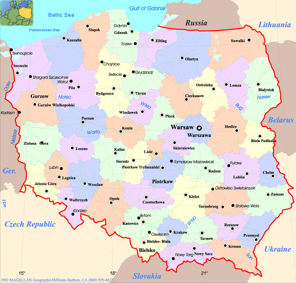
POLAND PROVINCES MAP
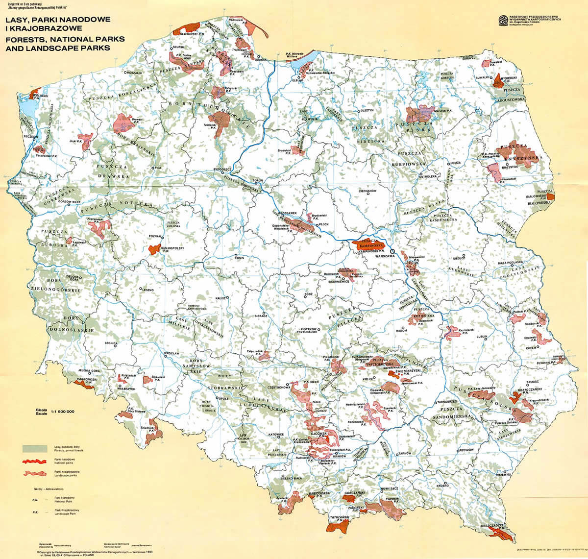
POLAND RELIEF MAP
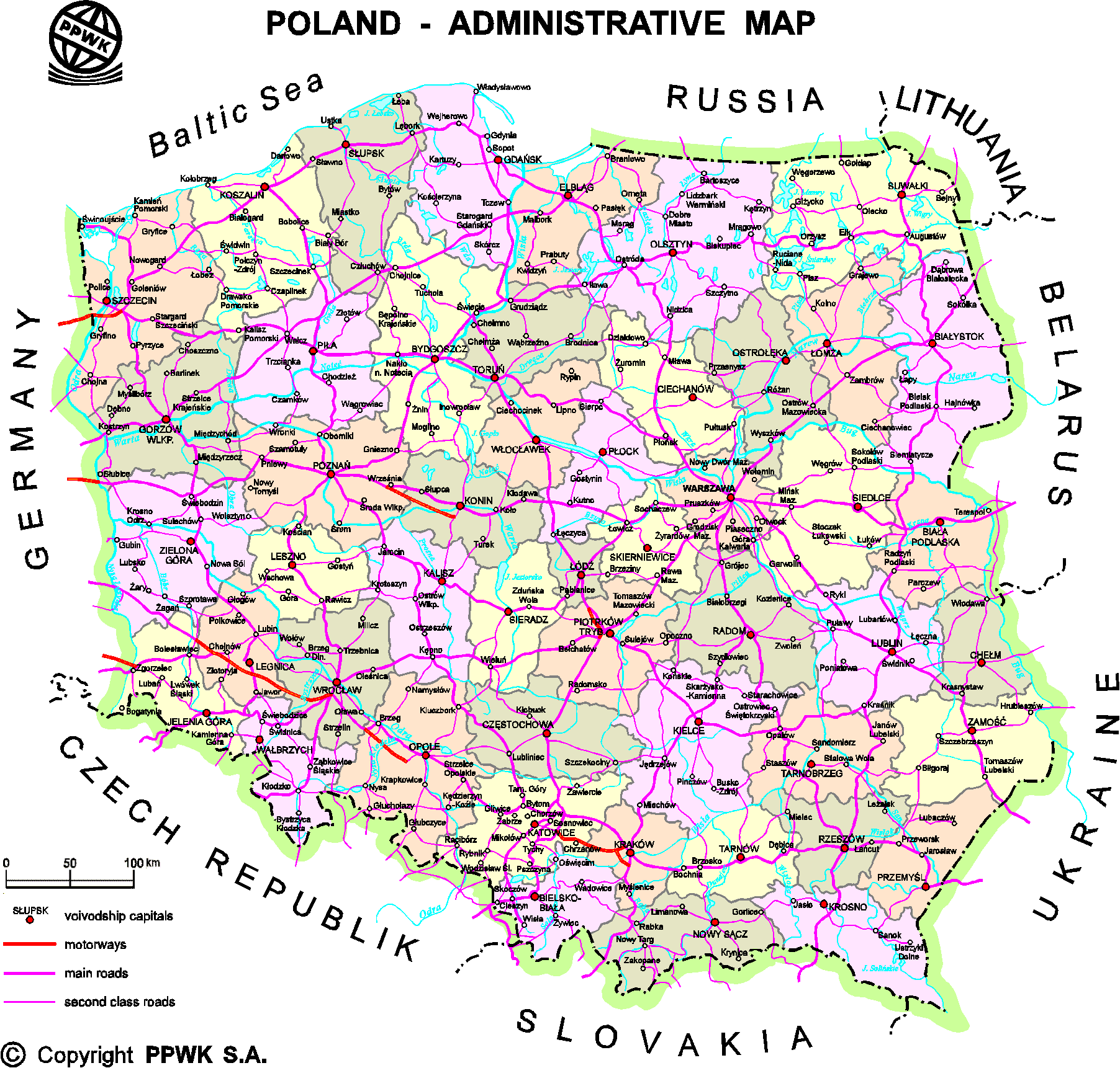
POLAND ROAD MAP
POLAND TOPOGRAPHIC MAP
POLAND TOURIST MAP
POLAND TOURIST MAP B

POLISH PROVINCES MAP
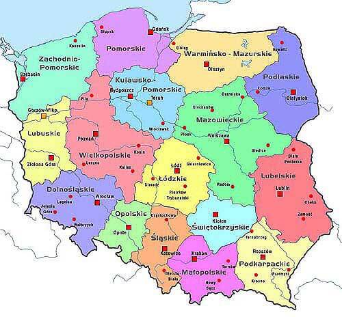
PROVINCES POLAND MAP
POLAND EARTH MAP
Top 10 Must-Visit Attractions in Warsaw for Every Traveler
Please subscribe on "World Guide" channnel on Youtube at youtube.com/c/WorldGuide
Exploring Krakow: The Ultimate Tourist Visits for a Memorable Trip
Largest Cities' Map of Poland
Warsaw Map Gdansk Map Radom Map Czestochowa Map Katowice Map Poznan Map Sosnowiec Map Torun Map Bialystok Map Wroclaw Map Kielce Map Lublin Map Bydgoszcz Map Szczecin Map Krakow Map Lodz Map
Addresse: Hakarinne 2 Espoo, Uusimaa - Finland 02210
Web: istanbul-city-guide.com
Email: [email protected]
Web: istanbul-city-guide.com
Email: [email protected]
Copyright istanbul-city-guide.com - 2004 - 2026. All rights reserved. Privacy Policy | Disclaimer