United Arab Emirates Map
Navigate United Arab Emirates map, satellite images of the United Arab Emirates, states, largest cities, political map, capitals and physical maps.
- Capital : Abu Dhabi
- Population : 8,264,070
- GDP : $360.136 billion
- Per Capita : $67,008
- Calling Code : +971
- Jobless Rate : 4.60%
- Time Zone : +4
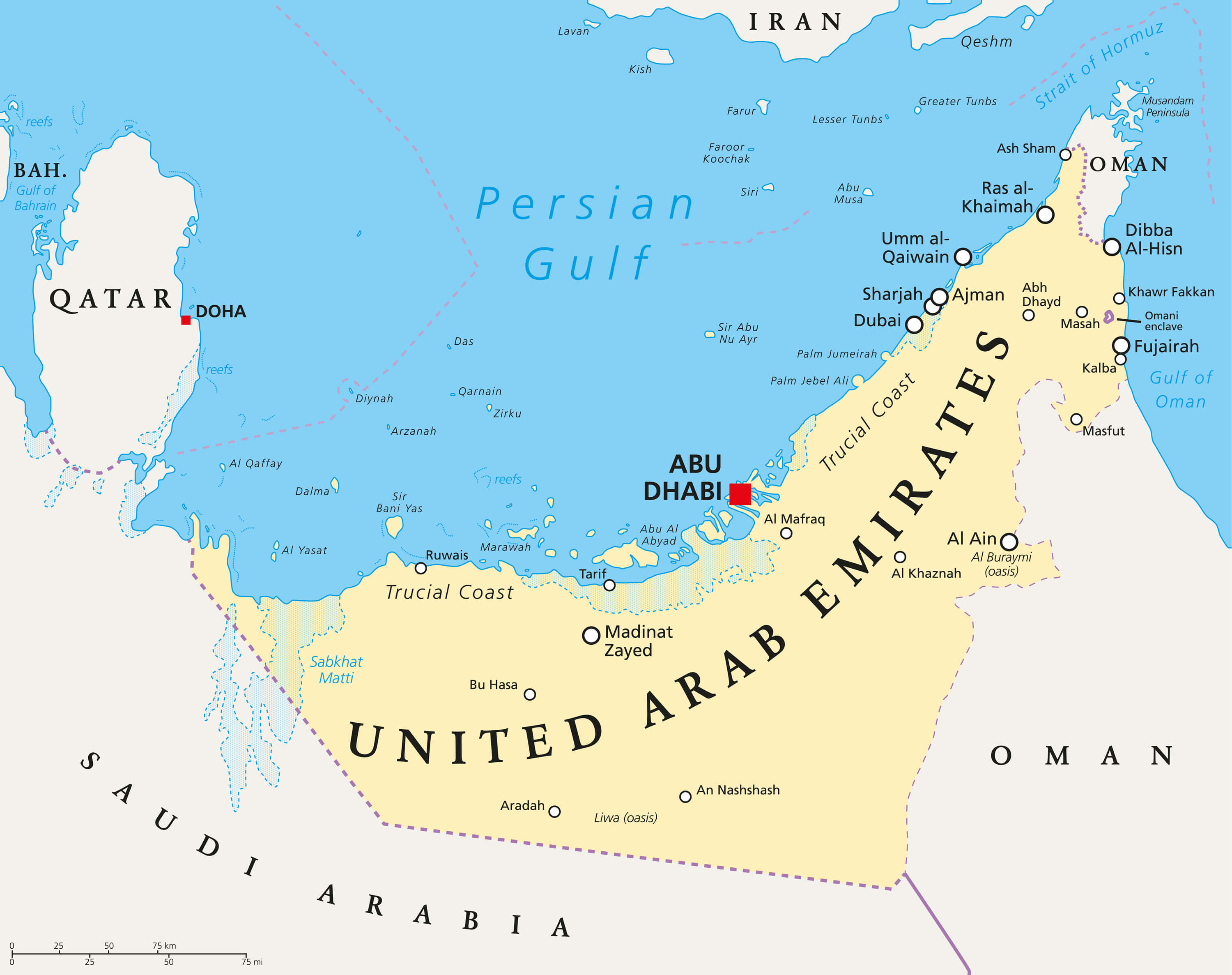
United Arab Emirates Gulf Region Countries Map
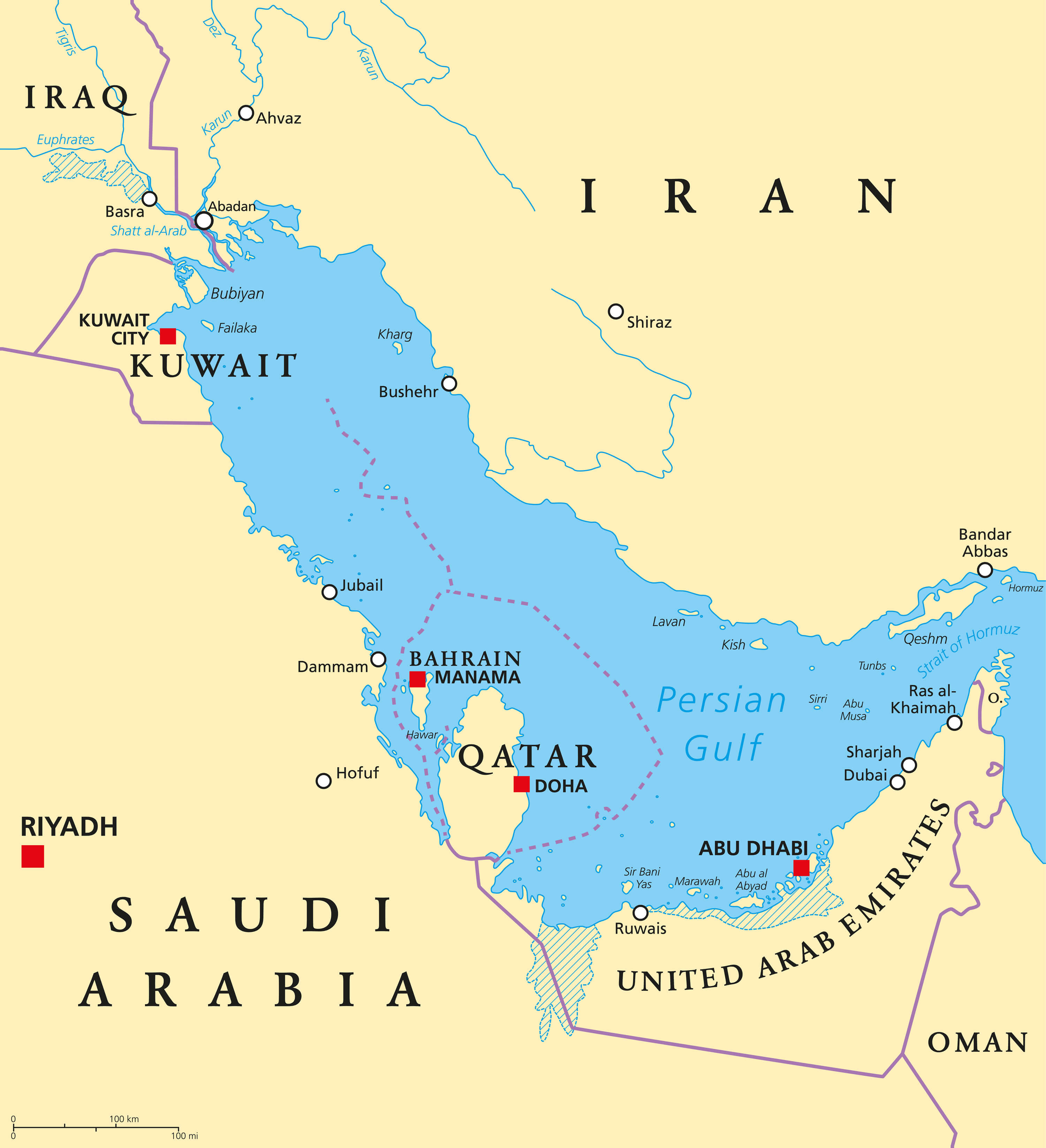 Persian Gulf region countries political map. Capitals, borders, cities and rivers. Iran, Iraq, Kuwait, Qatar, Bahrain, United Arab Emirates, United Arab Emirates Map Arabia, Oman. Illustration. English labeling. Vector.
United Arab Emirates Earth Map
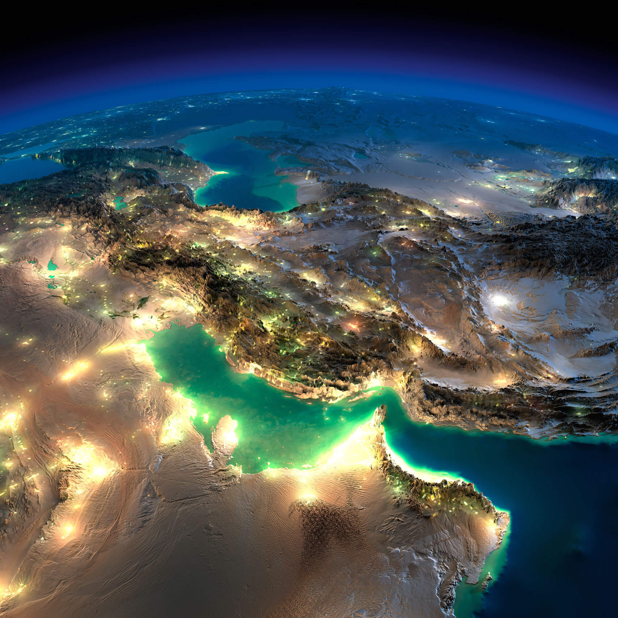 Highly detailed Earth, illuminated by moonlight. The glow of cities sheds light on the detailed exaggerated terrain. Night Earth. Persian Gulf. Elements of this image furnished by NASA.
United Arab Emirates Map
 United Arab Emirates Map
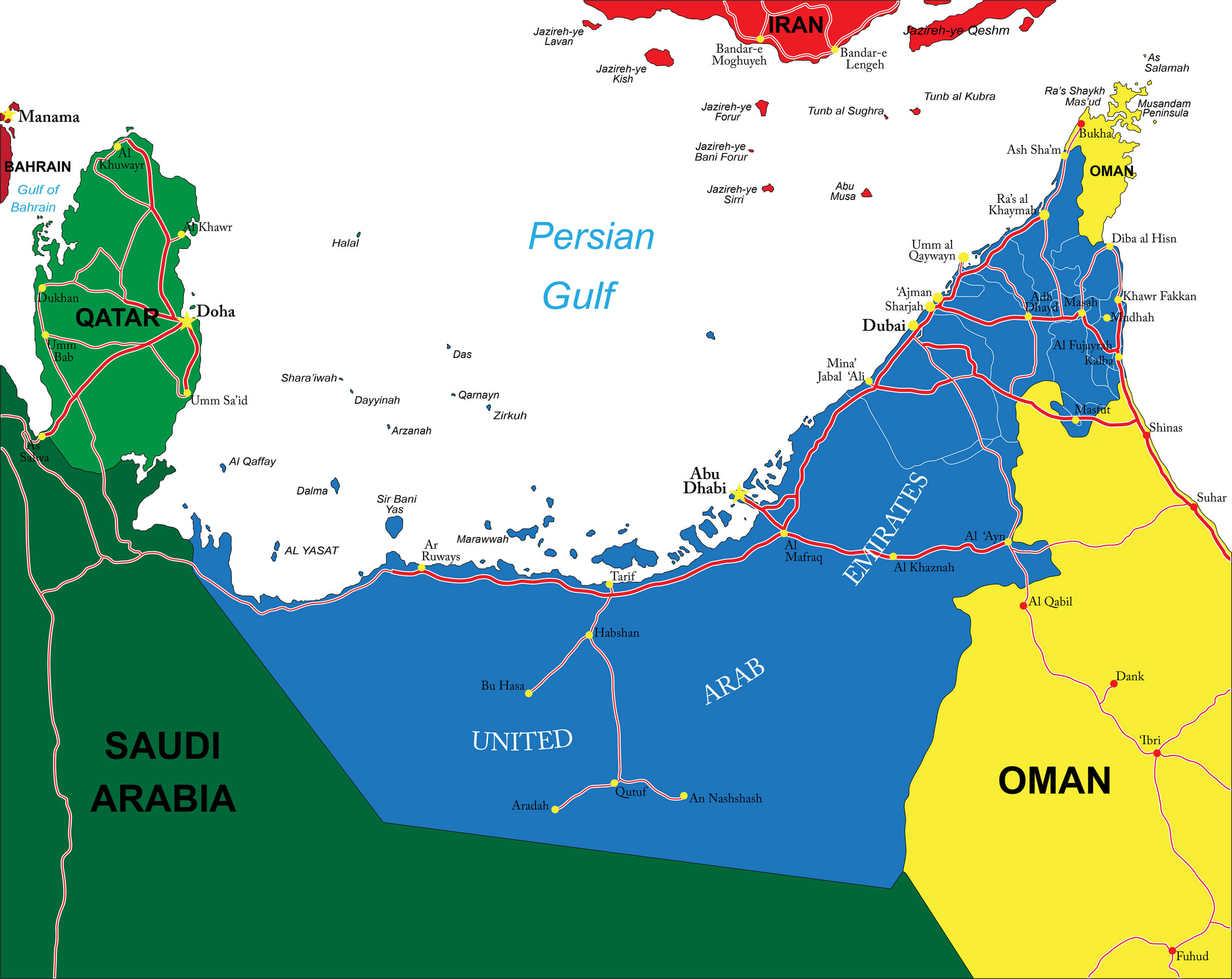
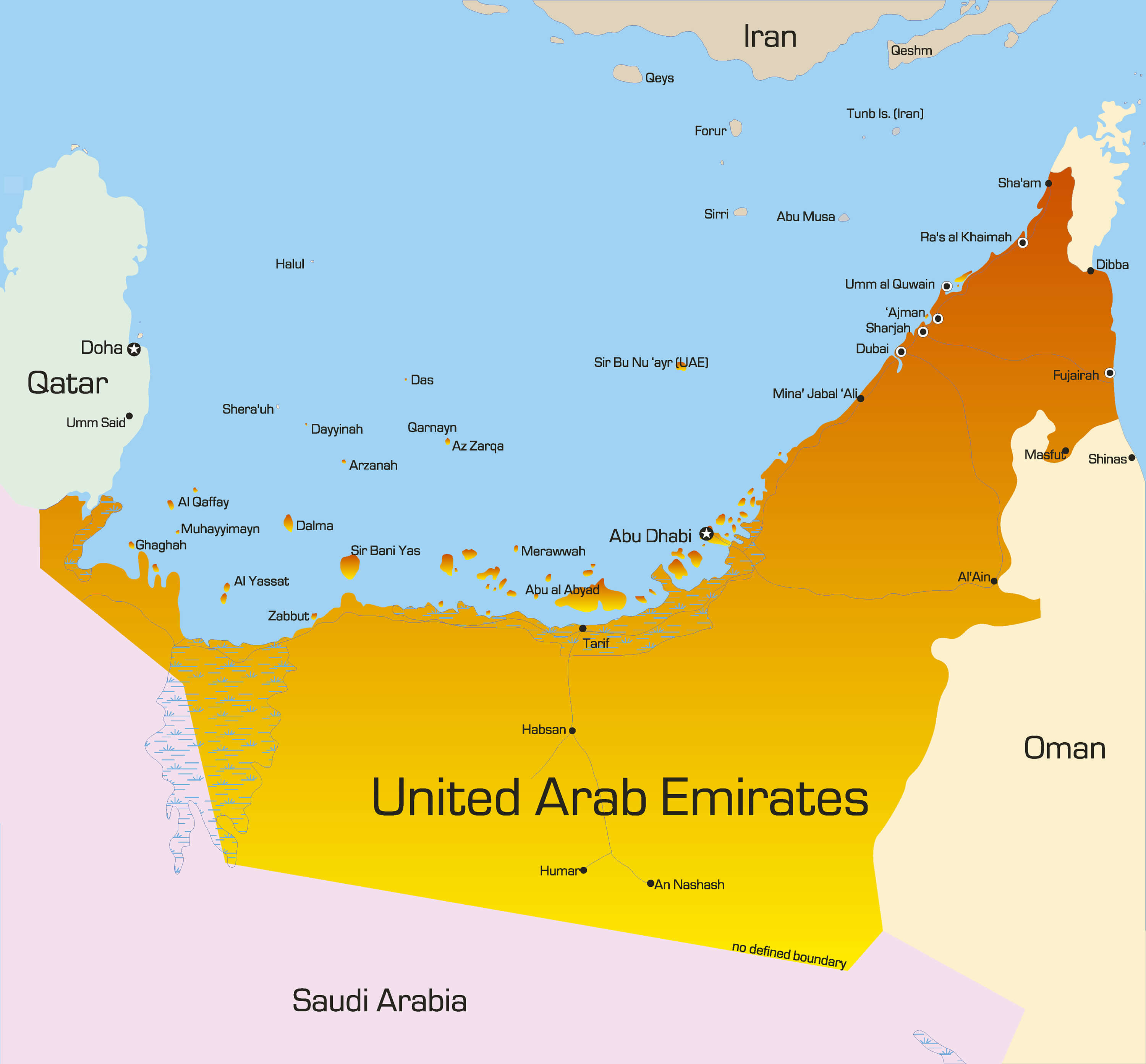
United Arab Emirates Political Map
 UAE United Arab Emirates political map with capital Abu Dhabi, national borders, important cities and bodies of water. English labeling and scaling. Illustration.
United Arab Emirates Colorful Map
 Vector color map of United Arab Emirates country.
United Arab Emirates Regions Map
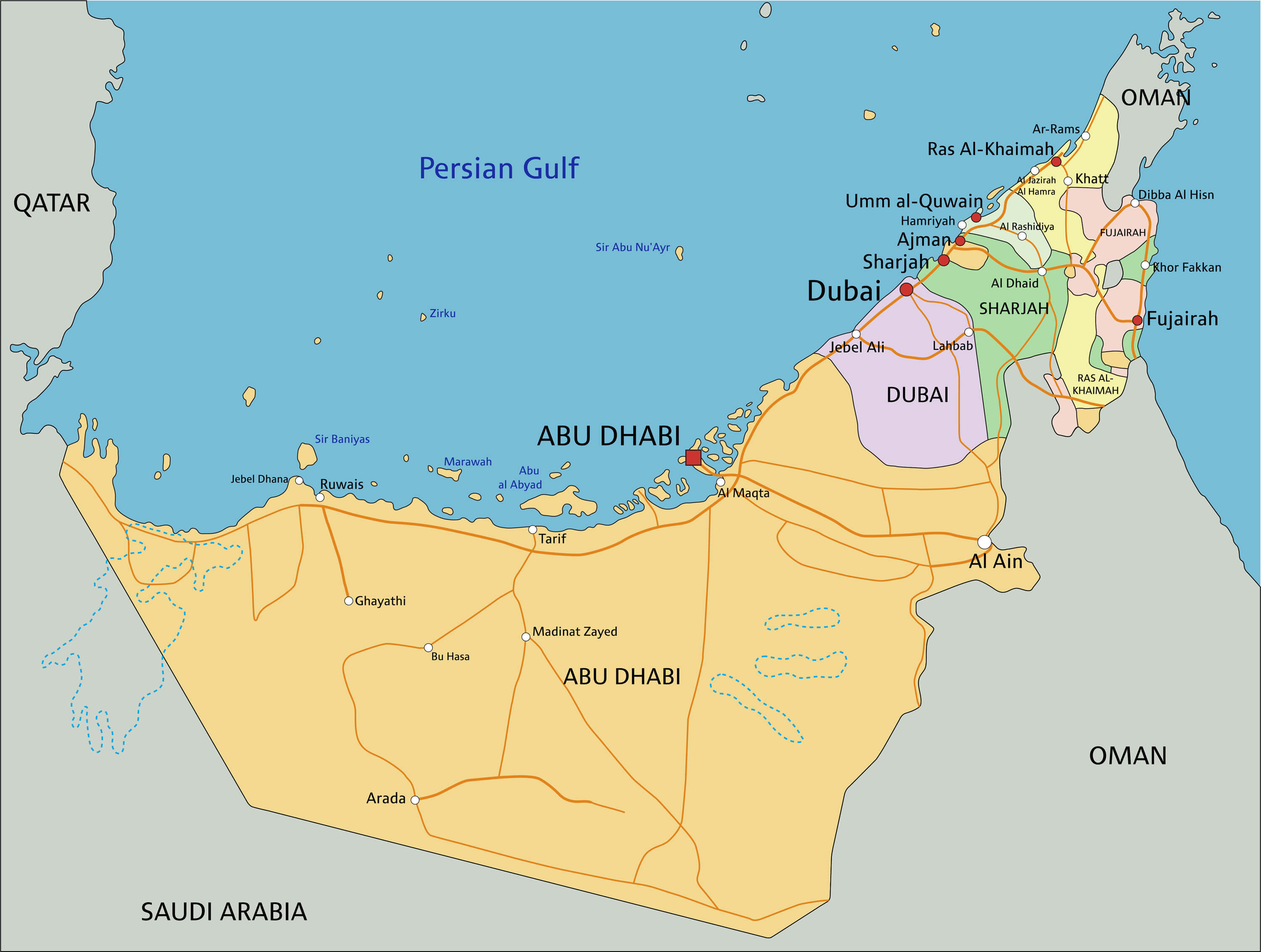 United Arab Emirates - Highly detailed editable political map with labeling.
United Arab Emirates Cities Map
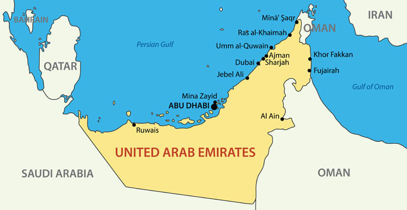 United Arab Emirates - vector map with cities.
Largest Cities' Map of United Arab Emirates
Abu Dhabi Map Ajman Map Al Ain Map Al Fujayrah Map Ash Shariqah Map Dubai Map Khawr Fakkan Map Ras Al Khaimah Map Umm al Qaywayn Map
Addresse: Hakarinne 2 Espoo, Uusimaa - Finland 02210
Web: istanbul-city-guide.com
Email: [email protected]
Web: istanbul-city-guide.com
Email: [email protected]
Copyright istanbul-city-guide.com - 2004 - 2026. All rights reserved. Privacy Policy | Disclaimer