Czech Republic Map
Navigate Czech Republic map, satellite images of the Czech Republic, states, largest cities, political map, capitals and physical maps.
- Capital : Prague (Praha)
- Population : 10,513,209
- GDP : $193.513 billion
- Per Capita : $18,337
- Calling Code : +420
- Jobless Rate : 9.40%
- Time Zone : +1
Czech Republic Shaded Relief Map
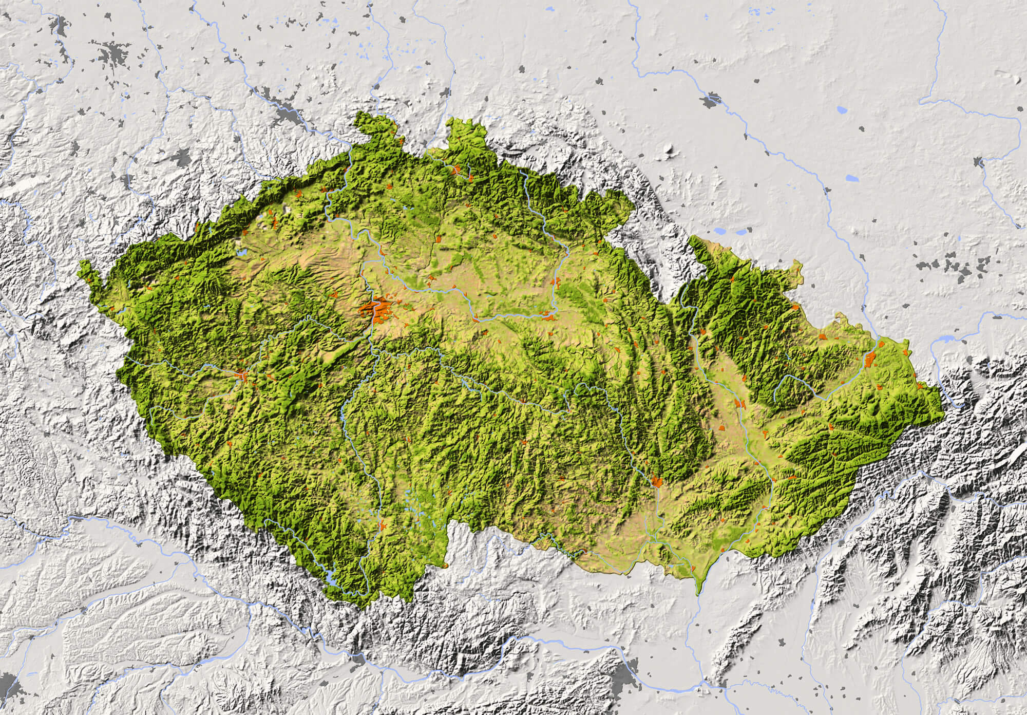 Czech Republic Shaded relief map with major urban areas. Surrounding territory greyed out. Colored according to vegetation. Includes clip path for the state area.
Czech Republic Relief Map
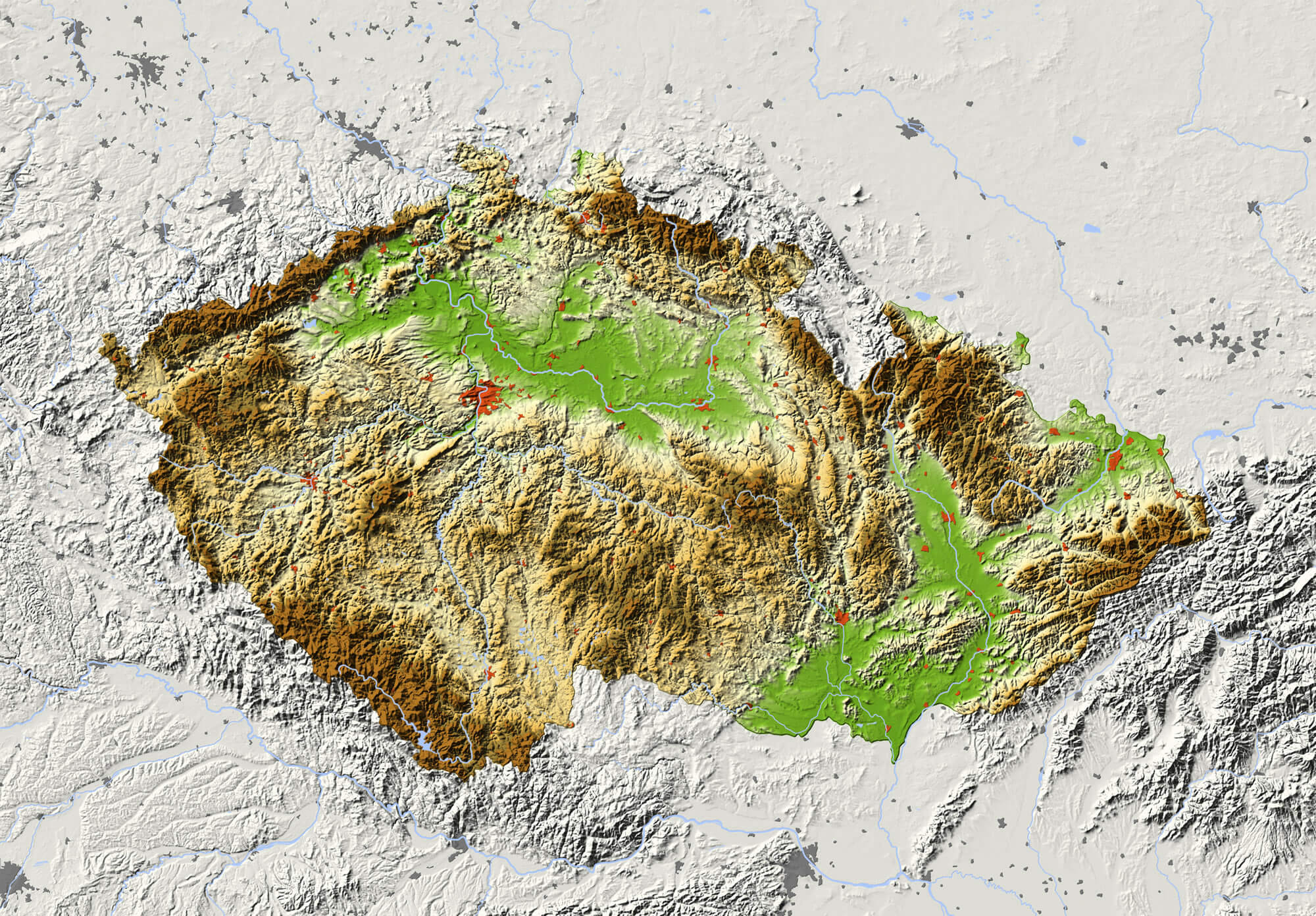 Czech Republic. Shaded relief map with major urban areas. Surrounding territory greyed out. Colored according to elevation. Includes clip path for the state area.
Political Map of Czech Republic
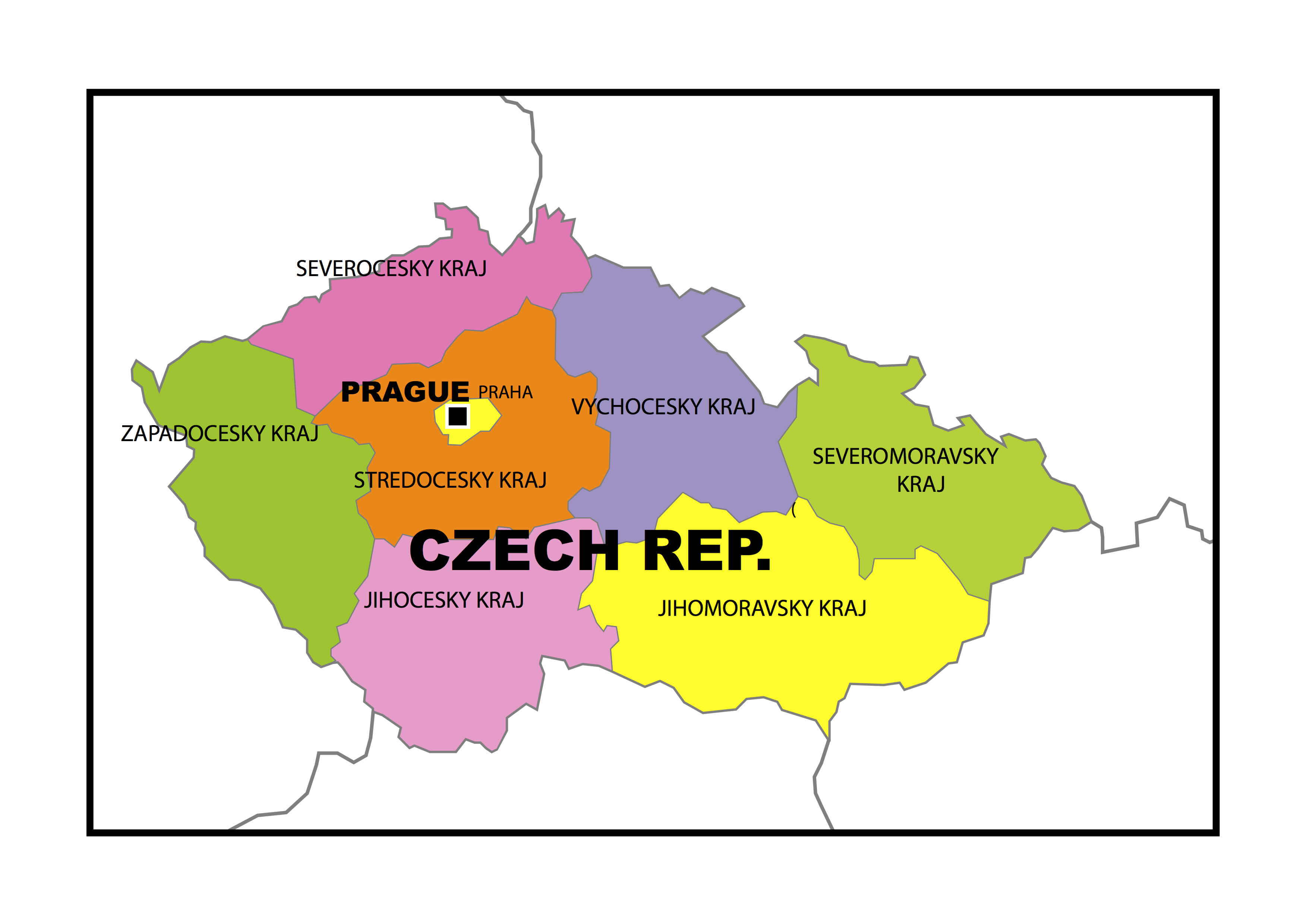 Political map of Czech Republic with provinces.
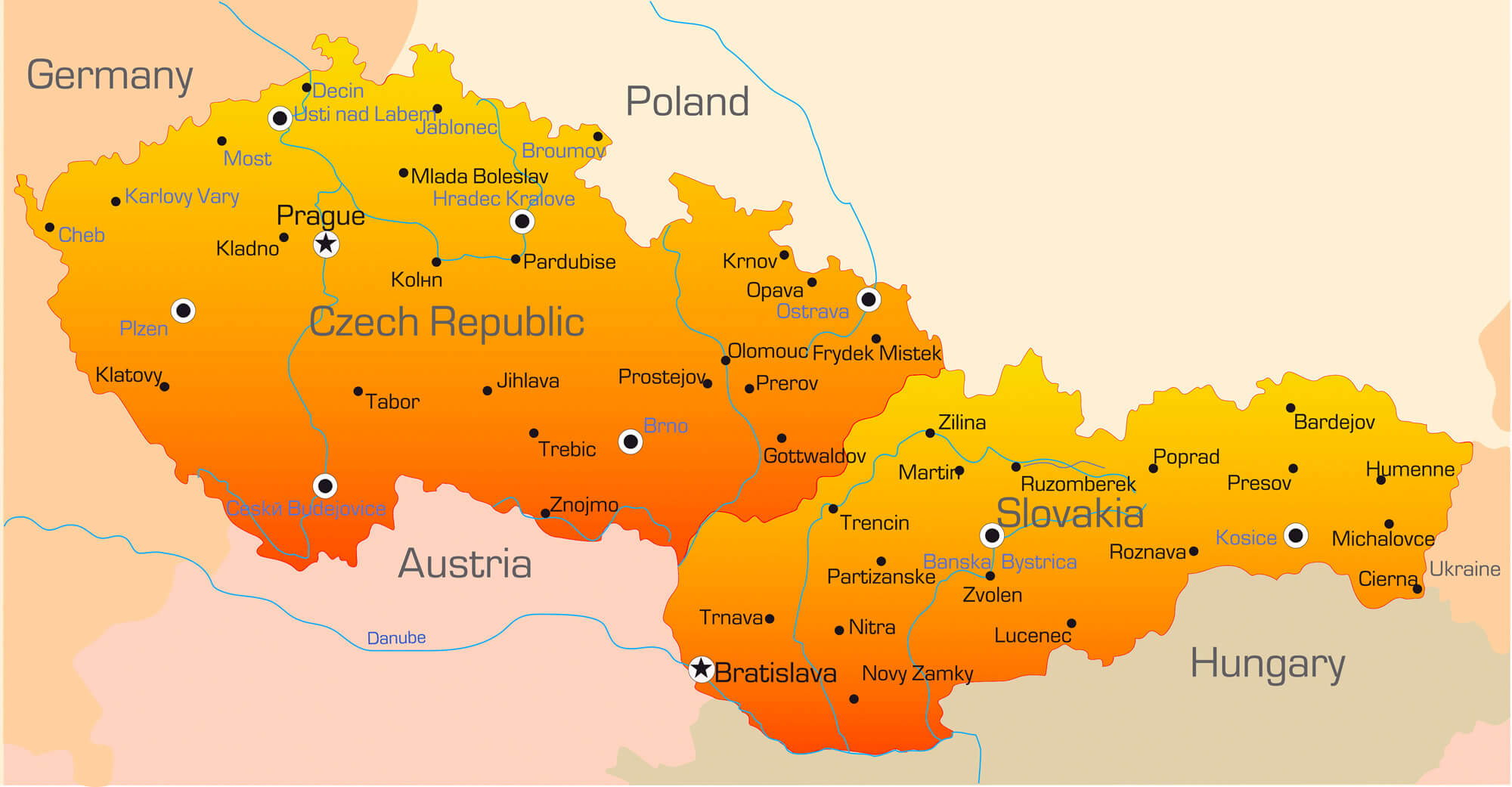
Czech Republic Political Map
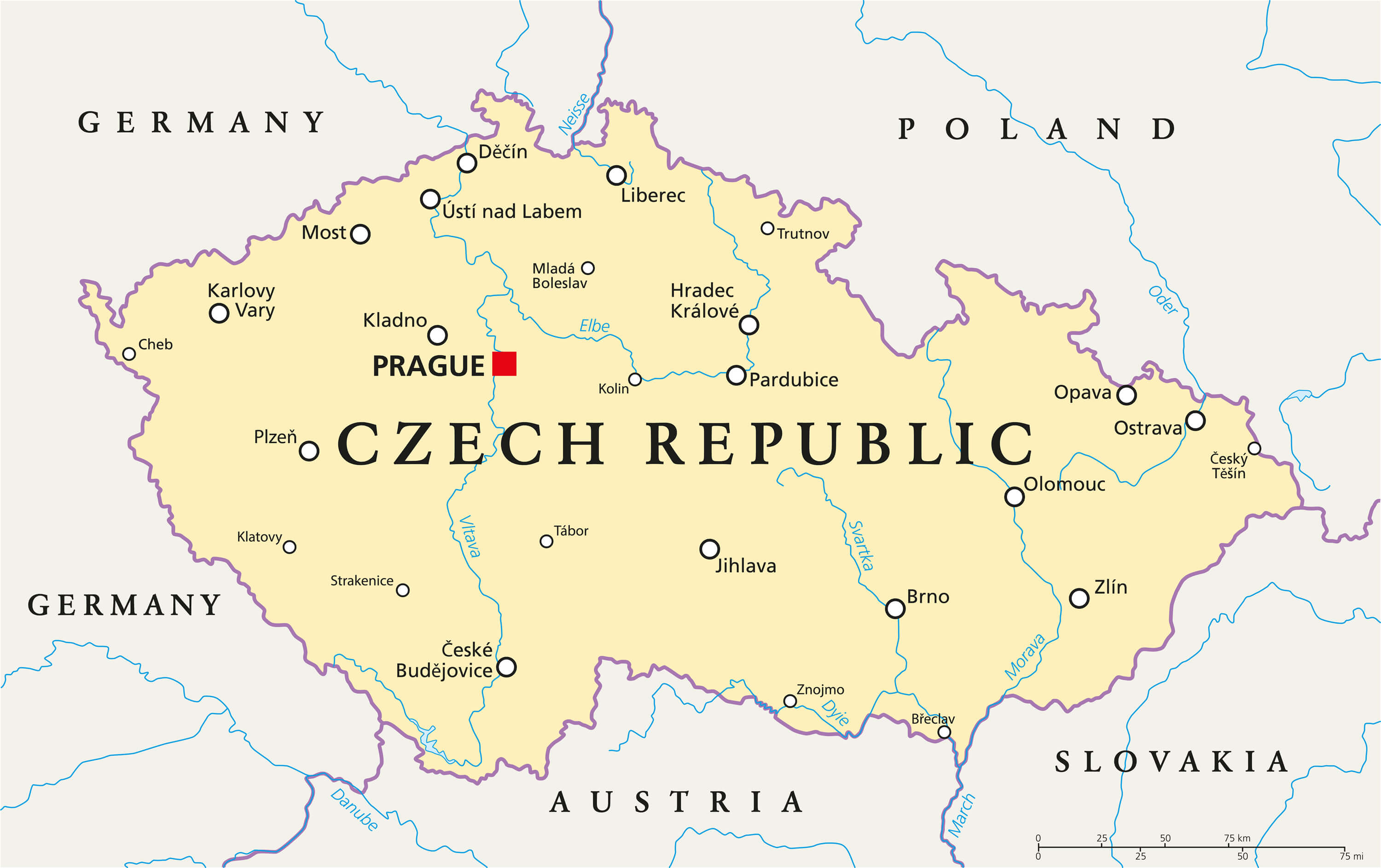 Czech Republic Political Map with capital Prague, national borders, important cities, rivers and lakes. English labeling and scaling. Illustration.
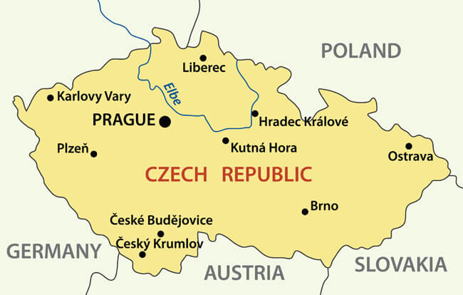
Map of Czech Republic
 Map of Czech Republic as an overview map in pastel green.
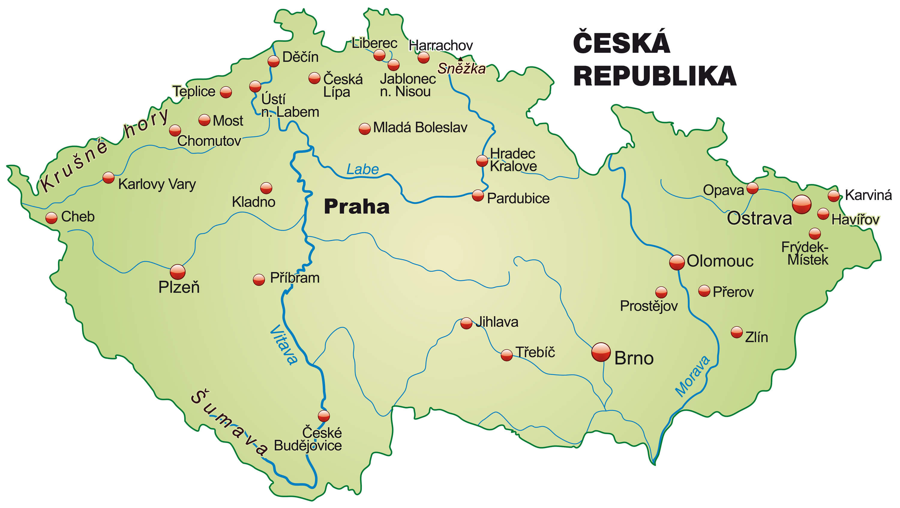
Vector Map of Czech republic
 Vector map of Czech republic | Monochrome contour map with city names.
Czech Republic Road Map
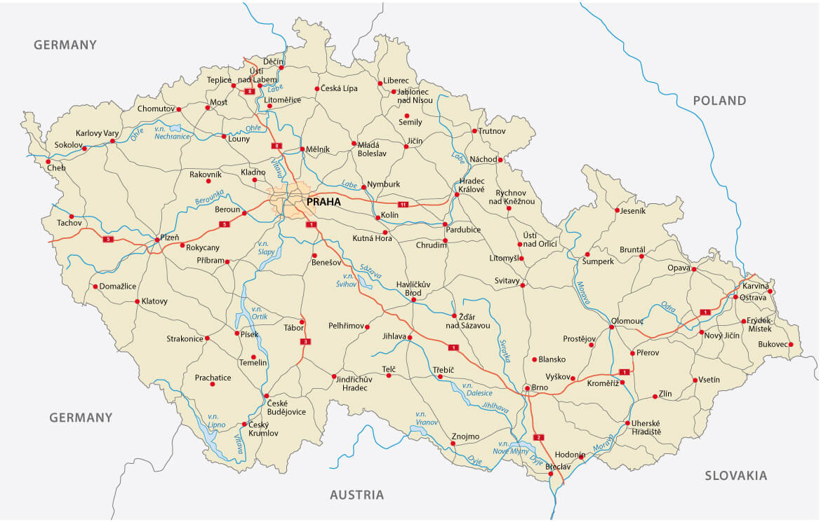 Czech Republic road map with major cities.
Color Map of Czech Republic
 Abstract vector color map of Czech Republic and Slovakia country.
Czech Republic Administrative Map
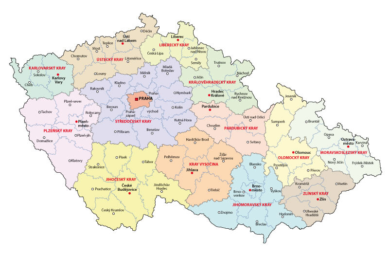 Czech Republic administrative map with main cities and regions.
Czech Republic Regions Map
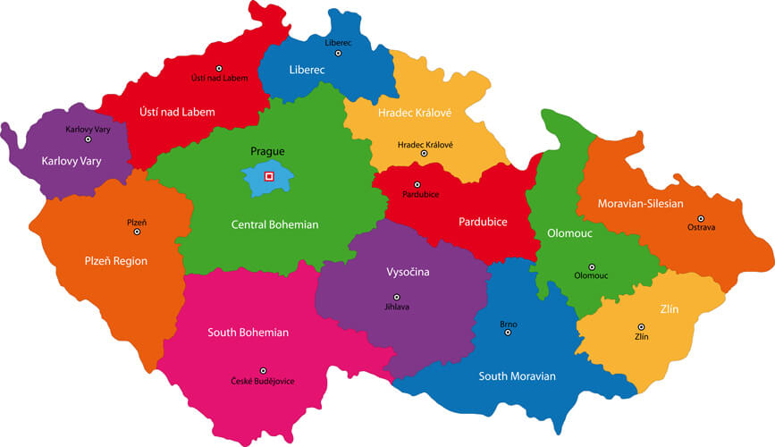 Regions of the Czech Republic with capital cities.
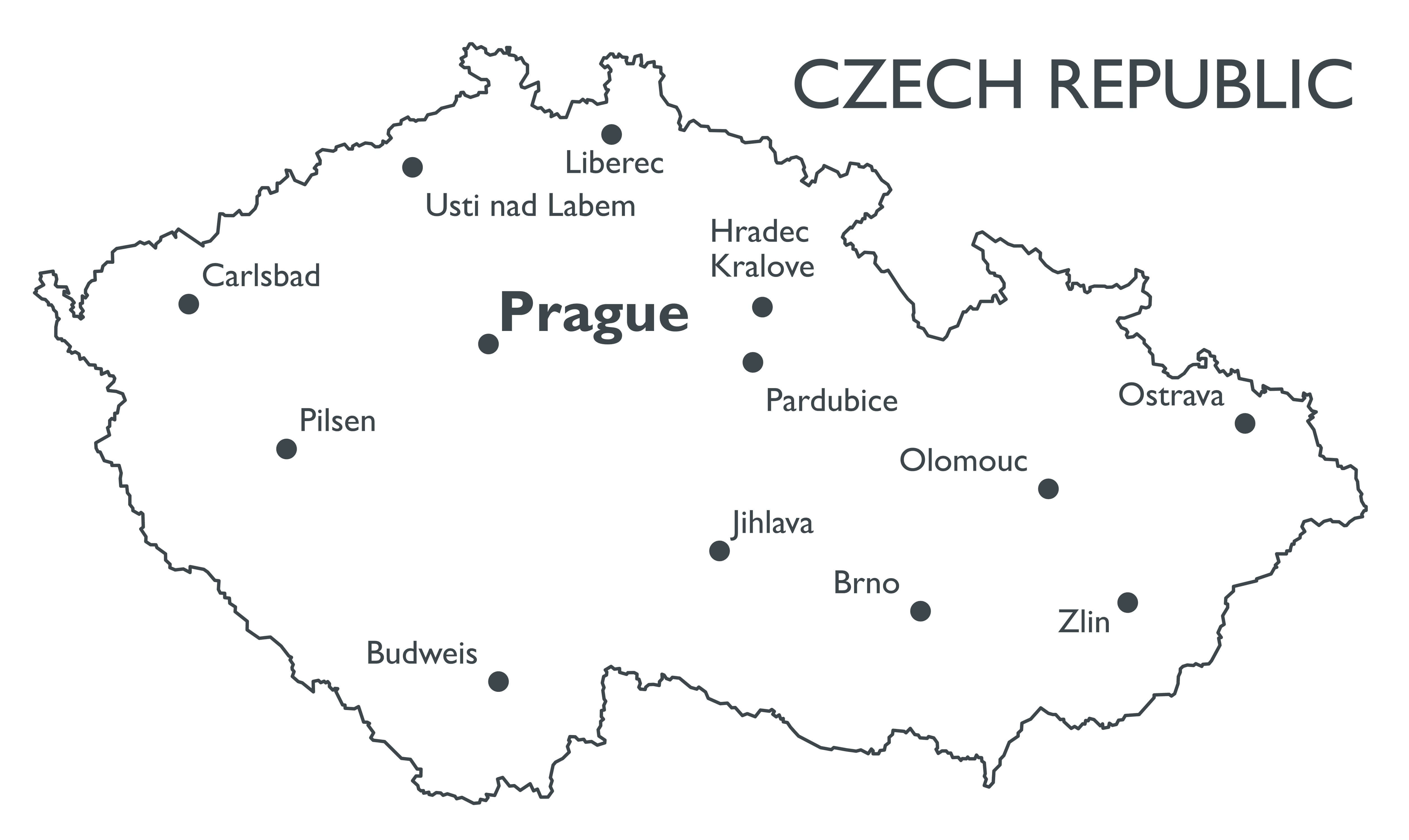
Czech Republic Vector Map
 Czech Republic Vector map with major cities.
Largest Cities' Map of Czech Republic
Praha Map Brno Map Ostrava Map Plzen Map Olomouc Map Liberec Map
Addresse: Hakarinne 2 Espoo, Uusimaa - Finland 02210
Web: istanbul-city-guide.com
Email: [email protected]
Web: istanbul-city-guide.com
Email: [email protected]
Copyright istanbul-city-guide.com - 2004 - 2026. All rights reserved. Privacy Policy | Disclaimer