Hungary Map and Hungary Satellite Images
Explore map of Hungary, Hungary map, cities map of Hungary, satellite images of Hungary, Hungary largest cities maps, political map of Hungary, driving directions, country atlas and traffic map.
Hungary Map FQA
How many cities are in Hungary ?
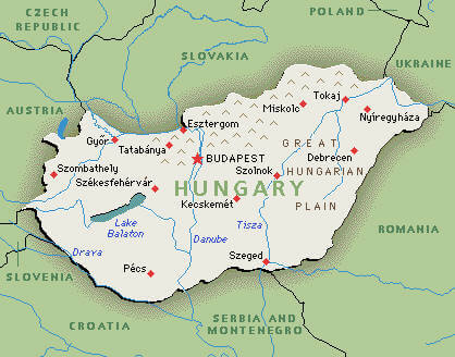
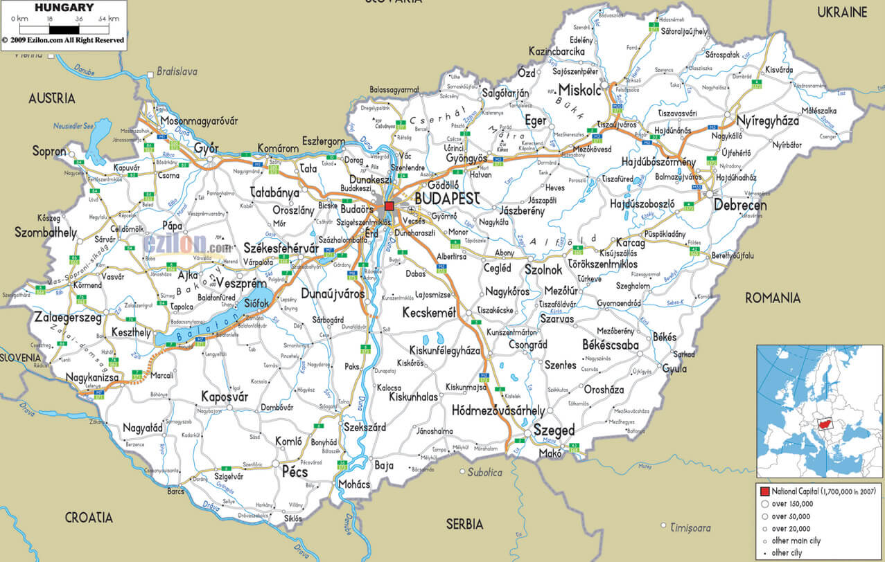
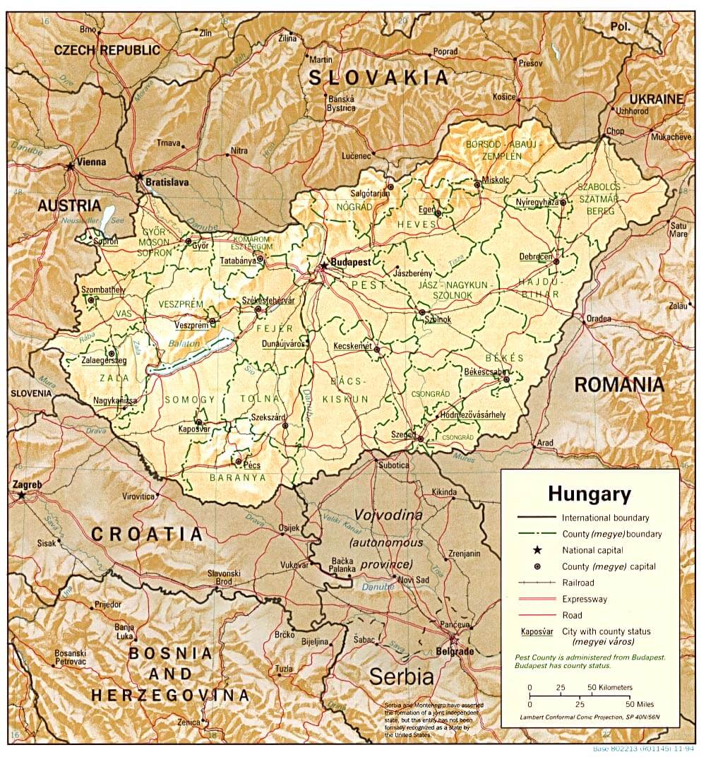
Hungary has about 350 cities and towns. The 10 largest are: Budapest, Debrecen, Szeged, Miskolc, Pécs, Gyor, Nyíregyháza, Kecskemét, Székesfehérvár, and Szombathely.What are the major geographical features of Hungary ?
Hungary is a landlocked country in Central Europe, dominated by the Great Hungarian Plain. The Danube and Tisza rivers are major features, along with the Transdanubian Hills and Lake Balaton.WHERE IS HUNGARY IN THE WORLD
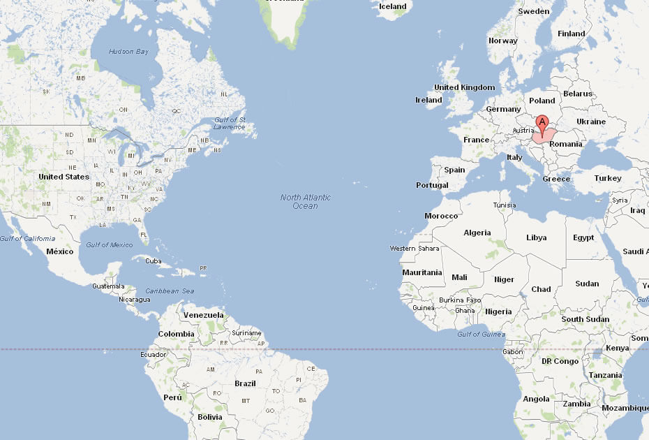
HUNGARY LOCATION MAP
WHERE IS HUNGARY IN THE WORLD
Can I download a high-resolution map of Hungary ?
Yes. Download high-resolution political and physical maps of Hungary for personal or educational use. Redistribution is subject to the terms of our license.
- Capital : Budapest
- Population : 9,942,000
- GDP : $140.303 billion
- Per Capita : $13,045
- Calling Code : +36
- Jobless Rate : 10.70%
- Time Zone : +1
For more about Hungary >>
A Collection of Hungary Maps and Hungary Satellite Images
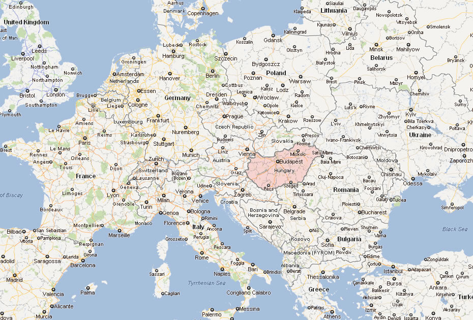
MAP OF HUNGARY
HUNGARY LOCATION MAP
WHERE IS HUNGARY IN THE WORLD
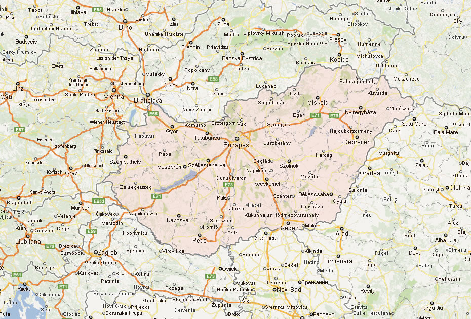
HUNGARY CITIES MAP
HUNGARY MAP
HUNGARY MAP
HUNGARY MAP
HUNGARY CITIES MAP
HUNGARY MAP
HUNGARY MAP
HUNGARY MAP EUROPE
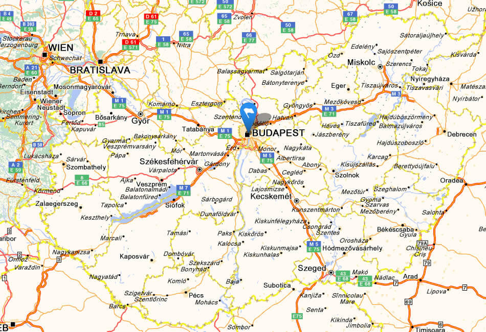
HUNGARY ROAD MAP
MAP OF HUNGARY EUROPE
MAP OF HUNGARY WORLD
MAP OF HUNGARY
MAP HUNGARY
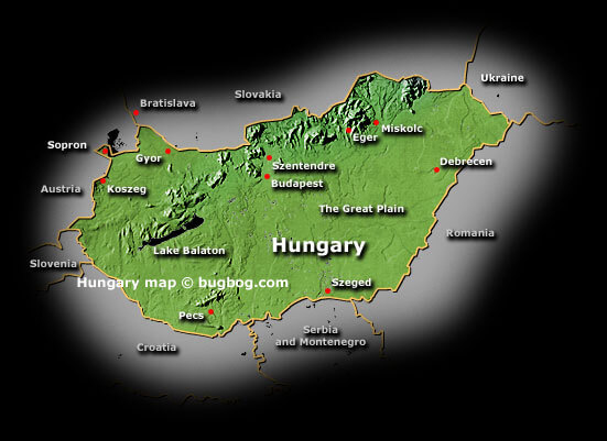
PHYSICAL MAP OF HUNGARY
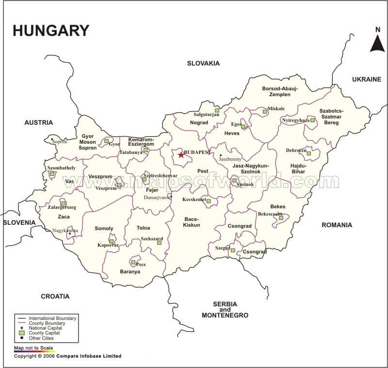
POLITICAL MAP OF HUNGARY
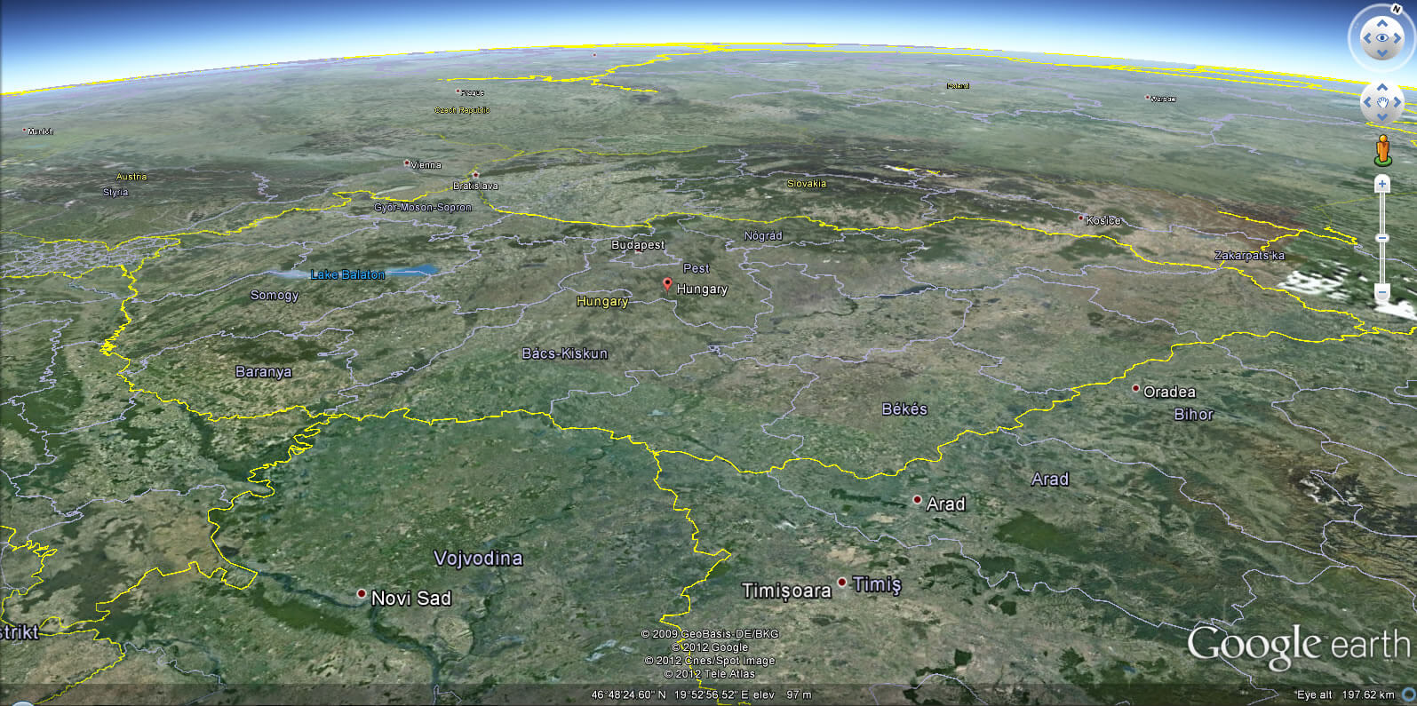
HUNGARY EARTH MAP
Budapest, the heart of Hungary
Please subscribe on "World Guide" channnel on Youtube at youtube.com/c/WorldGuide
Mapping Europe: A Deep Dive into the Continent's Cartographic Stories
Largest Cities' Map of Hungary
Budapest Map Debrecen Map Gyor Map Kecskemet Map Miskoic Map Nyiregyhaza Map Pecs Map Szeged Map Szekesfehervar Map Szombathely Map
Addresse: Hakarinne 2 Espoo, Uusimaa - Finland 02210
Web: istanbul-city-guide.com
Email: [email protected]
Web: istanbul-city-guide.com
Email: [email protected]
Copyright istanbul-city-guide.com - 2004 - 2026. All rights reserved. Privacy Policy | Disclaimer