Sri Lanka Map and Sri Lanka Satellite Images
Explore map of Sri Lanka, Sri Lanka map, cities map of Sri Lanka, satellite images of Sri Lanka, Sri Lanka largest cities maps, political map of Sri Lanka, driving directions, country atlas and traffic map.
Sri Lanka Map FQA
How many cities are in Sri Lanka ?
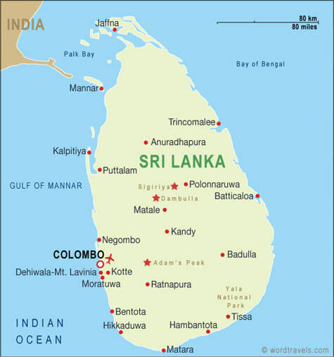
Sri Lanka has more than 10 major cities. The largest by population are: Colombo; Dehiwala-Mount Lavinia; Moratuwa; Jaffna; Negombo; Kandy; Kalmunai; Trincomalee; Batticaloa; Anuradhapura.What are the major geographical features of Sri Lanka ?
Sri Lanka is an island nation in the Indian Ocean, featuring central highlands, coastal plains, and rivers. Notable features include Adam’s Peak, the Mahaweli River, and lush rainforests as well as dry zones.WHERE IS SRI LANKA IN THE WORLD
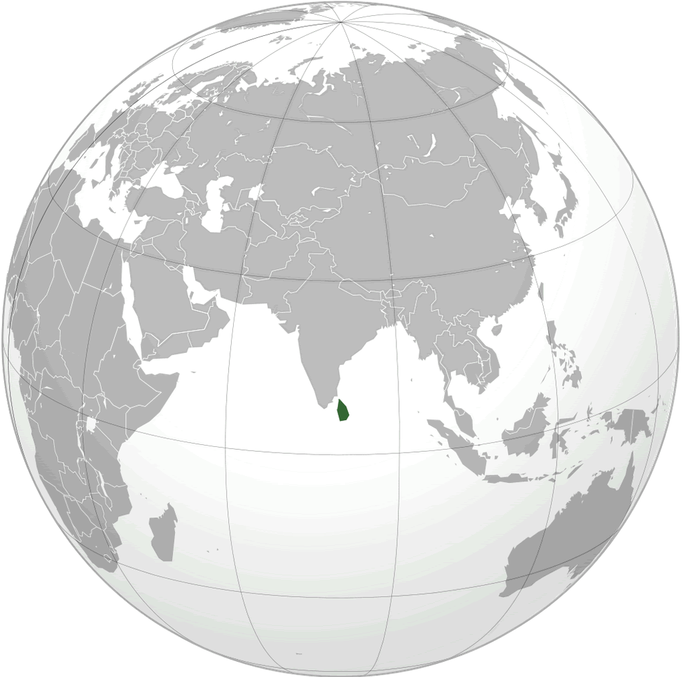
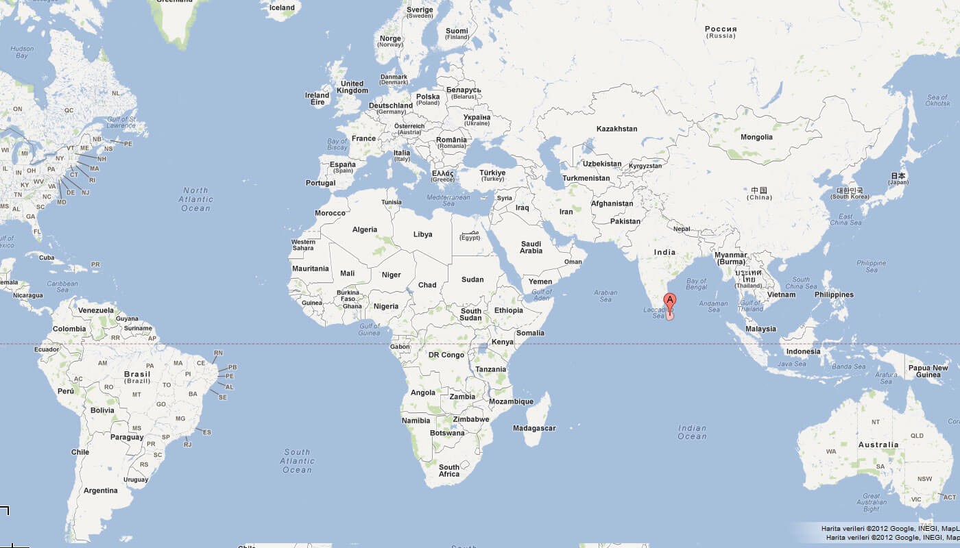
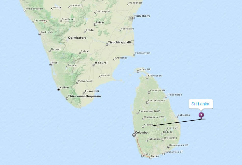
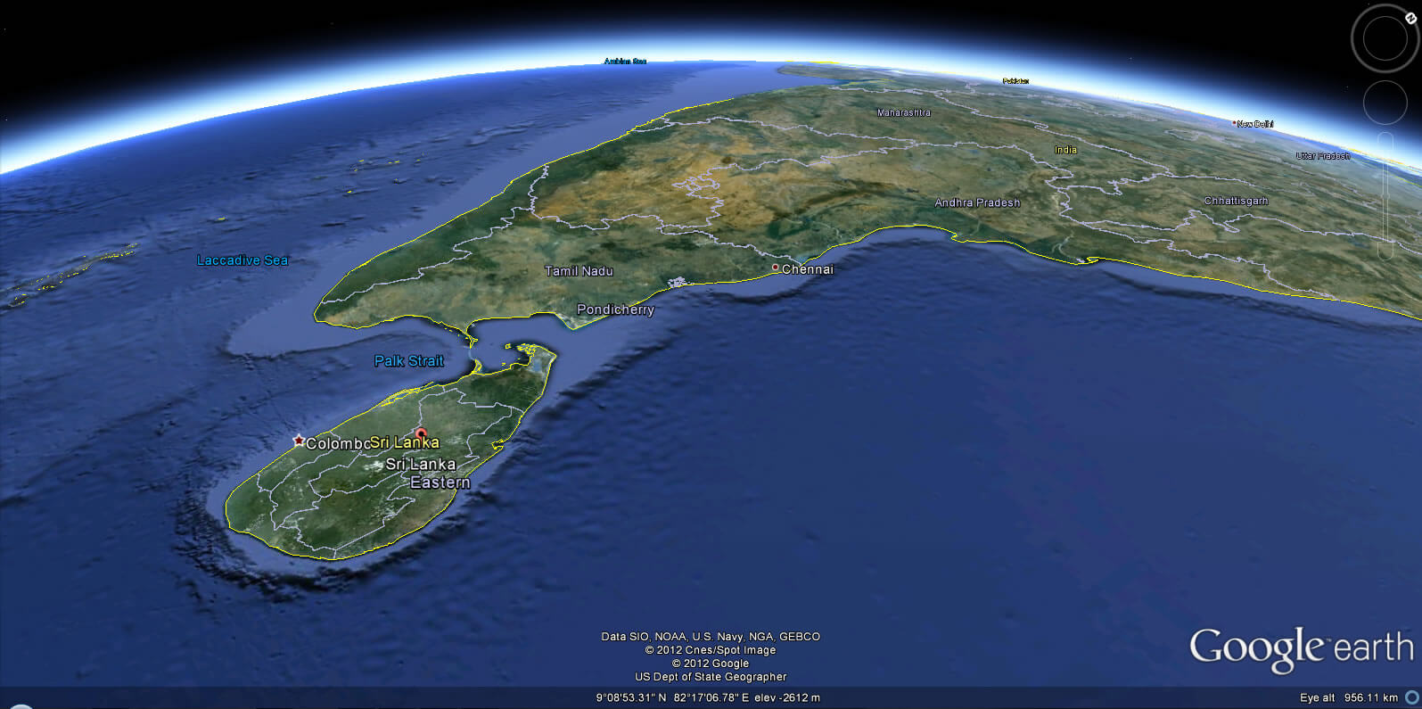
SRI LANKA LOCATION MAP
WHERE IS SRI LANKA IN THE WORLD
Can I download a high-resolution map of Sri Lanka ?
Yes. Download high-resolution political and physical maps of Sri Lanka for personal or educational use. Redistribution is subject to the terms of our license.
- Capital : Sri Jayawardenapura Kotte
- Population : 20,277,597
- GDP : $64.914 billion
- Per Capita : $3,139
- Calling Code : +94
- Jobless Rate : 3.90%
- Time Zone : +5,30
For more about Sri Lanka >>
A Collection of Sri Lanka Maps and Sri Lanka Satellite Images
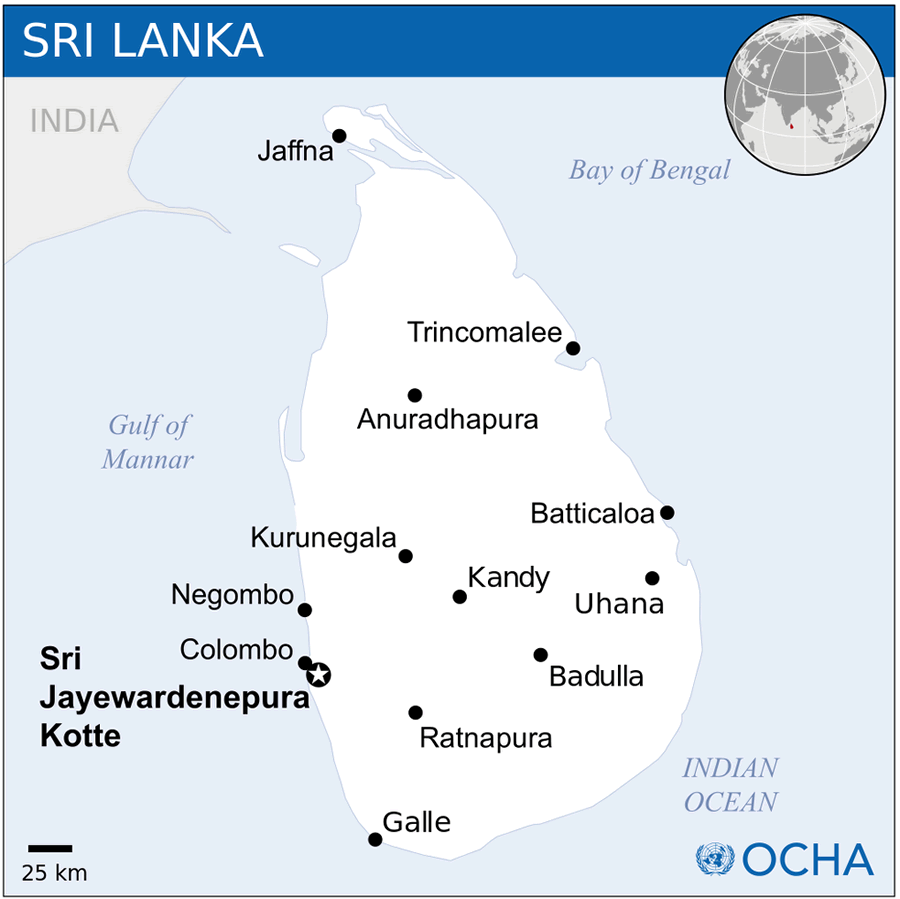
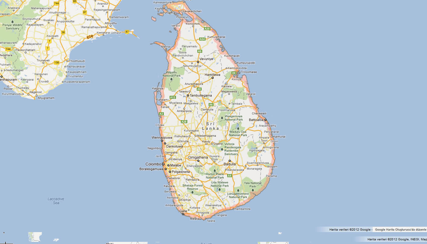
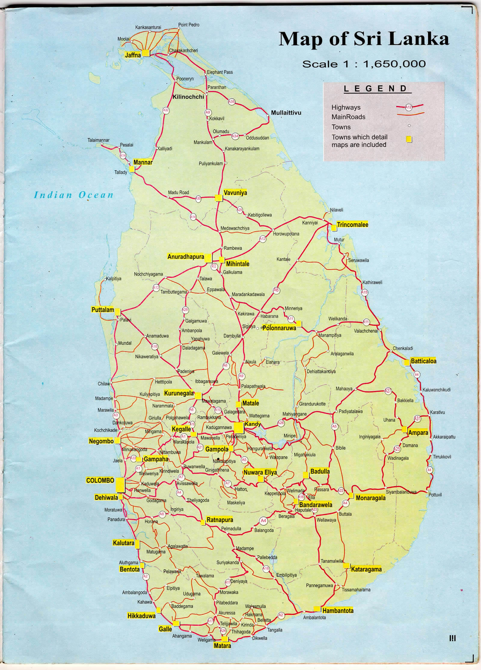
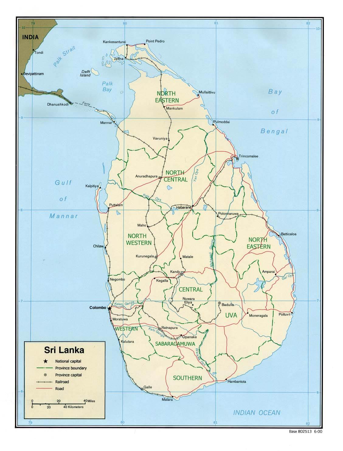
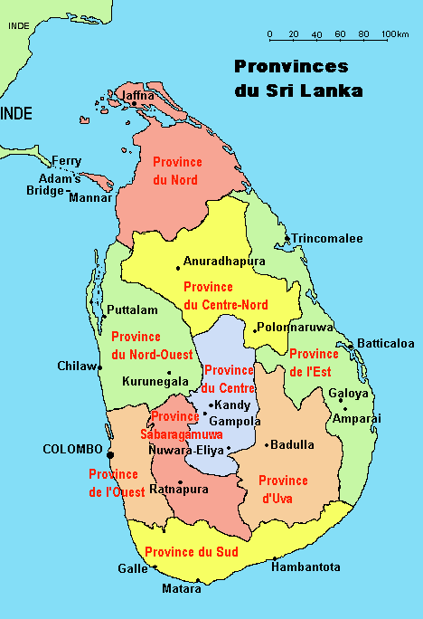
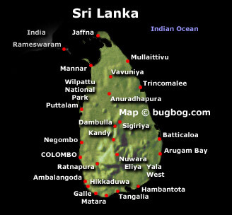
MAP OF SRI LANKA

SRI LANKA LOCATION MAP
WHERE IS SRI LANKA IN THE WORLD
MAP OF SRI LANKA INDIA
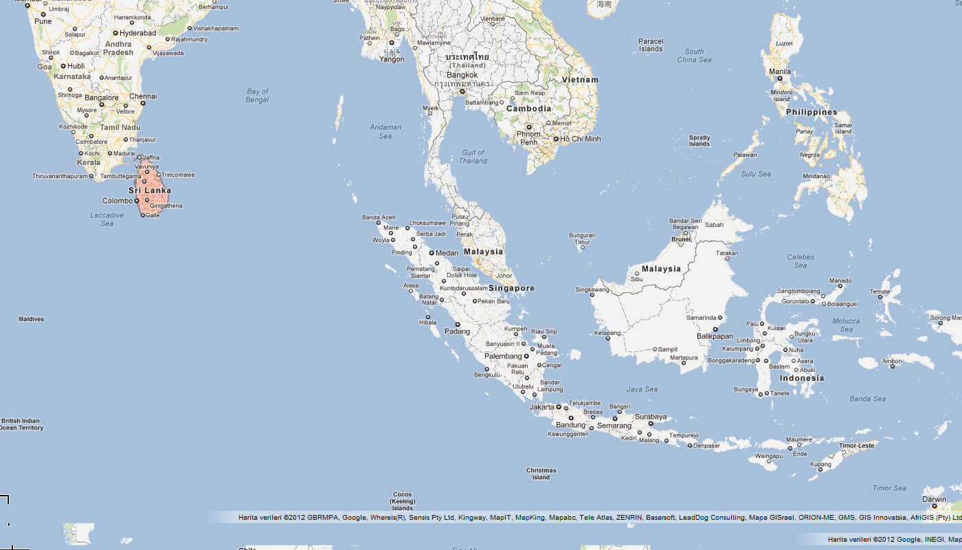
MAP OF SRI LANKA WORLD
MAP OF SRI LANKA
MAP SRI LANKA
MAP SRI LANKA
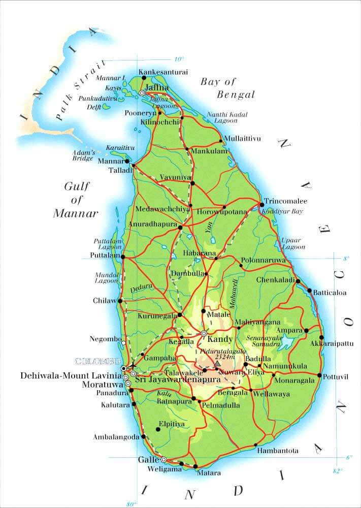
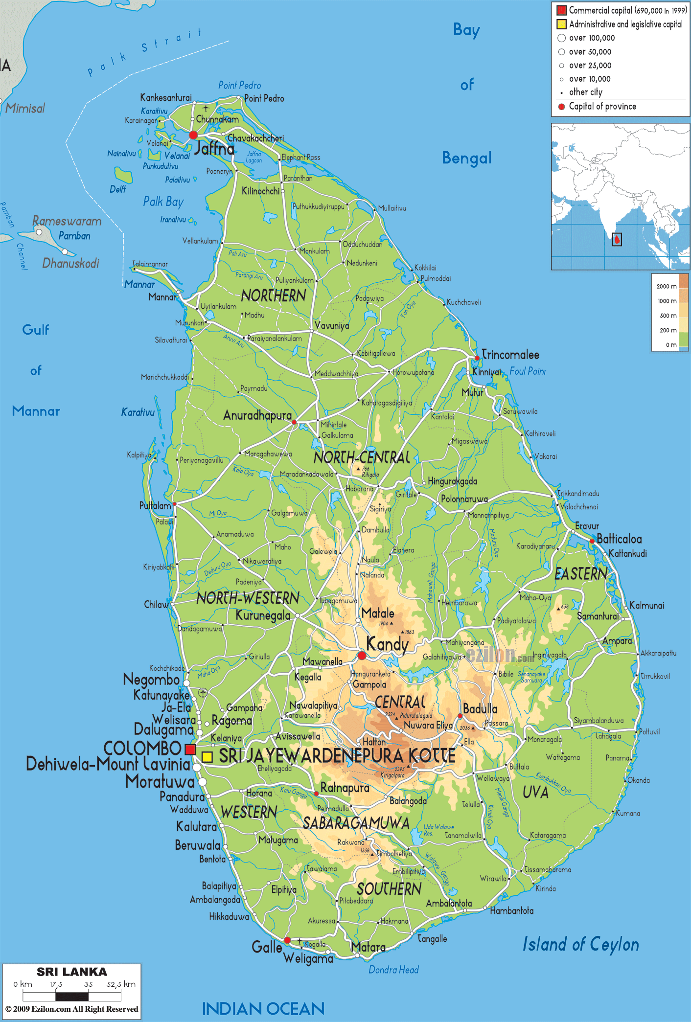
PHYSICAL MAP OF SRI LANKA
PHYSICAL MAP OF SRILANKA
SRI LANKA MAP
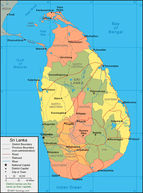
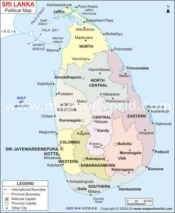
SRI LANKA POLITICAL MAP
SRI LANKA MAP
SRI LANKA POLITICAL MAP
SRI LANKA REGIONAL MAP
SRI LANKA SATELLITE MAP
SRI LANKA EARTH MAP
Largest Cities' Map of Sri Lanka
Dehiwala Mount Lavinia Map Colombo Map Moratuwa Map Jaffna Map Kotte Map
Addresse: Hakarinne 2 Espoo, Uusimaa - Finland 02210
Web: istanbul-city-guide.com
Email: [email protected]
Web: istanbul-city-guide.com
Email: [email protected]
Copyright istanbul-city-guide.com - 2004 - 2026. All rights reserved. Privacy Policy | Disclaimer