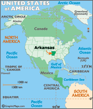
Arkansas Map and Arkansas Satellite Images
Discover the stunning natural beauty, rich history, and key points of interest in Arkansas with WorldMap1's interactive Arkansas map. Explore the state's 75 counties, major cities like Little Rock, Fayetteville, and Hot Springs, and popular attractions including Hot Springs National Park, the Ozark Mountains, and the Crystal Bridges Museum of American Art. With our detailed and easy-to-use map, you can plan your trip to Arkansas or learn more about this beautiful state from the comfort of your own home.
Arkansas Map FQA
How many cities are in Arkansas ?
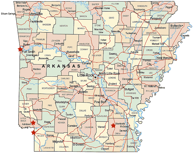
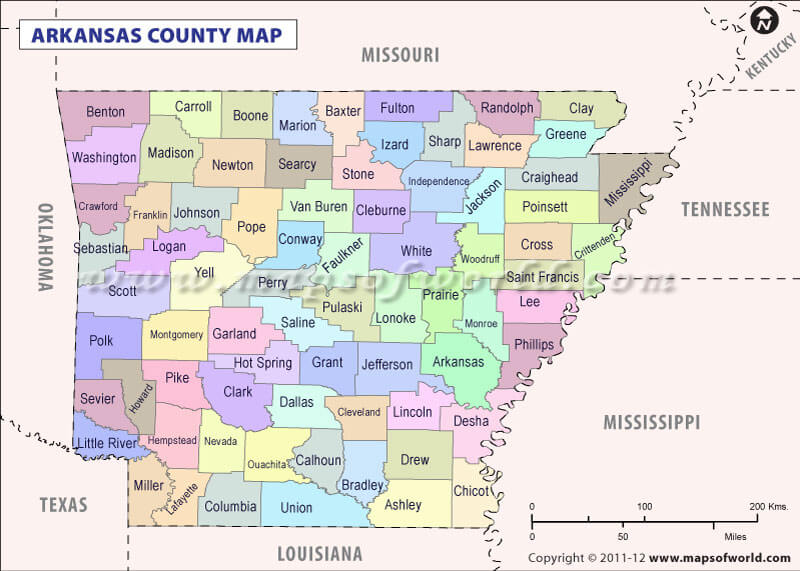
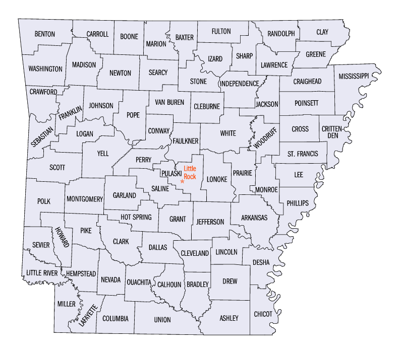
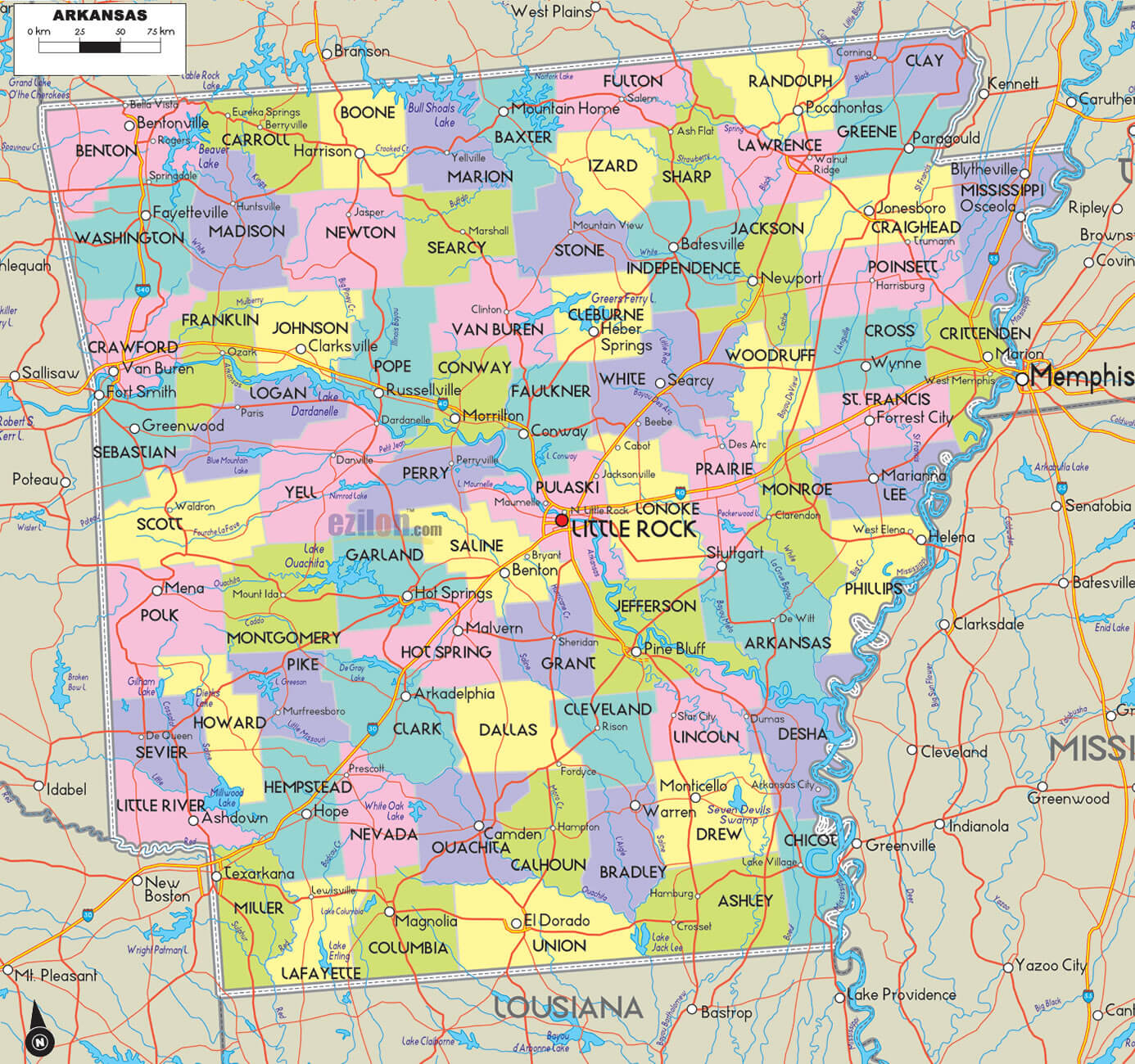
Arkansas has 75 counties. The largest by population are: Pulaski County; Benton County; Washington County; Sebastian County; Faulkner County; Saline County; Craighead County; Garland County; White County; Lonoke County.What are the major geographical features of Arkansas ?
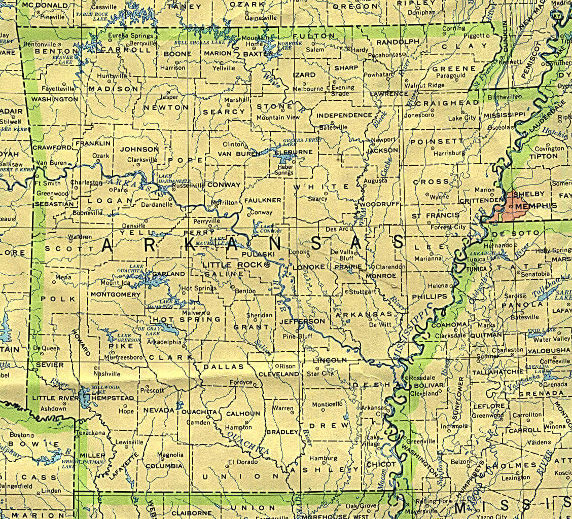
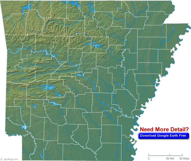
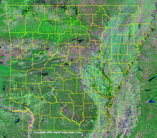
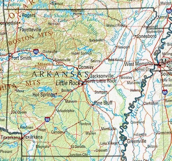
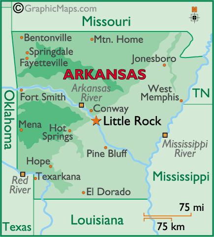
Arkansas features the Ozark and Ouachita Mountains in the north and west, the Mississippi Alluvial Plain in the east, and the Arkansas River Valley. It has forests, plains, and rolling hills.Can I download a high-resolution map of Arkansas ?
Yes. Download high-resolution political and physical maps of Arkansas for personal or educational use. Redistribution is subject to the terms of our license.Whether you're planning a trip to Arkansas, researching for a school project, or simply curious about this fascinating state, our Arkansas map has everything you need to know. So, let's embark on a journey to explore Arkansas's majestic mountains, pristine lakes, charming small towns, and cultural landmarks, and discover what makes the Natural State so special!
For all Arkansas Cities Map
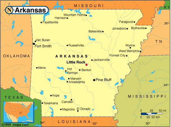
MAP OF ARKANSAS
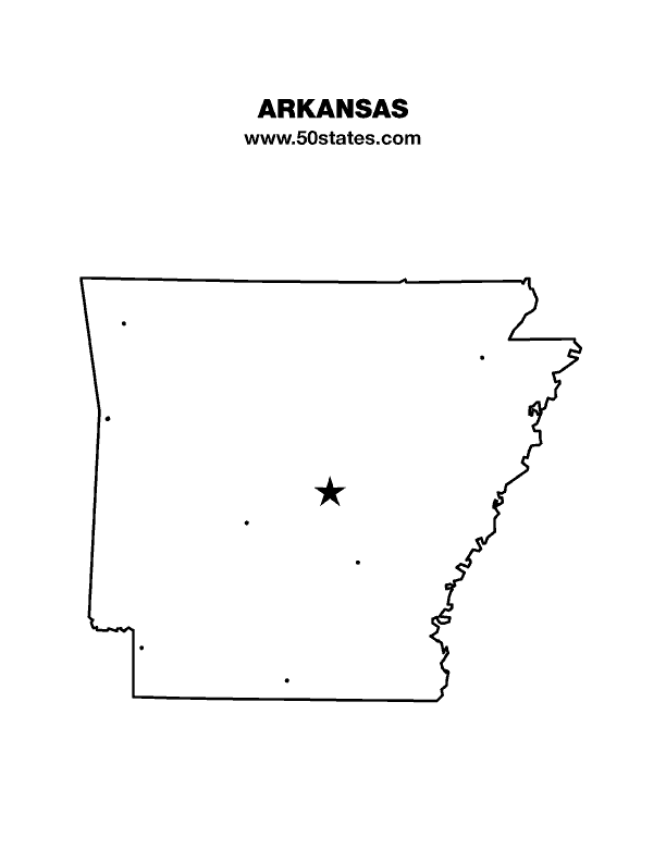
ARKANSAS BLANK MAP
Arkansas Unveiled: The Hidden Wonders of The Natural State
Please subscribe on "World Guide" channnel on Youtube at youtube.com/c/WorldGuide
The Earth, North America and Countries View from Space - Day Time and in the Night
Brief information about Arkansas, US
Arkansas is a state located in the southern region of the United States. As of 2020, the estimated population of Arkansas was 3.0 million people. The state has a diverse demographic profile, with 72.0% of the population identifying as White, 15.9% as Black or African American, and 7.1% as Hispanic or Latino. Arkansas also has a significant Native American population, with several recognized tribes located in the state.A Collection of Arkansas Maps and Arkansas Satellite Images
MAP OF ARKANSAS

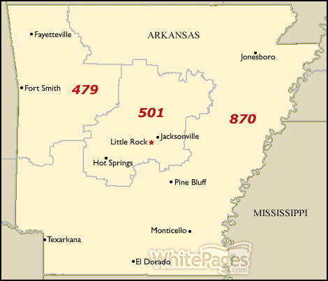
ARKANSAS AREA CODE MAP
ARKANSAS BIG CITIES MAP
ARKANSAS BLANK MAP
ARKANSAS CITIES MAP

ARKANSAS COUNTIES MAP

ARKANSAS COUNTY MAP
ARKANSAS COUNTY MAP
ARKANSAS HISTORICAL MAP
ARKANSAS LARGEST CITIES MAP

ARKANSAS MAP COUNTIES

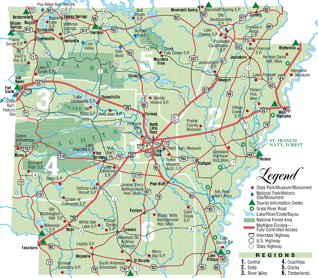
ARKANSAS PHYSICAL MAP
ARKANSAS REFERENCE MAP

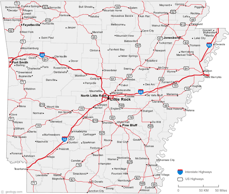
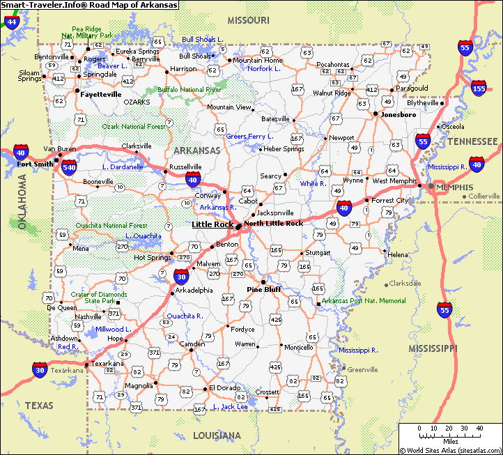
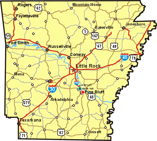
ARKANSAS ROAD MAP
ARKANSAS SATELLITE IMAGES
ARKANSAS STATE PARK MAP
ARKANSAS STATES MAP
ARKANSAS USA MAP
COUNTIES MAP OF ARKANSAS
PHYSICAL MAP OF ARKANSAS
POLITICAL MAP OF ARKANSAS
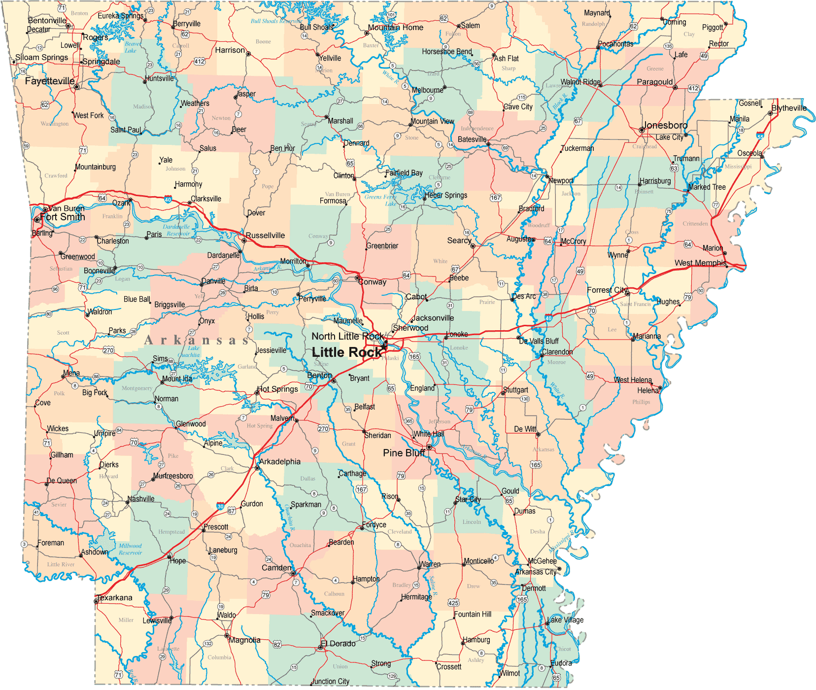
ROAD MAP OF ARKANSAS
STATE MAP OF ARKANSAS
A collection of Arkansas Maps
- Head of Performance Marketing
- Head of SEO
- Linkedin Profile: linkedin.com/in/arifcagrici
Largest Cities Map of Arkansas and Population
Little Rock Map - 193,524 Fort Smith Map - 86,209 Fayetteville Map - 73,580 Springdale Map - 69,797 Jonesboro Map - 67,263 North Little Rock Map - 62,304 Conway Map - 58,908 Rogers Map - 55,964 Pine Bluff Map - 49,083 Bentonville Map - 35,301 Hot Springs Map - 35,193 Benton Map - 30,681 Texarkana Map - 29,919 Sherwood Map - 29,523 Jacksonville Map - 28,364 Monette Map - 1,501
Addresse: Hakarinne 2 Espoo, Uusimaa - Finland 02210
Web: istanbul-city-guide.com
Email: [email protected]
Web: istanbul-city-guide.com
Email: [email protected]
Copyright istanbul-city-guide.com - 2004 - 2026. All rights reserved. Privacy Policy | Disclaimer