Map of Kentucky, United States
Navigate Kentucky map, Kentucky country map, satellite images of Kentucky, Kentucky largest cities, towns maps, political map of Kentucky, driving directions, physical, atlas and traffic maps in United States.
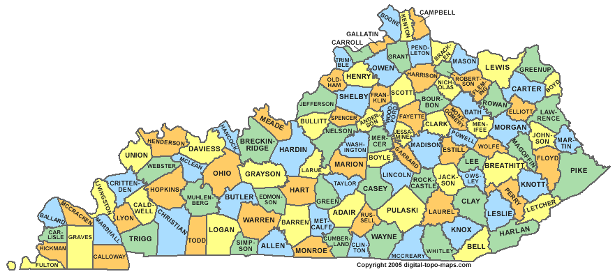
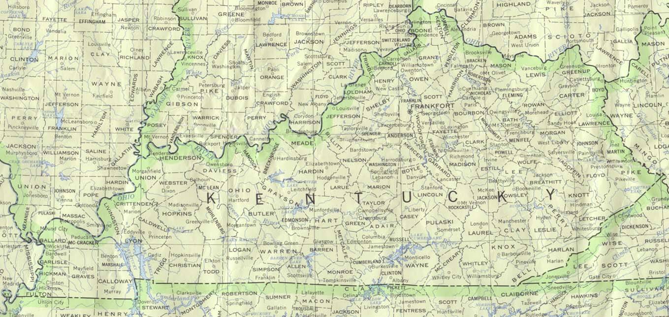
KENTUCKY COUNTY MAP
A Collection of Kentucky Maps and Kentucky Satellite Images
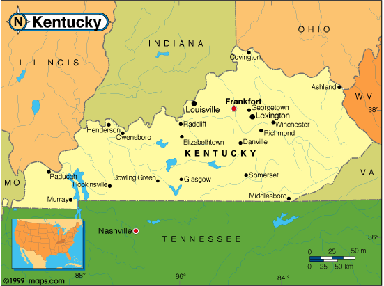
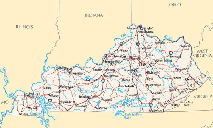
MAP OF KENTUCKY
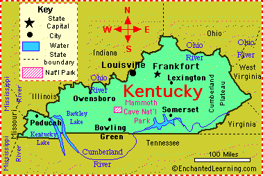
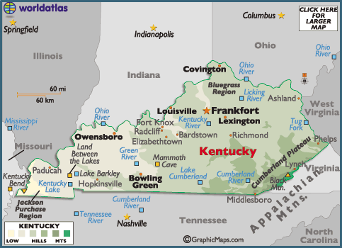
CITIES MAP OF KENTUCKY
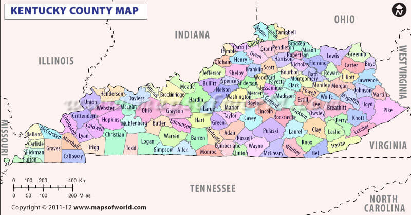
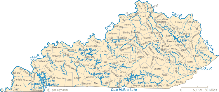
KENTUCKY COUNTY MAP
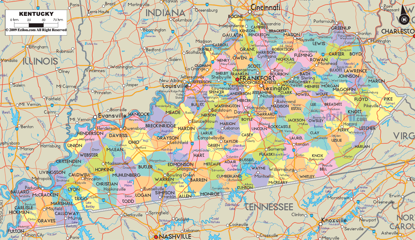
KENTUCKY COUNTY MAP
KENTUCKY MAP
KENTUCKY CITIES MAP
KENTUCKY COUNTY MAP
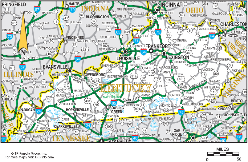
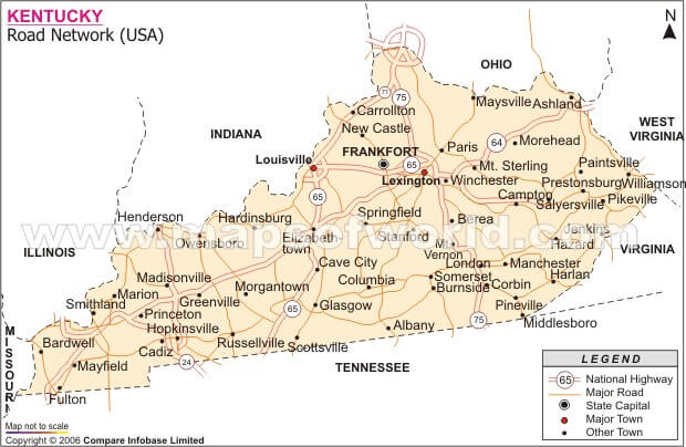
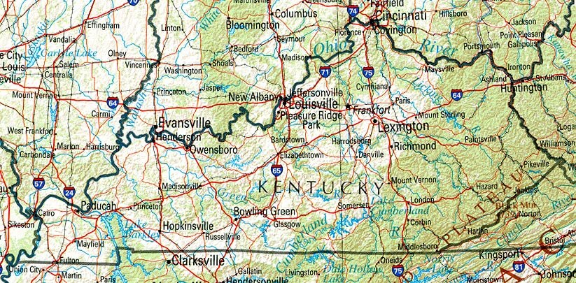
KENTUCKY HIGHWAYS MAP
KENTUCKY LAND MAP
KENTUCKY MAP LEXINGTON
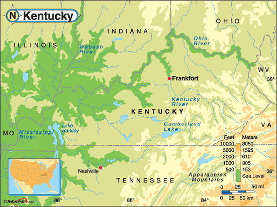
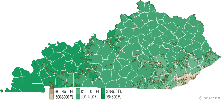
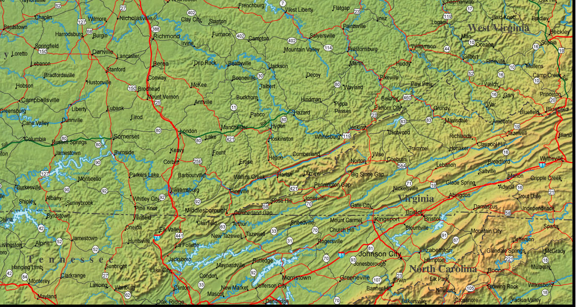
KENTUCKY PHYSICAL MAP
KENTUCKY REFERENCE MAP
KENTUCKY RIVERS MAP
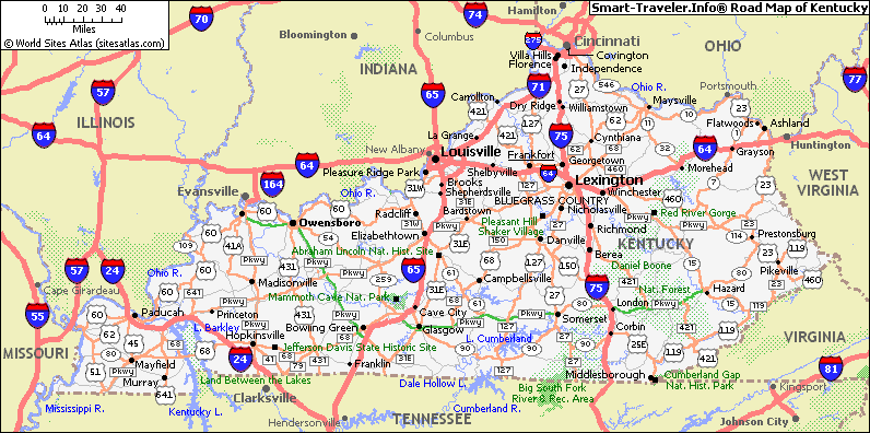
KENTUCKY ROAD MAP

KENTUCKY STATE MAP
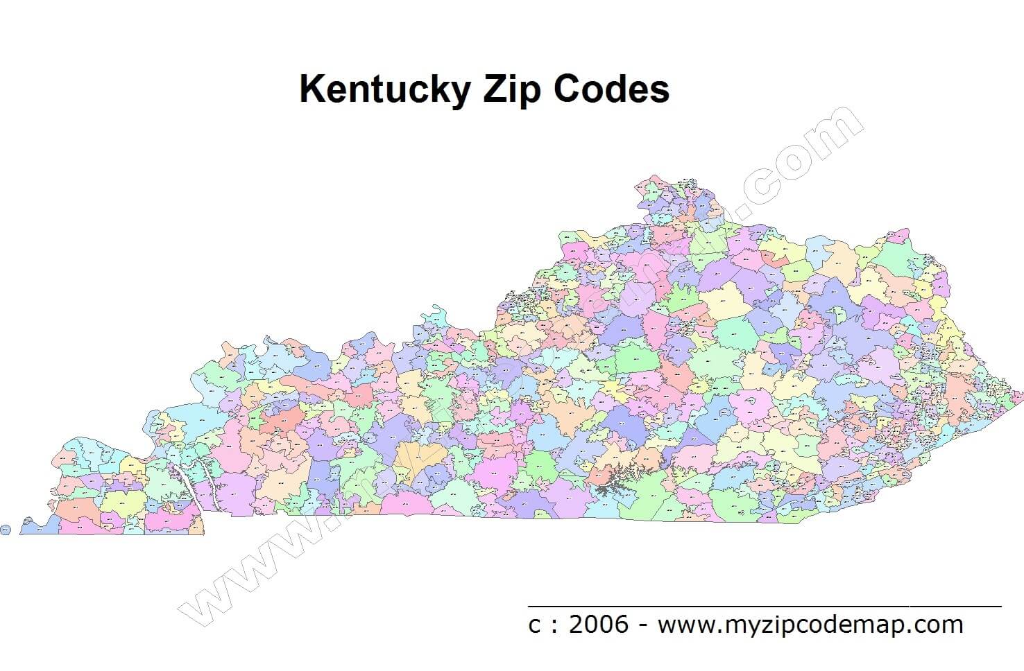
KENTUCKY ZIP CODE MAP
PHYSICAL MAP OF KENTUCKY
ROUTE MAP OF KENTUCKY
Largest Cities Map of Kentucky and Population
Louisville - 597,337 Lexington Fayette - 295,803 Bowling Green - 58,067 Owensboro - 57,265 Covington - 40,640 Hopkinsville - 31,577 Richmond - 31,364 Florence - 29,951 Georgetown - 29,098 Henderson - 28,757 Elizabethtown - 28,531 Nicholasville - 28,015 Jeffersontown - 26,595 Frankfort - 25,527 Paducah - 25,024 Mayfield - 10,024For All Kentucky Cities Map
- Head of Performance Marketing
- Head of SEO
- Linkedin Profile: linkedin.com/in/arifcagrici
See Also
Kentucky Google Map, Street Views, Maps Directions, Satellite Images
istanbul-city-guide.com offers a collection of Kentucky map, google map, Kentucky atlas, political, physical, satellite view, country infos, cities map and more map of Kentucky.
United States Largest Cities Map by Population
New York City Map Los Angeles Map Chicago Map Brooklyn Map Houston Map Philadelphia Map Manhattan Map Phoenix Map San Antonio Map San Diego Map Dallas Map San Jose Map Jacksonville Map Indianapolis Map San Francisco Map Austin Map Columbus Map Fort Worth Map Charlotte Map Detroit Map
Addresse: Hakarinne 2 Espoo, Uusimaa - Finland 02210
Web: istanbul-city-guide.com
Email: [email protected]
Web: istanbul-city-guide.com
Email: [email protected]
Copyright istanbul-city-guide.com - 2004 - 2026. All rights reserved. Privacy Policy | Disclaimer