
Map of Kansas, United States
Navigate Kansas map, Kansas country map, satellite images of Kansas, Kansas largest cities, towns maps, political map of Kansas, driving directions, physical, atlas and traffic maps in United States.
MAP OF KANSAS
A Collection of Kansas Maps and Kansas Satellite Images
MAP OF KANSAS

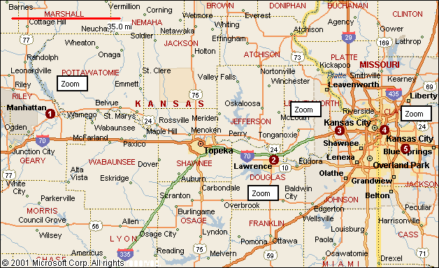
KANSAS CITIES MAP

KANSAS CITIES MAP

KANSAS CITIES TOWNS MAP

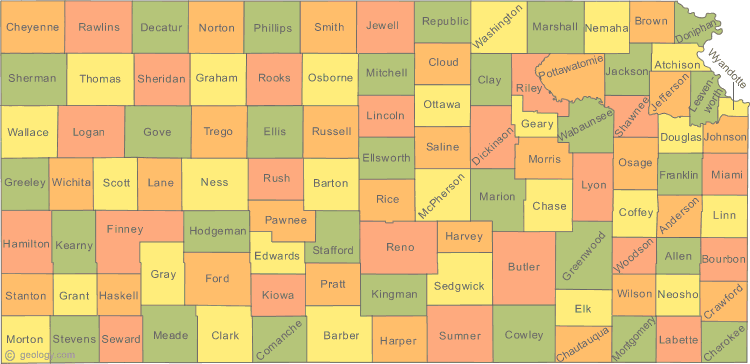
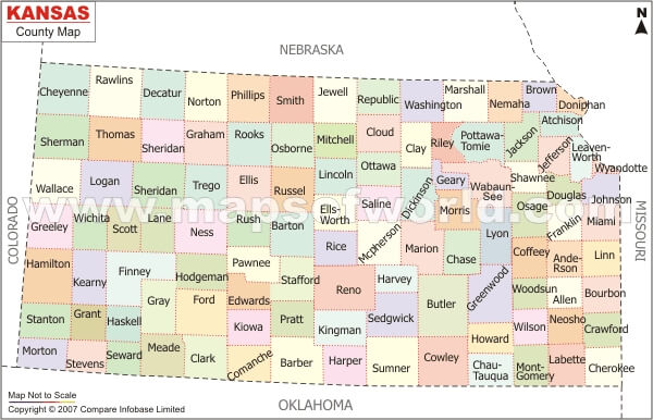
KANSAS COUNTY MAP

KANSAS POLITICAL MAP

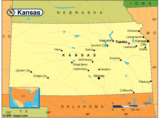
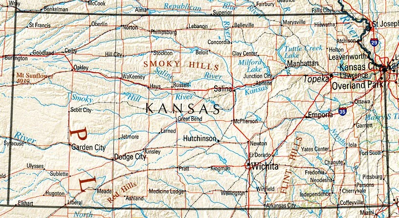
KANSAS REFERENCE MAP

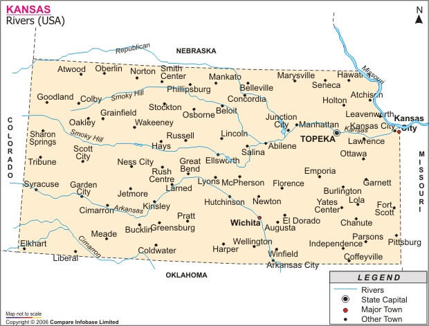
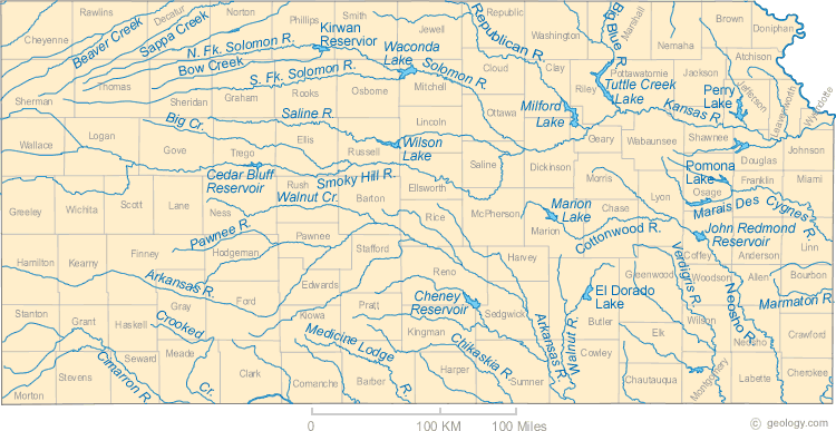
KANSAS RIVERS MAP

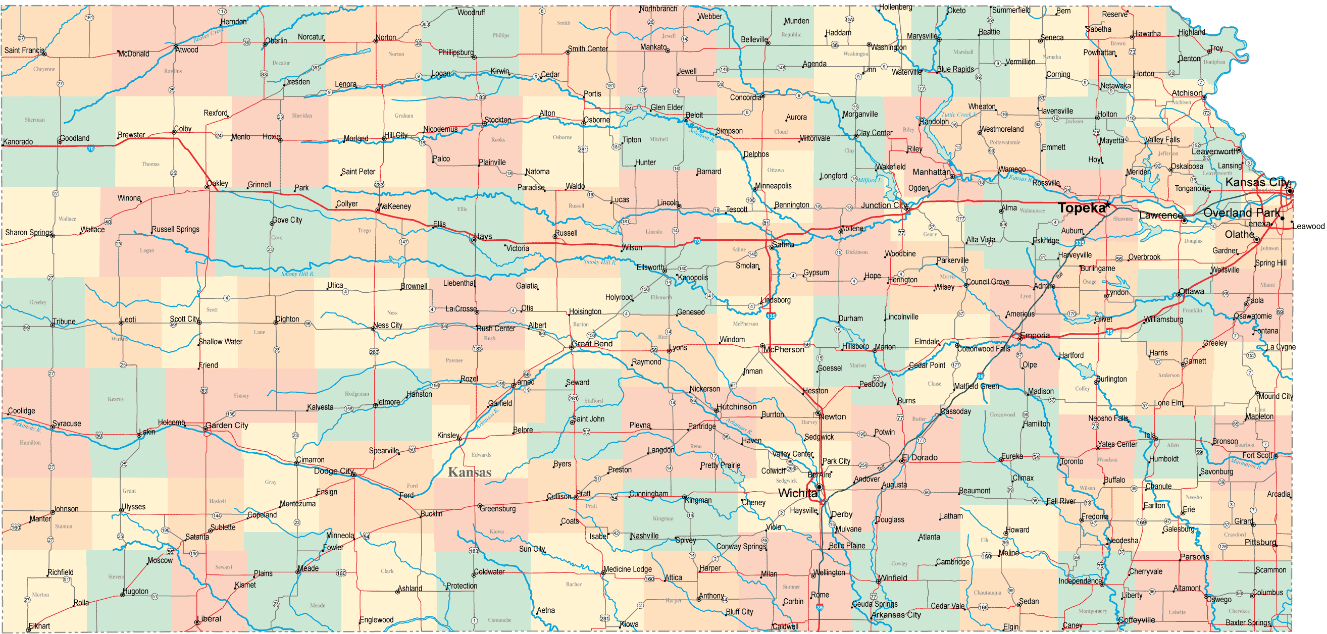
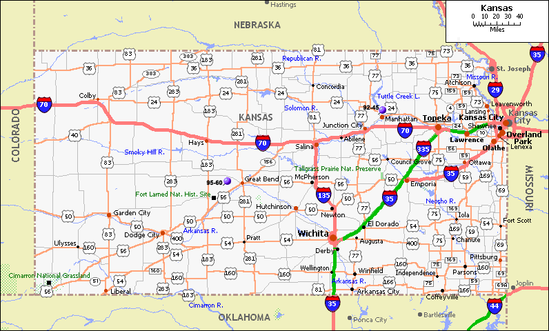
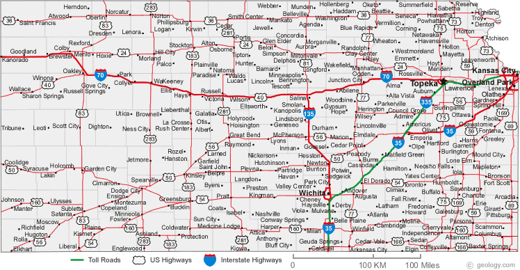
KANSAS ROAD MAP

MAP OF KANSAS CITIES

Largest Cities Map of Kansas and Population
Wichita - 382,368 Overland Park - 173,372 Kansas City - 145,786 Topeka - 127,473 Olathe - 125,872 Lawrence - 87,643 Shawnee - 62,209 Manhattan - 52,281 Lenexa - 48,190 Salina - 47,707 Hutchinson - 42,080 Leavenworth - 35,251 Leawood - 31,867 Dodge City - 27,340 Garden City - 26,658For All Kansas Cities Map
- Head of Performance Marketing
- Head of SEO
- Linkedin Profile: linkedin.com/in/arifcagrici
See Also
Kansas Google Map, Street Views, Maps Directions, Satellite Images
istanbul-city-guide.com offers a collection of Kansas map, google map, Kansas atlas, political, physical, satellite view, country infos, cities map and more map of Kansas.
United States Largest Cities Map by Population
New York City Map Los Angeles Map Chicago Map Brooklyn Map Houston Map Philadelphia Map Manhattan Map Phoenix Map San Antonio Map San Diego Map Dallas Map San Jose Map Jacksonville Map Indianapolis Map San Francisco Map Austin Map Columbus Map Fort Worth Map Charlotte Map Detroit Map
Addresse: Hakarinne 2 Espoo, Uusimaa - Finland 02210
Web: istanbul-city-guide.com
Email: [email protected]
Phone: +358 44 934 9129
Web: istanbul-city-guide.com
Email: [email protected]
Phone: +358 44 934 9129
Copyright istanbul-city-guide.com - 2004 - 2025. All rights reserved. Privacy Policy | Disclaimer