Central African Republic Map and Central African Republic Satellite Images
Explore map of Central African Republic, Central African Republic map, cities map of Central African Republic, satellite images of Central African Republic, Central African Republic largest cities maps, political map of Central African Republic, driving directions, country atlas and traffic map.
Central African Republic Map FQA
How many cities are in Central African Republic ?
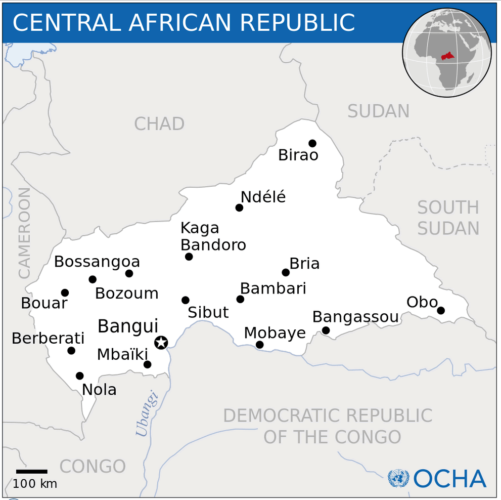
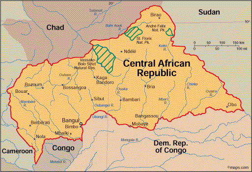
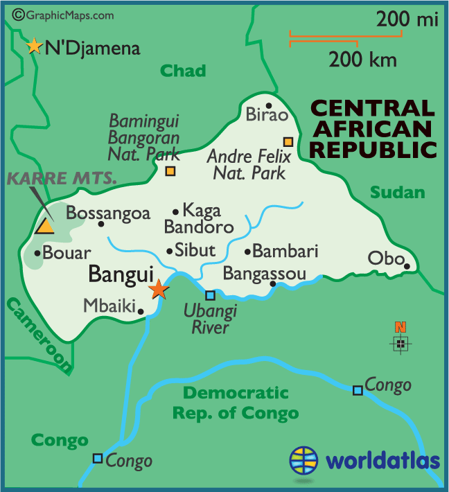
The Central African Republic has around 20 cities. The 10 largest are: Bangui, Bimbo, Mbaïki, Berbérati, Kaga-Bandoro, Bozoum, Carnot, Sibut, Bambari, and Bria.What are the major geographical features of Central African Republic ?
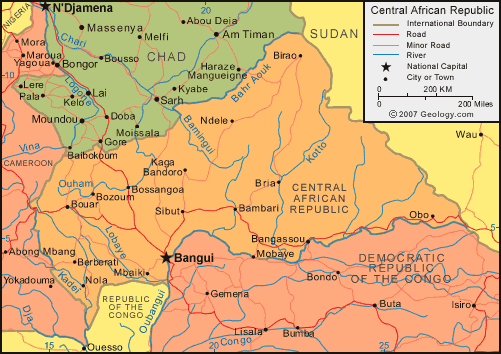
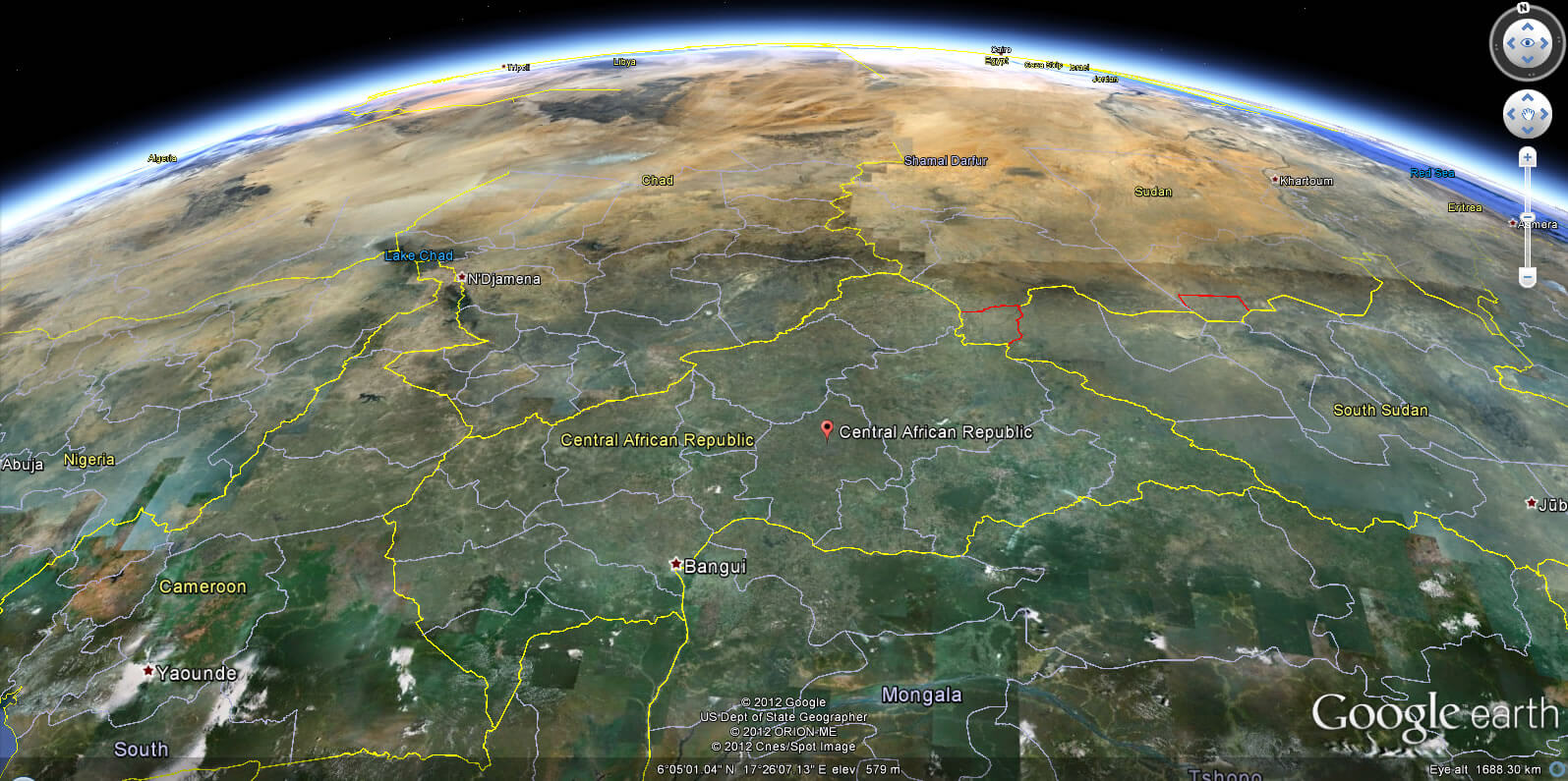
The Central African Republic is a landlocked country with flat savannas, scattered hills, and river basins. Major rivers include the Ubangi and Chari, and the country also has parts of the Congo Basin rainforest.WHERE IS CENTRAL AFRICAN REPUBLIC IN THE WORLD
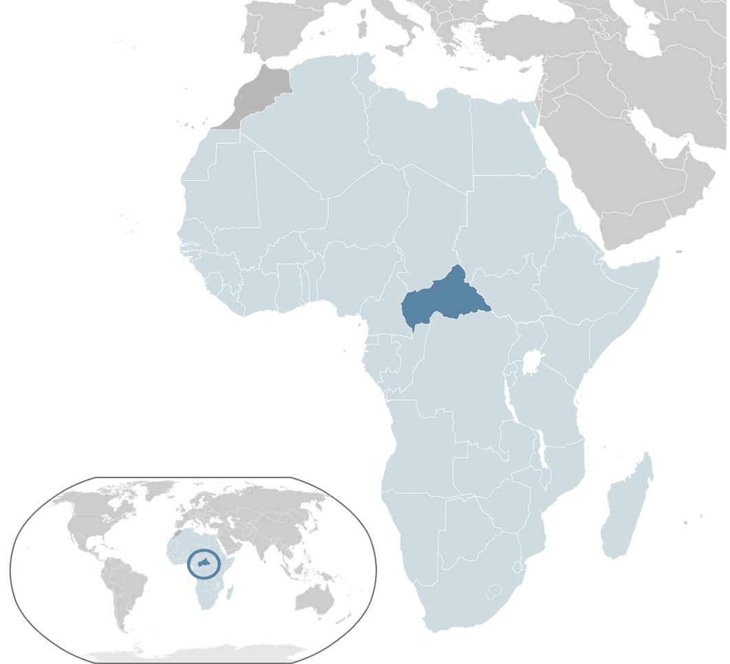
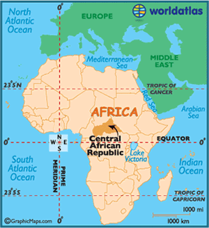
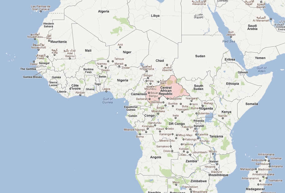
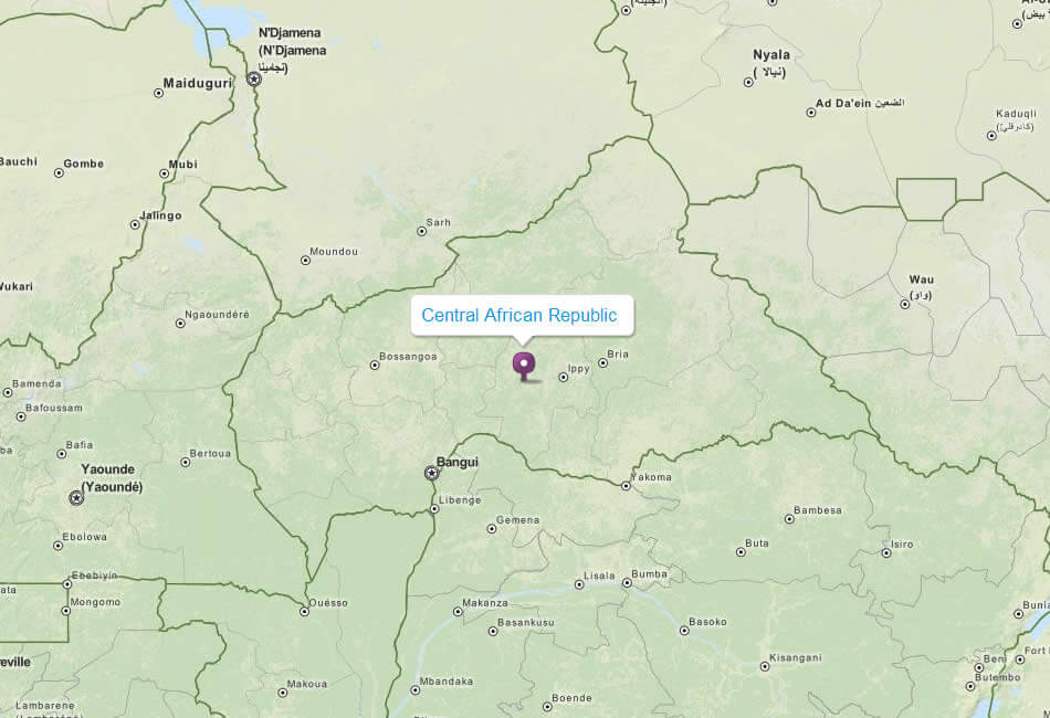
CENTRAL AFRICAN REPUBLIC LOCATION MAP
WHERE IS CENTRAL AFRICAN REPUBLIC IN THE WORLD
Can I download a high-resolution map of Central African Republic ?
Yes. Download high-resolution political and physical maps of Central African Republic for personal or educational use. Redistribution is subject to the terms of our license.
- Capital : Bangui
- Population : 4,422,000
- GDP : $2.165 billion
- Per Capita : $456
- Calling Code : +236
- Jobless Rate : 16.10%
- Time Zone : +1
For more about Central African Republic >>
A Collection of Central African Republic Maps and Central African Republic Satellite Images
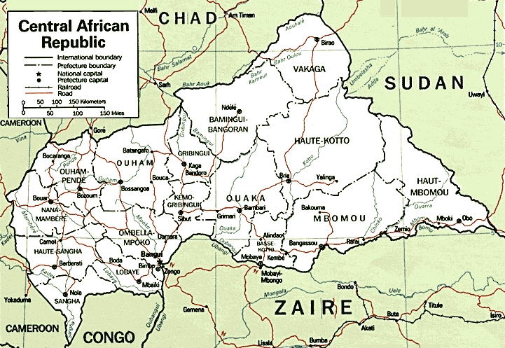
MAP OF CENTRAL AFRICAN REPUBLIC
CENTRAL AFRICAN REPUBLIC LOCATION MAP
WHERE IS CENTRAL AFRICAN REPUBLIC IN THE WORLD
CENTRAL AFRICAN REPUBLIC MAP
CENTRAL AFRICA MAP
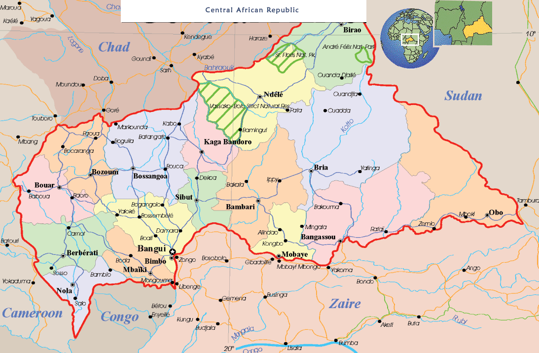
CENTRAL AFRICAN REPUBLIC MAP
CENTRAL AFRICAN REPUBLIC MAP
MAP OF CENTRAL AFRICAN REPUBLIC AFRICA
MAP OF CENTRAL AFRICAN REPUBLIC
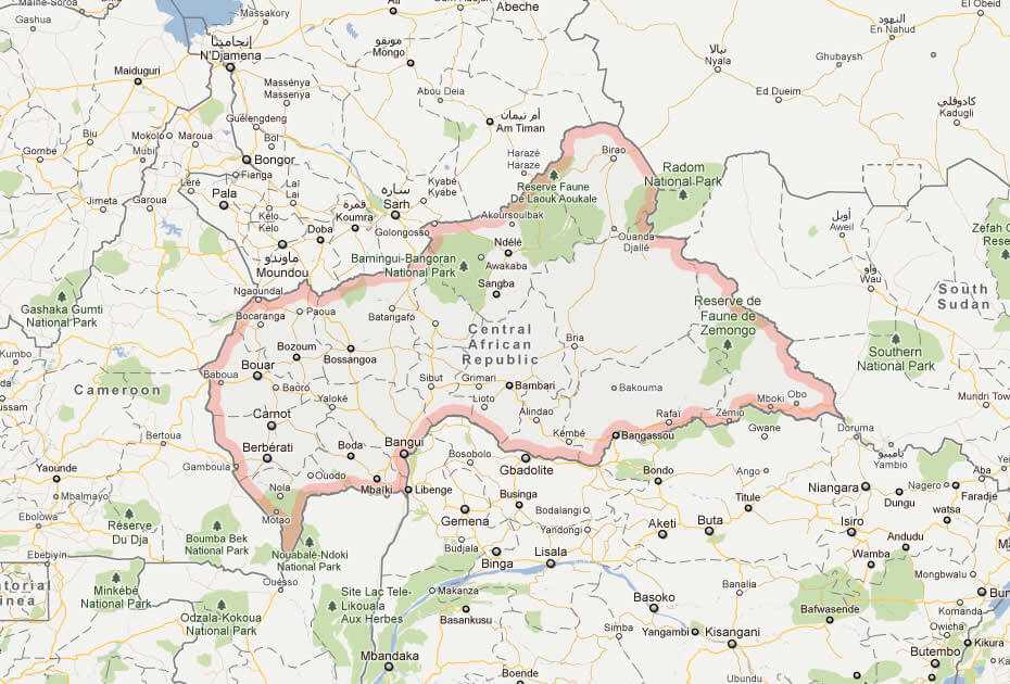
MAP CENTRAL AFRICAN REPUBLIC
POLITICAL MAP CENTRAL AFRICAN REPUBLIC
CENTRAL AFRICAN REPUBLIC EARTH MAP
Largest Cities' Map of Central African Republic
Bangui Map Bria Map Bouar Map Bossangoa Map Berberati Map Nola Map Bimbo Map Bangassou Map Carnot Map Bambari Map
Addresse: Hakarinne 2 Espoo, Uusimaa - Finland 02210
Web: istanbul-city-guide.com
Email: [email protected]
Web: istanbul-city-guide.com
Email: [email protected]
Copyright istanbul-city-guide.com - 2004 - 2026. All rights reserved. Privacy Policy | Disclaimer