Benin Map and Benin Satellite Images
Explore map of Benin, Benin map, cities map of Benin, satellite images of Benin, Benin largest cities maps, political map of Benin, driving directions, country atlas and traffic map.
Benin Map FQA
How many cities are in Benin ?
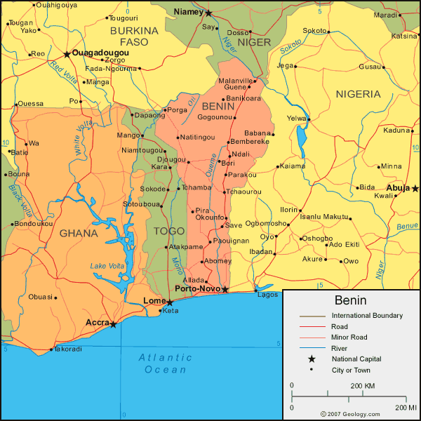
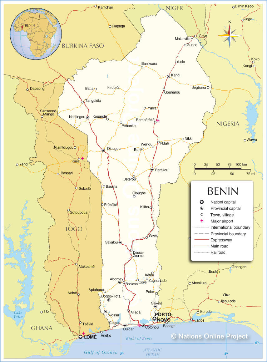
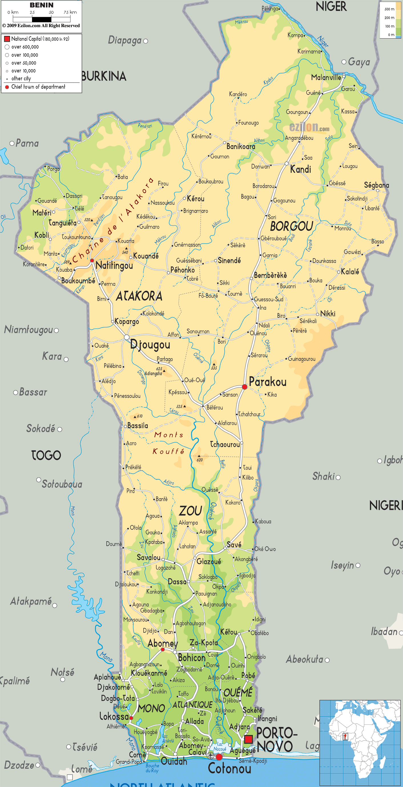
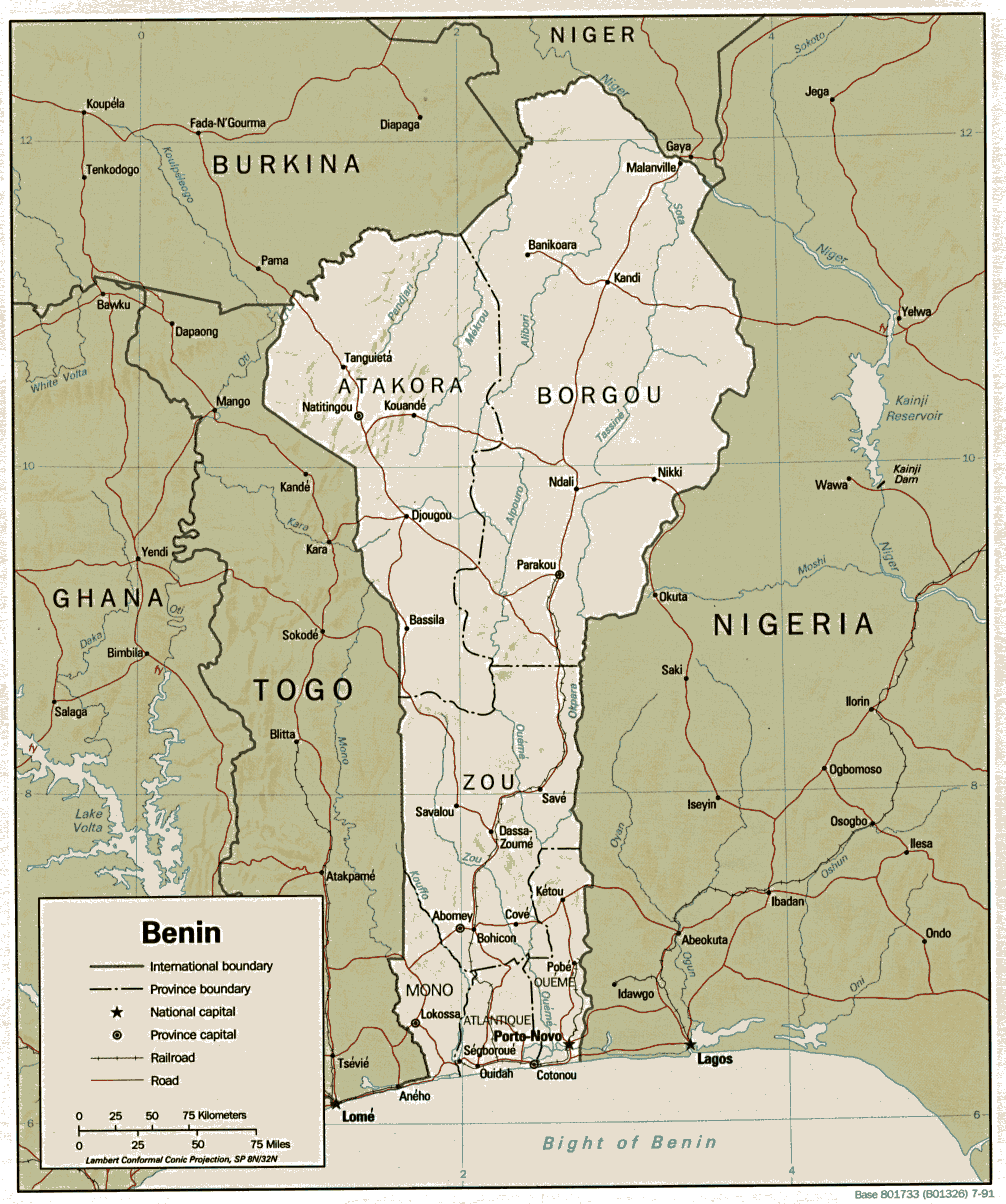
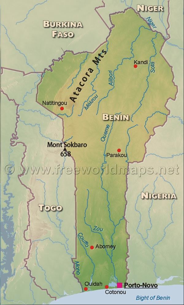
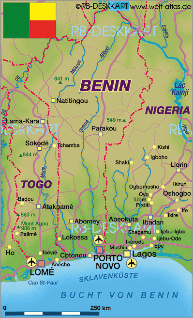
Benin has more than 20 cities. The 10 largest are: Cotonou, Porto-Novo, Parakou, Djougou, Bohicon, Kandi, Abomey, Natitingou, Lokossa, and Ouidah.What are the major geographical features of Benin ?
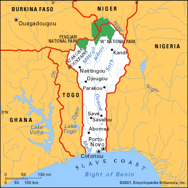
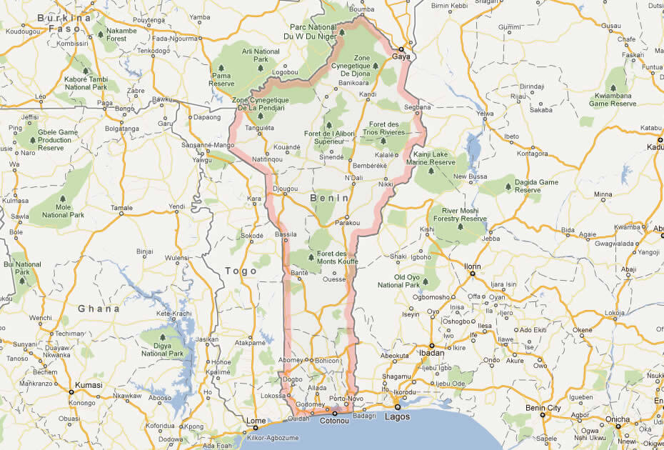
Benin in West Africa has a narrow coastline along the Atlantic Ocean, flat plains in the south, and a plateau that rises toward the north. The Atacora Mountains are in the northwest, and rivers like the Ouémé and Niger cross the country.WHERE IS BENIN IN THE WORLD
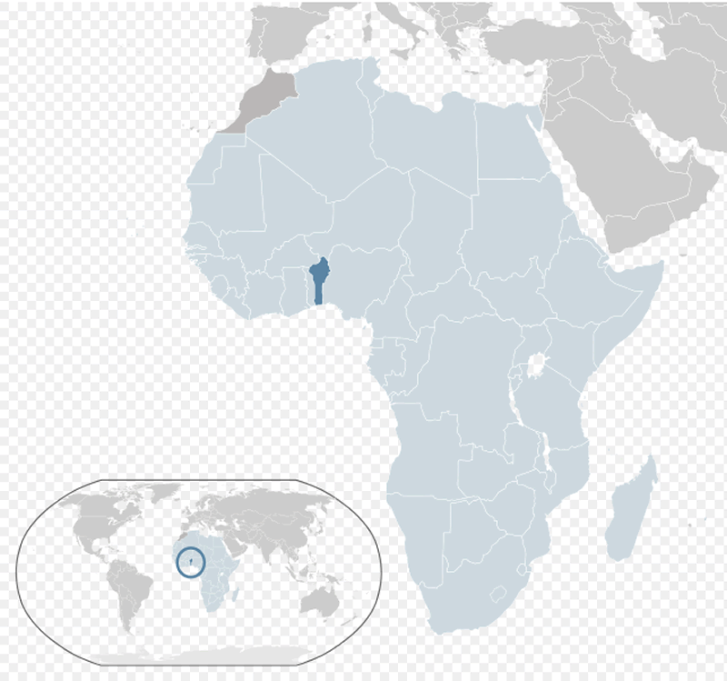
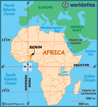
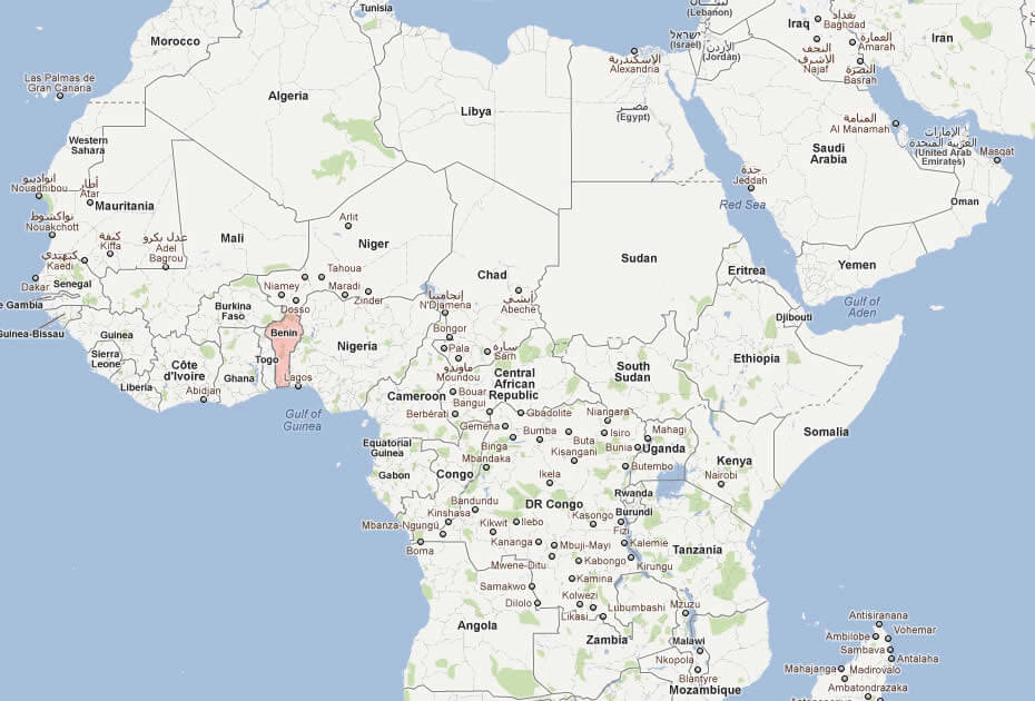
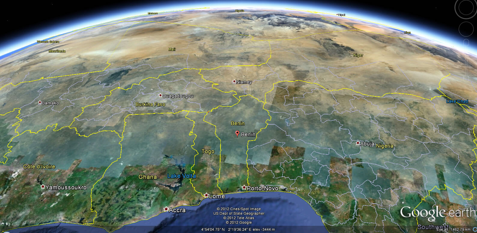
BENIN LOCATION MAP

WHERE IS BENIN IN THE WORLD
Can I download a high-resolution map of Benin ?
Yes. Download high-resolution political and physical maps of Benin for personal or educational use. Redistribution is subject to the terms of our license.
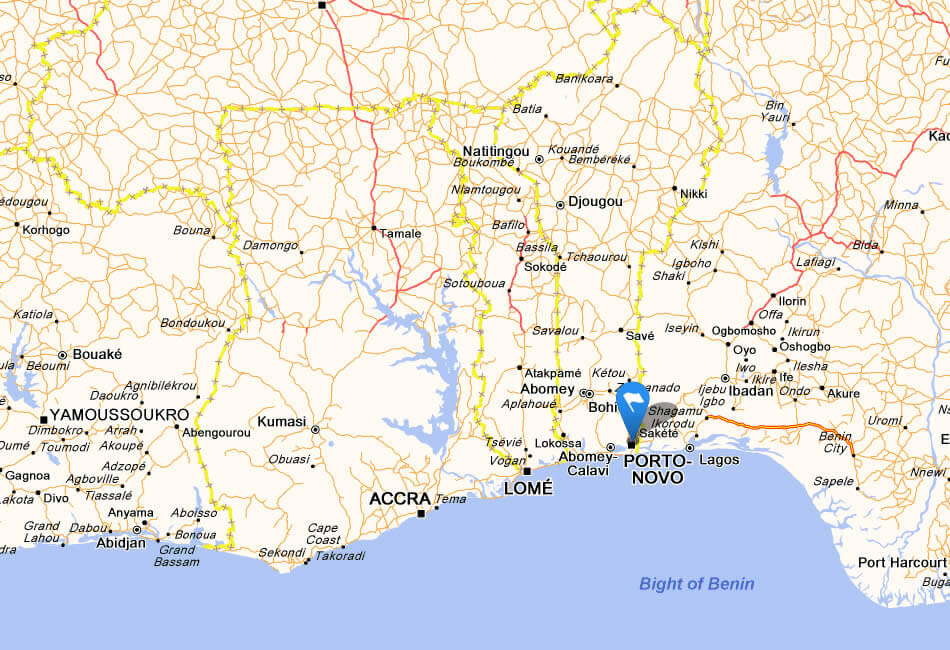
- Capital : Porto-Novo
- Population : 9,598,787
- GDP : $7.306 billion
- Per Capita : $736
- Calling Code : +229
- Jobless Rate : 1.00%
- Time Zone : +1
For more about Benin >>
A Collection of Benin Maps and Benin Satellite Images
MAP OF BENIN
BENIN LOCATION MAP
WHERE IS BENIN IN THE WORLD
BENIN MAP AFRICA
BENIN MAP

BENIN POLITICAL MAP
BENIN PHYSICAL MAP
BENIN MAP
BENIN POLITICAL MAP
MAP OF BENIN AFRICA
MAP OF BENIN
MAP BENIN
PHYSICAL BENIN MAP
PHYSICAL MAP OF BENIN
BENIN EARTH MAP
Addresse: Hakarinne 2 Espoo, Uusimaa - Finland 02210
Web: istanbul-city-guide.com
Email: [email protected]
Web: istanbul-city-guide.com
Email: [email protected]
Copyright istanbul-city-guide.com - 2004 - 2026. All rights reserved. Privacy Policy | Disclaimer