Anguilla Map and Anguilla Satellite Images
Explore map of Anguilla, Anguilla map, cities map of Anguilla, satellite images of Anguilla, Anguilla largest cities maps, political map of Anguilla, driving directions, country atlas and traffic map.
Anguilla Map FQA
How many cities are in Anguilla ?
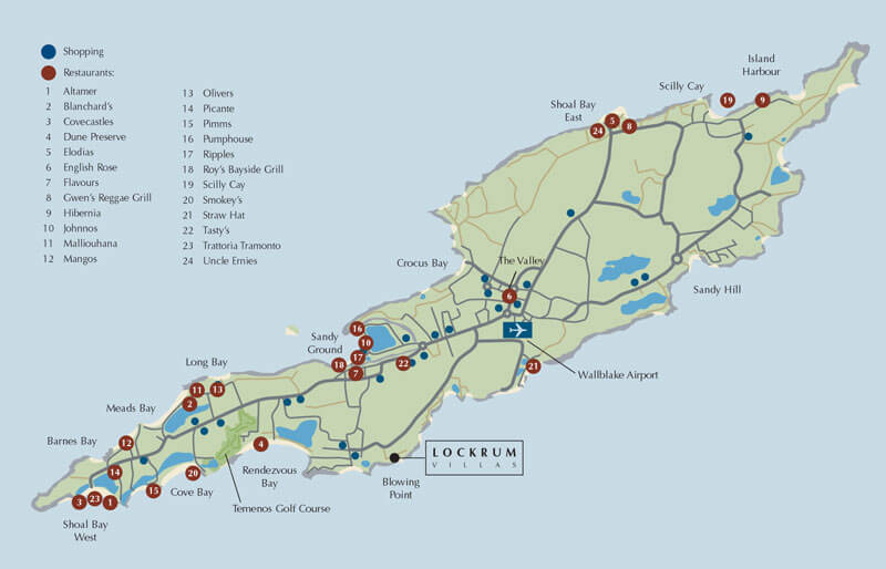
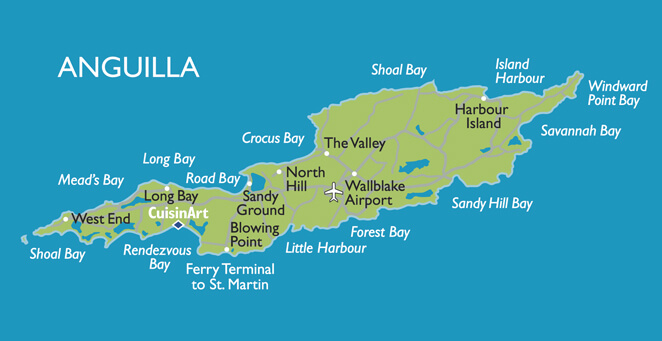
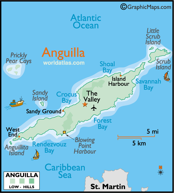
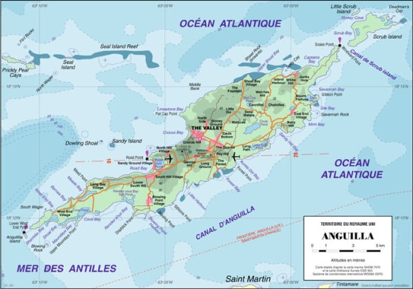
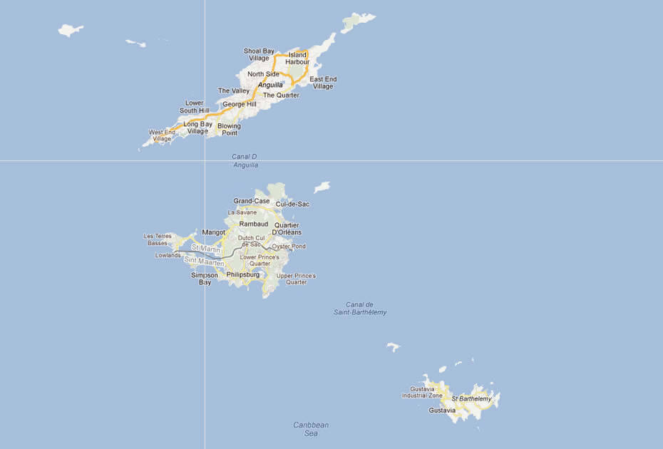
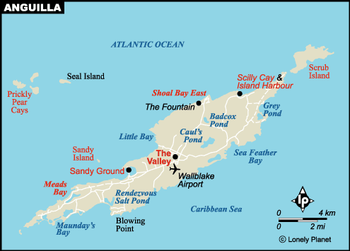
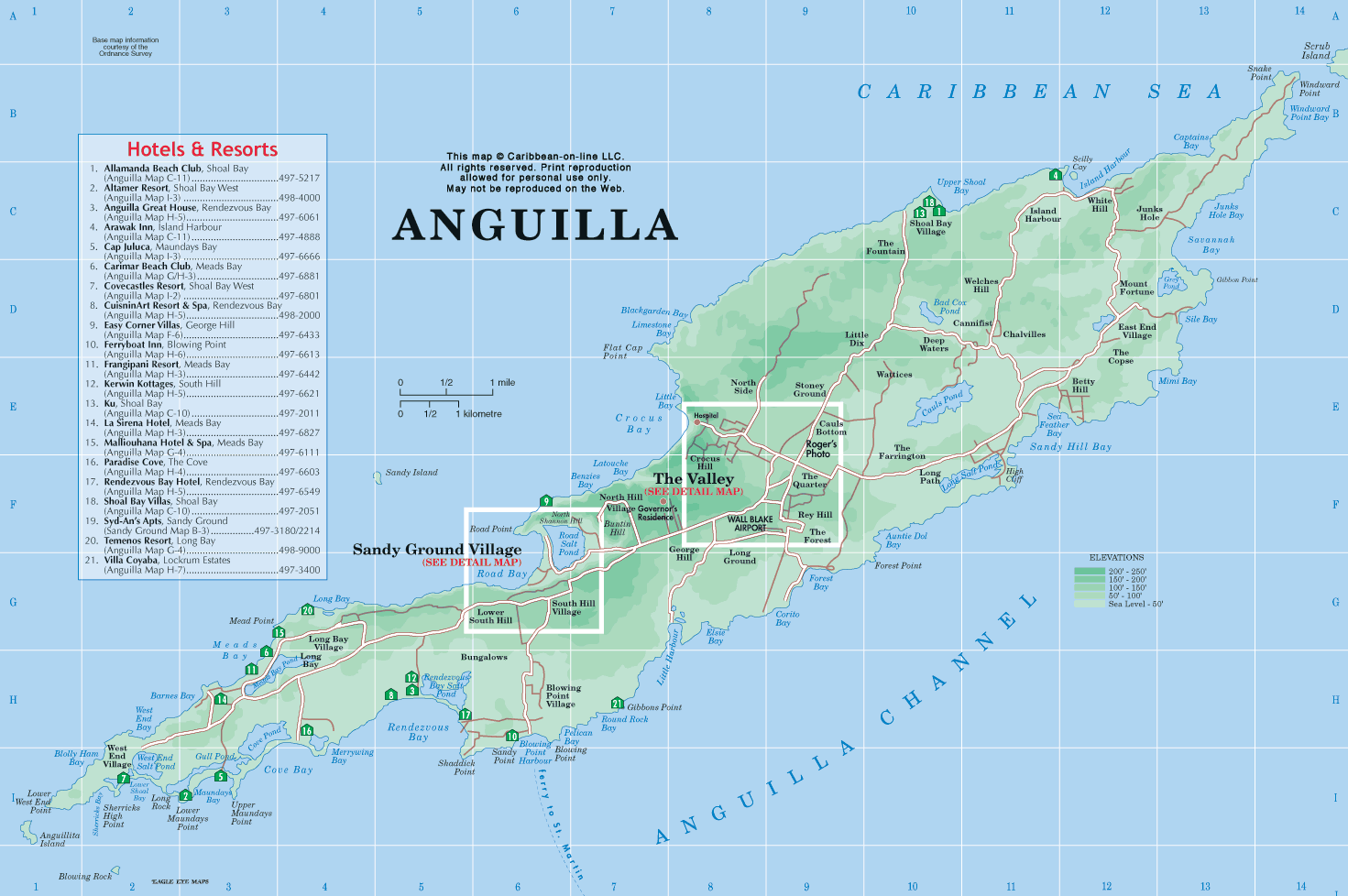
Anguilla is a small territory with no large cities. The main towns are The Valley, Blowing Point, Sandy Ground, East End, Island Harbour, North Hill, and West End.What are the major geographical features of Anguilla ?
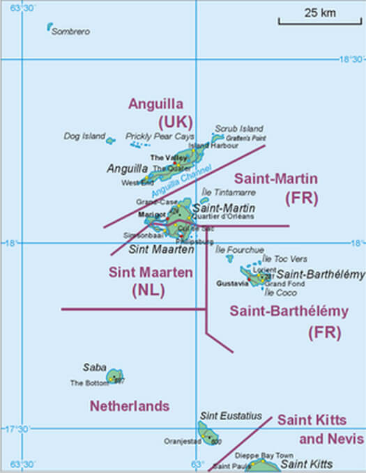
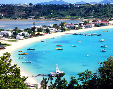
Anguilla is a flat, low-lying island in the Caribbean, known for its sandy beaches, limestone terrain, and coral reefs. It lacks mountains or major rivers, and its geography is dominated by coastal features and dry scrubland.ANGUILLA ISLANDS MAP
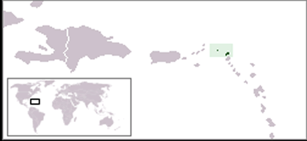
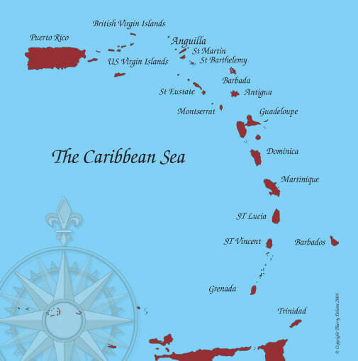
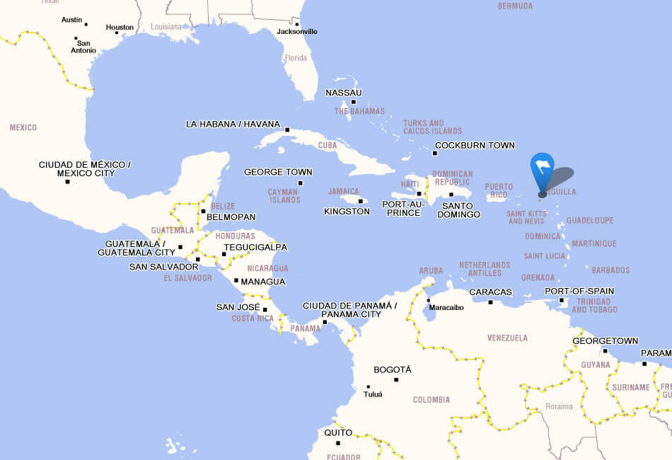
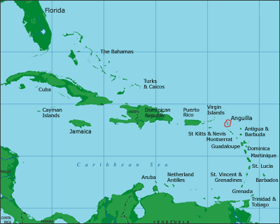
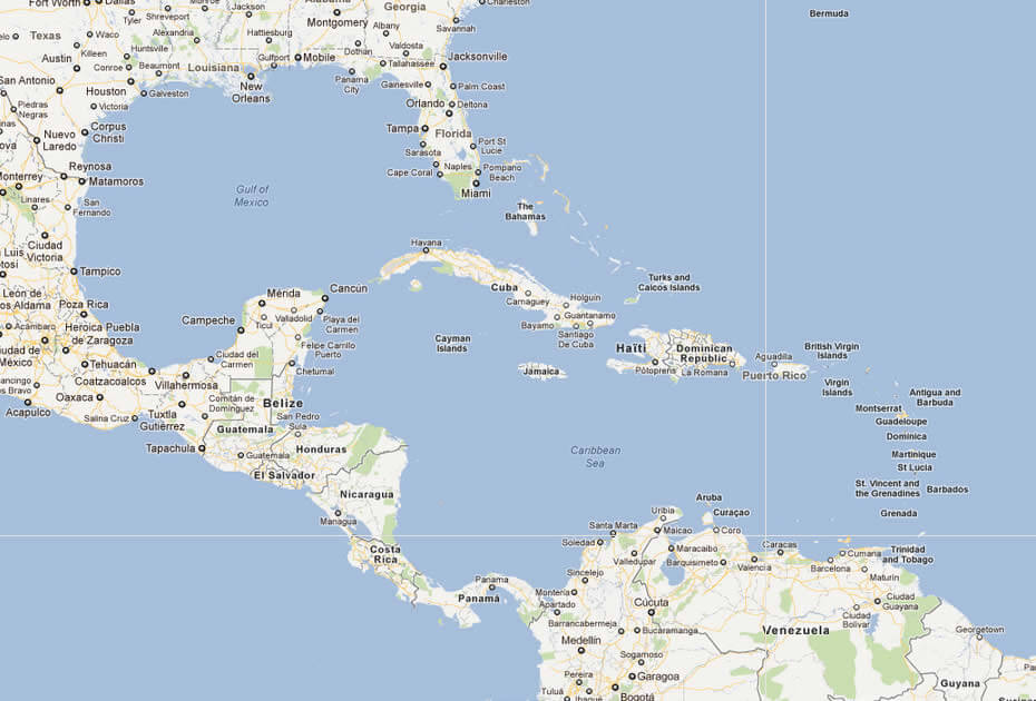
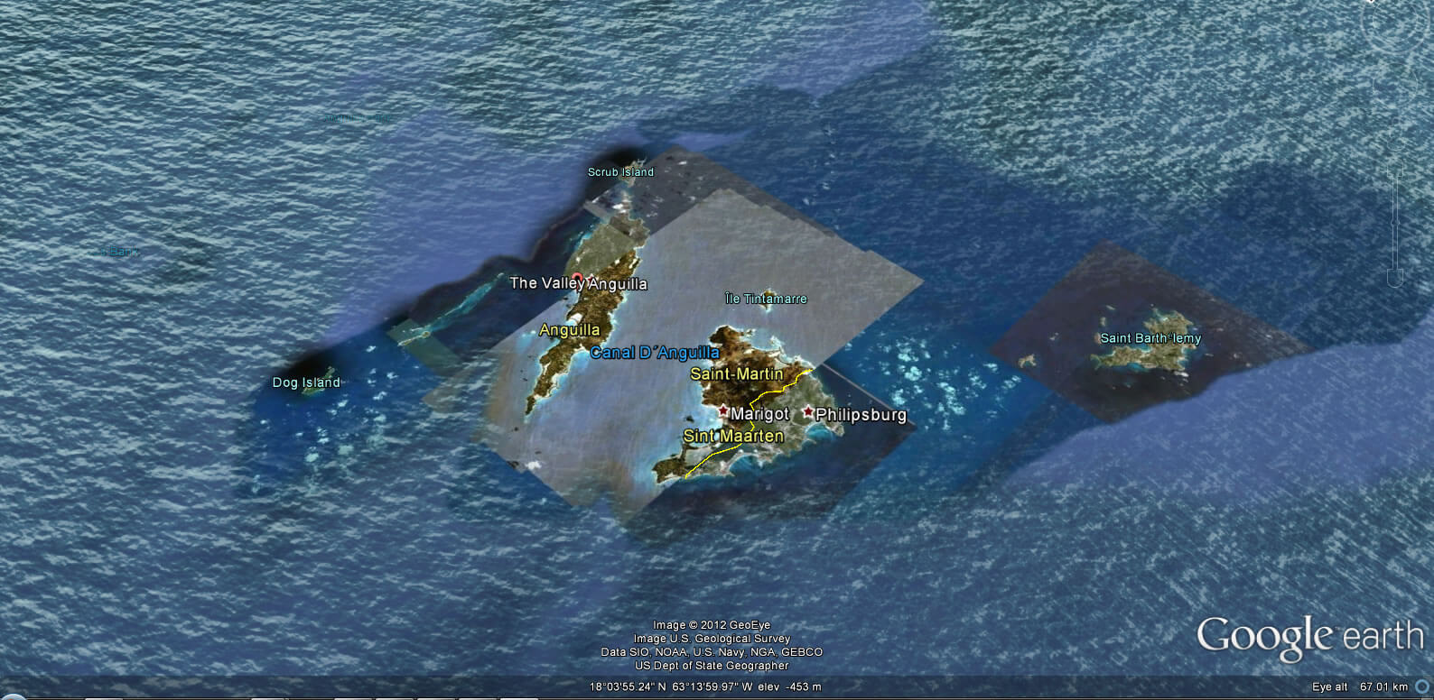
WHERE IS ANGUILLA IN THE WORLD
ANGUILLA ISLANDS MAP
Can I download a high-resolution map of Anguilla ?
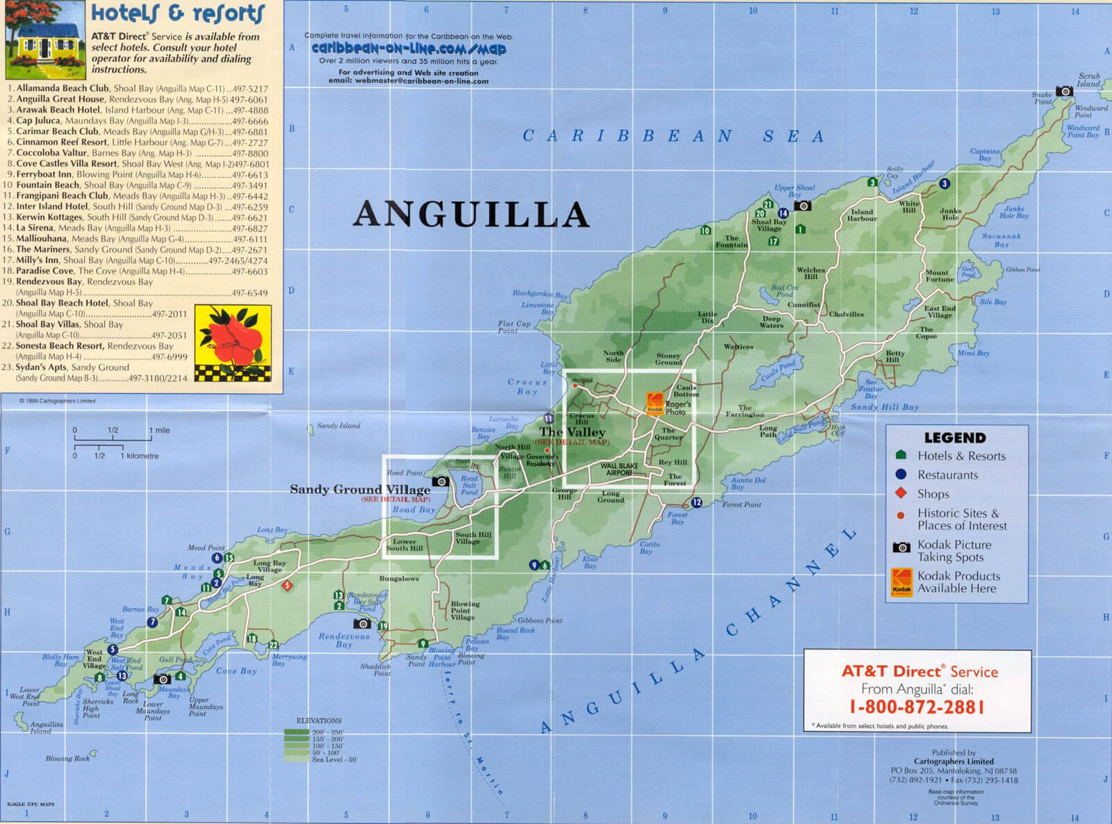
Yes. Download high-resolution political and physical maps of Anguilla for personal or educational use. Redistribution is subject to the terms of our license.
- Capital : The Valley
- Population : 13,600
- GDP : $108.9 million
- Per Capita : $8,800
- Calling Code : +1264
- Jobless Rate : N/A
- Time Zone : -4
For more about Anguilla >>
A Collection of Anguilla Maps and Anguilla Satellite Images
MAP OF ANGUILLA
WHERE IS ANGUILLA IN THE WORLD
ANGUILLA ISLANDS MAP
ANGUILLA MAP CARIBBEAN SEA
ANGUILLA MAP
ANGUILLA PHYSICAL MAP
ANGUILLA ISLAND
ANGUILLA MAP
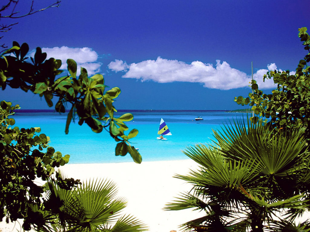
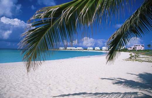
ANGUILLA BEACHES
ANGUILLA MAP
ANGUILLA POLITICAL MAP
ANGUILLA TOURISTIC
CARIBBEAN ANGUILLA MAP
MAP OF ANGUILLA CARIBBEAN SEA
MAP OF ANGUILLA
MAP OF ANGUILLA
POLITICAL MAP OF ANGUILLA
ANGUILLA EARTH MAP
Addresse: Hakarinne 2 Espoo, Uusimaa - Finland 02210
Web: istanbul-city-guide.com
Email: [email protected]
Web: istanbul-city-guide.com
Email: [email protected]
Copyright istanbul-city-guide.com - 2004 - 2026. All rights reserved. Privacy Policy | Disclaimer