
Iran Map and Iran Satellite Images
Explore map of Iran, Iran map, cities map of Iran, satellite images of Iran, Iran largest cities maps, political map of Iran, driving directions, country atlas and traffic map.

- Capital : Tehran
- Population : 75,149,669
- GDP : $482.445 billion
- Per Capita : $6,359
- Calling Code : +98
- Jobless Rate : 7.10%
- Time Zone : +3.30
For more about Iran >>
A Collection of Iran Maps and Iran Satellite Images
map of iran

achaemenid empire map darius iran

iran location map

boundaries of iran map

empty iran map

ethnic groups map of iran

gas oil map of iran

iran ethnic groups

iran map

iran physical map

iran cities map

iran ethnic groups map

iran fault activity map

iran major towns map

iran map

iran map colorful

iran map in persian

iran map in persian b

iran maps

iran outline map

iran physical map
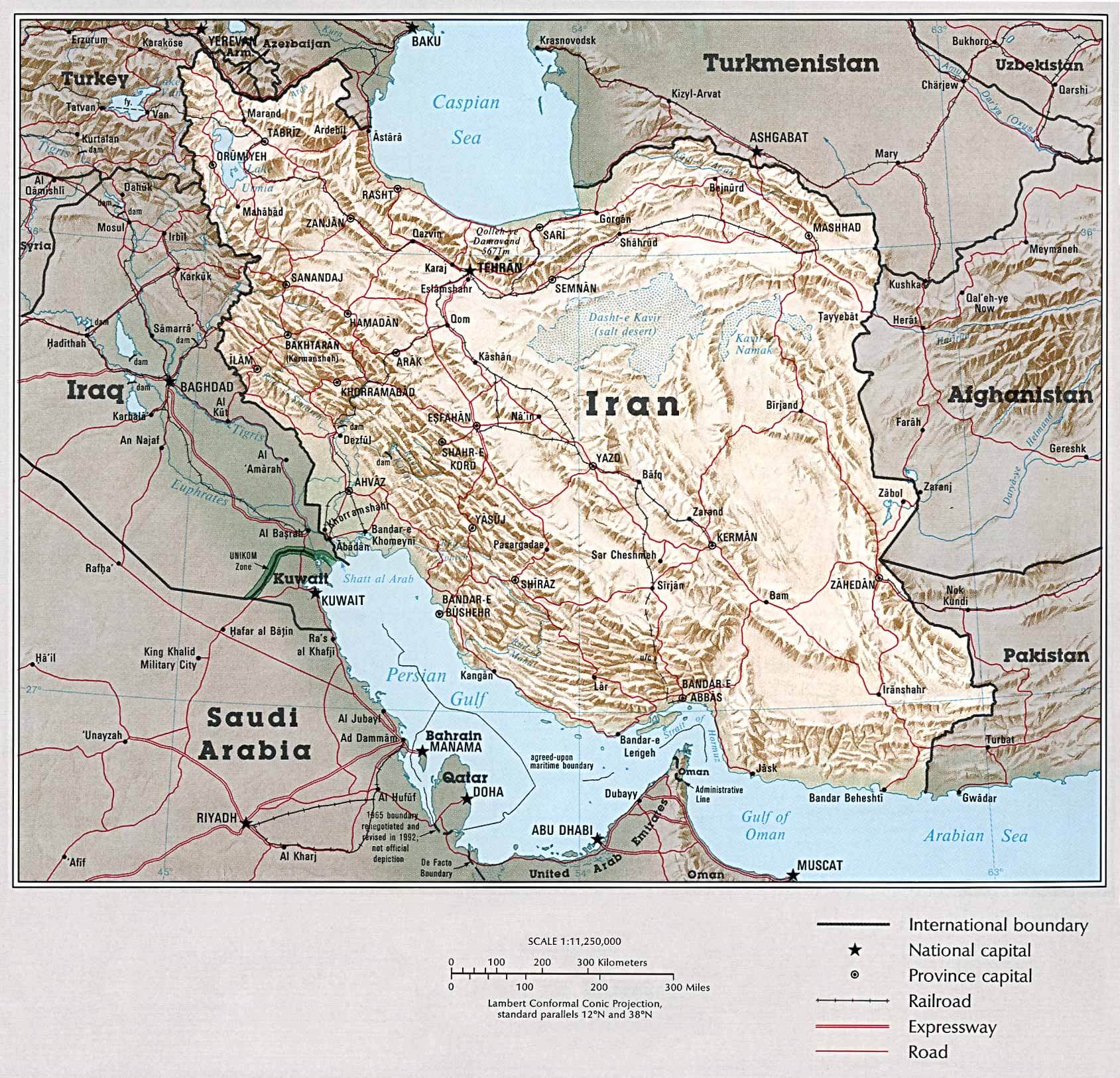
iran political map

iran population density map

iran rail map

iranmap

land map of iran
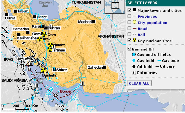
map of iran
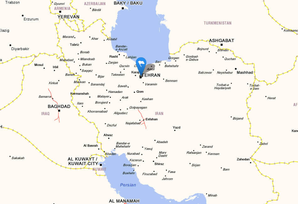
map iran

map of iran

map of tehran iran
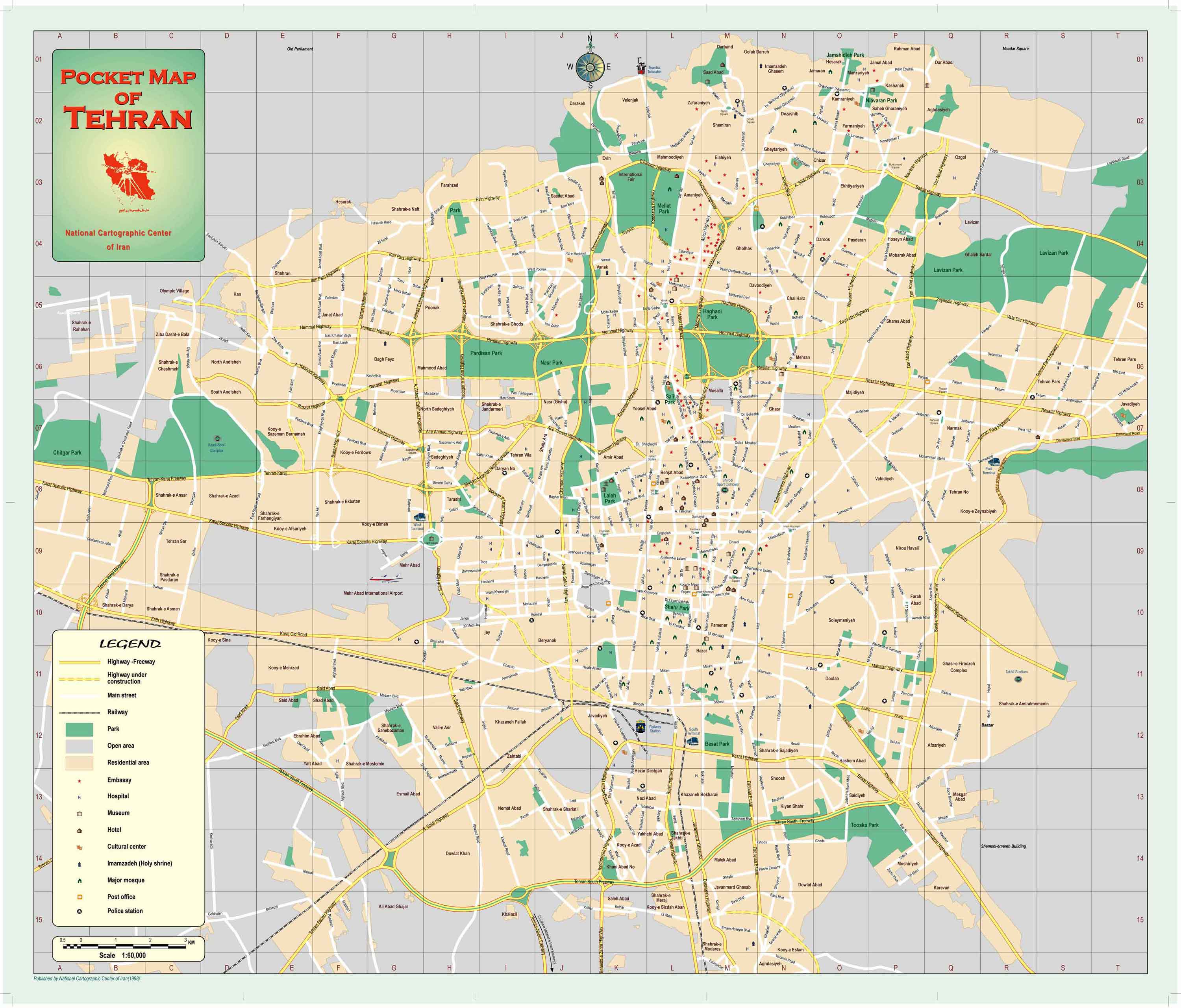
maps of iran

nuclear map of iran

persian iran map

physical map iran

political iran map

population map of iran

provinces map of iran

rail map of iran

road map of iran

satellite image of iran

sketch of iran

topographic map of iran

Iran Earth Map

Iran Map FQA
How many cities are in Iran ?
Iran has about 125 cities. The 10 largest are: Tehran, Mashhad, Isfahan, Karaj, Shiraz, Tabriz, Qom, Ahvaz, Kermanshah, and Urmia.What are the major geographical features of Iran ?
Iran is dominated by mountains such as the Zagros and Alborz ranges, with the Dasht-e Kavir and Dasht-e Lut deserts in central regions. The Caspian Sea and Persian Gulf form its northern and southern coastlines.Can I download a high-resolution map of Iran ?
Yes. Download high-resolution political and physical maps of Iran for personal or educational use. Redistribution is subject to the terms of our license.Largest Cities' Map of Iran
Ahvaz Map Isfahan Map Karaj Map Kerman Map Bakhtaran Map Mashhad Map Orumieh Map Qom Map Rasht Map Shiraz Map Tabriz Map Tehran Map Zahedan Map
Addresse: Hakarinne 2 Espoo, Uusimaa - Finland 02210
Web: istanbul-city-guide.com
Email: [email protected]
Web: istanbul-city-guide.com
Email: [email protected]
Copyright istanbul-city-guide.com - 2004 - 2026. All rights reserved. Privacy Policy | Disclaimer