Guinea Bissau Map and Guinea Bissau Satellite Images
Explore map of Guinea Bissau, Guinea Bissau map, cities map of Guinea Bissau, satellite images of Guinea Bissau, Guinea Bissau largest cities maps, political map of Guinea Bissau, driving directions, country atlas and traffic map.
Guinea Bissau Map FQA
How many cities are in Guinea Bissau ?
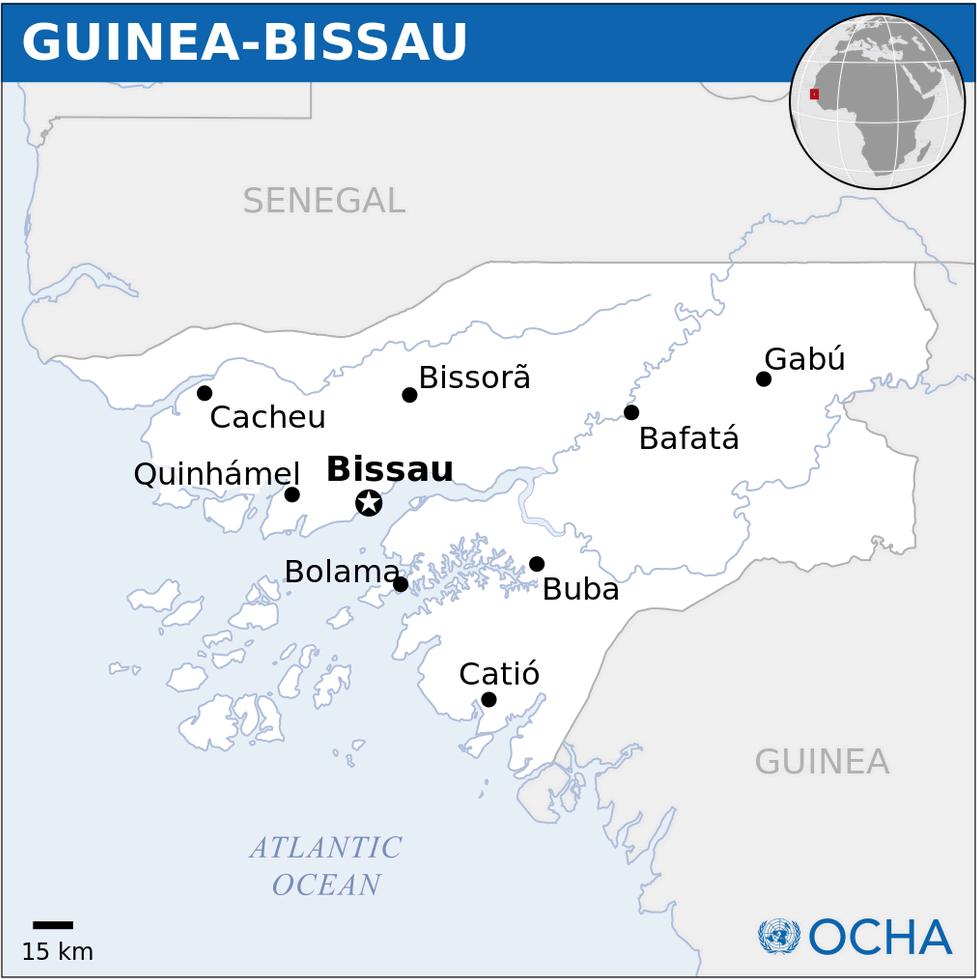
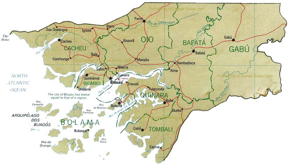
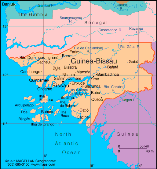
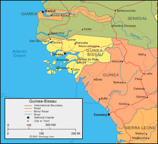
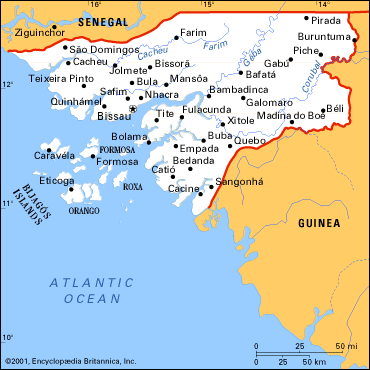
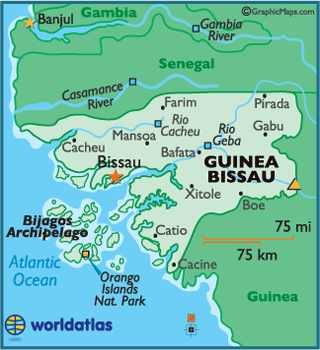
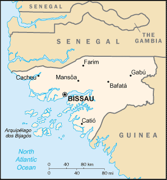
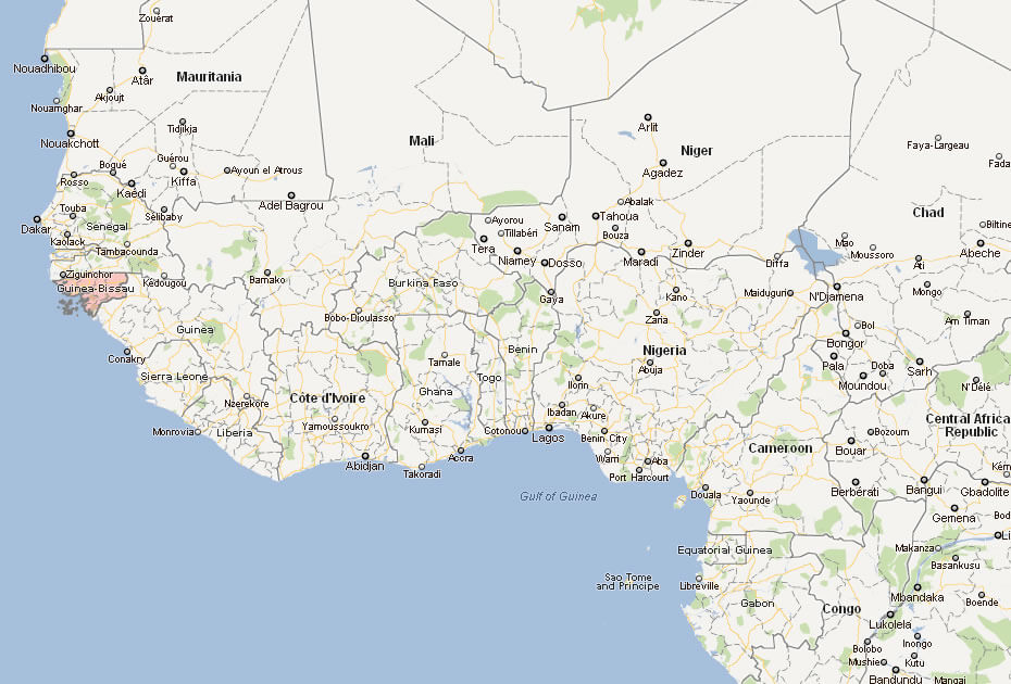
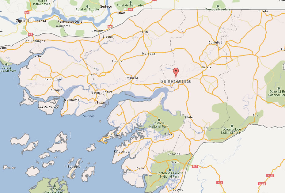
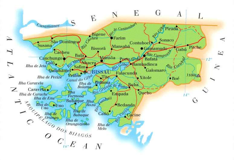
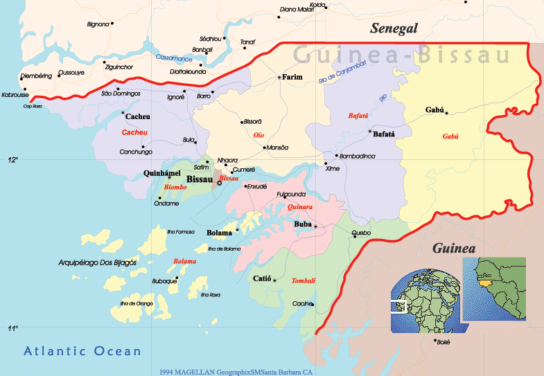
Guinea-Bissau has around 10 towns. The largest are: Bissau, Bafatá, Gabú, Canchungo, Bissorã, Bolama, Cacheu, Catió, Mansôa, and Farim.What are the major geographical features of Guinea Bissau ?
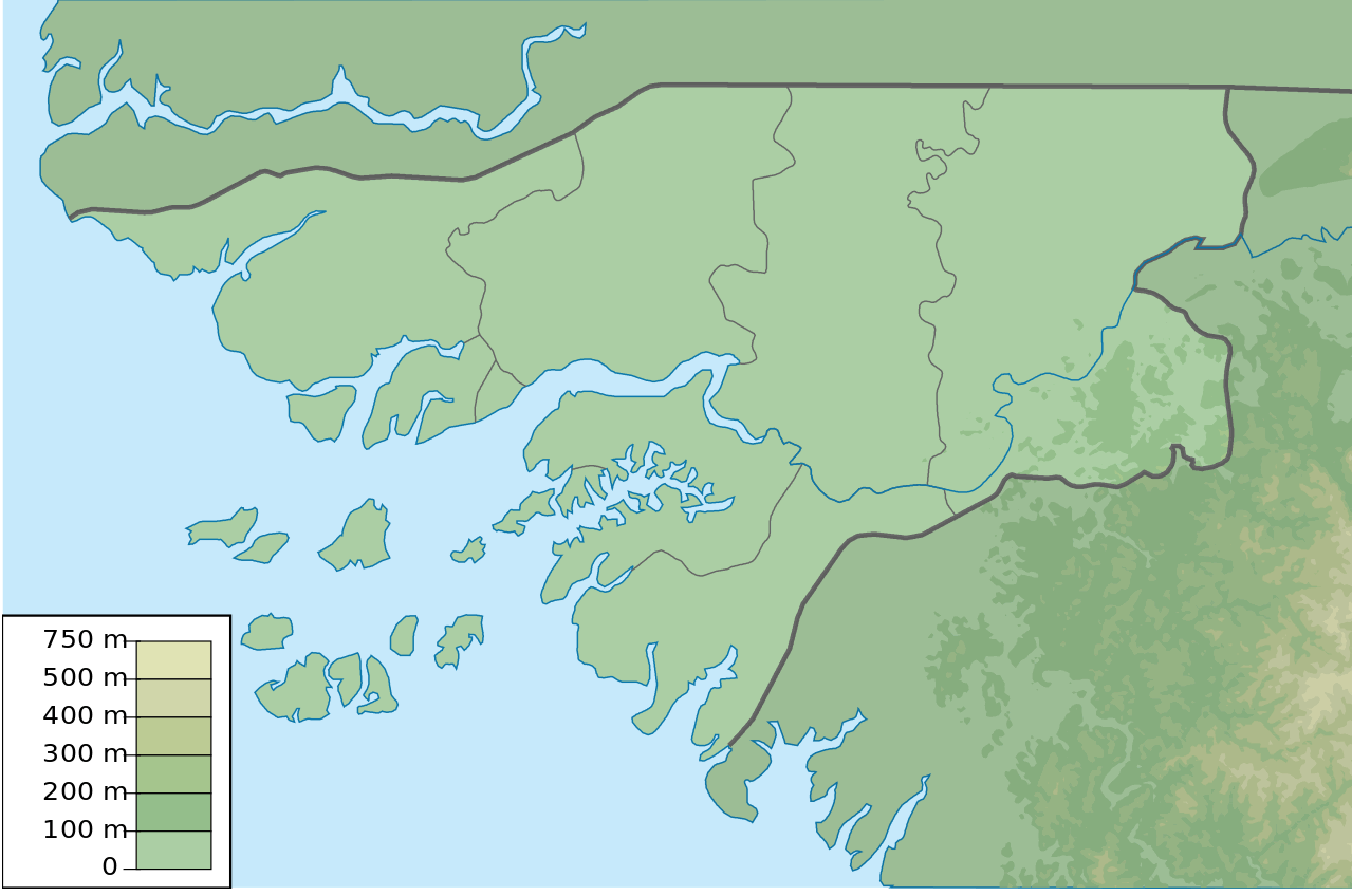
Guinea-Bissau has a low-lying coastal plain with mangroves, tidal rivers, and the Bijagós Archipelago. The inland regions include savannas and low hills.WHERE IS GUINEA BISSAU IN THE WORLD
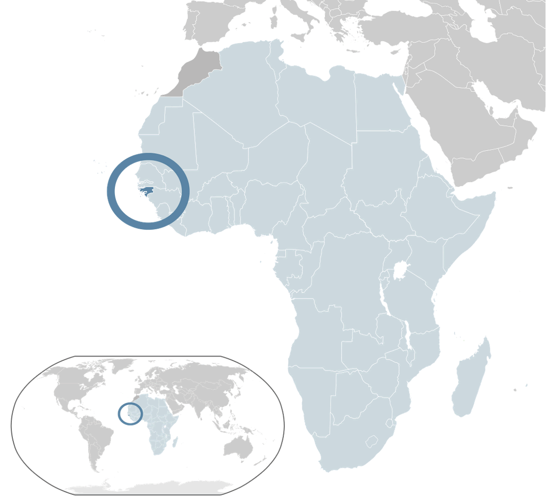
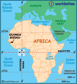
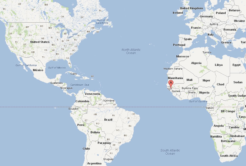
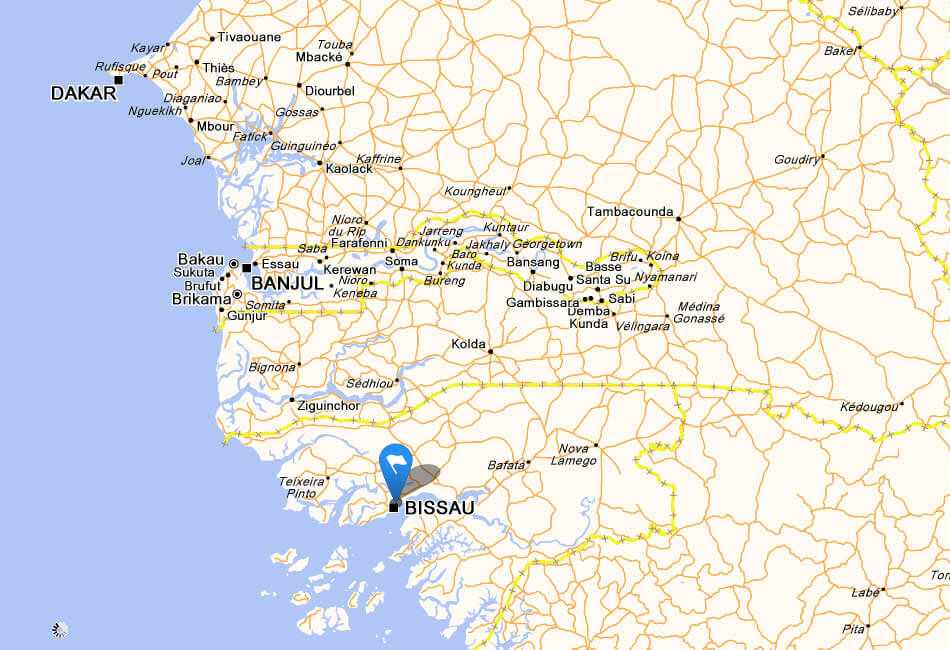
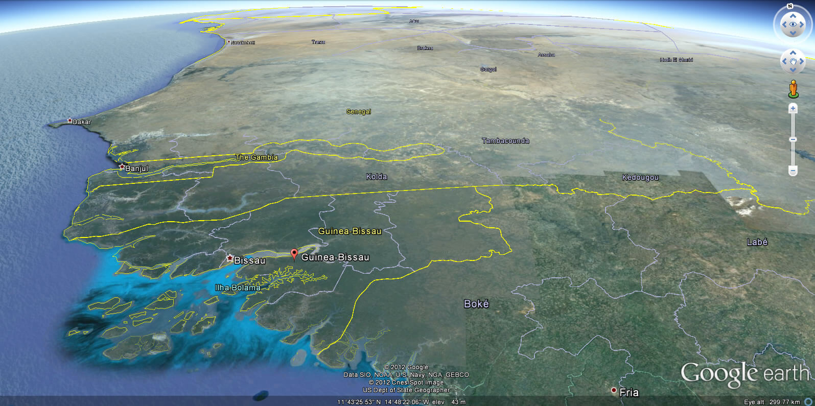
GUINEA BISSAU LOCATION MAP
WHERE IS GUINEA BISSAU IN THE WORLD
Can I download a high-resolution map of Guinea Bissau ?
Yes. Download high-resolution political and physical maps of Guinea Bissau for personal or educational use. Redistribution is subject to the terms of our license.
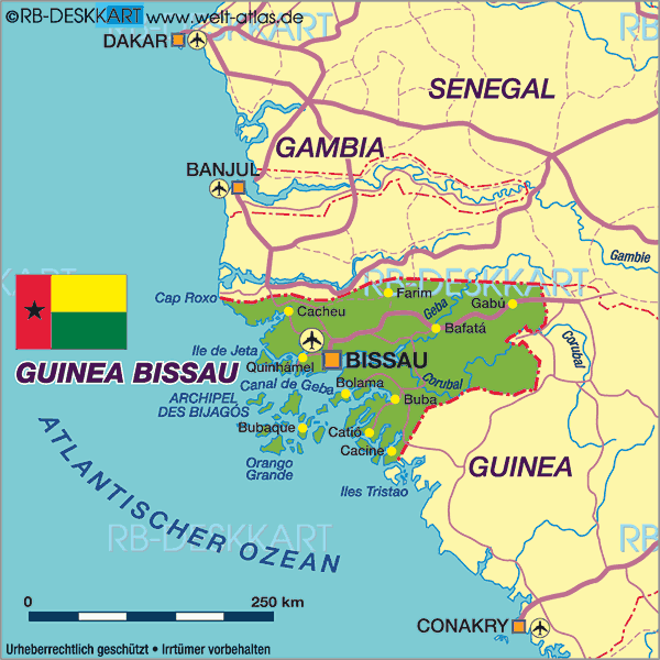
- Capital : Bissau
- Population : 1,647,000
- GDP : $969 million
- Per Capita : $575
- Calling Code : +245
- Jobless Rate : 7.60%
- Time Zone : +0
For more about Guinea Bissau >>
A Collection of Guinea Bissau Maps and Guinea Bissau Satellite Images
MAP OF GUINEA BISSAU
GUINEA BISSAU LOCATION MAP
WHERE IS GUINEA BISSAU IN THE WORLD
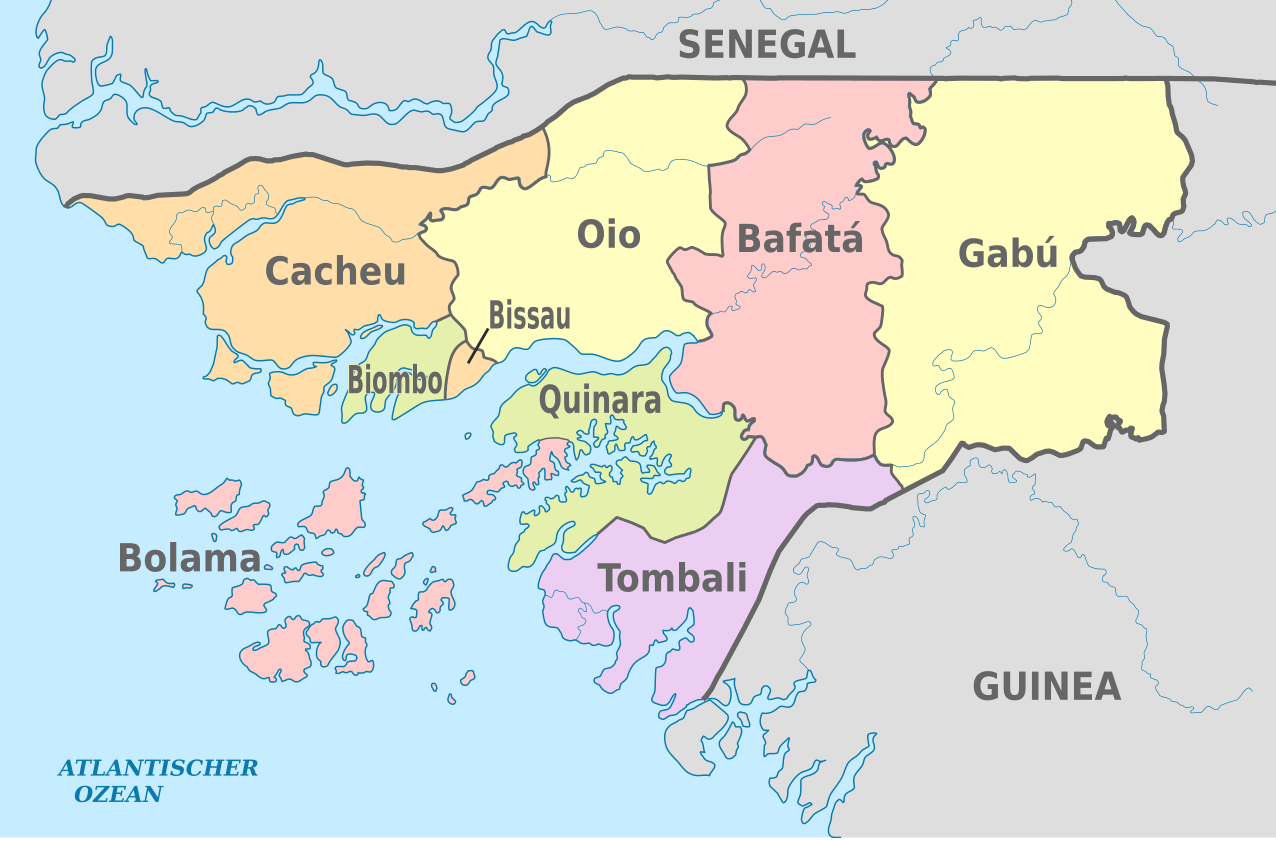
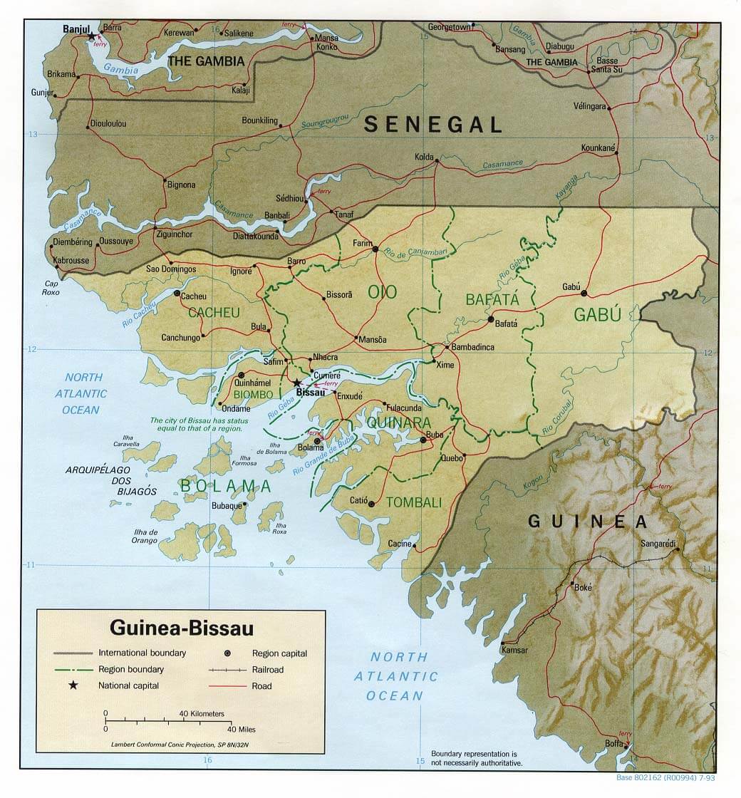
GUINEA BISSAU PROVINCES MAP
GUINEA BISSAU PHSICAL MAP ELEVATION
ADMINISTRATIVE MAP OF GUINEA BISSAU
GUINEA BISSAU MAP AFRICA
GUINEA BISSAU MAP
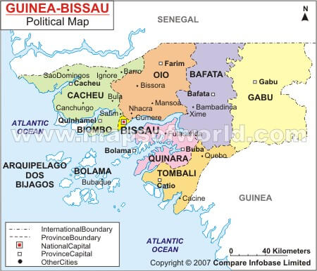
GUINEA BISSAU POLITIC MAP
GUINEA BISSAU MAP
GUINEA BISSAU CITIES MAP
GUINEA BISSAU MAP
GUINEA BISSAU MAP
GUINEA BISSAU MAPS
GUINEA BISSAU POLITICAL MAP
MAP OF GUINEA BISSAU AFRICA
MAP OF GUINEA BISSAU WORLD
MAP OF GUINEA BISSAU
MAP GUINEA BISSAU
MAP GUINEA BISSAU
POLITICAL MAP OF GUINEA BISSAU
GUINEA BISSAU EARTH MAP
Addresse: Hakarinne 2 Espoo, Uusimaa - Finland 02210
Web: istanbul-city-guide.com
Email: [email protected]
Web: istanbul-city-guide.com
Email: [email protected]
Copyright istanbul-city-guide.com - 2004 - 2026. All rights reserved. Privacy Policy | Disclaimer