
You are at :
home »
world »
north america »
united states »
pennsylvania »
philadelphia pennsylvania map
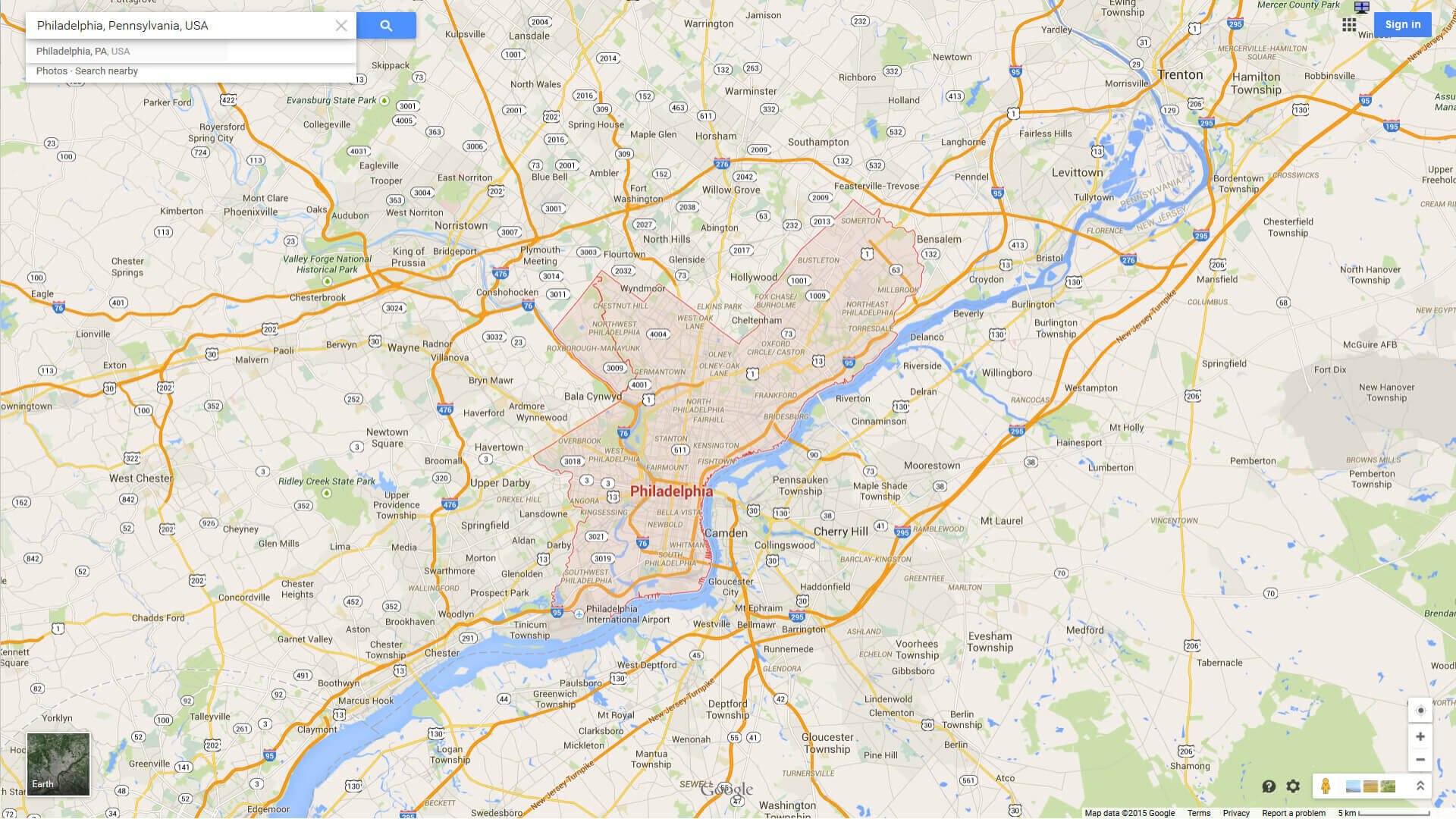
Philadelphia Pennsylvania Map
Philadelphia Pennsylvania Map : Explore detailed Map of Philadelphia, Philadelphia Pennsylvania travel map, Philadelphia satellite image, city, sketch, road map of Philadelphia and information. For more maps and satellite images please follow the page.
You can find desired maps by entering country, city, town, region or village names regarding under search criteria. On upper left Map of Philadelphia Pennsylvania districts (+) beside zoom in and (-) sign to to zoom out via the links you can visit. On Philadelphia Pennsylvania Map move the mouse over it via (left click) and clicking the image you can drag. Right upper Map, Satellite, Terrain icons via the map view, satellite, hybrid and mixed land can switch between images.
Philadelphia Pennsylvania street, aerial, road, interactive travel maps
central philadelphia map

Where is Pennsylvania in the US and Cities Map of Pennsylvania
Please subscribe on "World Guide" channnel on Youtube at youtube.com/c/WorldGuide
A collection map of Philadelphia, cities traffic and interactive maps.
central philadelphia map
map of philadelphia

philadelphia area map
philadelphia city map

philadelphia city hall pennsylvania usa

philadelphia pennsylvania usa skyline schuylkill river

philadelphia downtown map

philadelphia map interstate 95

philadelphia pennsylvania map usa

philadelphia map pennsylvania us
philadelphia map pennsylvania us satellite

Philadelphia Pennsylvania Highway and Road Map with Satellite View

Philadelphia Pennsylvania Highway and Road Map

Largest Cities Map of Philadelphia Pennsylvania
Philadelphia Map - (1,526,006) Pittsburgh Map - (305,704) Allentown Map - (118,032) Erie Map - (101,786) Reading Map - (88,082) Scranton Map - (76,089) Bethlehem Map - (74,982) Lancaster Map - (59,322) Levittown Map - (52,983) Harrisburg Map - (49,528) Altoona Map - (46,320) York Map - (43,718) Penn Hills Township Map - (42,329) State College Map - (42,034) Wilkes Barre Map - (41,498) Norristown Map - (34,324) Chester Map - (33,972) Mount Lebanon Township Map - (33,137) Bethel Park Map - (32,313) Radnor Township Map - (31,531) Williamsport Map - (29,381) Monroeville Map - (28,386) Drexel Hill Map - (28,043) Plum Map - (27,126) Easton Map - (26,800)For All Pennsylvania Cities Map
Philadelphia Pennsylvania Google Map, Street Views, Maps Directions, Satellite Images
Please Not : You can find local businesses, public places, tourist attractions via map view, satellite image, hybrid view, driving directions in Philadelphia Pennsylvania Map. You'll also find a varity map of Philadelphia Pennsylvania such as political, administrative, transportation, demographics maps following Google map.
Submit URL to Philadelphia Pennsylvania :
Addresse: Kemalpasa Mh. Uzum Sk No:4/15 Kucukcekeme, Istanbul
Web: Istanbul-City-Guide.com
Email: [email protected]
Web: Istanbul-City-Guide.com
Email: [email protected]
Copyright Istanbul-City-Guide.com - 2004 - 2023. All rights reserved. Privacy Policy | Disclaimer